


Winter Weather Advisory Sunday As Snowfall In Two Parts Affecting Two Different Areas
Saturday Evening Update January 17 2026 One thing I carry after all of my years of forecasting: If one model does a really good job in an active pattern, then…
Tuesday, November 18, 2025
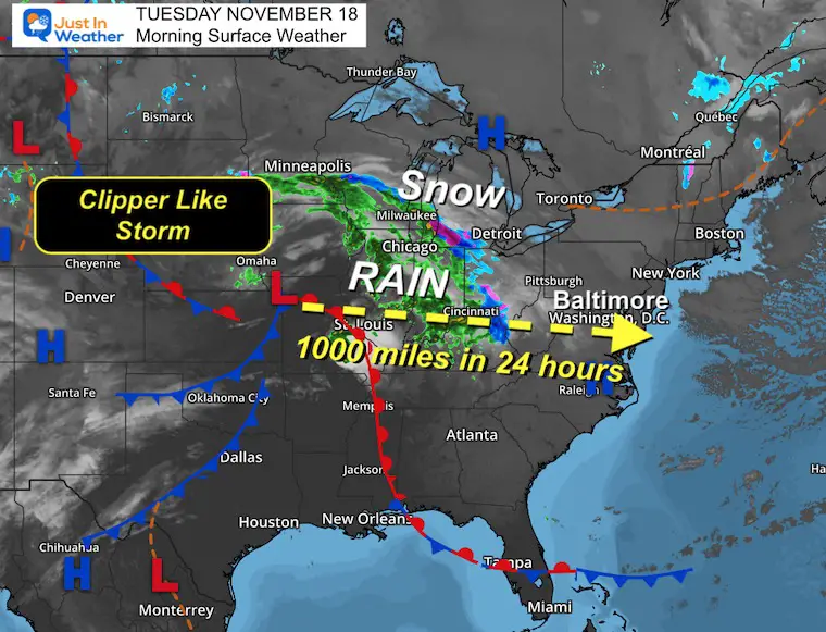
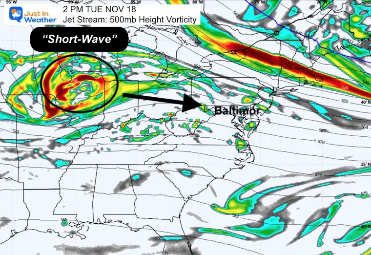
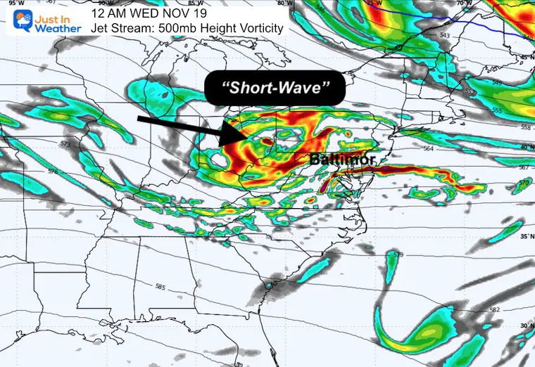
We need rain, and we have a fast-moving clipper-like storm that will bring a moderate burst. This morning, it was plotted near Kansas City, MO, and tomorrow morning, it will be moving off the coast from Ocean City, MD. That is a track of over 1000 miles in 24 hours—definitely a quick mover.
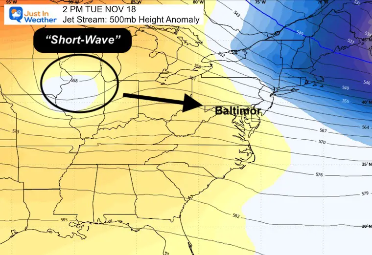
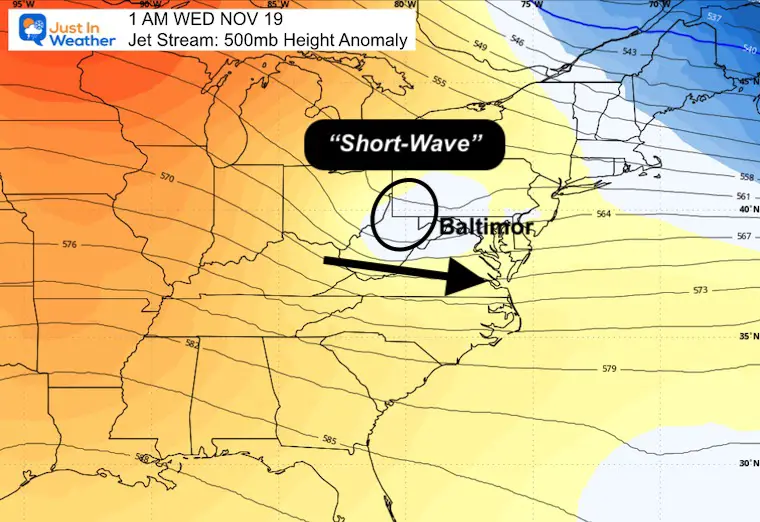
The upper-level short wave does resemble a clipper, which is often a winter storm that tracks across Canada and can bring a quick burst of snow. This is farther south and means rain for us, but some snow in the Great Lakes may transfer to the mountains of Pennsylvania tonight.
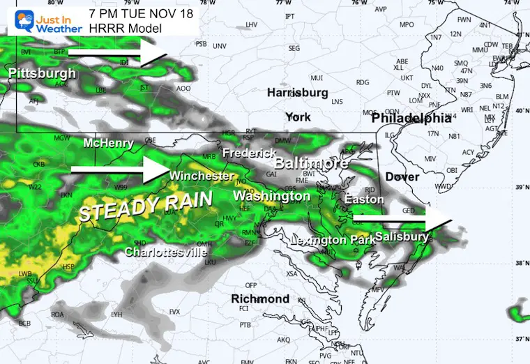
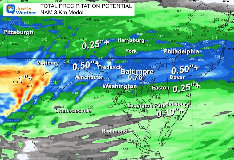
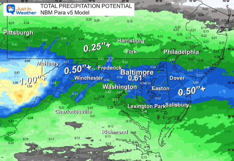
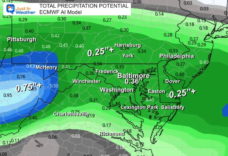
This is important because it may signal which models are best at handling winter events. We will compare 4 models for rain totals below.
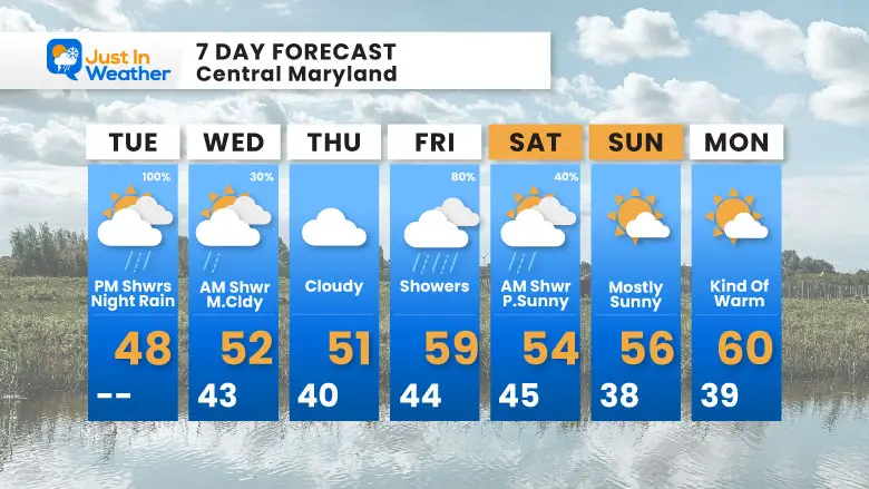
Another system will race in on Friday, then finally depart with some sun and a warm-up later in the weekend.
Yesterday: Low 41F; High 65F
Precipitation: Trace
Sunrise at 6:54 AM
Sunset at 4:50 PM
Normal Low in Baltimore: 36ºF
Record 20ºF in 1959
Normal High in Baltimore: 57ºF
Record 78ºF 1928; 1938
Rainfall Deficit at BWI
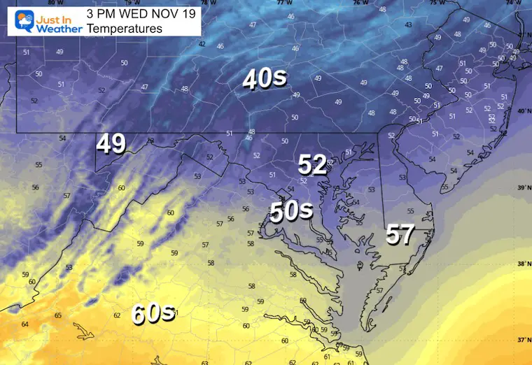
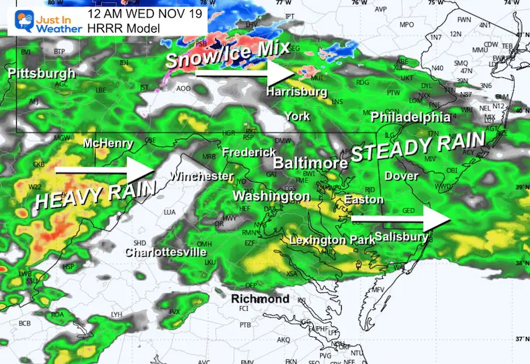
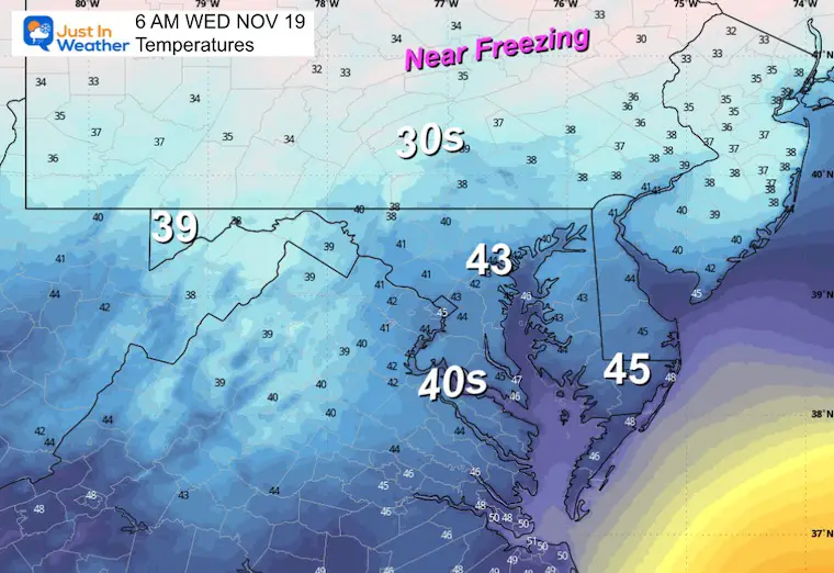
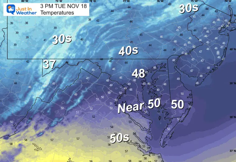
As clouds increase, temperatures will hold in the 40s for most of us. The 30s will hold in the mountains.
The National Blend of Models suggests the rain arrives in the mountains close to noon and could expand to near Hagerstown in the afternoon.
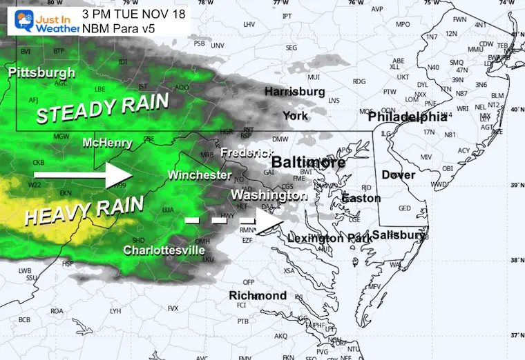
Light Rain will be scattered across metro areas as heavy rain shows up in the mountains.
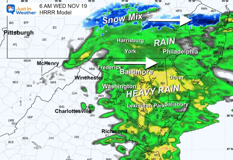
Heaviest rain.
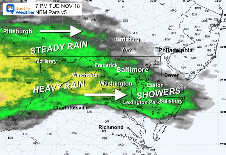
The burst of heavy rain will be moving east of the cities. Roads will be wet.
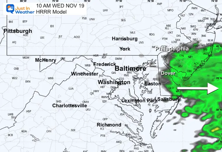
The storm will be off the coast. Clouds linger, and some showers might still fall over Delmarva.
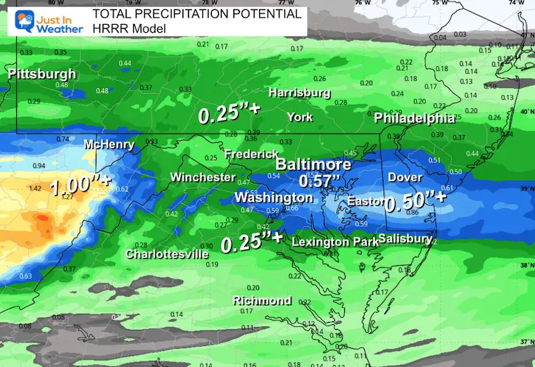
Comparing 4 models, we will review after the event.
From highest to lowest…..
Friday to Sunday
Rain will develop during the day Friday into Saturday, followed by clearing and a little bump in slightly warmer temps on Sunday.
Subscribe for eMail Alerts
Sign up and be the first to know!
Click here for the full report

This was issued October 9, as expected: A weak and short-lived event to start winter may play a different role this winter

These are NOT all the same caterpillar!


Click to see more and ‘Book’ a visit to your school


The annual event: Hiking and biking 329 miles in 7 days between The Summit of Wisp to Ocean City.
Each day, we honor a kid and their family’s cancer journey.
Fundraising is for Just In Power Kids: Funding Free Holistic Programs. I never have and never will take a penny. It is all for our nonprofit to operate.
Click here or the image to donate:

I am aware there are some spelling and grammar typos and occasional other glitches. I take responsibility for my mistakes and even the computer glitches I may miss. I have made a few public statements over the years, but if you are new here, you may have missed it: I have dyslexia and found out during my second year at Cornell University. It didn’t stop me from getting my meteorology degree and being the first to get the AMS CBM in the Baltimore/Washington region. One of my professors told me that I had made it that far without knowing and to not let it be a crutch going forward. That was Mark Wysocki, and he was absolutely correct! I do miss my mistakes in my own proofreading. The autocorrect spell check on my computer sometimes does an injustice to make it worse. I can also make mistakes in forecasting. No one is perfect at predicting the future. All of the maps and information are accurate. The ‘wordy’ stuff can get sticky. There has been no editor who can check my work while writing and to have it ready to send out in a newsworthy timeline. Barbara Werner is a member of the web team that helps me maintain this site. She has taken it upon herself to edit typos when she is available. That could be AFTER you read this. I accept this and perhaps proves what you read is really from me… It’s part of my charm. #FITF