


Winter Weather Advisory Sunday As Snowfall In Two Parts Affecting Two Different Areas
Saturday Evening Update January 17 2026 One thing I carry after all of my years of forecasting: If one model does a really good job in an active pattern, then…
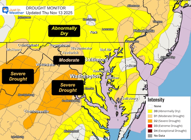
Saturday, November 15 2025
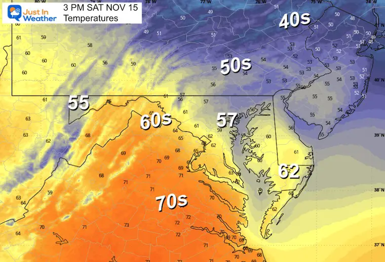
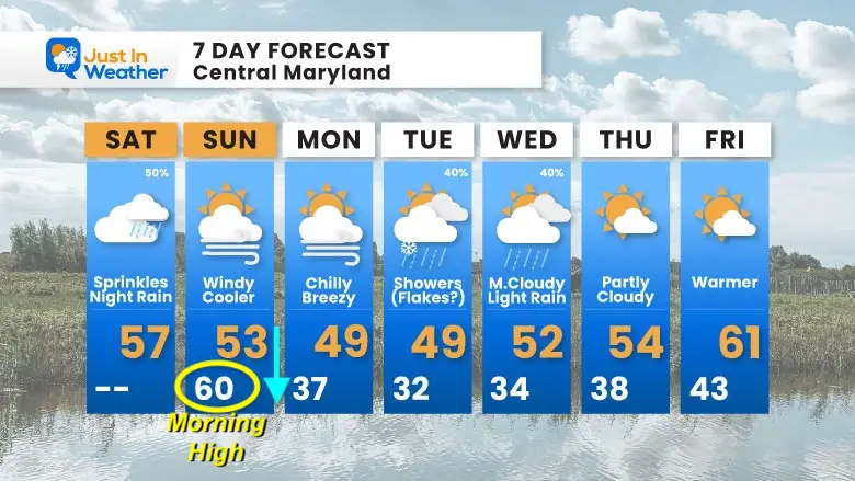
A quick-moving clipper-type storm will affect our weekend. Clouds today may produce some sprinkles, then expect rain after dark. A brief warm-up will peak overnight, then temps will fall all day on Sunday as the system races away.
The next event will pass south with showers Tuesday and Wednesday as we hold onto the chill.
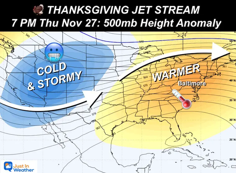
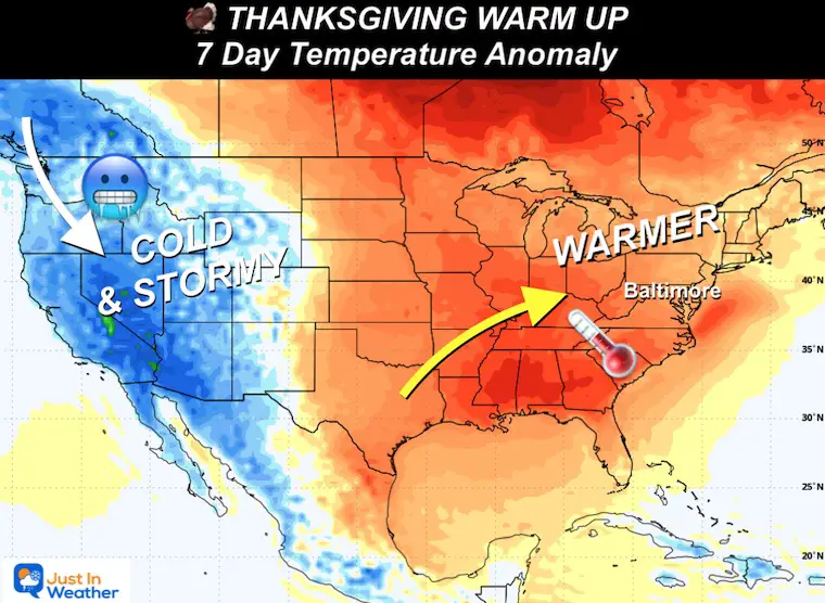
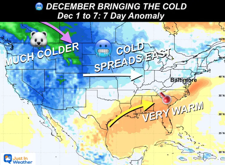
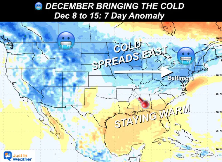
A warm-up and pattern change is expected by the end of the week to last through Thanksgiving. The long-range pattern looks warm for the holiday, followed by a pattern change and a winter setup that could make for a busy December.
Clouds along a warm front that may produce some sprinkles. Rain will race in tonight as the storm passes quickly to our north and drags in colder air from the Northern Plains on Sunday.
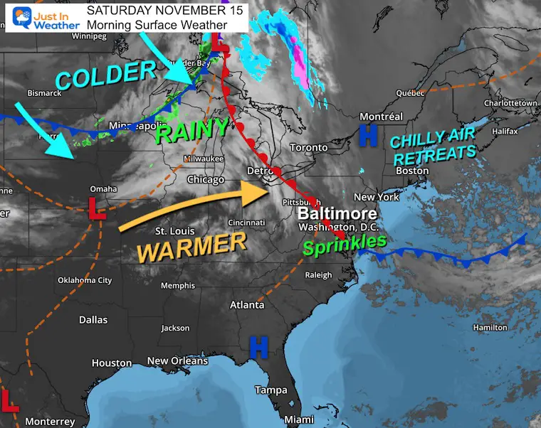
This quick-moving pattern will bring in rain after dark and pump in warmer air overnight.
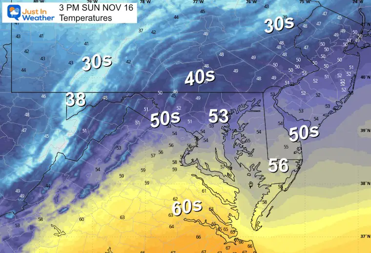
The rain will be done by sunrise, but so will the warm air. Colder winds will flow in all day as temperatures drop through the afternoon.
Sprinkles today may not show on radar.
Rain is more likely after dark and overnight.
Yesterday: Low 30F; High 56F
Precipitation: 0.00”
Sunrise at 6:50 AM
Sunset at 4:52 PM
Normal Low in Baltimore: 37ºF
Record 19ºF in 1986
Normal High in Baltimore: 58ºF
Record 79ºF 1993
Rainfall Deficit at BWI
Click here for the full report

Subscribe for eMail Alerts
Sign up and be the first to know!
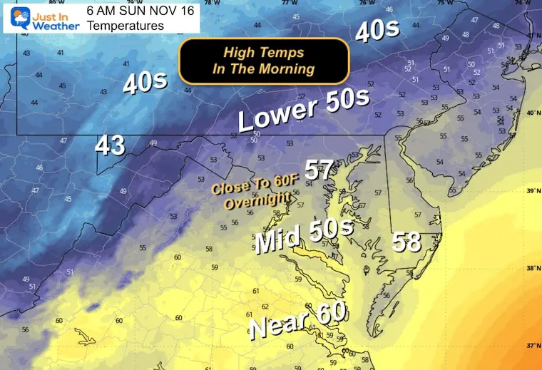
The high for the day will be before sunrise. Temps begin to fall in the morning, and strong winds will bring colder air in through the afternoon.
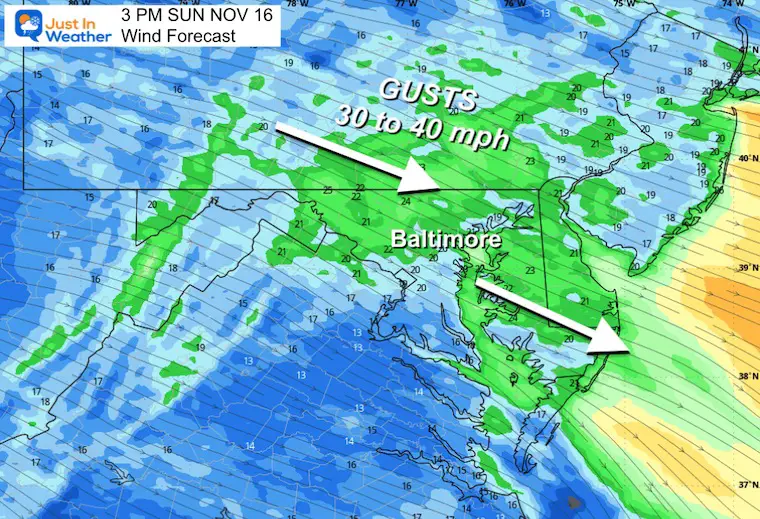
Strong winds will increase through the day.
Gusts 30 to 40 mph,
A weak system will pass to our south. This may tap into leftover colder air and mix a flake or two with some light rain.
After this passes, a warm-up will begin by the end of the work week.
This is a general overview of the long-range pattern. Specifics are vague, which is why I do not believe in showing snow maps for next month. You can find them somewhere else, but I think they are misleading.
The overall jet stream AND temperature can be seen with the trend of above and below average. That is what I see here in response to the Stratospheric Warming Event I mentioned:
Subscribe for eMail Alerts
Sign up and be the first to know!

This was issued October 9, as expected: A weak and short-lived event to start winter may play a different role this winter

These are NOT all the same caterpillar!


Click to see more and ‘Book’ a visit to your school


The annual event: Hiking and biking 329 miles in 7 days between The Summit of Wisp to Ocean City.
Each day, we honor a kid and their family’s cancer journey.
Fundraising is for Just In Power Kids: Funding Free Holistic Programs. I never have and never will take a penny. It is all for our nonprofit to operate.
Click here or the image to donate:

I am aware there are some spelling and grammar typos and occasional other glitches. I take responsibility for my mistakes and even the computer glitches I may miss. I have made a few public statements over the years, but if you are new here, you may have missed it: I have dyslexia and found out during my second year at Cornell University. It didn’t stop me from getting my meteorology degree and being the first to get the AMS CBM in the Baltimore/Washington region. One of my professors told me that I had made it that far without knowing and to not let it be a crutch going forward. That was Mark Wysocki, and he was absolutely correct! I do miss my mistakes in my own proofreading. The autocorrect spell check on my computer sometimes does an injustice to make it worse. I can also make mistakes in forecasting. No one is perfect at predicting the future. All of the maps and information are accurate. The ‘wordy’ stuff can get sticky. There has been no editor who can check my work while writing and to have it ready to send out in a newsworthy timeline. Barbara Werner is a member of the web team that helps me maintain this site. She has taken it upon herself to edit typos when she is available. That could be AFTER you read this. I accept this and perhaps proves what you read is really from me… It’s part of my charm. #FITF