Monday November 3, 2025
The good news you may already feel good with extra sleep, AND the added sunlight on your way to work as the sun rises at 6:37 AM in Baltimore. The flip side will be the earlier sunset at 5:03 PM, but at least most of us will see the sun by then.
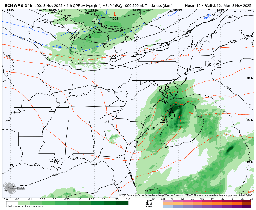
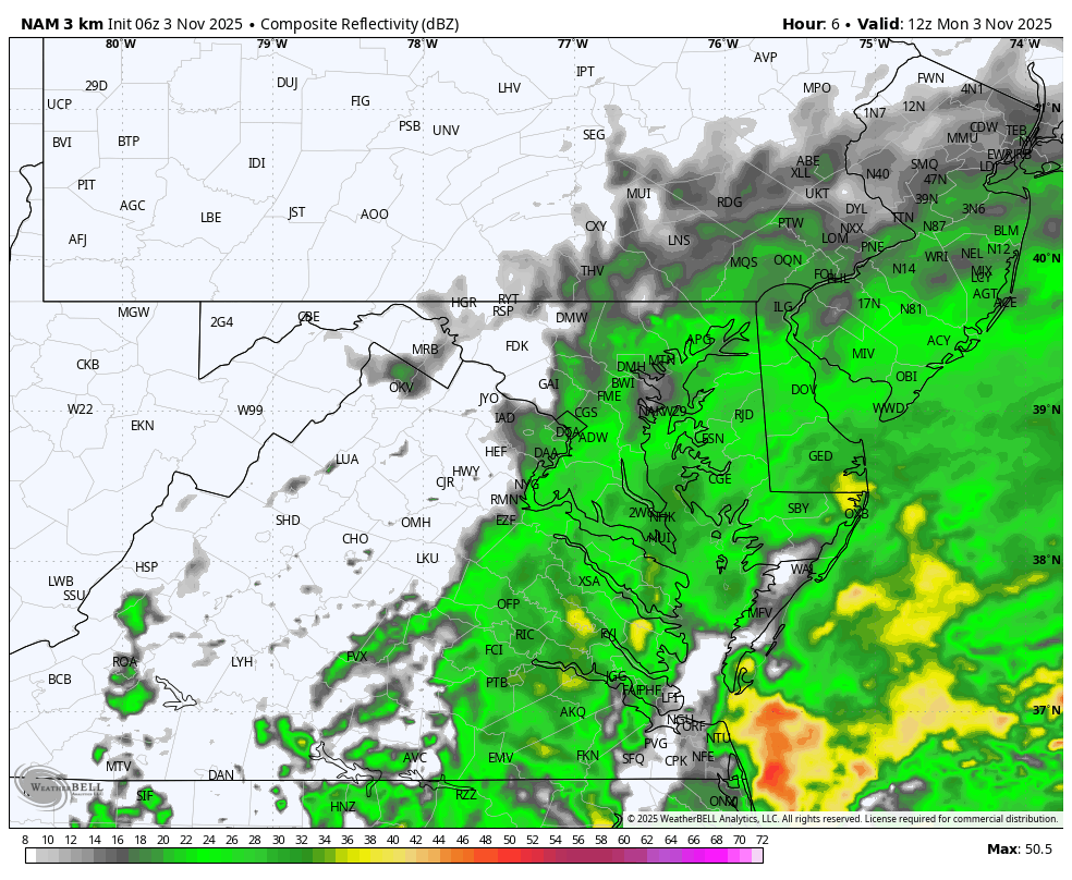
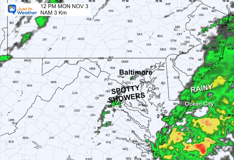
A small coastal storm is passing to our south today with rain primarily south of Baltimore to the coast. More sunshine inland, and that will expand this afternoon.
This will be an active week that brings the warmest air on Wednesday, with a chance that some areas get close to 70°F.
I see a few weather systems with the focus on rain later Friday, then a larger event on Sunday that may mark the pattern change.
Looking further ahead, the jet stream shows an early winter signal NEXT WEEK that could bring the first snow of the season to the mountains of far western Maryland and West Virginia.
WEATHER TODAY
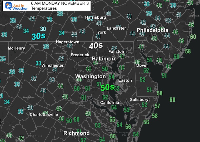
Morning Temperatures
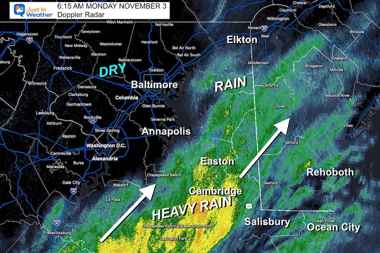
Morning Radar Snapshot
The rain is primarily on the East Side of the Chesapeake Bay.
Heavy Rain is moving north through Cambridge and Easton… this will be a Delmarva issue this morning.
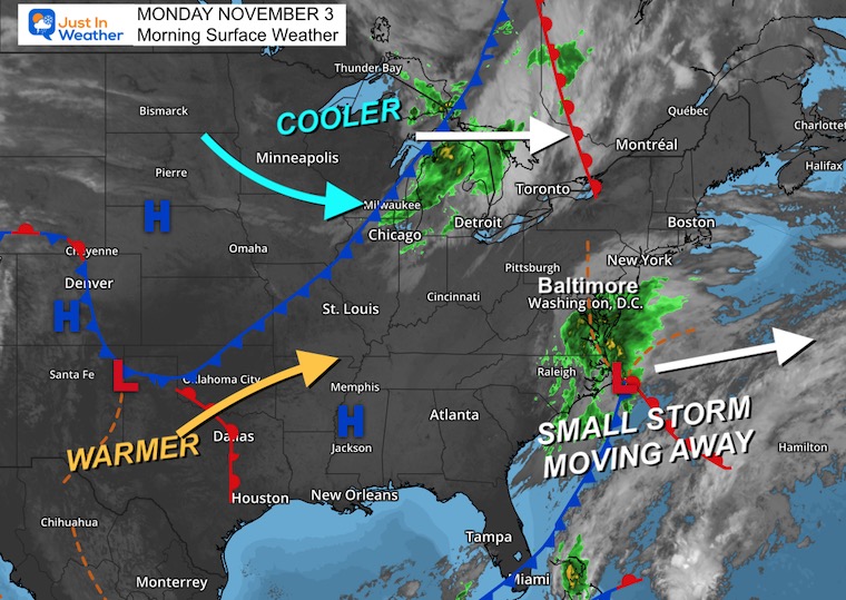
Surface Weather
A small coastal storm is responsible for the rain across Southern Maryland and the coast through the Carolinas.
Brief Storm View
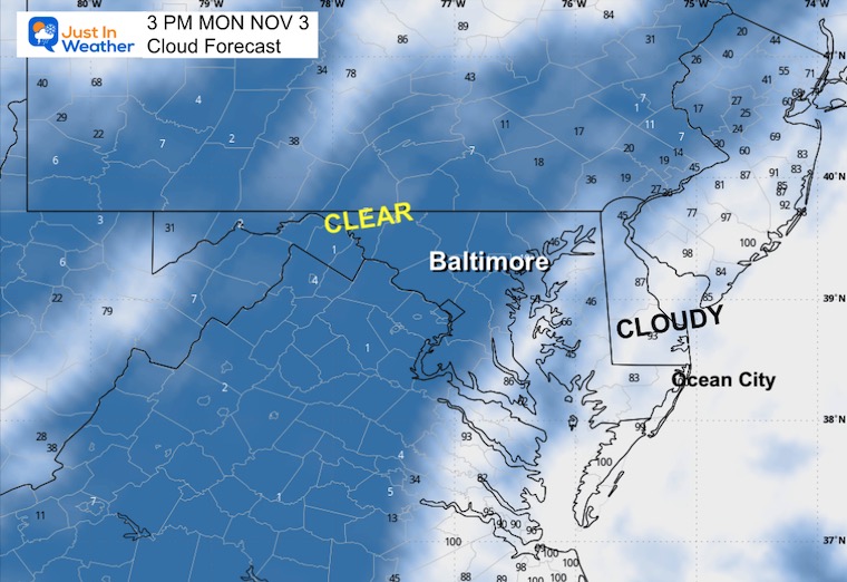
This storm will move away this afternoon, allowing more sun. Slightly cooler air will spill in tomorrow.
Live Radar Widget
Radar Simulation 7 AM to 5 PM
Afternoon Snapshot at 3 PM
Cloud Forecast
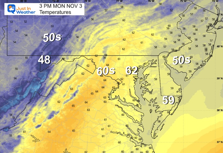
High Temperatures
CLIMATE DATA: Baltimore
Yesterday: Low 37F; High 65F
Precipitation: 0.00
TODAY November 3
Sunrise at 6:37 AM
Sunset at 5:03 PM
Normal Low in Baltimore: 40ºF
Record 25ºF in 1951
Normal High in Baltimore: 62ºF
Record 80ºF 2003
Rainfall Deficit at BWI
- Ending 2024 = -8.00”
- Since Jan 1 = 5.36”
- We are STILL DOWN -13.36” INCLUDING LAST YEAR
Subscribe for eMail Alerts
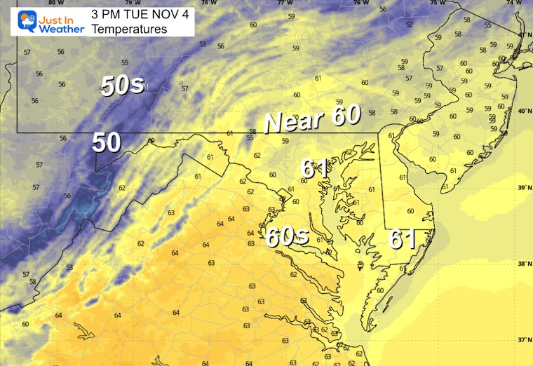
TUESDAY
Morning Temperatures

Afternoon Temperatures
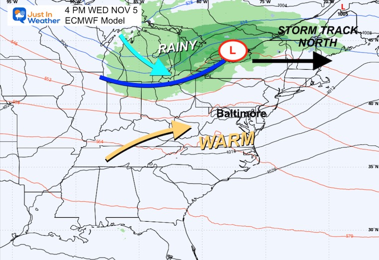
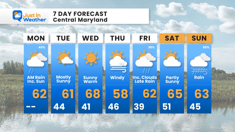
End Of Week Stormy Pattern
Wednesday to Sunday
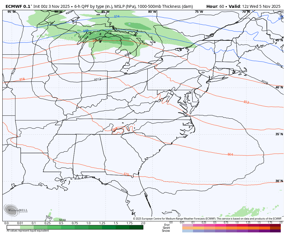
Wednesday Afternoon
Our warmest day of the week – Upper 60s to near 70°F.
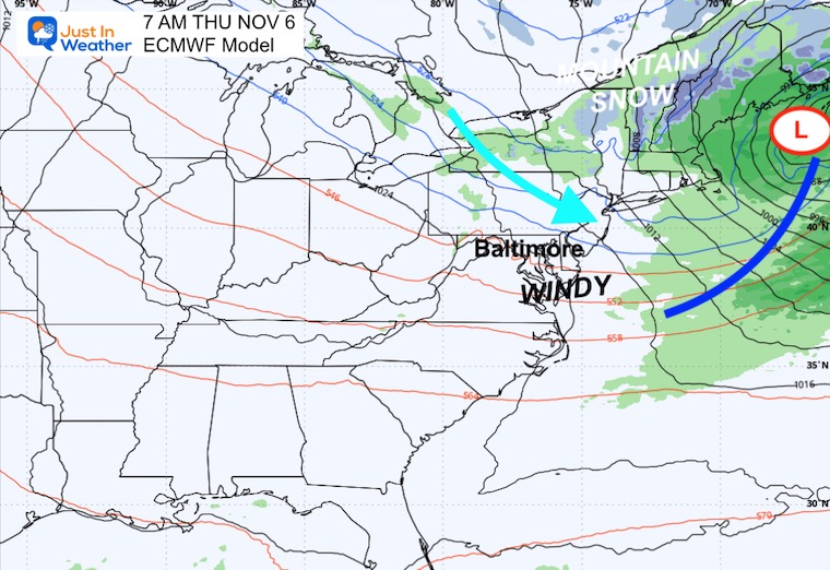
Thursday Morning
Windy and cooler
Friday Evening
This cold front may arrive sooner than suggested here. Plan for the chance of rain arriving later in the day and evening.

Saturday Morning
This looks like a classic Fall windy day with showers in the mountains and variable clouds.

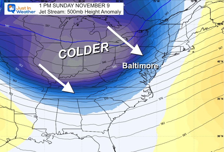
Sunday
The next event may bring steady and heavier rain as Low Pressure wraps up cold air across the Great Lakes. This will dive in following the storm.

Jet Stream: Sunday
The leading edge of a very strong winter air mass will follow the storm.
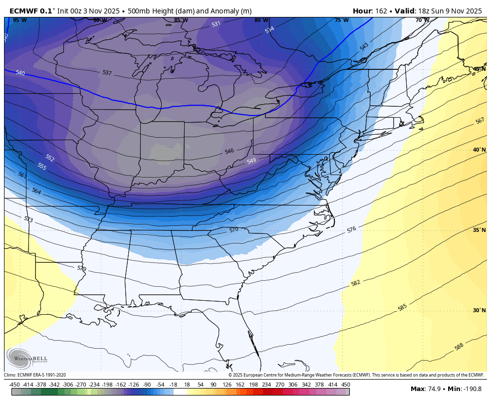
Animation: Sunday to Next Tuesday (Veterans Day)
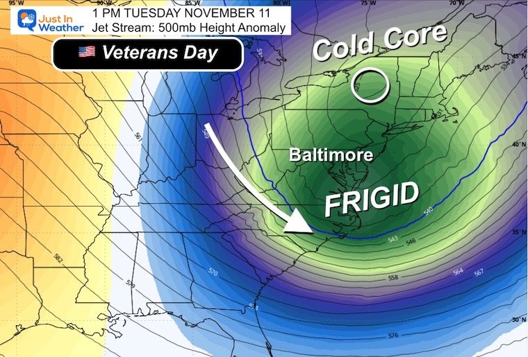
The first winter-looking air mass arrives with frigid air moving to the Southeast as well.
Jet Stream: Veterans Day Tuesday
This may open up Lake Effect Snow to reach the high mountains of Western Maryland and West Virginia.
7 Day Forecast
- Today: Small Coastal Moves Away
- Wednesday: Warmest Day This Week
- Rain Events: Late Friday AND Sunday
Subscribe for eMail Alerts
Average First Frost

La Niña Advisory
This was issued October 9, as expected: A weak and short-lived event to start winter may play a different role this winter

4 SUPERMOONS In A ROW

In Case You Missed It
Woolly Bear Caterpillar Winter Folklore
These are NOT all the same caterpillar!

Winter Outlook From 2 Farmers’ Almanacs

STEM Assemblies/In School Fields Trips Are Back
Click to see more and ‘Book’ a visit to your school

THANK YOU:
Baltimore Sun Magazine Readers’ Choice Best Of Baltimore

Maryland Trek 12 Day 7 Completed Sat August 9
UPDATED: We raised OVER $166,000 for Just In Power Kids – AND Still Collecting More
The annual event: Hiking and biking 329 miles in 7 days between The Summit of Wisp to Ocean City.
Each day, we honor a kid and their family’s cancer journey.
Fundraising is for Just In Power Kids: Funding Free Holistic Programs. I never have and never will take a penny. It is all for our nonprofit to operate.
Click here or the image to donate:

RESTATING MY MESSAGE ABOUT DYSLEXIA
I am aware there are some spelling and grammar typos and occasional other glitches. I take responsibility for my mistakes and even the computer glitches I may miss. I have made a few public statements over the years, but if you are new here, you may have missed it: I have dyslexia and found out during my second year at Cornell University. It didn’t stop me from getting my meteorology degree and being the first to get the AMS CBM in the Baltimore/Washington region. One of my professors told me that I had made it that far without knowing and to not let it be a crutch going forward. That was Mark Wysocki, and he was absolutely correct! I do miss my mistakes in my own proofreading. The autocorrect spell check on my computer sometimes does an injustice to make it worse. I can also make mistakes in forecasting. No one is perfect at predicting the future. All of the maps and information are accurate. The ‘wordy’ stuff can get sticky. There has been no editor who can check my work while writing and to have it ready to send out in a newsworthy timeline. Barbara Werner is a member of the web team that helps me maintain this site. She has taken it upon herself to edit typos when she is available. That could be AFTER you read this. I accept this and perhaps proves what you read is really from me… It’s part of my charm. #FITF
Please share your thoughts and best weather pics/videos, or just keep in touch via social media.


