Thursday, October 23, 2025
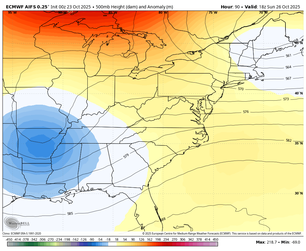
We are in a classic Autumn pattern, and the colder air will dominate. It looks like the NOAA warm outlook is not going to verify, which is why I did not show it. Our temperatures will remain below average for the foreseeable future. This will include inland frost over the next few mornings that will include suburban Baltimore and Washington areas.
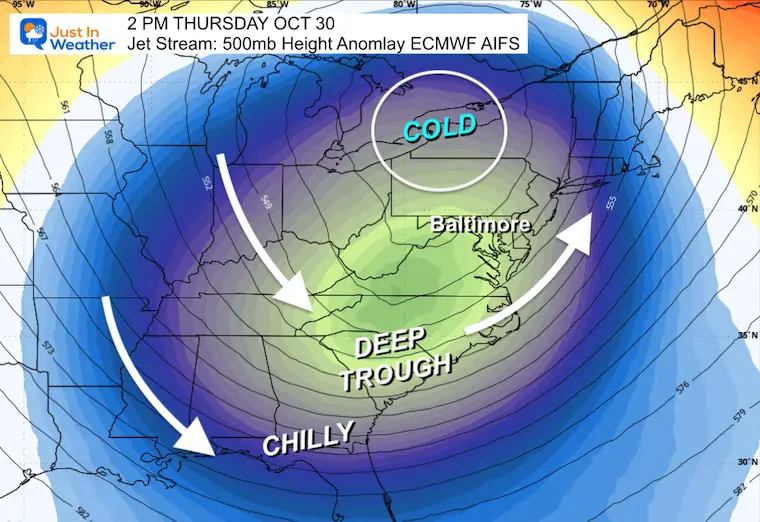
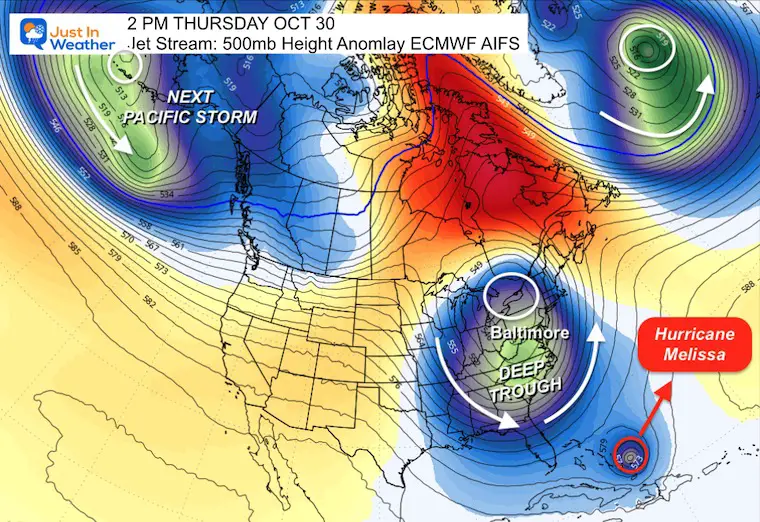
Reinforcing surges of cold air are part of an active jet stream that may involve a large storm next week. That will send the cold air to the Gulf Coast AND may be responsible for taking Tropical Storm Melissa up into the Central Atlantic.
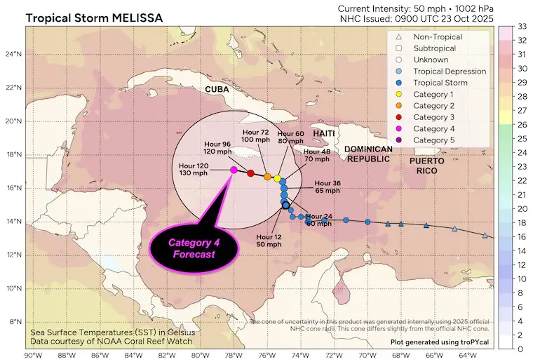
The tropical storm is expected to become a major hurricane that will crawl to the south of Jamaica. Many vacation spots will be in the zone for heavy rain and the eventual track towards Bermuda next week.
Our next storm and cold air for us next week will work to pull this storm north into the Atlantic and away from the US mainland.
Let’s take a look…
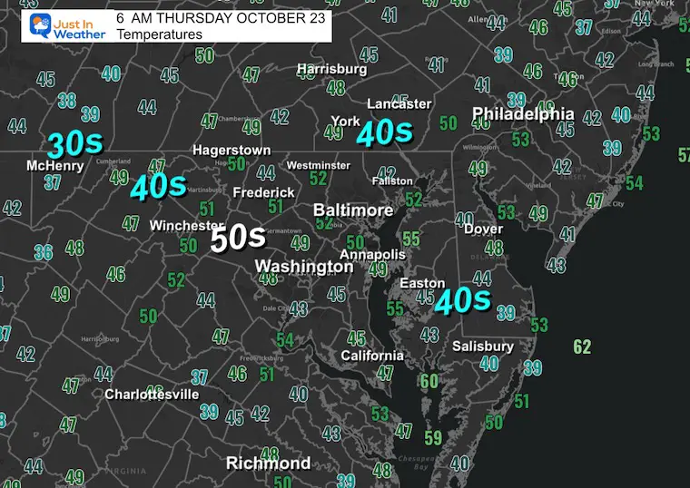
Morning Temperatures
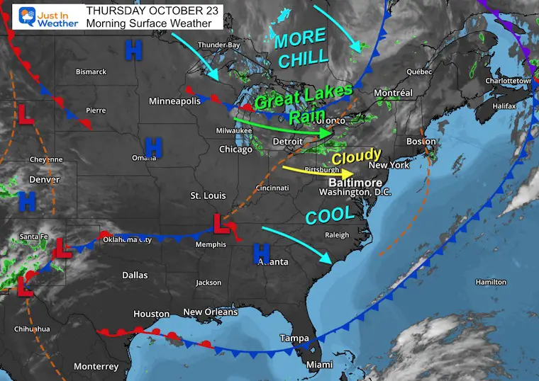
Surface Weather
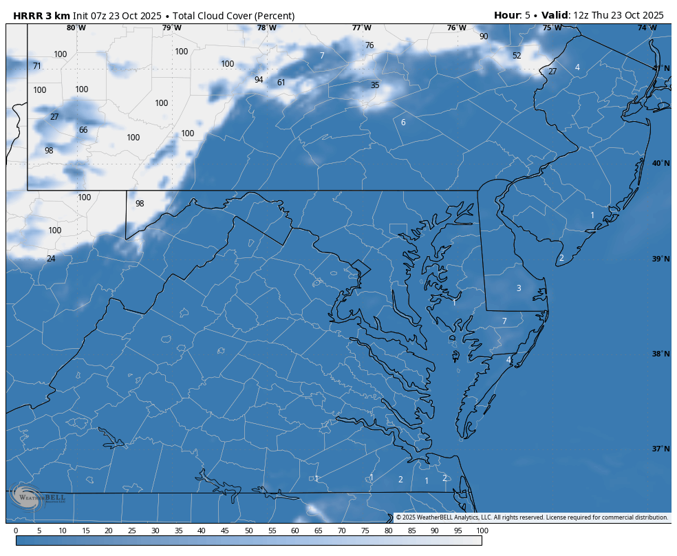
This cold dominated weather map shows the cool air in place and winds across the Great Lakes that will provide additional moisture.
This means another round of inland clouds, while rain will continue across the Lakes.
There is more chilly air in the waiting that will keep temperatures below normal through next week.
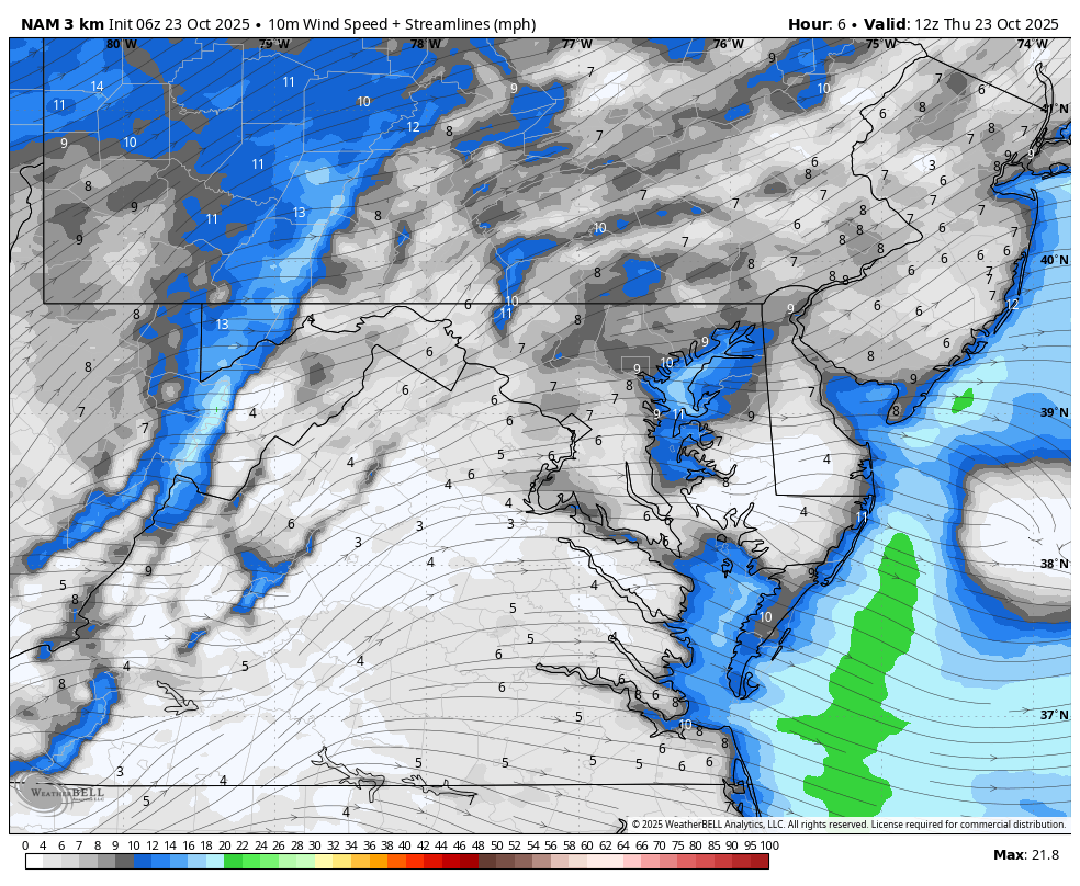
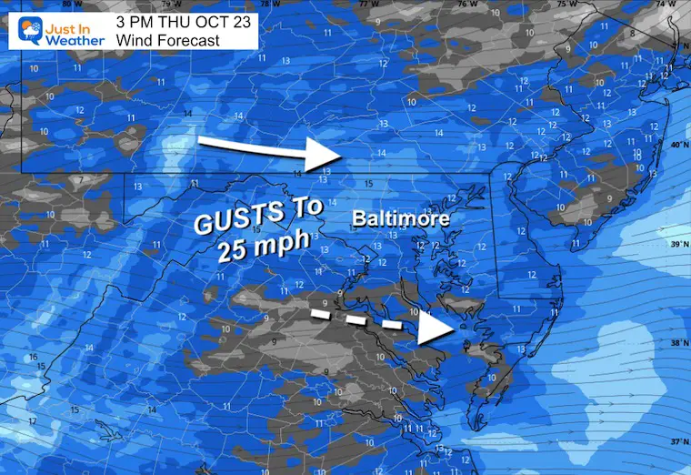
Afternoon Wind Forecast
Another day with winds increasing during the daylight hours.
Afternoon Snapshot
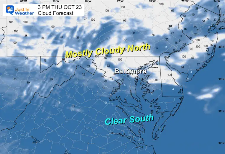
Cloud Forecast
Afternoon Snapshot
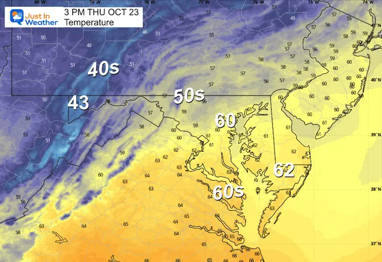
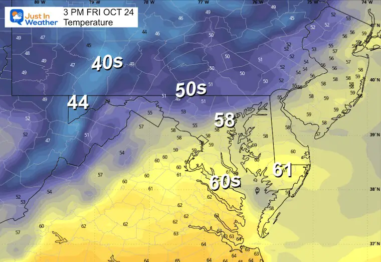
Afternoon Temperatures
CLIMATE DATA: Baltimore
Yesterday: Low 44F; High 66F
Precipitation: 0.00” (up to midnight)
TODAY October 23
Sunrise at 7:25 AM
Sunset at 6:16 PM
Normal Low in Baltimore: 44ºF
Record 28ºF in 1997
Normal High in Baltimore: 66ºF
Record 91ºF 1947
Rainfall Deficit at BWI
- Ending 2024 = -8.00”
- Since Jan 1 = 6.08”
- We are STILL DOWN -14.08” INCLUDING LAST YEAR
Subscribe for eMail Alerts
FRIDAY
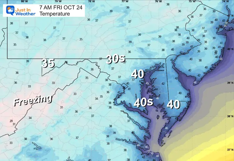
Morning Temperatures
Afternoon Temperatures
WEEKEND WEATHER
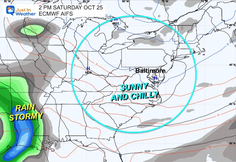
Saturday
Sunny, cool, and dry. The next storm will be in the Southern Plains states.
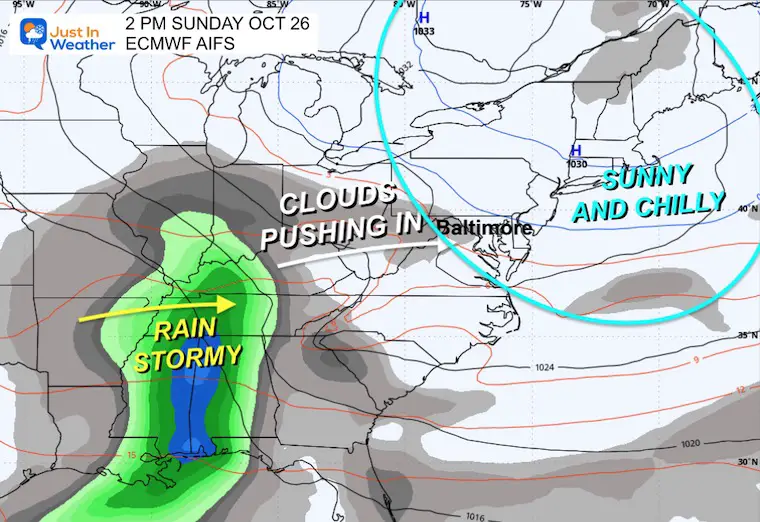
Sunday
Clouds may arrive in the afternoon ahead of the next storm, but we will remain dry.
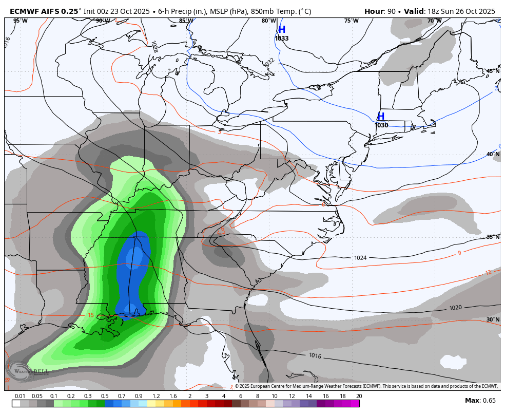
Storm Forecast Animation: Sunday to Wednesday
The rain will arrive by late Monday and Tuesday. This will usher in the next round of cold air and pattern change.
Jet Stream: Thursday October 23 to NEXT Thursday October 30
Reinforcing surges of chilly air will get a big boost with a very deep trough next week. If you look to the right, you will see Melissa (possibly as a hurricane) getting pulled up to the North well off the coast.
Snapshots
NEXT Thursday, October 30
A Deep Trough will dominate the Eastern US and bring chilly air all the way down into Florida.
Wide View
This shows North America and may better show the influence of the Jet Stream and Melissa in the Caribbean, getting pulled north next week.
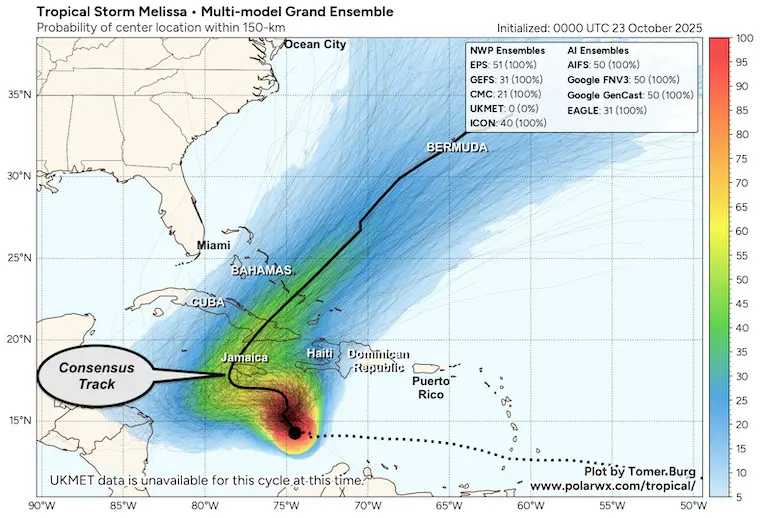
Melissa Computer Model Ensemble Tracks
The consensus among most computer models shows the drift to the West, then a sharp turn as it gets picked up and pulled North into the Atlantic.
While NOT a US mainland storm, the concern from Jamaica to The Dominican Republic and The Bahamas now extends to another near hit for Bermuda.
Tropical Outlook
Tropical Storm Melissa still has 50 mph winds. This is not well organized yet, but it will have a chance to flare up in a hurry!
The light winds will allow a stall and crawl over very warm water. This will encourage rapid development to major hurricane intensity.
Satellite Loop
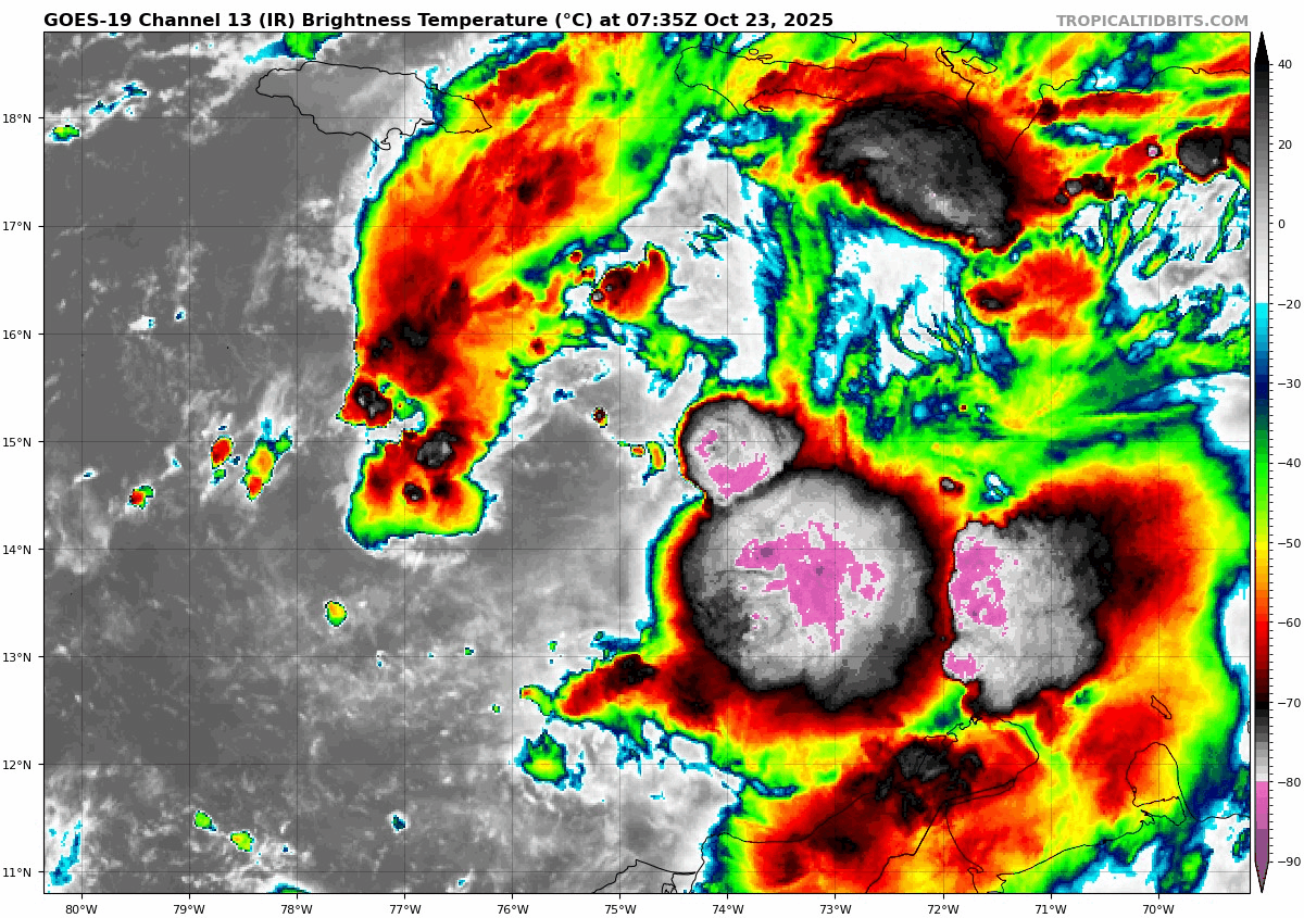
SUMMARY OF 500 AM EDT…0900 UTC…INFORMATION
———————————————-
- LOCATION…15.0N 74.9W
- ABOUT 240 MI…390 KM SSE OF KINGSTON JAMAICA
- ABOUT 300 MI…485 KM SW OF PORT AU PRINCE HAITI
- MAXIMUM SUSTAINED WINDS…50 MPH…85 KM/H
- PRESENT MOVEMENT…WNW OR 300 DEGREES AT 3 MPH…6 KM/H
- MINIMUM CENTRAL PRESSURE…1002 MB…29.59 INCHES
National Hurricane Center Forecast Track
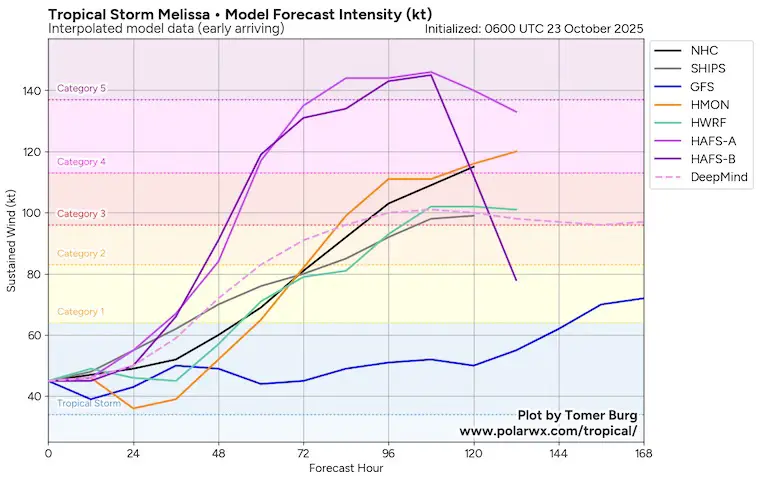
More Detailed Look: Thanks to Tomer Burg
This is expected to become a Category 4 Hurricane as it stalls or crawls to the south side of Jamaica.
Model Forecast Intensity
There is a range of potential development with some hurricane models trying to push it to Category 5 intensity.
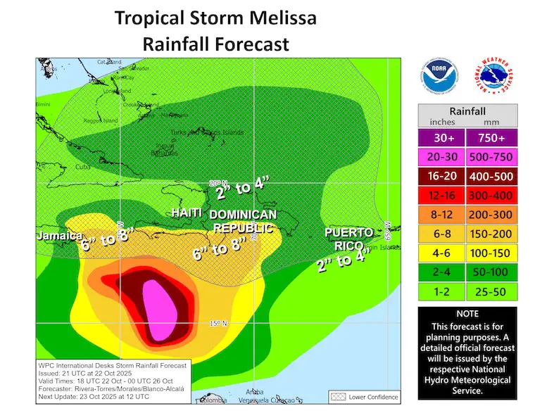
Rainfall Forecast
Heavy Rain may be enhanced even more over the mountains on these islands.
There will be a swath of up to 8 inches for parts of Jamaica to southern Hispaniola (Haiti and DR).
Puerto Rico will also see a lot of rain across the island.
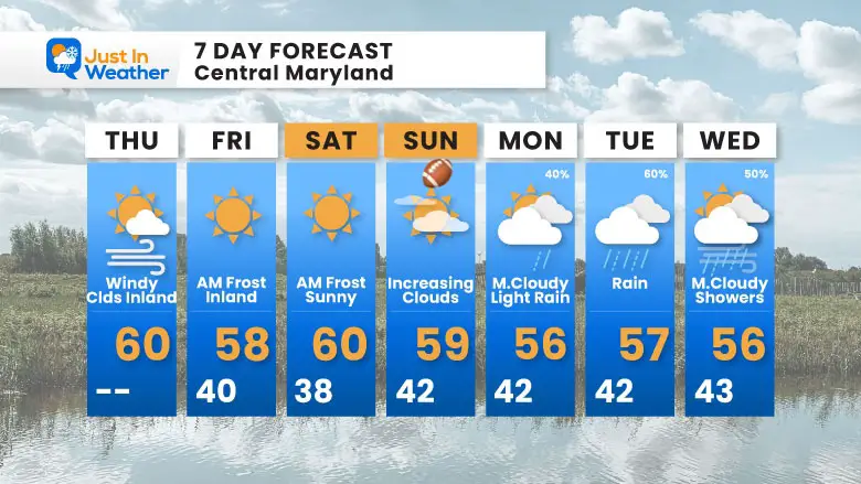
OUR LOCAL 7 Day Forecast
- Today: Cool Wind And Inland Clouds
- Frosty Mornings With Daytime Sun
- Temps REMAIN Below Average
- Sunday: Chilly For The Ravens Home Game
- Next Week: Pattern Change Brings Rain
Subscribe for eMail Alerts
Average First Frost

La Niña Advisory
This was issued October 9, as expected: A weak and short-lived event to start winter may play a different role this winter

4 SUPERMOONS In A ROW

In Case You Missed It
Woolly Bear Caterpillar Winter Folklore
These are NOT all the same caterpillar!

Winter Outlook From 2 Farmers’ Almanacs

STEM Assemblies/In School Fields Trips Are Back
Click to see more and ‘Book’ a visit to your school

THANK YOU:
Baltimore Sun Magazine Readers’ Choice Best Of Baltimore

Maryland Trek 12 Day 7 Completed Sat August 9
UPDATED: We raised OVER $166,000 for Just In Power Kids – AND Still Collecting More
The annual event: Hiking and biking 329 miles in 7 days between The Summit of Wisp to Ocean City.
Each day, we honor a kid and their family’s cancer journey.
Fundraising is for Just In Power Kids: Funding Free Holistic Programs. I never have and never will take a penny. It is all for our nonprofit to operate.
Click here or the image to donate:

RESTATING MY MESSAGE ABOUT DYSLEXIA
I am aware there are some spelling and grammar typos and occasional other glitches. I take responsibility for my mistakes and even the computer glitches I may miss. I have made a few public statements over the years, but if you are new here, you may have missed it: I have dyslexia and found out during my second year at Cornell University. It didn’t stop me from getting my meteorology degree and being the first to get the AMS CBM in the Baltimore/Washington region. One of my professors told me that I had made it that far without knowing and to not let it be a crutch going forward. That was Mark Wysocki, and he was absolutely correct! I do miss my mistakes in my own proofreading. The autocorrect spell check on my computer sometimes does an injustice to make it worse. I can also make mistakes in forecasting. No one is perfect at predicting the future. All of the maps and information are accurate. The ‘wordy’ stuff can get sticky. There has been no editor who can check my work while writing and to have it ready to send out in a newsworthy timeline. Barbara Werner is a member of the web team that helps me maintain this site. She has taken it upon herself to edit typos when she is available. That could be AFTER you read this. I accept this and perhaps proves what you read is really from me… It’s part of my charm. #FITF
Please share your thoughts and best weather pics/videos, or just keep in touch via social media.


