Wednesday, October 22, 2025
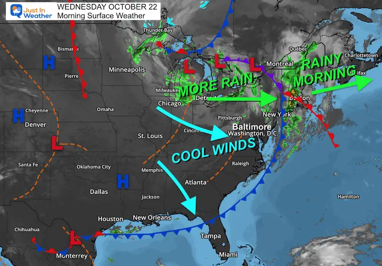
The rain that arrived last night was part of a cold front that is setting up a new weather pattern. Yes, it is Autumn, and it will feel chilly. But temps will be running below average and holding the cold through next week.
Reinforcing surges of cold air are part of an active jet stream that may involve a large storm next week. That will send the cold to the Gulf Coast, AND may be responsible for taking newly formed Tropical Storm Melissa up into the Central Atlantic.
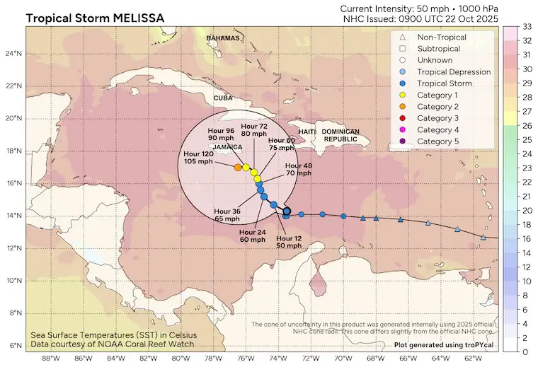
The tropical storm is expected to become a hurricane and may stall near Jamaica this weekend until that cold air can lift it away.
Let’s take a look…
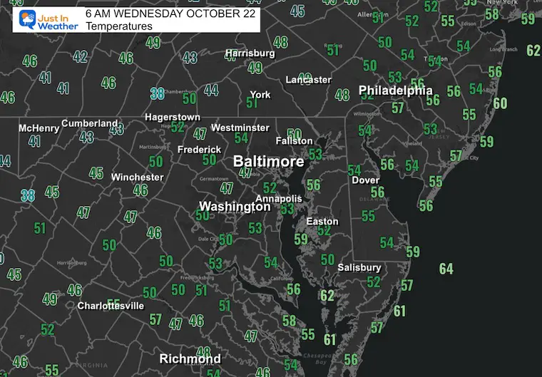
Morning Temperatures
Surface Weather
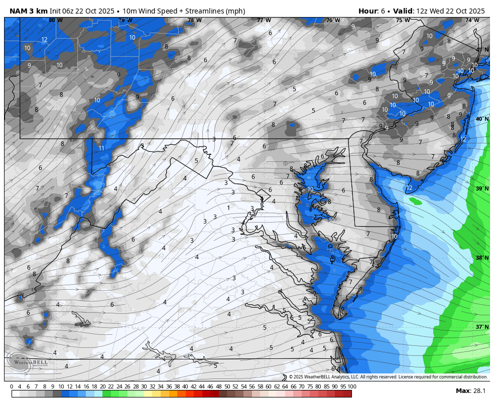
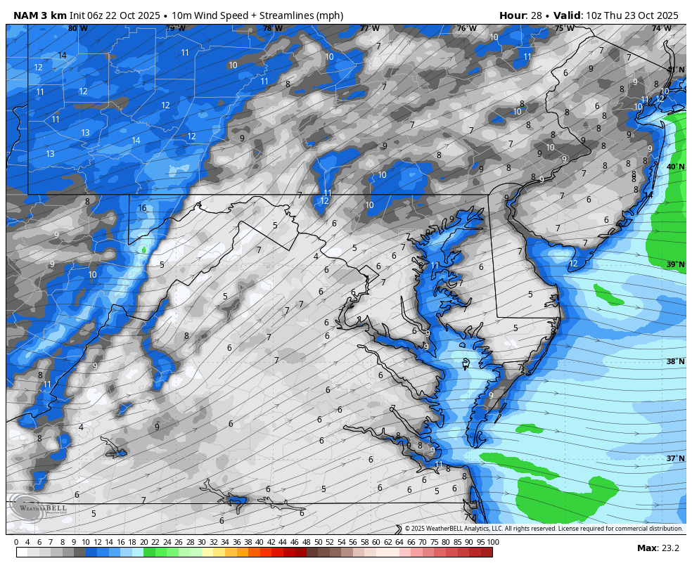
Wind Forecast 8 AM to Midnight
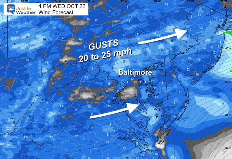
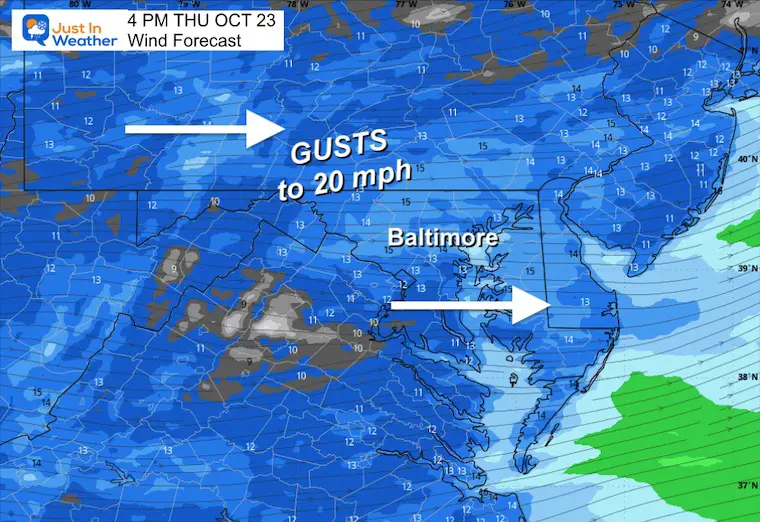
Afternoon Wind Forecast
Gusts 20 to 25 mph and definitely a chilly feel in the air.
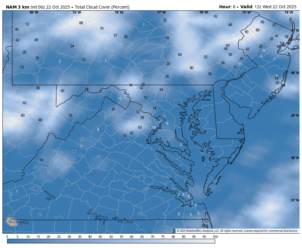
Cloud Forecast 8 AM to Midnight
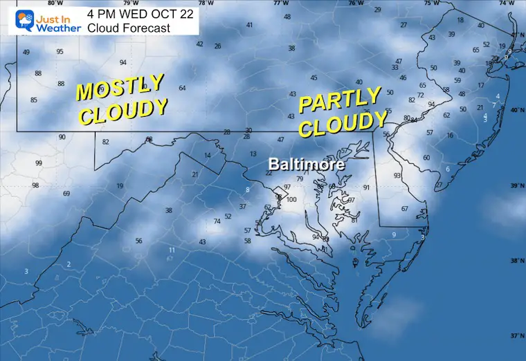
Afternoon Clouds
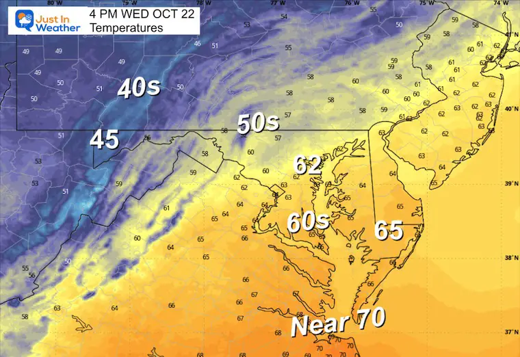
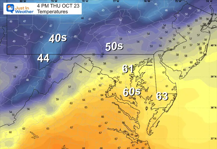
Afternoon Temperatures
CLIMATE DATA: Baltimore
Yesterday: Low 40F; High 73F
Precipitation: 0.02”
TODAY October 22
Sunrise at 7:24 AM
Sunset at 6:18 PM
Normal Low in Baltimore: 44ºF
Record 31ºF in 1952
Normal High in Baltimore: 66ºF
Record 85ºF 1920; 1979
Rainfall Deficit at BWI
Ending 2024 = -8.00”
Since Jan 1 = 5.96”
We are STILL DOWN -13.96” INCLUDING LAST YEAR
Subscribe for eMail Alerts
THURSDAY
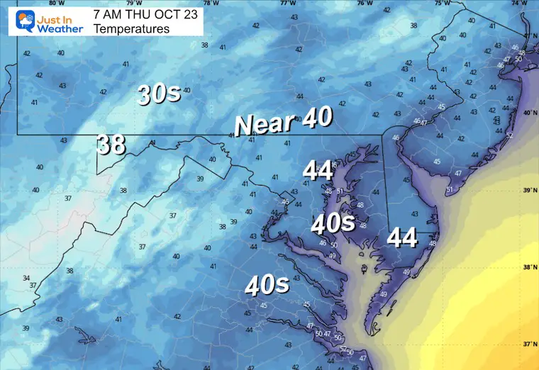
Morning Temperatures
Wind Forecast
Afternoon Wind Snapshot
Still brisk winds around 20 mph from the West.
Afternoon Temperatures
Looking Ahead:
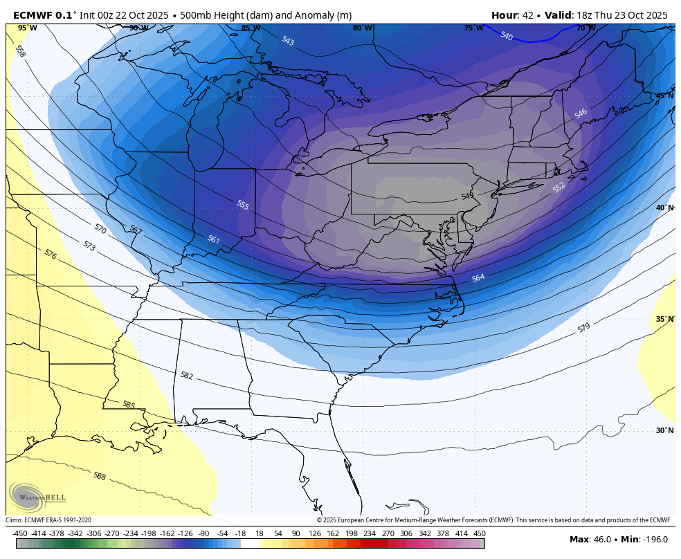
Jet Stream: Thursday, October 23, to NEXT Thursday, October 30
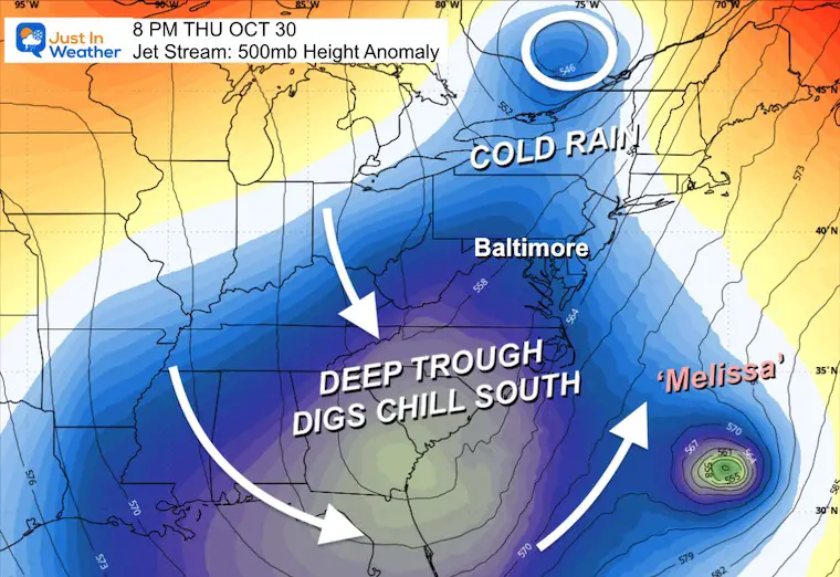
Reinforcing surges of chilly air will get a big boost with a very deep trough next week. If you look to the right, you will see Melissa (possibly as a hurricane) getting pulled up to the North well off the coast.
Snapshots
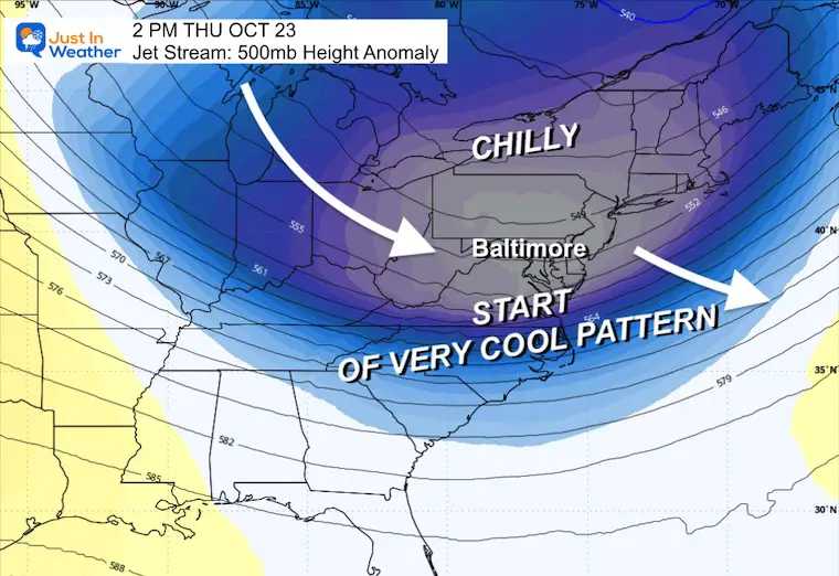
Thursday October 23
The core of this round of cool air settles in.
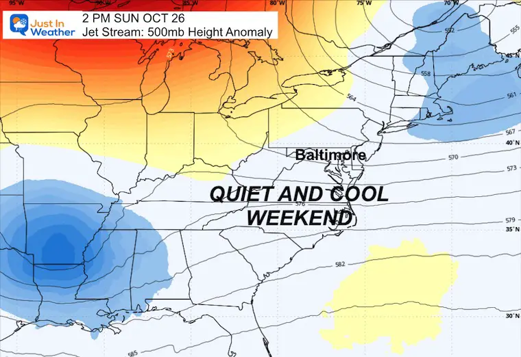
Sunday October 26
Quiet and calm wind… still chilly.
NEXT Thursday, October 30
This DEEP TROUGH will be a major pattern adjustment for the East Coast, AND will dig far enough south to pull Melissa up into the Atlantic.
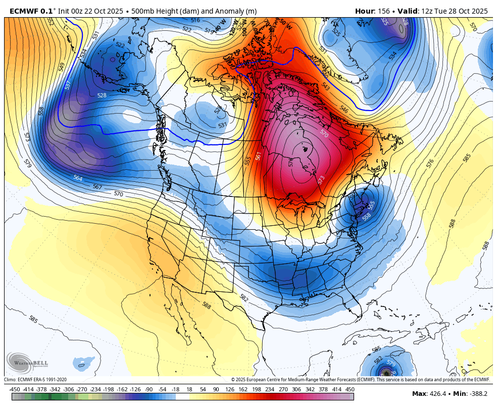
Wide View
This shows North America and may better show the influence of the Jet Stream and Melissa in the Caribbean, getting pulled north next week.
Tropical Outlook
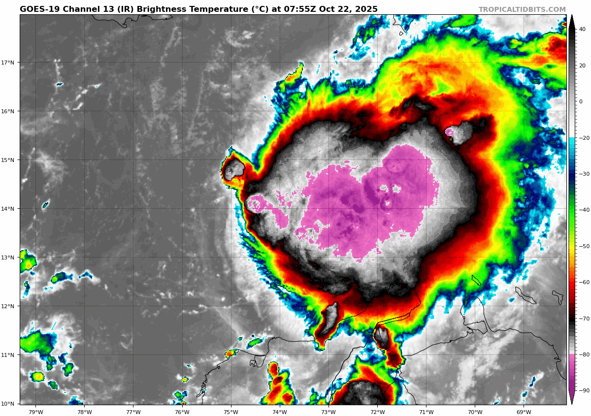
Tropical Storm Melissa has 50 mph winds. Its movement to the West Northwest at 7 mph is slowing down.
SUMMARY OF 500 AM EDT…0900 UTC…INFORMATION
- LOCATION…14.3N 73.5W
- ABOUT 305 MI…495 KM SSW OF PORT AU PRINCE HAITI
- MAXIMUM SUSTAINED WINDS…50 MPH…85 KM/H
- PRESENT MOVEMENT…WNW OR 295 DEGREES AT 7 MPH…11 KM/H
- MINIMUM CENTRAL PRESSURE…1000 MB…29.53 INCHES
Satellite Loop Wednesday Morning
National Hurricane Center Forecast Track
It is expected to become a Category 2 Hurricane and stall near Jamaica for a few days.

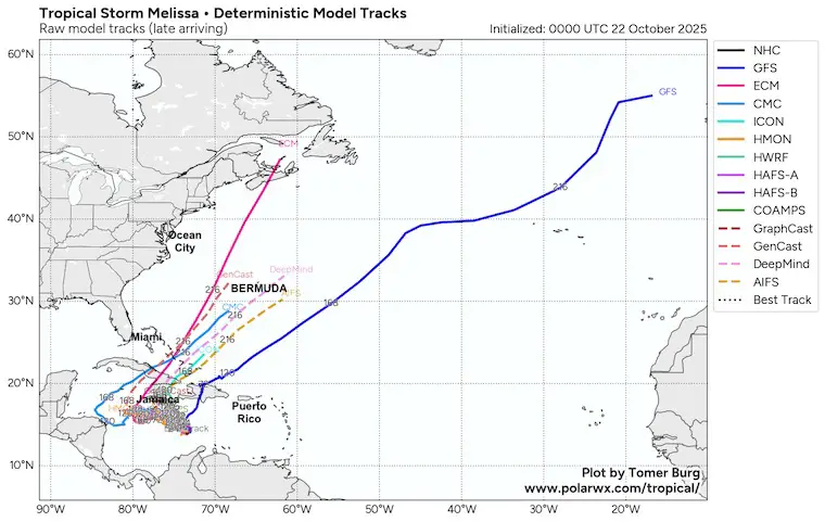
More Detailed Look: Thanks to Tomer Burg
Computer Guidance: Deterministic Model Tracks
The GFS Model is the outlier bringing this north, while the consensus is an expected stall near Jamaica through the weekend until it gets picked up by our East Coast TROUGH next week. Google DeepMind and ECMWF are later and closer to the Bahamas. The Canadian CMC is later, and the outlier taking it close to New England. I would not rely on that.
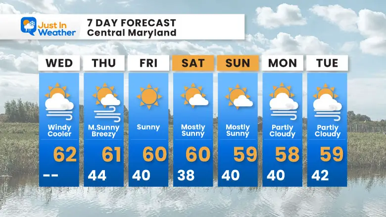
7 Day Forecast
- Today: Windy and Cooler
- More Chilly Air To Last Through Next Week
- Weekend: Sunny With Less Wind
Subscribe for eMail Alerts
Average First Frost

La Niña Advisory
This was issued October 9, as expected: A weak and short-lived event to start winter may play a different role this winter

4 SUPERMOONS In A ROW

In Case You Missed It
Woolly Bear Caterpillar Winter Folklore
These are NOT all the same caterpillar!

Winter Outlook From 2 Farmers’ Almanacs

STEM Assemblies/In School Fields Trips Are Back
Click to see more and ‘Book’ a visit to your school

THANK YOU:
Baltimore Sun Magazine Readers’ Choice Best Of Baltimore

Maryland Trek 12 Day 7 Completed Sat August 9
UPDATED: We raised OVER $166,000 for Just In Power Kids – AND Still Collecting More
The annual event: Hiking and biking 329 miles in 7 days between The Summit of Wisp to Ocean City.
Each day, we honor a kid and their family’s cancer journey.
Fundraising is for Just In Power Kids: Funding Free Holistic Programs. I never have and never will take a penny. It is all for our nonprofit to operate.
Click here or the image to donate:

RESTATING MY MESSAGE ABOUT DYSLEXIA
I am aware there are some spelling and grammar typos and occasional other glitches. I take responsibility for my mistakes and even the computer glitches I may miss. I have made a few public statements over the years, but if you are new here, you may have missed it: I have dyslexia and found out during my second year at Cornell University. It didn’t stop me from getting my meteorology degree and being the first to get the AMS CBM in the Baltimore/Washington region. One of my professors told me that I had made it that far without knowing and to not let it be a crutch going forward. That was Mark Wysocki, and he was absolutely correct! I do miss my mistakes in my own proofreading. The autocorrect spell check on my computer sometimes does an injustice to make it worse. I can also make mistakes in forecasting. No one is perfect at predicting the future. All of the maps and information are accurate. The ‘wordy’ stuff can get sticky. There has been no editor who can check my work while writing and to have it ready to send out in a newsworthy timeline. Barbara Werner is a member of the web team that helps me maintain this site. She has taken it upon herself to edit typos when she is available. That could be AFTER you read this. I accept this and perhaps proves what you read is really from me… It’s part of my charm. #FITF
Please share your thoughts and best weather pics/videos, or just keep in touch via social media.


