Monday, October 13 2025
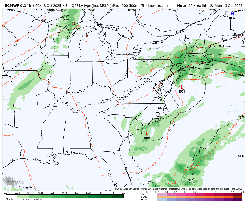
Today is ANOTHER Storm Day! Low Pressure is located off the coast of Delaware as part of this complex system expanding along most of the Eastern US. This produced the expected high wind and waves, which has resulted in extensive beach erosion.
While a rare and difficult weather event to forecast, it has done what was expected, with the exception of the rainfall total. Today, the rain will expand inland to include metro areas. This will also include strong and gusty winds that will combine to keep us chilly in the upper 50s.
As the storm moves away, our weather will improve during the week.
Let’s take a look…
Storm Highlights Yesterday
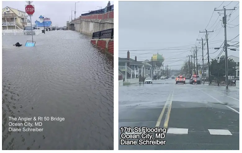
Flooding in Ocean City
Photos From Diane Schreiber
High Waves At The Ocean City Inlet
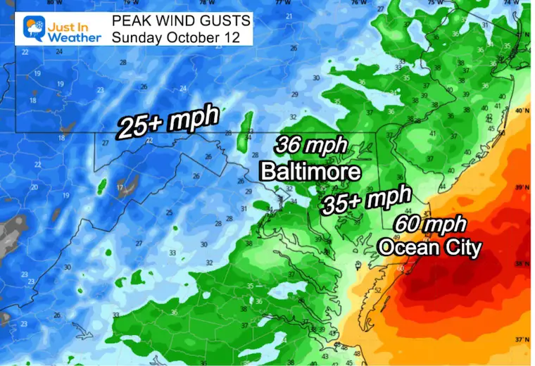
Peak Wind Gusts
Ocean City did reach 60 mph
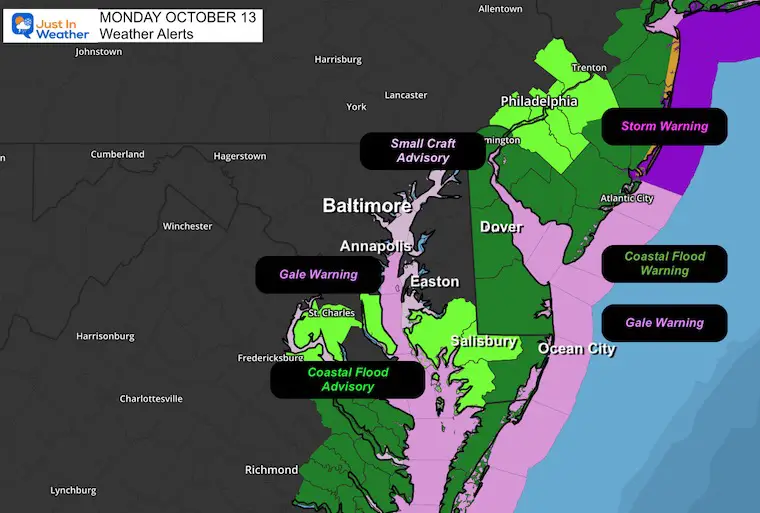
Weather Alerts
A Gale Warning on the Chesapeake Bay to the Mid-Atlantic coast.
A Storm Warning along the New Jersey and New York coast.
Coastal Flooding is still a concern from the Southern Chesapeake Bay to the ocean shoreline.
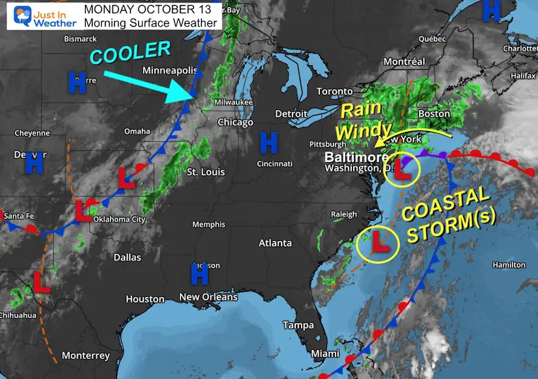
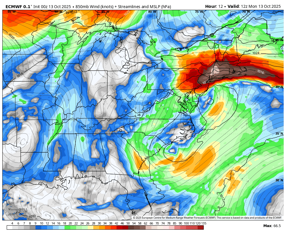
Surface Weather
There are two areas of Low Pressure off the East Coast. Our focus is on the circulation east of Delaware. This will remain nearly stalled all day as it pumps steady rain across New England, wraps into Pennsylvania, and back down to Maryland.
The next focus will be the cool air mass in the Northern Plains that will arrive mid-week.
Low-Level Jet Stream Wind Forecast at 5,000 Ft
Through Tuesday Night
Winds at cloud level will start 60 to 80 mph, then spin out as the stalled Low will get a push off the coast.
Storm Forecast Through Tuesday Night
The ‘Loop’ around the Mid-Atlantic will give way to this storm complex moving away from the coast.
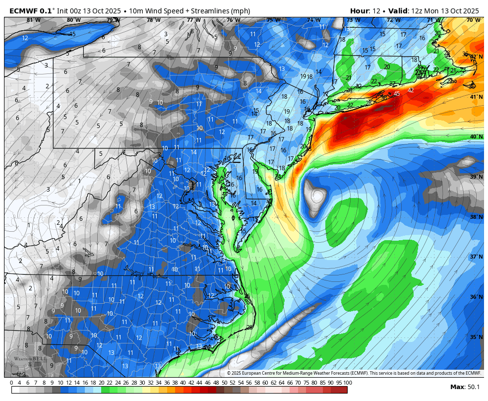
Surface Wind Forecast Through Tuesday Night
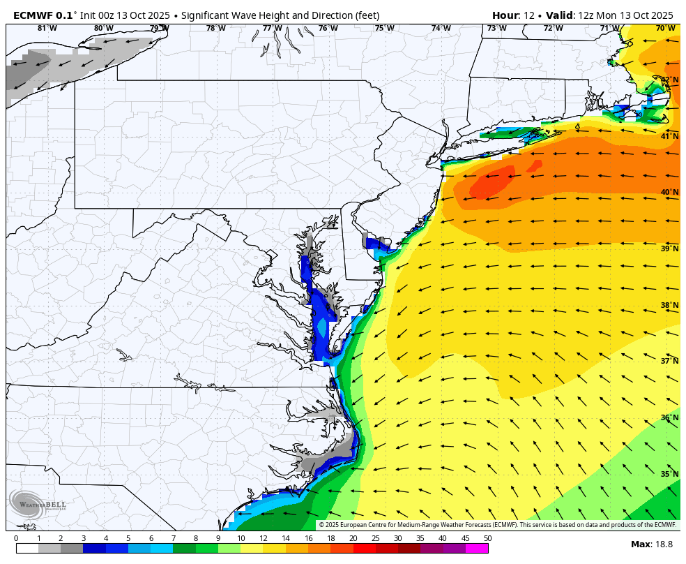
Significant Wave Forecast Through Tuesday Night
LOCAL WEATHER
CLIMATE DATA: Baltimore
Yesterday: Low 58F; High 66F
Precipitation: 0.02”
TODAY October 13
Sunrise at 7:15 AM
Sunset at 6:30 PM
Normal Low in Baltimore: 48ºF
Record 32ºF in 1957; 1988; 2006
Normal High in Baltimore: 69ºF
Record 89ºF 1954
Rainfall Deficit at BWI
- Ending 2024 = -8.00”
- Since Jan 1 = 5.37”
- We are STILL DOWN -13.37” INCLUDING LAST YEAR
Subscribe for eMail Alerts
TODAY
Live Radar Widget
Radar Simulation: 8 AM to Midnight
Wind Animation: 8 AM to Midnight
4 PM Snapshots
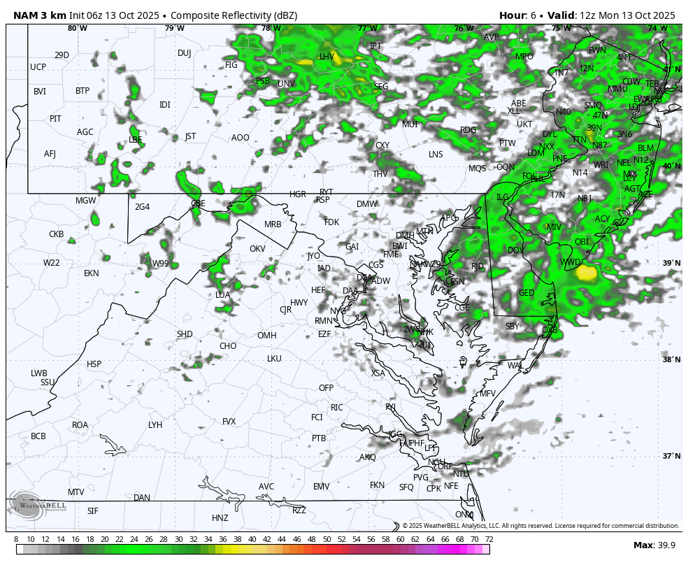
Radar
Rain showers will continue all day.
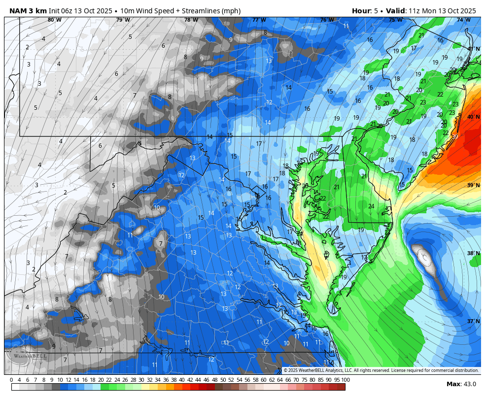
Afternoon Winds
Strong Breeze! The wind direction along the beaches will shift offshore, which will ease the flooding.
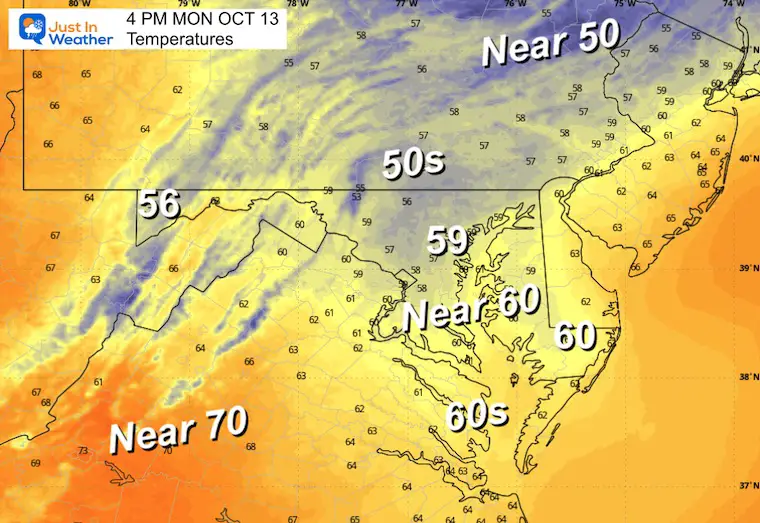
Afternoon Temperatures
TUESDAY
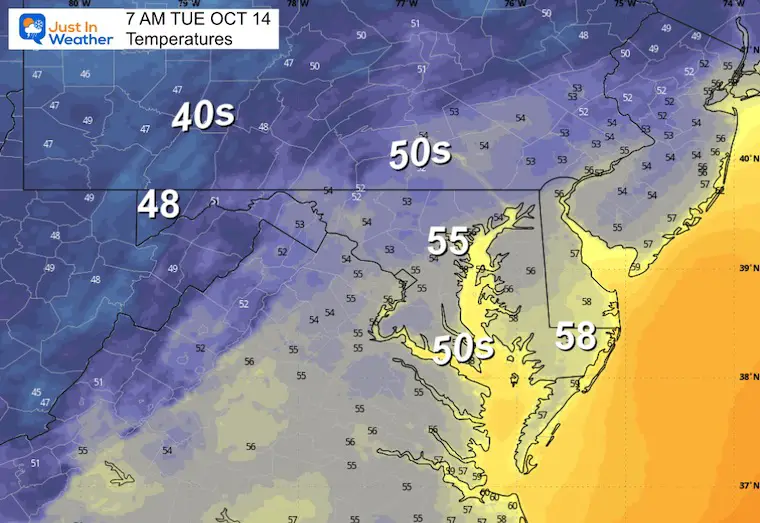
Morning Temperatures
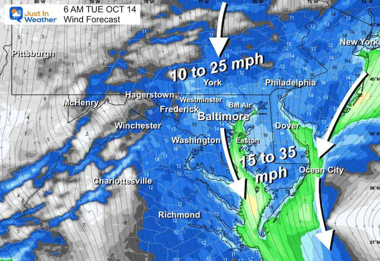
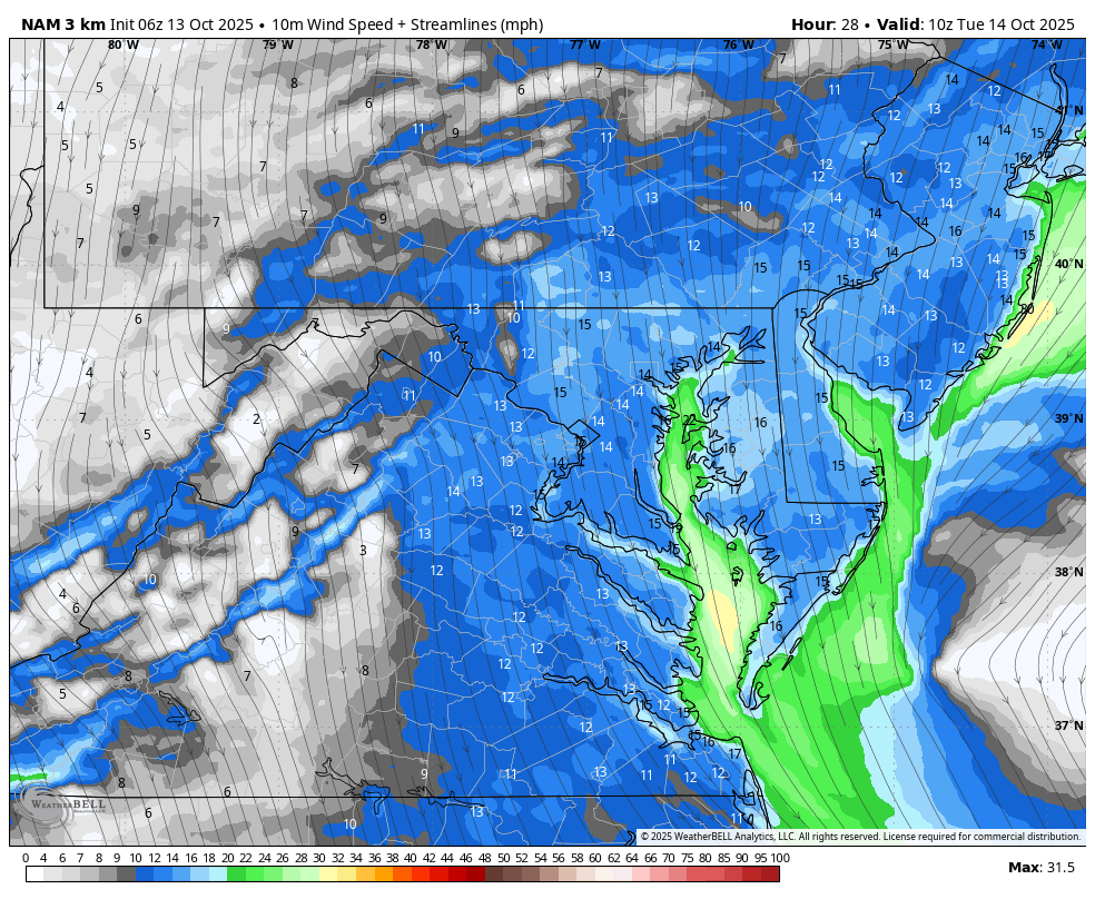
Morning Wind
Strong breeze will continue from the north.
Wind Forecast
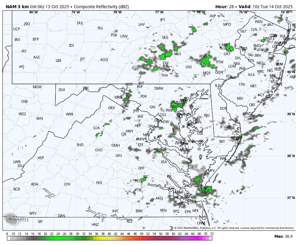
Radar Forecast
Early showers then clearing.
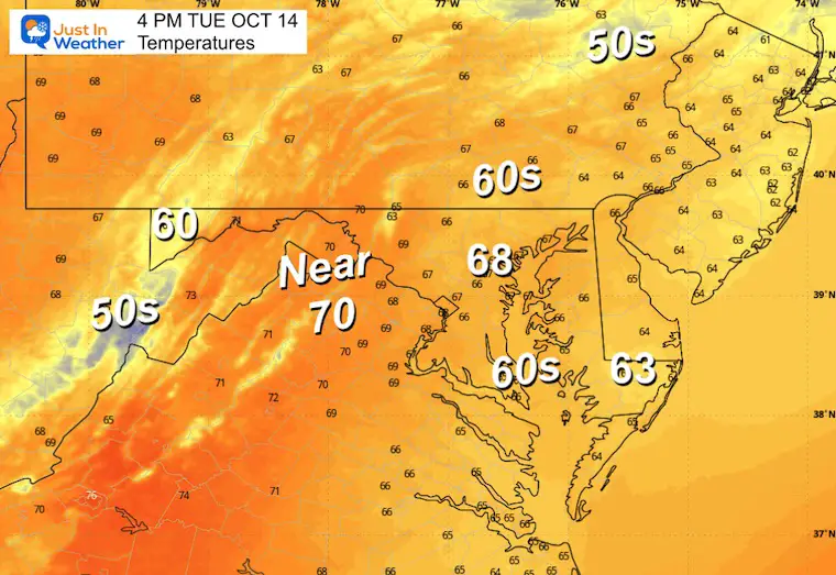
Afternoon Temperatures
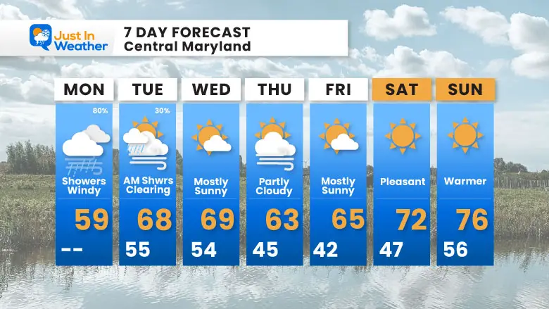
7 Day Forecast
- Today: Storm Day: Rain, Wind, Waves, Beach Erosion
- Tuesday: Morning Showers Then Clearing
- Dry Weather Then Warming Next Weekend
Subscribe for eMail Alerts
La Niña Advisory
This was issued October 9, as expected: A weak and short-lived event to start winter may play a different role this winter

4 SUPERMOONS In A ROW

In Case You Missed It
Woolly Bear Caterpillar Winter Folklore
These are NOT all the same caterpillar!

Winter Outlook From 2 Farmers’ Almanacs

STEM Assemblies/In School Fields Trips Are Back
Click to see more and ‘Book’ a visit to your school

THANK YOU:
Baltimore Sun Magazine Readers’ Choice Best Of Baltimore

Maryland Trek 12 Day 7 Completed Sat August 9
UPDATED: We raised OVER $166,000 for Just In Power Kids – AND Still Collecting More
The annual event: Hiking and biking 329 miles in 7 days between The Summit of Wisp to Ocean City.
Each day, we honor a kid and their family’s cancer journey.
Fundraising is for Just In Power Kids: Funding Free Holistic Programs. I never have and never will take a penny. It is all for our nonprofit to operate.
Click here or the image to donate:

RESTATING MY MESSAGE ABOUT DYSLEXIA
I am aware there are some spelling and grammar typos and occasional other glitches. I take responsibility for my mistakes and even the computer glitches I may miss. I have made a few public statements over the years, but if you are new here, you may have missed it: I have dyslexia and found out during my second year at Cornell University. It didn’t stop me from getting my meteorology degree and being the first to get the AMS CBM in the Baltimore/Washington region. One of my professors told me that I had made it that far without knowing and to not let it be a crutch going forward. That was Mark Wysocki, and he was absolutely correct! I do miss my mistakes in my own proofreading. The autocorrect spell check on my computer sometimes does an injustice to make it worse. I can also make mistakes in forecasting. No one is perfect at predicting the future. All of the maps and information are accurate. The ‘wordy’ stuff can get sticky. There has been no editor who can check my work while writing and to have it ready to send out in a newsworthy timeline. Barbara Werner is a member of the web team that helps me maintain this site. She has taken it upon herself to edit typos when she is available. That could be AFTER you read this. I accept this and perhaps proves what you read is really from me… It’s part of my charm. #FITF
Please share your thoughts and best weather pics/videos, or just keep in touch via social media.


