Sunday, October 12 2025
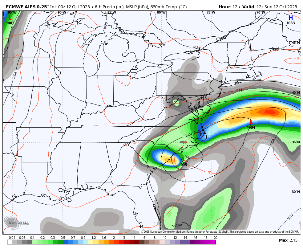
Today is Storm Day! Low Pressure is located off the North Carolina coast, and a baroclinic zone has set up along the coast. The funneling of winds, along with the heaviest rain, is in a band moving across the coastal Mid-Atlantic and up towards New England.
The expectation is Low Pressure to pass offshore, then loop around while weakening and possibly skimming Delmarva.
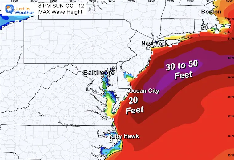
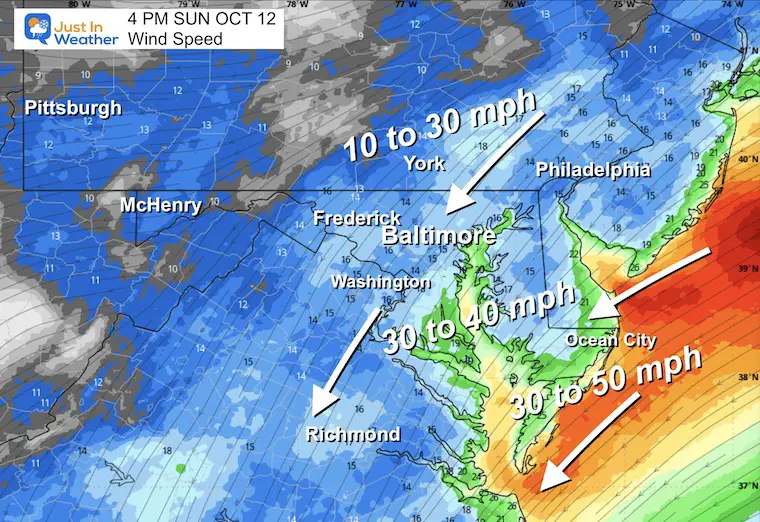
Destructive wind and waves will lead to beach erosion, and the wind direction will help slosh water to the Western Shore of the Chesapeake Bay.
Let’s take a look…
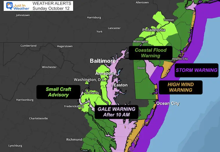
Weather Alerts
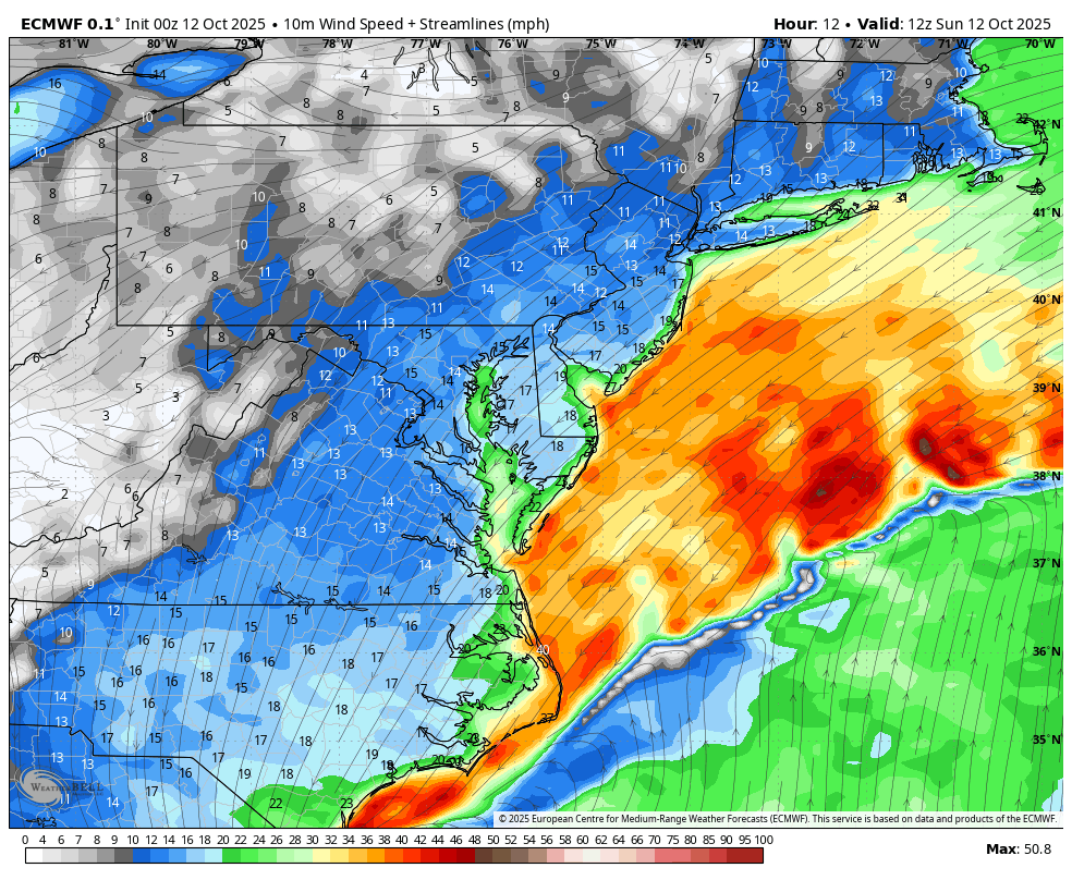
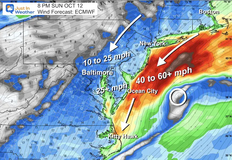
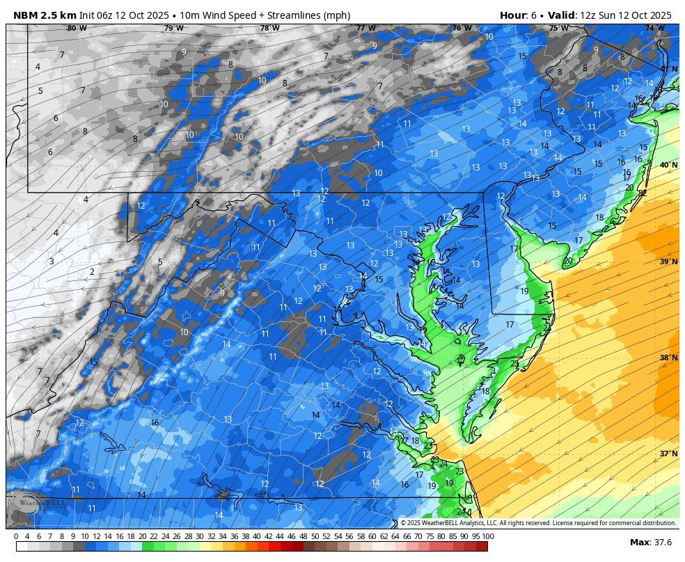
Winds will be growing stronger today and have prompted A Gale Warning on the Chesapeake Bay, plus a Storm Warning on the Atlantic Coast.
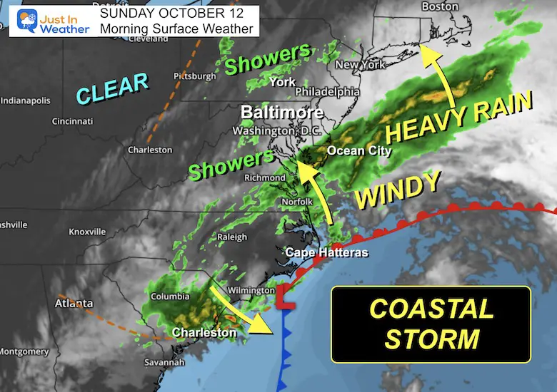
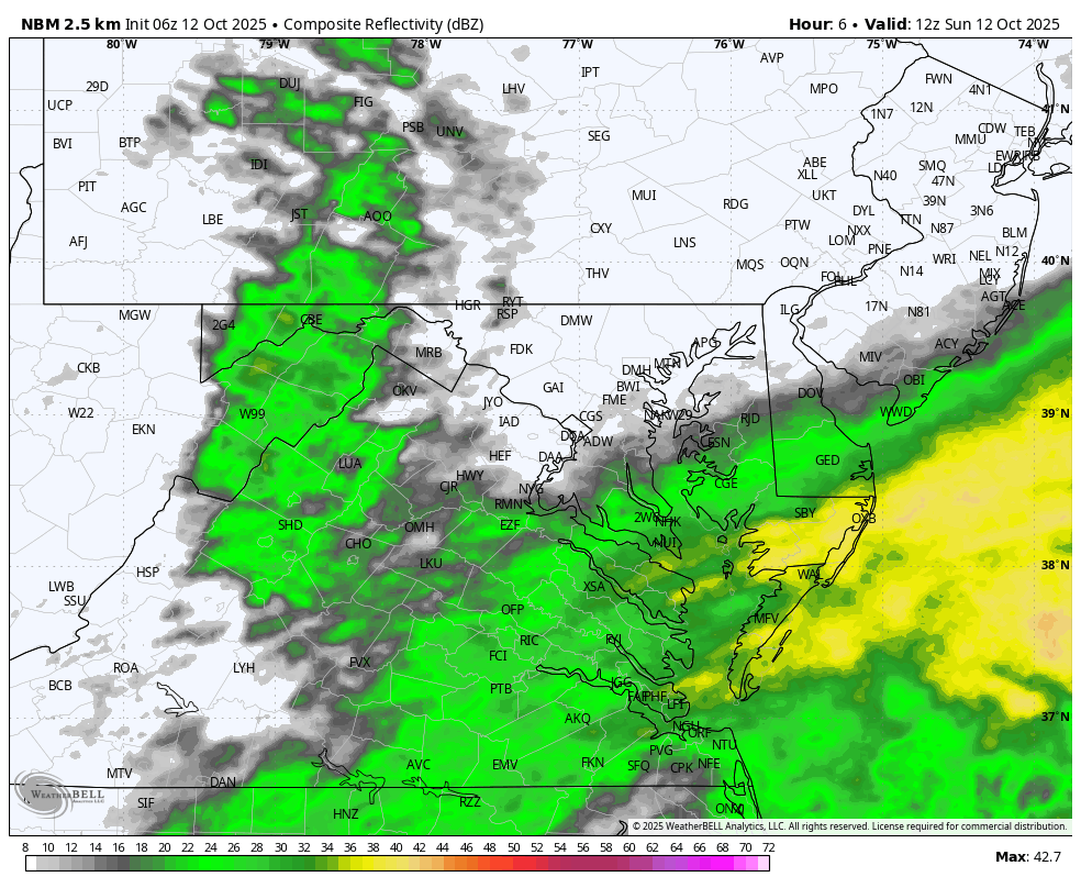
Surface Weather
Winds have gusted over 60 mph this morning, north of the low-pressure system in coastal North Carolina.
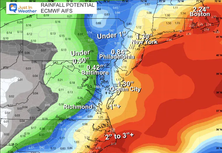
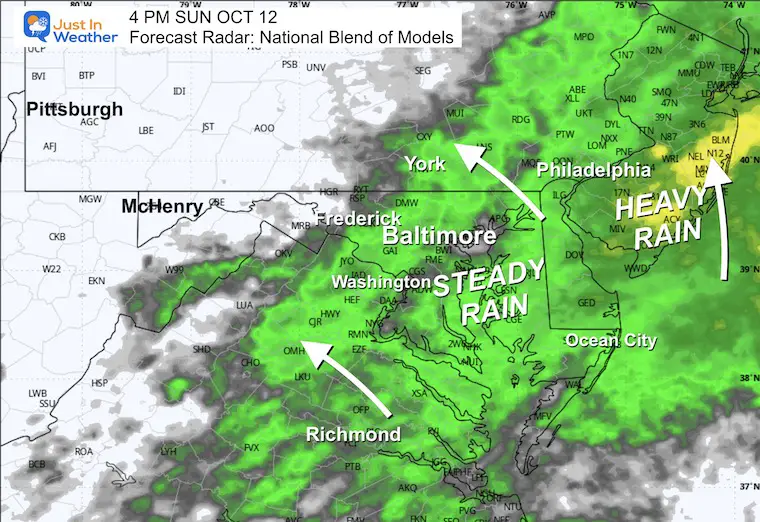
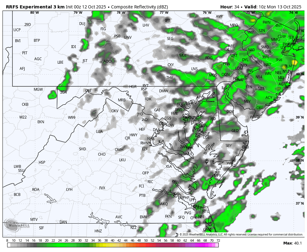
The heaviest rain will be along the coast and up to New England. While rain showers have pushed inland, the steady rain will gradually expand into Central Maryland during the day and tonight.
Rain and breezy weather will linger into Monday. As it appears now, the system will pass off the coast on Tuesday, leaving us with a brief warm-up before the next chilly air mass.
Live Radar Widget
Storm Forecast Sunday Morning to Tuesday Afternoon
We still see the ‘Loop’ around the Mid-Atlantic with one Low Pressure in the complex setup. The focus of the worst weather may hold off the coast while the heaviest rain gets pushed into New England.
Wind Forecast Sunday Morning to Wednesday Morning
Sunday Night Snapshots
Wind Forecast
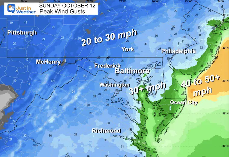
Conditions will deteriorate all day and likely be the worst tonight in the Mid-Atlantic.
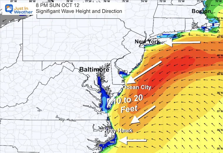
Significant Wave Forecast Saturday to Tuesday
Max Wave Heights
POTENTIAL Rainfall Total
The AI Version of the ECMWF Model has held the heaviest rain to the East and other models have followed the lead.
LOCAL WEATHER
CLIMATE DATA: Baltimore
Yesterday: Low 45F; High 70F
Precipitation: 0.01”
TODAY October 12
Sunrise at 7:14 AM
Sunset at 6:32 PM
Normal Low in Baltimore: 48ºF
Record 29ºF in 1964
Normal High in Baltimore: 70ºF
Record 89ºF 1919; 1954
Rainfall Deficit at BWI
- Ending 2024 = -8.00”
- Since Jan 1 = 5.27”
- We are STILL DOWN -13.27” INCLUDING LAST YEAR
Subscribe for eMail Alerts
SUNDAY
Radar Simulation: 8 AM to Midnight
Wind Animation: 8 AM to Midnight
4 PM Snapshots
Radar
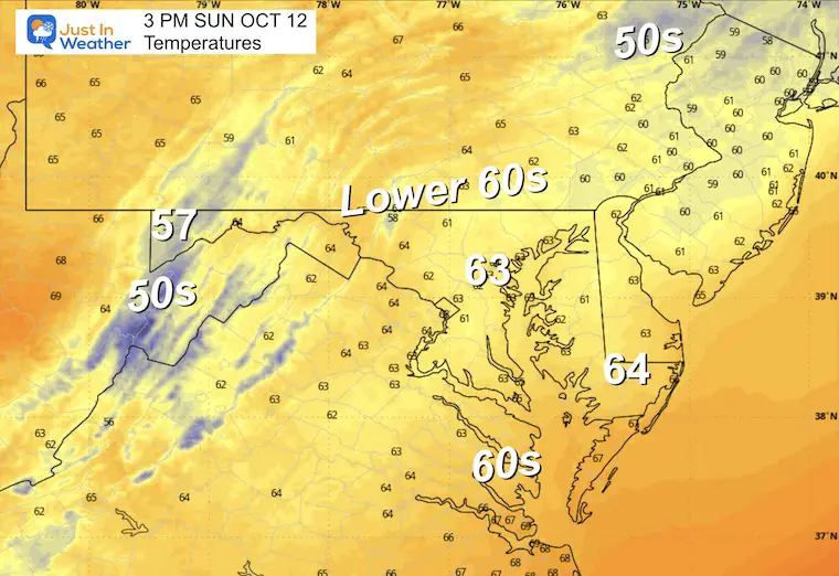
Afternoon Temperatures
Afternoon Winds
Peak Wind Gusts
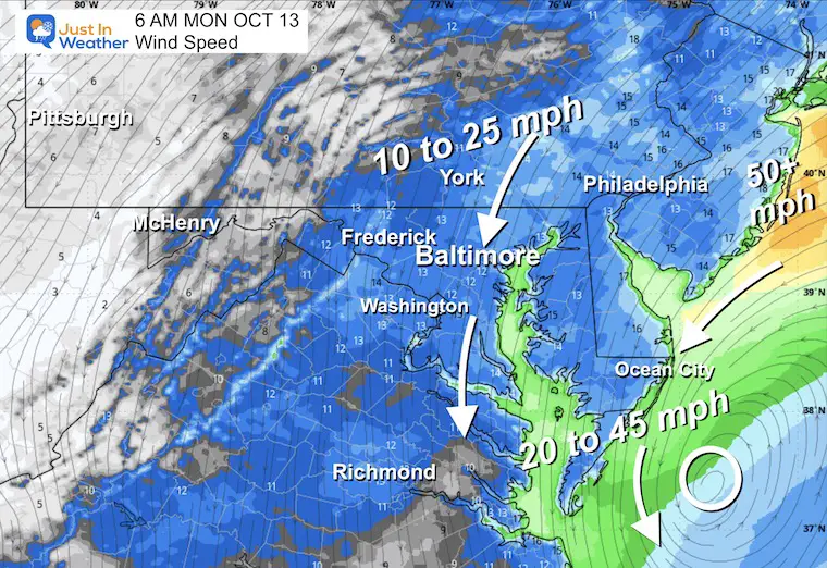
MONDAY
Radar Simulation: 6 AM to 8 PM
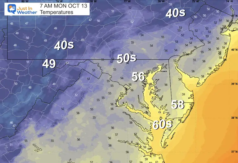
Morning Temperatures
Morning Wind
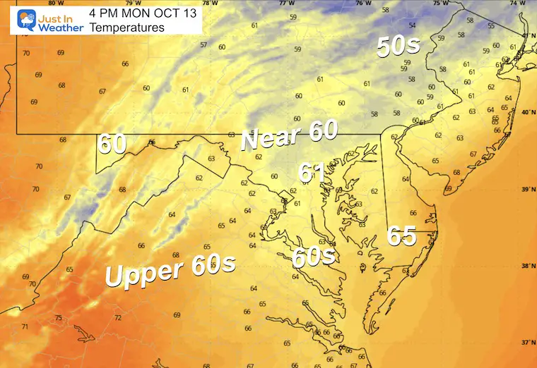
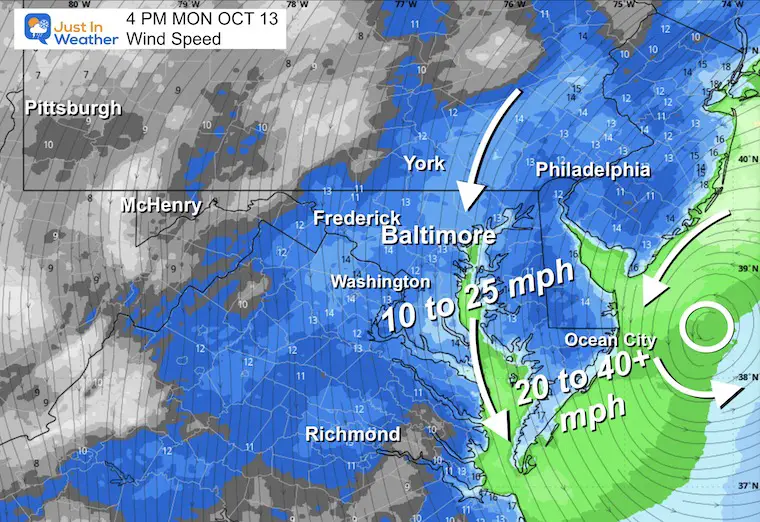
Afternoon Snapshots
Temperatures
4 PM Wind
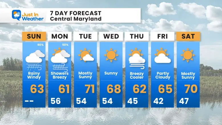
7 Day Forecast
- Today: Storm Day: Rain, Wind, Waves, Beach Erosion
- Monday: Rain Showers
- Tuesday: Briefly Mild Then Chilly Again
Subscribe for eMail Alerts
La Niña Advisory
This was issued October 9, as expected: A weak and short-lived event to start winter may play a different role this winter

4 SUPERMOONS In A ROW

In Case You Missed It
Woolly Bear Caterpillar Winter Folklore
These are NOT all the same caterpillar!

Winter Outlook From 2 Farmers’ Almanacs

STEM Assemblies/In School Fields Trips Are Back
Click to see more and ‘Book’ a visit to your school

THANK YOU:
Baltimore Sun Magazine Readers’ Choice Best Of Baltimore

Maryland Trek 12 Day 7 Completed Sat August 9
UPDATED: We raised OVER $166,000 for Just In Power Kids – AND Still Collecting More
The annual event: Hiking and biking 329 miles in 7 days between The Summit of Wisp to Ocean City.
Each day, we honor a kid and their family’s cancer journey.
Fundraising is for Just In Power Kids: Funding Free Holistic Programs. I never have and never will take a penny. It is all for our nonprofit to operate.
Click here or the image to donate:

RESTATING MY MESSAGE ABOUT DYSLEXIA
I am aware there are some spelling and grammar typos and occasional other glitches. I take responsibility for my mistakes and even the computer glitches I may miss. I have made a few public statements over the years, but if you are new here, you may have missed it: I have dyslexia and found out during my second year at Cornell University. It didn’t stop me from getting my meteorology degree and being the first to get the AMS CBM in the Baltimore/Washington region. One of my professors told me that I had made it that far without knowing and to not let it be a crutch going forward. That was Mark Wysocki, and he was absolutely correct! I do miss my mistakes in my own proofreading. The autocorrect spell check on my computer sometimes does an injustice to make it worse. I can also make mistakes in forecasting. No one is perfect at predicting the future. All of the maps and information are accurate. The ‘wordy’ stuff can get sticky. There has been no editor who can check my work while writing and to have it ready to send out in a newsworthy timeline. Barbara Werner is a member of the web team that helps me maintain this site. She has taken it upon herself to edit typos when she is available. That could be AFTER you read this. I accept this and perhaps proves what you read is really from me… It’s part of my charm. #FITF
Please share your thoughts and best weather pics/videos, or just keep in touch via social media.


