Saturday, October 11, 2025
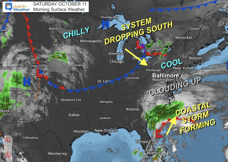
Here we go… The Coastal Storm has taken shape off the Florida coast and will spread northward. This is still a complex system with the second piece dropping south across the Great Lakes and the expected ‘loop’of Low Pressure around the Mid-Atlantic for a few days.
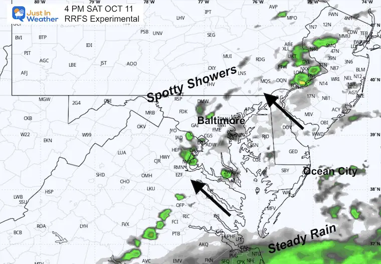
Rain showers will spread across central Maryland today, with more rain and wind on Sunday. I am in far Western Maryland for the Autumn Glory Parade, and this region should escape with outer edge clouds for today, while staying dry.
Tomorrow will bring the influence of the storm closer with more rain and stronger winds.
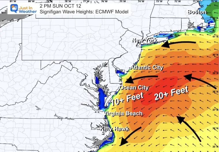
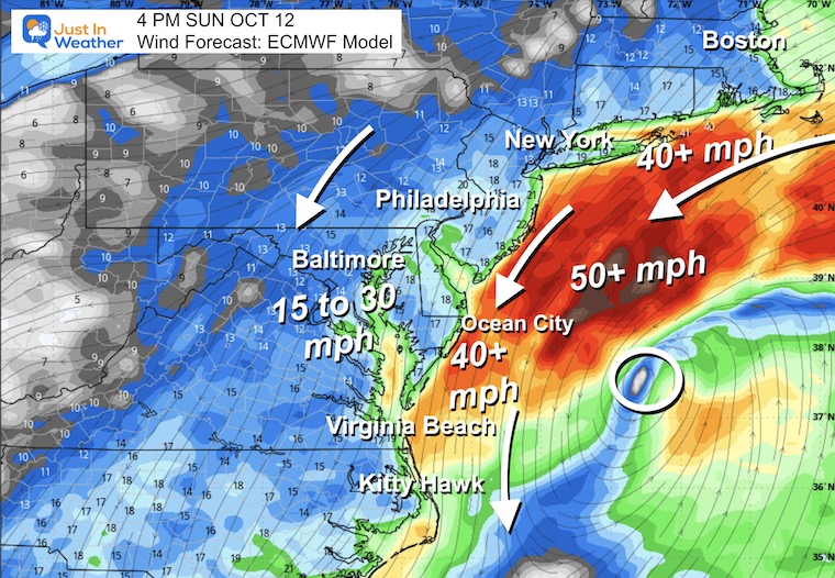
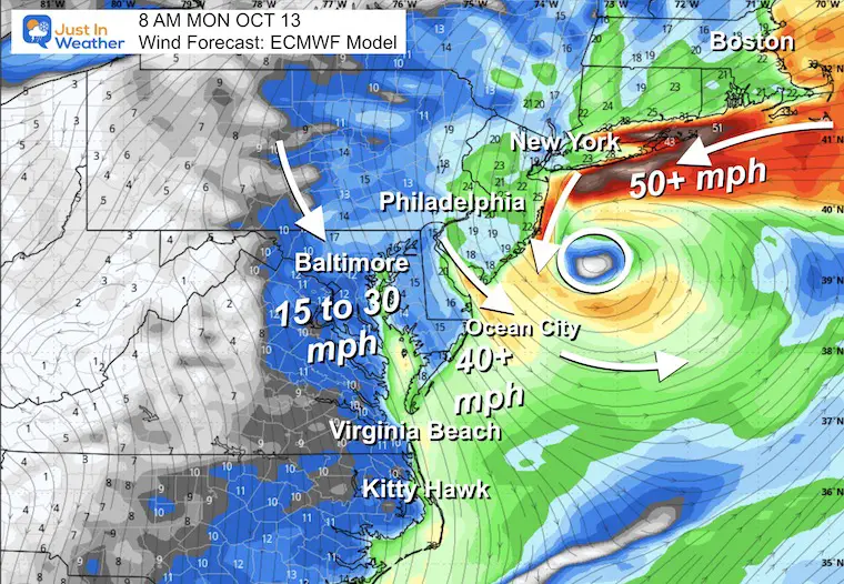
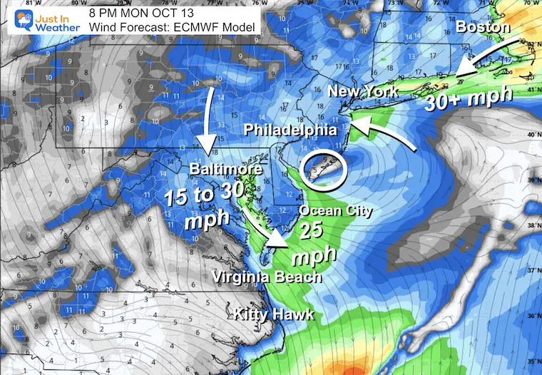
I still have confidence in the impact along the beaches with high waves, strong winds, and extensive erosion from the Mid-Atlantic through New Jersey and Long Island, New York.
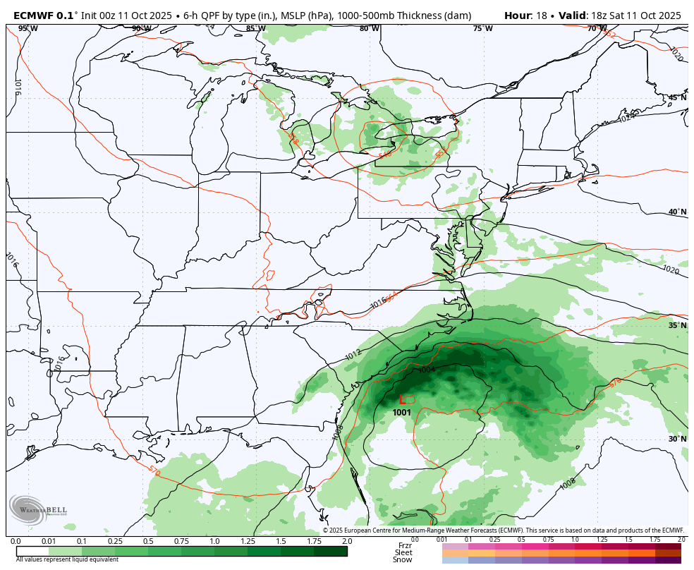
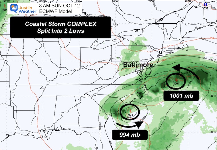
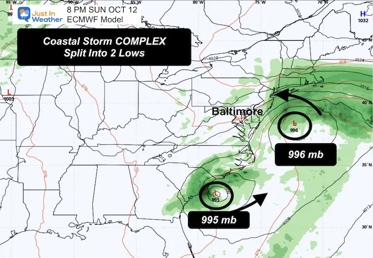
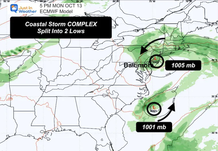
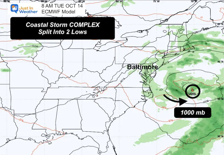
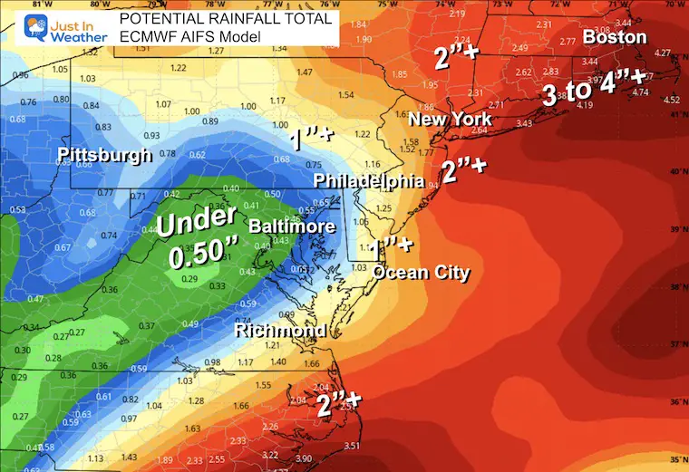
The precise loop may split two low-pressure centers off the coast with a shift east. This would be a nightmare if it were a winter storm with snow forecast. I see this as a trial run that lends more credibility to the European Model AI Version. That is why I am showing multiple rain forecast totals and leaning toward the mid-range to lower amounts. We will get rain and wind. How much is what I want to explore in this report.
Let’s take a look….
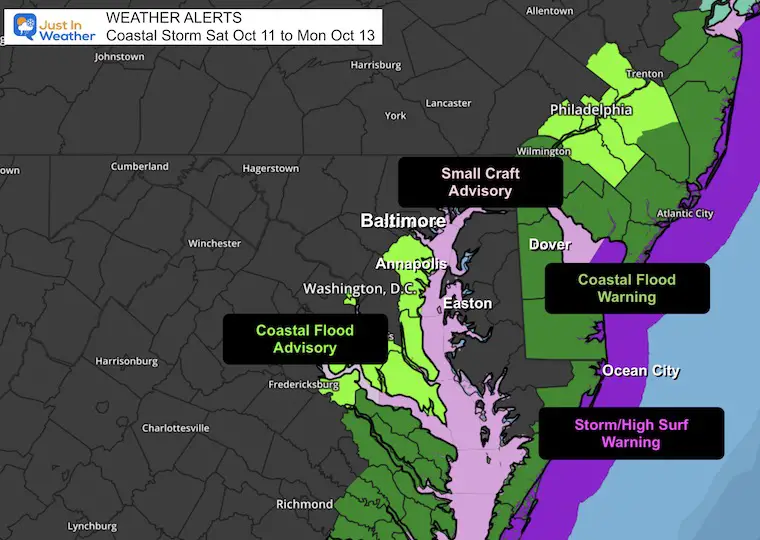
Storm Alerts
The increasing wind FROM THE EAST will push higher water on the Western Shore of the Bay and Ocean Coast. Where there is a flood concern.
The Winds have prompted the Small Craft Advisory on the Bay and Storm Warning on the Ocean water.
Surface Weather
Low Pressure is off the Florida Coast. The second short wave in the Great Lakes is part of this dance that will cause the enhanced strength and loop over the next few days.
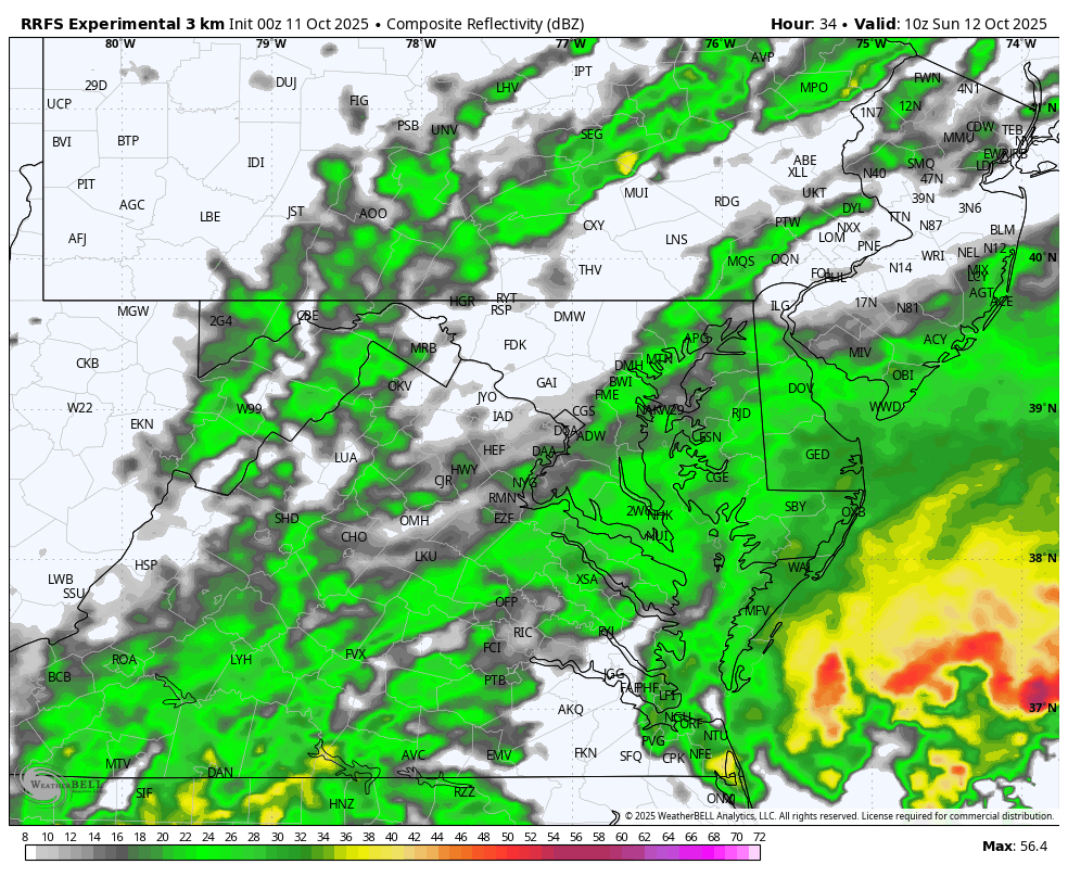
Live Radar Widget
Storm Forecast Saturday through Tuesday
The suggestion here is that two Low-Pressure centers will split the energy, with the focus shifting to the one farther east.
We will still see the ‘Loop’ around the Mid-Atlantic.
Snapshots
Sunday Morning
Sunday Night
Monday
Tuesday
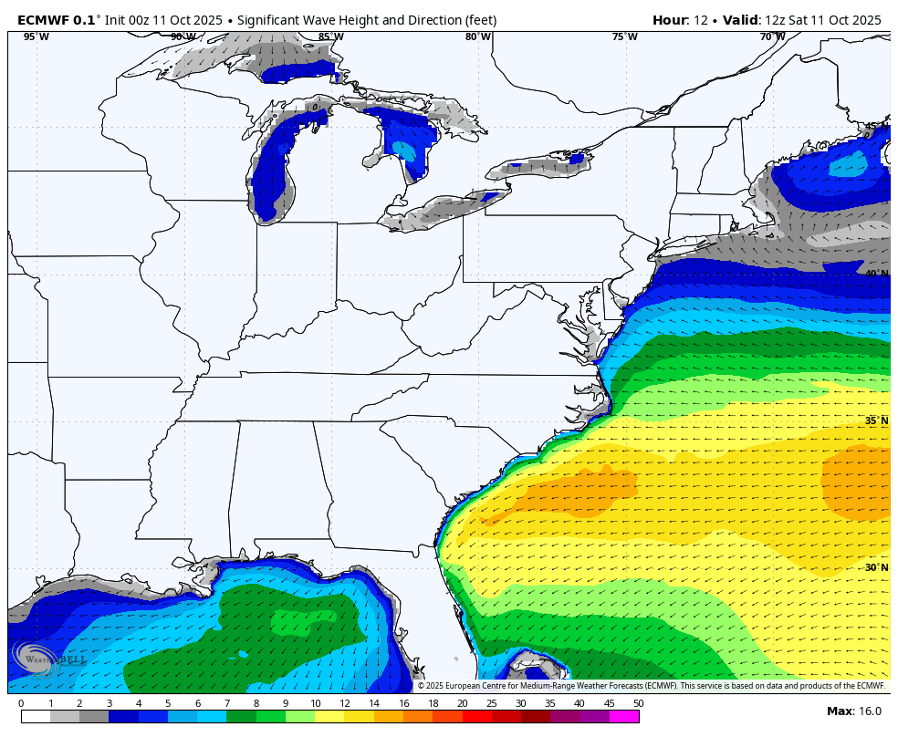
Wave Forecast Saturday to Tuesday
Snapshot Sunday Afternoon
- Ocean City can expect OVER 10 Ft waves FROM the East. This will lead to erosion.
- Maximum Wave Heights will be higher.
- Offshore, we still expect waves over 20 feet and may push to 50 feet at times.
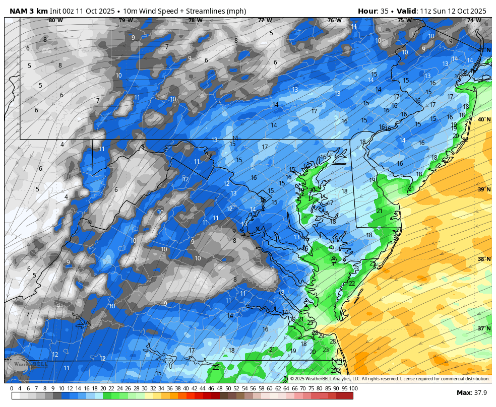
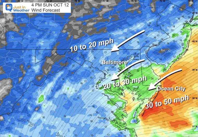
Wind Forecast Saturday to Tuesday
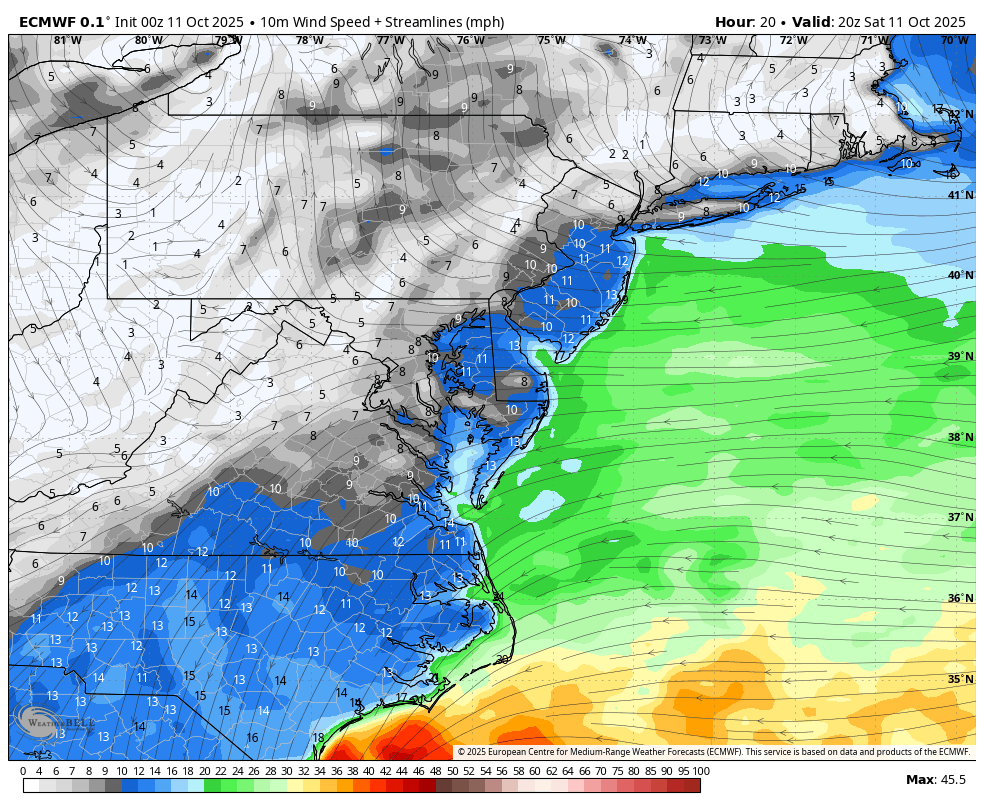
Sunday Afternoon
Monday Morning
Monday Night
POTENTIAL Rainfall Total
The AI Version of the ECMWF Model has shifted the heaviest rain to the east. This was the first model (again) to show this.
LOCAL WEATHER
CLIMATE DATA: Baltimore
Yesterday: Low 44F; High 65F
Precipitation: 0.00”
TODAY October 11
Sunrise at 7:13 AM
Sunset at 6:33 PM
Normal Low in Baltimore: 48ºF
Record 27ºF in 1964
Normal High in Baltimore: 70ºF
Record 89ºF 1919; 1954
Rainfall Deficit at BWI
- Ending 2024 = -8.00”
- Since Jan 1 = 5.16”
- We are STILL DOWN -13.16” INCLUDING LAST YEAR
Subscribe for eMail Alerts
SATURDAY
Radar Simulation
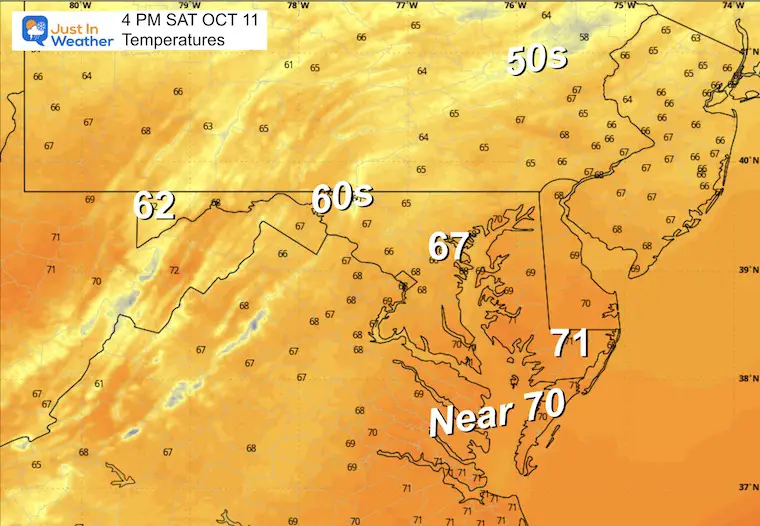
4 PM Snapshot
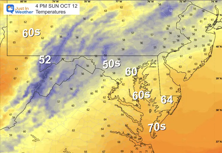
Afternoon Temperatures
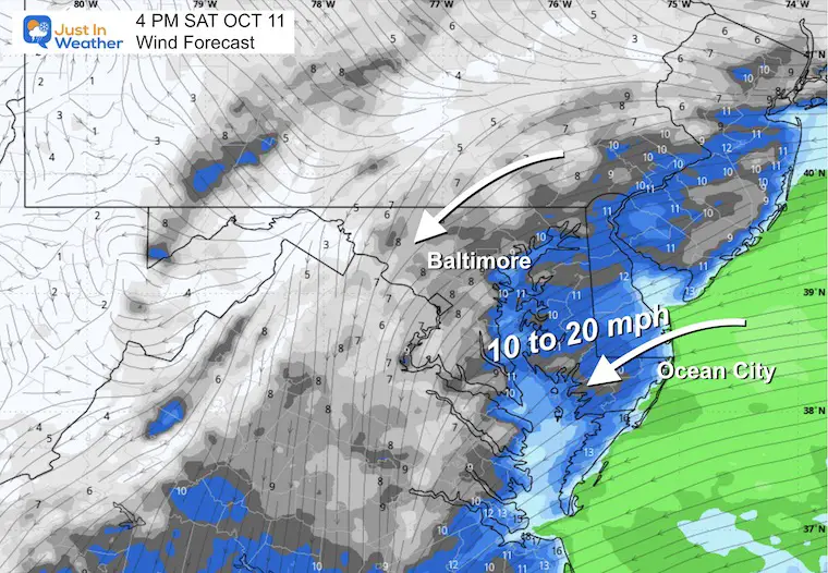
Afternoon Wind
The breeze will increase by the beach. Not too bad inland.
SUNDAY
Morning Temperatures
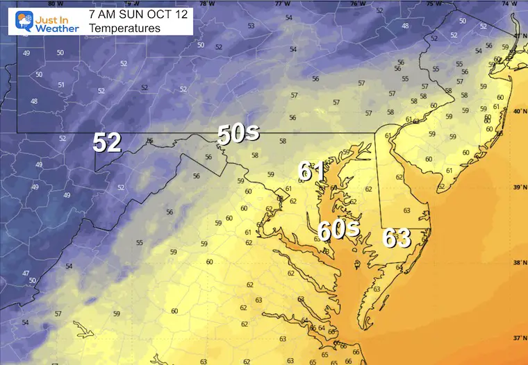
Morning Wind
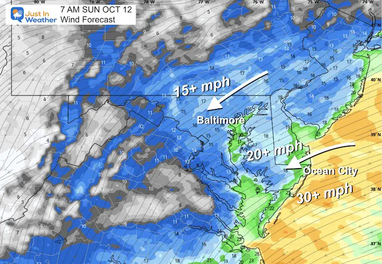
Wind Forecast 7 AM to 8 PM
Rain Radar Forecast Suggestion
Afternoon Snapshots
4 PM Wind
Temperatures
It may get cooler with the wind and rain showers.
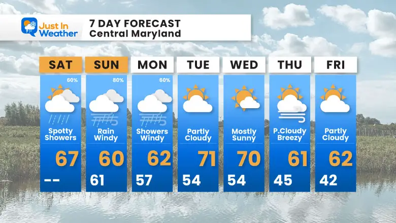
7 Day Forecast
- Today: Spotty Showers Roll In
- Sunday to Tuesday: Rain, Wind, Waves, Beach Erosion
- Brief Mild Weather Follows the Storm; Then Chilly Again
Subscribe for eMail Alerts
La Niña Advisory
This was issued October 9, as expected: A weak and short-lived event to start winter may play a different role this winter

4 SUPERMOONS In A ROW

In Case You Missed It
Woolly Bear Caterpillar Winter Folklore
These are NOT all the same caterpillar!

Winter Outlook From 2 Farmers’ Almanacs

STEM Assemblies/In School Fields Trips Are Back
Click to see more and ‘Book’ a visit to your school

THANK YOU:
Baltimore Sun Magazine Readers’ Choice Best Of Baltimore

Maryland Trek 12 Day 7 Completed Sat August 9
UPDATED: We raised OVER $166,000 for Just In Power Kids – AND Still Collecting More
The annual event: Hiking and biking 329 miles in 7 days between The Summit of Wisp to Ocean City.
Each day, we honor a kid and their family’s cancer journey.
Fundraising is for Just In Power Kids: Funding Free Holistic Programs. I never have and never will take a penny. It is all for our nonprofit to operate.
Click here or the image to donate:

RESTATING MY MESSAGE ABOUT DYSLEXIA
I am aware there are some spelling and grammar typos and occasional other glitches. I take responsibility for my mistakes and even the computer glitches I may miss. I have made a few public statements over the years, but if you are new here, you may have missed it: I have dyslexia and found out during my second year at Cornell University. It didn’t stop me from getting my meteorology degree and being the first to get the AMS CBM in the Baltimore/Washington region. One of my professors told me that I had made it that far without knowing and to not let it be a crutch going forward. That was Mark Wysocki, and he was absolutely correct! I do miss my mistakes in my own proofreading. The autocorrect spell check on my computer sometimes does an injustice to make it worse. I can also make mistakes in forecasting. No one is perfect at predicting the future. All of the maps and information are accurate. The ‘wordy’ stuff can get sticky. There has been no editor who can check my work while writing and to have it ready to send out in a newsworthy timeline. Barbara Werner is a member of the web team that helps me maintain this site. She has taken it upon herself to edit typos when she is available. That could be AFTER you read this. I accept this and perhaps proves what you read is really from me… It’s part of my charm. #FITF
Please share your thoughts and best weather pics/videos, or just keep in touch via social media.


