


October 12 Coastal Storm Brings Worst Conditions To Mid Atlantic Tonight
Sunday, October 12 2025 Today is Storm Day! Low Pressure is located off the North Carolina coast, and a baroclinic zone has set up along the coast. The funneling of…
Friday, October 10, 2025
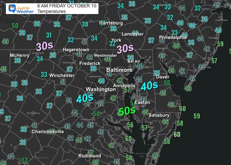
The coldest of the air has settled in with temperatures down into the 30s across many areas west and north of Baltimore. The Frost Advisory and Freeze Warning have been validated. The clear sky and light wind will hold the chill all day.
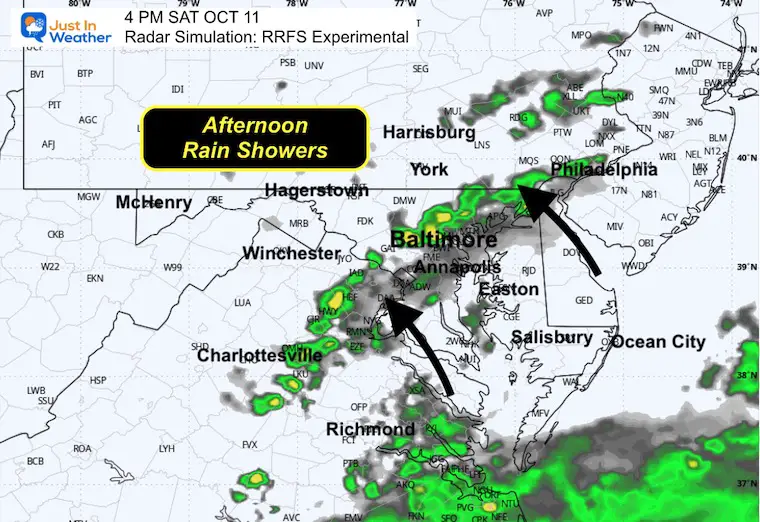
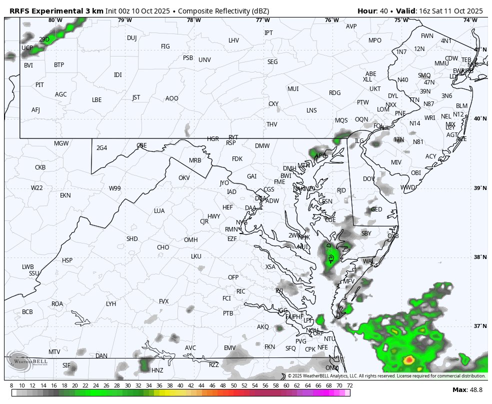
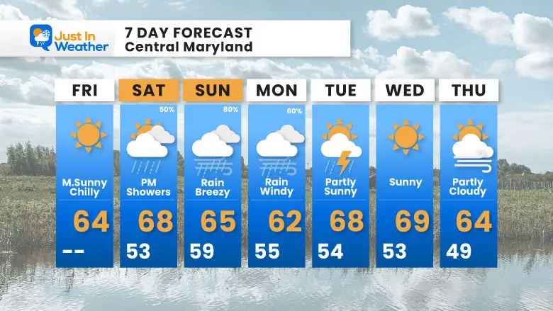
The coastal storm is just starting to take form, but there is more that will join together over the weekend. Locally, we can expect the first rain showers on Saturday afternoon, followed by more rain Sunday with increasing wind through Monday.
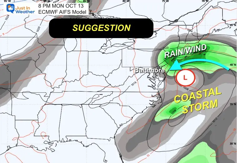
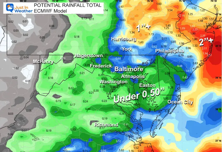
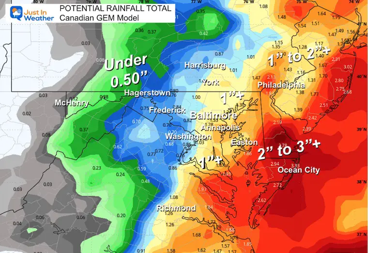
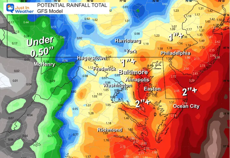
This is still a complicated setup as Low Pressure is poised to loop around the Mid-Atlantic for a day or two. The precise track of that loop will determine how much rain and wind will push inland.
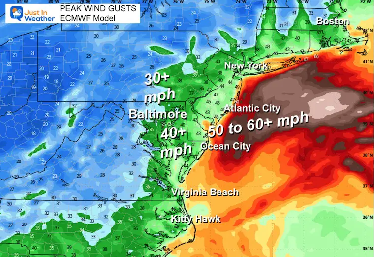
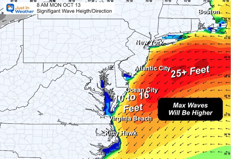
The beaches are most certainly going to get pounded with high waves and more erosion.
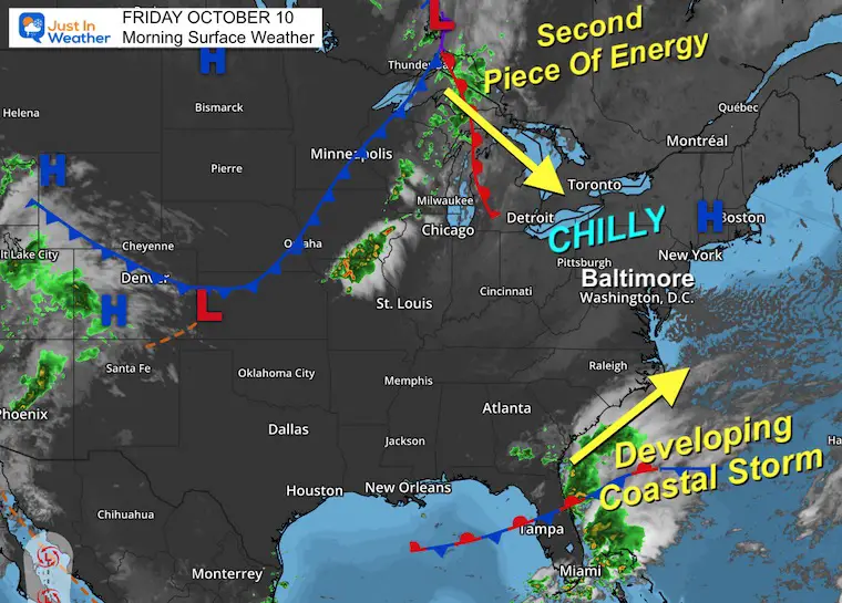
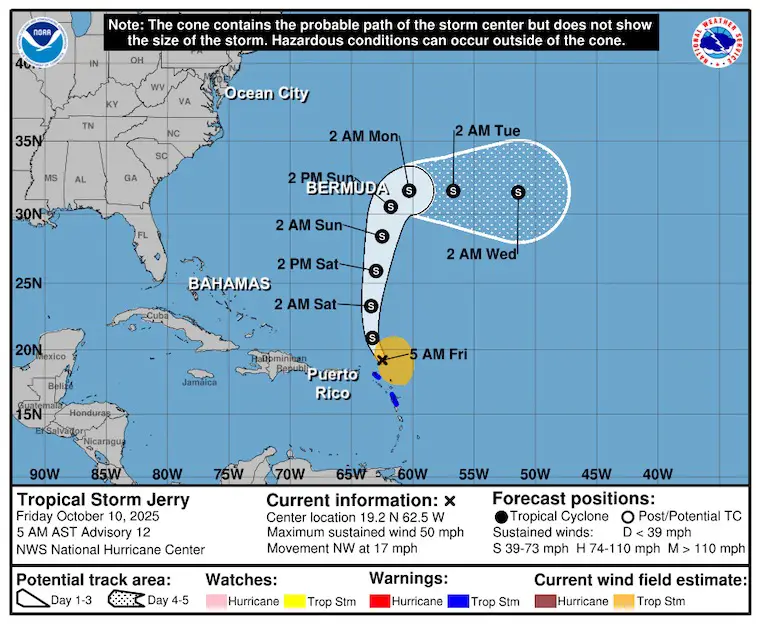
Tropical Storm Jerry now has winds up to 50 mph. This will pass north of Puerto Rico and then turn East of Bermuda. This is NOT a US coastal event and is completely separate from the storm we are watching this weekend.
Let’s take a look….
High Pressure nearby has provided us the clear skies and light wind to produce the chilly temperatures.
The Coastal Storm is taking initial form across Florida. The second piece is driving through the Great Lakes.

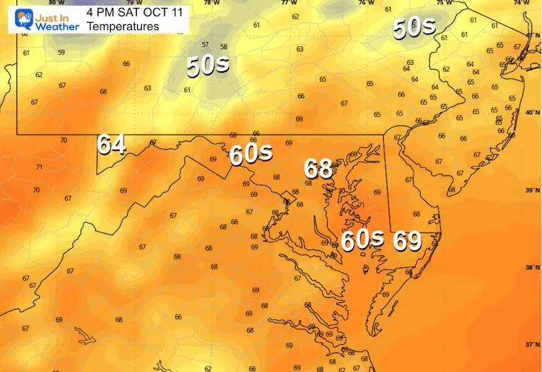
Yesterday: Low 46F; High 64F
Precipitation: 0.00”
Sunrise at 7:12 AM
Sunset at 6:35 PM
Normal Low in Baltimore: 49ºF
Record 34ºF in 1979
Normal High in Baltimore: 70ºF
Record 93ºF 1939
Rainfall Deficit at BWI
Ending 2024 = -8.00”
Since Jan 1 = 5.03”
We are STILL DOWN -13.03” INCLUDING LAST YEAR
Subscribe for eMail Alerts
Sign up and be the first to know!
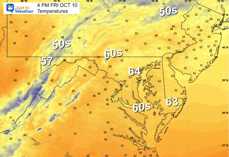
Not as chilly with clouds moving in.
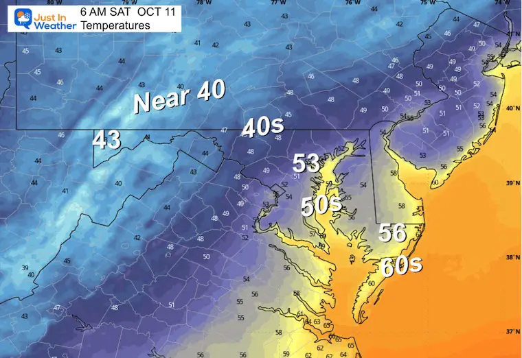
A band of rain will be expanding to the North and West that may reach central Maryland by this time.
More rain will follow from the south.
Here is the ECWMF AI version. This solution shows the coastal storm looping back. As of now, this is the solution that keeps the storm weaker, with the bulk of the rain just offshore.
These situations tend to be very fickle, and any change in location can dramatically change how much wind and rain will push onshore and inland.
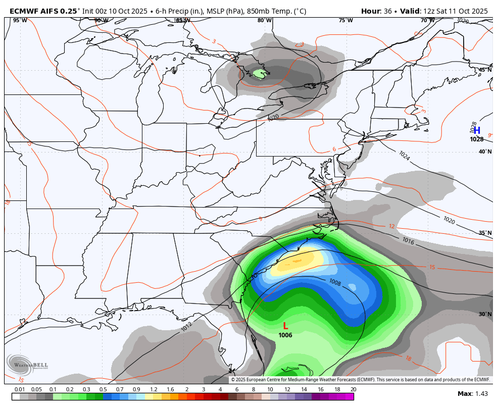
One of MULTIPLE POSSIBLE Solutions
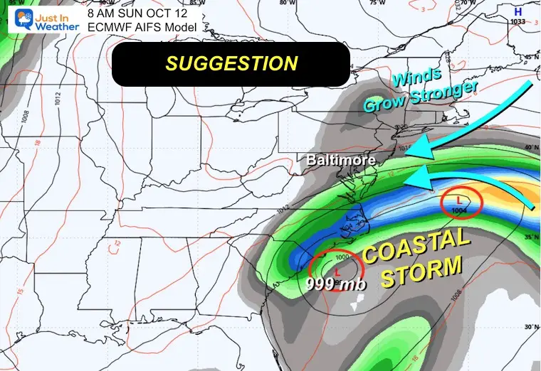
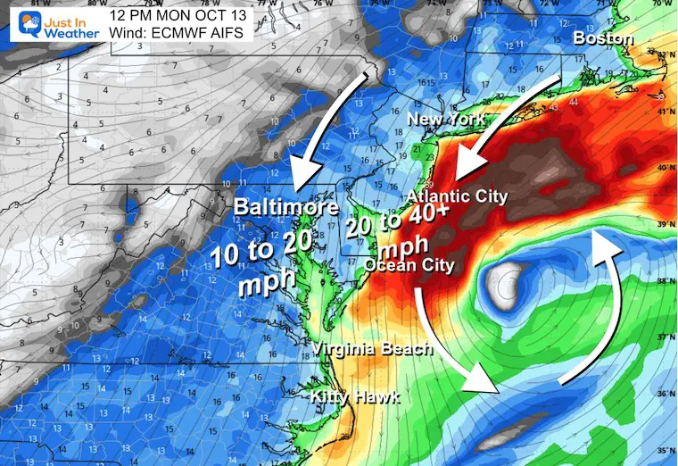
Strong winds around the coastal storm. The precise location of the storm center will determine how winds will push onshore and inland.
How close the storm loops along with the speed, will play a role in how much rain will fall and where.
Tropical Storm Jerry has winds of 50 mph and is still expected to become a hurricane. The track keeps it NORTH of Puerto Rico and turns East of Bermuda. So, no threat to the East Coast.
Subscribe for eMail Alerts
Sign up and be the first to know!
This was issued October 9, as expected: A weak and short-lived event to start winter may play a different role this winter


These are NOT all the same caterpillar!


Click to see more and ‘Book’ a visit to your school


The annual event: Hiking and biking 329 miles in 7 days between The Summit of Wisp to Ocean City.
Each day, we honor a kid and their family’s cancer journey.
Fundraising is for Just In Power Kids: Funding Free Holistic Programs. I never have and never will take a penny. It is all for our nonprofit to operate.
Click here or the image to donate:

I am aware there are some spelling and grammar typos and occasional other glitches. I take responsibility for my mistakes and even the computer glitches I may miss. I have made a few public statements over the years, but if you are new here, you may have missed it: I have dyslexia and found out during my second year at Cornell University. It didn’t stop me from getting my meteorology degree and being the first to get the AMS CBM in the Baltimore/Washington region. One of my professors told me that I had made it that far without knowing and to not let it be a crutch going forward. That was Mark Wysocki, and he was absolutely correct! I do miss my mistakes in my own proofreading. The autocorrect spell check on my computer sometimes does an injustice to make it worse. I can also make mistakes in forecasting. No one is perfect at predicting the future. All of the maps and information are accurate. The ‘wordy’ stuff can get sticky. There has been no editor who can check my work while writing and to have it ready to send out in a newsworthy timeline. Barbara Werner is a member of the web team that helps me maintain this site. She has taken it upon herself to edit typos when she is available. That could be AFTER you read this. I accept this and perhaps proves what you read is really from me… It’s part of my charm. #FITF