


New Years Day Snow Squall And Falling Temps Entering 2026
Wednesday, December 31 New Year's Eve Update Closing out the year, we have a strong clipper to our north. This is going to drag a distinct push of arctic air…
Thursday, September 25, 2025
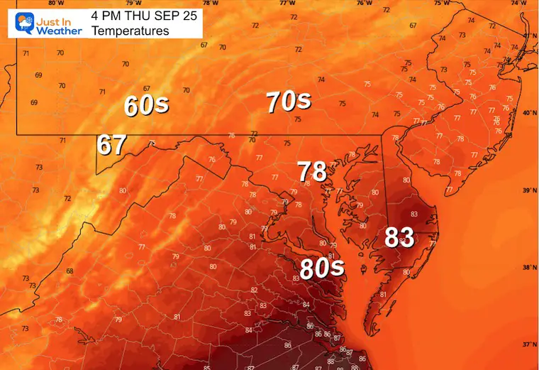
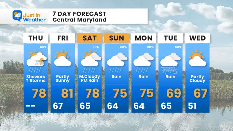
Today brings showers and potential for some thunderstorms to turn severe. This is with a cold front that will eventually stall to our south and return over the weekend.
If you have plans this weekend for the Seagull Century or Ocean’s Calling Music Festival between Salisbury and Ocean City, I am leaning towards a dry start, then turning wet later Saturday into Sunday.
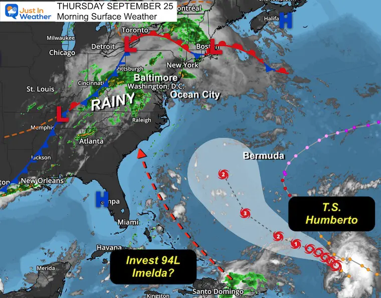
In the Atlantic, Hurricane Gabrielle is approaching the Azores and Europe.
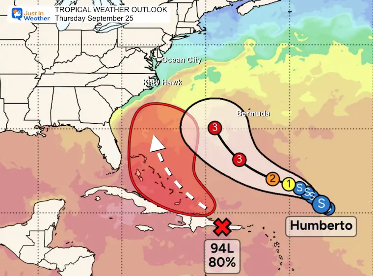
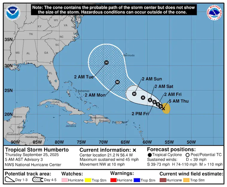
Tropical Storm Humberto has 45 mph winds and is now expected to pass WEST of Bermuda.
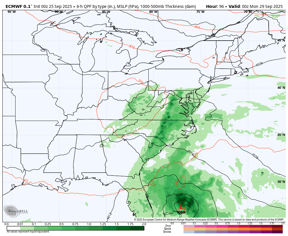
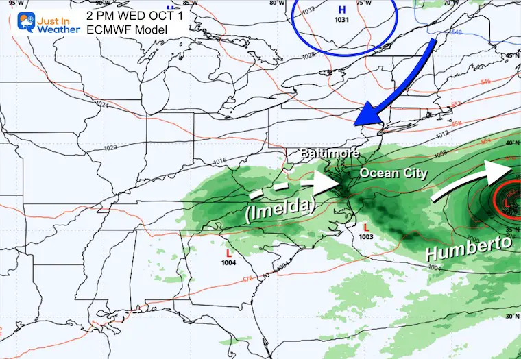
Another storm is expected to form, get named Imelda, and pass over the Bahamas. THEN the wild card is how Humberto affects it. There is a lot to unfold, but the European Model I will show below has an aggressive push into South Carolina, which will keep us rainy.
Let’s take a look.
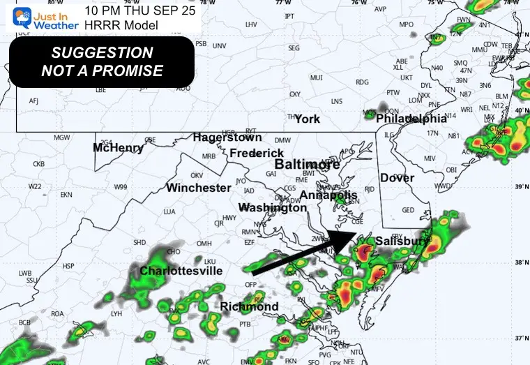
This is a Level 1 of 5, minimal chance, but some thunderstorms could reach severe levels.
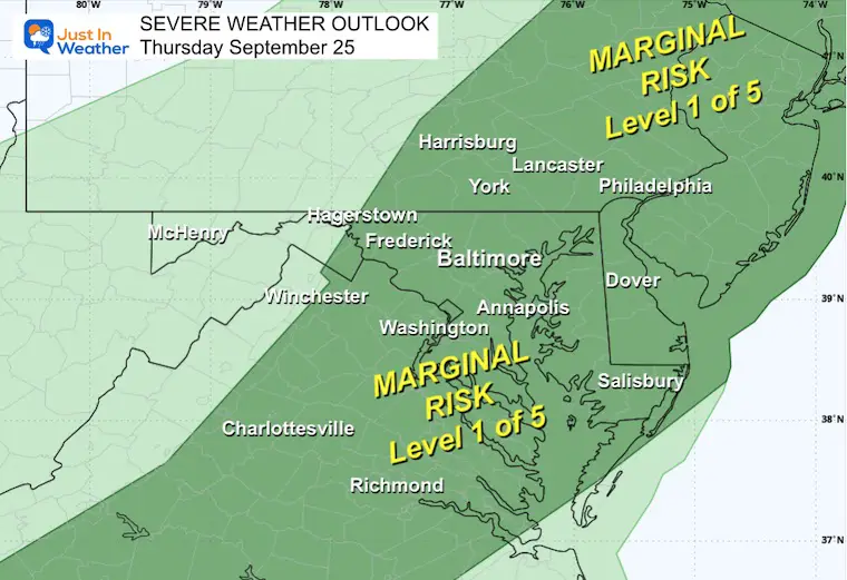
A cold front in the Ohio Valley is the weather maker locally today. Showers this morning and thunderstorms in the afternoon and evening.
The two tropical systems are seen well off the Southeast US coast.
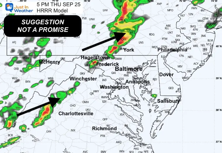
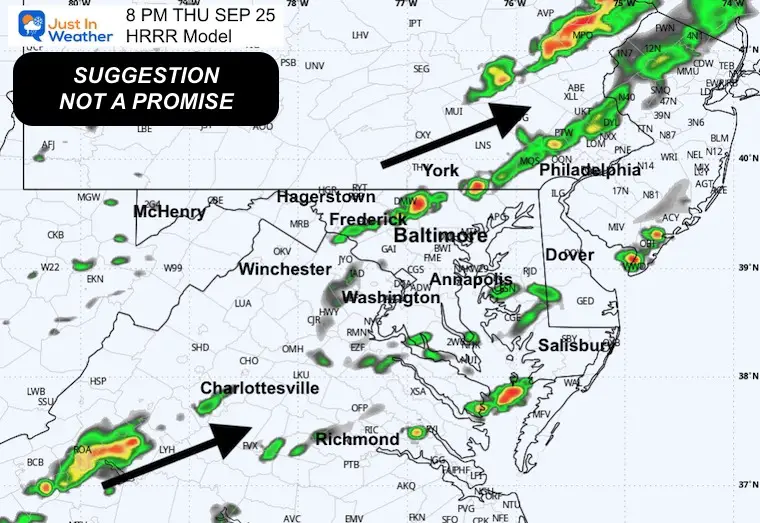
This is a suggestion, NOT a promise. I expect we will see more activity than shown here. This is a guide for possible timing.
Yesterday: Low 65F; High 77F
Precipitation: 0.14”
Sunrise at 6:57 AM
Sunset at 6:58 PM
Normal Low in Baltimore: 55ºF
Record 35ºF in 1963
Normal High in Baltimore: 76ºF
Record 97ºF 1970
Rainfall Deficit at BWI
Subscribe for eMail Alerts
Sign up and be the first to know!
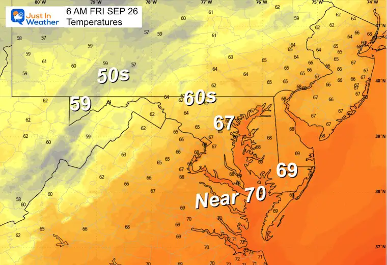
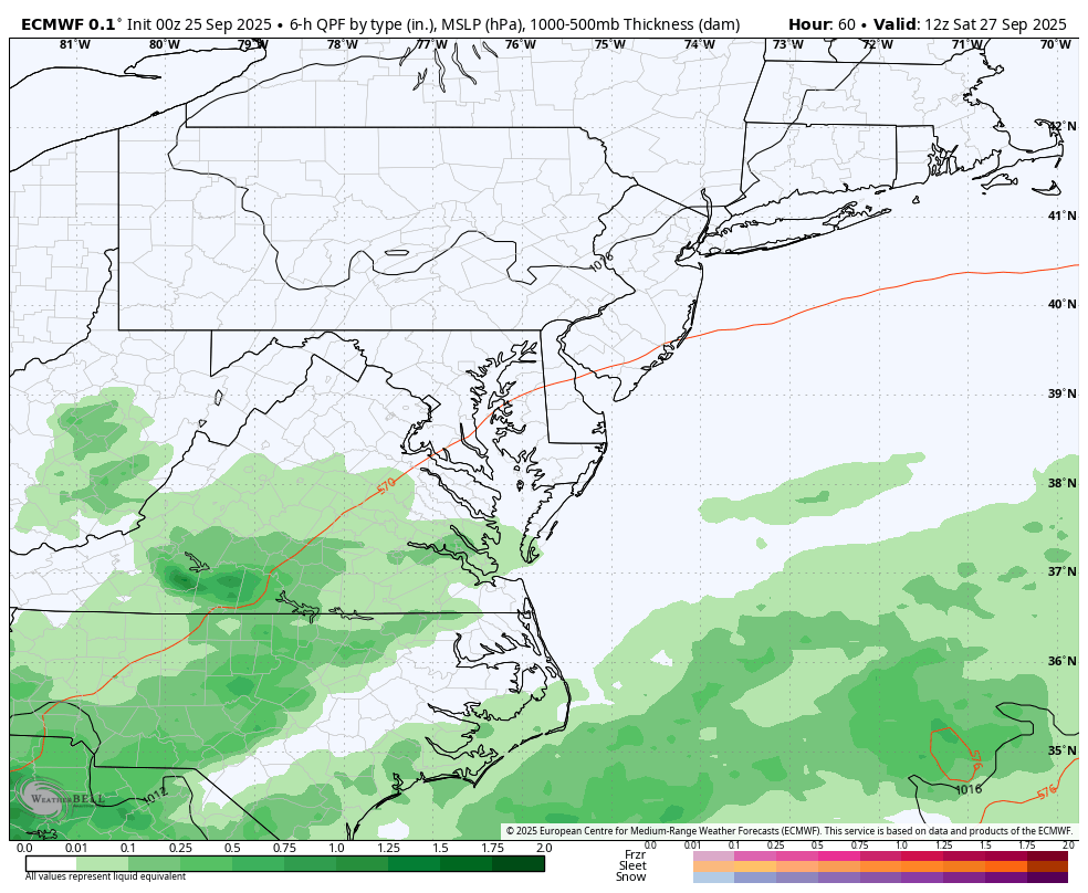
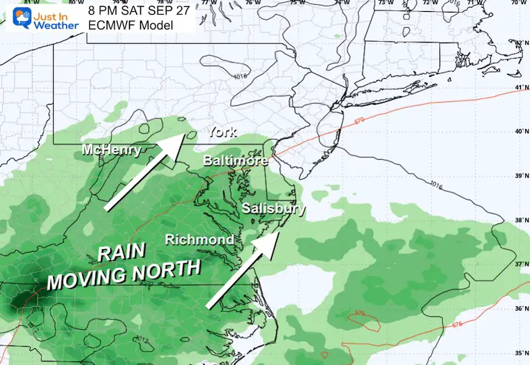
Let’s back up to Thursday night with the cold front. Here is the NAM 3 Km Model showing the storm line passing metro Baltimore after 10 PM. Then showers on the Lower Eastern Shore Friday morning… ending. This will allow a dry period for the rest of Friday into Saturday morning.
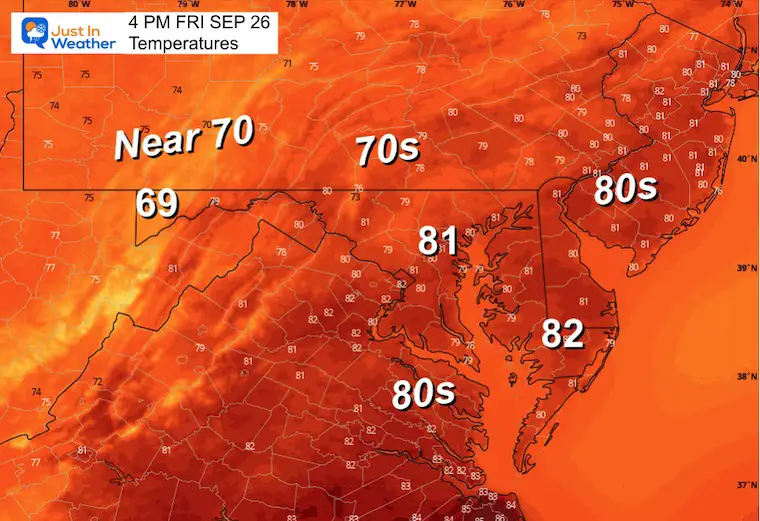
The push of rain will move north during the day on Saturday. It may start dry, then end wet. Then, more rainis expected on Sunday.
Hurricane Gabrielle has 85 mph winds and is heading into the Eastern Atlantic, so I shifted my focus West!
Tropical Storm Humberto has 45 mph winds.
Invest 94L has an 80% Chance to be named TS Imelda this weekend.
These two may affect each other, but until an organized center is identified with a new system, it is uncertain how the US will be affected.
This collection shows a very close approach to South Carolina, then a cold front pushing it east. Not all models show this, as seen below.
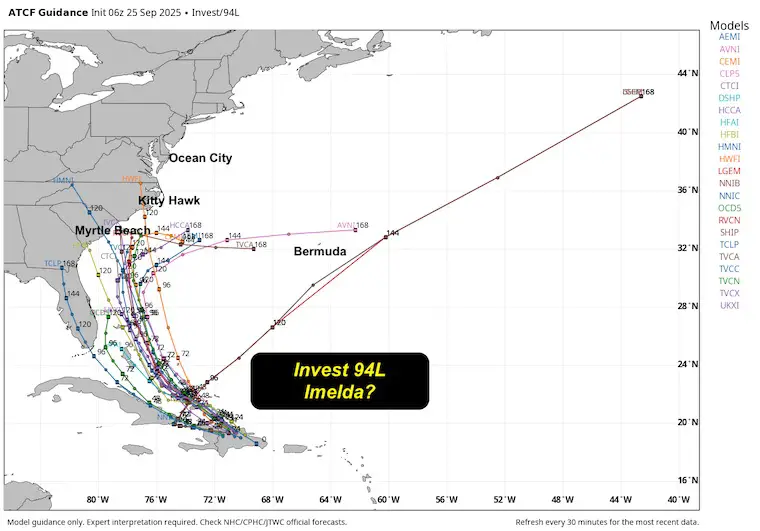
I am showing this because I have consistently shown this model. I do not look for the best or worst case scenario. This model has been reliable, AND it is not perfect. So there is room for adjustment.
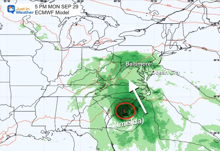
Here we see the new storm to be named Imelda getting pushed inland and spinning out with moderate rain for a few days.
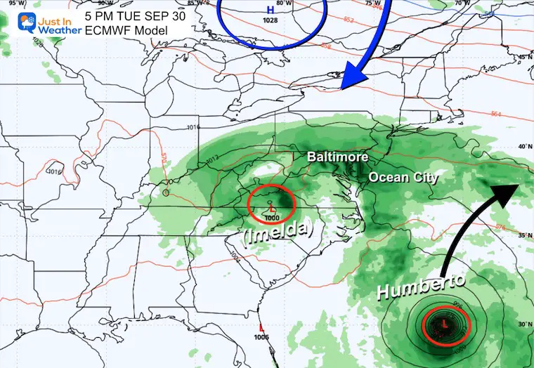
A Ridge of High Pressure from Canada is expected to drop south and suppress the storm, then help it finally follow Humberto and move out into the ocean.
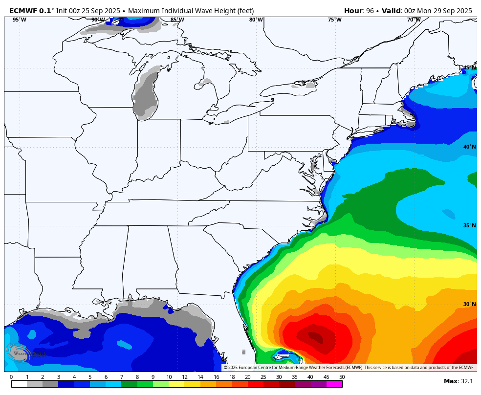
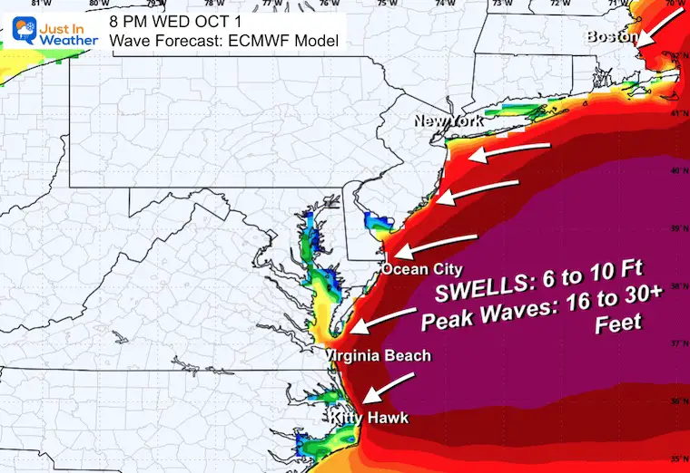
This is based on the European Model showing the highest waves off the East Coast at this time.
Take Away: There is no promise of the track, but there will be up to 5 days of high water pounding the coast with more beach erosion.
Sign up and be the first to know!
Click to see more and ‘Book’ a visit to your school 

The annual event: Hiking and biking 329 miles in 7 days between The Summit of Wisp to Ocean City.
Each day, we honor a kid and their family’s cancer journey.
Fundraising is for Just In Power Kids: Funding Free Holistic Programs. I never have and never will take a penny. It is all for our nonprofit to operate.
Click here or the image to donate:

I am aware there are some spelling and grammar typos and occasional other glitches. I take responsibility for my mistakes and even the computer glitches I may miss. I have made a few public statements over the years, but if you are new here, you may have missed it: I have dyslexia and found out during my second year at Cornell University. It didn’t stop me from getting my meteorology degree and being the first to get the AMS CBM in the Baltimore/Washington region. One of my professors told me that I had made it that far without knowing and to not let it be a crutch going forward. That was Mark Wysocki, and he was absolutely correct! I do miss my mistakes in my own proofreading. The autocorrect spell check on my computer sometimes does an injustice to make it worse. I can also make mistakes in forecasting. No one is perfect at predicting the future. All of the maps and information are accurate. The ‘wordy’ stuff can get sticky. There has been no editor who can check my work while writing and to have it ready to send out in a newsworthy timeline. Barbara Werner is a member of the web team that helps me maintain this site. She has taken it upon herself to edit typos when she is available. That could be AFTER you read this. I accept this and perhaps proves what you read is really from me… It’s part of my charm. #FITF