


New Years Day Snow Squall And Falling Temps Entering 2026
Wednesday, December 31 New Year's Eve Update Closing out the year, we have a strong clipper to our north. This is going to drag a distinct push of arctic air…
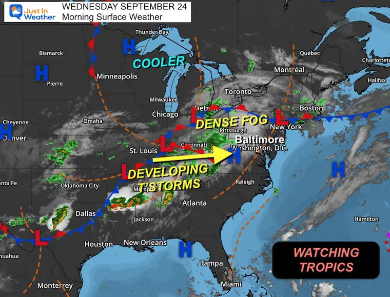
Wednesday, September 24, 2025
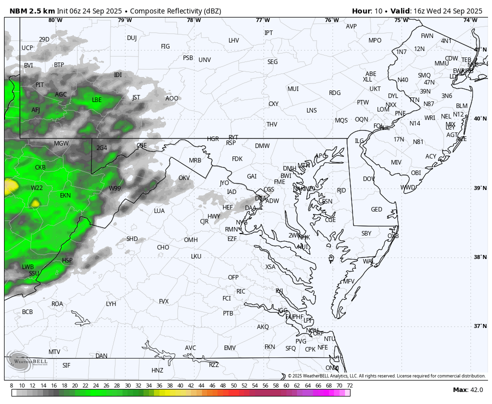
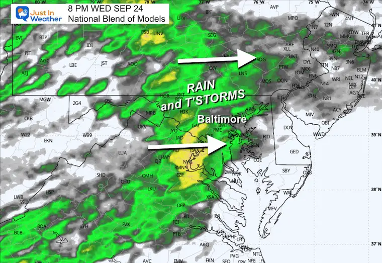
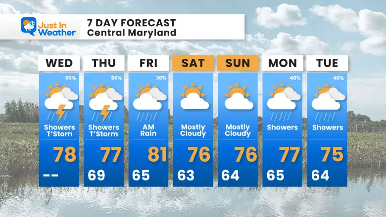
The showers and thunderstorms yesterday were not evenly spread across the region. If you missed out, there will be more options today and tomorrow.
If you have plans this weekend for the Seagull Century or Ocean’s Calling Music Festival, I will be watching closely. The latest modeling shows a break in the rain while clouds linger, but much more interesting weather next week.
In the Atlantic, Hurricane Gabrielle is well east of Bermuda and back down to a Category 3.
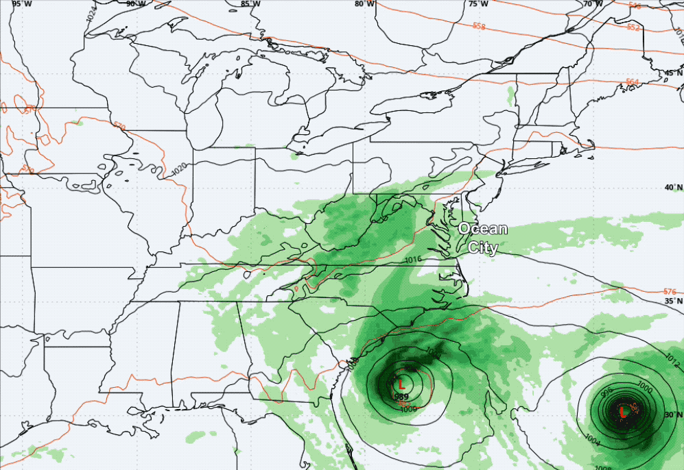
Two more storms may be named before the weekend and affect each other.
The closer one may track over the Bahamas and near the South Carolina coast. Below is a brief look. I will have a more detailed view later.
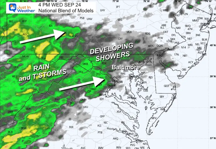
Dense Fog Advisory in place for Southern and Central Pennsylvania. The slow-moving frontal system to the west will send showers and thunderstorms our way this afternoon and tomorrow.
Live Radar Widget
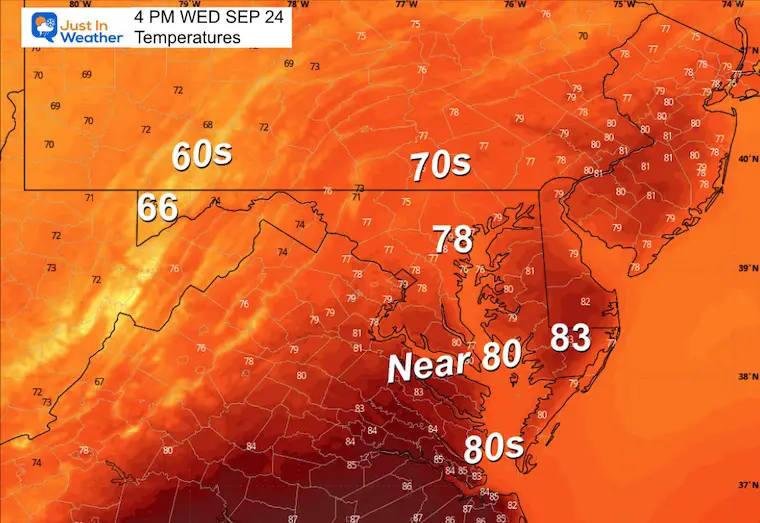
Yesterday: Low 62F; High 84F
Precipitation: 0.05”
Sunrise at 6:56 AM
Sunset at 6:59 PM
Normal Low in Baltimore: 56ºF
Record 39ºF in 1963; 1974; 1983
Normal High in Baltimore: 77ºF
Record 95ºF 1970; 2010
Rainfall Deficit at BWI
Subscribe for eMail Alerts
Sign up and be the first to know!
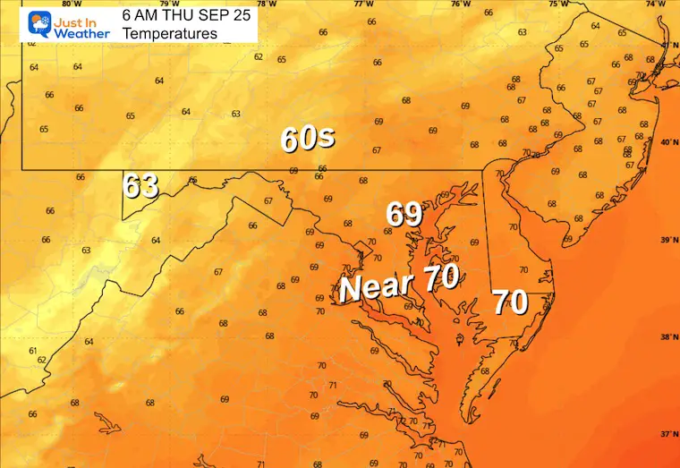
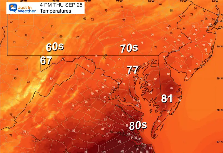
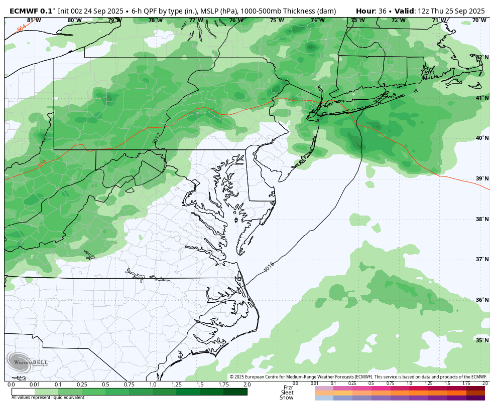
Rain and T’storms with the cold front will swing through Thursday night and Friday morning. At this point, the weekend looks dry, but clouds may linger as the front stalls to the south.
Hurricane Gabrielle has 115 mph winds and is heading towards Europe.
Two NEW Systems may develop by the weekend. The new names would be Humberto and Imelda.
If this happens, these two may affect each other, so the impact on the US is subject to change.
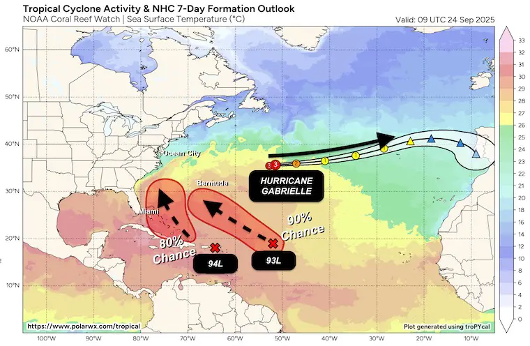
The expectation is to have two tropical storms named, perhaps upgraded to hurricane status, off the Southeast US coast. The system passing over the Bahamas may get close to the coast of South Carolina.
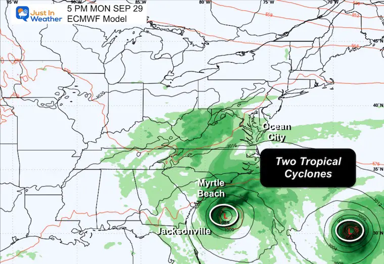
If we get two new tropical storms, they may affect each other, which in turn will affect the impact on the US East Coast. So this forecast is subject to change.
Afternoon and Evening Showers/T’Storms today and tomorrow.
Weekend: May remain cloudy and dry for Seagull Century 100 bike ride AND Ocean’s Calling Music Festival.
The TWO New Tropical Systems in the Atlantic MIGHT send clouds and showers on Monday and Tuesday.
Subscribe for eMail Alerts
Sign up and be the first to know!