


January 2 Weather Still Cold This Weekend With A Warm Up Next Week
Friday, January 2, 2026 After the New Year's Day Morning Snow Squall, the cold air mass has been firmly in place. One more system passed through overnight with flurries and…
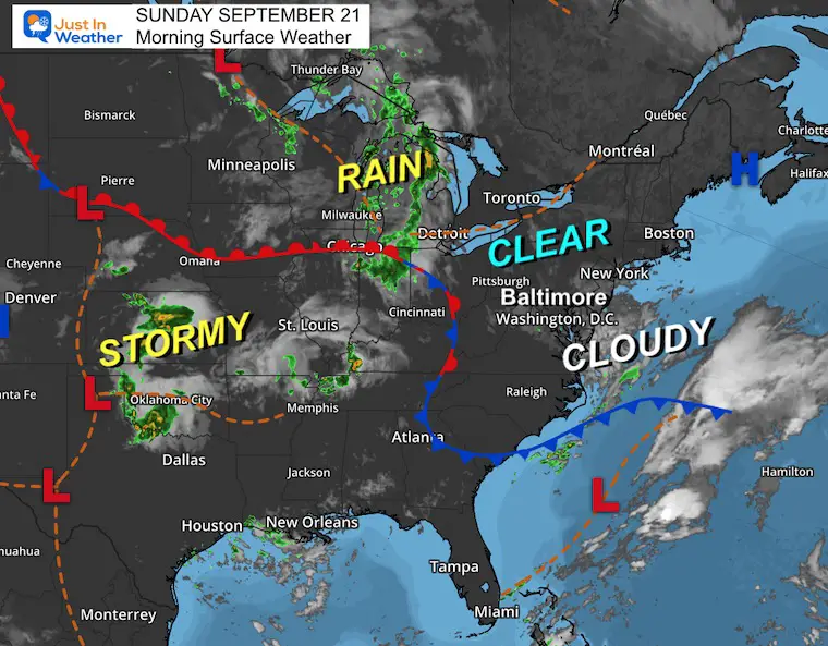
Sunday, September 21 2025
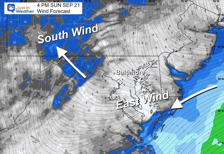
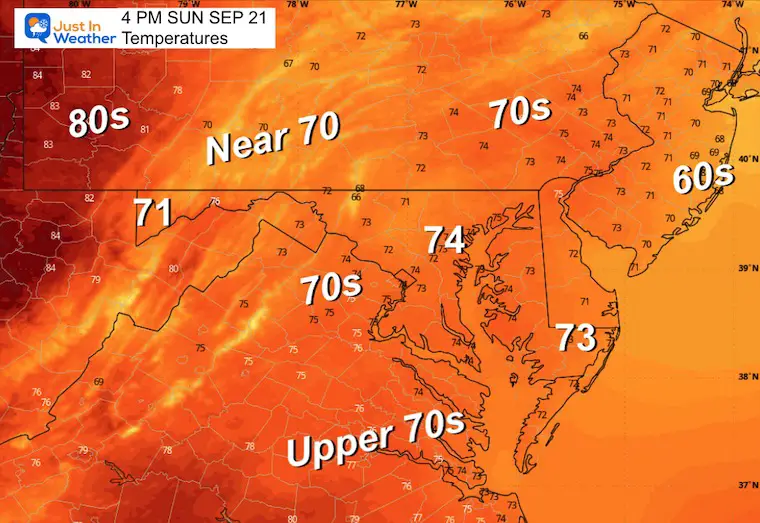
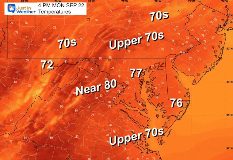
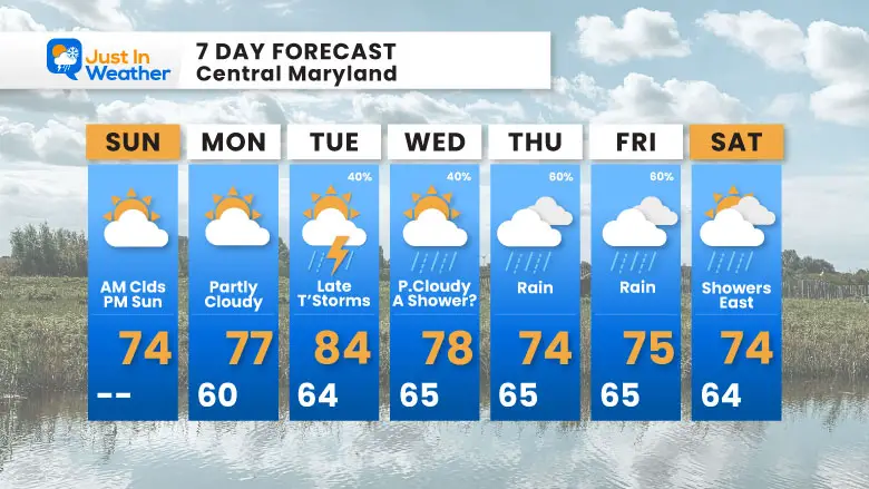
Today is the last full day of summer. The good news is that morning clouds should give way to the sun by afternoon. Temps will remain cool with the light easterly wind. Temps will be warmer with more sun and a shift to the south in the mountains.
The Autumnal Equinox is 2:19 PM Monday
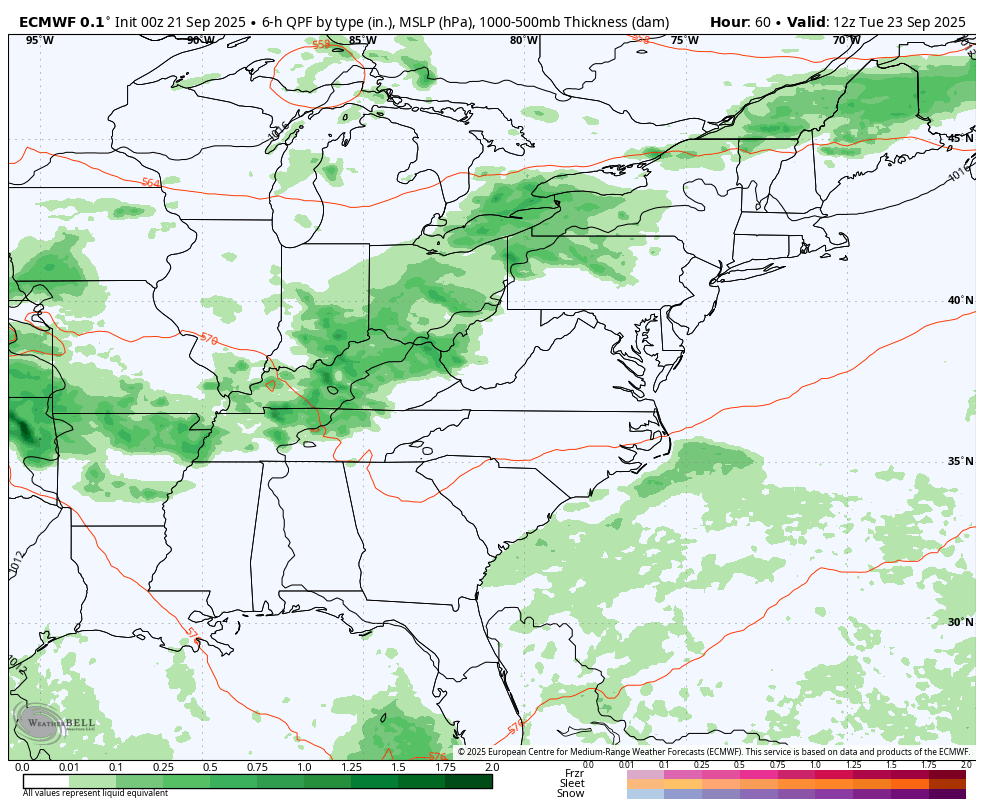
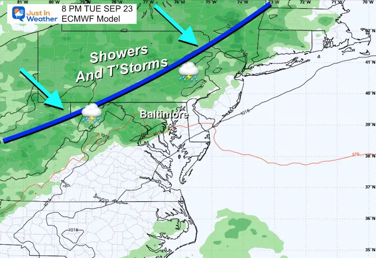
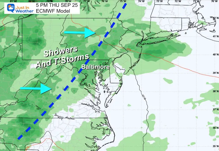
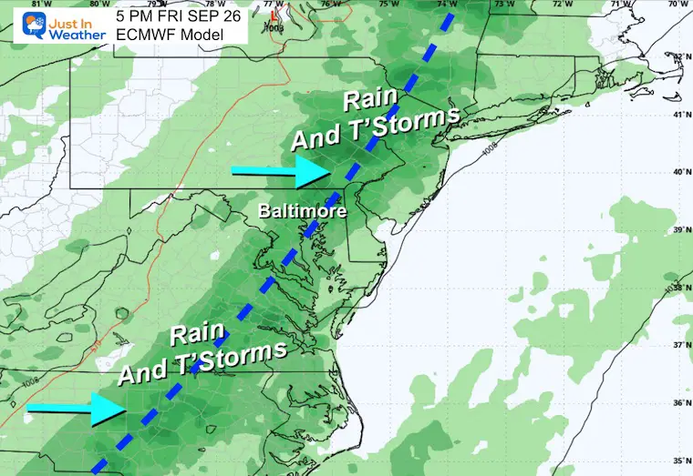
The next cold front will arrive later on Tuesday. So, a warmer day and then thunderstorms are possible. This front will stall with waves of Low Pressure that will ride along it and establish a few days of rain to end the work week.
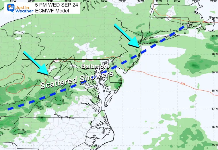
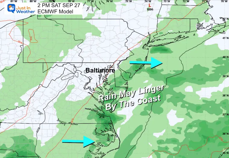
If you have plans next weekend for the Seagull Century or Ocean’s Calling Music Festival, I will be watching closely. As of now, there is a chance for showers to linger on Saturday, but there is time for this to shift.
A waterspout was spotted on the Chesapeake Bay yesterday.
This was pushed back to a later time, but local clouds may have obstructed your view.
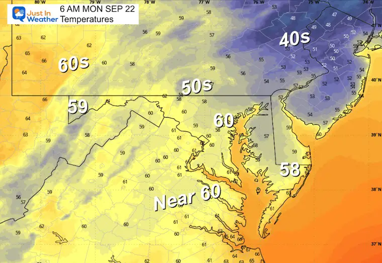
High Pressure is in control, but the East wind helped keep clouds around. There is clearing that will expand during the day.
The next weather system is in the Great Lakes. This will arrive later Tuesday and come to a halt by the East Coast.
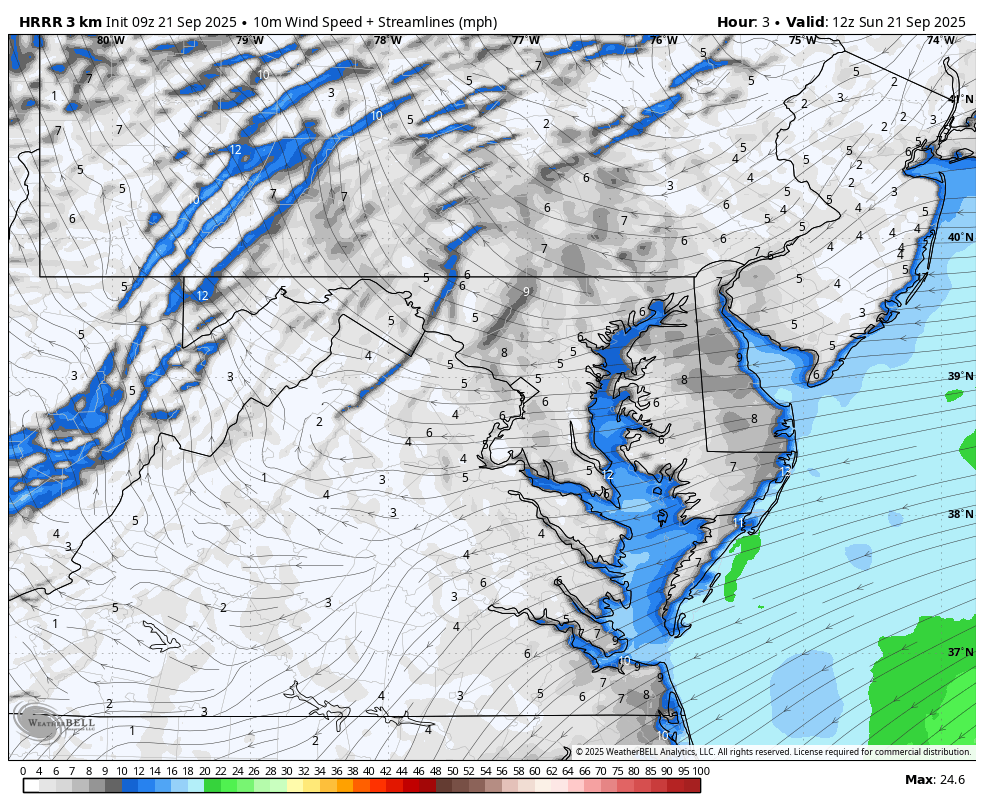
This wind FROM THE EAST will bring in cooler air and increase close to the coast. This will push inland on Sunday.
Yesterday: Low 67F; High 75F
Precipitation: 0.00”
Sunrise at 6:54 AM
Sunset at 7:05 PM
Normal Low in Baltimore: 57ºF
Record 37ºF in 1956; 1962
Normal High in Baltimore: 78ºF
Record 96ºF 1895; 1931
Rainfall Deficit at BWI
Subscribe for eMail Alerts
Sign up and be the first to know!
The next weather system will bring showers and thunderstorms from the Great Lakes to reach our region late Tuesday into Wednesday. That cold front will stall and keep showers around, perhaps a wave of Low Pressure with steadier rain on Thursday and Friday.
Tropical Storm Gabrielle has 65 mph winds. This will turn East of Bermuda and aim for brief hurricane intensity.
The next system will likely stay out in the ocean IF it develops, and likely follow a similar path.
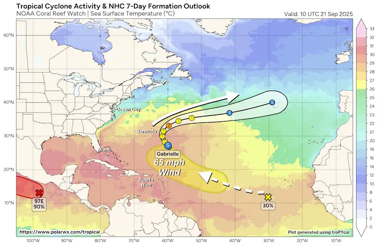
Next Weekend: Closely watching the rain by the coast for Seagull Century 100 bike ride AND Ocean’s Calling Music Festival.
Sign up and be the first to know!
Click to see more and ‘Book’ a visit to your school 

The annual event: Hiking and biking 329 miles in 7 days between The Summit of Wisp to Ocean City.
Each day, we honor a kid and their family’s cancer journey.
Fundraising is for Just In Power Kids: Funding Free Holistic Programs. I never have and never will take a penny. It is all for our nonprofit to operate.
Click here or the image to donate:

I am aware there are some spelling and grammar typos and occasional other glitches. I take responsibility for my mistakes and even the computer glitches I may miss. I have made a few public statements over the years, but if you are new here, you may have missed it: I have dyslexia and found out during my second year at Cornell University. It didn’t stop me from getting my meteorology degree and being the first to get the AMS CBM in the Baltimore/Washington region. One of my professors told me that I had made it that far without knowing and to not let it be a crutch going forward. That was Mark Wysocki, and he was absolutely correct! I do miss my mistakes in my own proofreading. The autocorrect spell check on my computer sometimes does an injustice to make it worse. I can also make mistakes in forecasting. No one is perfect at predicting the future. All of the maps and information are accurate. The ‘wordy’ stuff can get sticky. There has been no editor who can check my work while writing and to have it ready to send out in a newsworthy timeline. Barbara Werner is a member of the web team that helps me maintain this site. She has taken it upon herself to edit typos when she is available. That could be AFTER you read this. I accept this and perhaps proves what you read is really from me… It’s part of my charm. #FITF