


January 2 Weather Still Cold This Weekend With A Warm Up Next Week
Friday, January 2, 2026 After the New Year's Day Morning Snow Squall, the cold air mass has been firmly in place. One more system passed through overnight with flurries and…
Saturday, September 20, 2025
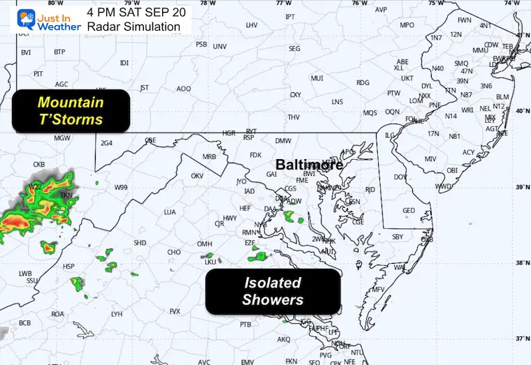
A cold front came through yesterday. It was hardly noticeable, with the exception of a narrow band of showers that formed across parts of Frederick and Carroll counties in the afternoon.
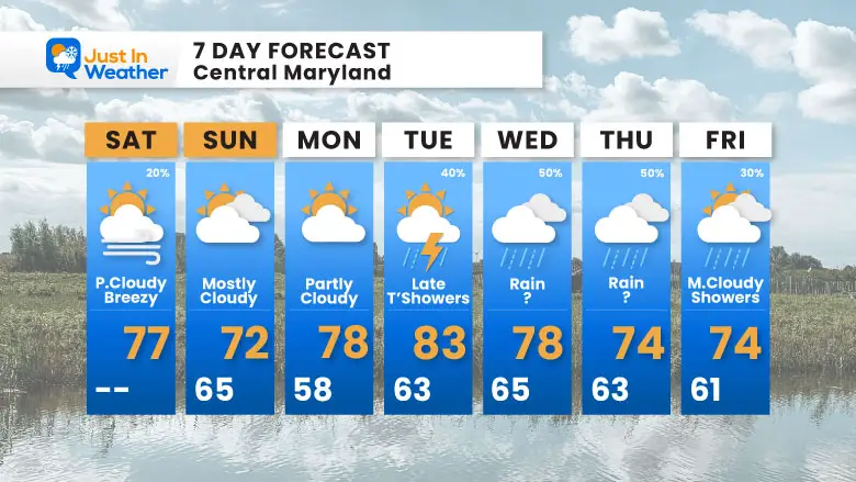
Today, we all get the benefit of the wind shift that will keep temperatures much cooler. Instead of ‘near 90F’, this afternoon should remain in the 70s.
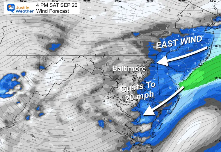
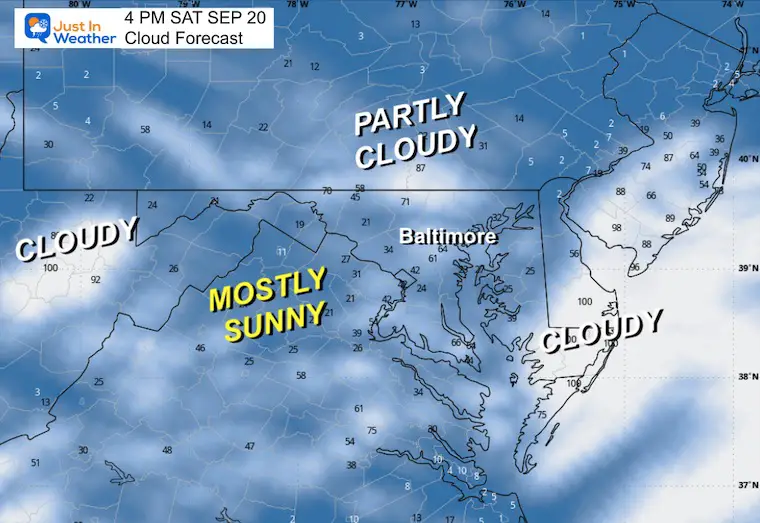
The wind from the East will increase this afternoon. This comes in from the ocean and will help to build some clouds, most likely near the beaches across Delmarva and in the hills and mountains to the west.
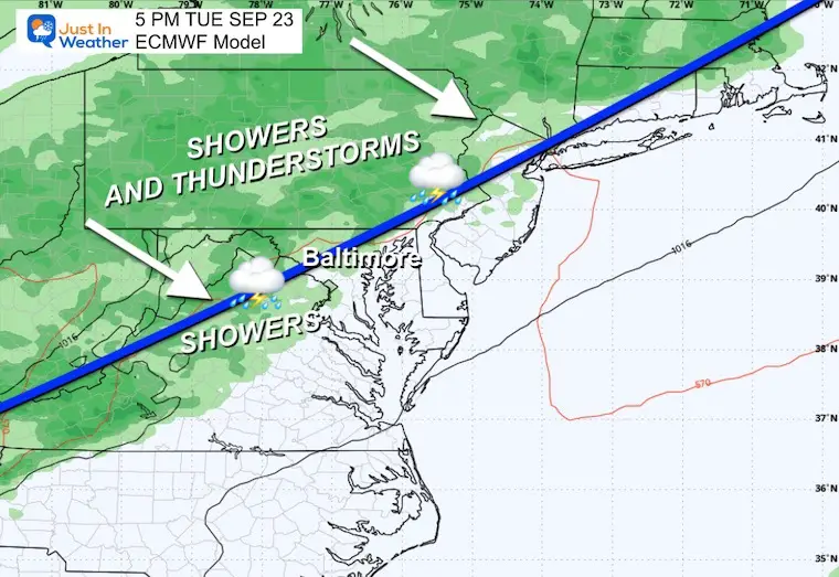
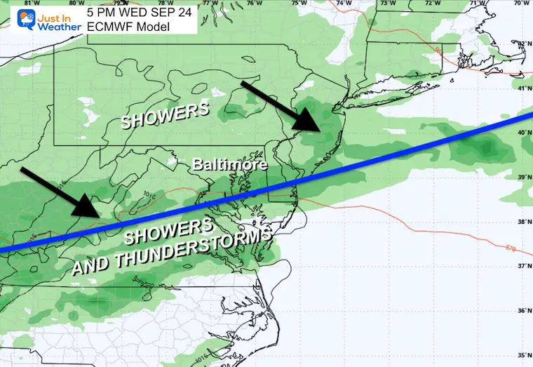
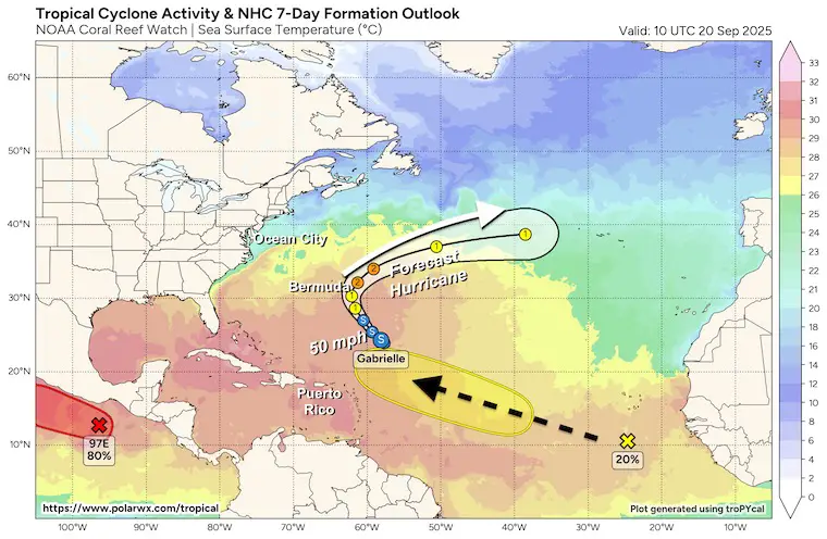
The next focus will be on the cold front mid-week. This may bring thunderstorms late Tuesday into Wednesday. If this front also stalls, it will keep the risk of rain around for a few days.
The crescent moon was in conjunction with Venus and the star Regulus on Friday morning.
NOTE: There will be a SpaceX Rocket Launch Sunday Morning at 5:20 AM. We may get to see it if the sky is clear.
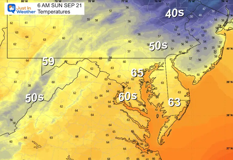
A cold front moved through yesterday and is stalling to our south; this will work to keep clouds around.
It has help from High Pressure to our North pushing winds in from the Atlantic.
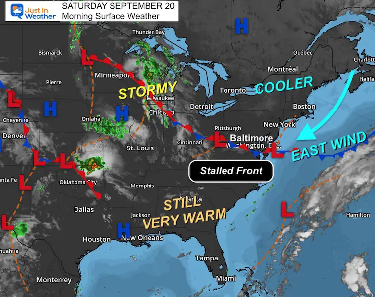
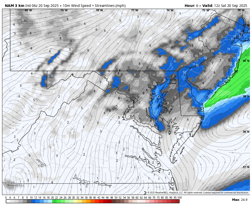
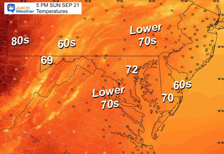
The wind FROM THE EAST will bring in cooler air and will increase close to the coast. This will push inland for Sunday.
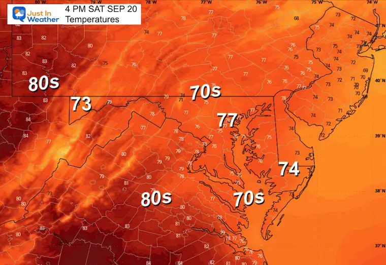
Yesterday: Low 59F; High 88F
Precipitation: 0.00”
Sunrise at 6:53 AM
Sunset at 7:06 PM
Normal Low in Baltimore: 57ºF
Record 42ºF in 1983
Normal High in Baltimore: 78ºF
Record 92ºF 1959; 2020
Rainfall Deficit at BWI
Subscribe for eMail Alerts
Sign up and be the first to know!
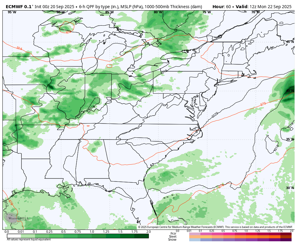
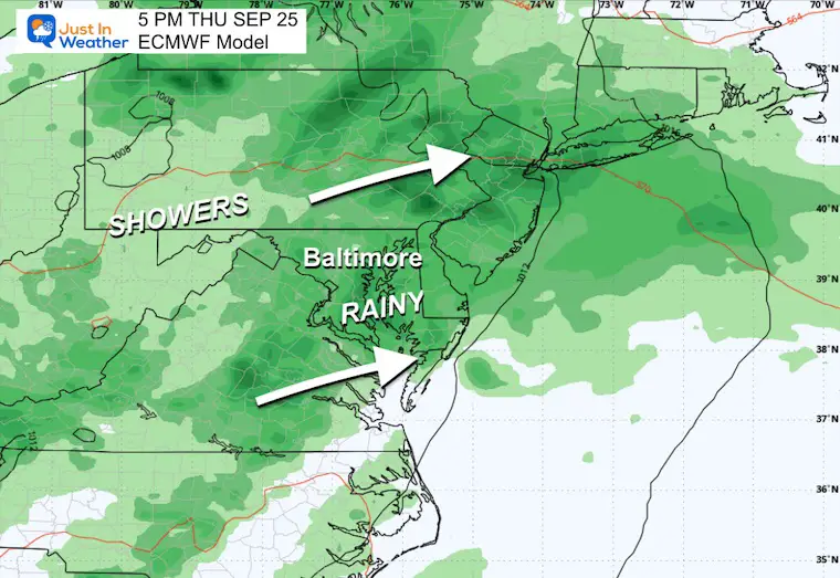
The next weather system will bring showers and thunderstorms from the Great Lakes to our region late Tuesday into Wednesday. That cold front will stall and keep showers around, with perhaps a wave of Low Pressure with steadier rain on Thursday.
Tropical Storm Gabrielle winds are still 50 mph. This looks to be turning East of Bermuda and becoming a Category 2 hurricane.
The next system will likely stay out in the ocean, and IF it develops, it will follow a similar path.
Sign up and be the first to know!
Click to see more and ‘Book’ a visit to your school


The annual event: Hiking and biking 329 miles in 7 days between The Summit of Wisp to Ocean City.
Each day, we honor a kid and their family’s cancer journey.
Fundraising is for Just In Power Kids: Funding Free Holistic Programs. I never have and never will take a penny. It is all for our nonprofit to operate.
Click here or the image to donate:

I am aware there are some spelling and grammar typos and occasional other glitches. I take responsibility for my mistakes and even the computer glitches I may miss. I have made a few public statements over the years, but if you are new here, you may have missed it: I have dyslexia and found out during my second year at Cornell University. It didn’t stop me from getting my meteorology degree and being the first to get the AMS CBM in the Baltimore/Washington region. One of my professors told me that I had made it that far without knowing and to not let it be a crutch going forward. That was Mark Wysocki, and he was absolutely correct! I do miss my mistakes in my own proofreading. The autocorrect spell check on my computer sometimes does an injustice to make it worse. I can also make mistakes in forecasting. No one is perfect at predicting the future. All of the maps and information are accurate. The ‘wordy’ stuff can get sticky. There has been no editor who can check my work while writing and to have it ready to send out in a newsworthy timeline. Barbara Werner is a member of the web team that helps me maintain this site. She has taken it upon herself to edit typos when she is available. That could be AFTER you read this. I accept this and perhaps proves what you read is really from me… It’s part of my charm. #FITF