


My Call For Snowfall Saturday Morning Inland And Sunday Closer To The Coast
Friday Evening Update January 16 2026 Two weather events will bring snow to our region this weekend. They are related to the fast winds aloft on the edge of this…
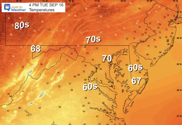
Monday Night Report: September 15 2025
We have another compact coastal storm developing off the Mid-Atlantic. There is a sense that this was trying to turn tropical by its tight circulation. But it will run out of room as it pushes onshore and bombards the region with a strong onshore airflow.
This will not affect all of our region equally. While the day will start breezy and cool with rain showers on Tuesday, strong winds, beach erosion, and heavier rain will affect Southern Maryland, Eastern Virginia, and North Carolina.
The prime impact will be Tuesday, but the Low Pressure will push inland and nearly stall as High Pressure in New England.
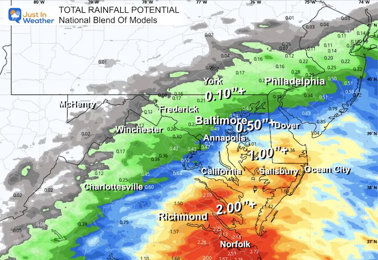
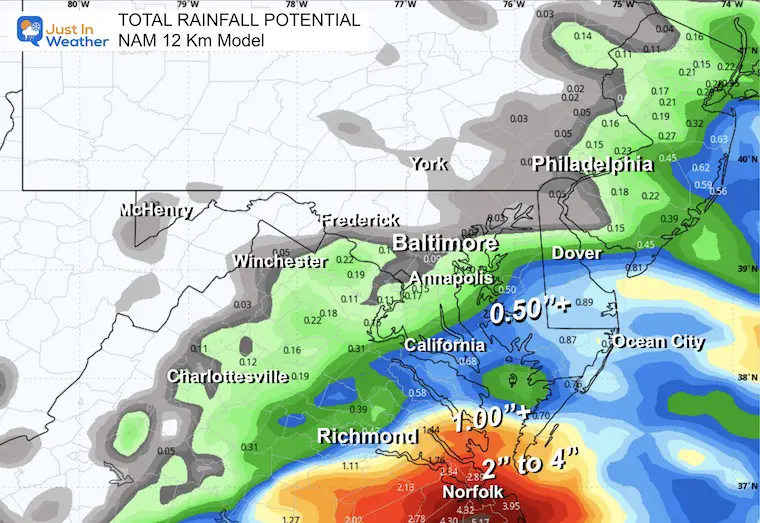
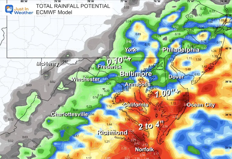
How much rainfall is the challenge. A good thing this is not a snowstorm in winter because the potential would be all over the place. Below is a look at the models to compare. Metro areas will get 0.10 to 0.25 inches, while closer to the storm will get over 1 inch and possibly up to 4 inches near the Low Pressure Center… that is where Flood Watches have been issued. It is wrapped tightly and compact.
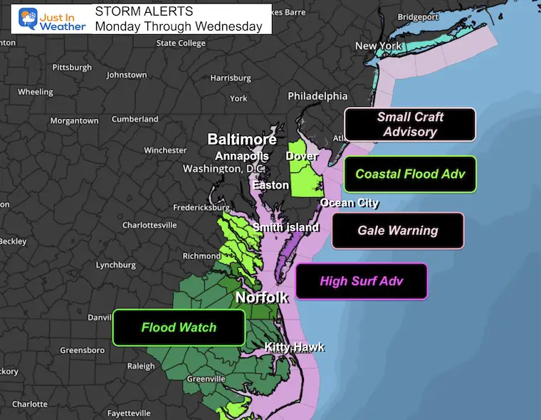
A Gale Warning goes into effect Tuesday morning for the Southern Chesapeake Bay towards North Carolina as winds are expected to gust over 40 knots (46 mph). This is tropical storm strength, but this is not a tropical storm.
Small Craft Advisory is for the Northern Chesapeake Bay and up to Long Island.
Coastal Flood Advisories are in place for Delaware and Southeast Virginia, while a Flood Watch is in place where the heaviest rain will fall between Norfolk and Eastern North Carolina. This is where 2 to 4 inches of rainfall is expected.
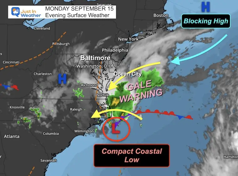
Low Pressure was located south of Cape Hatteras. This high spiral is being enhanced by a blocking high-pressure east of Boston.
REMEMBER THIS FOR POSSIBLE REPEATS IN THE MONTHS AHEAD.
The gradient between these systems is what will enhance the wind and push the rain inland on Tuesday.
With that Blocking High, this system will not be able to move much for the next day or two as it spins itself out after moving inland away from its energy source over the water.
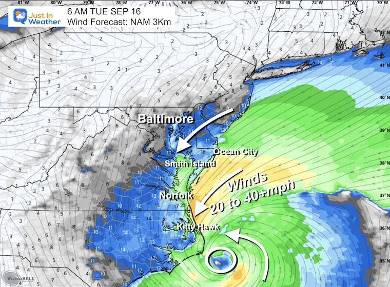
Low Pressure will creep closer to Cape Hatteras, and the winds will increase FROM the Northeast.
The strongest winds will be South of the Bay Bridge, which is where the Gale Warning has been issued.
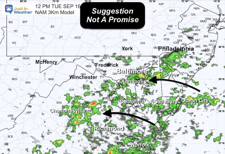
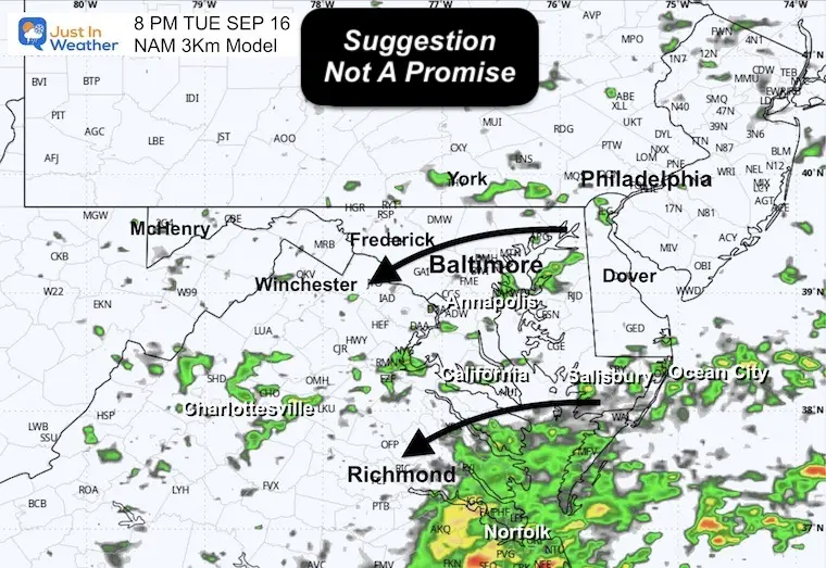
Track the low-pressure system moving inland by noon.
The moisture will push onshore TO THE WEST. The showers will be intermittent, but steadier farther south and closer to the Low Pressure Center.
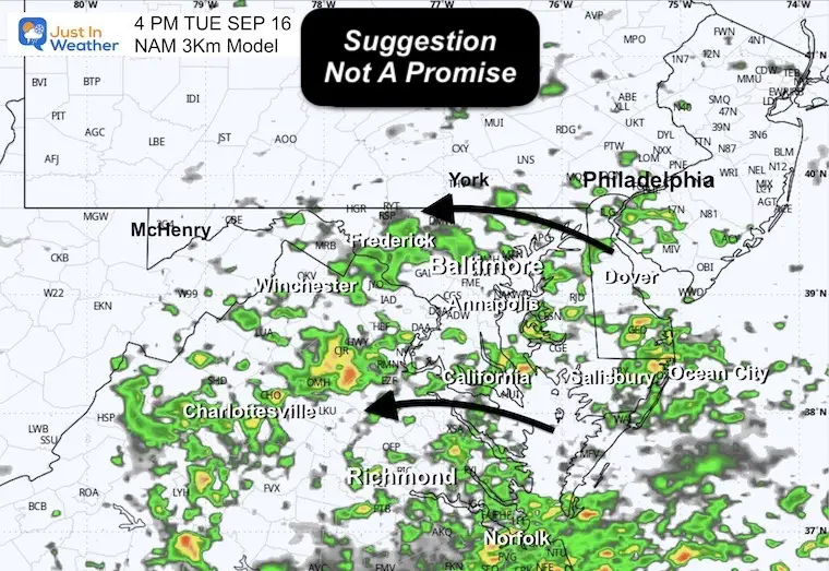
The peak rain impact will be in the afternoon, then fade in the evening as the moisture will be limited as the Low Pressure moves farther inland.
Again, a good thing this is not a winter storm. With just rainfall, it is obviously going to bring more to Virginia and North Carolina.
Central Maryland will range between 0.10” to 0.25”.
Southern Maryland may get close to 1 inch. Heavier rain in Southeast Virginia and North Carolina, where they may receive 2 to 4 inches of rain.
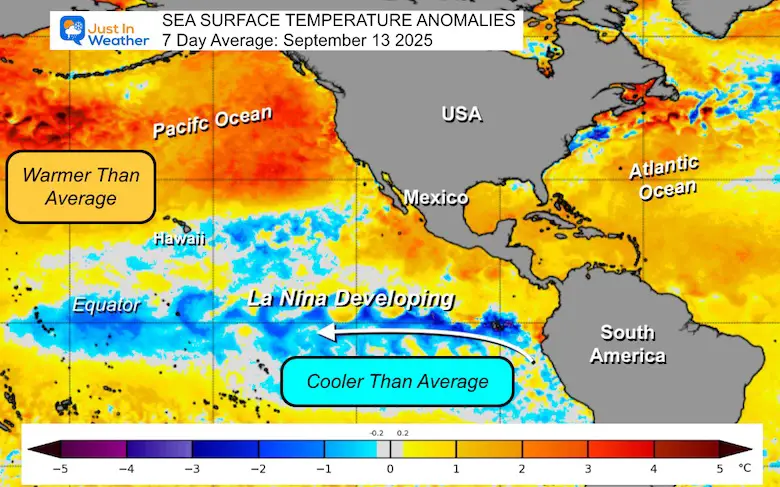
I posted a report earlier about The La Niña Watch. This is expected to be brief and trend back to neutral and may result in an active and snowy winter.
Take A Look…
Sign up and be the first to know!
Click to see more and ‘Book’ a visit to your school


The annual event: Hiking and biking 329 miles in 7 days between The Summit of Wisp to Ocean City.
Each day, we honor a kid and their family’s cancer journey.
Fundraising is for Just In Power Kids: Funding Free Holistic Programs. I never have and never will take a penny. It is all for our nonprofit to operate.
Click here or the image to donate:

I am aware there are some spelling and grammar typos and occasional other glitches. I take responsibility for my mistakes and even the computer glitches I may miss. I have made a few public statements over the years, but if you are new here, you may have missed it: I have dyslexia and found out during my second year at Cornell University. It didn’t stop me from getting my meteorology degree and being the first to get the AMS CBM in the Baltimore/Washington region. One of my professors told me that I had made it that far without knowing and to not let it be a crutch going forward. That was Mark Wysocki, and he was absolutely correct! I do miss my mistakes in my own proofreading. The autocorrect spell check on my computer sometimes does an injustice to make it worse. I can also make mistakes in forecasting. No one is perfect at predicting the future. All of the maps and information are accurate. The ‘wordy’ stuff can get sticky. There has been no editor who can check my work while writing and to have it ready to send out in a newsworthy timeline. Barbara Werner is a member of the web team that helps me maintain this site. She has taken it upon herself to edit typos when she is available. That could be AFTER you read this. I accept this and perhaps proves what you read is really from me… It’s part of my charm. #FITF