


My Call For Snowfall Saturday Morning Inland And Sunday Closer To The Coast
Friday Evening Update January 16 2026 Two weather events will bring snow to our region this weekend. They are related to the fast winds aloft on the edge of this…
Wednesday, September 3 2025
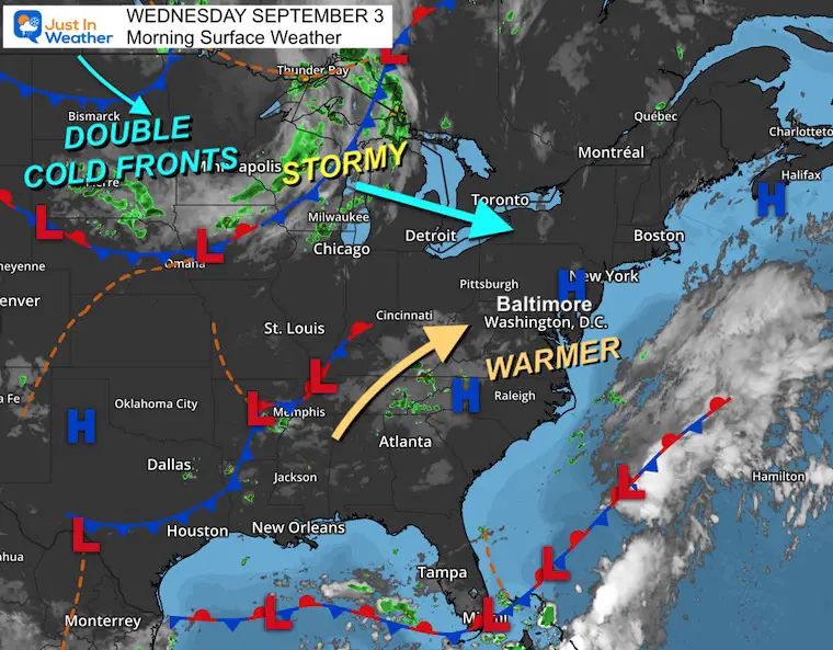
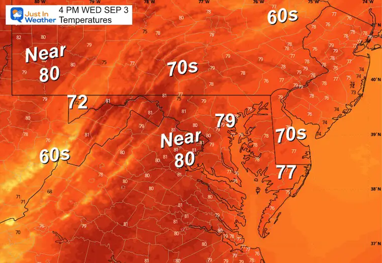
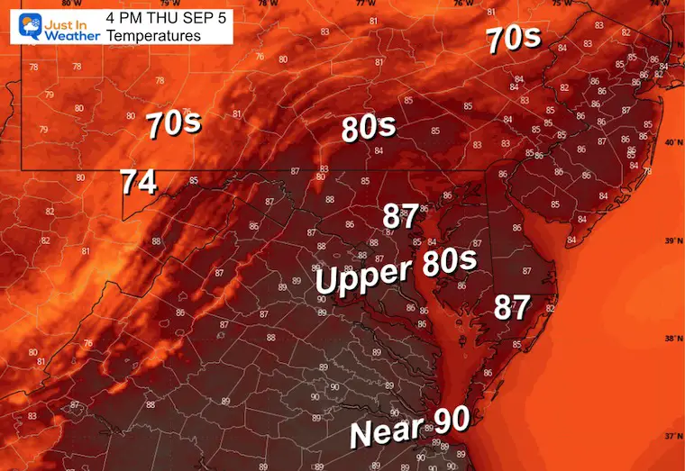
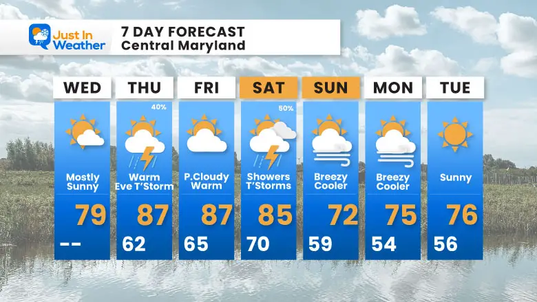
The next few days will validate the attempted balance of the atmosphere. After a record low temperature early this week and the very cool end of August, a warm-up will surge, and I am leaning toward the thought of higher temperatures. We will reach the upper 80s for a few days.
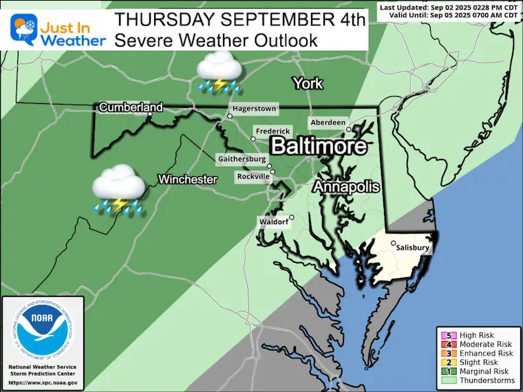
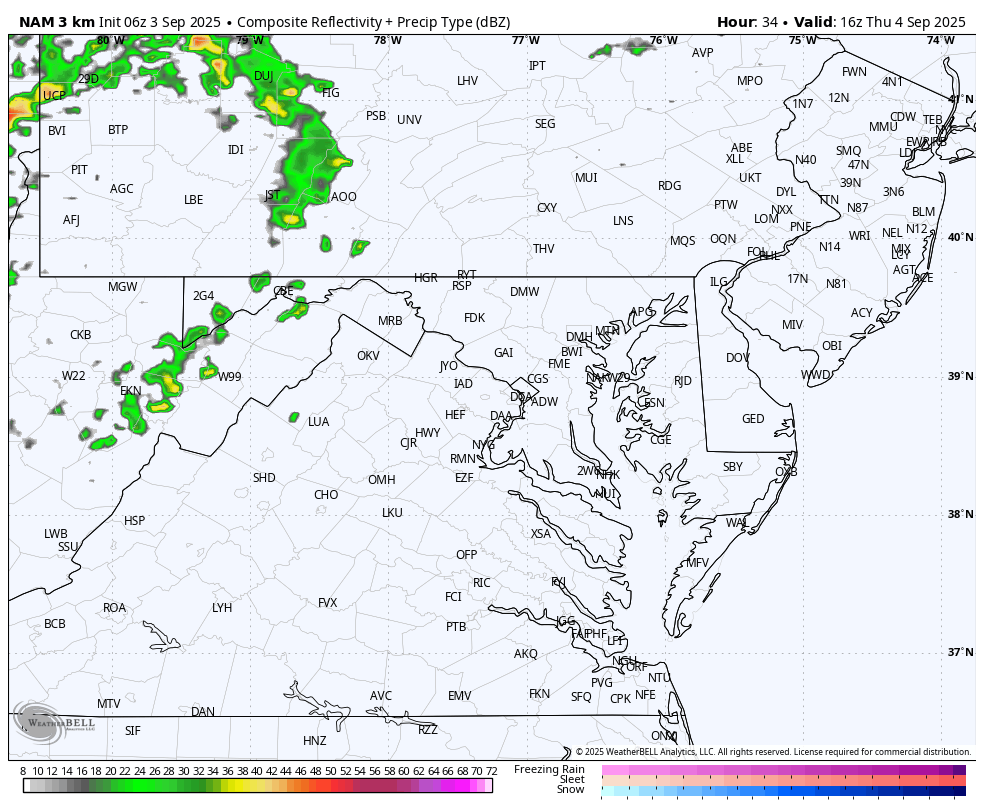
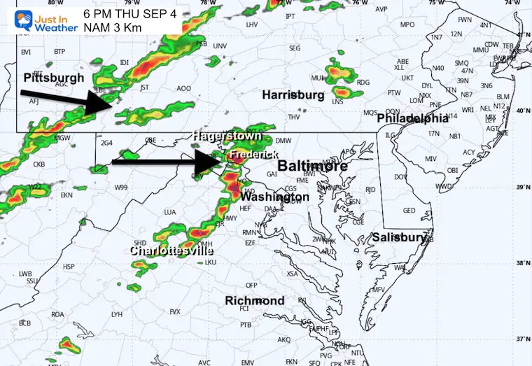
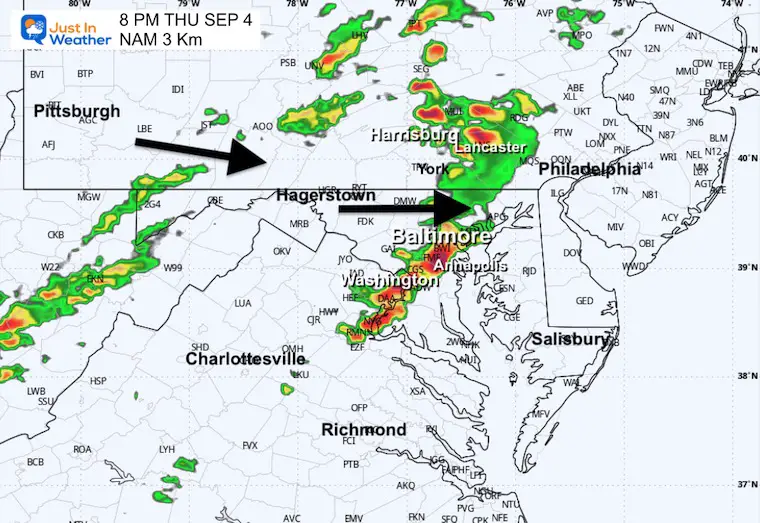
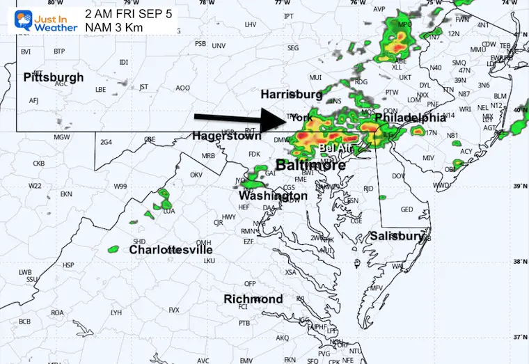
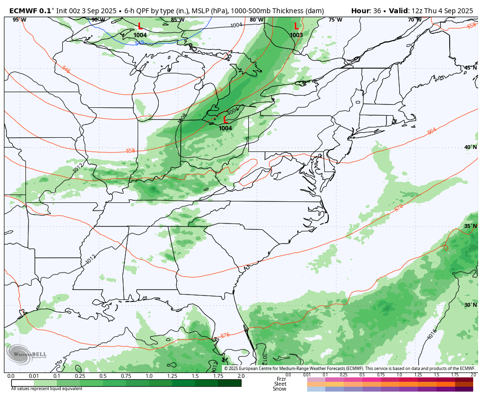
Two cold fronts are approaching and will tap into the increase in humidity with the heat. This will spark strong thunderstorms on Thursday evening with a marginal risk for some to turn severe. It has been over 2 weeks since we have had rain, so this will be an important change of pace.
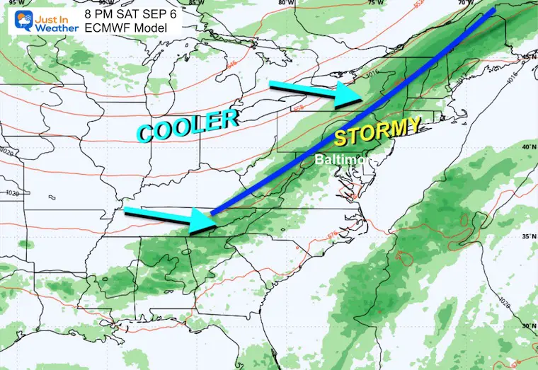
The cold air will not arrive until the second cold front passes on Saturday. This will bring another round of showers and thunderstorms, then the weekend will end with gusty winds and colder air.
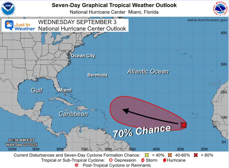
We are entering the peak of hurricane season in the Atlantic, and the only potential system is moving off the African coast. There is a 70% chance for development over the next 7 days… Optimally, this will stay in the open water like Fernand (the last storm).
As High Pressure shifts, warm weather will pivot to build in for a few days. This will feed into a double set of cold fronts that will move our way with thunderstorms.
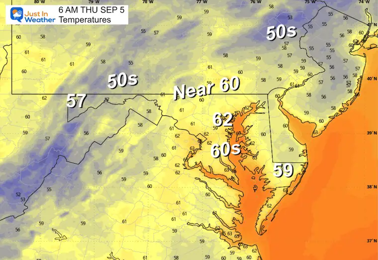
The next push of colder air will hold off until the end of the weekend.
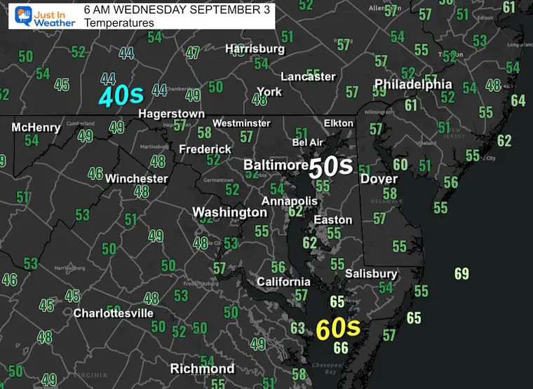
Yesterday: Low 54F (RECORD); High 78F
Precipitation: 0.00
Sunrise at 6:37 AM
Sunset at 7:34 PM
Normal Low in Baltimore: 63ºF
Record 46ºF in 1967
Normal High in Baltimore: 84ºF
Record 98ºF 2023
Rainfall Deficit at BWI
Subscribe for eMail Alerts
Sign up and be the first to know!
Click to see more and ‘Book’ a visit to your school 
The annual event: Hiking and biking 329 miles in 7 days between The Summit of Wisp to Ocean City.
Each day, we honor a kid and their family’s cancer journey.
Fundraising is for Just In Power Kids: Funding Free Holistic Programs. I never have and never will take a penny. It is all for our nonprofit to operate.
Click here or the image to donate:

Marginal Risk for severe storms as a storm line arrives in the evening.
Two cold fronts are expected to end the week.
The second cold front on Saturday will be stronger. This will bring more showers and thunderstorms, then bring back colder air.
This will be a warm day, starting dry but ending with showers and thunderstorms.
Sign up and be the first to know!

I am aware there are some spelling and grammar typos and occasional other glitches. I take responsibility for my mistakes and even the computer glitches I may miss. I have made a few public statements over the years, but if you are new here, you may have missed it: I have dyslexia and found out during my second year at Cornell University. It didn’t stop me from getting my meteorology degree and being the first to get the AMS CBM in the Baltimore/Washington region. One of my professors told me that I had made it that far without knowing and to not let it be a crutch going forward. That was Mark Wysocki, and he was absolutely correct! I do miss my mistakes in my own proofreading. The autocorrect spell check on my computer sometimes does an injustice to make it worse. I also can make mistakes in forecasting. No one is perfect at predicting the future. All of the maps and information are accurate. The ‘wordy’ stuff can get sticky. There has been no editor who can check my work while writing and to have it ready to send out in a newsworthy timeline. Barbara Werner is a member of the web team that helps me maintain this site. She has taken it upon herself to edit typos when she is available. That could be AFTER you read this. I accept this and perhaps proves what you read is really from me… It’s part of my charm. #FITF