


My Call For Snowfall Saturday Morning Inland And Sunday Closer To The Coast
Friday Evening Update January 16 2026 Two weather events will bring snow to our region this weekend. They are related to the fast winds aloft on the edge of this…
SundayAugust 24 2025
Morning Report
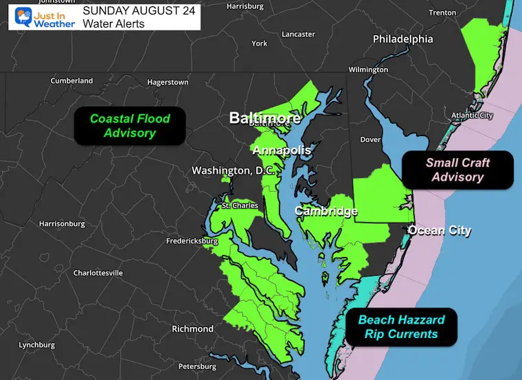
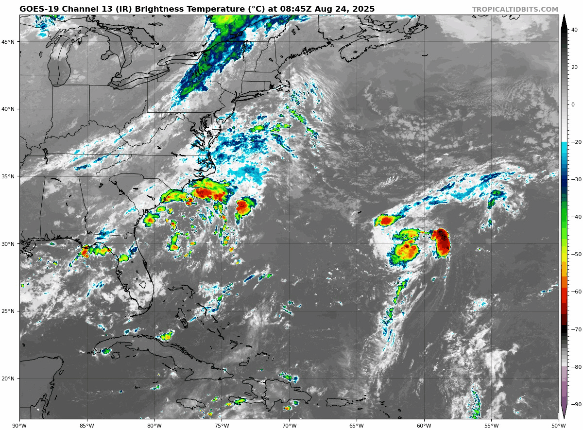
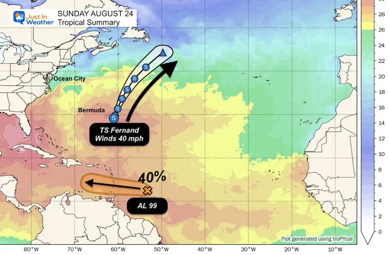
The water along the US East Coast continues to be rough and needs another day or two to settle down. The new Tropical Storm Fernand has formed and is holding with wind speeds of 40 mph. It is farther East than Erin and will have no impact on the US.
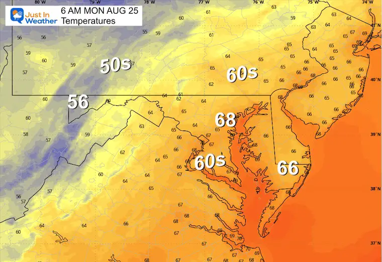
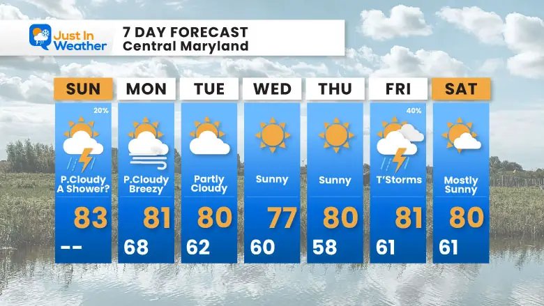
In the week ahead, a new air mass will arrive, giving us a taste of autumn. The cold front leading the change will bring spotty showers and maybe a thunderstorm today.
It will take the high water another day or two to settle down across the Chesapeake Bay. The same goes for the rip currents along the Atlantic beaches.
Winds 40 mph
Moving: NNE at 15 mph and staying in the ocean!
40% chance to hold together and develop. This is tracking into the Southern Caribbean.
An area of Low Pressure located off South Carolina will track like TS Fernand out to the Northeast and away from land.
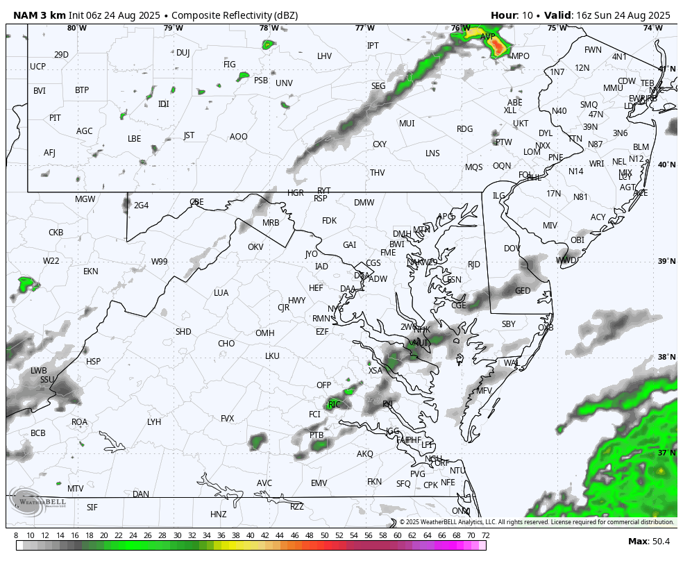
A cold front has spotty showers that may affect us today, but the air mass on the other side is the main story. This is a mark of early autumn weather: Much cooler and lower humidity.
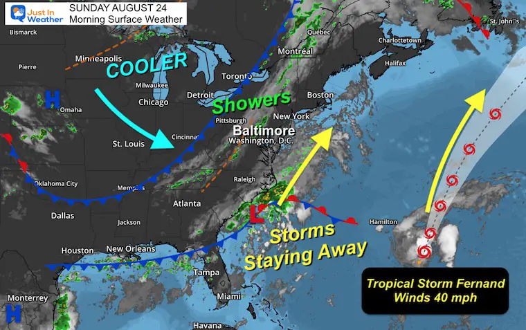
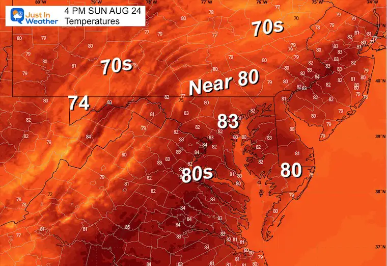
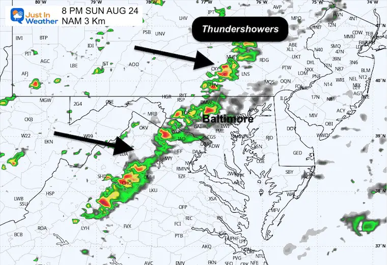
Spotty showers and a line of storms will develop this evening.
 ‘
‘
Yesterday: Low 58F; High 82F
Precipitation: 0.00”
Sunrise at 6:28 AM
Sunset at 7:49 PM
Normal Low in Baltimore: 65ºF
Record 48ºF in 1952
Normal High in Baltimore: 86ºF
Record 98ºF 1968
Rainfall Deficit at BWI
Subscribe for eMail Alerts
Sign up and be the first to know!
The annual event: Hiking and biking 329 miles in 7 days between The Summit of Wisp to Ocean City.
Each day, we honor a kid and their family’s cancer journey.
Fundraising is for Just In Power Kids: Funding Free Holistic Programs. I never have and never will take a penny. It is all for our nonprofit to operate.
Click here or the image to donate:

This is likely to build up clouds in the hills and mountains to the northwest.
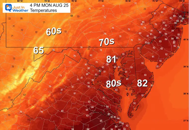
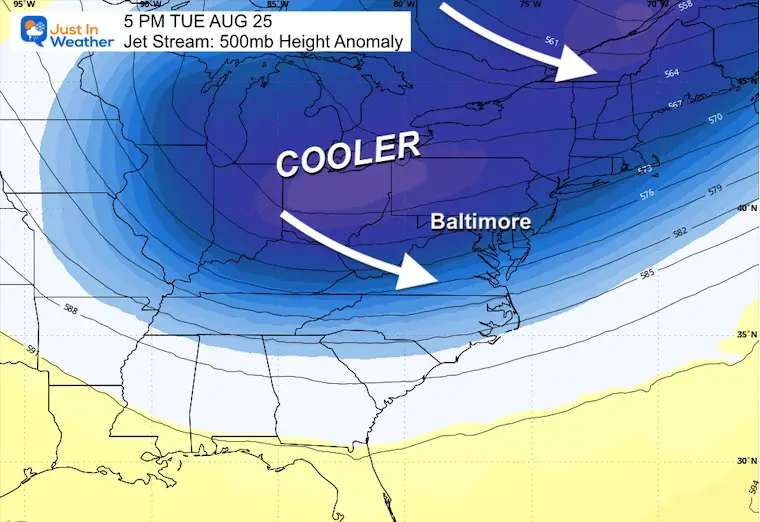
Monday Afternoon Through Friday Evening
This cool air mass will bring temperatures around 10 degrees below average into our region Next Week!
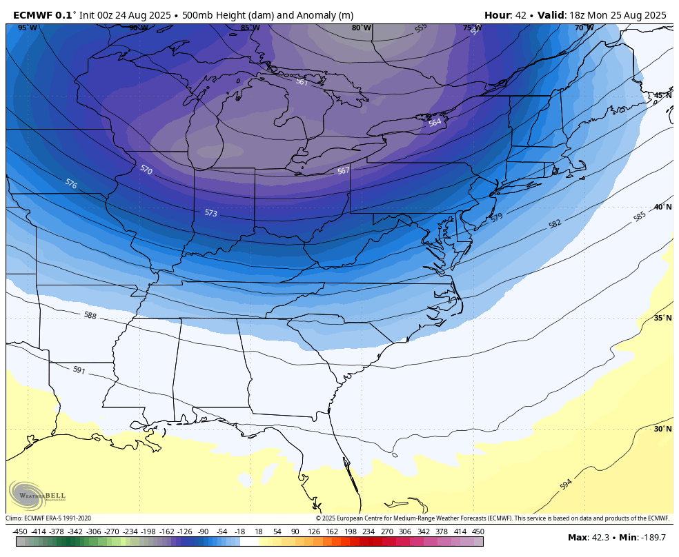
Reinforcing cold air will spill in all week.
Sign up and be the first to know!

I am aware there are some spelling and grammar typos and occasional other glitches. I take responsibility for my mistakes and even the computer glitches I may miss. I have made a few public statements over the years, but if you are new here, you may have missed it: I have dyslexia and found out during my second year at Cornell University. It didn’t stop me from getting my meteorology degree and being the first to get the AMS CBM in the Baltimore/Washington region. One of my professors told me that I had made it that far without knowing and to not let it be a crutch going forward. That was Mark Wysocki, and he was absolutely correct! I do miss my mistakes in my own proofreading. The autocorrect spell check on my computer sometimes does an injustice to make it worse. I also can make mistakes in forecasting. No one is perfect at predicting the future. All of the maps and information are accurate. The ‘wordy’ stuff can get sticky. There has been no editor who can check my work while writing and to have it ready to send out in a newsworthy timeline. Barbara Werner is a member of the web team that helps me maintain this site. She has taken it upon herself to edit typos when she is available. That could be AFTER you read this. I accept this and perhaps proves what you read is really from me… It’s part of my charm. #FITF