


My Call For Snowfall Saturday Morning Inland And Sunday Closer To The Coast
Friday Evening Update January 16 2026 Two weather events will bring snow to our region this weekend. They are related to the fast winds aloft on the edge of this…
Friday, August 22, 2025
Morning Report
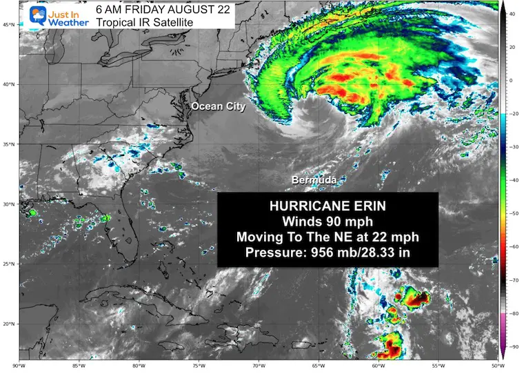
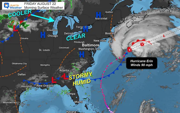
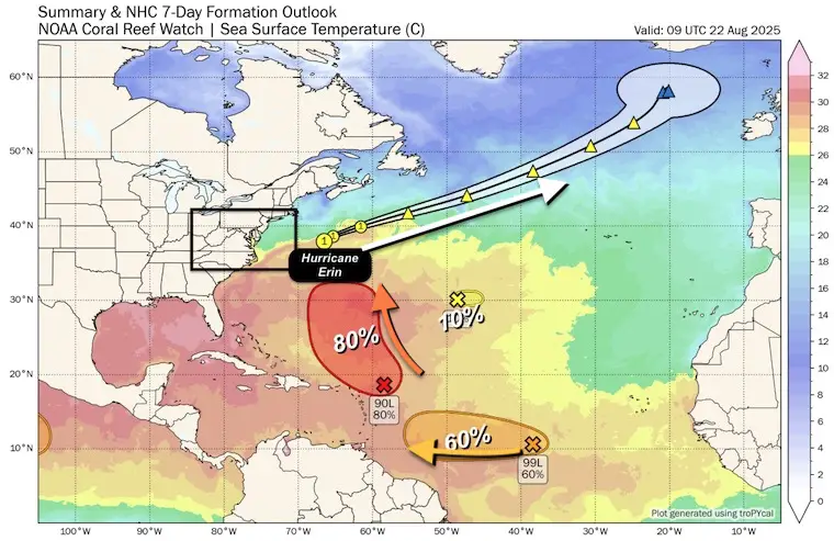
Hurricane Erin is down to Category 1 intensity this morning and moving away in a hurry. We dodged a bullet! This storm ranked among the top 10% in Atlantic history in size! The wind field stretched 600 miles, including tropical storm winds as far as 370 miles from the center on one side this morning. The north-to-south expanse was an astonishing 790 miles long!
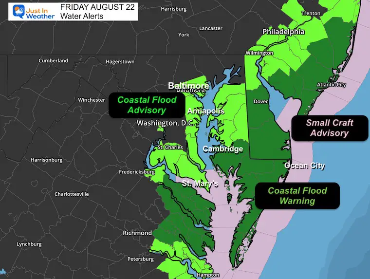
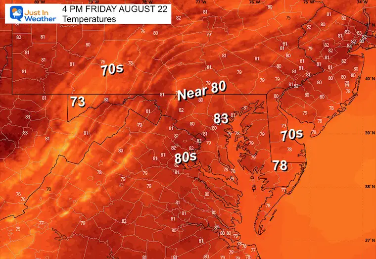
This affected water all along the US East Coast, flooding the Mid-Atlantic and New Jersey beaches. While the storm moves away, the water will take a couple of days to settle down. Below are more details and our forecast for the weekend. Next week will be cooler and calmer.
Video On Thursday: US Coast Guard Boats in Delaware Heading Out Into Hurricane Erin Affected Water
Winds were 90 mph, making this a Category 1.
Hurricane Force Winds reach 125 miles from the center, Tropical Storm Force Winds extend 370 miles from the center.
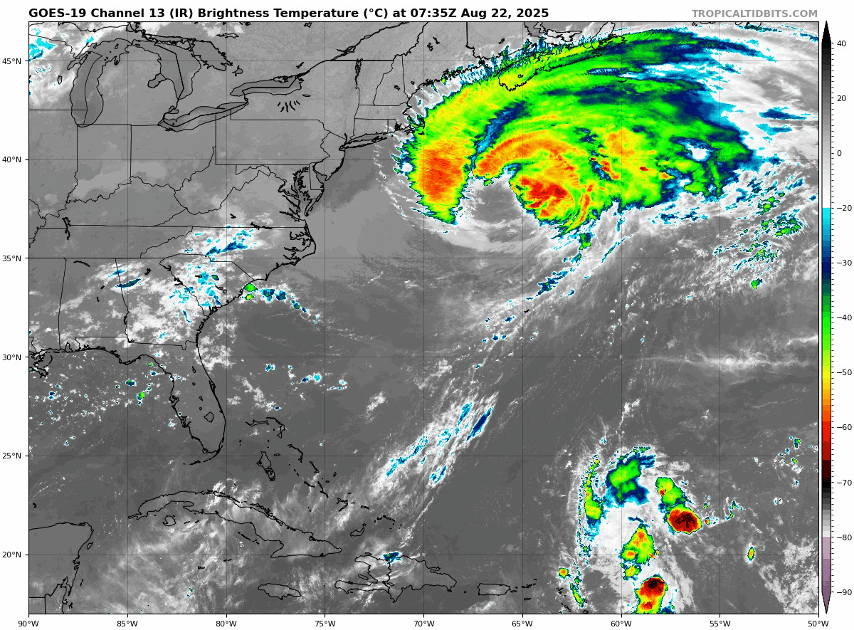
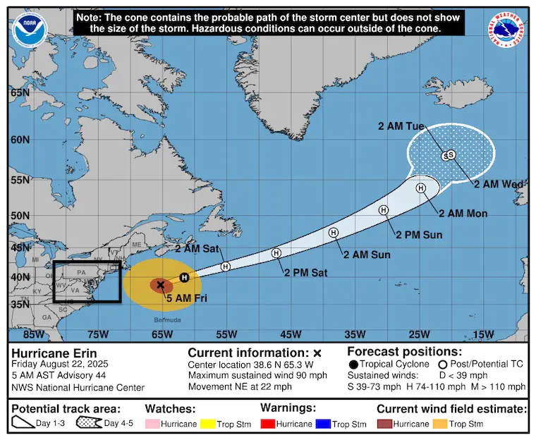
Hurricane Erin increases forward speed and then races into the North Atlantic.
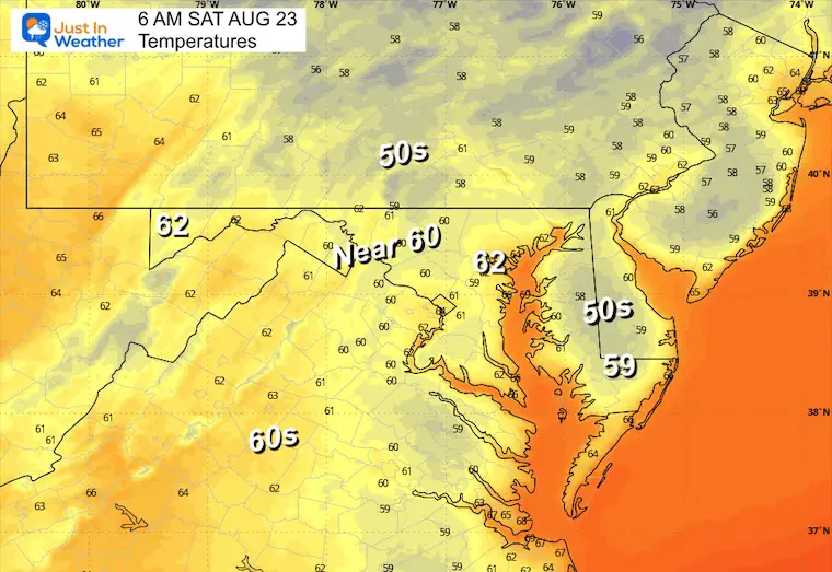
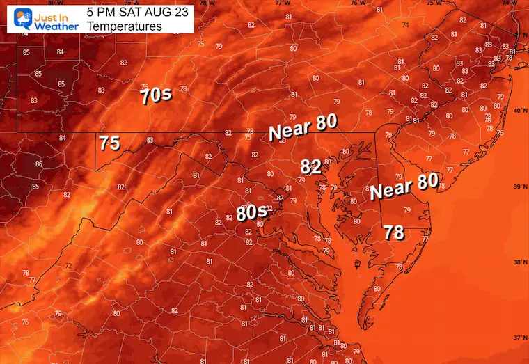
Hurricane Erin is departing, and High Pressure is bringing in a new air mass with lower humidity. This will result in two days of sun before the next weather system.
Yesterday: Low 64F; High 72F
Precipitation: Trace
Sunrise at 6:26 AM
Sunset at 7:52 PM
Normal Low in Baltimore: 65ºF
Record 52ºF in 1956
Normal High in Baltimore: 86ºF
Record 99ºF 1983
Rainfall Deficit at BWI
Subscribe for eMail Alerts
Sign up and be the first to know!
The annual event: Hiking and biking 329 miles in 7 days between The Summit of Wisp to Ocean City.
Each day, we honor a kid and their family’s cancer journey.
Fundraising is for Just In Power Kids: Funding Free Holistic Programs. I never have and never will take a penny. It is all for our nonprofit to operate.
Click here or the image to donate:

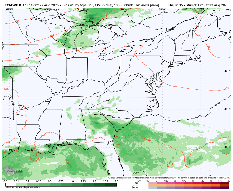
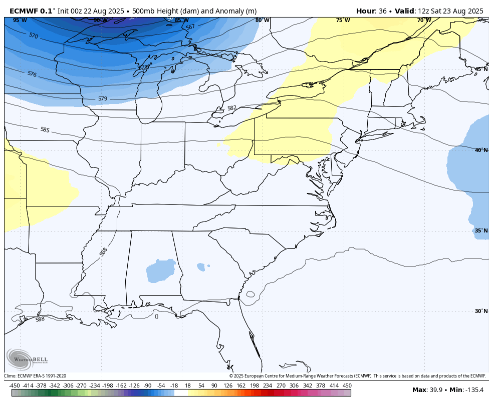
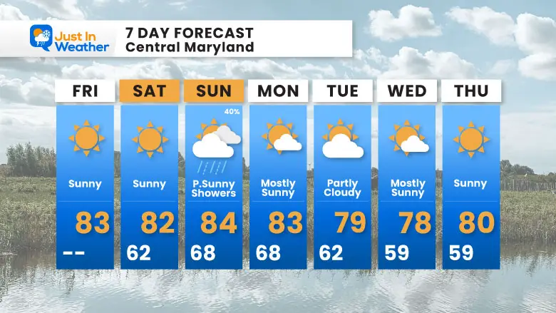
The only system will be a cold front that may bring showers later Sunday into Monday morning. This will be followed by a large, cool air mass spreading into the US.
This cool air mass will bring temperatures around 10 degrees below average into our region next week!
This is why the US will be mostly protected. Next week, a cooler air mass will dominate, helping to turn any tropical systems out to the Atlantic or south into the Caribbean.
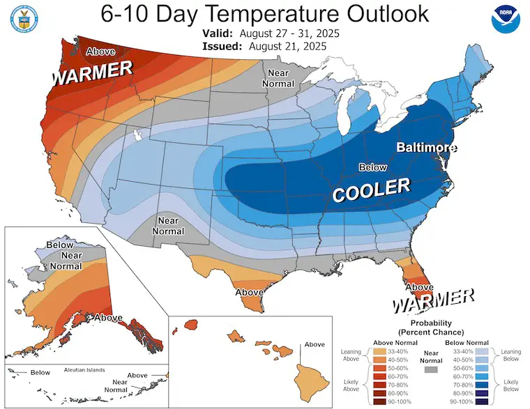
This is a reminder that we are now in the most busy time of the tropical season, through the middle of September. The next few systems will be blocked from the US for at least the next ten days.
Sign up and be the first to know!

I am aware there are some spelling and grammar typos and occasional other glitches. I take responsibility for my mistakes and even the computer glitches I may miss. I have made a few public statements over the years, but if you are new here, you may have missed it: I have dyslexia and found out during my second year at Cornell University. It didn’t stop me from getting my meteorology degree and being the first to get the AMS CBM in the Baltimore/Washington region. One of my professors told me that I had made it that far without knowing and to not let it be a crutch going forward. That was Mark Wysocki, and he was absolutely correct! I do miss my mistakes in my own proofreading. The autocorrect spell check on my computer sometimes does an injustice to make it worse. I also can make mistakes in forecasting. No one is perfect at predicting the future. All of the maps and information are accurate. The ‘wordy’ stuff can get sticky. There has been no editor who can check my work while writing and to have it ready to send out in a newsworthy timeline. Barbara Werner is a member of the web team that helps me maintain this site. She has taken it upon herself to edit typos when she is available. That could be AFTER you read this. I accept this and perhaps proves what you read is really from me… It’s part of my charm. #FITF