


My Call For Snowfall Saturday Morning Inland And Sunday Closer To The Coast
Friday Evening Update January 16 2026 Two weather events will bring snow to our region this weekend. They are related to the fast winds aloft on the edge of this…
Thursday, August 21, 2025
Morning Report
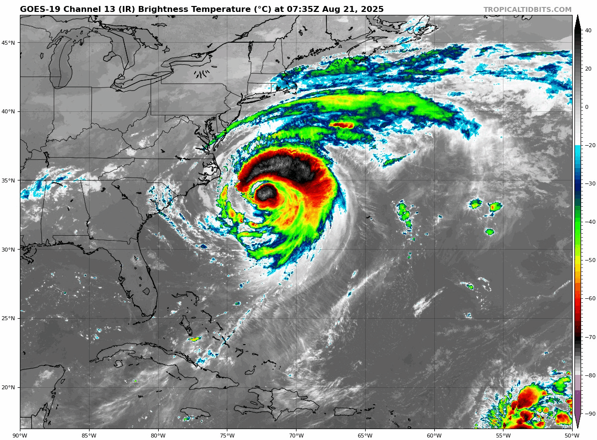
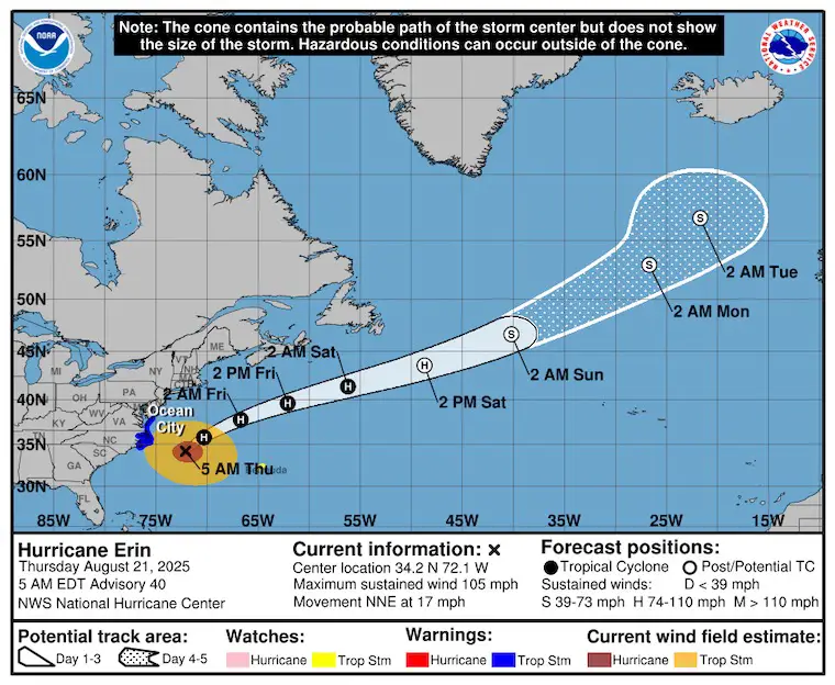
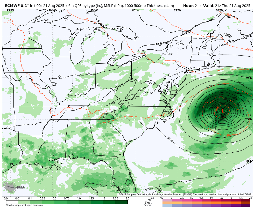
Hurricane Erin is hanging on as a Category 2 storm with 105 mph winds. The important part of this is the larger size. Tropical Storm Force Winds extend 320 miles from the center… scraping parts of the Mid-Atlantic Coast.
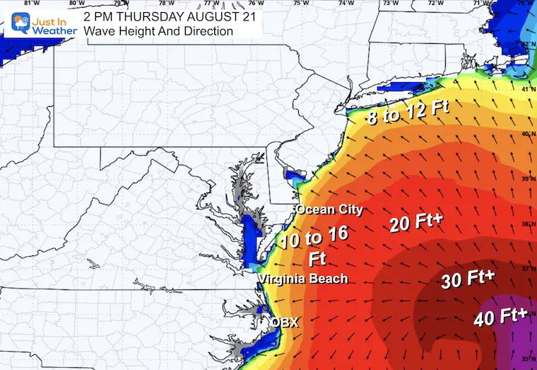
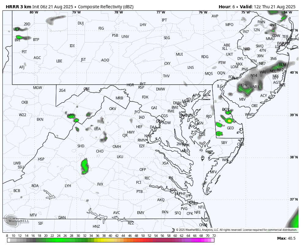
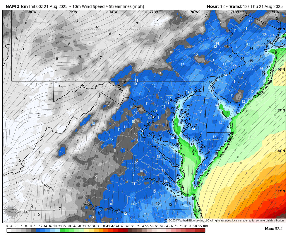
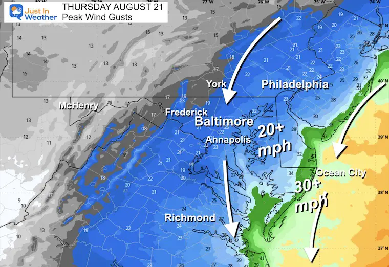
Some rain bands set up yesterday, but less rain expected today. Just a steady breeze for most of the region. Stronger winds and high waves will affect Ocean City.
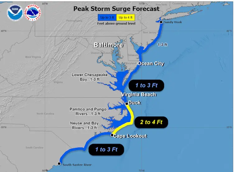
The water surge into the Chesapeake Bay will be minimized by the wind direction, helping to counter it from the opposite direction.
High Water Levels (not waves) peak in Eastern North Carolina. The Delmarva Coast water is expected to be 1 to 3 feet higher than average.
We continue to expect 10 to 16-foot waves off Ocean City into this afternoon.
Winds were 105 mph, making this a Category 2. The size has continued to expand and grow much larger!
Hurricane Force Winds reach 105 miles from the center, Tropical Storm Force Winds extend 320 miles from the center.
The outer cirrus cloud band from the hurricane has reached Delmarva, including Southern Delaware and Maryland’s Lower Eastern Shore.

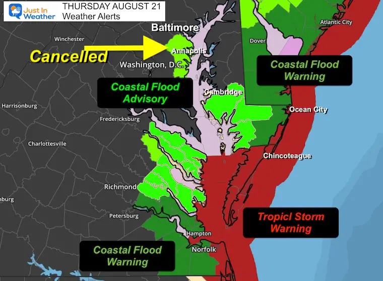
A Storm Surge Warning is in effect for…
* Cape Lookout to Duck, North Carolina
A Tropical Storm Warning is in effect for…
* Beaufort Inlet, North Carolina to the North Carolina/Virginia border, including Pamlico and Albemarle sounds.
*Offshore through Maryland, Delaware, and New Jersey coastlines.
A Tropical Storm Watch is in effect for…
* Bermuda
As Hurricane Erin passes by and turns Northeast, it will pick up forward speed and race into the North Atlantic.
This is playing out as forecast. A cold front to our south has protected the Mid-Atlantic and helped steer Hurricane Erin away from the coast. We will get cool winds today while the storm passes by and then increases speed to the Northeast.
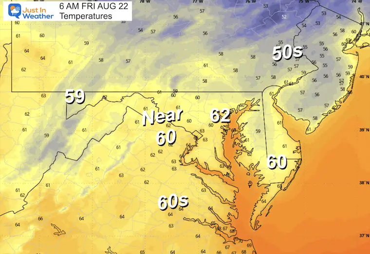
We will be under cloud cover. Clearing will build in from the west for tomorrow.
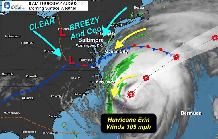
Not much rain expected today. Perhaps some spotty showers, but this is the dry, cloudy part of the storm.
The East wind will keep us cloudy and cool. It will also help to slosh the water higher on the Western Shore of the Bay.
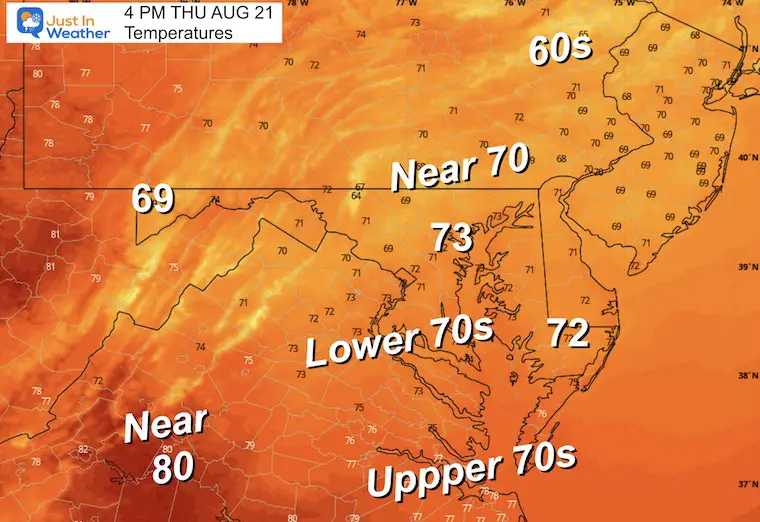
Yesterday: Low 67F; High 79F
Precipitation: 0.10”
Sunrise at 6:26 AM
Sunset at 7:53 PM
Normal Low in Baltimore: 65ºF
Record 51ºF in 1994; 2000
Normal High in Baltimore: 86ºF
Record 97ºF 1899
Rainfall Deficit at BWI
Subscribe for eMail Alerts
Sign up and be the first to know!
The annual event: Hiking and biking 329 miles in 7 days between The Summit of Wisp to Ocean City.
Each day, we honor a kid and their family’s cancer journey.
Fundraising is for Just In Power Kids: Funding Free Holistic Programs. I never have and never will take a penny. It is all for our nonprofit to operate.
Click here or the image to donate:

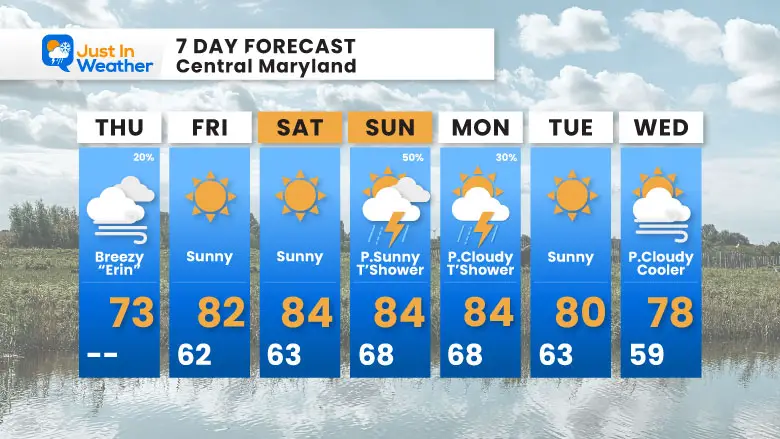
After Erin passes, the next system will approach with rain and thundershowers on Sunday afternoon.
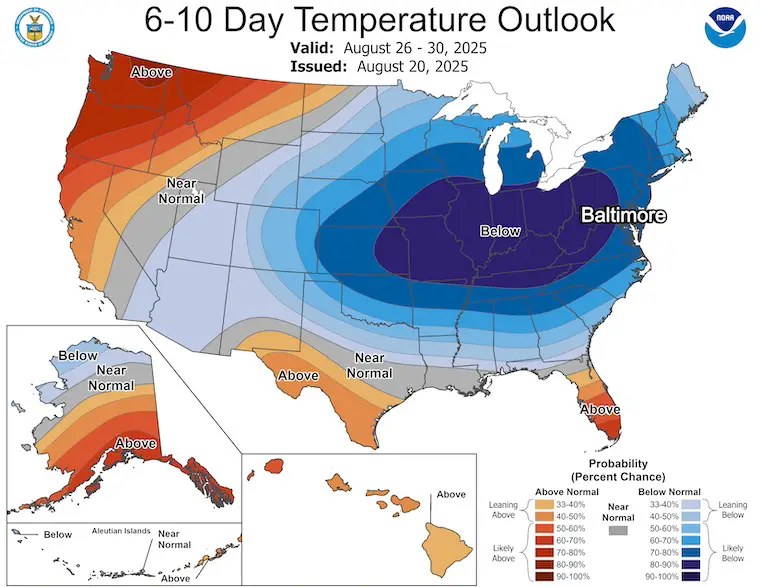
The big story here is the apparent shift in seasonal pattern. A large, cool air mass will drop south from Canada and bring COOLER than average temperatures across the eastern two-thirds of the nation. The core of the cool air will be felt in the Great Lakes, Ohio Valley, and here in the Mid-Atlantic.
Sign up and be the first to know!

I am aware there are some spelling and grammar typos and occasional other glitches. I take responsibility for my mistakes and even the computer glitches I may miss. I have made a few public statements over the years, but if you are new here, you may have missed it: I have dyslexia and found out during my second year at Cornell University. It didn’t stop me from getting my meteorology degree and being the first to get the AMS CBM in the Baltimore/Washington region. One of my professors told me that I had made it that far without knowing and to not let it be a crutch going forward. That was Mark Wysocki, and he was absolutely correct! I do miss my mistakes in my own proofreading. The autocorrect spell check on my computer sometimes does an injustice to make it worse. I also can make mistakes in forecasting. No one is perfect at predicting the future. All of the maps and information are accurate. The ‘wordy’ stuff can get sticky. There has been no editor who can check my work while writing and to have it ready to send out in a newsworthy timeline. Barbara Werner is a member of the web team that helps me maintain this site. She has taken it upon herself to edit typos when she is available. That could be AFTER you read this. I accept this and perhaps proves what you read is really from me… It’s part of my charm. #FITF