


Winter Weather Advisory Sunday As Snowfall In Two Parts Affecting Two Different Areas
Saturday Evening Update January 17 2026 One thing I carry after all of my years of forecasting: If one model does a really good job in an active pattern, then…
Friday August 15 2025
Morning Report
A cold front moved through as many felt with heavy thunderstorms yesterday. The two day rain total for Baltimore at BWI is 1.95 inches!
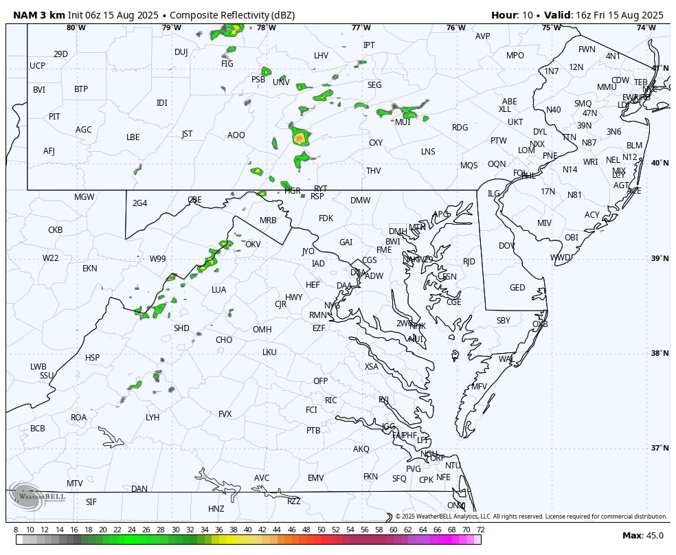
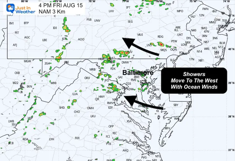
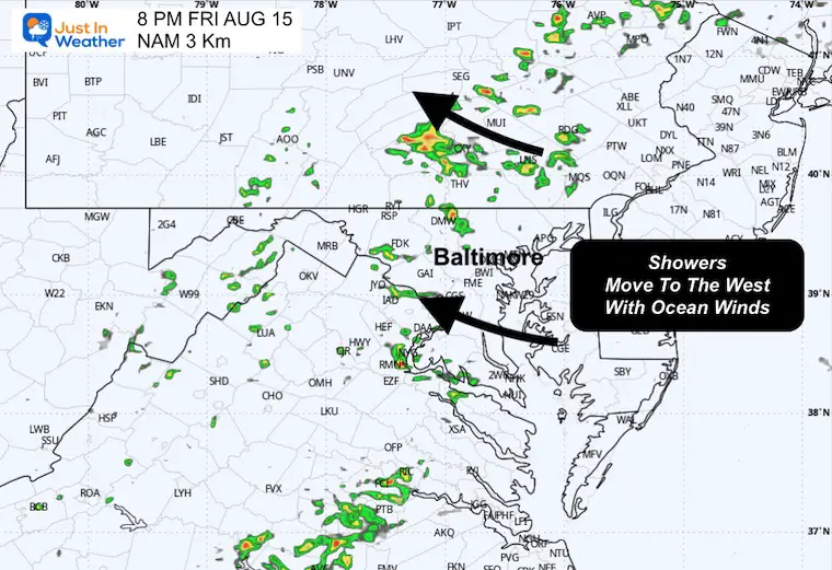
Today there is a muggy feel to the air and winds from the East will keep that in place. It will also help more thunder develop this afternoon and move in a rare direction TO THE WEST!
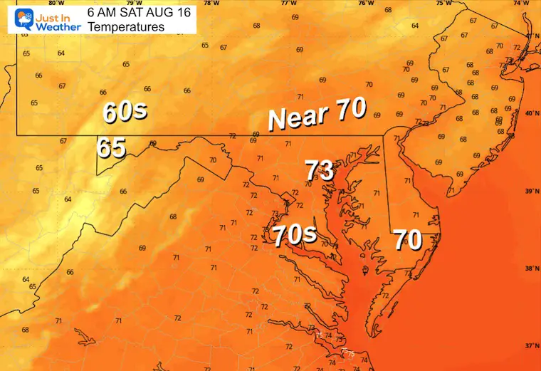
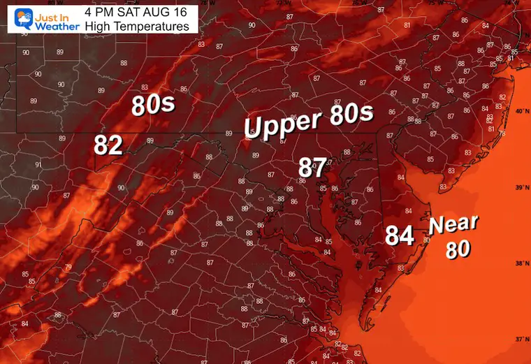
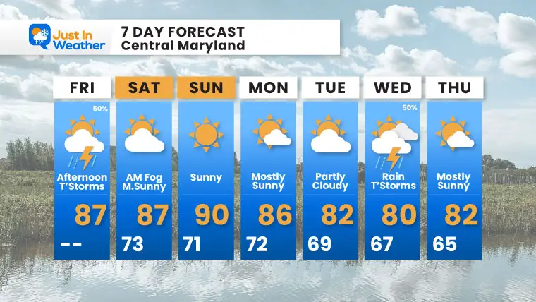
This weekend will be less humid and more pleasant! Next week will start warm, then mid week storms will protect us from the new hurricane, and be followed by a cool down.
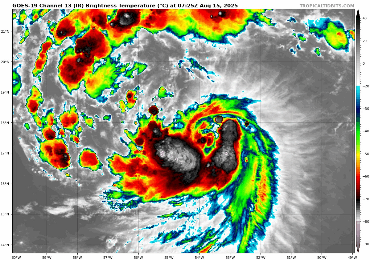
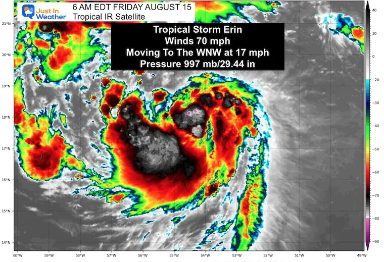
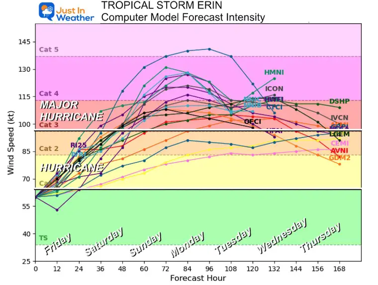
Erin is still a Tropical Storm, but with 70 mph winds is on the verge of becoming a hurricane today. Perhaps this morning. It is racing across the Central Atlantic Ocean to the West Northwest at 17 mph.
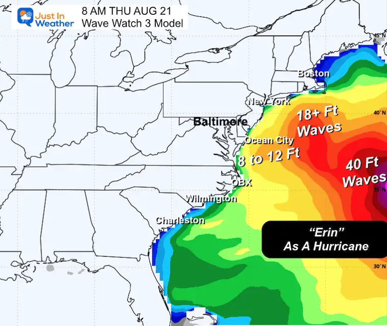
This is still expected to become a major hurricane AND CURVE AWAY from the East Coast. The latest look is below, including the waves for the local beaches.
Even through a cold front has passed through, the winds will be from the East and help keep a muggy feel to the air. This will develop more thunderstorms this atenoon.
The other area of interest is in the Western Gulf of Mexico. There is 50% chance for formation, but may run out of time as it moves inland.
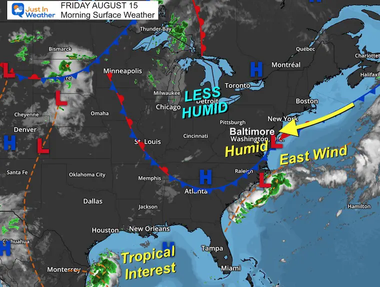
Scattered Thundershowers will form with the East wind. This will be scattered and move towards the West/Northwest.
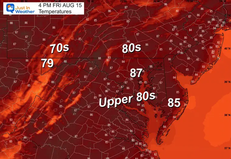
Yesterday: Low 73F; High 90F
Rainfall = 0.85”; Total 1.95” in the last two days
Sunrise at 6:20 AM
Sunset at 8:01 PM
Normal Low in Baltimore: 66ºF
Record 49ºF in 1961
Normal High in Baltimore: 87ºF
Record 103ºF 1988
Rainfall Deficit at BWI
Subscribe for eMail Alerts
Sign up and be the first to know!
The annual event: Hiking and biking 329 miles in 7 days between The Summit of Wisp to Ocean City.
Each day, we honor a kid and their family’s cancer journey.
Fundraising is for Just In Power Kids: Funding Free Holistic Programs. I never have and never will take a penny. It is all for our nonprofit to operate.
Click here or the image to donate:

Winds were 70 mph and extended 90 miles from the center.
A Tropical Storm Watch is in effect for…
This will be the first hurricane of the season in the Atlantic and expected to become a Category 3 or higher Major Hurricane.
Still expected to pass NORTH of the Caribbean Islands and East of The Bahamas AND West Of Bermuda.
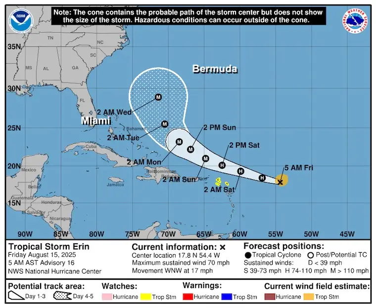
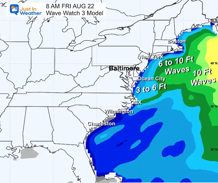
Both the Control And Mean have this curving AWAY from the US East coast. It will however churn up waters and rip currents next week.
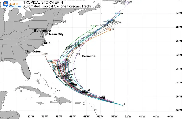
The typical curve is expected to pass well between the US and Bermuda.
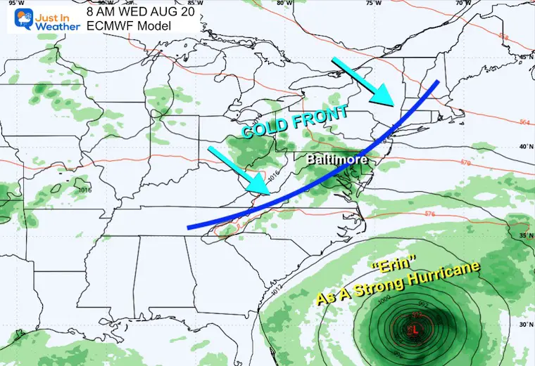
The rain bands will affect the Northeast Caribbean Islands and maybe The Outer Banks (OBX) of North Carolina. It will be a cold front approaching from the Ohio Valley and Great Lakes that will bring rain to the Mid Atlantic and keep Erin well offshore.
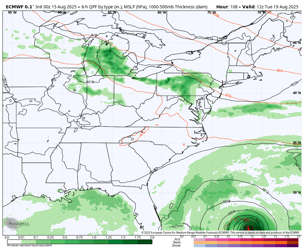
A cold front heading across the Ohio Valley is expected to help keep the expected hurricane off the coast.
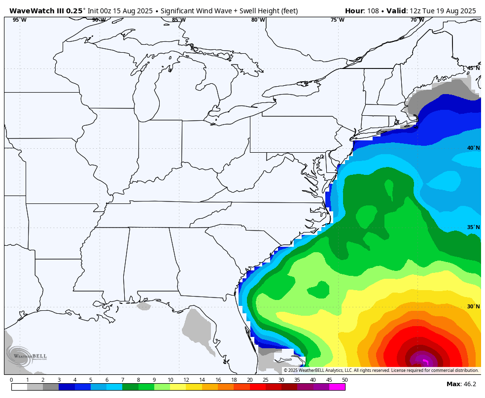
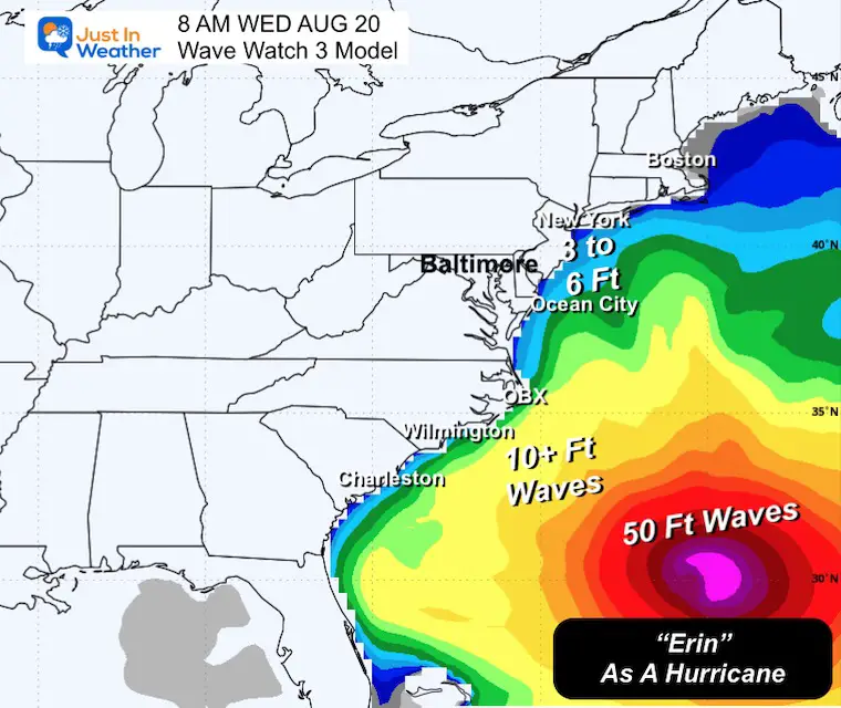
Waves 8 to 12 Feet across the Mid Atlantic Coast.
Over 50 Foot waves near the center of the storm well off the coast.
Sign up and be the first to know!
I am aware there are some spelling and grammar typos and occasional other glitches. I take responsibility for my mistakes and even the computer glitches I may miss. I have made a few public statements over the years, but if you are new here, you may have missed it: I have dyslexia and found out during my second year at Cornell University. It didn’t stop me from getting my meteorology degree and being the first to get the AMS CBM in the Baltimore/Washington region. One of my professors told me that I had made it that far without knowing and to not let it be a crutch going forward. That was Mark Wysocki, and he was absolutely correct! I do miss my mistakes in my own proofreading. The autocorrect spell check on my computer sometimes does an injustice to make it worse. I also can make mistakes in forecasting. No one is perfect at predicting the future. All of the maps and information are accurate. The ‘wordy’ stuff can get sticky. There has been no editor who can check my work while writing and to have it ready to send out in a newsworthy timeline. Barbara Werner is a member of the web team that helps me maintain this site. She has taken it upon herself to edit typos when she is available. That could be AFTER you read this. I accept this and perhaps proves what you read is really from me… It’s part of my charm. #FITF