


Winter Weather Advisory Sunday As Snowfall In Two Parts Affecting Two Different Areas
Saturday Evening Update January 17 2026 One thing I carry after all of my years of forecasting: If one model does a really good job in an active pattern, then…
Thursday, August 14 2025
Morning Report
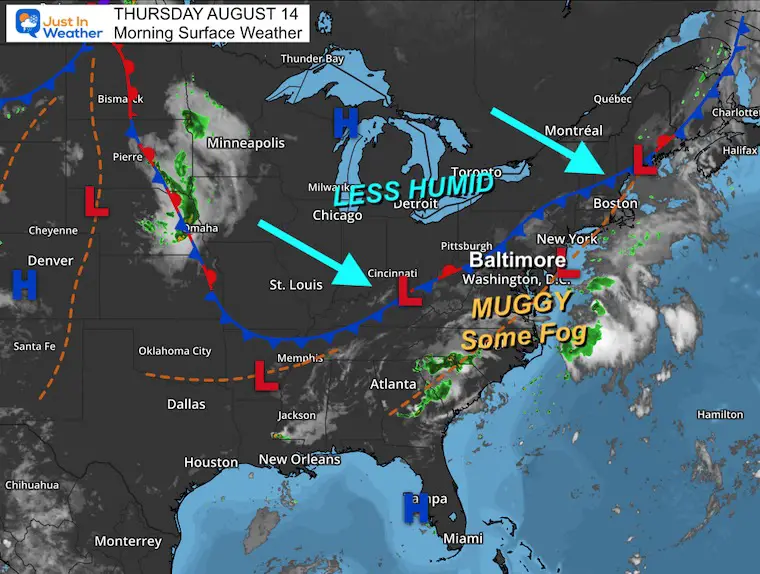
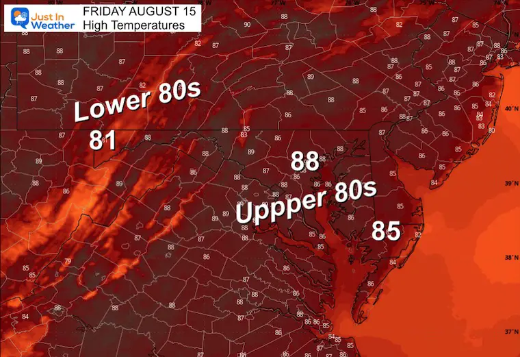
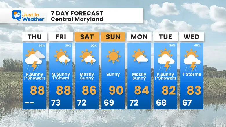
We start the day with areas of fog after yesterday’s storms. The air is still muggy, and the day will remain humid. This afternoon, new thunderstorms will pop up, but they will not be widespread. This is typical summer stuff.
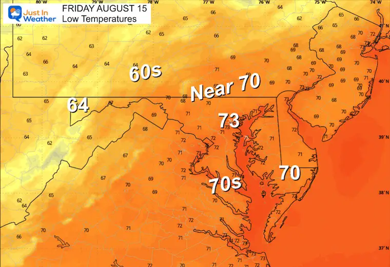
A drop in humidity is expected this weekend.
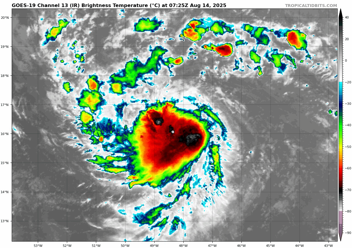
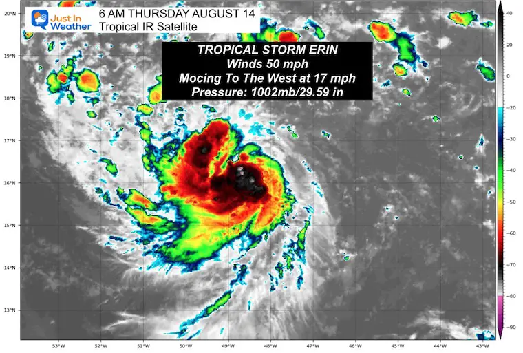
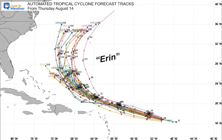
Tropical Storm Erin is still racing across the Central Atlantic Ocean. Winds are up to 50 mph, and the real growth will happen over the next few days. This is still expected to become a strong hurricane AND CURVE AWAY from the East Coast. The latest look is below, including the waves for the local beaches.
Still muggy and unsettled, but no major triggers in the atmosphere for the storms.
The weak cold front will bring in lower humidity for the weekend.
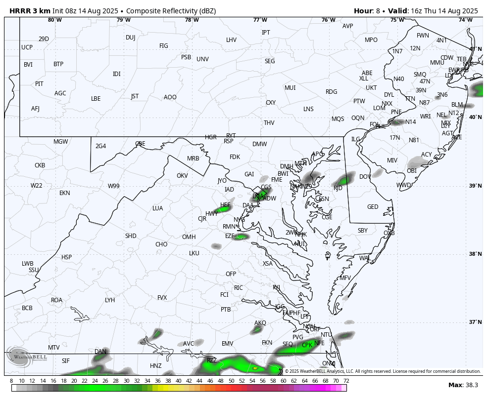
Scattered Thundershowers. This is a suggestion, NOT a promise of where and when they may develop.
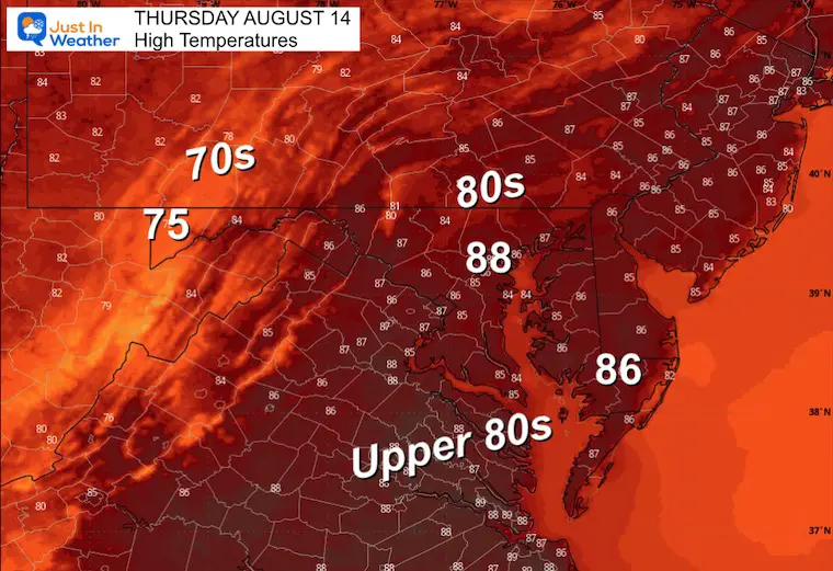
Yesterday: Low 74F; High 89F
Rainfall = 0.00”
Sunrise at 6:19 AM
Sunset at 8:03 PM
Normal Low in Baltimore: 66ºF
Record 51ºF in 1961
Normal High in Baltimore: 87ºF
Record 99ºF 1943
Rainfall Deficit at BWI
Ending 2024 = -8.00”
Since Jan 1 = -2.34”
We are STILL DOWN -10.34” INCLUDING LAST YEAR
Subscribe for eMail Alerts
Sign up and be the first to know!
The annual event: Hiking and biking 329 miles in 7 days between The Summit of Wisp to Ocean City.
Each day, we honor a kid and their family’s cancer journey.
Fundraising is for Just In Power Kids: Funding Free Holistic Programs. I never have and never will take a penny. It is all for our nonprofit to operate.
Click here or the image to donate:

Winds were 50 mph and extend 60 miles from the center.
Update From The National Hurricane Center Tuesday Morning
LOCATION…16.3N 48.2W
ABOUT 990 MI…1595 KM E OF THE NORTHERN LEEWARD ISLANDS
MAXIMUM SUSTAINED WINDS…50 MPH…85 KM/H
PRESENT MOVEMENT…W OR 270 DEGREES AT 17 MPH…28 KM/H
MINIMUM CENTRAL PRESSURE…1002 MB…29.59 INCHES
This will be the first hurricane of the season in the Atlantic and is expected to become a Category 3 or higher Major Hurricane.
Still expected to pass NORTH of the Caribbean Islands and East of The Bahamas.
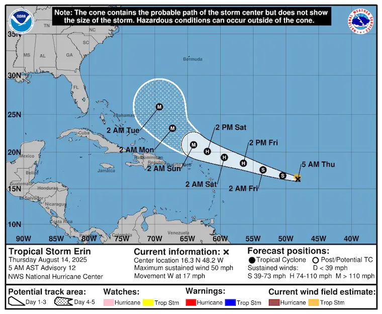
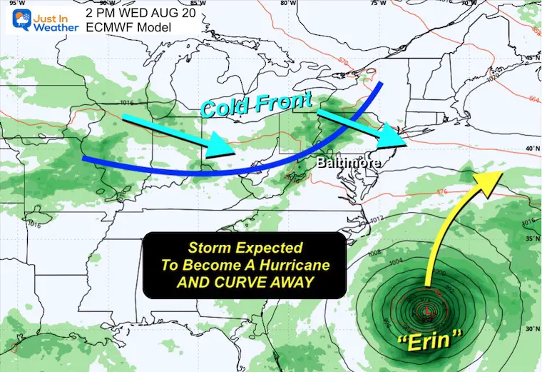
Both the Control and Mean have this curving away from the US East Coast. However, it will churn up waters and rip currents next week.
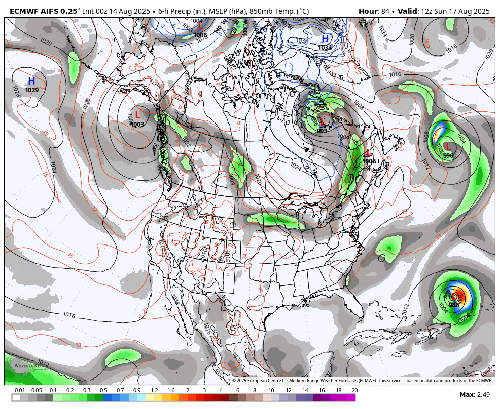
A cold front heading across the Ohio Valley is expected to help keep the expected hurricane off the coast.
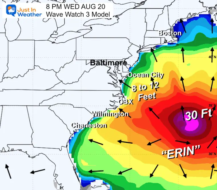
Waves 8 to 12 Feet across the Mid Atlantic Coast.
Over 30 Foot waves near the center of the storm, well off the coast.
Sign up and be the first to know!
I am aware there are some spelling and grammar typos and occasional other glitches. I take responsibility for my mistakes and even the computer glitches I may miss. I have made a few public statements over the years, but if you are new here, you may have missed it: I have dyslexia and found out during my second year at Cornell University. It didn’t stop me from getting my meteorology degree and being the first to get the AMS CBM in the Baltimore/Washington region. One of my professors told me that I had made it that far without knowing and to not let it be a crutch going forward. That was Mark Wysocki, and he was absolutely correct! I do miss my mistakes in my own proofreading. The autocorrect spell check on my computer sometimes does an injustice to make it worse. I also can make mistakes in forecasting. No one is perfect at predicting the future. All of the maps and information are accurate. The ‘wordy’ stuff can get sticky. There has been no editor who can check my work while writing and to have it ready to send out in a newsworthy timeline. Barbara Werner is a member of the web team that helps me maintain this site. She has taken it upon herself to edit typos when she is available. That could be AFTER you read this. I accept this and perhaps proves what you read is really from me… It’s part of my charm. #FITF