


Winter Weather Advisory Sunday As Snowfall In Two Parts Affecting Two Different Areas
Saturday Evening Update January 17 2026 One thing I carry after all of my years of forecasting: If one model does a really good job in an active pattern, then…
Tuesday August 12 2025
Morning Report
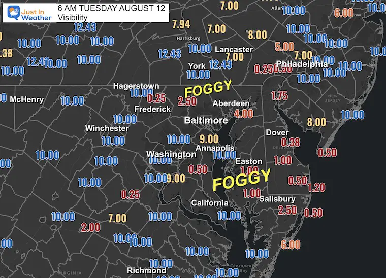
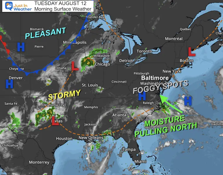
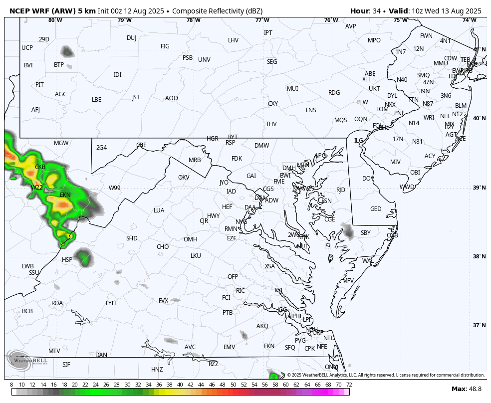
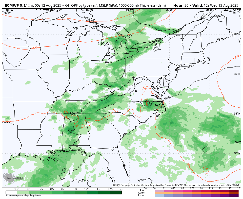
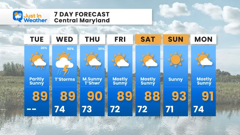
The morning may seem more humid as light winds from the south have increased the moisture in the air. Inland areas have low clouds and fog that will burn off, but also aid in more afternoon clouds and some thundershowers. This will become more widespread tomorrow.
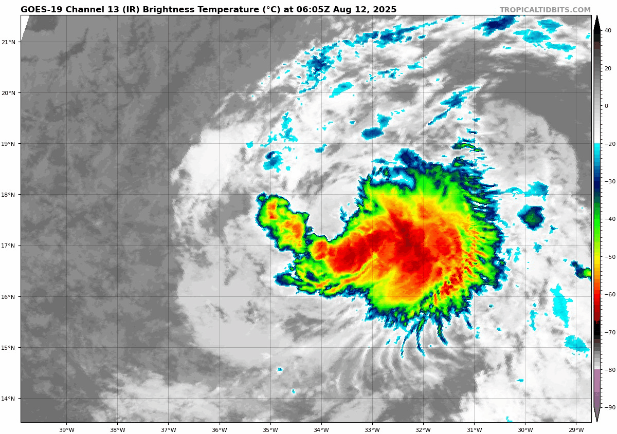
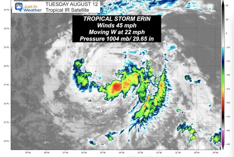
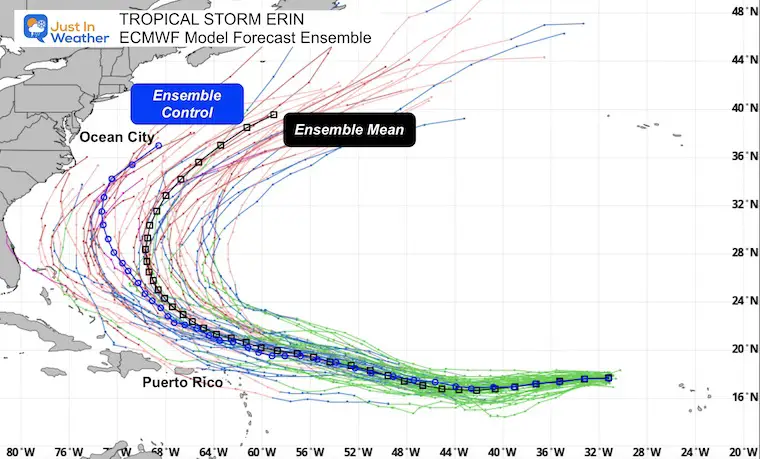
Meanwhile Tropical Storm Erin is getting better organized in the far eastern Atlantic. An update on that storm below.
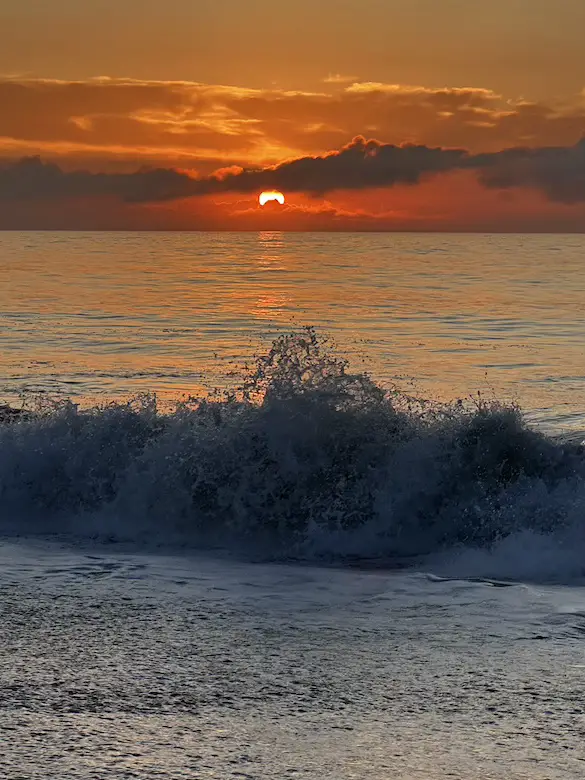
For starters on my last morning on the beach….
The annual event: Hiking and biking 329 miles in 7 days between The Summit of Wisp to Ocean City.
Each day, we honor a kid and their family’s cancer journey.
Fundraising is for Just In Power Kids: Funding Free Holistic Programs. I never have and never will take a penny. It is all for our nonprofit to operate.
Click here or the image to donate:

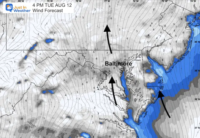
Light wind from the South will continue to increase the temps and humidity slightly.
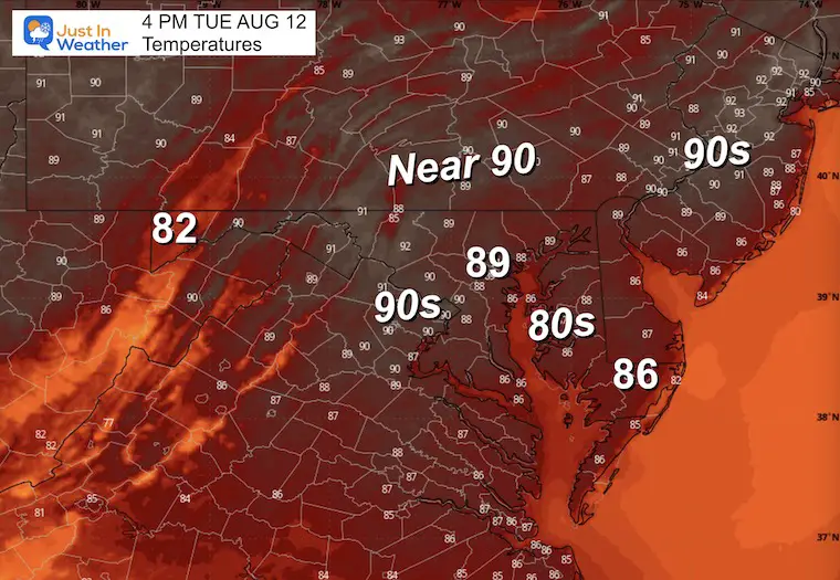
Yesterday: Low 63F; High 86F
Rainfall = 0.00”
Sunrise at 6:17 AM
Sunset at 8:05 PM
Normal Low in Baltimore: 67ºF
Record 54ºF in 1962
Normal High in Baltimore: 87ºF
Record 99ºF 1900
Rainfall Deficit at BWI
Sign up and be the first to know!
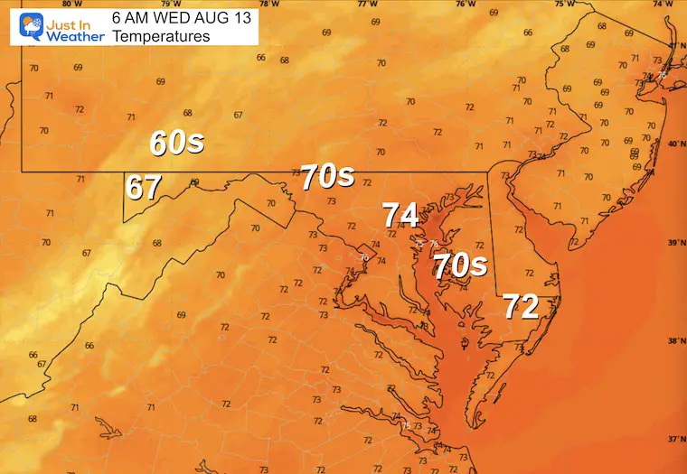
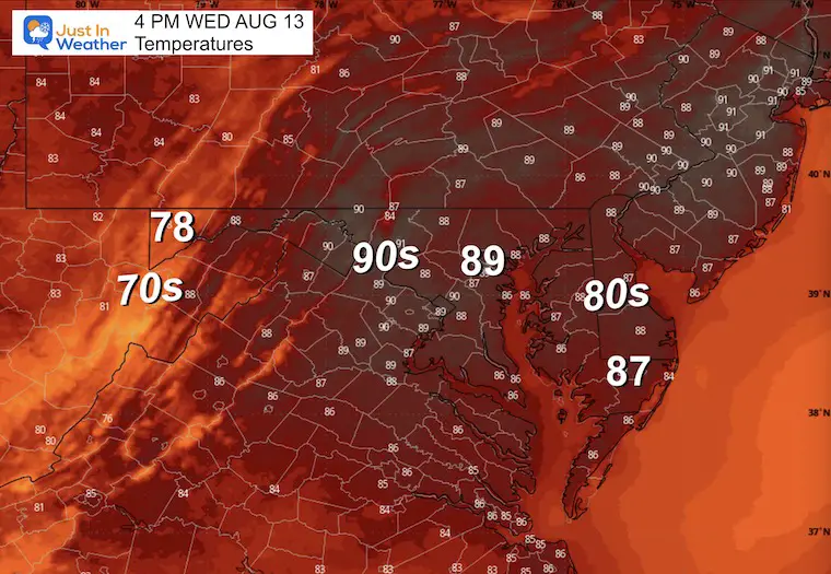
Showers and thunderstorms will develop in the afternoon and evening.
Winds were 45 mph and extended 45 miles from the center.
SUMMARY OF 500 AM AST…0900 UTC…INFORMATION
———————————————-
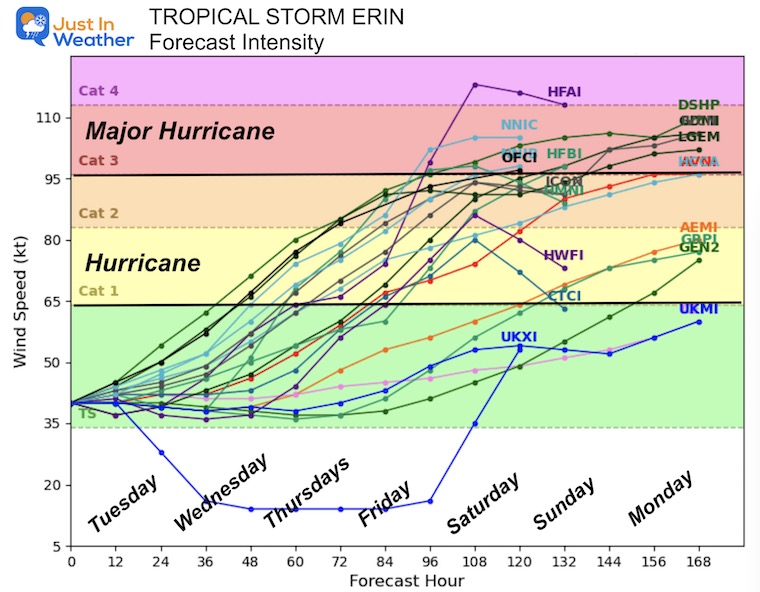
This will be the first hurricane of the season in the Atlantic and is expected to become a Category 3 or higher Major Hurricane.
Just NORTH of the Caribbean Islands.
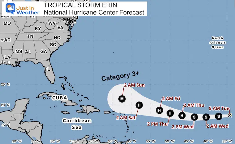
Both the Control and Mean have this curving away from the US East Coast. However, it will churn up waters and rip currents next week.
Sign up and be the first to know!
Sign up and be the first to know!
I am aware there are some spelling and grammar typos and occasional other glitches. I take responsibility for my mistakes and even the computer glitches I may miss. I have made a few public statements over the years, but if you are new here, you may have missed it: I have dyslexia and found out during my second year at Cornell University. It didn’t stop me from getting my meteorology degree and being the first to get the AMS CBM in the Baltimore/Washington region. One of my professors told me that I had made it that far without knowing and to not let it be a crutch going forward. That was Mark Wysocki, and he was absolutely correct! I do miss my mistakes in my own proofreading. The autocorrect spell check on my computer sometimes does an injustice to make it worse. I also can make mistakes in forecasting. No one is perfect at predicting the future. All of the maps and information are accurate. The ‘wordy’ stuff can get sticky. There has been no editor who can check my work while writing and to have it ready to send out in a newsworthy timeline. Barbara Werner is a member of the web team that helps me maintain this site. She has taken it upon herself to edit typos when she is available. That could be AFTER you read this. I accept this and perhaps proves what you read is really from me… It’s part of my charm. #FITF