


Winter Weather Advisory Sunday As Snowfall In Two Parts Affecting Two Different Areas
Saturday Evening Update January 17 2026 One thing I carry after all of my years of forecasting: If one model does a really good job in an active pattern, then…
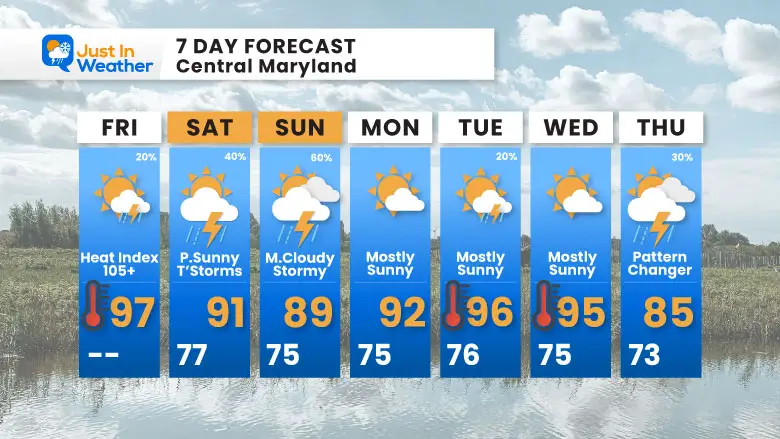
Friday, July 25, 2025
Morning Report
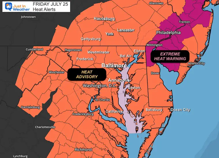
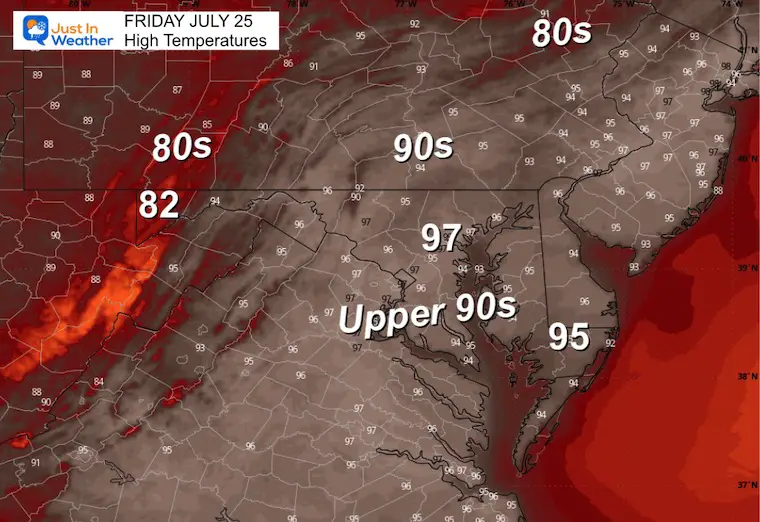
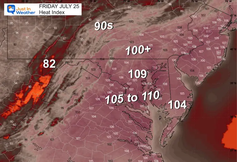
There is no way to sugarcoat this. Today will not feel good outside. Tropical humidity and temperatures surging into the upper 90s will combine to make it feel like 105°F to 110°F. A Heat Advisory is in place for most of the region.
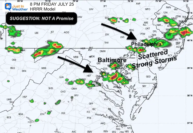
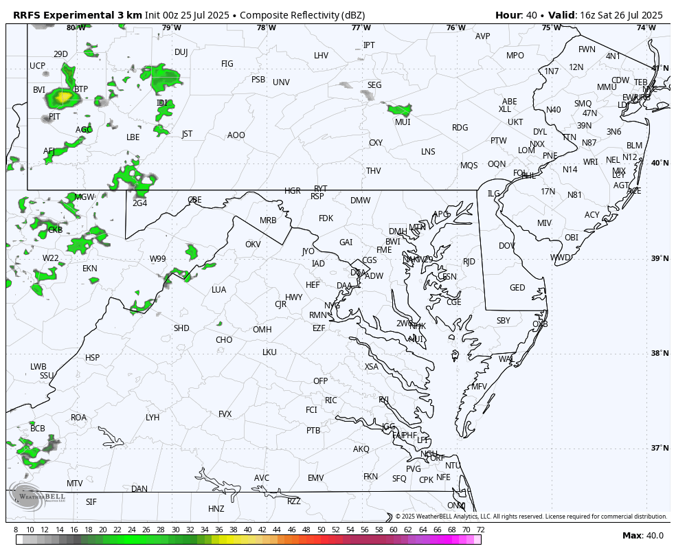
There is a small chance for a few pop-up strong thunderstorms this evening.
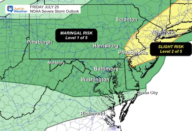
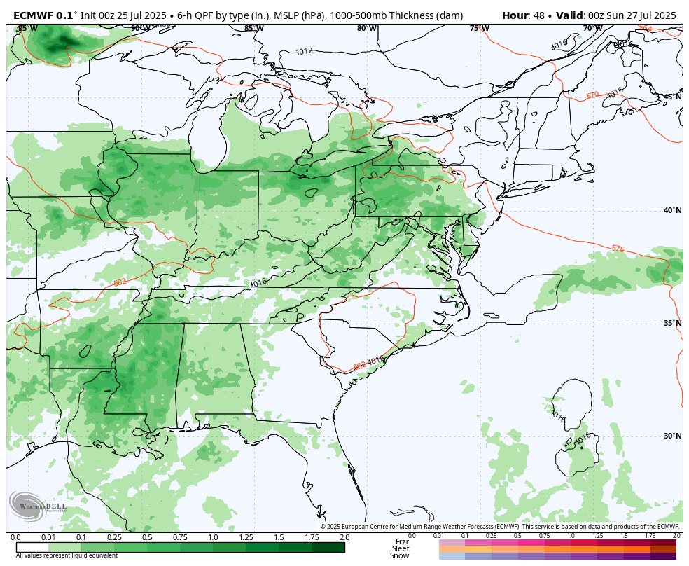
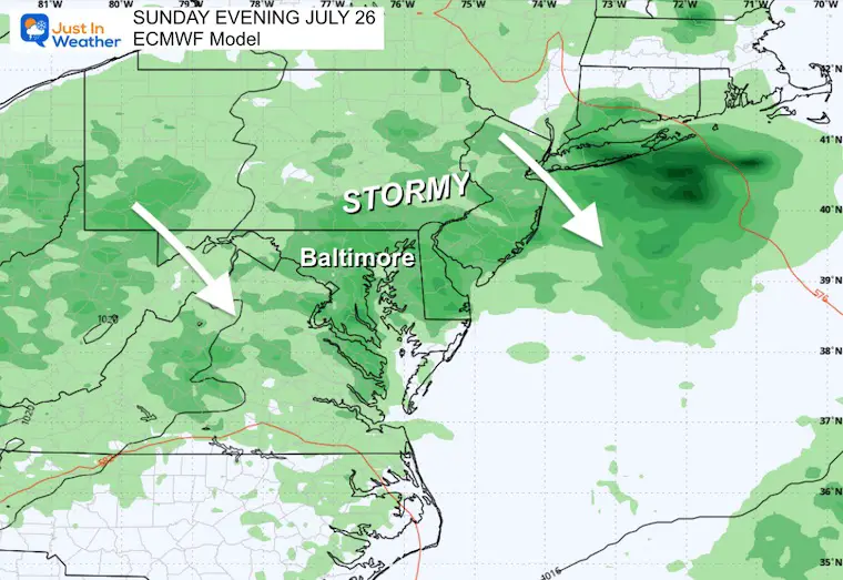
The environment will turn more turbulent this weekend with strong thunderstorms possible both Saturday and Sunday.
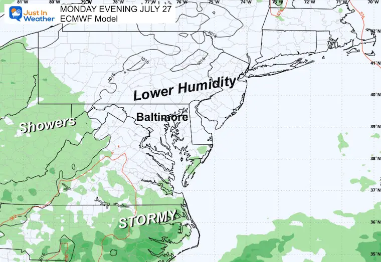
Monday looks like a break, then the heat will linger next week.
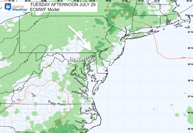
There is an end in sight. The next round of severe storms may be Thursday, followed by a pattern change and cooler temperatures into August.
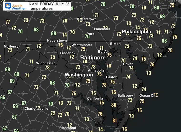
Temps will jump quickly, and combined with tropical humidity, it will feel like 105°F to 110°F.
The focus will be on a line of storms across the Great Lakes and Midwest along a frontal boundary. This will ignite storms and push our way this evening.
With the excessive heat, some pop-up storms may be strong to severe.
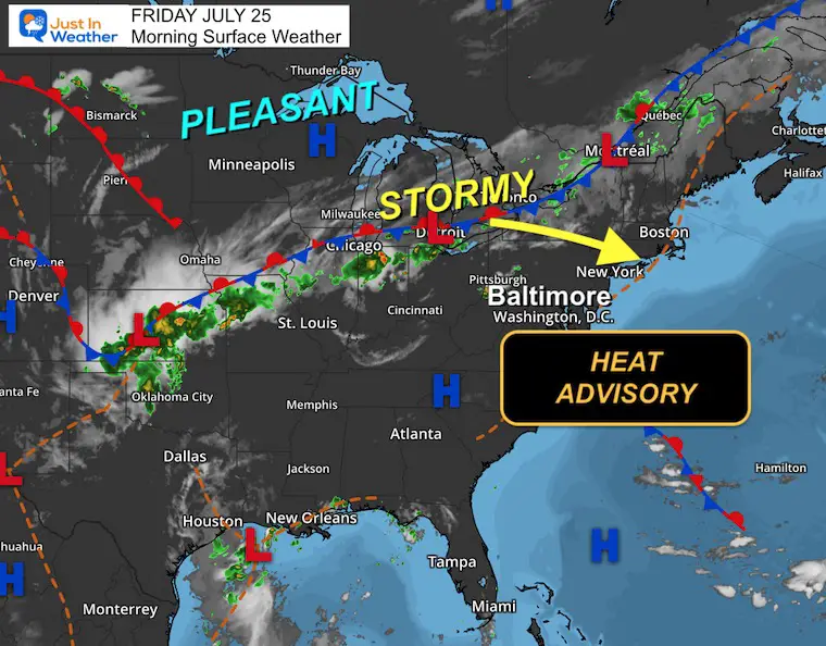
A higher chance for storms to turn severe in the northeast along I-95 through metro Philadelphia and New York.
Suggestion, NOT A PROMISE
Yesterday: Low 69F; High 86F
Rainfall = None
Sunrise at 6:01 AM
Sunset at 8:25 PM
Normal Low in Baltimore: 68ºF
Record 57ºF in 2014
Normal High in Baltimore: 89ºF
Record 100ºF 2010
Rainfall Deficit at BWI
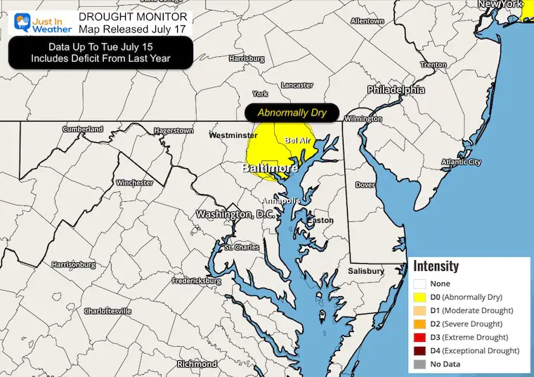
Drought Monitor
No Drought! There is still a long-term deficit plotted for Baltimore and Harford Counties.
Subscribe for eMail Alerts
Sign up and be the first to know!
4 PM to Midnight
Daily late afternoon and evening storms into the weekend.
Monday should bring a break from the action.
Sign up and be the first to know!
The annual event: Hiking and biking 329 miles in 7 days between The Summit of Wisp to Ocean City.
Each day, we honor a kid and their family’s cancer journey.
Fundraising is for Just In Power Kids: Funding Free Holistic Programs. I never have and never will take a penny. It is all for our nonprofit to operate.
Click here or the image to donate:

I am aware there are some spelling and grammar typos and occasional other glitches. I take responsibility for my mistakes and even the computer glitches I may miss. I have made a few public statements over the years, but if you are new here, you may have missed it: I have dyslexia and found out during my second year at Cornell University. It didn’t stop me from getting my meteorology degree and being the first to get the AMS CBM in the Baltimore/Washington region. One of my professors told me that I had made it that far without knowing and to not let it be a crutch going forward. That was Mark Wysocki, and he was absolutely correct! I do miss my mistakes in my own proofreading. The autocorrect spell check on my computer sometimes does an injustice to make it worse. I also can make mistakes in forecasting. No one is perfect at predicting the future. All of the maps and information are accurate. The ‘wordy’ stuff can get sticky. There has been no editor who can check my work while writing and to have it ready to send out in a newsworthy timeline. Barbara Werner is a member of the web team that helps me maintain this site. She has taken it upon herself to edit typos when she is available. That could be AFTER you read this. I accept this and perhaps proves what you read is really from me… It’s part of my charm. #FITF