


Winter Weather Advisory Sunday As Snowfall In Two Parts Affecting Two Different Areas
Saturday Evening Update January 17 2026 One thing I carry after all of my years of forecasting: If one model does a really good job in an active pattern, then…
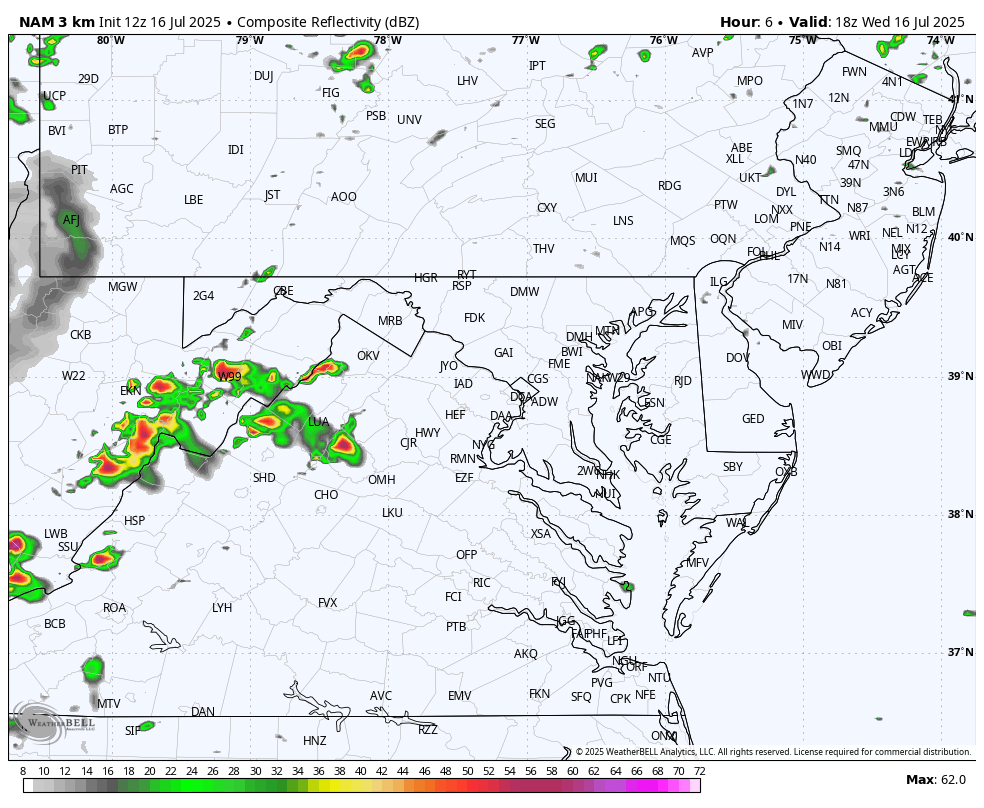
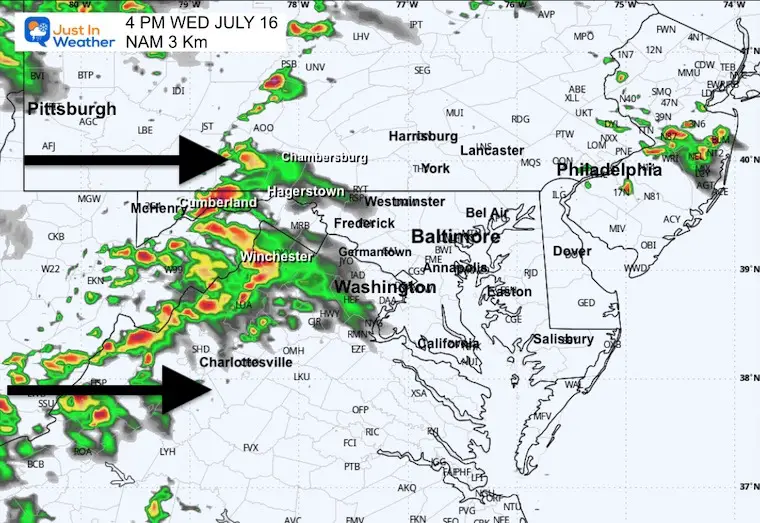
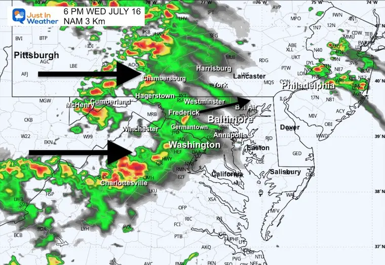
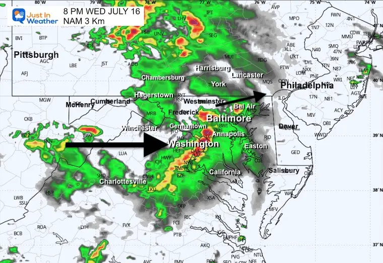
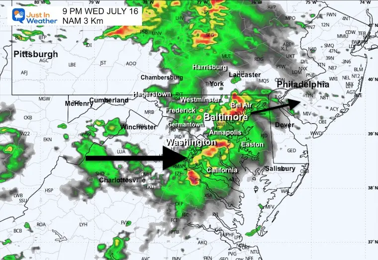
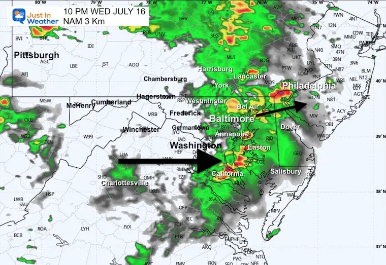
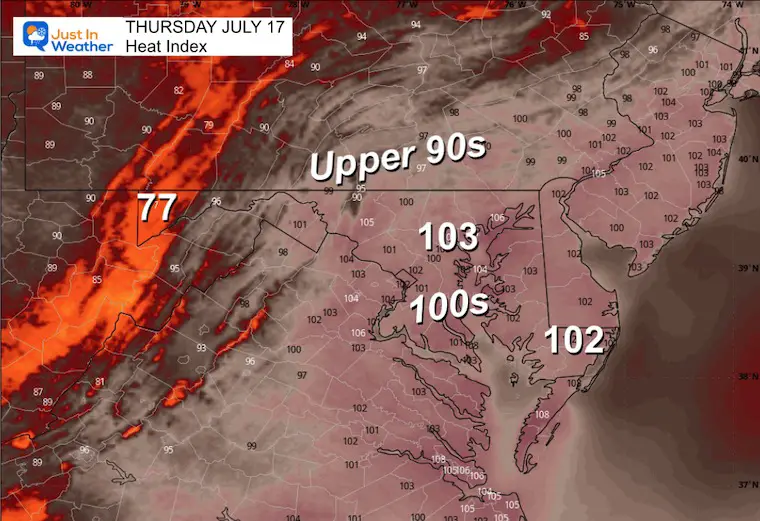
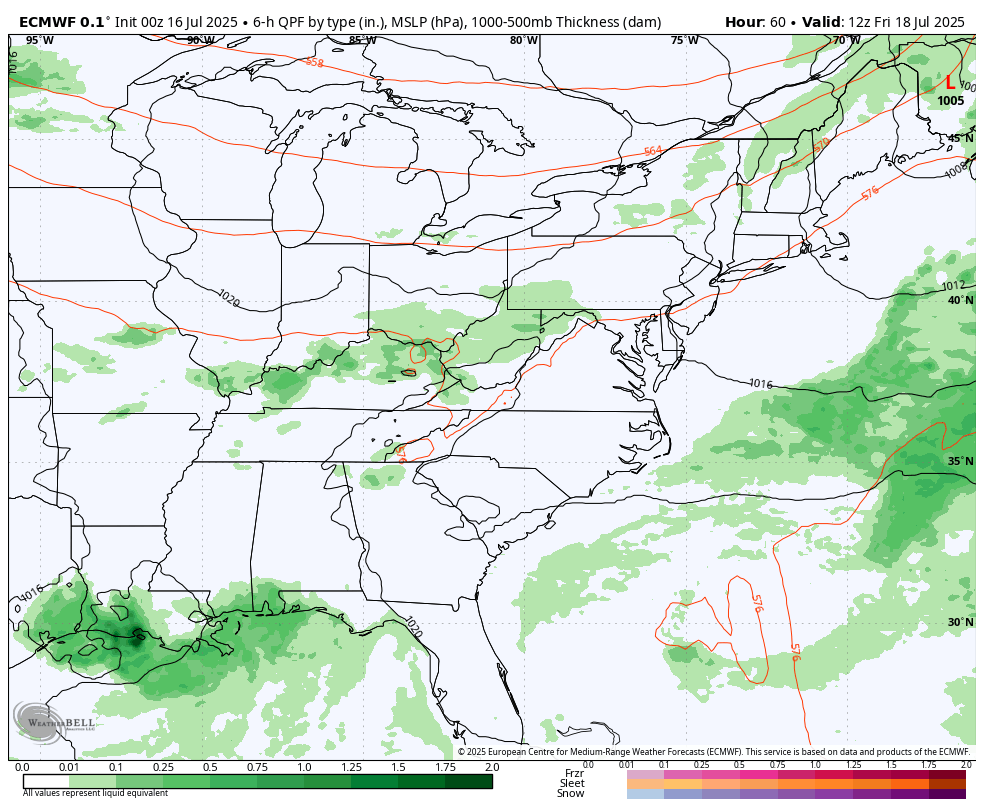
Wednesday Afternoon, July 16, 2025
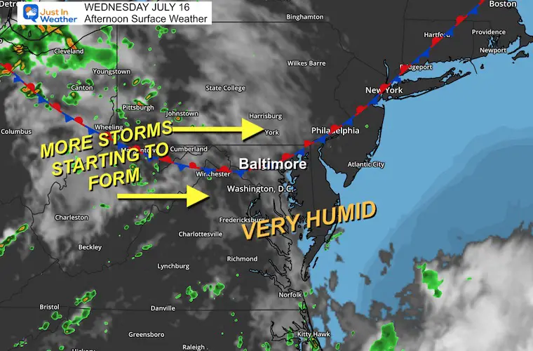
The atmosphere is still very juicy! Dew points are still high in the mid-70s, which is a tropical level, AND this means there is a lot of moisture in the atmosphere to work with. Does this sound familiar? I have used these words in multiple reports over the last two weeks.
Today, a stationary front is stalled overhead, providing additional support to storms forming in the mountains as they move eastward.
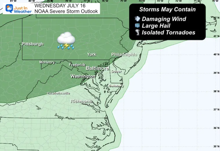
This post has the latest Alerts and Outlooks, and forecast radar simulation through tonight.
In this report, I have also included the LIVE Radar and Lightning Widget. It is important to note that any storm, even without a warning, can produce dangerous lightning and torrential downpours.
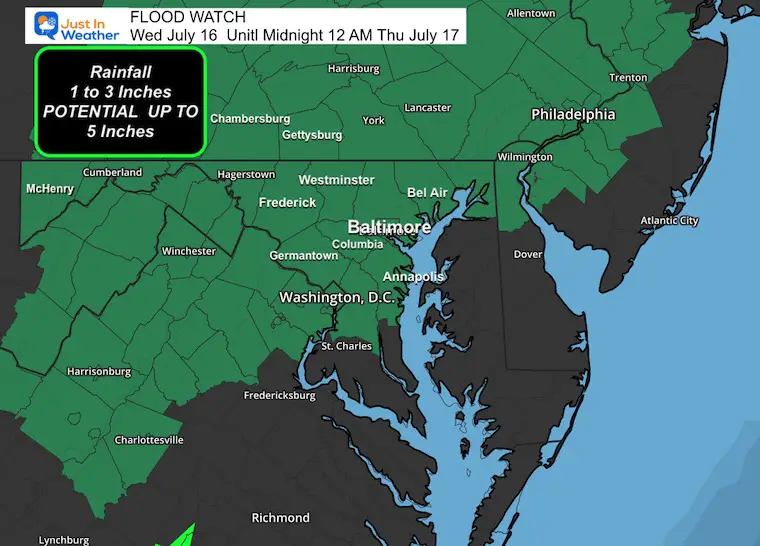
Flood Watch: Potential for rainfall totals 1 to 3 inches, with some unlucky spots capable of up to 5 inches.
Rainfall RATES in individual cells may (again) exceed 2 inches per hour.
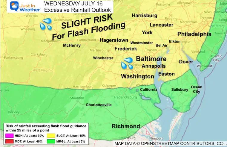
Slight Risk
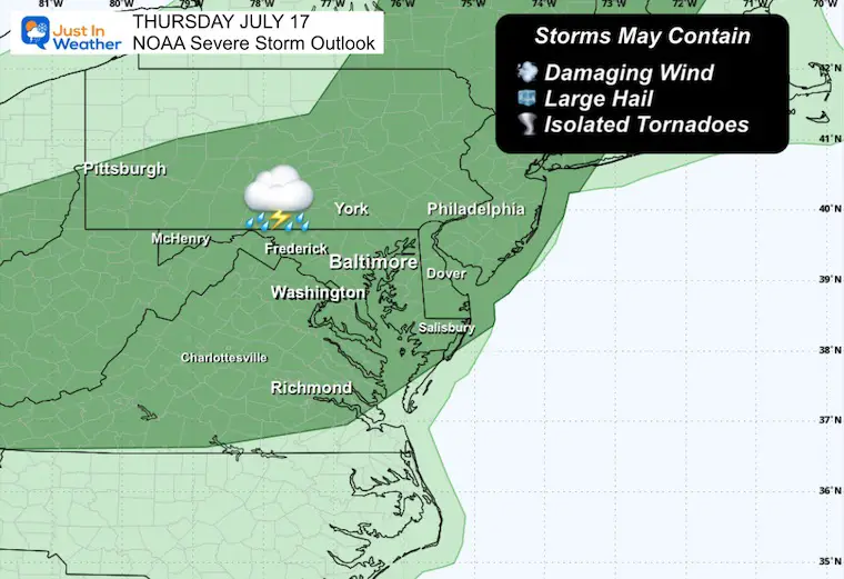
A chance for a thunderstorm to grow to severe levels, which may include:
A WARNING will be issued when storms are identified, and track-specific towns in the path will be listed. These usually last 45 minutes, while Flood Warnings may last many hours.
The stationary front is still stalled overhead. This weakness in the atmosphere will help any storms track in our direction.
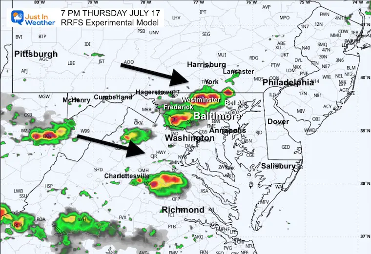
This simulation is a suggestion and not a promise. Use this as a rough guide for the timeline.
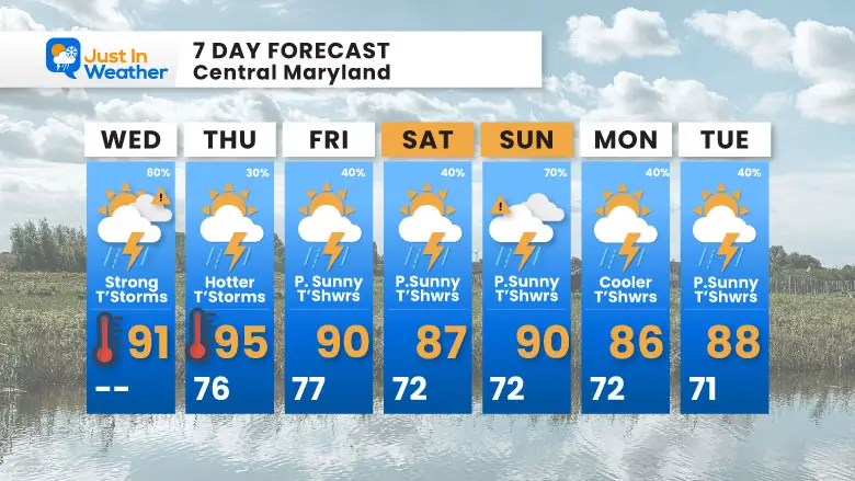
Numerous DAILY thunderstorms each afternoon and evening.
The Ring of Fire pattern aloft will continue to provide a track for strong to severe storms to move our way. So, there will be more of this next week as well.
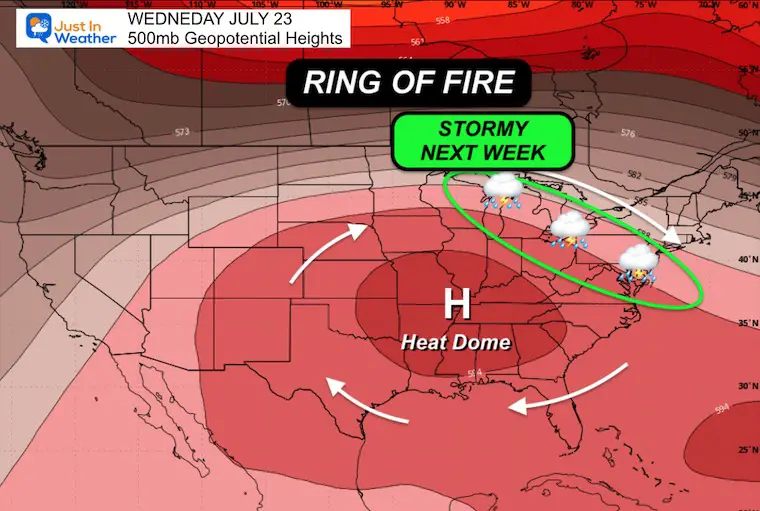
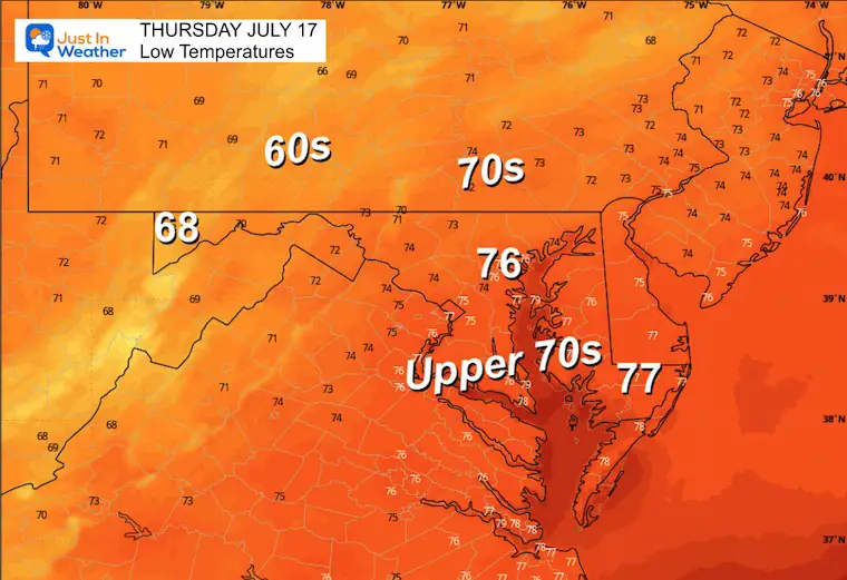
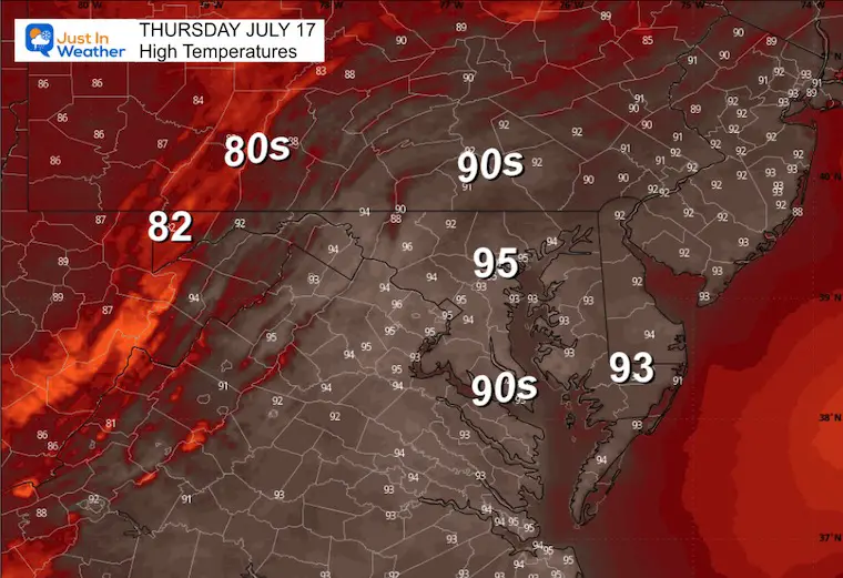
Only a slight pull back on the heat this weekend as storm risk peaks Sunday.
Sign up and be the first to know!
The annual event: Hiking and biking 329 miles in 7 days between The Summit of Wisp to Ocean City.
Each day, we honor a kid and their family’s cancer journey.
Fundraising is for Just In Power Kids: Funding Free Holistic Programs. I never have and never will take a penny. It is all for our nonprofit to operate.
Click here or the image to donate:

I am aware there are some spelling and grammar typos and occasional other glitches. I take responsibility for my mistakes and even the computer glitches I may miss. I have made a few public statements over the years, but if you are new here, you may have missed it: I have dyslexia and found out during my second year at Cornell University. It didn’t stop me from getting my meteorology degree and being the first to get the AMS CBM in the Baltimore/Washington region. One of my professors told me that I had made it that far without knowing and to not let it be a crutch going forward. That was Mark Wysocki, and he was absolutely correct! I do miss my mistakes in my own proofreading. The autocorrect spell check on my computer sometimes does an injustice to make it worse. I also can make mistakes in forecasting. No one is perfect at predicting the future. All of the maps and information are accurate. The ‘wordy’ stuff can get sticky. There has been no editor who can check my work while writing and to have it ready to send out in a newsworthy timeline. Barbara Werner is a member of the web team that helps me maintain this site. She has taken it upon herself to edit typos when she is available. That could be AFTER you read this. I accept this and perhaps proves what you read is really from me… It’s part of my charm. #FITF