


Winter Weather Advisory Sunday As Snowfall In Two Parts Affecting Two Different Areas
Saturday Evening Update January 17 2026 One thing I carry after all of my years of forecasting: If one model does a really good job in an active pattern, then…
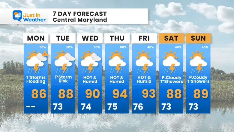
Monday July 14 2025
Morning Report
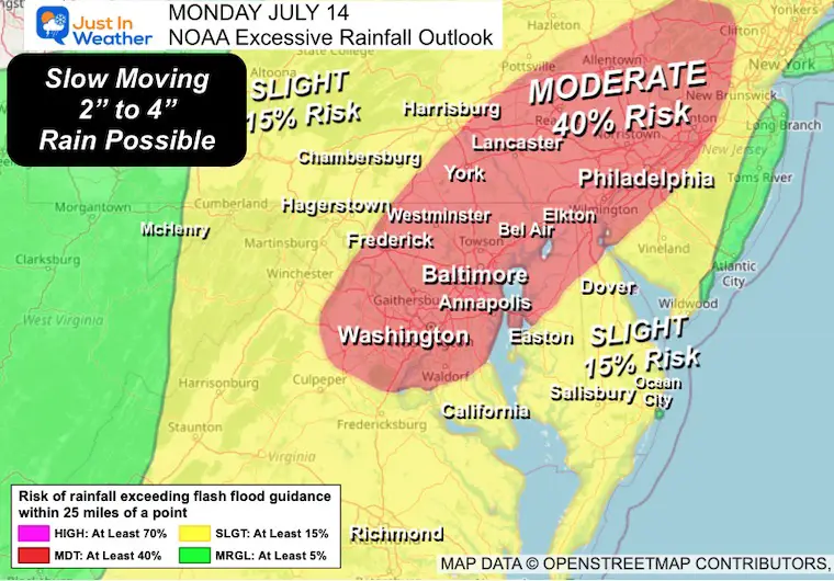
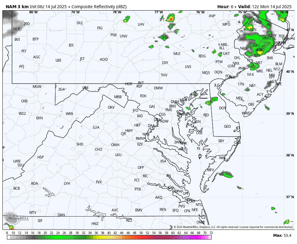
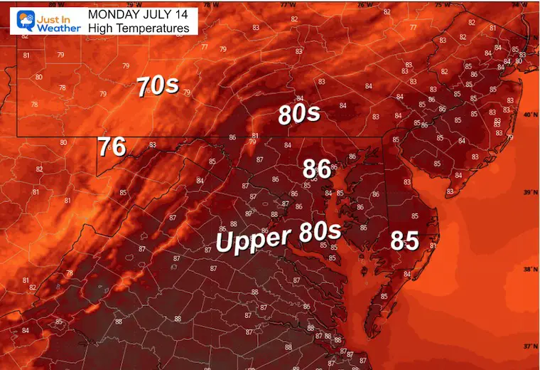
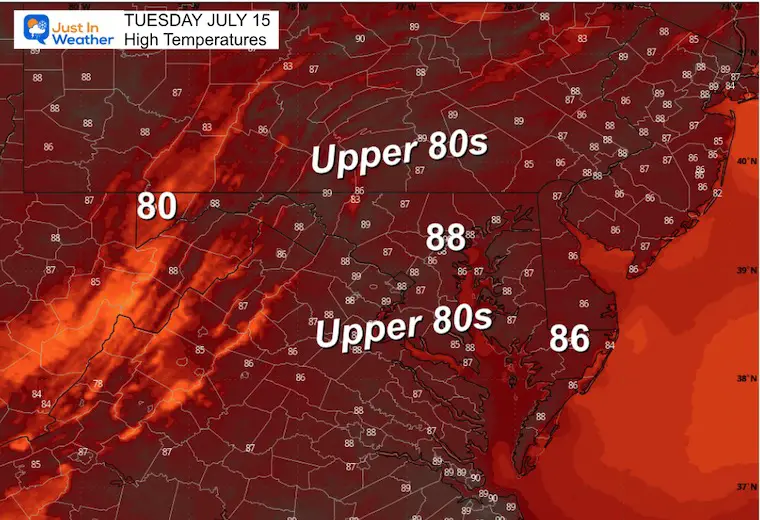
Last year on this day we tied the record high temperature in Baltimore at 101F. Today will not be that hot, but may FEEL less comfortable with the excessively high dew points in the mid to upper 70s. High humidity and slow moving storms may produce locally heavy downpours developing in addition to a line of strong to severe storms arriving in the evening. A Flood Watch is in place today through Midnight as rainfall rates may exceed 2 inches per hour.
Now THROUGH Midnight!
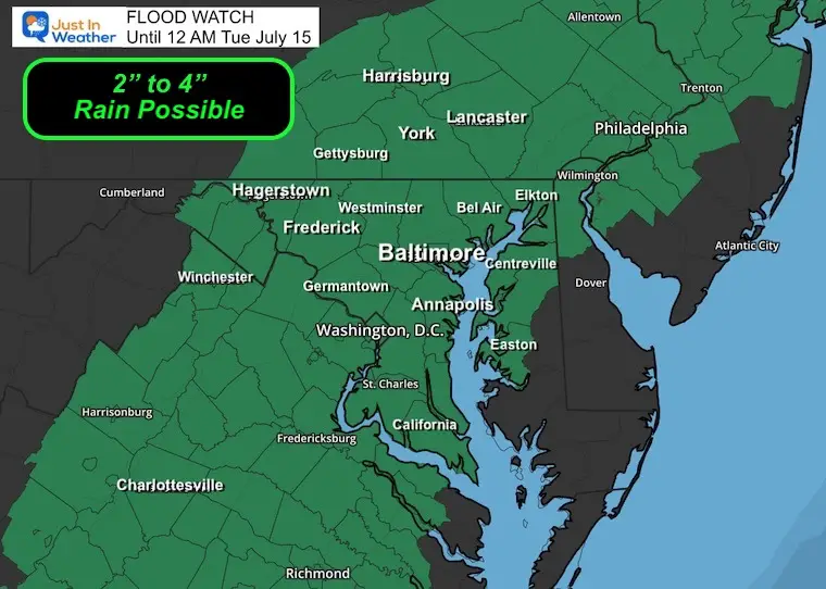
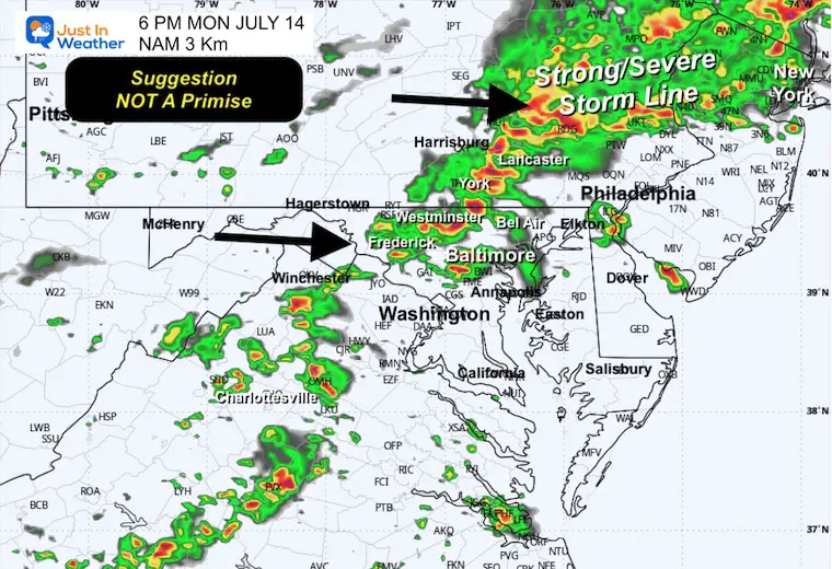
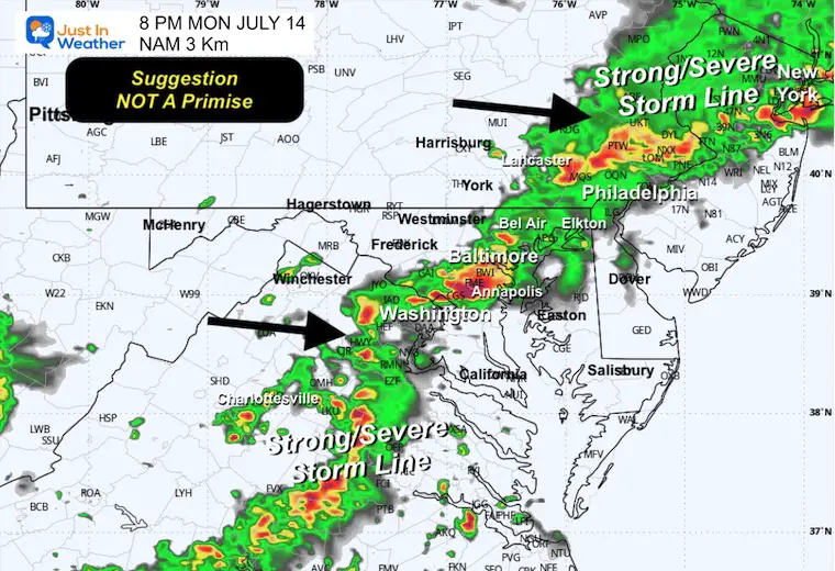
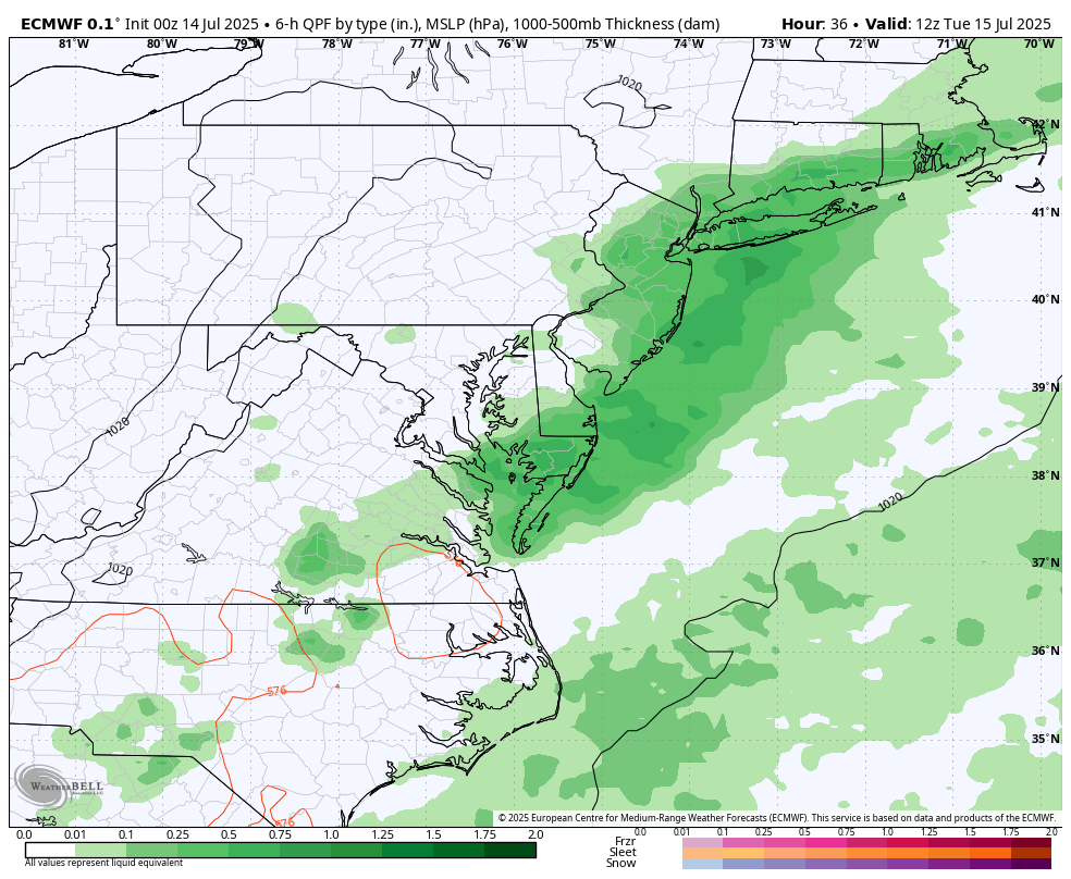
The main threat will be HEAVY RAIN as storms may form and sit over the same area, then the line of storms in the evening.
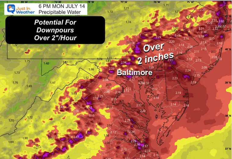
Rainfall RATES may be 2 inches per hour.
We can look at yesterday for a signal of what is possible today. Thunderstorms had developed in the morning and in some areas just stalled or crawled, resulting in over 3 inches of rain. The flooding was concentrated just west of Baltimore between Catonsville, Woodlawn, and Ellicott City. There was another cluster around Washington DC.
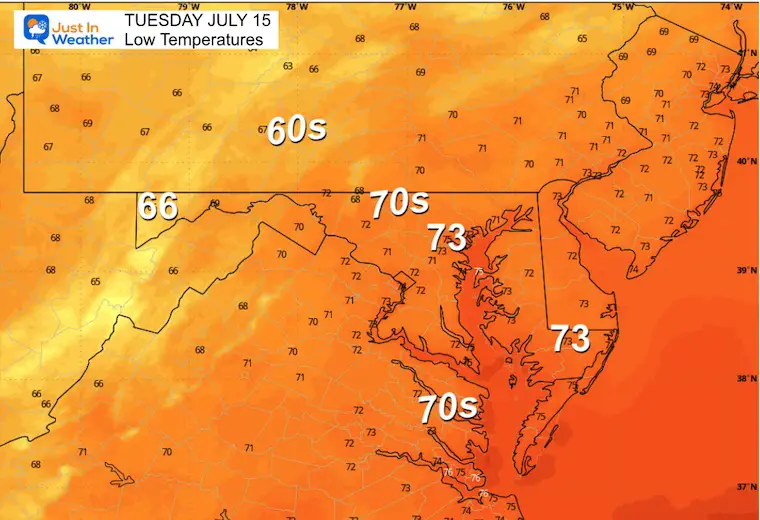
Today may be similar only in the potential for flooding with rainfall rates over 2 inches per hour. The high dew points this morning in the mid to upper 70s represent the available moisture.
Construction in this region is routine and many drivers have stated so is the poor drainage and flooding.
Marginal (Level 1) For Any Storm To Turn Severe.
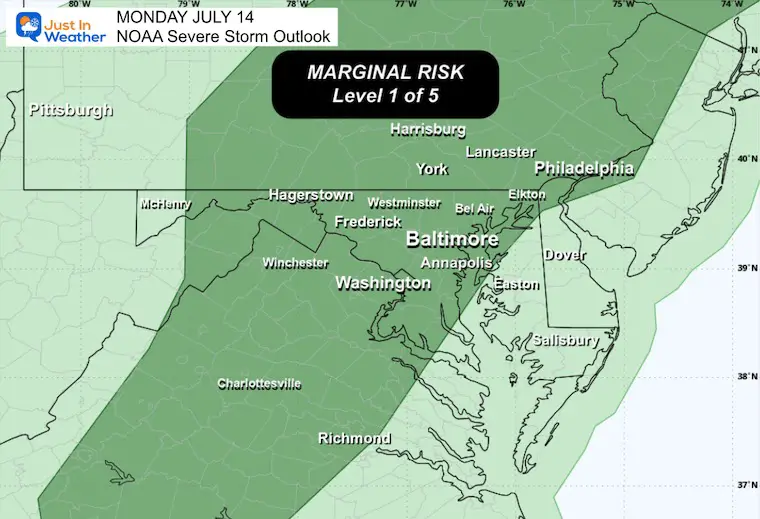
We remain in the ambiguous humid air mass. Today a cold front will interact and ignite more storms throughout the day.
Tropical Potential: The Southeast US coast has an area of Low Pressure that will drift WESTWARD across Florida into the Northern Gulf. This has a 30% chance to develop.
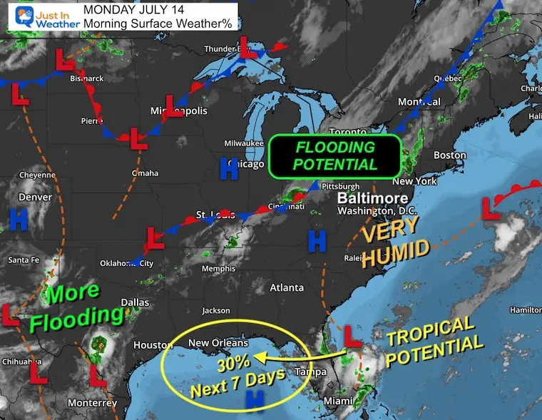
Next 7 days brings a 30% chance for tropical development.
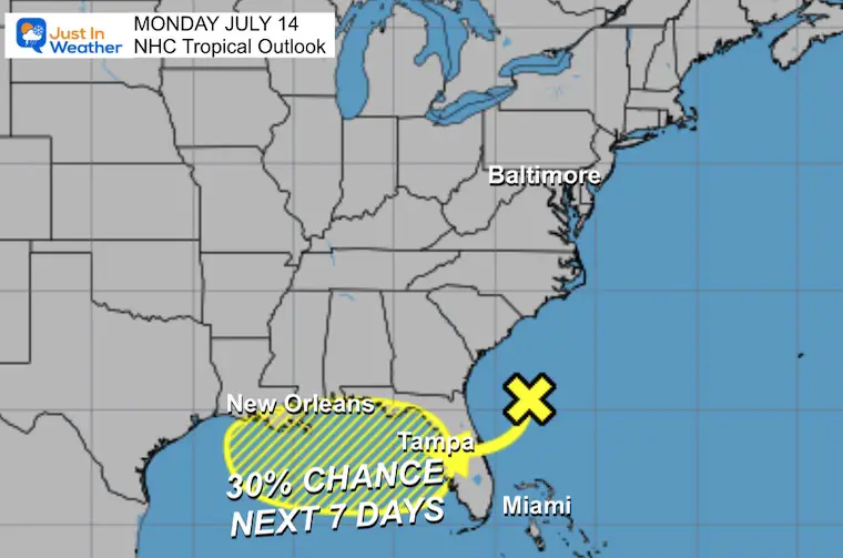
Suggestion NOT a Promise
The prime concern will be storms forming and just sitting over the same area for an hour or two. Rain potential total 1 to 3+ inches where this happens.
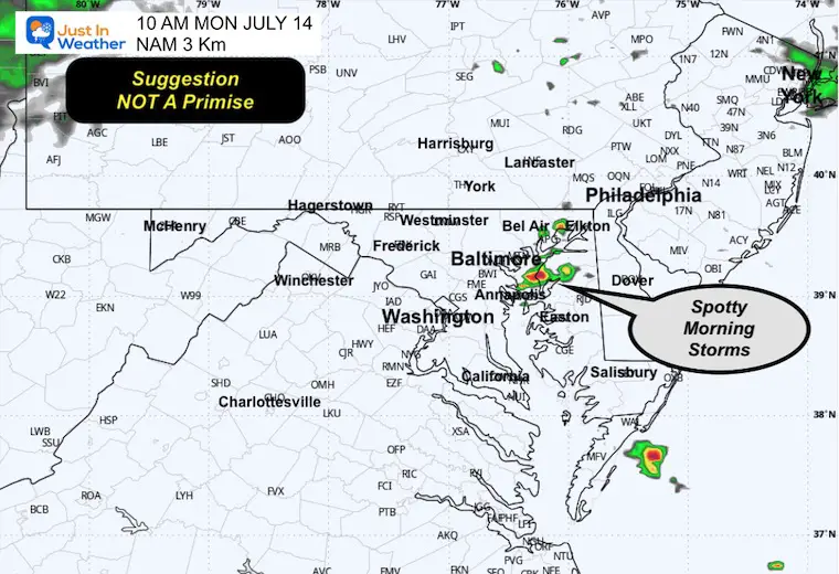
Once again a weak boundary along the Chesapeake Bay may produce some morning showers.
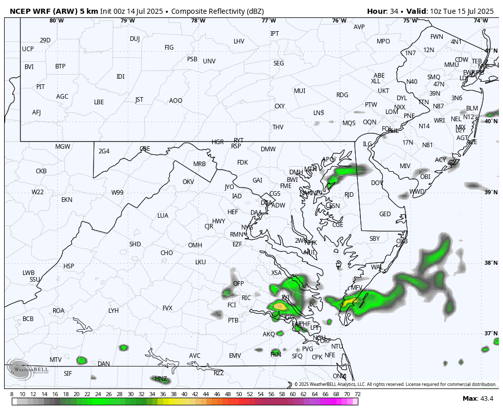
We should be able to identify the developing cold front in PA.
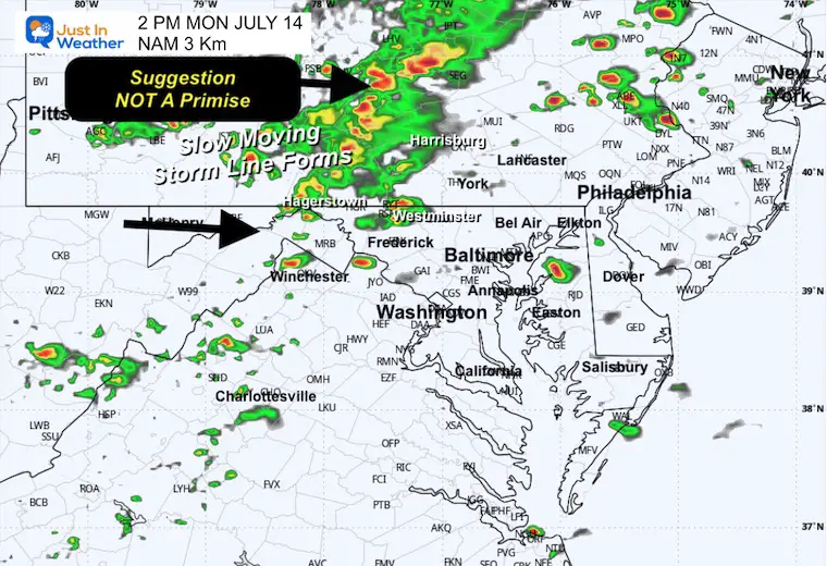
The slow moving line of storms will be expanding and getting closer.
The atmosphere has the potential to drop over 2 inches of rain per hour.
The line of storms will be entering Central Maryland. The window of concern will be any time between 5 PM and 10 PM.
Yesterday: Low 76F; High 86F
Rainfall = 0.19”
Sunrise at 5:52 AM
Sunset at 8:32 PM
Normal Low in Baltimore: 68ºF
Record 58ºF in 1895; 2001; 2009
Normal High in Baltimore: 89ºF
Record 101ºF 1954; 2024
Rainfall Deficit at BWI
Subscribe for eMail Alerts
Sign up and be the first to know!
SUGGESTION, NOT A PROMISE
Numerous DAILY thunderstorms each afternoon and evening.
More early in the week.
Sign up and be the first to know!
The annual event: Hiking and biking 329 miles in 7 days between The Summit of Wisp to Ocean City.
Each day, we honor a kid and their family’s cancer journey.
Fundraising is for Just In Power Kids: Funding Free Holistic Programs. I never have and never will take a penny. It is all for our nonprofit to operate.
Click here or the image to donate:

I am aware there are some spelling and grammar typos and occasional other glitches. I take responsibility for my mistakes and even the computer glitches I may miss. I have made a few public statements over the years, but if you are new here, you may have missed it: I have dyslexia and found out during my second year at Cornell University. It didn’t stop me from getting my meteorology degree and being the first to get the AMS CBM in the Baltimore/Washington region. One of my professors told me that I had made it that far without knowing and to not let it be a crutch going forward. That was Mark Wysocki, and he was absolutely correct! I do miss my mistakes in my own proofreading. The autocorrect spell check on my computer sometimes does an injustice to make it worse. I also can make mistakes in forecasting. No one is perfect at predicting the future. All of the maps and information are accurate. The ‘wordy’ stuff can get sticky. There has been no editor who can check my work while writing and to have it ready to send out in a newsworthy timeline. Barbara Werner is a member of the web team that helps me maintain this site. She has taken it upon herself to edit typos when she is available. That could be AFTER you read this. I accept this and perhaps proves what you read is really from me… It’s part of my charm. #FITF