Tuesday Afternoon Update
July 1 2024
The atmosphere is juicy! Dew points are high in the mid to upper 70s, which means there is the potential for heavy rainfall and additional flooding. This is in addition to the chance that thunderstorms will be both slow-moving AND reach severe levels. Basically, it is going to be a very busy day and evening to cap off the recent stretch of stormy days.
We have had a Moderate Risk for Severe Thunderstorms, and now we add TWO ALERTS.
Severe Thunderstorm Watch
And
Flood Watch, which is part of the NOAA Outlook for Excessive Rainfall.
I have included the LIVE Radar and Lightning Widget in this report. It is important to note that any storm, even without a warning, can produce dangerous lightning and torrential downpours.
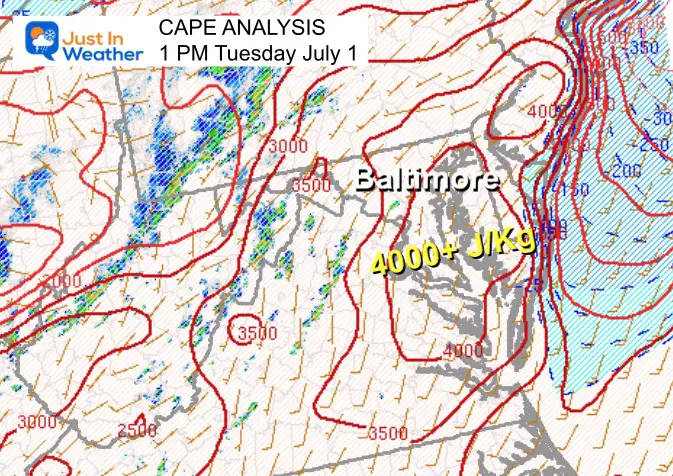
CAPE at 1 PM
This Convective Available Potential Energy measurement exceeding 400 J/Kg is very unstable and conducive to multiple supercells.
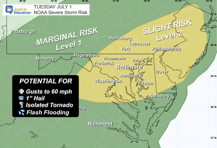
REMINDER: NOAA Severe Storm Risk
A chance for a thunderstorm to grow to severe levels, which may include:
- Damaging Wind Gusts
- Large Hail
- Isolated Tornadoes
- Any storm may contain dangerous lightning and local flash flooding
A WARNING will be issued when thunderstorms are detected. Specific towns in the storm’s path will be listed as part of the alert. These usually last 45 minutes, while Flood Warnings may last many hours.
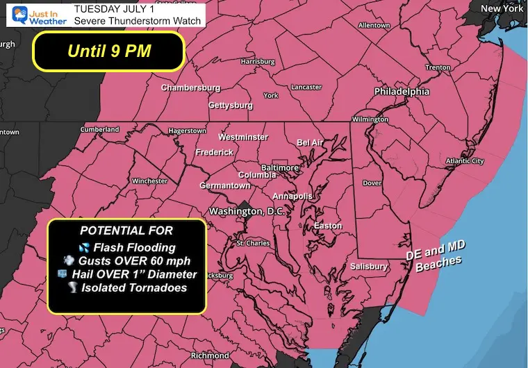
Severe Thunderstorm Watch
Until 9 PM
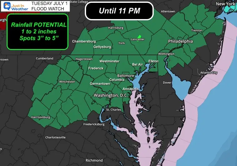
Flood Watch
Until 11 PM
The atmosphere is primed for the next round of thunderstorms to flare up late afternoon and evening over heavily populated Central Maryland. Up to 2 inches of rain is possible.
Some spots (like yesterday) may get stuck under slow or repeating cells and reach 3 to 5 inches of rainfall!
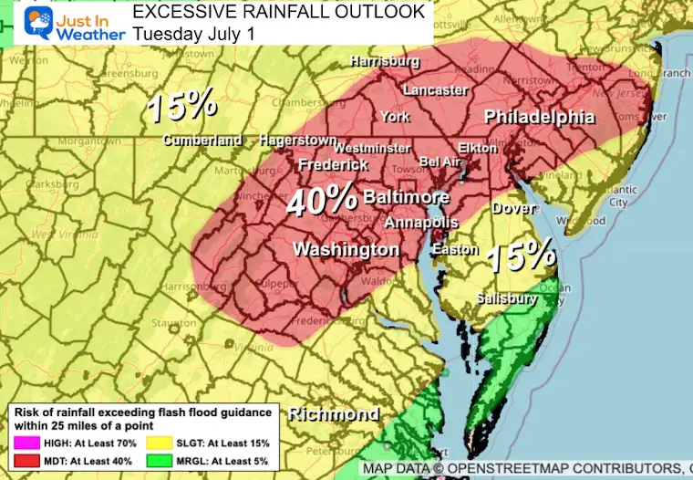
Excessive Rainfall Outlook Today
Moderate Risk of 40% for storms to produce flooding conditions. That means almost half of the people in these areas may experience this. Some for the second day in a row.
Live Radar and Lightning Widget
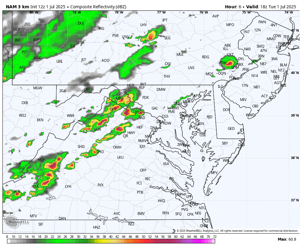
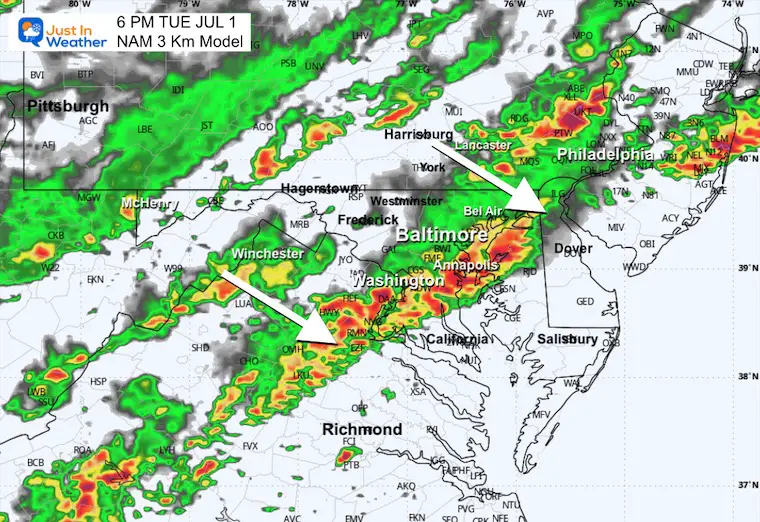
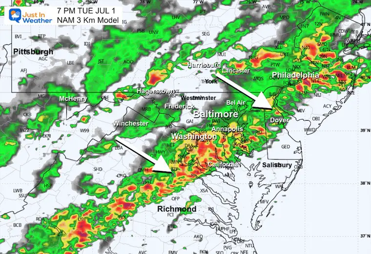
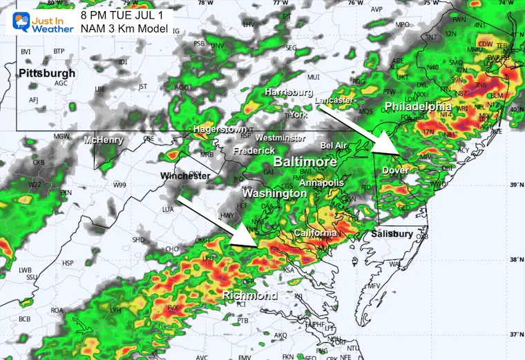
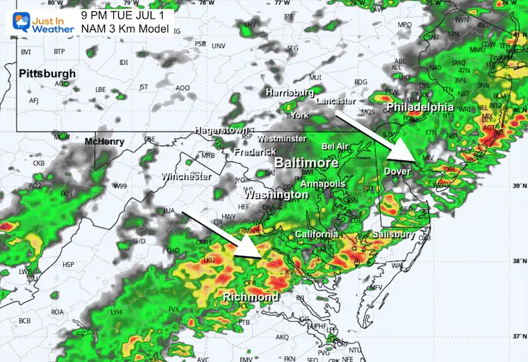
Radar Simulation 2 PM to Midnight
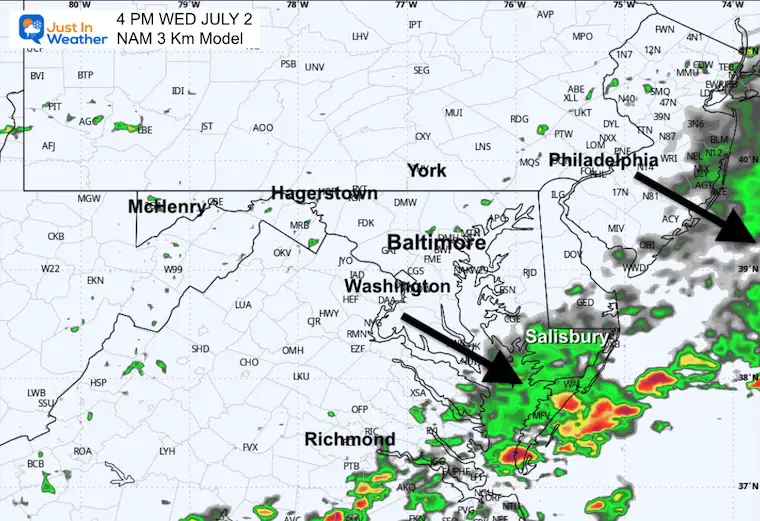
One main line is expected, AND there will be additional cells.
This simulation is a suggestion and not a promise. Use this as a rough guide for the timeline.
Snapshots
This simulation is the suggestion and not a promise. Use this as a rough guide for the timeline.
4 PM
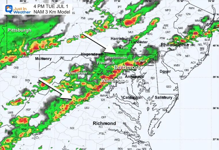
5 PM
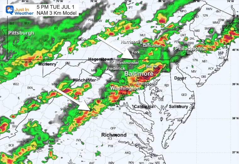
6 PM
7 PM
8 PM
9 PM
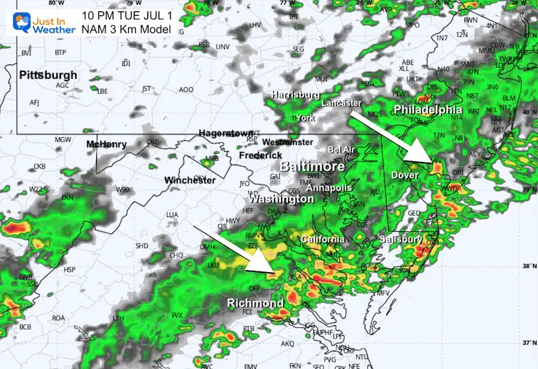
10 PM
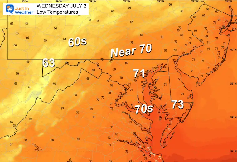
WEDNESDAY
Morning Low Temperatures
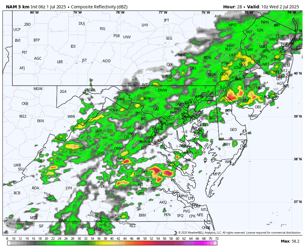
Morning Radar Snapshot
Rain to start the day…
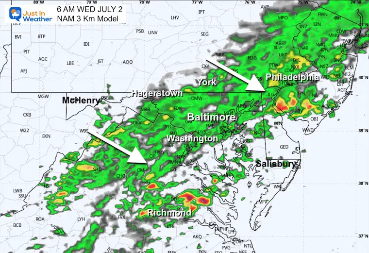
Radar Simulation: 6 AM to 8 PM
Rain will be drifting south with the front.
Afternoon Radar Snapshot
Rain will linger in southern Maryland as the north will clear.
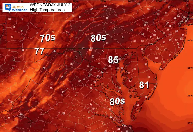
Afternoon High Temperatures
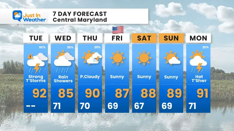
7 Day Forecast
- Today: Strong Storms and Possible Flooding
- Wednesday to July 4th Weekend: Sunny, Hot, and Less Humid
Subscribe for eMail Alerts
Please share your thoughts and best weather pics/videos, or just keep in touch via social media.
THANK YOU:
Baltimore Sun Magazine Readers Choice Best Of Baltimore
Maryland Trek 11 Day 7 Completed Sat August 10
We raised OVER $111,000 for Just In Power Kids – AND Still Collecting More
The annual event: Hiking and biking 329 miles in 7 days between The Summit of Wisp to Ocean City.
Each day, we honor a kid and their family’s cancer journey.
Fundraising is for Just In Power Kids: Funding Free Holistic Programs. I never have and never will take a penny. It is all for our nonprofit to operate.
Click here or the image to donate:

RESTATING MY MESSAGE ABOUT DYSLEXIA
I am aware there are some spelling and grammar typos and occasional other glitches. I take responsibility for my mistakes and even the computer glitches I may miss. I have made a few public statements over the years, but if you are new here, you may have missed it: I have dyslexia and found out during my second year at Cornell University. It didn’t stop me from getting my meteorology degree and being the first to get the AMS CBM in the Baltimore/Washington region. One of my professors told me that I had made it that far without knowing and to not let it be a crutch going forward. That was Mark Wysocki, and he was absolutely correct! I do miss my mistakes in my own proofreading. The autocorrect spell check on my computer sometimes does an injustice to make it worse. I also can make mistakes in forecasting. No one is perfect at predicting the future. All of the maps and information are accurate. The ‘wordy’ stuff can get sticky. There has been no editor who can check my work while writing and to have it ready to send out in a newsworthy timeline. Barbara Werner is a member of the web team that helps me maintain this site. She has taken it upon herself to edit typos when she is available. That could be AFTER you read this. I accept this and perhaps proves what you read is really from me… It’s part of my charm. #FITF


