Monday Afternoon Update
June 30, 2025
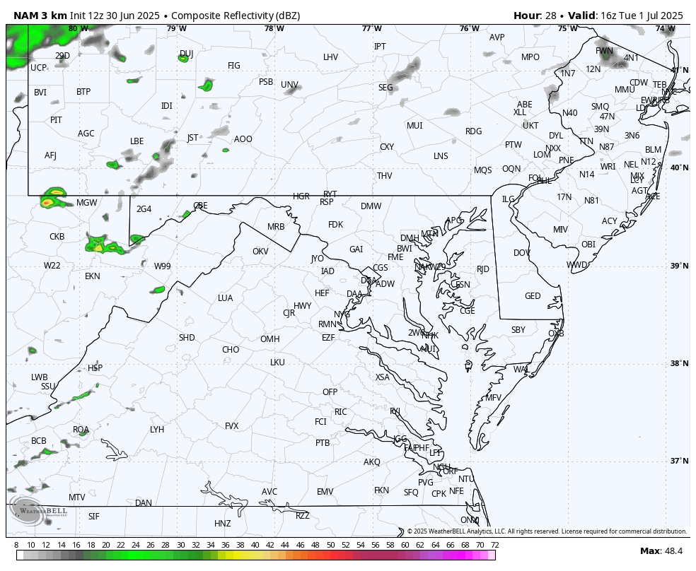
We continue to be stuck in a pattern with slow-moving thunderstorms that build in the afternoon and evening. With air temperatures in the 90s and dew points in the 70s, the air is juicy and can trigger torrential downpours.
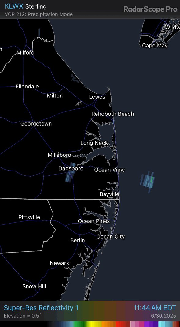
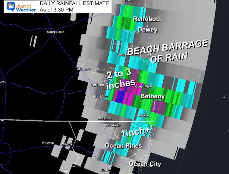
Today’s first event was concentrated on the beaches with the heaviest rainfall lasting for hours along the Delaware seashore. Rainfall totals jumped up to 3 inches, and the radar has been impressive.
11:30 AM to 2:30 PM Doppler Radar
Doppler Radar Rainfall Estimate
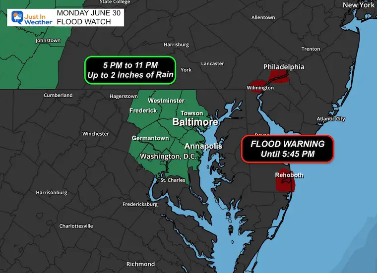
Flood Watch
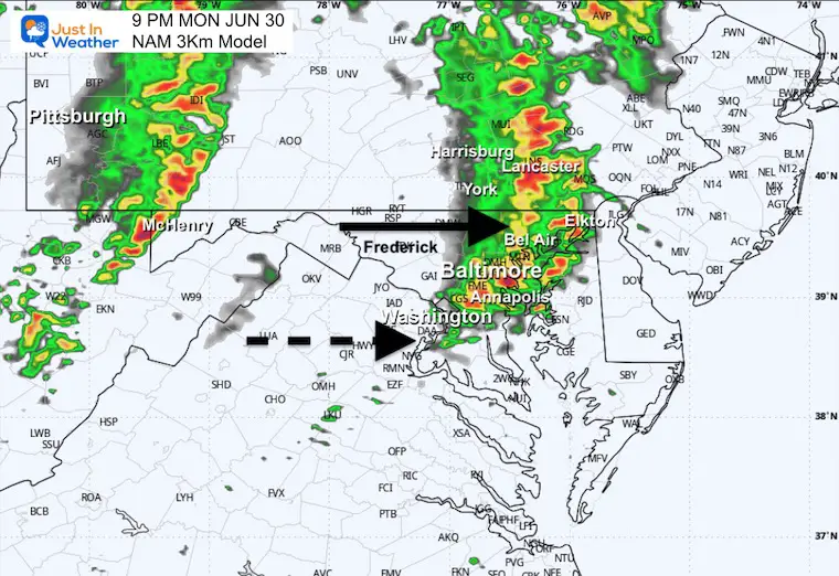
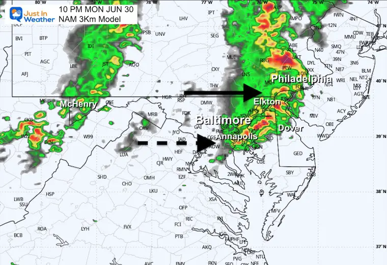
The focus will be from 5 PM to 11 PM in metro Baltimore.
The atmosphere is primed for the next round of thunderstorms to flare up late afternoon and evening over heavily populated Central Maryland. There is potential for up to 2 inches of rain that may produce flash flooding.
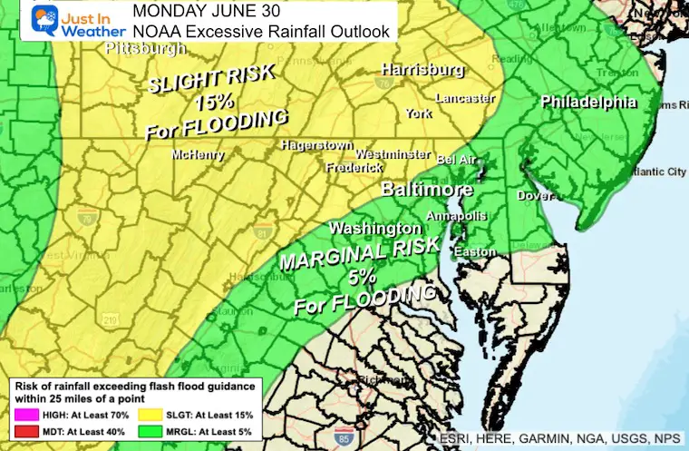
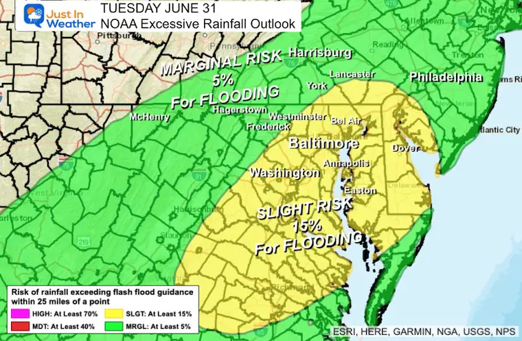
Excessive Rainfall Outlook Today
The Slight Risk will follow the line of storms shown below in our simulation. This will include Southern Pennsylvania as well, even if not in the current watch… I would pay close attention if you are in the southern counties of Adams, York, and Lancaster.
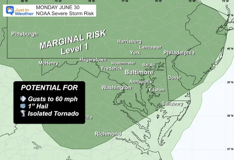
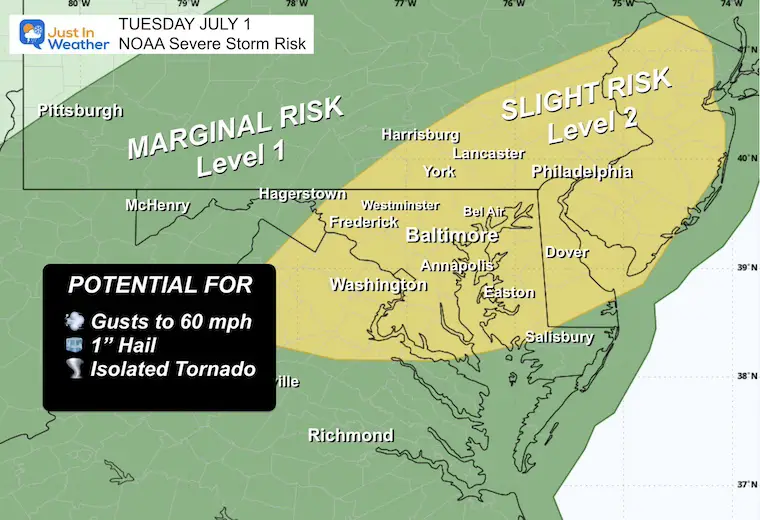
REMINDER: NOAA Severe Storm Risk
A chance for a thunderstorm to grow to severe levels, which may include:
- Damaging Wind Gusts
- Large Hail
- Isolated Tornadoes
- Any storm may contain dangerous lightning and local flash flooding.
If a storm is identified with these conditions, a WARNING will be issued and specific towns in its path will be tracked.
Live Radar and Lightning Widget
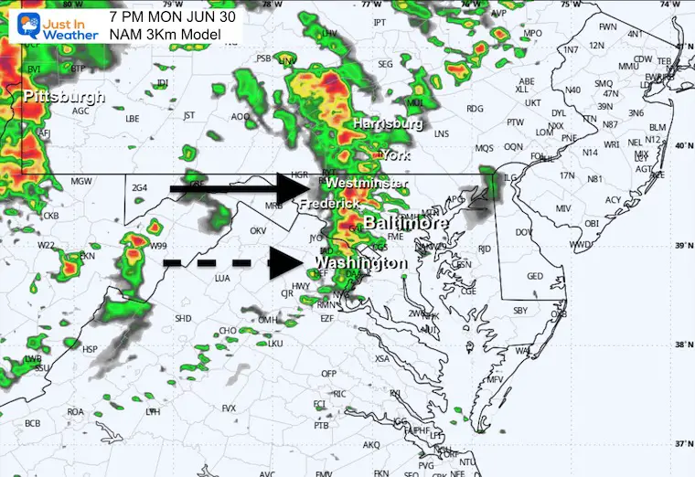
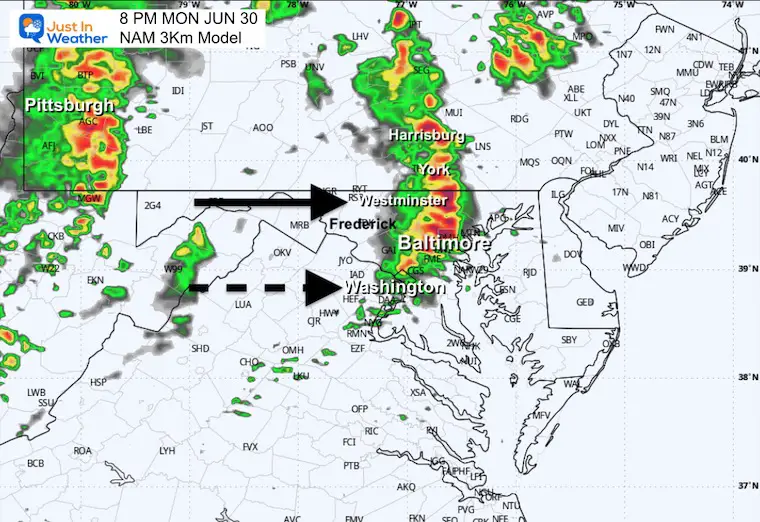
Radar Simulation 4 PM to Midnight
There will be showers that pop up ahead of the main line. Any storm may contain dangerous lightning.
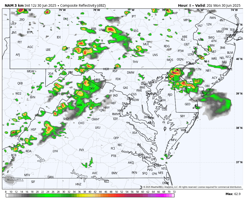
Snapshots
This product is performing the best, but may be off by an hour, as suggested here, and what actually develops. The real storms may show sooner than shown here.
7 PM
8 PM
9 PM
10 PM
TOMORROW:
Excessive Rainfall Outlook
NOAA Severe Storm Risk
Radar Simulation Noon to Midnight
A stronger line of storms is expected to develop and pass through between 4 PM and 9 PM.
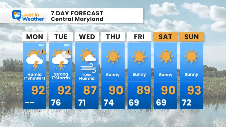
7 Day Forecast
- Today: Hot and Humid; Scattered T’showers
- Tuesday: Strong Storms and Possible Flooding
- Wednesday to July 4th Weekend: Sunny, Hot, and Less Humid
Subscribe for eMail Alerts
Please share your thoughts and best weather pics/videos, or just keep in touch via social media.
THANK YOU:
Baltimore Sun Magazine Readers Choice Best Of Baltimore
Maryland Trek 11 Day 7 Completed Sat August 10
We raised OVER $111,000 for Just In Power Kids – AND Still Collecting More
The annual event: Hiking and biking 329 miles in 7 days between The Summit of Wisp to Ocean City.
Each day, we honor a kid and their family’s cancer journey.
Fundraising is for Just In Power Kids: Funding Free Holistic Programs. I never have and never will take a penny. It is all for our nonprofit to operate.
Click here or the image to donate:

RESTATING MY MESSAGE ABOUT DYSLEXIA
I am aware there are some spelling and grammar typos and occasional other glitches. I take responsibility for my mistakes and even the computer glitches I may miss. I have made a few public statements over the years, but if you are new here, you may have missed it: I have dyslexia and found out during my second year at Cornell University. It didn’t stop me from getting my meteorology degree and being the first to get the AMS CBM in the Baltimore/Washington region. One of my professors told me that I had made it that far without knowing and to not let it be a crutch going forward. That was Mark Wysocki, and he was absolutely correct! I do miss my mistakes in my own proofreading. The autocorrect spell check on my computer sometimes does an injustice to make it worse. I also can make mistakes in forecasting. No one is perfect at predicting the future. All of the maps and information are accurate. The ‘wordy’ stuff can get sticky. There has been no editor who can check my work while writing and to have it ready to send out in a newsworthy timeline. Barbara Werner is a member of the web team that helps me maintain this site. She has taken it upon herself to edit typos when she is available. That could be AFTER you read this. I accept this and perhaps proves what you read is really from me… It’s part of my charm. #FITF


