Sunday, June 29, 2025
Morning Report
The return of the warm air will arrive on the other side of the frontal boundary, moving back through today.
The full force of the heat wave will miss us, but the edge ‘ring of fire’ will keep us in the active daily thunderstorms for the next few days.
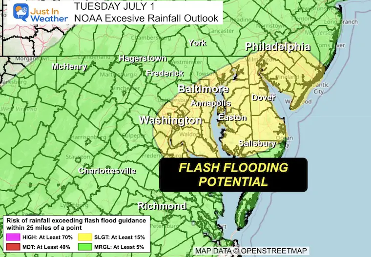
The peak of the storms is expected to be on Tuesday. NOAA has posted an excessive rainfall outlook, meaning we may need to stay alert for flash flooding.
Then we return to seasonal hot afternoons but a more stable and dry setup to end the week. The July 4th holiday is looking sunny, seasonably hot, and dry!
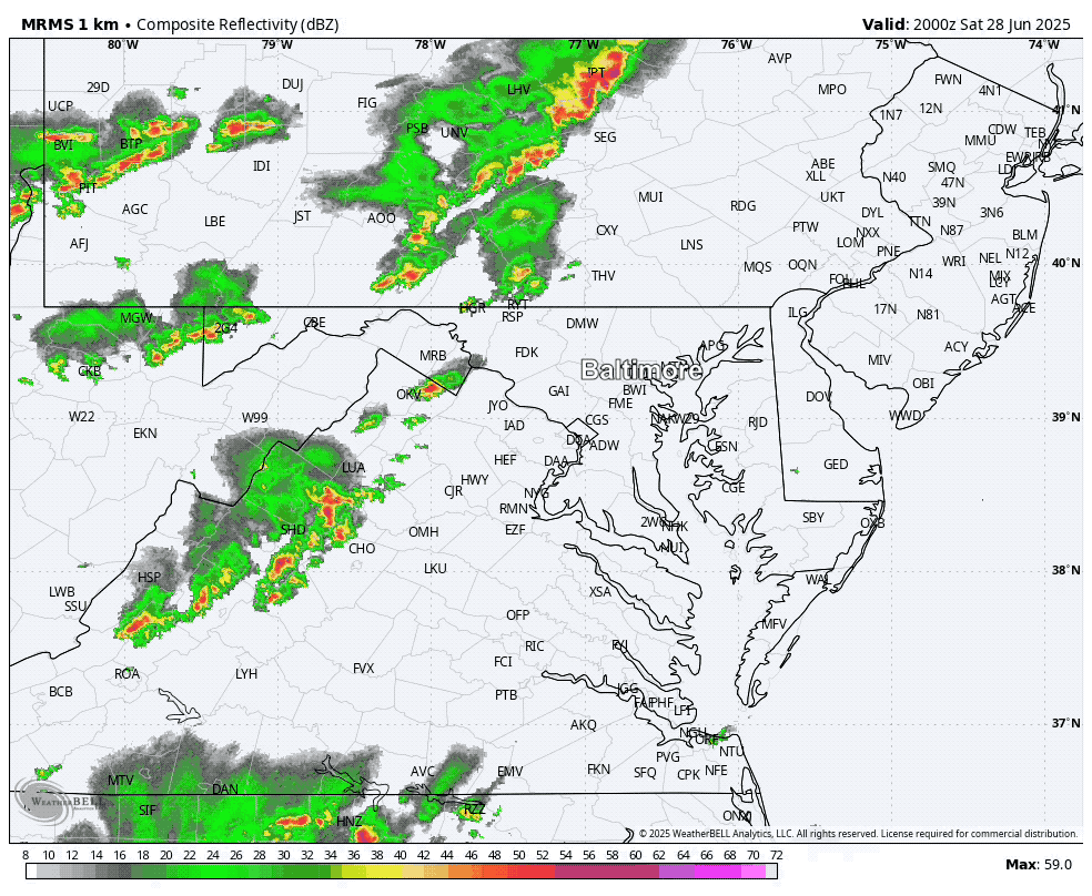
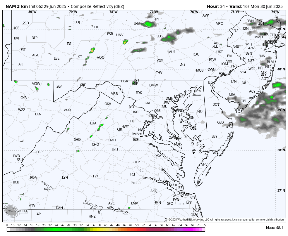
Radar Recap Yesterday
Between 4 PM and Midnight
There was a flare-up of strong and severe thunderstorms developing in a line that pushed with peak intensity near Hagerstown and Frederick, then quickly faded, only to pulse again.
Rogue showers did develop outside of this region.
This helps demonstrate the randomness of subtle boundaries and energy in the atmosphere that makes it nearly impossible to pinpoint a specific location at any time for getting hit.
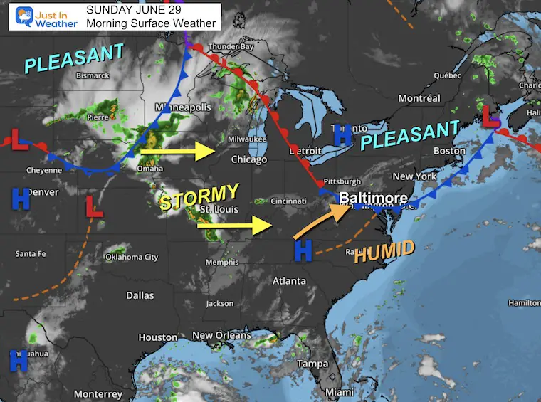
Morning Surface Weather
The pleasant air is carved out in the Northeast US while the humidity is returning FROM the South. This will be expanding into Maryland today and may kick up thunderstorms.
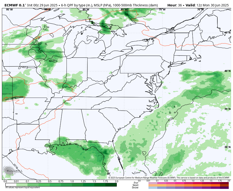
The really active weather is in the Midwest and Northern Plains. That is the instigator for severe storms today. It will spread our way and make for potential flooding into Tuesday.
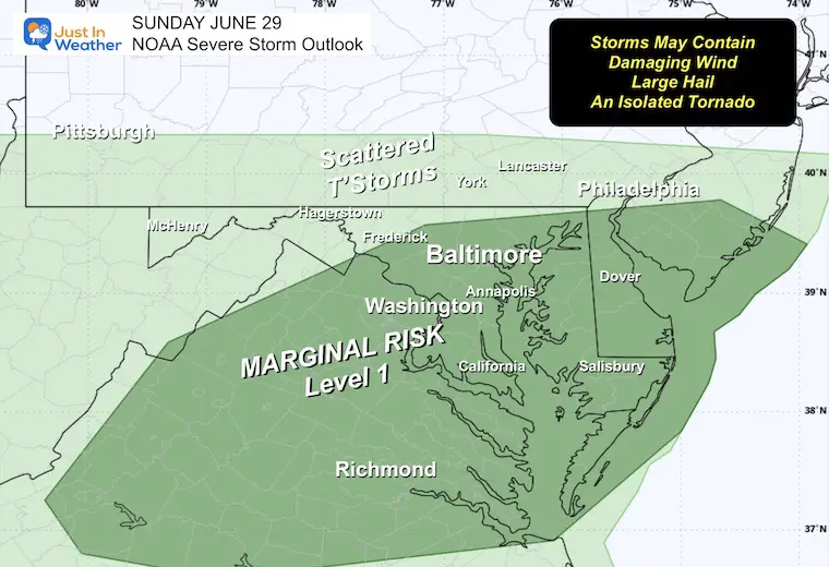
NOAA Severe Storm Risk
A chance for a thundershower to grow to severe levels, which may include:
- Damaging Wind Gusts
- Large Hail
- Isolated Tornadoes
- Any storm may contain dangerous lightning and local flash flooding
Live Radar and Lightning Widget
Radar Simulation: Noon to Midnight
This is a SUGGESTION, NOT A PROMISE.
Low confidence CONTINUES in this product with the setup. Scattered showers and thunderstorms may pop up any time in the afternoon heat, then settle down in the evening.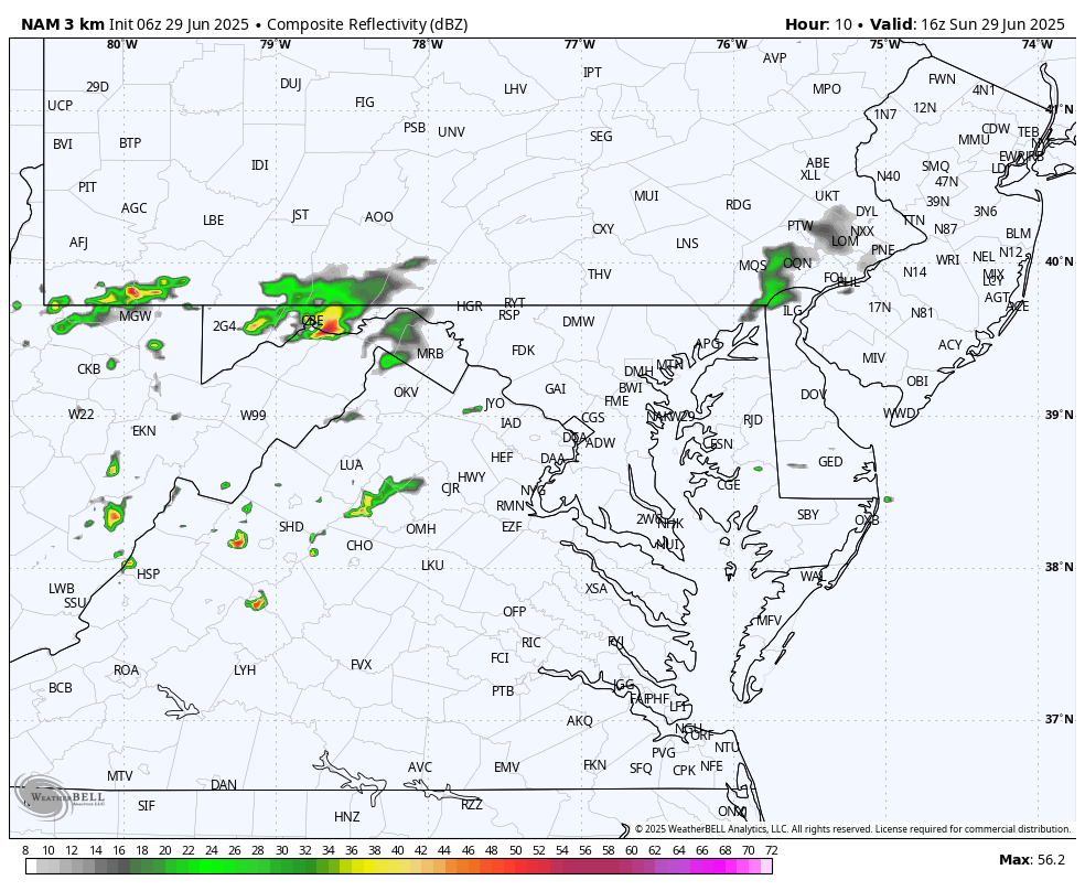
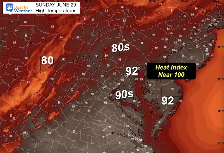
Afternoon High Temperatures
As we reach the lower 90s, it will ‘feel’ close to 100°F.
Subscribe for eMail Alerts
CLIMATE DATA: Baltimore
TODAY June 29
Sunrise at 5:43 AM
Sunset at 8:37 PM
Normal Low in Baltimore: 66ºF
Record 53ºF in 1974
Normal High in Baltimore: 88ºF
Record 105ºF 1934
Rainfall Deficit at BWI
- Ending 2024 = -8.00”
- Since Jan 1 = -1.87”
- We are STILL DOWN -9.87” INCLUDING LAST YEAR
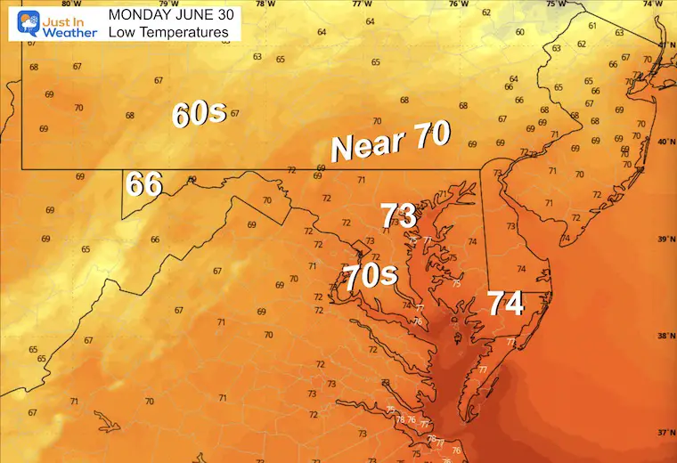
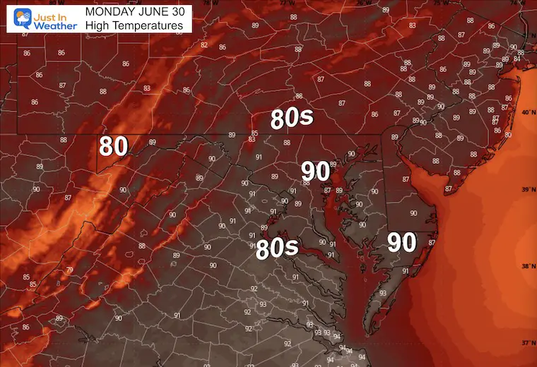
MONDAY
Morning Low Temperatures
Afternoon High Temperatures
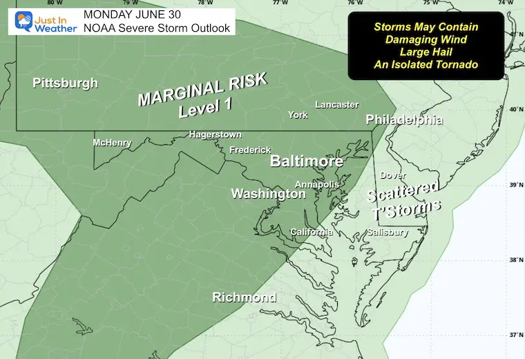
NOAA Severe Storm Risk
A chance for a thunderstorm to grow to severe levels, which may include:
- Damaging Wind Gusts
- Large Hail
- Isolated Tornadoes
- Any storm may contain dangerous lightning and local flash flooding
Radar Simulation: Noon to Midnight
Looking Ahead
Storm Simulation: Monday to Wednesday
- Pulsing Rain in the afternoon and evening
- Peak Heavy Rain Tuesday Evening
- Wednesday: Dry And Less Humid
Tuesday Outlook
NOAA Excessive Rainfall = Risk For Flash Flooding
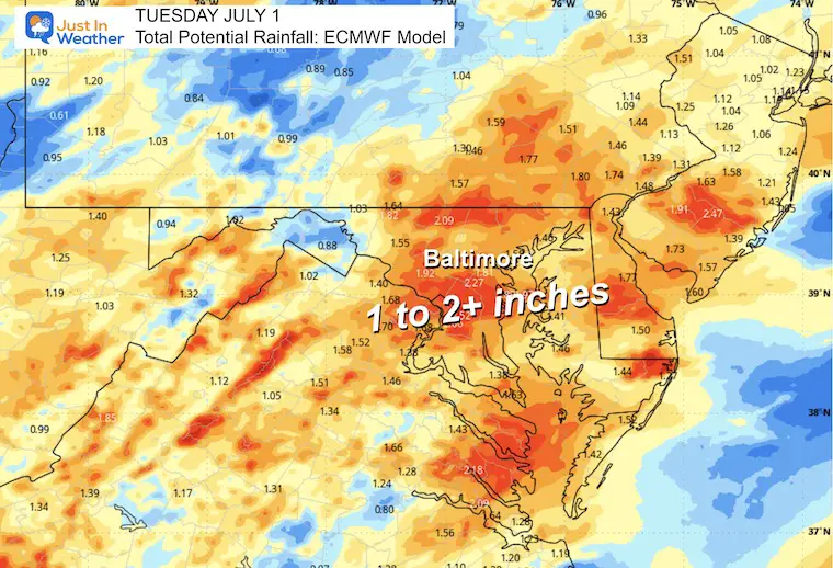
Rainfall Potential
1 to 2+ inches. Some spots may have slow-moving or repeating cells, which could reach much higher amounts, resulting in Flash Flooding.
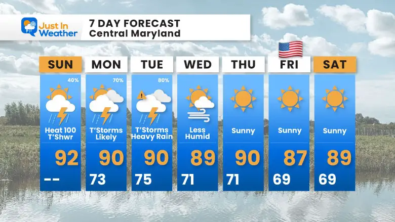
7 Day Forecast
- Today: Hot and Humid; Scattered T’showers
- Monday/Tuesday: Strong Storms
- Potential Flooding on Tuesday
- Wednesday to July 4th Weekend: Sunny, Hot, and Less Humid
Subscribe for eMail Alerts
Please share your thoughts and best weather pics/videos, or just keep in touch via social media.
THANK YOU:
Baltimore Sun Magazine Readers Choice Best Of Baltimore
Maryland Trek 11 Day 7 Completed Sat August 10
We raised OVER $111,000 for Just In Power Kids – AND Still Collecting More
The annual event: Hiking and biking 329 miles in 7 days between The Summit of Wisp to Ocean City.
Each day, we honor a kid and their family’s cancer journey.
Fundraising is for Just In Power Kids: Funding Free Holistic Programs. I never have and never will take a penny. It is all for our nonprofit to operate.
Click here or the image to donate:

RESTATING MY MESSAGE ABOUT DYSLEXIA
I am aware there are some spelling and grammar typos and occasional other glitches. I take responsibility for my mistakes and even the computer glitches I may miss. I have made a few public statements over the years, but if you are new here, you may have missed it: I have dyslexia and found out during my second year at Cornell University. It didn’t stop me from getting my meteorology degree and being the first to get the AMS CBM in the Baltimore/Washington region. One of my professors told me that I had made it that far without knowing and to not let it be a crutch going forward. That was Mark Wysocki, and he was absolutely correct! I do miss my mistakes in my own proofreading. The autocorrect spell check on my computer sometimes does an injustice to make it worse. I also can make mistakes in forecasting. No one is perfect at predicting the future. All of the maps and information are accurate. The ‘wordy’ stuff can get sticky. There has been no editor who can check my work while writing and to have it ready to send out in a newsworthy timeline. Barbara Werner is a member of the web team that helps me maintain this site. She has taken it upon herself to edit typos when she is available. That could be AFTER you read this. I accept this and perhaps proves what you read is really from me… It’s part of my charm. #FITF


