June 28 Weather Heat and Humidity Return With A Slight Risk For Severe Storms The Next Few Afternoons
Saturday, June 28, 2025
Morning Report
The back door cold front that passed by yesterday kept the afternoon in the 70s. This was a sharp contrast to the record-high temperatures on Wednesday and record-warm lows on Tuesday.
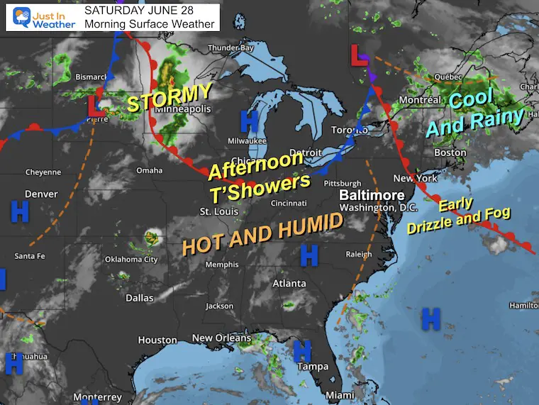
This morning there is drizzle and fog as that boundary moves back north. This will allow a return to the hot and humid weather, with daily afternoon thunderstorms.
This typical summer setup is also nearly impossible to pin down for any location. Thunderstorms may pop up at any time beyond the simulations. Please have a safety plan for lightning, and keep in mind that it can be dangerous even without a severe warning.
More storms will build up through Tuesday, and then it will be hot and dry for the second half of the week ahead.
TODAY’S WEATHER
The return of the warm air will arrive on the other side the the frontal boundary moving back through today.
The full force of the heat wave will miss us, but the edge ‘ring of fire’ will keep us in the active daily thunderstorms for the next few days.
The peak of the storms is expected to be Tuesday, then we get back to seasonal hot afternoons, but a more stable and dry setup to end the week.
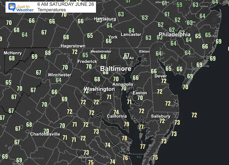
Morning Temperatures at 6 AM
Morning Surface Weather
Drizzle and fog this morning as the cold front will be moving to the north as a warm front. The wind shift will allow the heat and humidity to return.
Live Radar and Lightning Widget
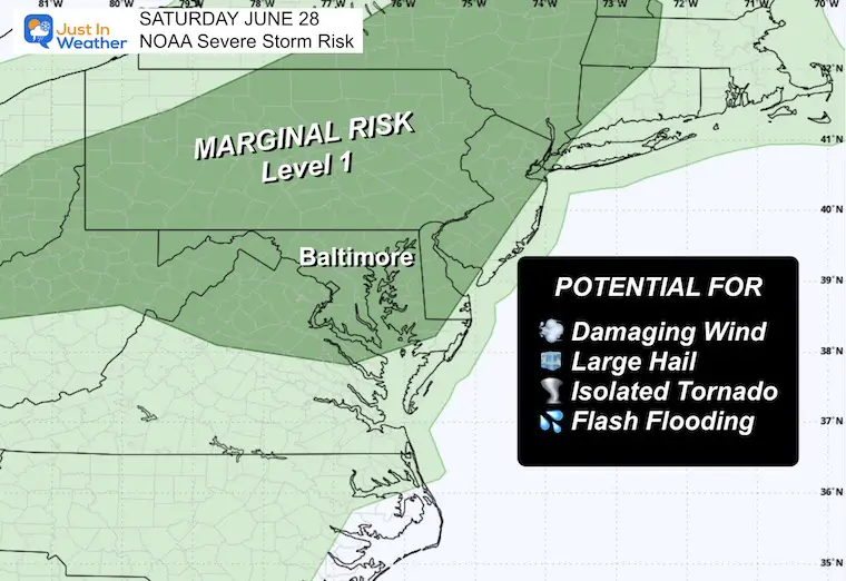
NOAA Severe Storm Risk
A chance for a thundershower to grow to severe levels, which may include:
- Damaging Wind Gusts
- Large Hail
- Isolated Tornadoes
- Any storm may contain dangerous lightning and local flash flooding
Today
Marginal Level 1
Storm Forecast Saturday Through Wednesday
Daily thunderstorms will erupt in the afternoon heat and then settle down in the evening. This is expected to peak on Tuesday with a strong cold front. On the other side, remaining hot, just less humid, Wednesday into the holiday weekend.
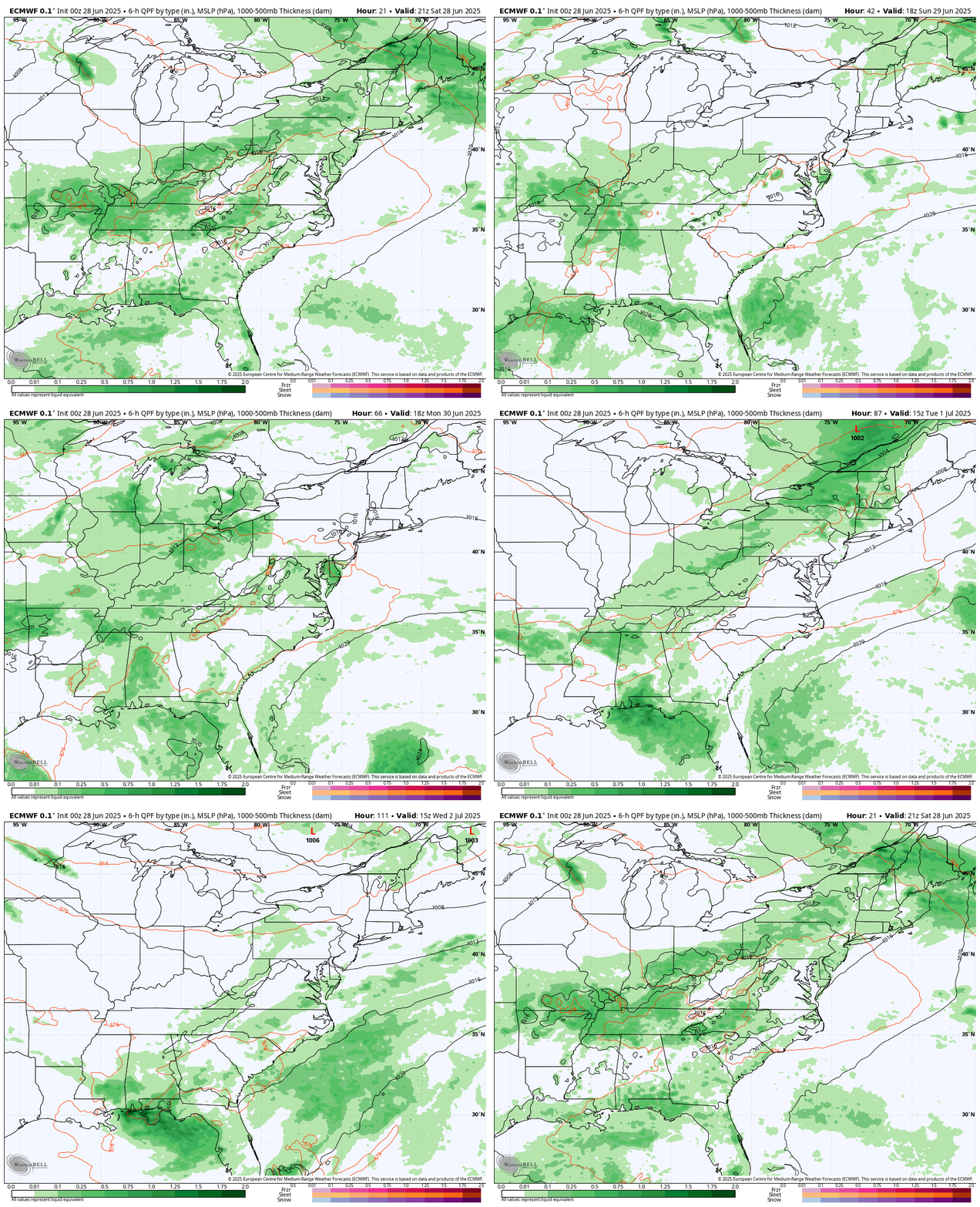
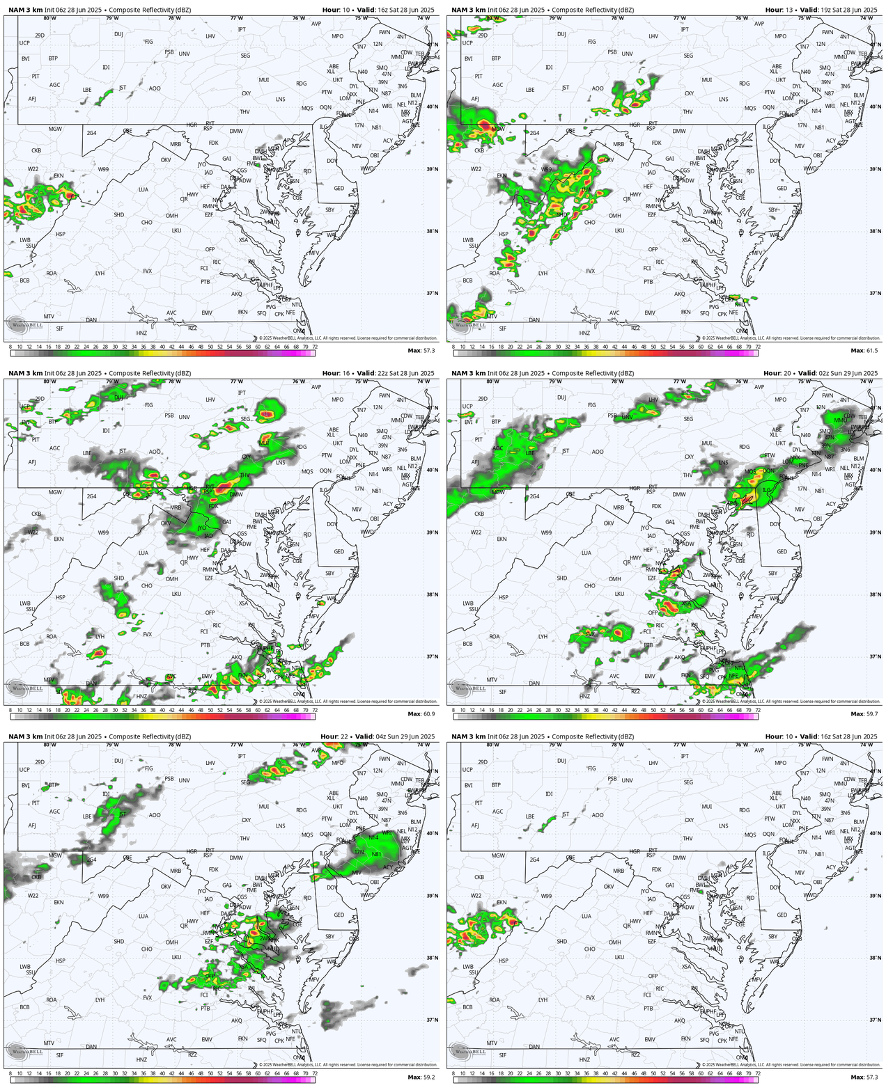
Radar Simulation: Noon to Midnight
This is a SUGGESTION, NOT A PROMISE. Low confidence in this product with the setup. Scattered showers and thunderstorms may pop up any time in the afternoon heat, then settle down in the evening.
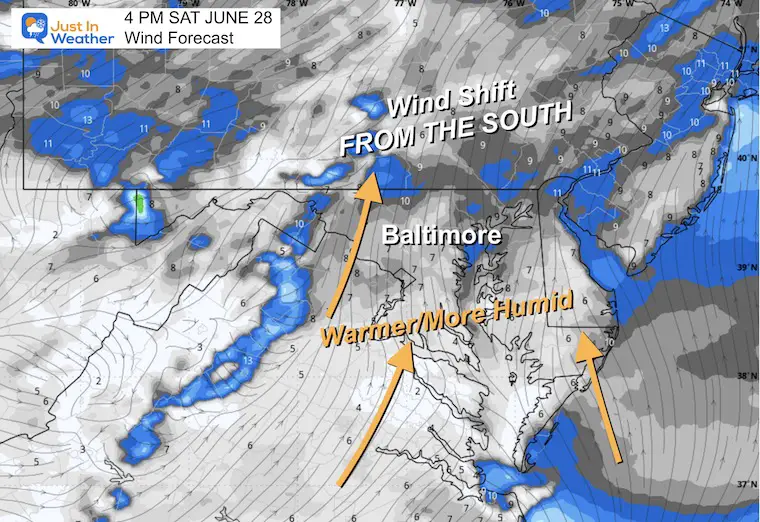
Wind Forecast
The wind direction will shift back FROM THE SOUTH. This will allow the heat and humidity to return.
However, the risk of flooding will be where these storms may crawl or stall.
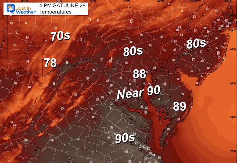
Afternoon High Temperatures
Subscribe for eMail Alerts
Weather posts straight to your inbox
Sign up and be the first to know!
CLIMATE DATA: Baltimore
TODAY June 28
Sunrise at 5:43 AM
Sunset at 8:37 PM
Normal Low in Baltimore: 66ºF
Record 51ºF in 2017
Normal High in Baltimore: 88ºF
Record 99ºF 2010
Rainfall Deficit at BWI
- Ending 2024 = -8.00”
- Since Jan 1 = -1.76”
- We are STILL DOWN -9.76” INCLUDING LAST YEAR
SUNDAY
Morning Low Temperatures
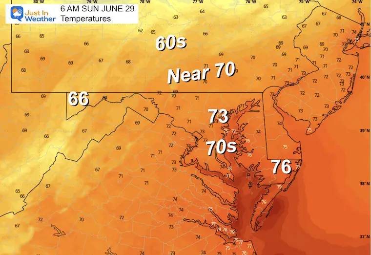
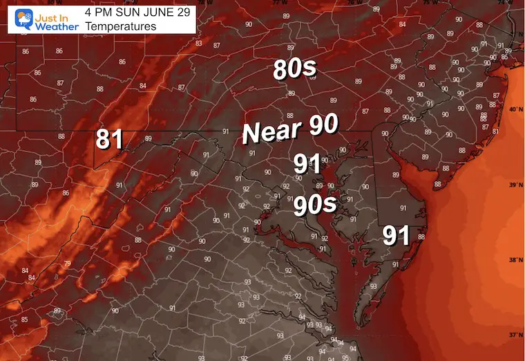
Afternoon High Temperatures
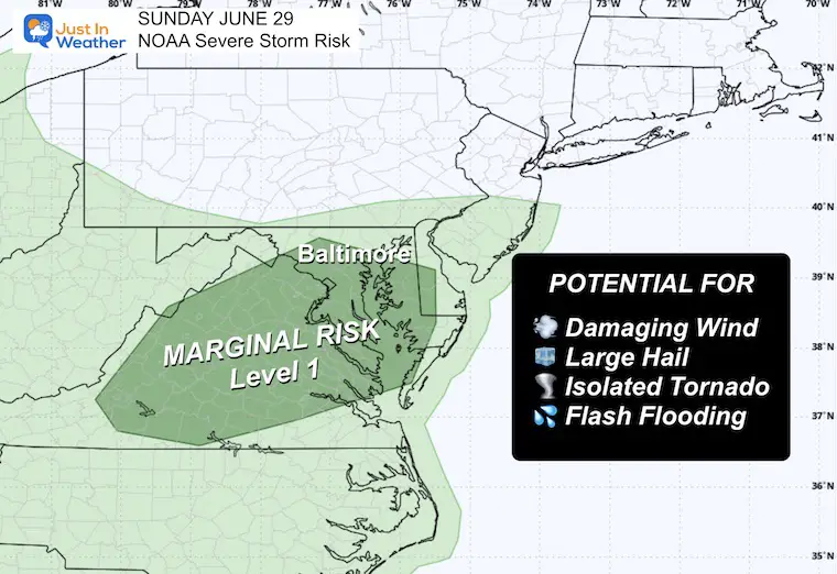
Sunday: NOAA Severe Storm Risk
Marginal Level 1
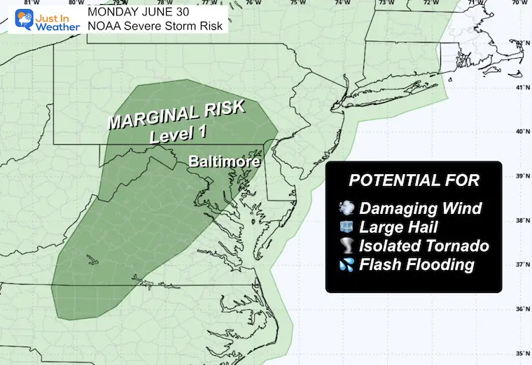
Monday: NOAA Severe Storm Risk
Marginal Level 1
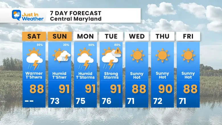
7 Day Forecast
- Weekend: Heat Returns With Afternoon Storms
- Monday/Tuesday: Strong Storms
- Wednesday: Hot and Less Humid
Subscribe for eMail Alerts
Weather posts straight to your inbox
Sign up and be the first to know!
Weather posts straight to your inbox
Sign up and be the first to know!
Please share your thoughts and best weather pics/videos, or just keep in touch via social media.
-
Facebook: Justin Berk, Meteorologist
-
Twitter
-
Instagram
THANK YOU:
Baltimore Sun Magazine Readers Choice Best Of Baltimore
Maryland Trek 11 Day 7 Completed Sat August 10
We raised OVER $111,000 for Just In Power Kids – AND Still Collecting More
The annual event: Hiking and biking 329 miles in 7 days between The Summit of Wisp to Ocean City.
Each day, we honor a kid and their family’s cancer journey.
Fundraising is for Just In Power Kids: Funding Free Holistic Programs. I never have and never will take a penny. It is all for our nonprofit to operate.
Click here or the image to donate:
RESTATING MY MESSAGE ABOUT DYSLEXIA
I am aware there are some spelling and grammar typos and occasional other glitches. I take responsibility for my mistakes and even the computer glitches I may miss. I have made a few public statements over the years, but if you are new here, you may have missed it: I have dyslexia and found out during my second year at Cornell University. It didn’t stop me from getting my meteorology degree and being the first to get the AMS CBM in the Baltimore/Washington region. One of my professors told me that I had made it that far without knowing and to not let it be a crutch going forward. That was Mark Wysocki, and he was absolutely correct! I do miss my mistakes in my own proofreading. The autocorrect spell check on my computer sometimes does an injustice to make it worse. I also can make mistakes in forecasting. No one is perfect at predicting the future. All of the maps and information are accurate. The ‘wordy’ stuff can get sticky. There has been no editor who can check my work while writing and to have it ready to send out in a newsworthy timeline. Barbara Werner is a member of the web team that helps me maintain this site. She has taken it upon herself to edit typos when she is available. That could be AFTER you read this. I accept this and perhaps proves what you read is really from me… It’s part of my charm. #FITF


