Wednesday June 18, Afternoon Update
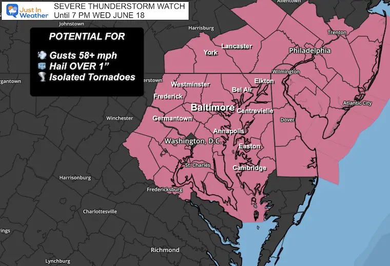
The warm air has finally broken through into Central Maryland, and the next wave of energy will tap into the high level of humidity in place. Dew points are in the mid-70s, which is very tropical and can result in torrential downpours. As a result, the National Weather Service has posted a Severe Thunderstorm Watch until 7 PM and a Flood Watch until 8 PM for the next round of thunderstorms.
This report will include the live radar and lightning widget to compare to the forecast simulation. Note that the risk for severe storms will increase tomorrow, Thursday. Then, we are set up for an intense heat wave beginning this weekend and lasting into next week.
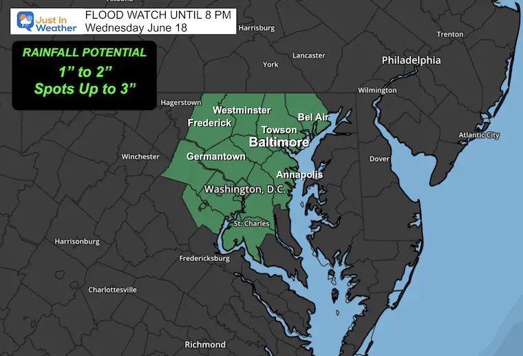
Flood Watch
- The counties of Central Maryland include metro Baltimore, Annapolis, and Washington.
- Rainfall is expected to be between 1 and 2 inches, with some spots receiving up to 3 inches due to slow-moving or repeating storm cells.
- This may overwhelm local waterways, so creeks and streams can overflow their banks.
UPDATED: SEVERE THUNDERSTORM WATCH UNTIL 7 PM
- A WATCH will be issued when there is a greater POTENTIAL for severe storms. This will list counties and cover a 4 to 6-hour time window.
- A WARNING will be issued when A STORM FORMS AND IS BEING TRACKED! This will list towns in the path and is usually a 45-minute window.
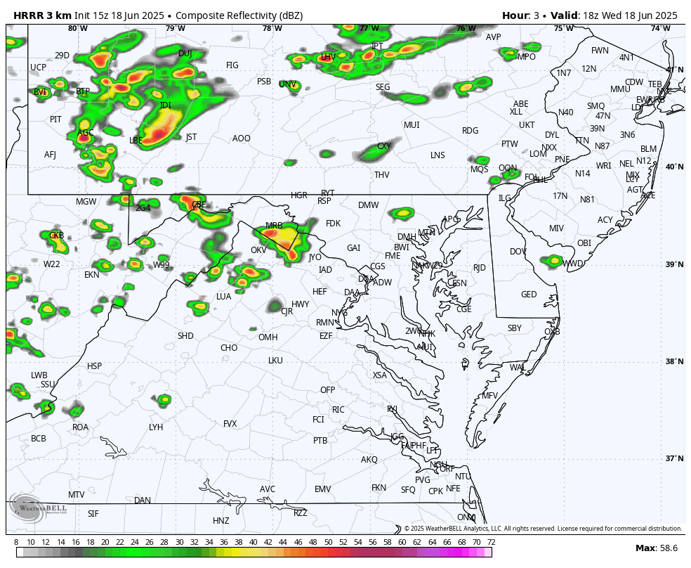
Doppler Radar Snapshot at 12:35 PM
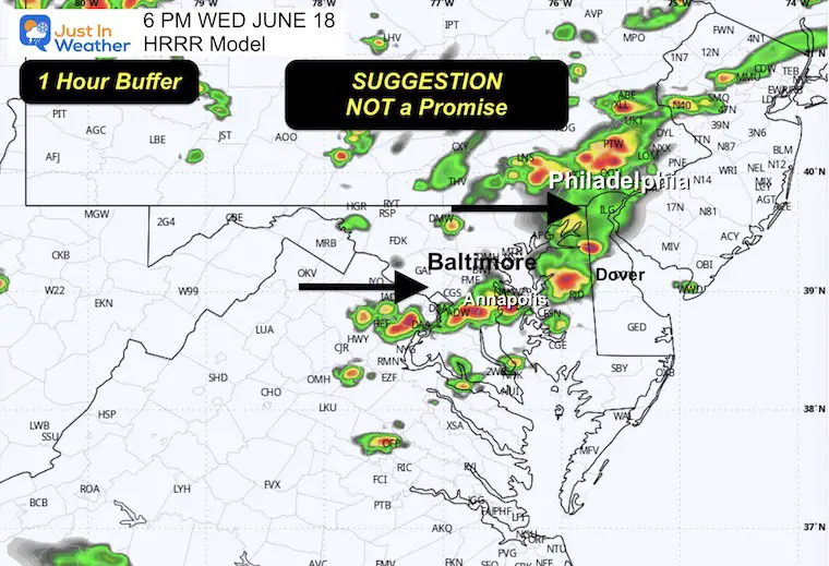
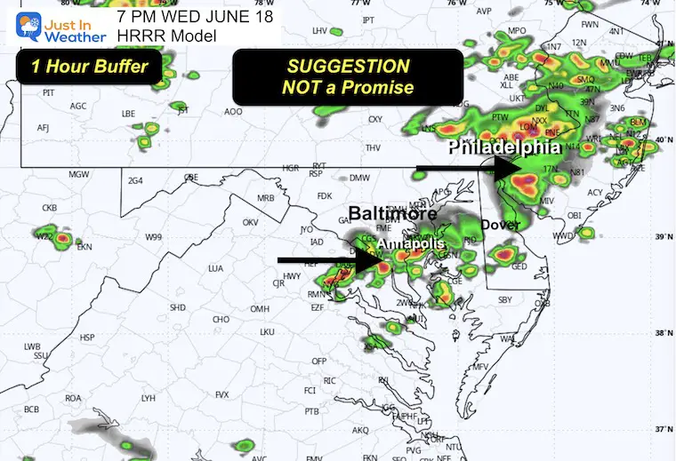
Storms are firing up early and may arrive up to one hour earlier than shown on the models below.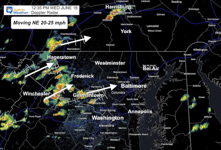
Live Radar and Lightning Widget
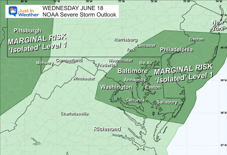
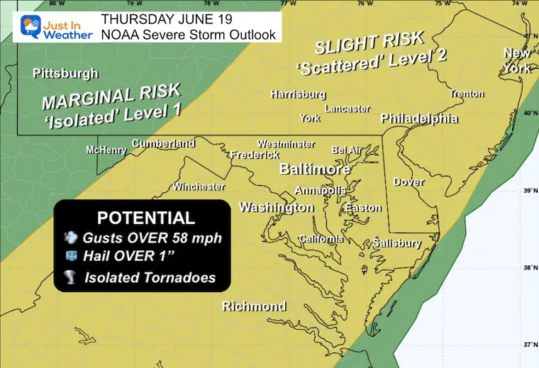
NOAA Severe Storm Outlook
Today
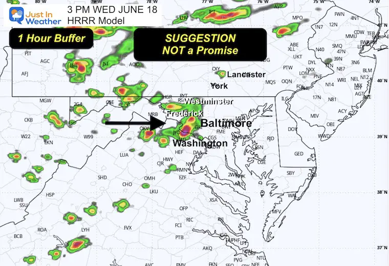
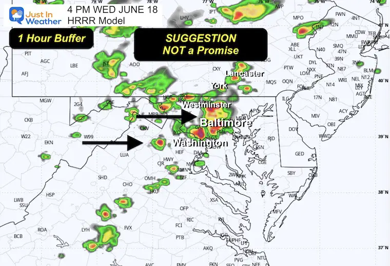
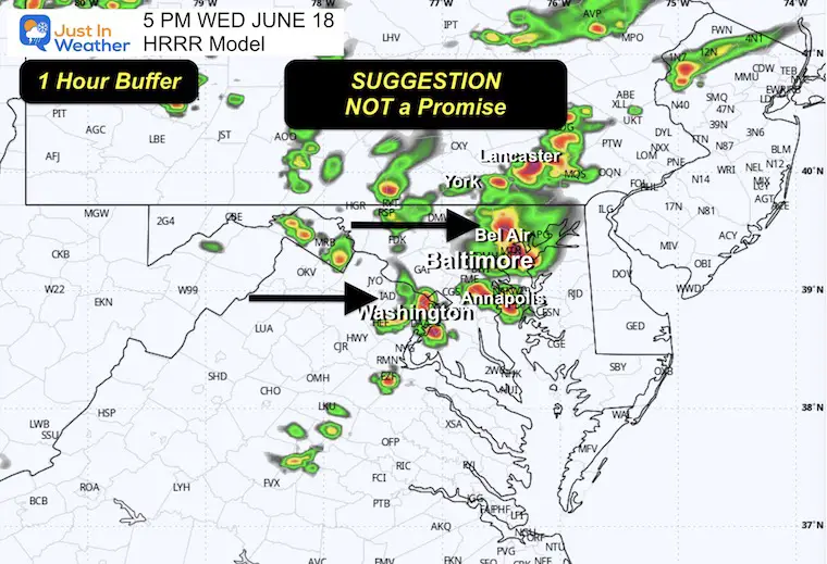
Radar Simulation 2 PM to 10 PM
Snapshots
3 PM
4 PM
5 PM
6 PM
7 PM
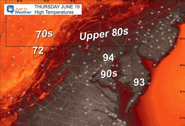
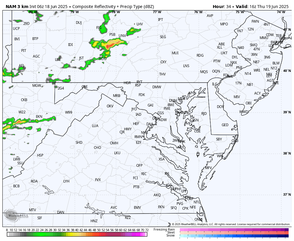
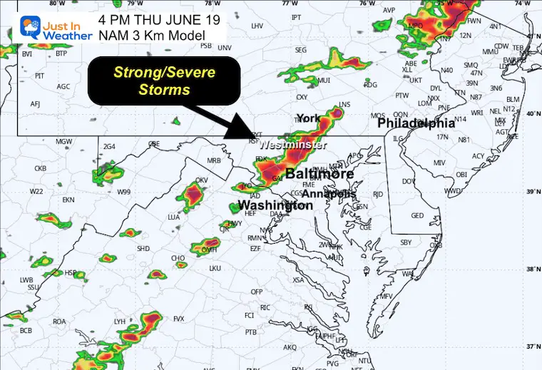
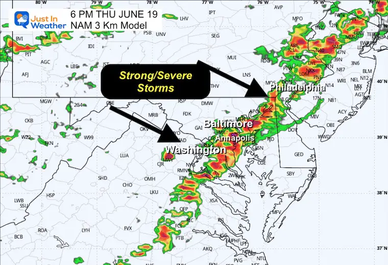
THURSDAY
NOAA SEVERE STORM OUTLOOK
A greater risk for storms that may produce damaging winds, large hail, and isolated tornadoes.
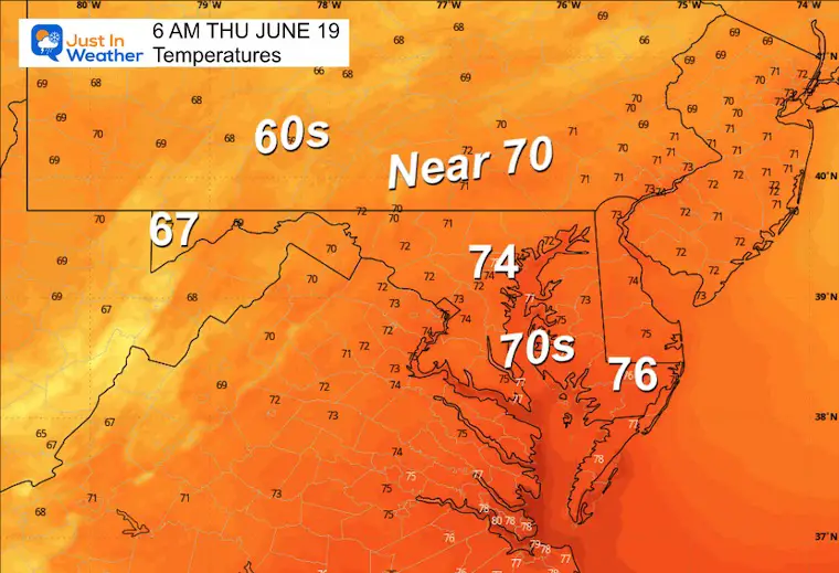
Morning Low Temperatures
Afternoon High Temperatures
Radar Simulation Noon to Midnight
A line of strong storms is expected, with numerous cells capable of producing damaging winds or more severe conditions.
SUGGESTED TIMELINE: NOT A PROMISE
4 PM Snapshot
6 PM Snapshot
LOOKING AHEAD
I posted this last night… Here is the look from the ECMWF Model. It is not the final word, but definitely pushing the worst of the heat!
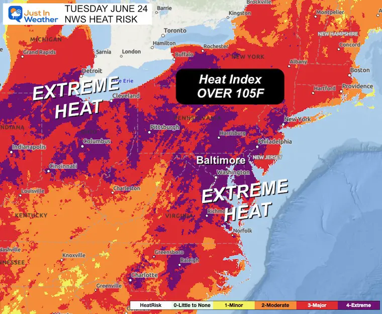
Tuesday Extreme Heat Risk
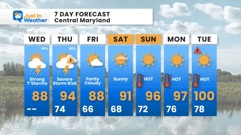
7 Day Forecast
- Severe Storm Risk Today And Thursday
- Weekend: Hot and Dry
- Next Week: Dangerous Heat
Subscribe for eMail Alerts
Please share your thoughts and best weather pics/videos, or just keep in touch via social media.
THANK YOU:
Baltimore Sun Magazine Readers Choice Best Of Baltimore
Maryland Trek 11 Day 7 Completed Sat August 10
We raised OVER $111,000 for Just In Power Kids – AND Still Collecting More
The annual event: Hiking and biking 329 miles in 7 days between The Summit of Wisp to Ocean City.
Each day, we honor a kid and their family’s cancer journey.
Fundraising is for Just In Power Kids: Funding Free Holistic Programs. I never have and never will take a penny. It is all for our nonprofit to operate.
Click here or the image to donate:

RESTATING MY MESSAGE ABOUT DYSLEXIA
I am aware there are some spelling and grammar typos and occasional other glitches. I take responsibility for my mistakes and even the computer glitches I may miss. I have made a few public statements over the years, but if you are new here, you may have missed it: I have dyslexia and found out during my second year at Cornell University. It didn’t stop me from getting my meteorology degree and being the first to get the AMS CBM in the Baltimore/Washington region. One of my professors told me that I had made it that far without knowing and to not let it be a crutch going forward. That was Mark Wysocki, and he was absolutely correct! I do miss my mistakes in my own proofreading. The autocorrect spell check on my computer sometimes does an injustice to make it worse. I also can make mistakes in forecasting. No one is perfect at predicting the future. All of the maps and information are accurate. The ‘wordy’ stuff can get sticky. There has been no editor who can check my work while writing and to have it ready to send out in a newsworthy timeline. Barbara Werner is a member of the web team that helps me maintain this site. She has taken it upon herself to edit typos when she is available. That could be AFTER you read this. I accept this and perhaps proves what you read is really from me… It’s part of my charm. #FITF


