


December 12 Weather Still Chilly And Focus On Snow Accumulation Early Sunday Morning
Friday Morning, December 12 This chapter of arctic air is about to peak this weekend as the second of the next two clippers will attempt to produce a burst of…
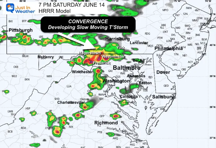
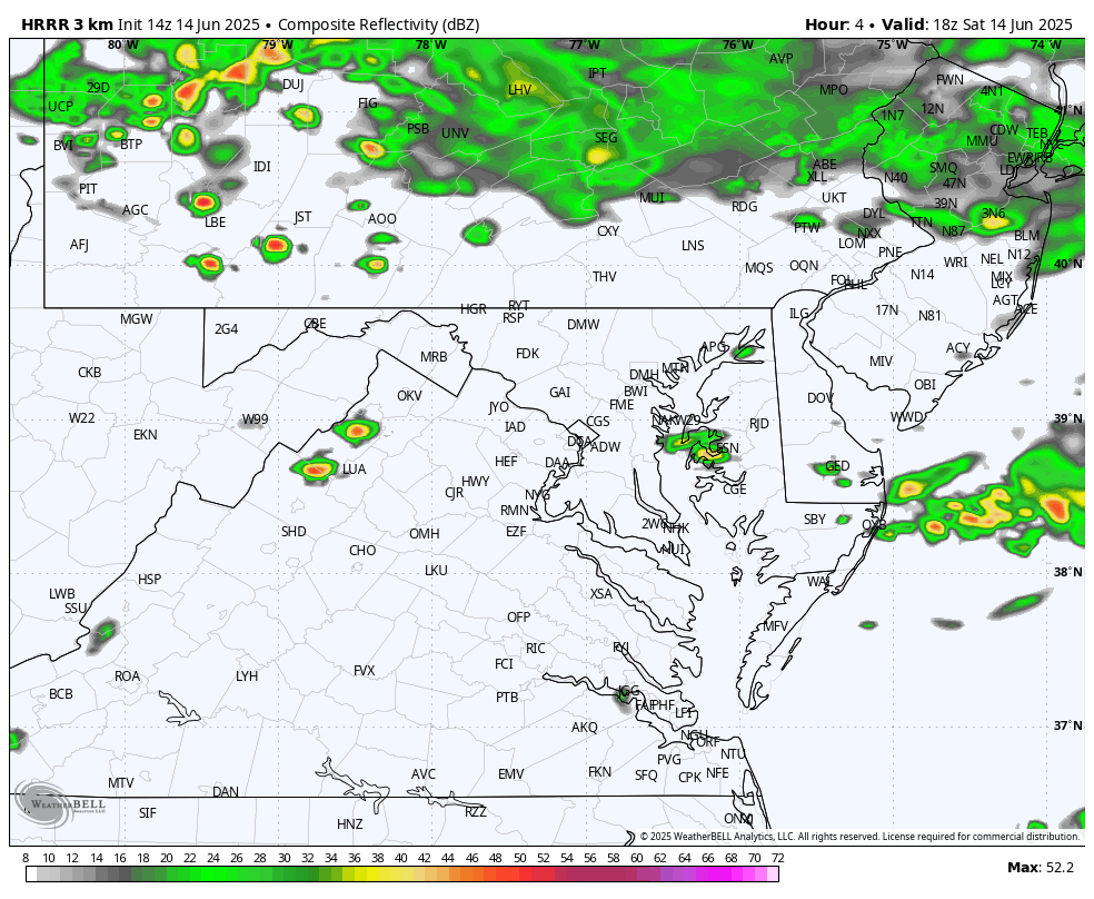
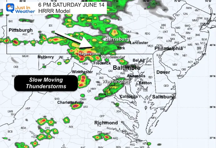
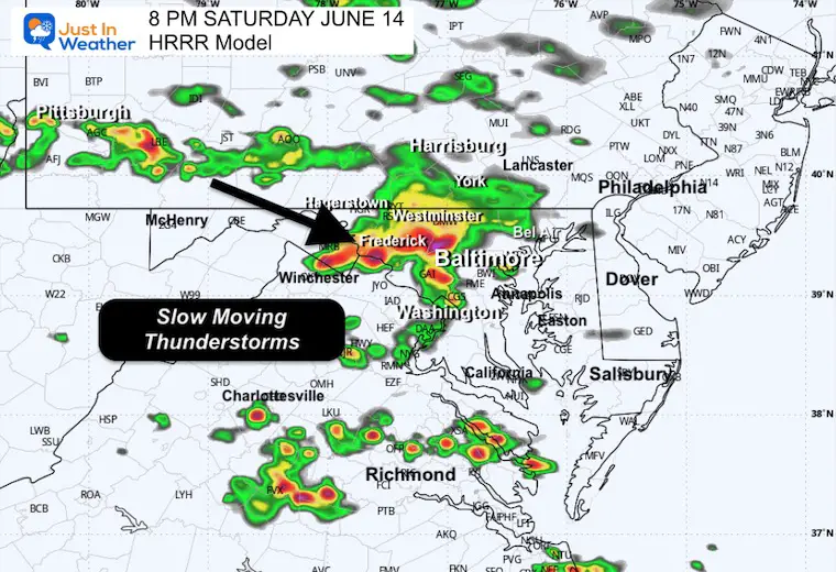
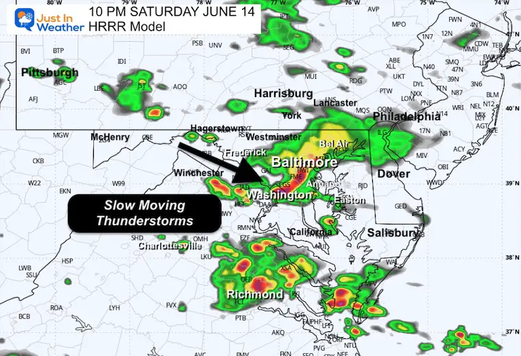
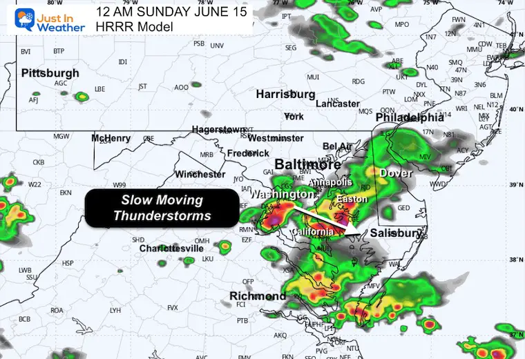
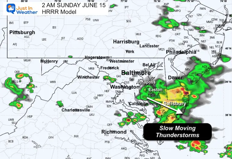
Saturday, June 14 Afternoon Update
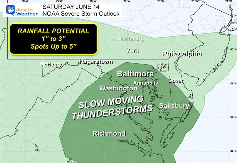
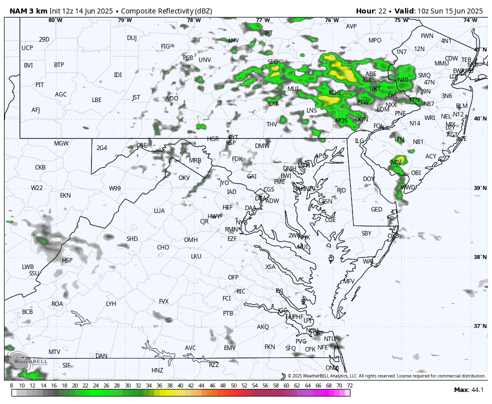
This is a similar setup to yesterday. A stationary frontal boundary is draped over north central Maryland with impulses of energy arriving from the west to team up with afternoon heating. There may once again be very little forcing aloft to allow developing thunderstorms to move VERY SLOWLY. This may keep storms over some areas for a few hours, resulting in rain totals between 1 and 3 inches. Some spots could reach up to 5 inches.
This report will include the live radar and lightning widget to compare to the forecast simulation.
The highlighted counties in Central Maryland are south and west of Baltimore. But like yesterday, we can see these cells carry farther east, so the rest of the metro area and Delmarva are also susceptible to flooding.
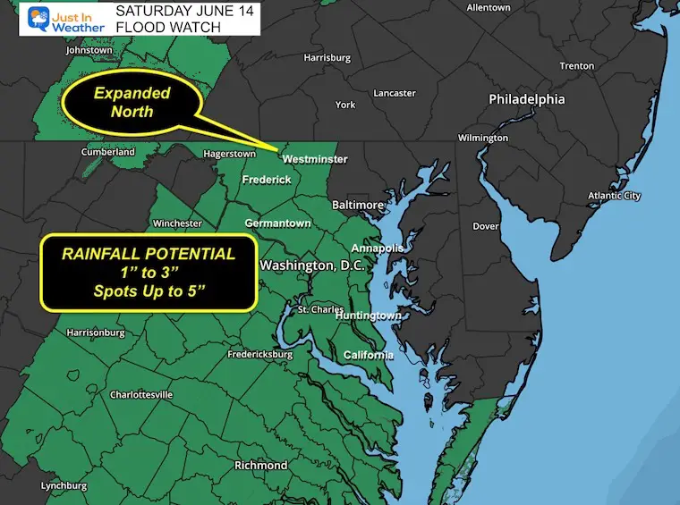
While some cells may reach levels of wind speeds to 60 mph, the main focus will be on the slow movement and local dumping of heavy rain between 1 and 3 inches. There may be spots up to 5 inches if there are larger cells that crawl through.
Alerts To Consider:
Winds are generally from the East. This has carried low-level smoke from a forest fire in New Jersey and layered parts of the region with noticeable smoke.
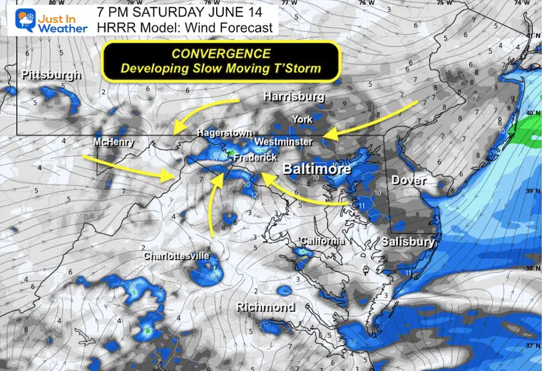
North to Northeast, where it is cooler. Southeast, where it is warm and humid.
This wind direction ENHANCES weather systems as it brings moisture in from the Atlantic and upslope to higher elevations inland. That means more rising air and taller clouds. As a result, showers and thunderstorms are forming and are more likely to expand through tonight. The slow movement can make them very heavy rain producers.
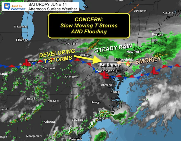
The wind convergence in that frontal boundary is where the storms are expected to be focused, and then move along. The movement will be slow.
A cluster of heavy rain will form along that boundary when the winds are merging together… When the cloud tops get higher, there should be a push to move the cells to the East/Southeast.
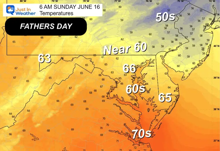
Cooler and more stable air will settle in. Temps will be lower, and while there will be some showers, the risk of heavy rain will be pushed farther south.
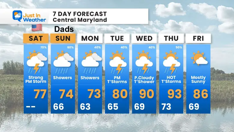
There will be a chance of showers or thunderstorms each day next week—NOT ALL-DAY WASHOUTS!
Sign up and be the first to know!
The annual event: Hiking and biking 329 miles in 7 days between The Summit of Wisp to Ocean City.
Each day, we honor a kid and their family’s cancer journey.
Fundraising is for Just In Power Kids: Funding Free Holistic Programs. I never have and never will take a penny. It is all for our nonprofit to operate.
Click here or the image to donate:

I am aware there are some spelling and grammar typos and occasional other glitches. I take responsibility for my mistakes and even the computer glitches I may miss. I have made a few public statements over the years, but if you are new here, you may have missed it: I have dyslexia and found out during my second year at Cornell University. It didn’t stop me from getting my meteorology degree and being the first to get the AMS CBM in the Baltimore/Washington region. One of my professors told me that I had made it that far without knowing and to not let it be a crutch going forward. That was Mark Wysocki, and he was absolutely correct! I do miss my mistakes in my own proofreading. The autocorrect spell check on my computer sometimes does an injustice to make it worse. I also can make mistakes in forecasting. No one is perfect at predicting the future. All of the maps and information are accurate. The ‘wordy’ stuff can get sticky. There has been no editor who can check my work while writing and to have it ready to send out in a newsworthy timeline. Barbara Werner is a member of the web team that helps me maintain this site. She has taken it upon herself to edit typos when she is available. That could be AFTER you read this. I accept this and perhaps proves what you read is really from me… It’s part of my charm. #FITF