June 8, 2025
Sunday Afternoon Update
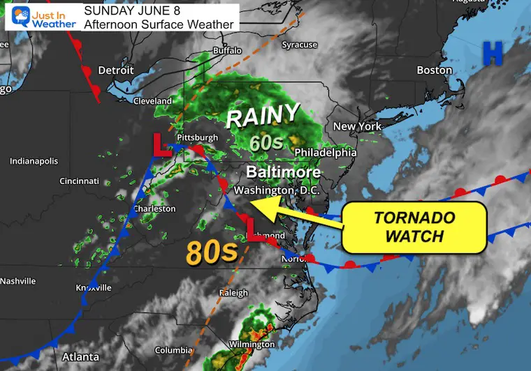
The expectation for weather to turn severe this afternoon and evening has turned up a notch. A frontal boundary draped between Maryland and Virginia will be the focus for developing thunderstorms that may ramp up to supercell intensity. There is enough wind shear (change in direction with height) to lead to rotation and possible tornadoes.
This report will include a live radar and lightning widget as well as the updated High Resolution Rapid Refresh Model timeline suggestion for how this may play out.
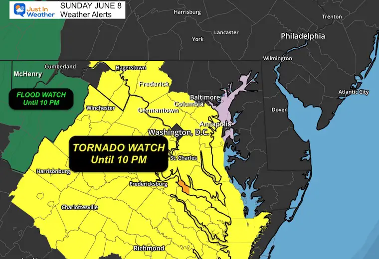
Tornado Watch
- Maryland: Counties WEST AND SOUTH of Baltimore. This includes Frederick, Washington, and Annapolis.
- Virginia: Most of the state along I-81 through Richmond.
This means that these storms are possible, NOT promised.
Storms may also contain winds over 60 mph and large hail over 1” in diameter.
If a severe storm or tornado is identified, a WARNING will be issued with specific towns in the path and a 45-minute time window.
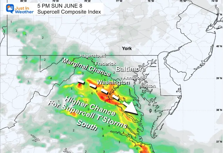
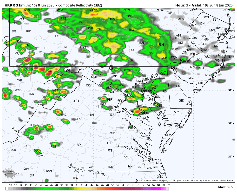
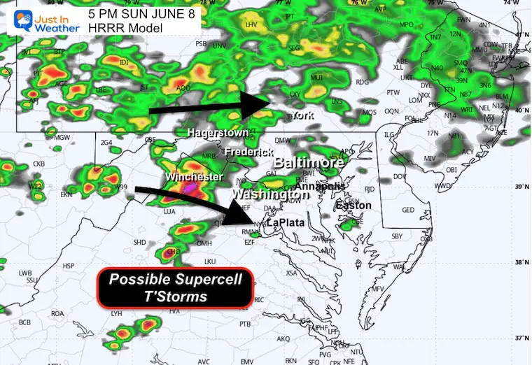
Late Afternoon Break Down at 5 PM
Supercell Composite Index
This matches the same area under the Tornado Watch.
Wind Forecast
The frontal boundary can be seen, and cooler winds to the north keep Delmarva and Northeast Maryland more stable.
The strongest storms will have high energy in the southerly winds flowing into the boundary across Virginia and the Potomac.

Live Radar and Lightning Widget
Set Up: Surface Weather Sunday Afternoon
Low Pressure in Southeast Virginia is flanked by the primary Low in Eastern Ohio. The system is moving east, and the rain is mainly moving to the East/Northeast as well.
The stationary boundary will help direct the wind convergence and supercells to ride along and southeastward.
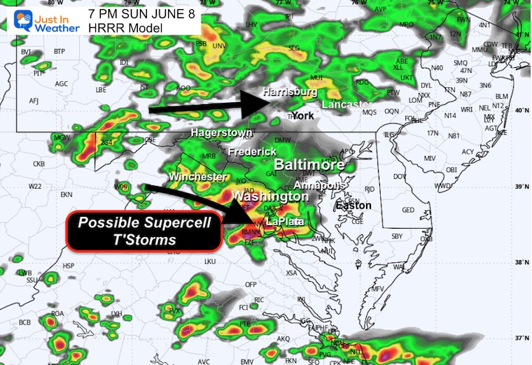
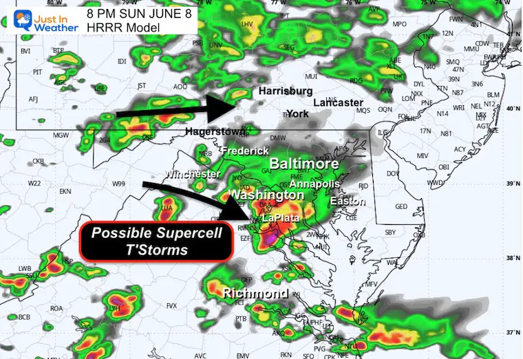
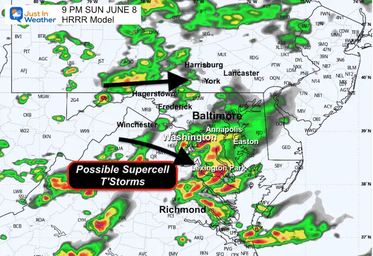
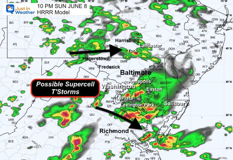
Radar Simulation: HRRR Model 3 PM to Midnight
This is a suggestion, not exact! See the hourly snapshots below.
Lightning Forecast 3 PM to Midnight
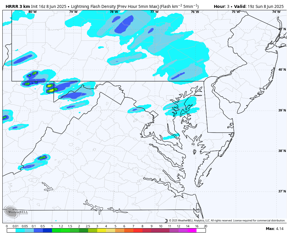
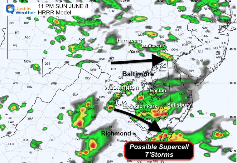
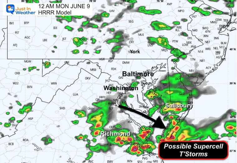
Timeline Snapshots
5 PM
7 PM
8 PM
9 PM
10 PM
11 PM
Midnight
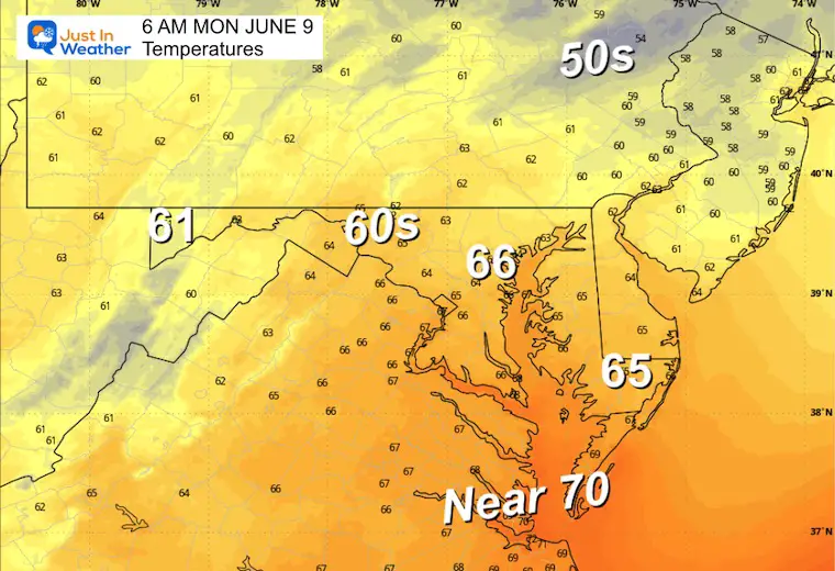
MONDAY
Morning Low Temps
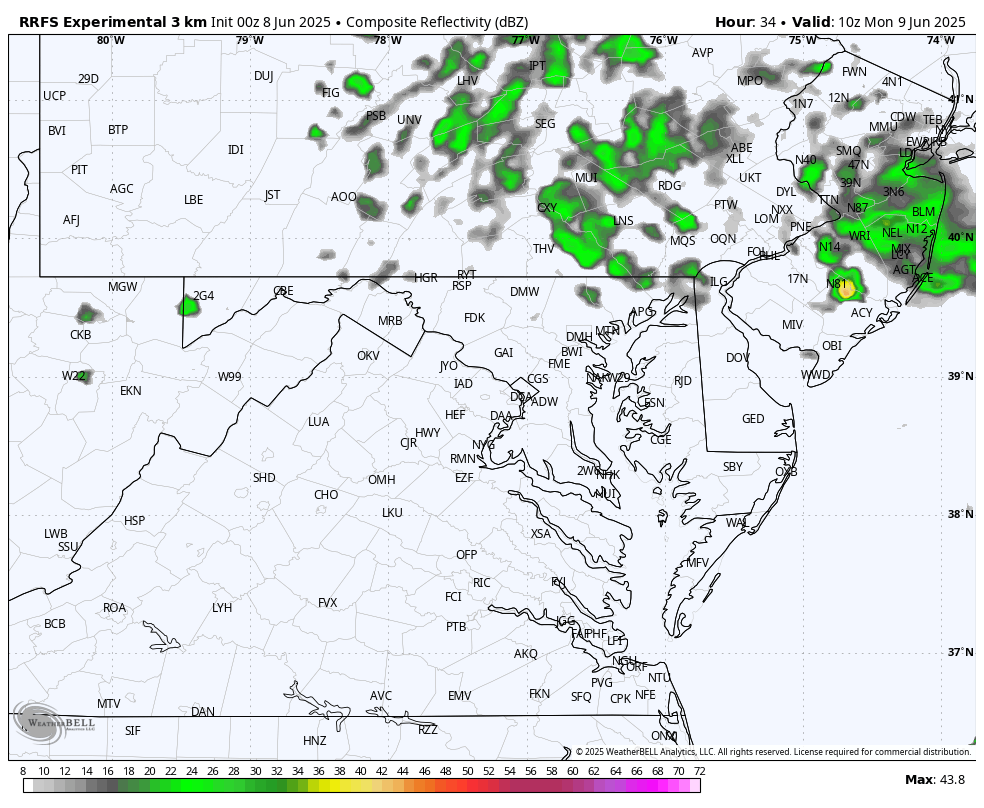
Radar Simulation 6 AM to Midnight
Only scattered showers expected, but plenty of clouds and temps remaining below average.
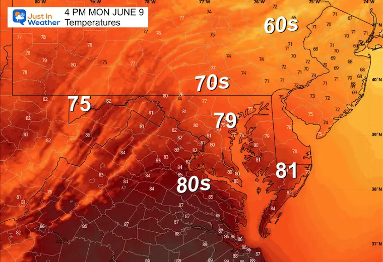
Afternoon Temperatures
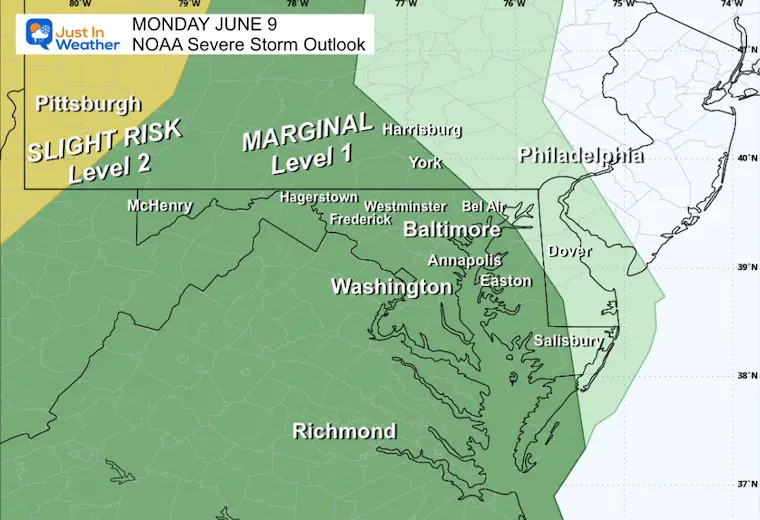
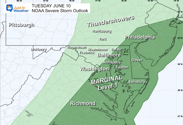
NOAA Severe Storm Risk
Monday
Tuesday
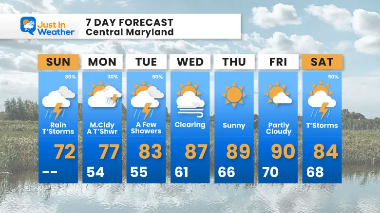
7 Day Forecast
- Sunday: More Rain and Stronger Storms
- Monday: Mostly Cloudy… only a chance of a shower
- Tuesday: Chance For Storms Again
THEN…
Clearing and Summer Heat Settles In
Subscribe for eMail Alerts
Please share your thoughts and best weather pics/videos, or just keep in touch via social media.
THANK YOU:
Baltimore Magazine Readers Choice Best Of Baltimore
Maryland Trek 11 Day 7 Completed Sat August 10
We raised OVER $111,000 for Just In Power Kids – AND Still Collecting More
The annual event: Hiking and biking 329 miles in 7 days between The Summit of Wisp to Ocean City.
Each day, we honor a kid and their family’s cancer journey.
Fundraising is for Just In Power Kids: Funding Free Holistic Programs. I never have and never will take a penny. It is all for our nonprofit to operate.
Click here or the image to donate:

RESTATING MY MESSAGE ABOUT DYSLEXIA
I am aware there are some spelling and grammar typos and occasional other glitches. I take responsibility for my mistakes and even the computer glitches I may miss. I have made a few public statements over the years, but if you are new here, you may have missed it: I have dyslexia and found out during my second year at Cornell University. It didn’t stop me from getting my meteorology degree and being the first to get the AMS CBM in the Baltimore/Washington region. One of my professors told me that I had made it that far without knowing and to not let it be a crutch going forward. That was Mark Wysocki, and he was absolutely correct! I do miss my mistakes in my own proofreading. The autocorrect spell check on my computer sometimes does an injustice to make it worse. I also can make mistakes in forecasting. No one is perfect at predicting the future. All of the maps and information are accurate. The ‘wordy’ stuff can get sticky. There has been no editor who can check my work while writing and to have it ready to send out in a newsworthy timeline. Barbara Werner is a member of the web team that helps me maintain this site. She has taken it upon herself to edit typos when she is available. That could be AFTER you read this. I accept this and perhaps proves what you read is really from me… It’s part of my charm. #FITF
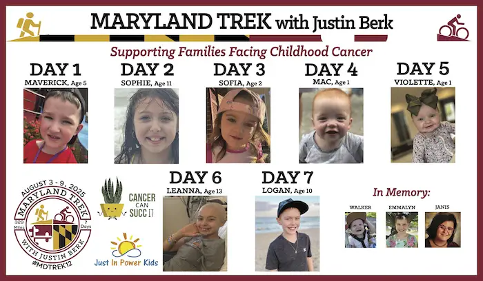
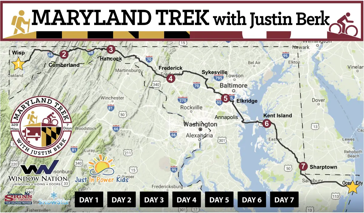
Maryland Trek 12 August 3 to 9
This is an annual event: Hiking and biking 329 miles in 7 days between the Summit of Wisp to Ocean City.
Here are the kids we will be honoring each day as we cross Maryland.
Our full week team is set. We have our Day 4 all-bike ride open for registration.