


Snow Report And Grade My Forecast December 14
Sunday December 14 2025 Our second true snow maker of the season left a big mark across Central Maryland to Southeast Pennsylvania as expected. I advertised an over achiever Near…
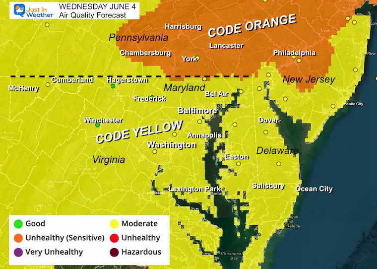
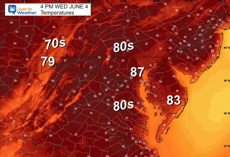
Wednesday June 4 2025
There is still a haze in the sky, but not as thick as yesterday. So the sun views may not be as vivid. Unfortunately the smoke particles will be lower in the atmosphere today and there is concern for poor air quality.
This was the scene I captured in Southern Pennsylvania yesterday.
The particles of ash from the Canadian Wildfires will be lower in the atmosphere. You may smell smoke in Southern Pennsylvania and Northern Maryland.
Air Quality Forecast
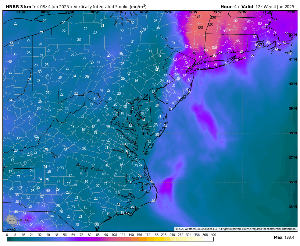
HRRR Model 8 AM to 8 PM
We still have haze from the wildfire smoke, but not nearly as thick as yesterday.
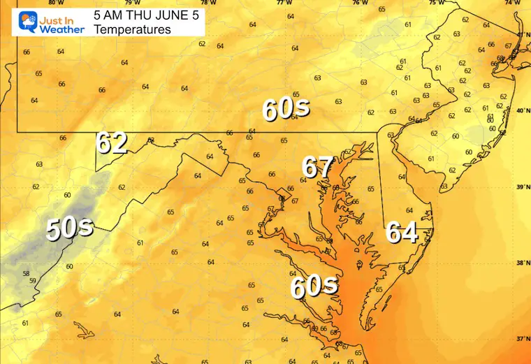
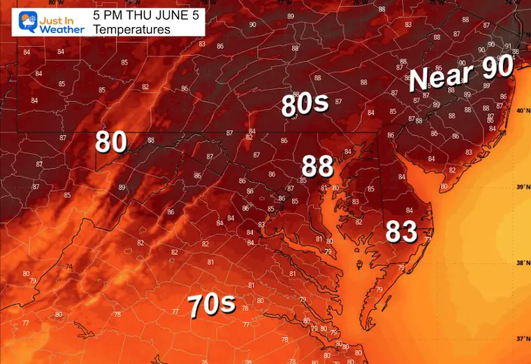
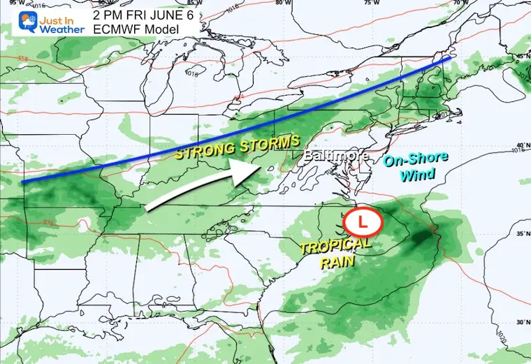
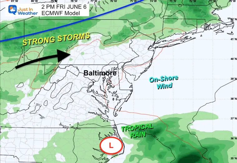
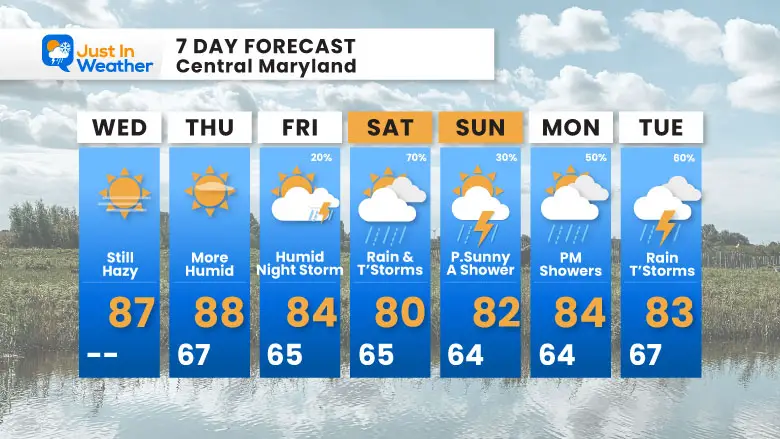
Summer heat will finally arrive, but temps may stay below the 90°F mark now. The next weather system will bring in late day showers on Friday… more likely to reach metro areas at night.
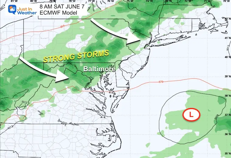
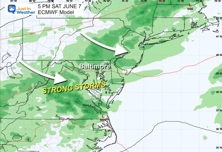
Saturday looks more soggy, as this front will take all day to cross the region. The next wet day looks like Monday, as Low Pressure will pass through, a bit like our last event.
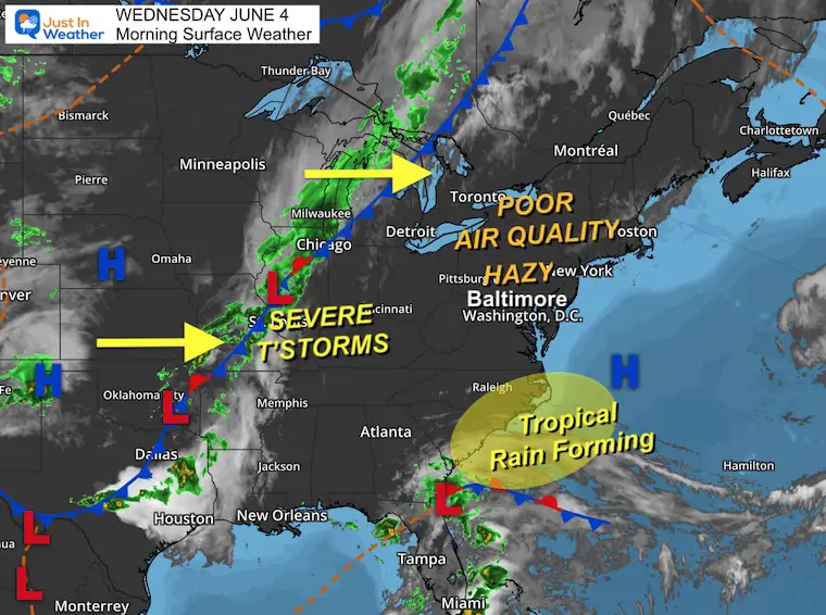
High Pressure is off the East Coast, but there is an area of concern along the Carolinas that will bring tropical rain. This has a low 10% chance to develop, but it will help mix up the air AND affect our weather into the weekend.
Sunrise at 5:41 AM
Sunset at 8:29 PM
Normal Low in Baltimore: 59ºF
Record 46ºF in 1964; 2019
Normal High in Baltimore: 81ºF
Record 96ºF 1925; 1930
Rainfall Deficit at BWI
Subscribe for eMail Alerts
Sign up and be the first to know!
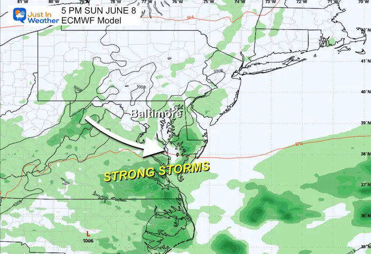
As we watch that tropical-like coastal Low off the Carolinas, it will slow down the cold front approaching from the West.
Saturday looks wet with rain or storms at any time.
Sunday still has some showers…
Monday and Tuesday will bring more rain.
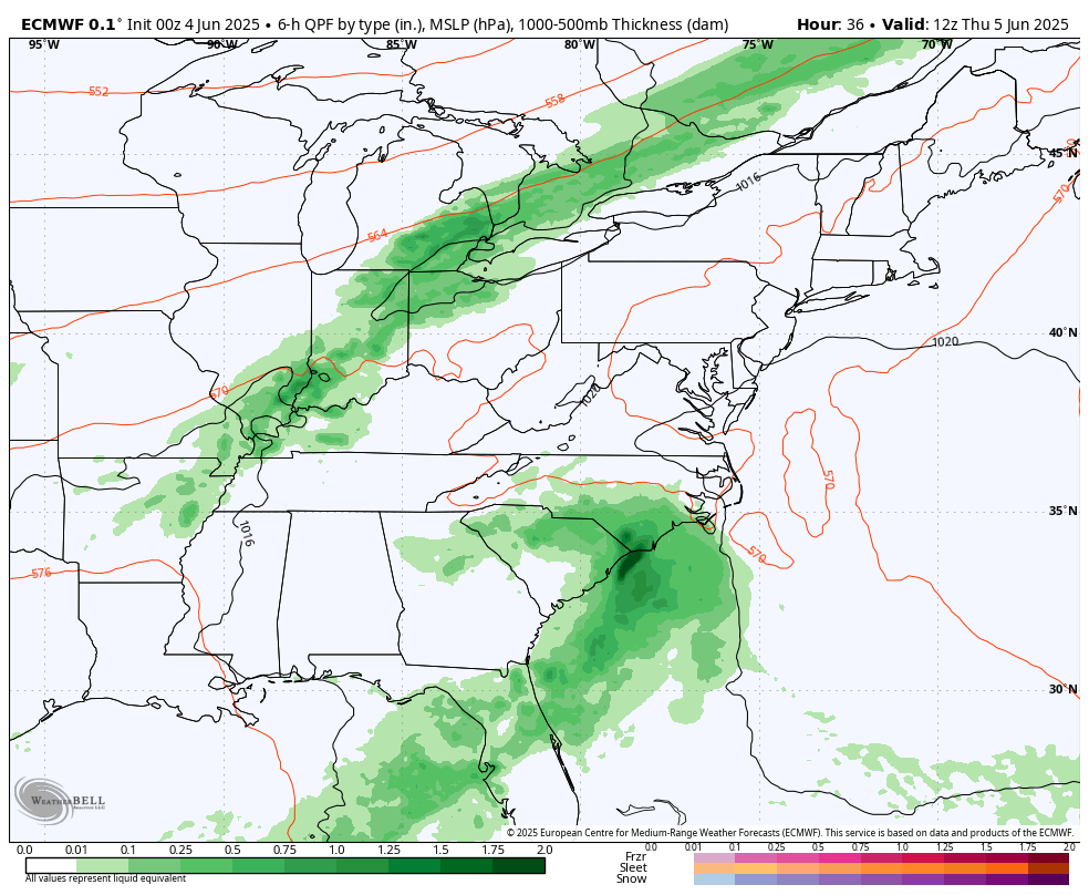
The cold front will be to our west and tropical-like rain along the North Carolina coast.
Sign up and be the first to know!
The annual event: Hiking and biking 329 miles in 7 days between The Summit of Wisp to Ocean City.
Each day, we honor a kid and their family’s cancer journey.
Fundraising is for Just In Power Kids: Funding Free Holistic Programs. I never have and never will take a penny. It is all for our nonprofit to operate.
Click here or the image to donate:

I am aware there are some spelling and grammar typos and occasional other glitches. I take responsibility for my mistakes and even the computer glitches I may miss. I have made a few public statements over the years, but if you are new here, you may have missed it: I have dyslexia and found out during my second year at Cornell University. It didn’t stop me from getting my meteorology degree and being the first to get the AMS CBM in the Baltimore/Washington region. One of my professors told me that I had made it that far without knowing and to not let it be a crutch going forward. That was Mark Wysocki, and he was absolutely correct! I do miss my mistakes in my own proofreading. The autocorrect spell check on my computer sometimes does an injustice to make it worse. I also can make mistakes in forecasting. No one is perfect at predicting the future. All of the maps and information are accurate. The ‘wordy’ stuff can get sticky. There has been no editor who can check my work while writing and to have it ready to send out in a newsworthy timeline. Barbara Werner is a member of the web team that helps me maintain this site. She has taken it upon herself to edit typos when she is available. That could be AFTER you read this. I accept this and perhaps proves what you read is really from me… It’s part of my charm. #FITF