Friday Afternoon Update
Another potential force of energy in this cool weather pattern will swing through and ignite heavy rain across our region. With the sun finally breaking out and a hint of humidity in the air, this is allowing additional energy to feed into the line of storms that will swing our way this evening.
In anticipation of the storms, The Baltimore Orioles moved up the start time of their evening game to 4:30 PM.
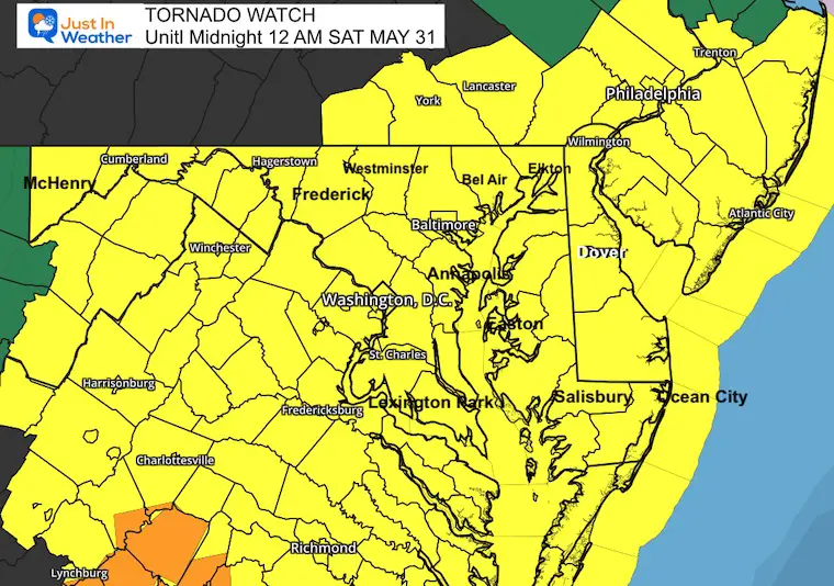
A Tornado Watch is in effect for most of our region through Midnight. Wind Sheer aloft will allow for storm cells to rotate. These can produce tornadoes and also straight line wind damage plus large hail!
7 PM Friday is the start of the Flood Watch as this will be when we watch for the flare up of storms entering the metro areas. This will continue for a few hours.
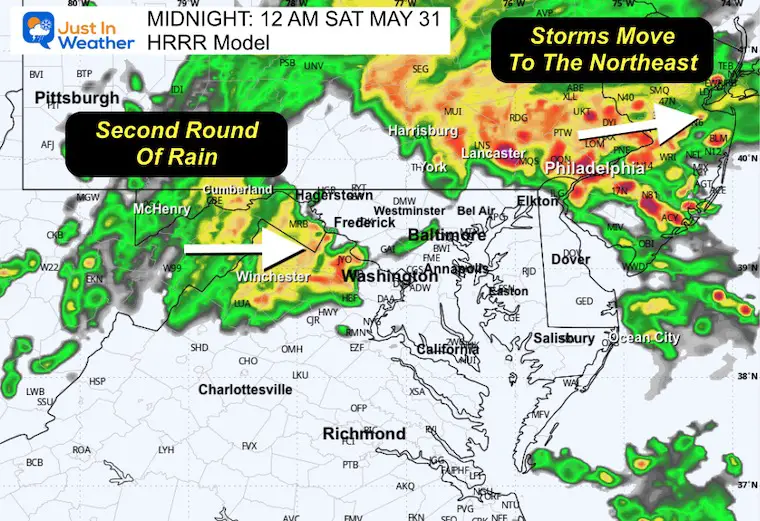
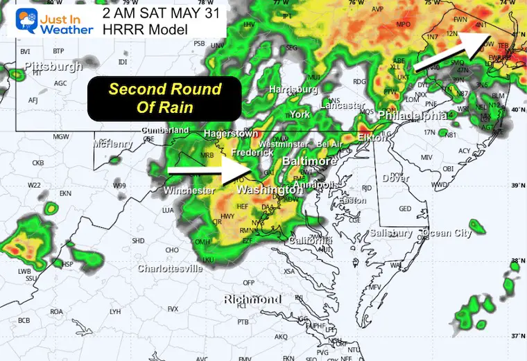
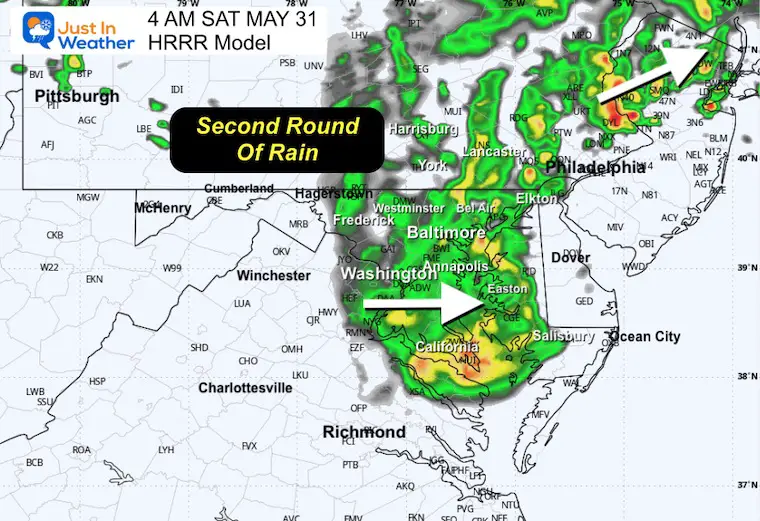
Low Pressure associated with this event will bring a second round of rain overnight, and should be gone by daybreak.
Alerts To Consider:
A WATCH will be issued when there is a greater POTENTIAL for severe storms. This will list counties and cover a 4 to 6 hours time window.
A WARNING will be issued when A STORM FORMS AND IS BEING TRACKED! This will list towns in the path and usually a 45 minute window.
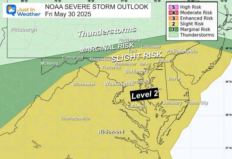
NOAA Severe Storm Risk
- Severe Storm ‘Slight’ Risk Level 2:
- This is for the potential, NOT a promise.
- Severe Storms May Contain: Wind Gusts Over 58 mph, Large Hail Over 1″ diameter (size of a quarter), Isolated Tornadoes
INCREASED Tornado Risk
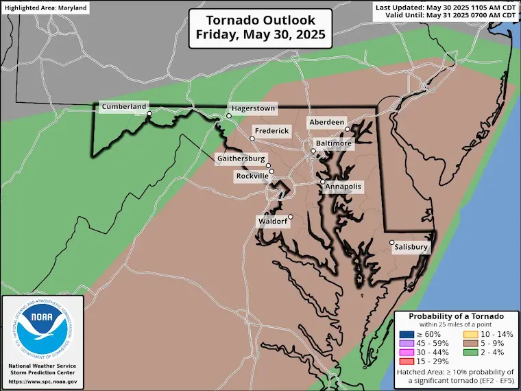
TORNADO and FLOOD WATCH
The Tornado Watch is for the leading line of storms that will swing through metro areas this evening.
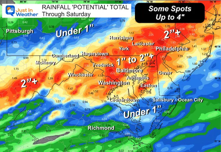
Expected NEW rainfall of 1 to 2 inches with some slow moving cells over repeating areas could reach between 3 and 4 inches.
Rainfall ‘POTENTIAL’ Total Through Saturday
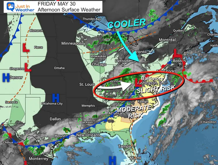
Afternoon Surface Weather
Low Pressure is crossing the mountains of West Virginia and Virginia. This will be responsible for the line of strong to severe thunderstorms that develop mid afternoon and evening, plus the second round of heavy rain overnight.
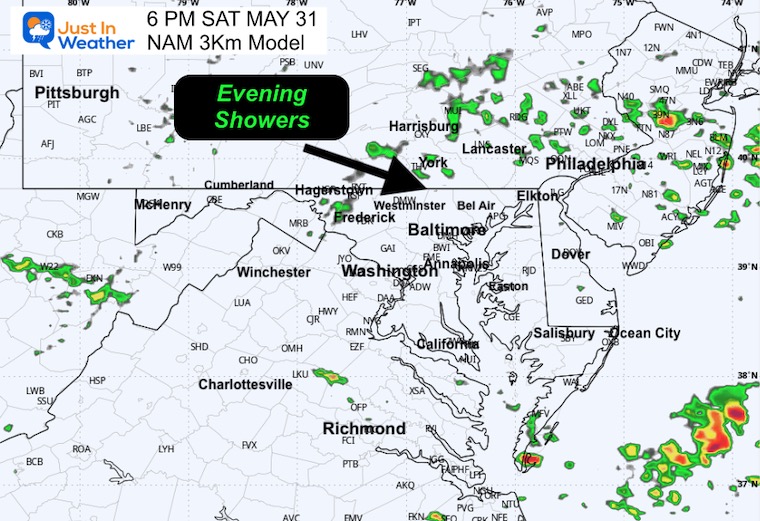
The final push of cooler air is with a cold front along the Great Lakes and arrive from Canada with additional showers Saturday afternoon.
Live Radar Widget
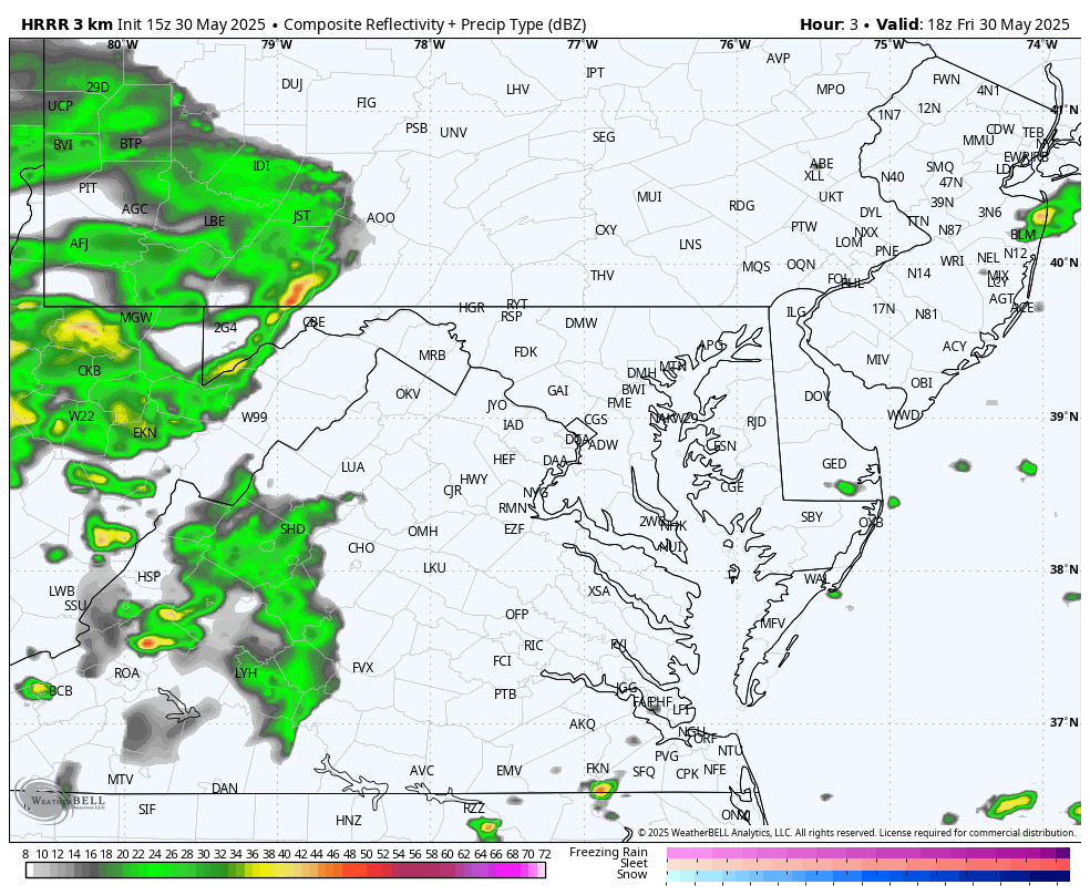
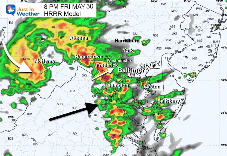
Radar Simulation 2 PM Fri to 4 AM Saturday
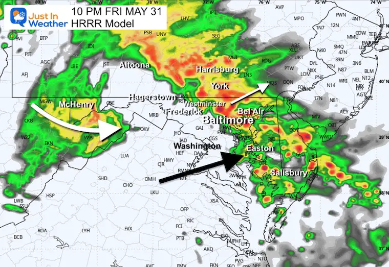
Isolated showers will pop up after 4 PM. Widespread thunderstorms will develop and cross metro areas this evening and tonight. A lull is expected in the big cities for a couple of hours, then another push of heavy rain after midnight.
Snapshots
8 PM
9 PM
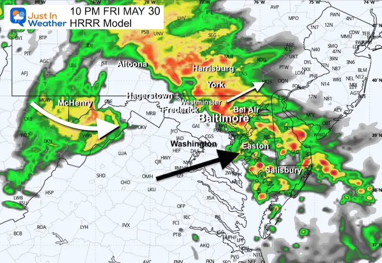
10 PM
Midnight
2 AM
4 AM
SATURDAY WEATHER
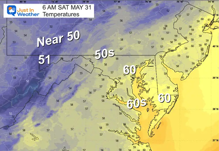
Morning Low Temperatures
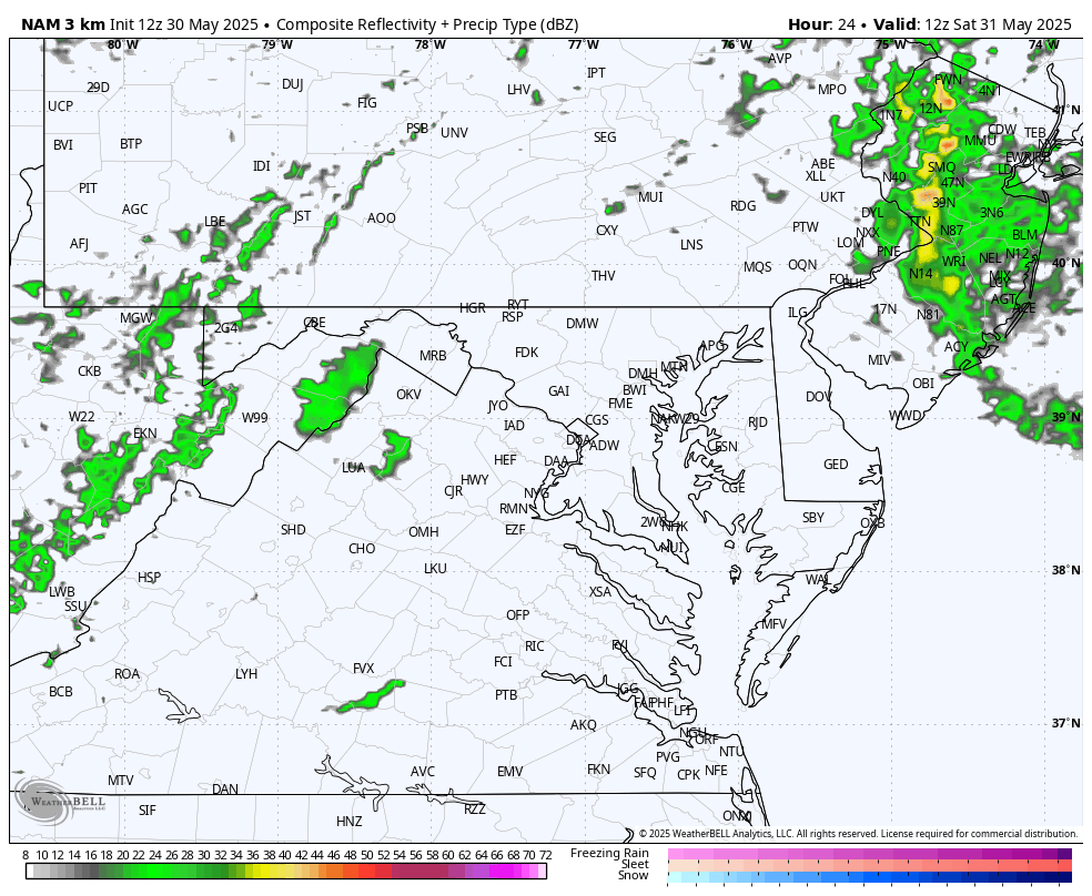
Radar Simulation 8 AM to 8 PM
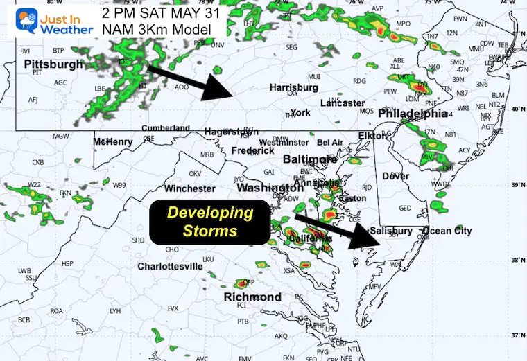
The push of thunderstorms will be mid-afternoon from south central Maryland to the beaches. Additional showers will develop in the Pennsylvania mountains mid-afternoon and slide near the Maryland line late afternoon and evening.
2 PM
4 PM
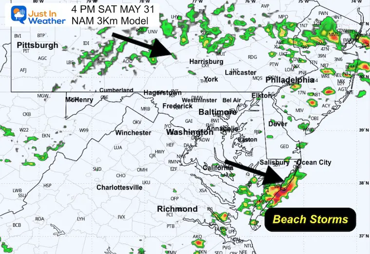
6 PM
LOOKING AHEAD
Jet Stream: Saturday Afternoon to Thursday Afternoon

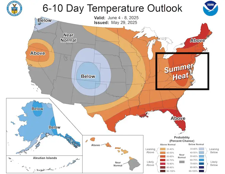
NOAA Temperature Outlook
Days 6 to 10
Summer heat is expected to show up by the middle of NEXT WEEK.
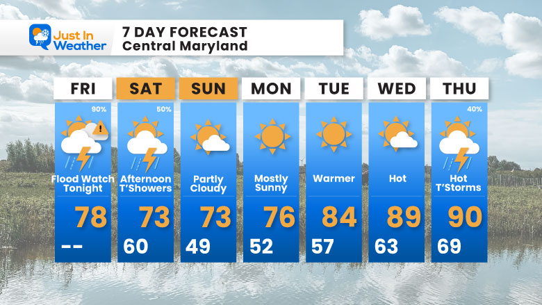
7 Day Forecast
- Flood Watch: Thunderstorms and Heavy Rain Tonight
- Saturday: Afternoon Showers Pushed South
- Sunday: Sunny and Still Slightly Cooler Than Average
- Summer Heat For The Middle Of Next Week
Subscribe for eMail Alerts
Please share your thoughts and best weather pics/videos, or just keep in touch via social media.
SCHEDULE A WEATHER BASED STEM ASSEMBLY
Severe Weather: Storm Smart October and next spring Winter Weather FITF (Faith in the Flakes): November To March Click to see more and send a request for your school.

THANK YOU:
Baltimore Magazine Readers Choice Best Of Baltimore
Maryland Trek 11 Day 7 Completed Sat August 10
We raised OVER $111,000 for Just In Power Kids – AND Still Collecting More
The annual event: Hiking and biking 329 miles in 7 days between The Summit of Wisp to Ocean City.
Each day, we honor a kid and their family’s cancer journey.
Fundraising is for Just In Power Kids: Funding Free Holistic Programs. I never have and never will take a penny. It is all for our nonprofit to operate.
Click here or the image to donate:

RESTATING MY MESSAGE ABOUT DYSLEXIA
I am aware there are some spelling and grammar typos and occasional other glitches. I take responsibility for my mistakes and even the computer glitches I may miss. I have made a few public statements over the years, but if you are new here, you may have missed it: I have dyslexia and found out during my second year at Cornell University. It didn’t stop me from getting my meteorology degree and being the first to get the AMS CBM in the Baltimore/Washington region. One of my professors told me that I had made it that far without knowing and to not let it be a crutch going forward. That was Mark Wysocki, and he was absolutely correct! I do miss my mistakes in my own proofreading. The autocorrect spell check on my computer sometimes does an injustice to make it worse. I also can make mistakes in forecasting. No one is perfect at predicting the future. All of the maps and information are accurate. The ‘wordy’ stuff can get sticky. There has been no editor who can check my work while writing and to have it ready to send out in a newsworthy timeline. Barbara Werner is a member of the web team that helps me maintain this site. She has taken it upon herself to edit typos when she is available. That could be AFTER you read this. I accept this and perhaps proves what you read is really from me… It’s part of my charm. #FITF


