


December 12 Weather Still Chilly And Focus On Snow Accumulation Early Sunday Morning
Friday Morning, December 12 This chapter of arctic air is about to peak this weekend as the second of the next two clippers will attempt to produce a burst of…
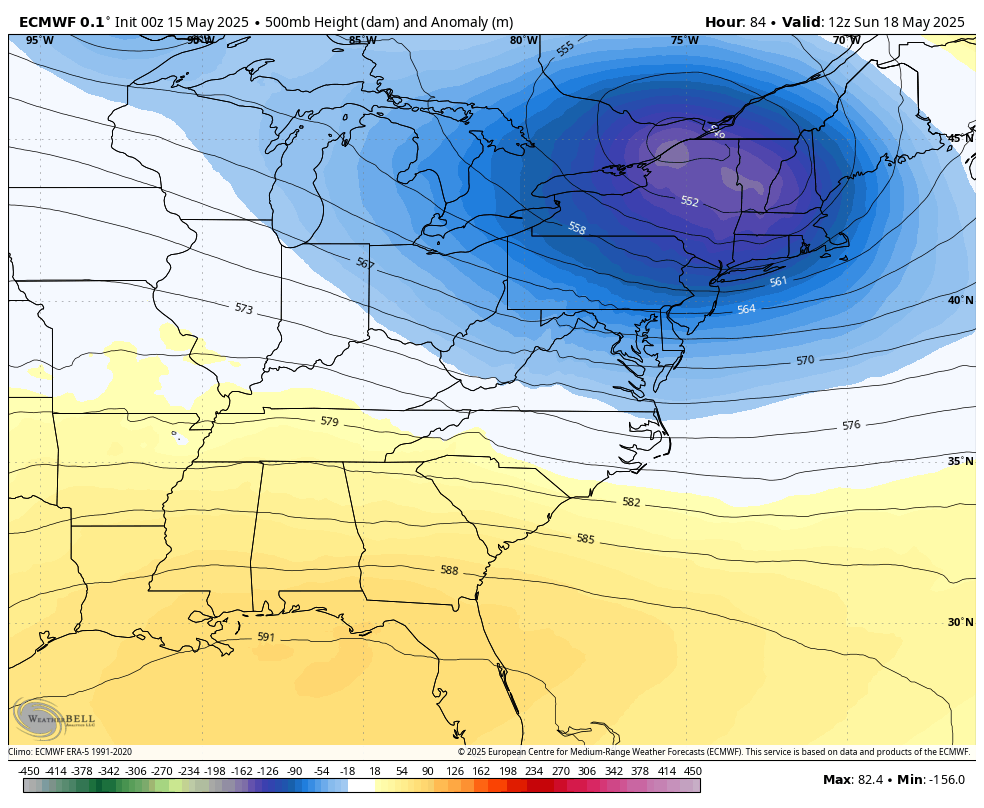
Thursday, May 15, 2025
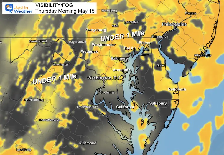
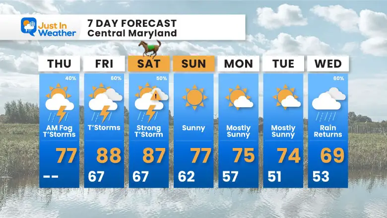
With recent rainfall, soggy ground, and areas of drizzle, we have thick fog that has developed, which may slow down travel this morning. It also keeps the same setup with the unstable atmosphere that may produce more strong thunderstorms with heavy downpours.
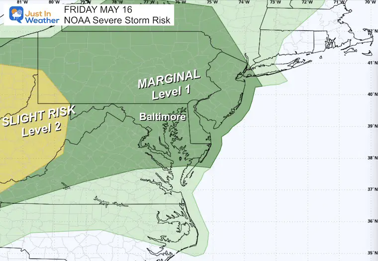
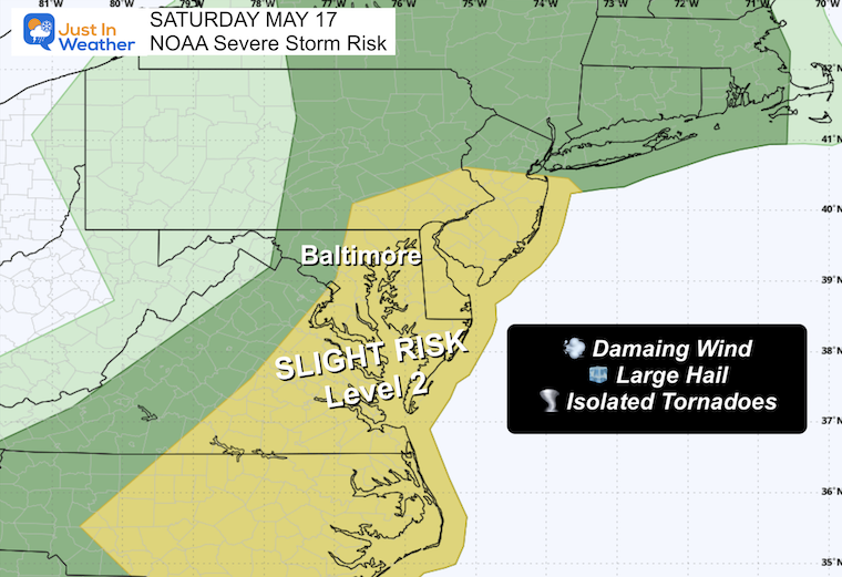
The pattern will remain, with the risk of storms turning severe this afternoon and evening. Storms are more likely to develop in our region on Friday and Saturday. At this time, the Preakness may have some rain to deal with, but timing could work out to be clear for the premier race.
Next week will turn cooler, and we will remain in that cool pattern for much of the rest of this month.
Area of dense fog with visibility under 1 mile.
Following the record rainfall on Tuesday, yesterday brought 0.66 inches of rain to BWI. This has helped make a dent in our deficit, but it is important to note that some heavy rain runs off instead of soaking into the ground. We also had a deficit of 8 inches last year to catch up with.
A new Drought Monitor map will be released today… I do suspect there will be a downgrade to the concern..
Rainfall Deficit at BWI
Sunrise at 5:53 AM
Sunset at 8:13 PM
Normal Low in Baltimore: 53ºF
Record 41ºF in 1984
Normal High in Baltimore: 75ºF
Record 96ºF 1962
Subscribe for eMail Alerts
Sign up and be the first to know!
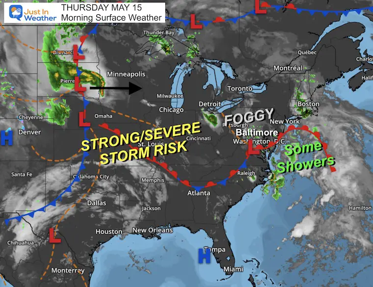
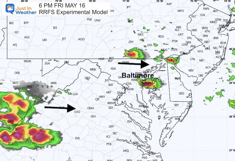
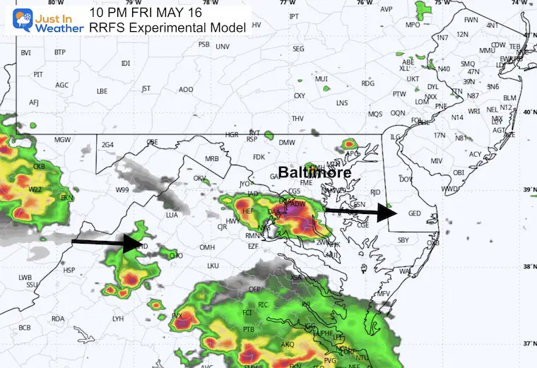
Low Pressure and the unstable setup over the Mid-Atlantic will help another round of thunderstorms develop today. The focus may be mid-afternoon through tonight, and the flow will be from South to North, which could pulse over the same areas with multiple storms.
A chance for showers and thunderstorms to pulse, especially in the afternoons. A steady rain may fall in some areas on Saturday, then clear out on Sunday.
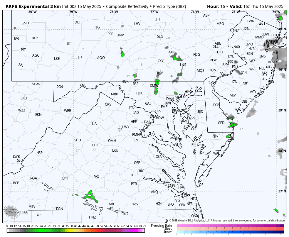
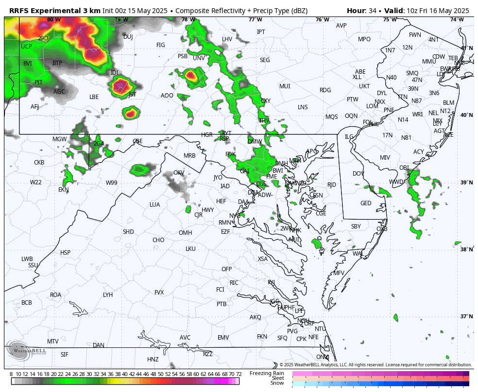
I have shown a few models recently with low reliability. Here is a look at the new Rapid Refresh Forecast System’s ‘Experimental’ Product to see how it performs.
Thunderstorms are expected to develop mid-afternoon and evening, and spread from South to North.

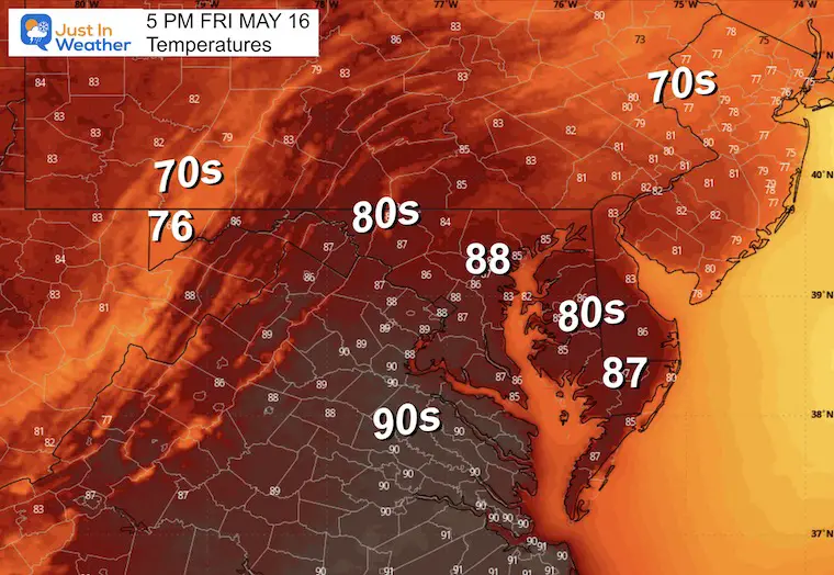
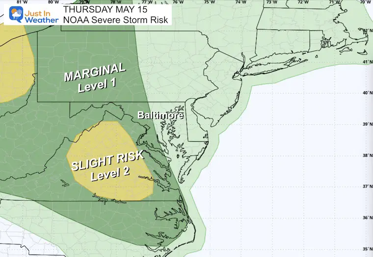
Strong to severe storms are possible late afternoon through midnight.
The trend for next week is cooler weather. This will come with rain on Wednesday.
Sign up and be the first to know!
Severe Weather: Storm Smart October and next spring Winter Weather FITF (Faith in the Flakes): November To March Click to see more and send a request for your school.

The annual event: Hiking and biking 329 miles in 7 days between The Summit of Wisp to Ocean City.
Each day, we honor a kid and their family’s cancer journey.
Fundraising is for Just In Power Kids: Funding Free Holistic Programs. I never have and never will take a penny. It is all for our nonprofit to operate.
Click here or the image to donate:

I am aware there are some spelling and grammar typos and occasional other glitches. I take responsibility for my mistakes and even the computer glitches I may miss. I have made a few public statements over the years, but if you are new here, you may have missed it: I have dyslexia and found out during my second year at Cornell University. It didn’t stop me from getting my meteorology degree and being the first to get the AMS CBM in the Baltimore/Washington region. One of my professors told me that I had made it that far without knowing and to not let it be a crutch going forward. That was Mark Wysocki, and he was absolutely correct! I do miss my mistakes in my own proofreading. The autocorrect spell check on my computer sometimes does an injustice to make it worse. I also can make mistakes in forecasting. No one is perfect at predicting the future. All of the maps and information are accurate. The ‘wordy’ stuff can get sticky. There has been no editor who can check my work while writing and to have it ready to send out in a newsworthy timeline. Barbara Werner is a member of the web team that helps me maintain this site. She has taken it upon herself to edit typos when she is available. That could be AFTER you read this. I accept this and perhaps proves what you read is really from me… It’s part of my charm. #FITF