Tuesday, May ,6 2025
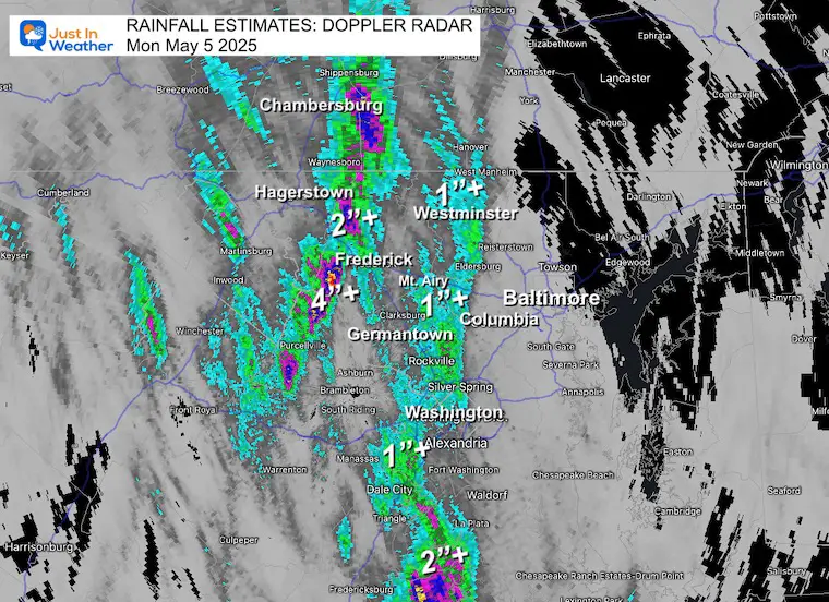
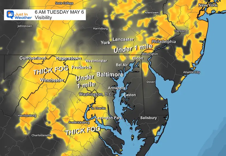
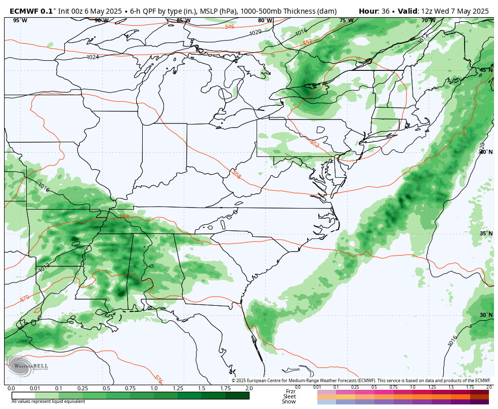
The active weather has shifted, but the results are still with us. Areas that got heavy rain yesterday, more than likely have fog this morning. Some places did get under the persistent bands of storms and ended up with over 1 inch of rain, while Baltimore and eastward missed out for the most part.
Some of the storms did turn severe, and a video from Howard County showed a funnel cloud trying to form in the middle of the afternoon.
Video Clip of Funnel Cloud Forming
4:30 PM Mon May 5
The forecast radar today is less active but does show more showers forming. This is a suggestion for the timing and location of these bands of rain. It is NOT PERFECT! So consider the chance for more pop-up showers at any time midday through the afternoon.
A gradual improvement over the next two days means fewer showers. Another pocket of cool air aloft is likely to bring more rain on Thursday and Friday!
Let’s take a look…
Rainfall Estimate Yesterday:
Morning Fog
Visibility is compromised in the mountains and areas of fog will expand in some of the same inland areas that got rain.
Drought Reminder
The heavy rain did not hit everyone. Baltimore only got 0.07” and is still in a deep hole since last year.
Rainfall Deficit at BWI
- Ending 2024 = -8.00”
- Since Jan 1 = -4.23”
- We are DOWN -12.23” including last year
CLIMATE DATA: Baltimore
TODAY May 6
Sunrise at 6:02 AM
Sunset at 8:05 PM
Normal Low in Baltimore: 50ºF
Record 40ºF in 1891; 1925; 2011
Normal High in Baltimore: 73ºF
Record 92ºF 1949
Subscribe for eMail Alerts
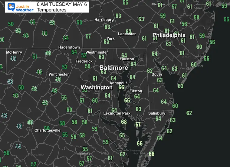
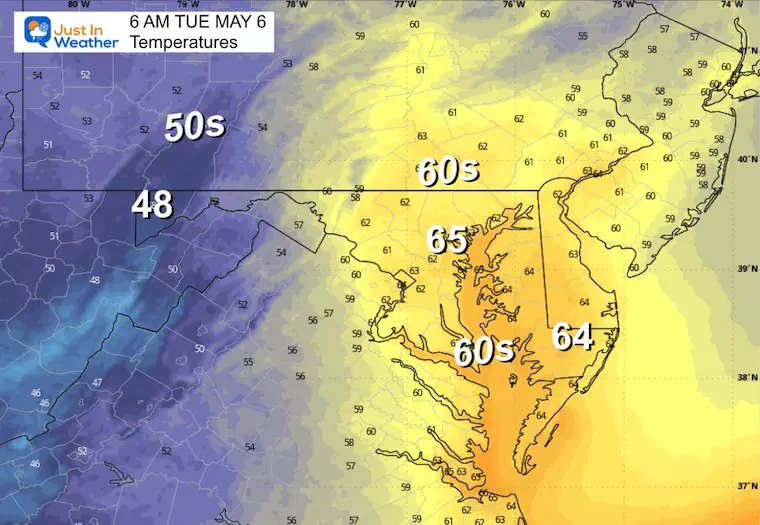
Morning Temperatures
Live and Lightning Radar Widget
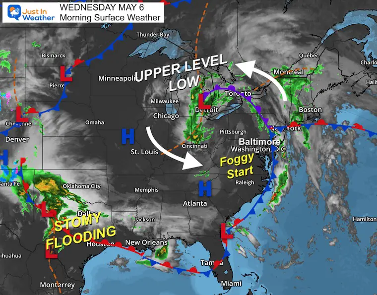
Surface Weather
The Upper-Level Low was observed near Detroit, Michigan. The large circulation has pivoted the rain focus east, and where it did rain yesterday, there are areas of thick fog this morning.
The air is unsettled, and any peaks of the sun will quickly bubble up more clouds, which will develop into more showers and thunderstorms.
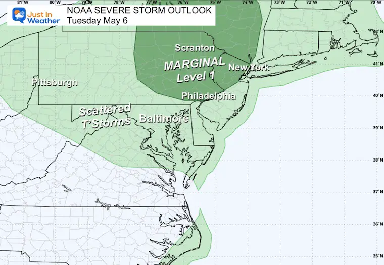
NOAA Severe Storm Risk
Low Level 1 chance for thunderstorms with the focus on Eastern Pennsylvania.
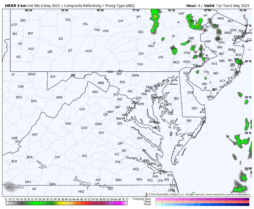
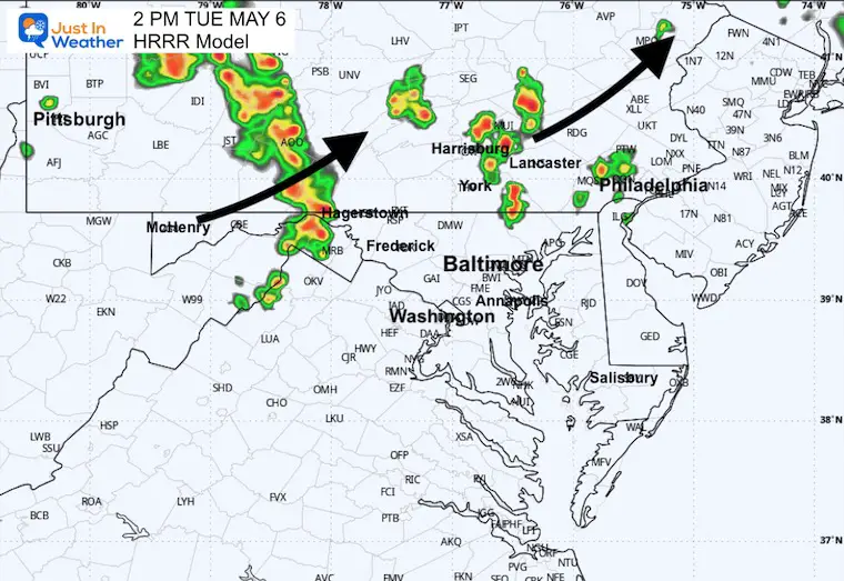
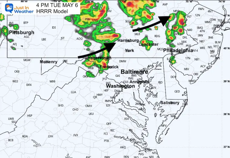
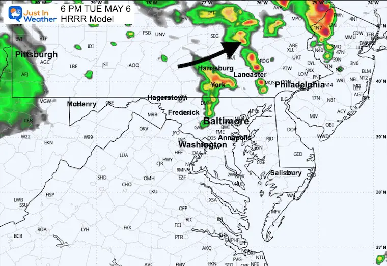
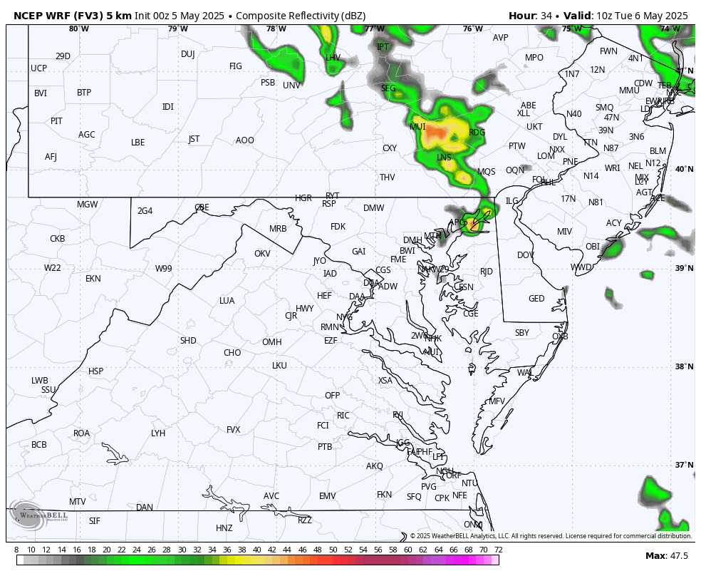
Radar Simulation: 8 AM To 8 PM
Showers and thunderstorms will develop again today… However, the focus will be closer to the Maryland and Pennsylvania border and north.
2 PM
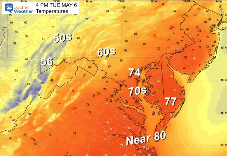
4 PM
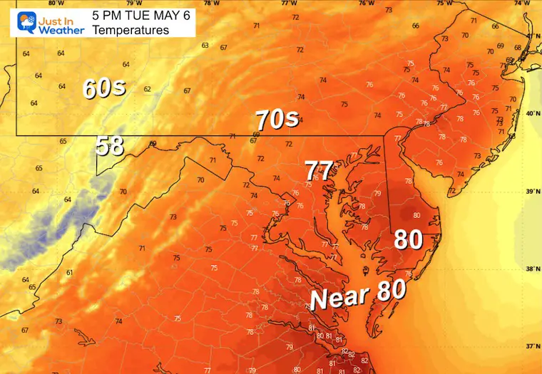
Temperatures
6 PM
Wednesday
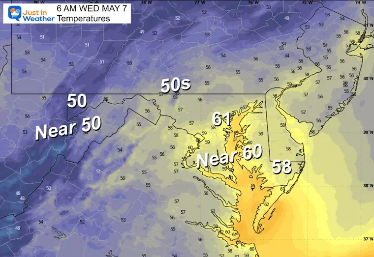
Morning Low Temps
Afternoon High Temperatures
LOOKING AHEAD
This pattern will relax mid-week, then a push of colder air is expected to drop temperatures and bring more rain on Friday.
Storm Pattern Wednesday to Saturday
Timing is speeding up: As this round of wet weather breaks Wednesday morning, the next will develop Thursday and Friday, which could be chilly and damp.
Saturday now appears to be clearing out sooner.
Snapshots:
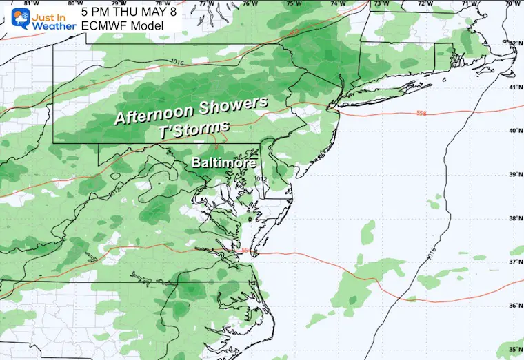
Thursday
Return of showers and thunderstorms building in the afternoon.
Friday Afternoon
This is looking like a wet day as that pocket of cool air and a slow-moving upper-level storm pass through the region.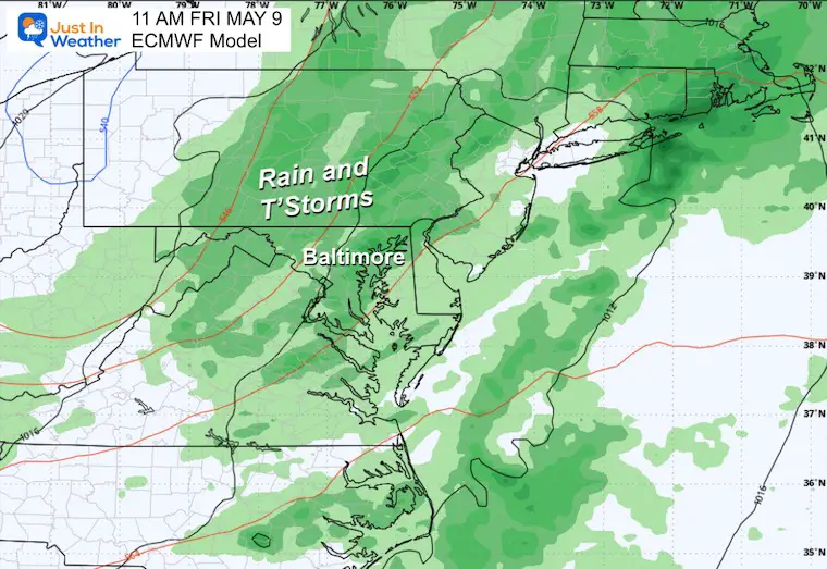
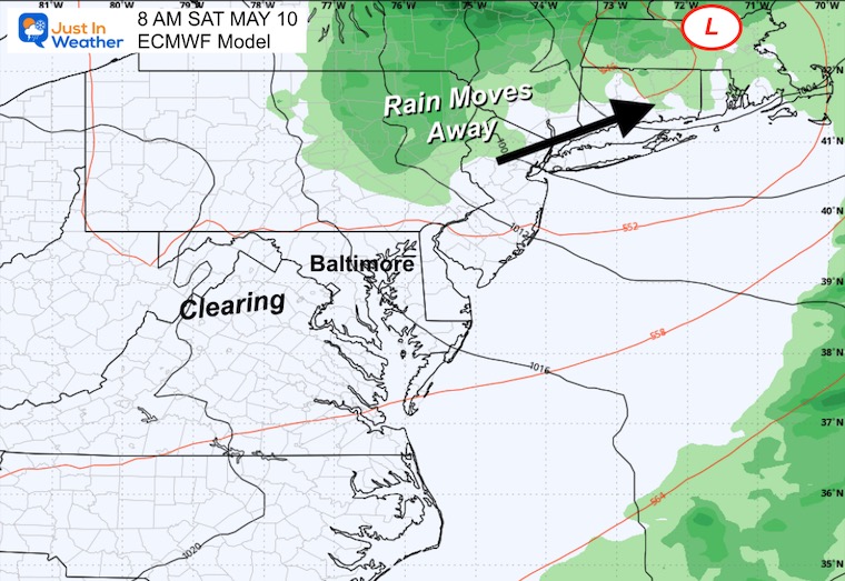
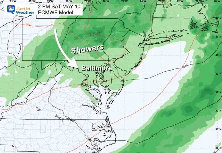
Saturday Morning
The energy will pivot to our north, with the focus of showers and thunderstorms shifting.
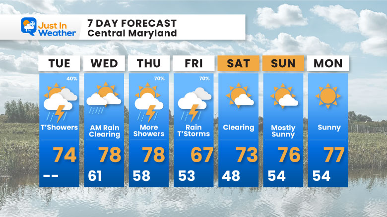
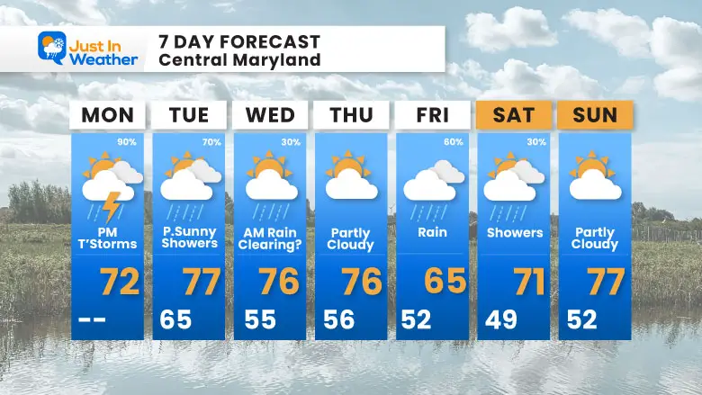
7 Day Forecast
- The chance for showers and storms… especially North of Baltimore
- Wednesday clearing.
- Return of afternoon showers, then rain and thunderstorms Thursday and Friday.
- The weekend is looking much better now.
Tuesday
Morning Low Temps
Radar Simulation 6 AM to 8 PM
Another day with showers and some thunderstorms developing in the heat of the day… while steadier rain may move in across the mountains towards evening.
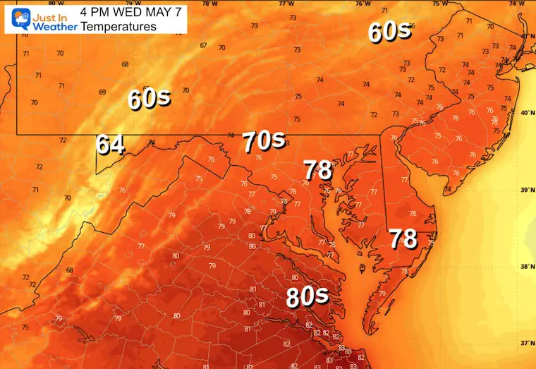
Afternoon High Temperatures
LOOKING AHEAD
This pattern will relax mid-week, and then a push of colder air is expected to drop temperatures and bring more rain on Friday.
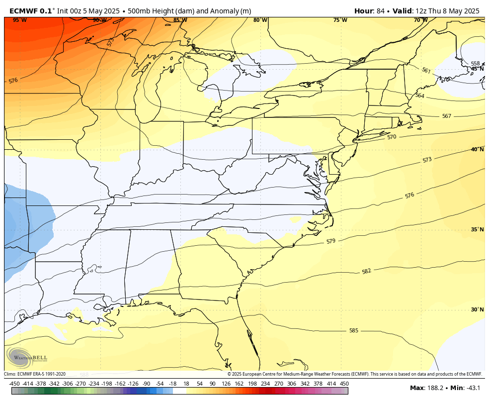
Jet Stream: Thursday to Sunday
The upper-level pattern will transition to another pocket of cool and unsettled air that may bring the next round of rain.
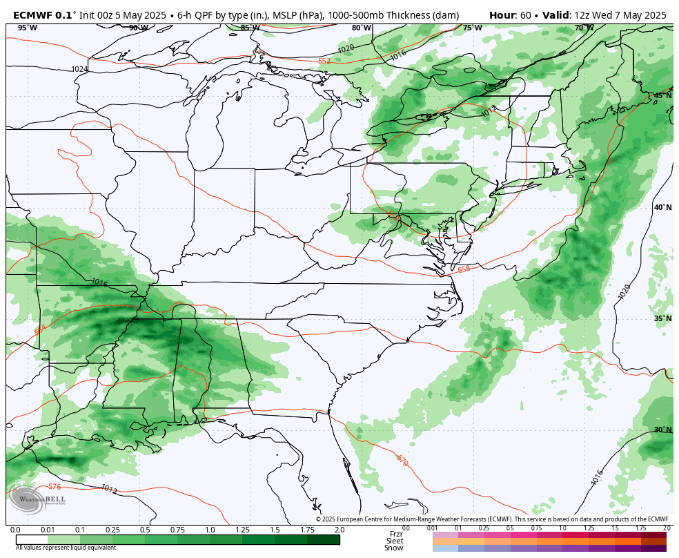
Storm Pattern Wednesday to Saturday
As this round of wet weather breaks Wednesday afternoon, the next will develop Friday, which could be chilly and wet.
Then showers on Saturday will shift away and give us a nicer end to the weekend.
Snapshots:
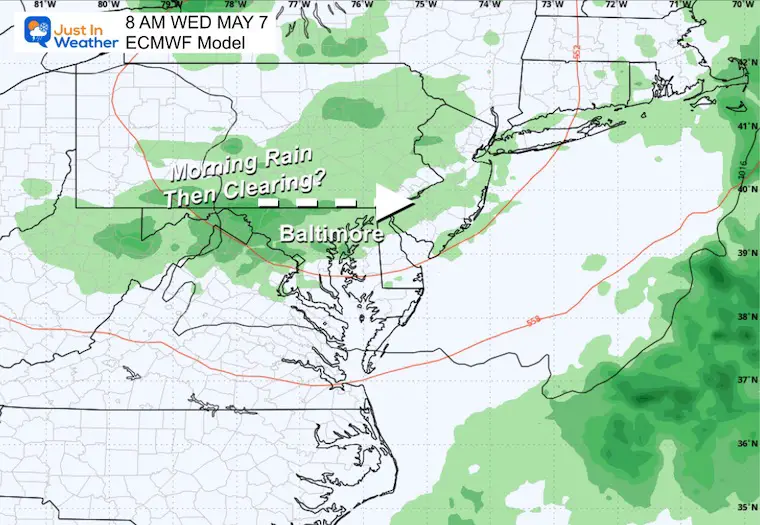
Wednesday
This may start with a morning rain, then some clearing and diminished showers with our break in the action.
Thursday
This looks like a dry day (for now).
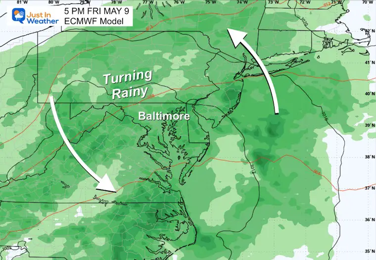
Friday Afternoon
This is looking like a wet day as that pocket of cool air and a slow-moving upper-level storm passes through the region.
Saturday Afternoon
The energy will pivot to our north, with the focus of showers and thunderstorms shifting.
7 Day Forecast
- The chance for showers and storms will decrease on Tuesday.
- Wednesday may start wet and then end with clearing.
- The next pocket of chilly air brings rain Friday and showers Saturday, then improving Sunday.
Subscribe for eMail Alerts
Please share your thoughts and best weather pics/videos, or just keep in touch via social media.
SCHEDULE A WEATHER BASED STEM ASSEMBLY
Severe Weather: Storm Smart October and next spring Winter Weather FITF (Faith in the Flakes): November To March Click to see more and send a request for your school.

THANK YOU:
Baltimore Magazine Readers Choice Best Of Baltimore
Maryland Trek 11 Day 7 Completed Sat August 10
We raised OVER $111,000 for Just In Power Kids – AND Still Collecting More
The annual event: Hiking and biking 329 miles in 7 days between The Summit of Wisp to Ocean City.
Each day, we honor a kid and their family’s cancer journey.
Fundraising is for Just In Power Kids: Funding Free Holistic Programs. I never have and never will take a penny. It is all for our nonprofit to operate.
Click here or the image to donate:

RESTATING MY MESSAGE ABOUT DYSLEXIA
I am aware there are some spelling and grammar typos and occasional other glitches. I take responsibility for my mistakes and even the computer glitches I may miss. I have made a few public statements over the years, but if you are new here, you may have missed it: I have dyslexia and found out during my second year at Cornell University. It didn’t stop me from getting my meteorology degree and being the first to get the AMS CBM in the Baltimore/Washington region. One of my professors told me that I had made it that far without knowing and to not let it be a crutch going forward. That was Mark Wysocki, and he was absolutely correct! I do miss my mistakes in my own proofreading. The autocorrect spell check on my computer sometimes does an injustice to make it worse. I also can make mistakes in forecasting. No one is perfect at predicting the future. All of the maps and information are accurate. The ‘wordy’ stuff can get sticky. There has been no editor who can check my work while writing and to have it ready to send out in a newsworthy timeline. Barbara Werner is a member of the web team that helps me maintain this site. She has taken it upon herself to edit typos when she is available. That could be AFTER you read this. I accept this and perhaps proves what you read is really from me… It’s part of my charm. #FITF


