Sunday May 4 2024
The day had started with a Slight Risk for Severe Storms from NOAA’s Storm Prediction Center. While short range computer model simulations did not anticipate the timing of the late afternoon flare up well, the overall forecast for storms did verify.
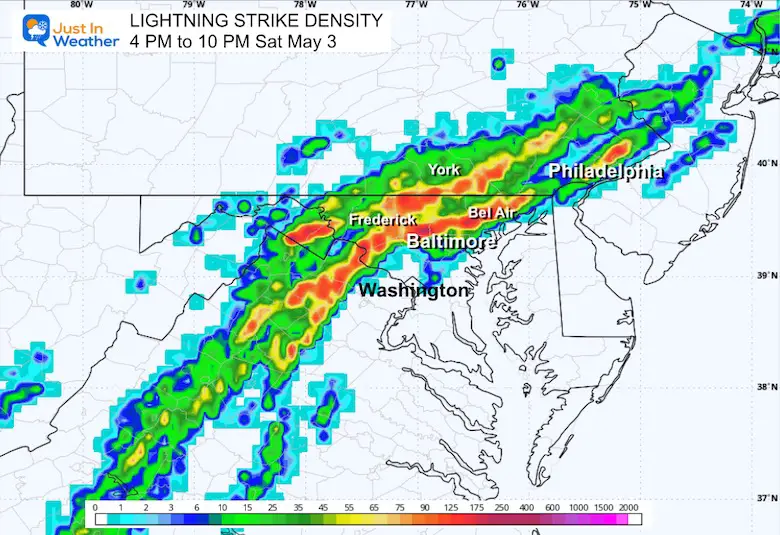
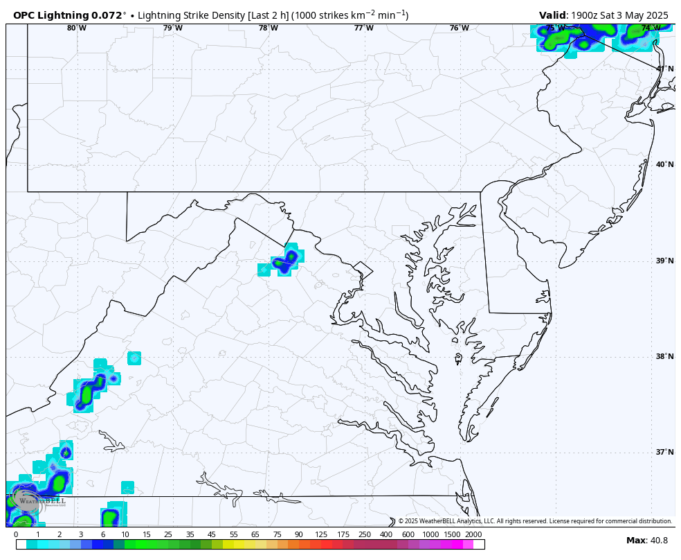
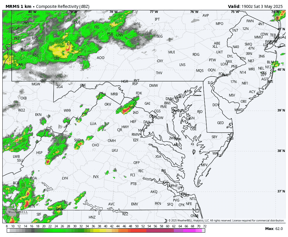
Below are animations showing the recap of Doppler Radar AND Lightning Detection.
A cluster initially formed in North Central Virginia mid afternoon. This moved northward into Central Maryland and then an explosive Supercell did show rotation on Doppler Radar just north of Baltimore City.
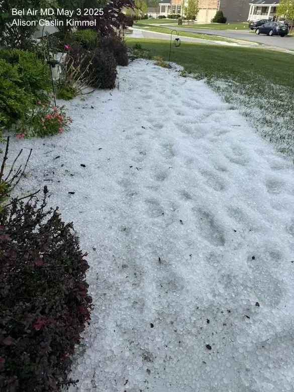
Hail In Bel Air MD
This was with reports of being measured up to 4 inches deep, also some individual hail stones up to 1.75” in diameter.
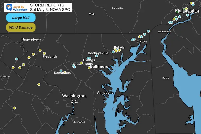
Storm Reports From NWS
That cell was responsible for hail as large as 1.75 inches and a coating on the ground in places near Bel Air, MD inches deep.
- 3:51 PM 1” Hail 3 Miles SW of Damascus
- 4:13 PM 1.5” Hail 1 Mile NE Glenwood
- 4:48 PM 1” 1 Mile N of McDonough
- 4:49 PM 1.25” Hail Martinsburg, WV
- 4:51 PM 1” Hail Owings Mills
- 4:56 PM 1.75” 1 Mile W of Timonium
- 5:18 PM 1.75” Pleasant Hills
- 5:35 PM 1.5” 1 mile SSE Bel Air
- 6:10 PM 1.5” Woodlawn/Cecil County
- 6:15 PM 1.5” Pleasant Hill
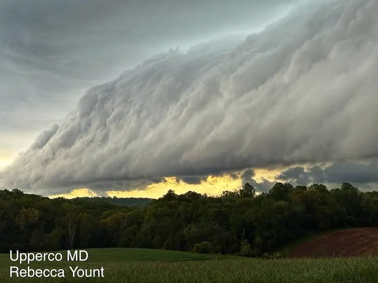
Shelf Cloud in Upperco MD
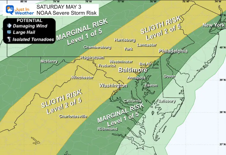
COMPARE THE FORECAST TO THE RESULTS
Here is the look the NOAA Severe Storm Risk, which is the broad expectation that worked out much better than the short range model plots.
REMINDER: Severe Storm Risk Map
This was the NOAA suggested region I showed in my morning report.
Lightning Density 4 PM to 10 PM
Animation 3 PM to 11 PM
Wide View Radar Loop
3 PM to 10 PM
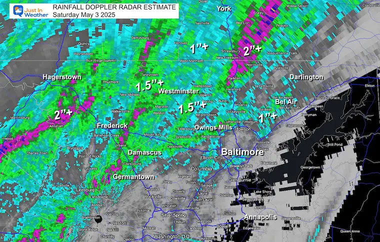
Rainfall Doppler Radar Estimate
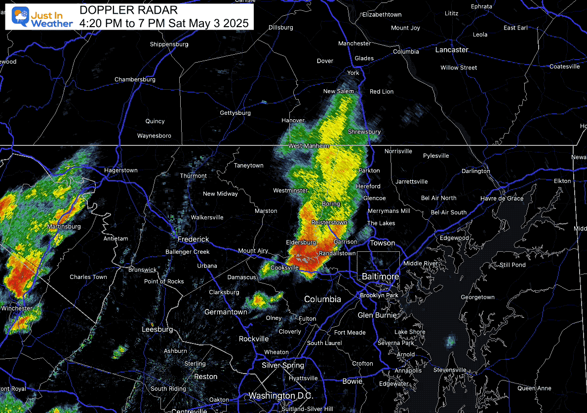
Local Radar Recap 4:20 PM to 7 PM
This is the close-up highlight in Central Maryland.
4:47 PM Snapshot
This image of rotation shown by Doppler Radar just north of Baltimore was when I got concerned. The warning was for Baltimore County and Northern Harford County… The redevelopment hit Southern Harford County hardest.
Video From Bel Air
I was out with friends and recorded this hail falling. Less than half a mile away, the storm was actually worse.
Storm Photo Collection
I gathered a few photos. Many others were shared in the comments of this post on my Facebook page.
Subscribe for eMail Alerts
Please share your thoughts and best weather pics/videos, or just keep in touch via social media.
SCHEDULE A WEATHER BASED STEM ASSEMBLY
Severe Weather: Storm Smart October and next spring Winter Weather FITF (Faith in the Flakes): November To March Click to see more and send a request for your school.

THANK YOU:
Baltimore Magazine Readers Choice Best Of Baltimore
Maryland Trek 11 Day 7 Completed Sat August 10
We raised OVER $104,000 for Just In Power Kids – AND Still Collecting More
The annual event: Hiking and biking 329 miles in 7 days between The Summit of Wisp to Ocean City.
Each day, we honor a kid and their family’s cancer journey.
Fundraising is for Just In Power Kids: Funding Free Holistic Programs. I never have and never will take a penny. It is all for our nonprofit to operate.
Click here or the image to donate:

RESTATING MY MESSAGE ABOUT DYSLEXIA
I am aware there are some spelling and grammar typos and occasional other glitches. I take responsibility for my mistakes and even the computer glitches I may miss. I have made a few public statements over the years, but if you are new here, you may have missed it: I have dyslexia and found out during my second year at Cornell University. It didn’t stop me from getting my meteorology degree and being the first to get the AMS CBM in the Baltimore/Washington region. One of my professors told me that I had made it that far without knowing and to not let it be a crutch going forward. That was Mark Wysocki, and he was absolutely correct! I do miss my mistakes in my own proofreading. The autocorrect spell check on my computer sometimes does an injustice to make it worse. I also can make mistakes in forecasting. No one is perfect at predicting the future. All of the maps and information are accurate. The ‘wordy’ stuff can get sticky. There has been no editor who can check my work while writing and to have it ready to send out in a newsworthy timeline. Barbara Werner is a member of the web team that helps me maintain this site. She has taken it upon herself to edit typos when she is available. That could be AFTER you read this. I accept this and perhaps proves what you read is really from me… It’s part of my charm. #FITF


