Saturday, May 3, 2025
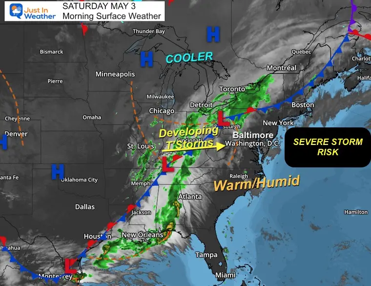
This first weekend of May will start off warm and a tad more humid. The anticipation of rain is now mixed with the risk for severe storms, and the timing is still uncertain.
I can see the potential for storms to turn severe in this pattern, but I have doubts with the high-resolution models… I still show them here in my report, but with the reminder that they are a SUGGESTION.
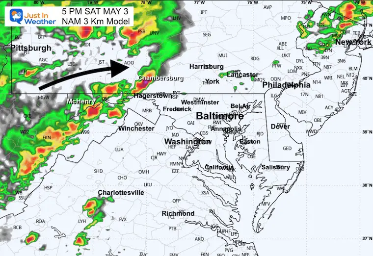
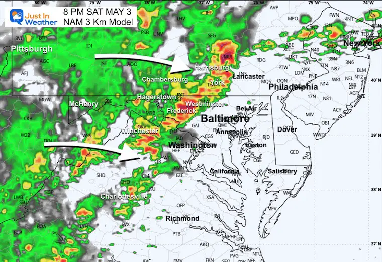
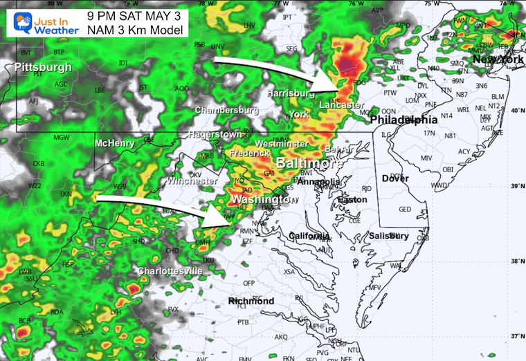
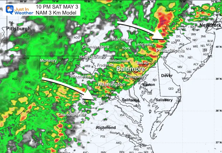
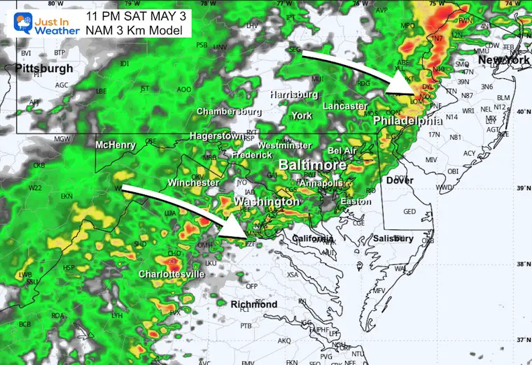
What will see is a line of strong thunderstorms develop in the mountains this afternoon and spread east across Central Maryland and Southern Pennsylvania this evening and tonight.
Our afternoon may end up drier, but pop-up showers are possible ahead of the main event.
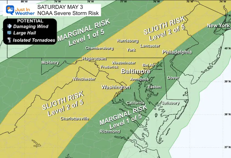
NOAA Severe Thunderstorms Risk
This ‘Slight Risk’ means that any thunderstorm may grow but is not promised to produce damaging winds, large hail, and an isolated tornado.
This zone includes much of Central Maryland and Southern Pennsylvania.
Alert Reminder:
Watch: Are issued for POTENTIAL, NOT a Promise. This will cover a large area for up to 6 hours.
Warning: Gets issued when a storm has formed and is being tracked. This will usually last 45 minutes and include towns in the path.
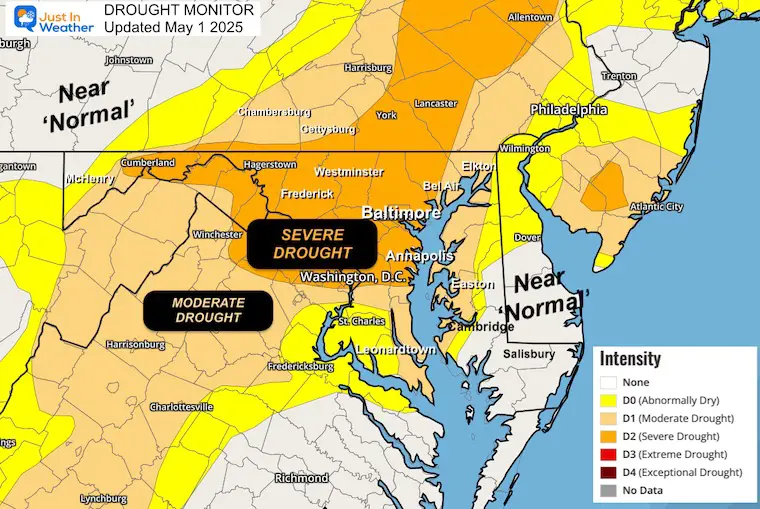
Drought Reminder
Rainfall Deficit at BWI
- Ending 2024 = -8.00”
- Since Jan 1 = -4.24”
- We are DOWN -12.24” including last year
CLIMATE DATA: Baltimore
TODAY May 3
Sunrise at 6:06 AM
Sunset at 8:02 PM
Normal Low in Baltimore: 49ºF
Record 33ºF in 1986; 2005
Normal High in Baltimore: 72ºF
Record 92ºF 2018
Subscribe for eMail Alerts
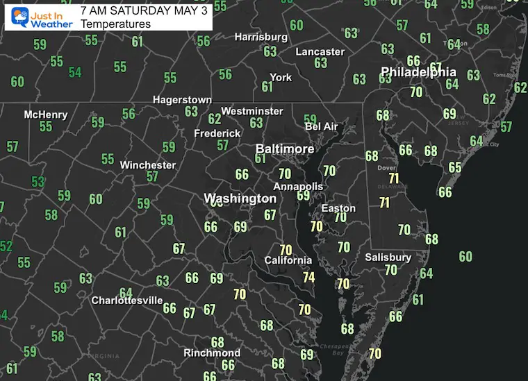
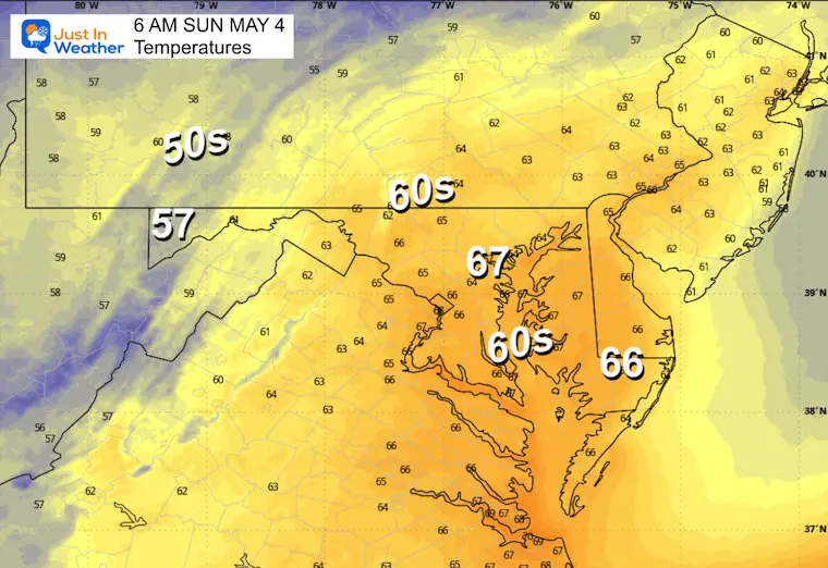
Morning Temperatures
Surface Weather
Live and Lightning Radar Widget
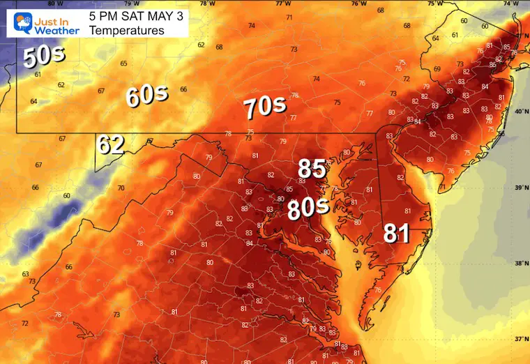
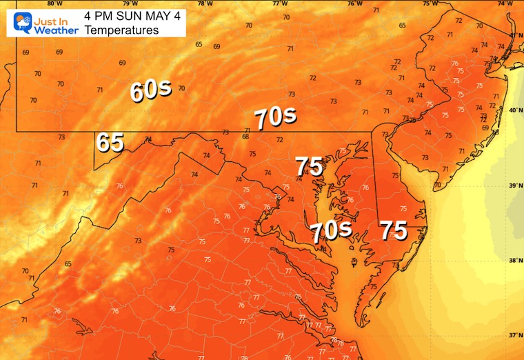
Afternoon Temperatures
Radar Simulation: 8 AM To Midnight
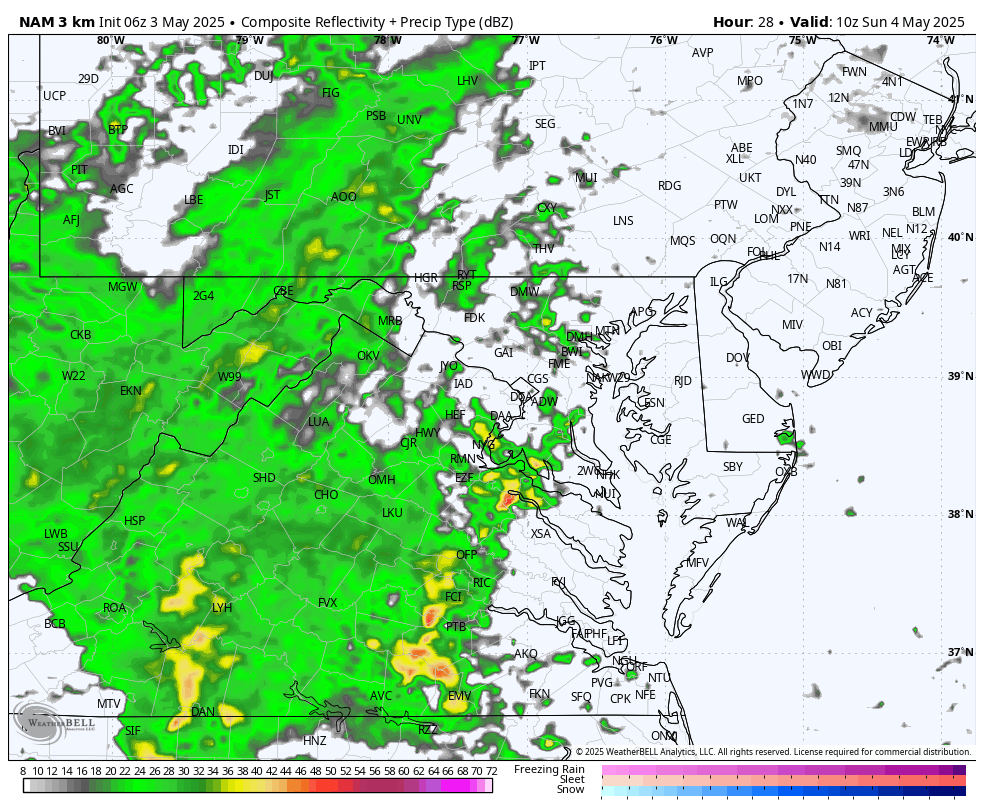
Tracking the build-up of strong to severe thunderstorms along with a band of heavy rain….
This will push eastward, and the “suggestion” is just that: A SUGGESTION…
Storms in the mountains form during the afternoon, then move east into Central Maryland this evening and tonight.
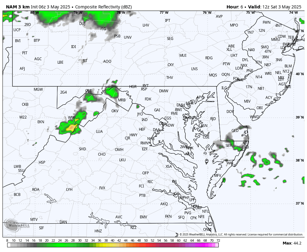
5 PM Snapshot
8 PM
9 PM
10 PM
11 PM
SUNDAY
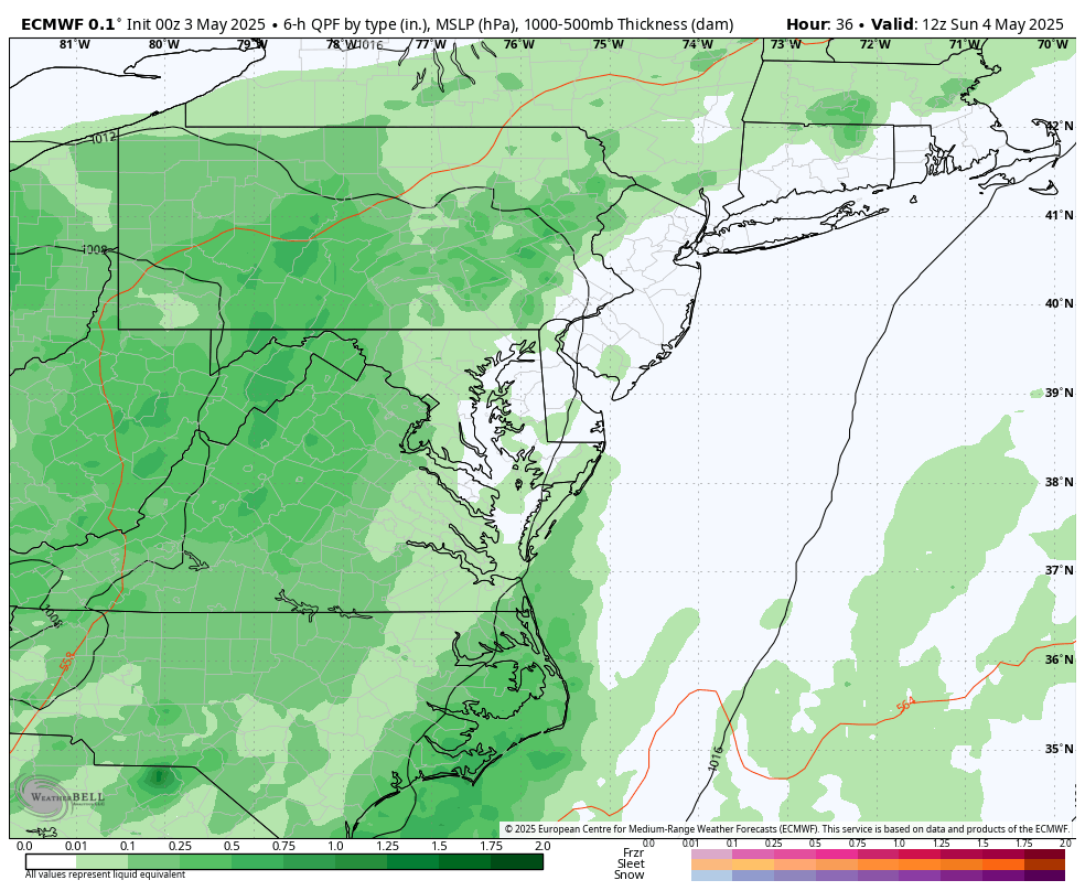
This will be a cooler day with more rain in the morning.
Morning Low Temps
Radar Simulation: 6 AM to 8 PM
Morning rain followed by a break with scattered showers and a few thunderstorms. Again, I do not trust the specifics here, so consider a shower or thunderstorm for your plans.
Afternoon High Temperatures
LOOKING AHEAD
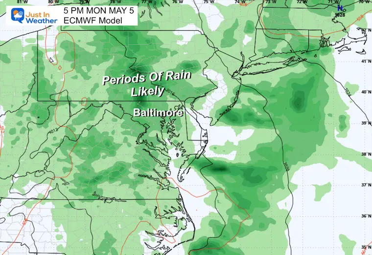
The pattern will be wet for four days, but not a steady rain for the entire time. Monday will be more unsettled, and then the pattern will keep us with off-and-on showers that may build more activity each afternoon with the heat of the day.
Surface Weather: Sunday to Wednesday
Snapshots:
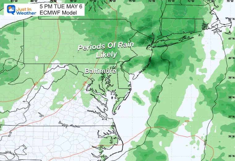
Monday Afternoon
Rain is more likely.
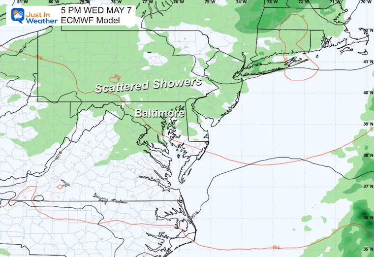
Tuesday Afternoon
Mostly Cloudy with showers on and off… more in the afternoon.
Wednesday Afternoon
Partly to mostly sunny with scattered showers… again more building in the afternoon.
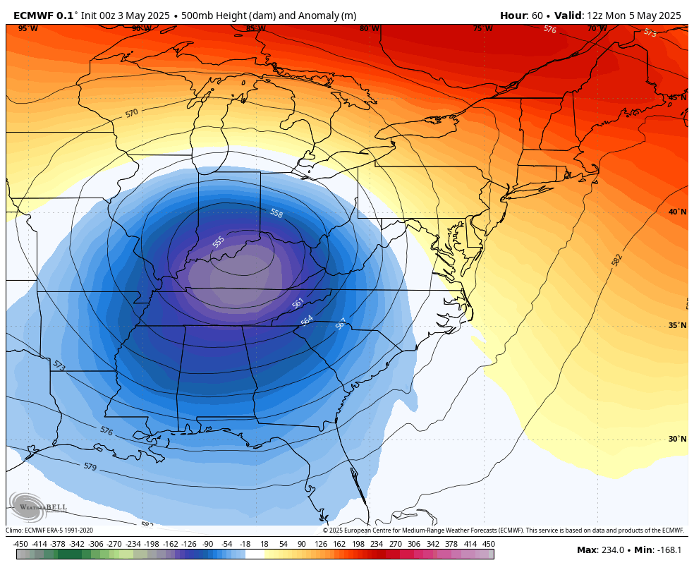
Jet Stream: Monday to Friday
The large upper-level Low in the Midwest will spin itself out…. This is what will be responsible for our unsettled pattern. Then, by Friday, a new impulse of cooler air will drop south from New England.
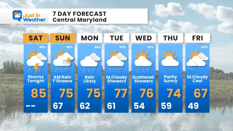
7 Day Forecast
It looks wet almost every day. This weekend may turn soggy Saturday afternoon into Sunday…
Next week will keep the showers around, with afternoon thunderstorms building in the heat of the day and settling at night.
Subscribe for eMail Alerts
Please share your thoughts and best weather pics/videos, or just keep in touch via social media.
SCHEDULE A WEATHER BASED STEM ASSEMBLY
Severe Weather: Storm Smart October and next spring Winter Weather FITF (Faith in the Flakes): November To March Click to see more and send a request for your school.

THANK YOU:
Baltimore Magazine Readers Choice Best Of Baltimore
Maryland Trek 11 Day 7 Completed Sat August 10
We raised OVER $104,000 for Just In Power Kids – AND Still Collecting More
The annual event: Hiking and biking 329 miles in 7 days between The Summit of Wisp to Ocean City.
Each day, we honor a kid and their family’s cancer journey.
Fundraising is for Just In Power Kids: Funding Free Holistic Programs. I never have and never will take a penny. It is all for our nonprofit to operate.
Click here or the image to donate:

RESTATING MY MESSAGE ABOUT DYSLEXIA
I am aware there are some spelling and grammar typos and occasional other glitches. I take responsibility for my mistakes and even the computer glitches I may miss. I have made a few public statements over the years, but if you are new here, you may have missed it: I have dyslexia and found out during my second year at Cornell University. It didn’t stop me from getting my meteorology degree and being the first to get the AMS CBM in the Baltimore/Washington region. One of my professors told me that I had made it that far without knowing and to not let it be a crutch going forward. That was Mark Wysocki, and he was absolutely correct! I do miss my mistakes in my own proofreading. The autocorrect spell check on my computer sometimes does an injustice to make it worse. I also can make mistakes in forecasting. No one is perfect at predicting the future. All of the maps and information are accurate. The ‘wordy’ stuff can get sticky. There has been no editor who can check my work while writing and to have it ready to send out in a newsworthy timeline. Barbara Werner is a member of the web team that helps me maintain this site. She has taken it upon herself to edit typos when she is available. That could be AFTER you read this. I accept this and perhaps proves what you read is really from me… It’s part of my charm. #FITF


