Tuesday, April 29, 2025
One year ago on this date, we set a new record high temperature in Baltimore with 92°F. Today, there will be a hint of summer heat and humidity, just not that warm. It’s quickly becoming pest control season.
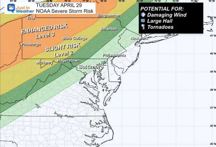
Our surge in temperatures will come ahead of a cold front that has all the hallmarks of a severe storm outbreak across the nation. The focus today with the most dangerous storms will be across Ohio, Western Pennsylvania, and into Central New York. There may be widespread damaging winds, large hail, and some supercells with multiple tornadoes.
NOAA SEVERE STORM RISK
A large area of strong to severe thunderstorms across the nation today.
Level 3 Enhanced Risk for Ohio to Western Pennsylvania and Central New York.
There may be multiple supercells with large hail AND tornadoes.
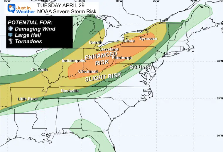
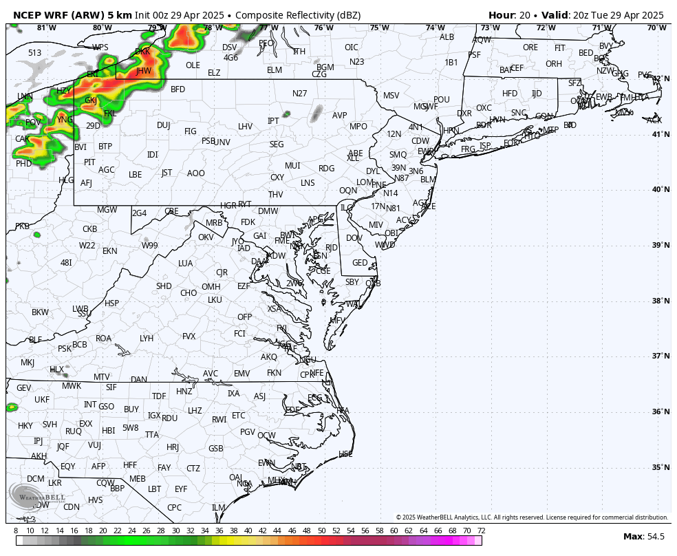
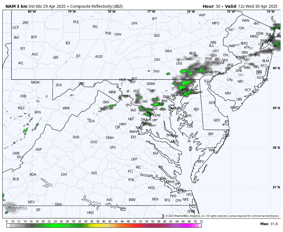
These storms will weaken across the mountains, but bring us rain showers overnight.
Slightly cooler tomorrow and then we may get more daily thunderstorms later Thursday and Friday. We need rain, and the pattern could begin to turn wetter this weekend and into next week.
Drought Reminder
Rainfall Deficit at BWI
- Ending 2024 = -8.00”
- Since Jan 1 = -3.77”
- We are DOWN -11.77” including last year
CLIMATE DATA: Baltimore
TODAY April 29
Sunrise at 6:10 AM
Sunset at 7:58 PM
Normal Low in Baltimore: 48ºF
Record 32ºF in 2022
Normal High in Baltimore: 71ºF
Record 92ºF 2024
Subscribe for eMail Alerts
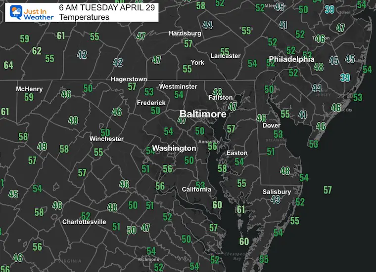
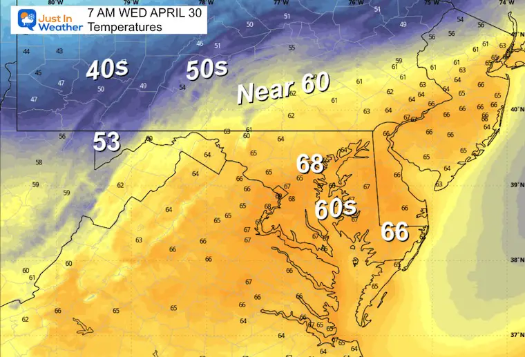
Morning Temperatures
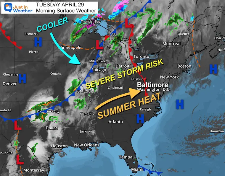
Surface Weather
A strong cold front will be the focus of the line of severe storms today. The most intense activity will focus along this front into the Ohio Valley through Central New York.
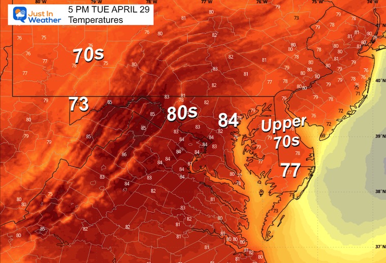
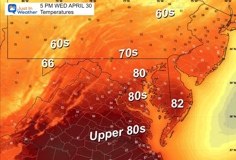
Here in the Mid-Atlantic ahead of that system, southerly winds will pump in more heat and a hint of summer humidity.
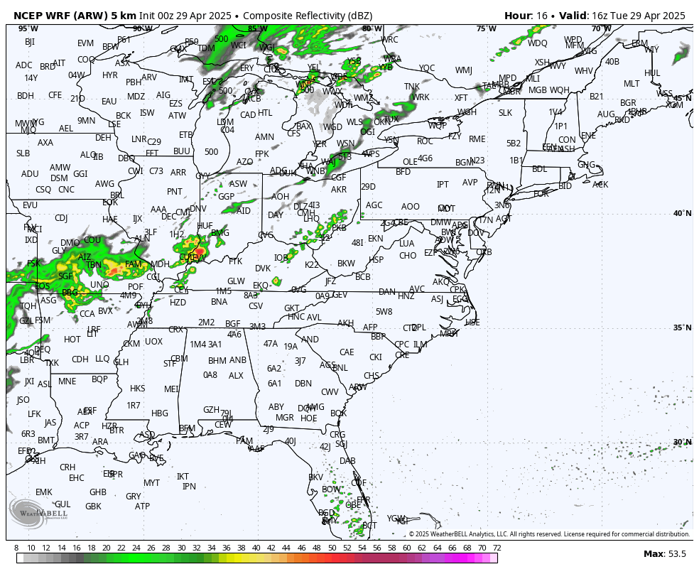
Radar Simulation: 8 AM to Midnight
CLOSER LOOK
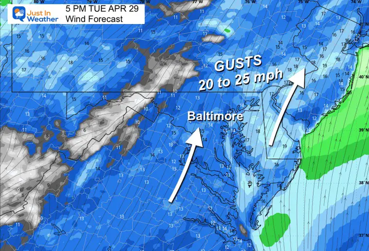
Afternoon Winds
Gusts FROM THE SOUTH 20 to 25 mph.
Afternoon Temperatures
NOAA SEVERE STORM RISK
Level 3 Enhanced Risk for Ohio to Western Pennsylvania and Central New York.
There may be multiple supercells with large hail AND tornadoes.
Radar Simulation 8 AM to Midnight
Snapshots
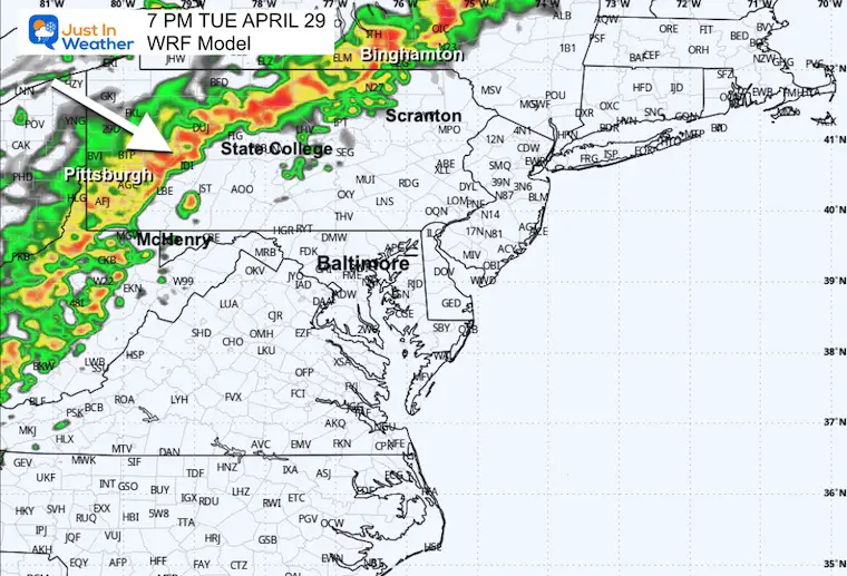
7 PM
The peak activity will reach Western PA and NY, then begin to weaken as it crosses the mountains.
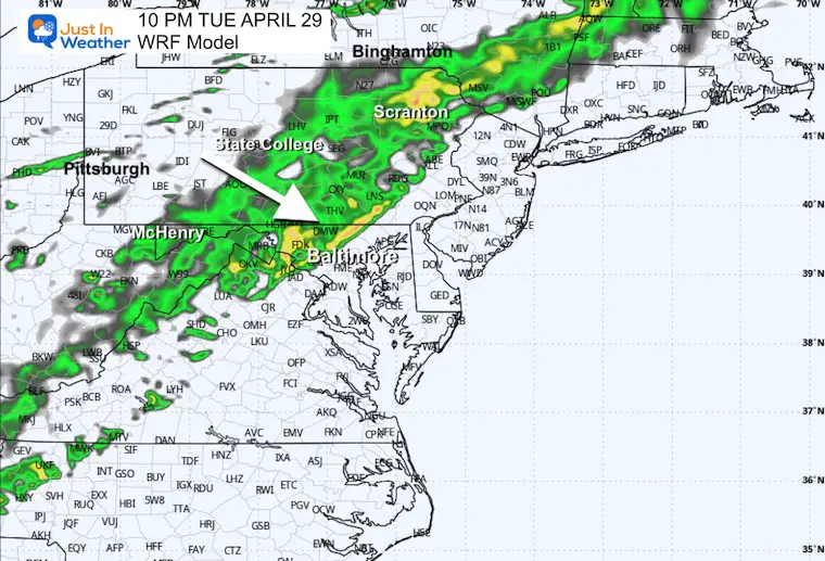
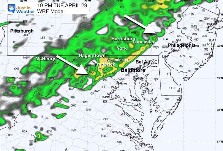
10 PM
Remnants of those storms will bring showers into our Mid-Atlantic region.
Home Focus
10 PM
Midnight

WEDNESDAY
Morning Low Temps
Radar Simulation: 8 AM to Midnight
A morning shower, then the focus for rain and storms will shift with the heat to Southern Virginia.
Afternoon High Temperatures
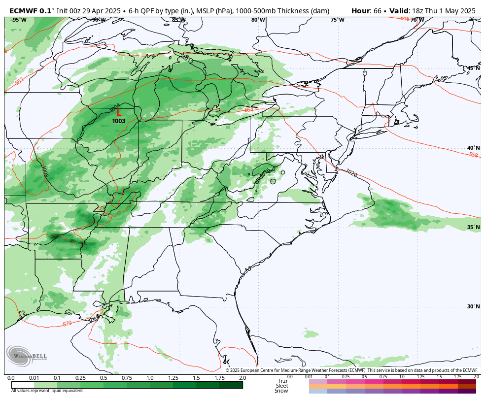
LOOKING AHEAD
Storm Forecast: Thursday Afternoon to Monday
Evening thundershowers on Thursday and Friday.
Steady rain may arrive Saturday afternoon
Then…
A new pattern may lock in an upper Low and Easterly flow from the Atlantic, sending us cool ocean winds and rain on Monday.
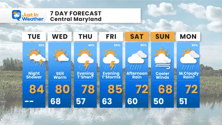
7 Day Forecast
- Today: Summer Heat and Humidity
- Tonight: Rain Showers….
- Thursday and Friday: Evening T’Storms
- Rain: It is possible we get steady rain Saturday, then again Monday into next week.
Subscribe for eMail Alerts
Please share your thoughts and best weather pics/videos, or just keep in touch via social media.
SCHEDULE A WEATHER BASED STEM ASSEMBLY
Severe Weather: Storm Smart October and next spring Winter Weather FITF (Faith in the Flakes): November To March Click to see more and send a request for your school.

THANK YOU:
Baltimore Magazine Readers Choice Best Of Baltimore
Maryland Trek 11 Day 7 Completed Sat August 10
We raised OVER $104,000 for Just In Power Kids – AND Still Collecting More
The annual event: Hiking and biking 329 miles in 7 days between The Summit of Wisp to Ocean City.
Each day, we honor a kid and their family’s cancer journey.
Fundraising is for Just In Power Kids: Funding Free Holistic Programs. I never have and never will take a penny. It is all for our nonprofit to operate.
Click here or the image to donate:

RESTATING MY MESSAGE ABOUT DYSLEXIA
I am aware there are some spelling and grammar typos and occasional other glitches. I take responsibility for my mistakes and even the computer glitches I may miss. I have made a few public statements over the years, but if you are new here, you may have missed it: I have dyslexia and found out during my second year at Cornell University. It didn’t stop me from getting my meteorology degree and being the first to get the AMS CBM in the Baltimore/Washington region. One of my professors told me that I had made it that far without knowing and to not let it be a crutch going forward. That was Mark Wysocki, and he was absolutely correct! I do miss my mistakes in my own proofreading. The autocorrect spell check on my computer sometimes does an injustice to make it worse. I also can make mistakes in forecasting. No one is perfect at predicting the future. All of the maps and information are accurate. The ‘wordy’ stuff can get sticky. There has been no editor who can check my work while writing and to have it ready to send out in a newsworthy timeline. Barbara Werner is a member of the web team that helps me maintain this site. She has taken it upon herself to edit typos when she is available. That could be AFTER you read this. I accept this and perhaps proves what you read is really from me… It’s part of my charm. #FITF


