April 26 2025
Saturday Morning Report
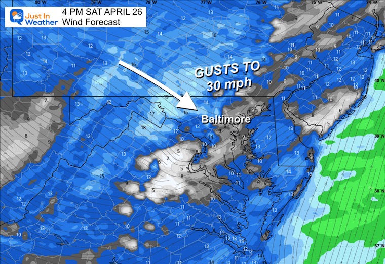
A classic frontal boundary will cross our region today. Rain showers are moving through this morning, and then a line of stronger cells with thunder and downpours will develop as the cold front moves through this afternoon.
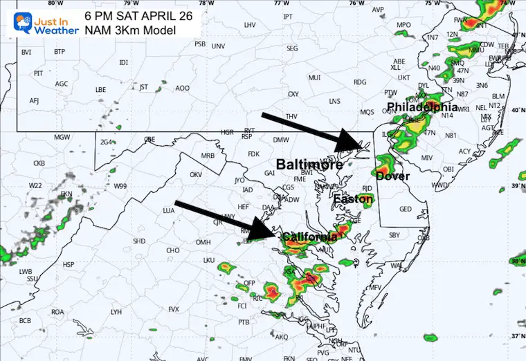
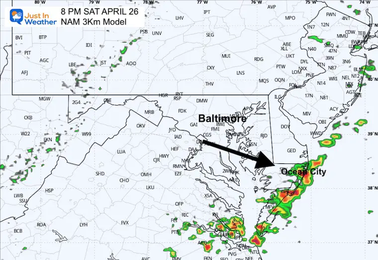
The timing has been narrowed to a 2-hour window shown between the high-resolution short-range HRRR and NAM 3 km models. I will compare the two below, which show metro Baltimore between 2 PM and 4 PM.
A cooler wind will prevail Sunday, and then summer heat will build in for a couple of days during the work week. Depending on the next storm system, this may be limited.
Remember, we are in a SEVERE DROUGHT, and any rain is welcome as we have seen an uptick in regional brush fires over the past week.
Drought Reminder
Rainfall Deficit at BWI
- Ending 2024 = -8.00”
- Since Jan 1 = -3.78”
- We are DOWN -11.78” including last year
CLIMATE DATA: Baltimore
TODAY April 26
Sunrise at 6:14 AM
Sunset at 7:55 PM
Normal Low in Baltimore: 47ºF
Record 32ºF in 2001
Normal High in Baltimore: 70ºF
Record 92ºF 1990
Subscribe for eMail Alerts
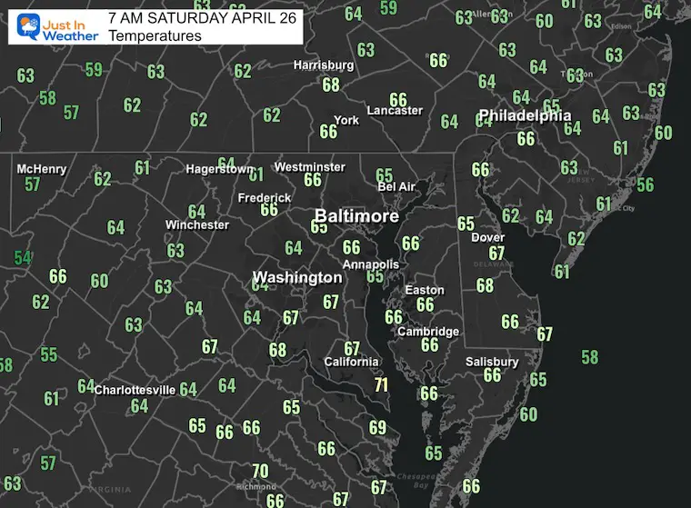
Morning Temperatures
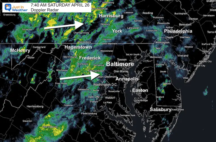
Radar Snapshot at 7:40 AM
Live Radar Widget
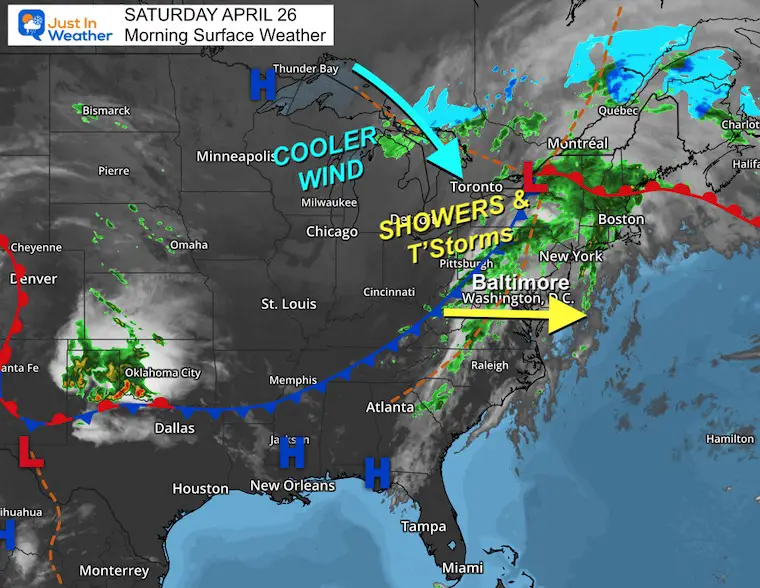
Surface Weather
The cold front responsible for our weather was located in the Ohio Valley and is pushing to the East. Showers and thunderstorms will develop along this boundary this afternoon and evening.
Cooler winds with a new air mass on the other side, centered with High Pressure in the Northern Plains.
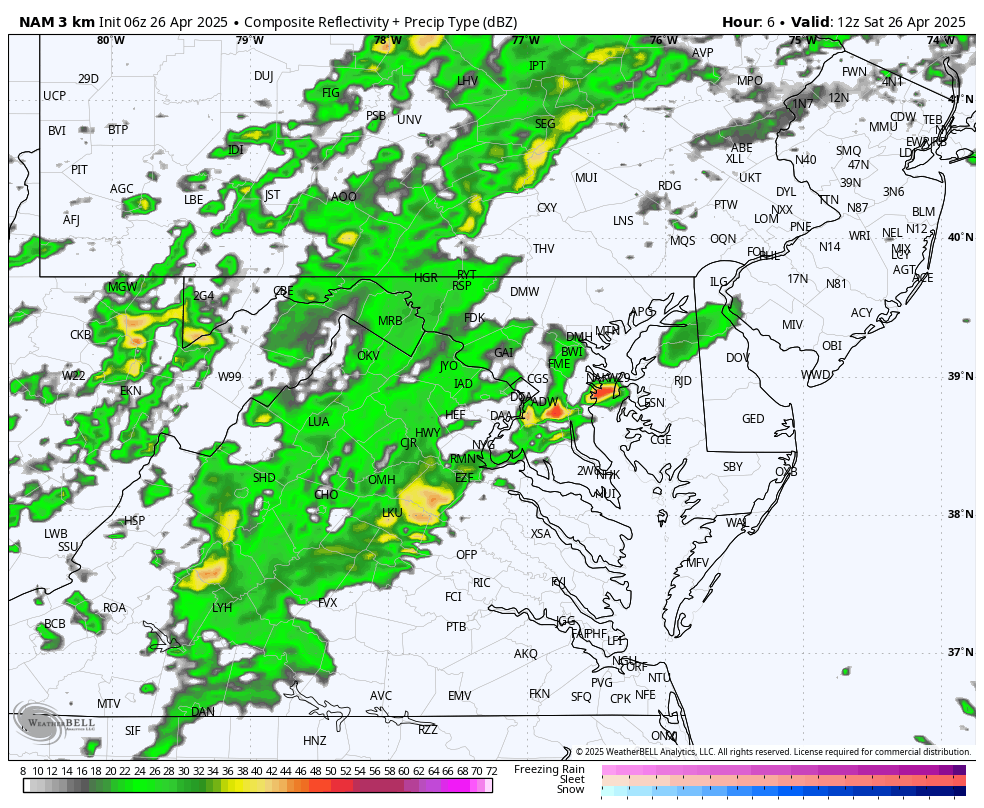
Radar Simulations: 8 AM to 10 PM
Comparing Two Models
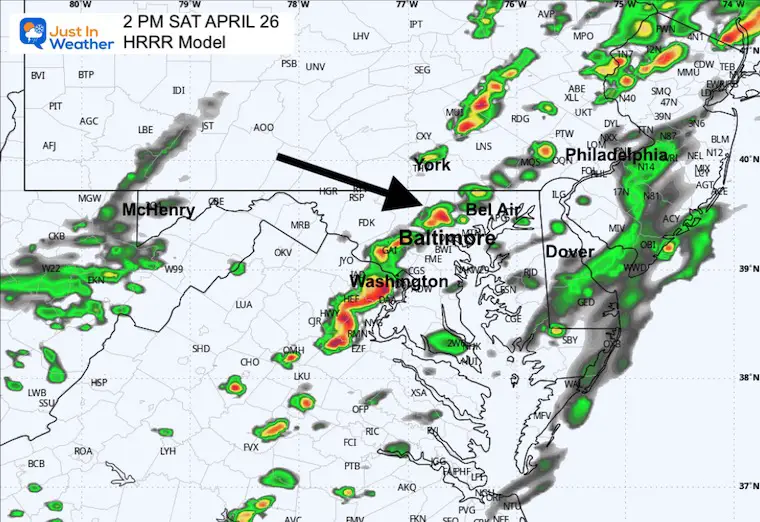
HRRR Model
This one is a little faster with the line of thunderstorms.
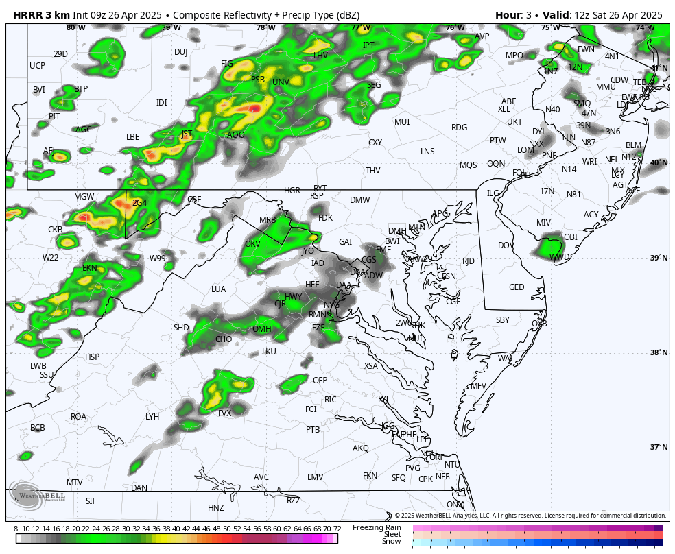
Snapshot at 2 PM
This is when the line of storms is forecast to develop near the western suburbs of Baltimore.
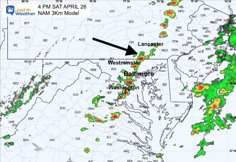
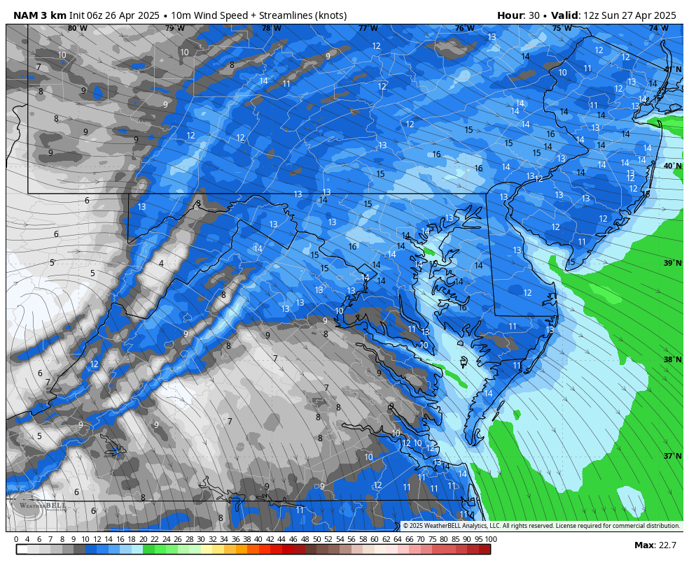
NAM 3Km Model
This model is a little slower and stronger with the line of thunderstorms.
Snapshot at 4 PM
That same line near metro Baltimore seen two hours later by this model.
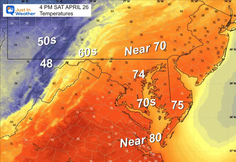
Afternoon Temperatures
Afternoon Wind Forecast
Snapshot at 6 PM
Storm line crossing the Chesapeake Bay to central Delmarva.
Snapshot at 8 PM
Storm line reaches Ocean City.
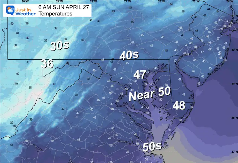
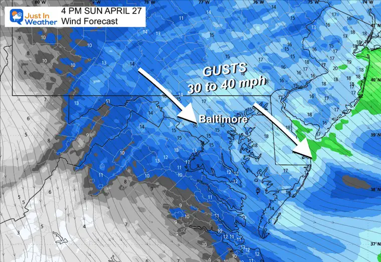
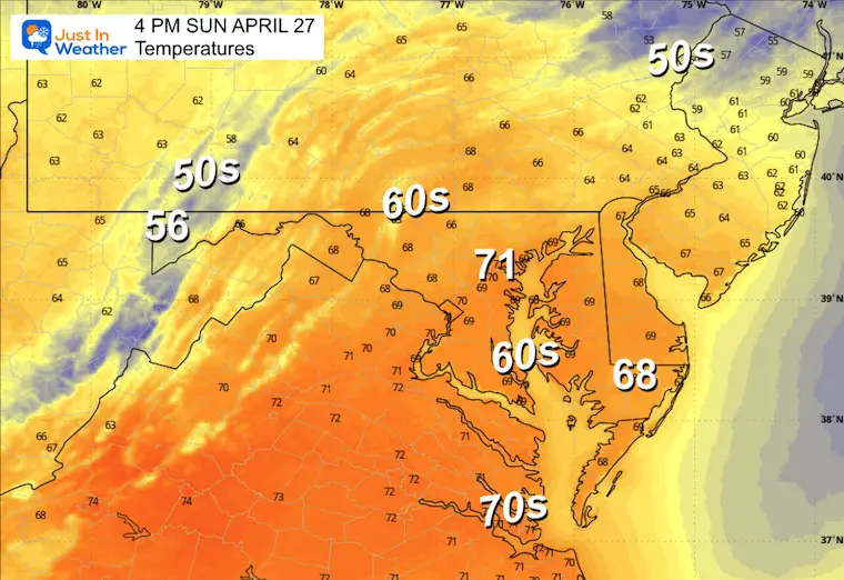
SUNDAY
A cooler wind with a new air mass building in.
Morning Low Temps
Wind Forecast
Snapshot
Afternoon High Temperatures
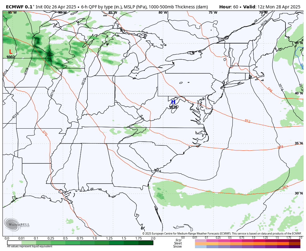
LOOKING AHEAD NEXT WEEK
Monday through Friday
There will be summer-like heat and humidity. The next weather system will attempt to bring showers in earlier by Tuesday evening and then linger with an added risk for (needed) rain Thursday and Friday.
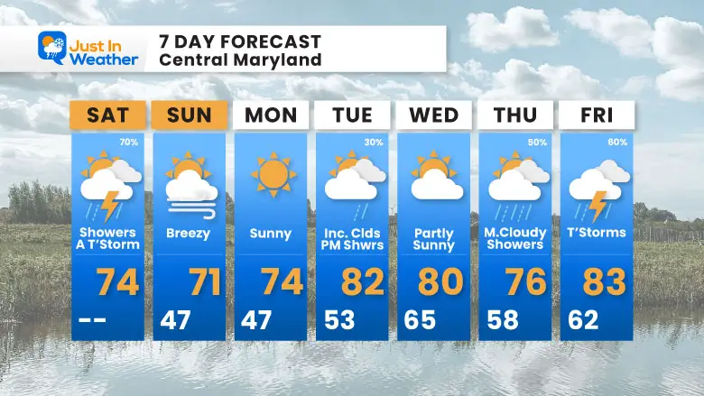
7 Day Forecast
- Today: Showers And Afternoon T’Storms
- Sunday: Breezy and Clearing
- Summer Heat Next Week
- Rain may arrive with thunderstorms Tuesday night and then on Thursday and Friday.
Subscribe for eMail Alerts
Please share your thoughts and best weather pics/videos, or just keep in touch via social media.
SCHEDULE A WEATHER BASED STEM ASSEMBLY
Severe Weather: Storm Smart October and next spring Winter Weather FITF (Faith in the Flakes): November To March Click to see more and send a request for your school.

THANK YOU:
Baltimore Magazine Readers Choice Best Of Baltimore
Maryland Trek 11 Day 7 Completed Sat August 10
We raised OVER $104,000 for Just In Power Kids – AND Still Collecting More
The annual event: Hiking and biking 329 miles in 7 days between The Summit of Wisp to Ocean City.
Each day, we honor a kid and their family’s cancer journey.
Fundraising is for Just In Power Kids: Funding Free Holistic Programs. I never have and never will take a penny. It is all for our nonprofit to operate.
Click here or the image to donate:

RESTATING MY MESSAGE ABOUT DYSLEXIA
I am aware there are some spelling and grammar typos and occasional other glitches. I take responsibility for my mistakes and even the computer glitches I may miss. I have made a few public statements over the years, but if you are new here, you may have missed it: I have dyslexia and found out during my second year at Cornell University. It didn’t stop me from getting my meteorology degree and being the first to get the AMS CBM in the Baltimore/Washington region. One of my professors told me that I had made it that far without knowing and to not let it be a crutch going forward. That was Mark Wysocki, and he was absolutely correct! I do miss my mistakes in my own proofreading. The autocorrect spell check on my computer sometimes does an injustice to make it worse. I also can make mistakes in forecasting. No one is perfect at predicting the future. All of the maps and information are accurate. The ‘wordy’ stuff can get sticky. There has been no editor who can check my work while writing and to have it ready to send out in a newsworthy timeline. Barbara Werner is a member of the web team that helps me maintain this site. She has taken it upon herself to edit typos when she is available. That could be AFTER you read this. I accept this and perhaps proves what you read is really from me… It’s part of my charm. #FITF


