April 25, 2025
Friday Evening Update
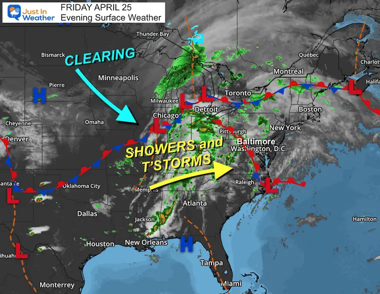
Some rain has developed this afternoon and more is expected through this evening and overnight. A few thunderstorms may pass overhead as well. I will lay it all out below for tomorrow.
Let’s start with the rain this evening and tonight. In fact, this may include thunder, lightning, and some downpours…
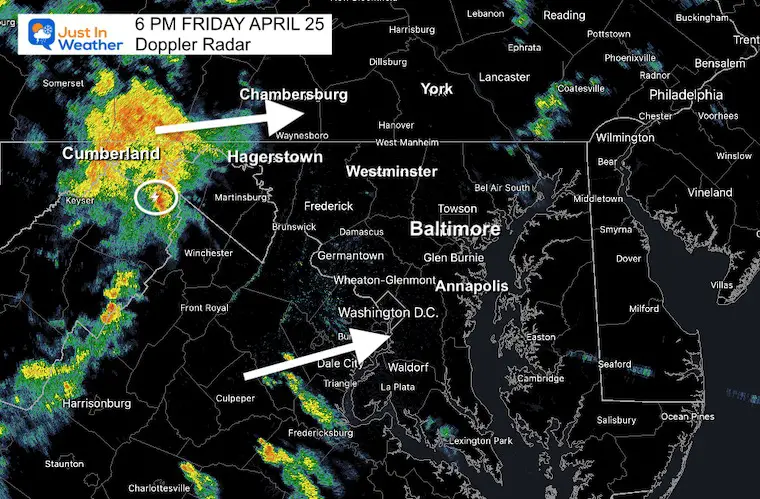
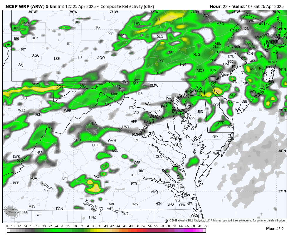
Doppler Radar at Snapshot at 6 PM
I took this snapshot just before posting. That cluster of storms in the mountains is what we are tracking to cross Central Maryland tonight. This actually looks MORE ACTIVE than the short range forecast models… So more of the region may get in on the rain tonight.
Live Radar Widget
(You will likely see this AFTER 6 PM, so the rain will have moved)
Short Range Forecast: Friday Night
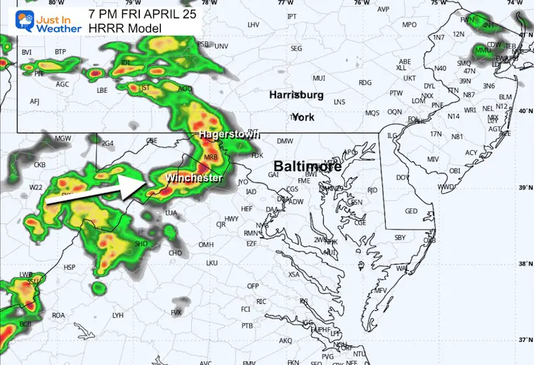
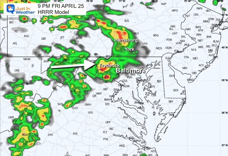
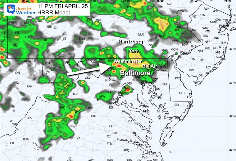
HRRR Model: 7 PM to Midnight
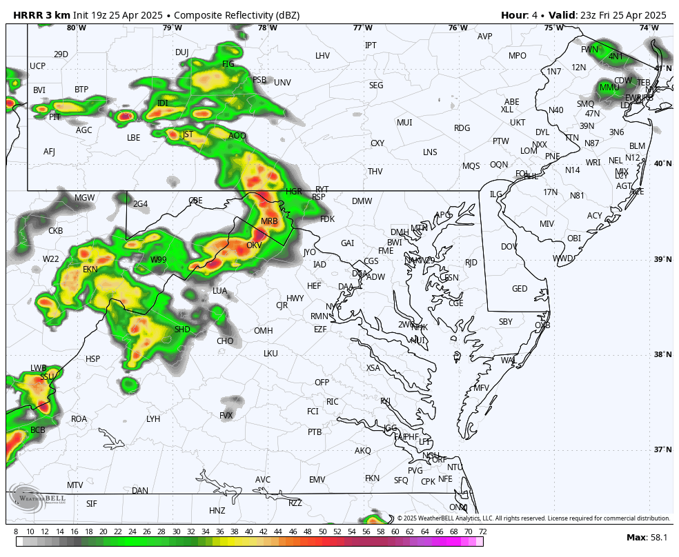
Hourly Snapshots
7 PM
This looks like a potent line of heavy rain heading through the mountains.
9 PM
The action is shown passing through Frederick to Harrisburg, PA. I believe there will be more activity than shown here south of that line in Northern Virginia.
11 PM
While this batch may pass north of Baltimore, I would watch that cell near Washington. As the radar I showed at 6 PM suggested, that part of the line may be more active, so more of Central Maryland, including Annapolis, may get in on the action before midnight.
The purpose of this post is to give you a general idea of our forecast for rain tonight into Saturday. I have a few computer models to compare with the idea of how the line of thunderstorms may affect your area during the day.
We need rain as we are in a severe drought. Baltimore has received -3.76 ” less rain than the average to date. If we include last year’s drought, BWI has decreased by -11.76” since Jan 1, 2024.
Also, brushfires have broken out, burning thousands of acres in Southern Pennsylvania. I wrote about that earlier today.
Friday Evening Set Up
There have been some rain showers over the Shippensburg, PA fire area this afternoon. The rain we have developing today has been well ahead of the main event in the Ohio Valley.
This is organizing and will pass through our region over the next 24 to 36 hours. Sunday will be nicer.
Weather forecasting is imperfect, but our society relies on it often. That is not a secret. Which is why I have made an effort to emphasize recently that the guidance I use for short-range forecasting has been less reliable. The maps I use for radar simulations are to be used as a guide for timing. Stronger events tend to work out better, but when scattered showers and thunderstorms pop up during the day, different computer models can diverge to show a wide range of how it will play out.
Wide View Forecast:
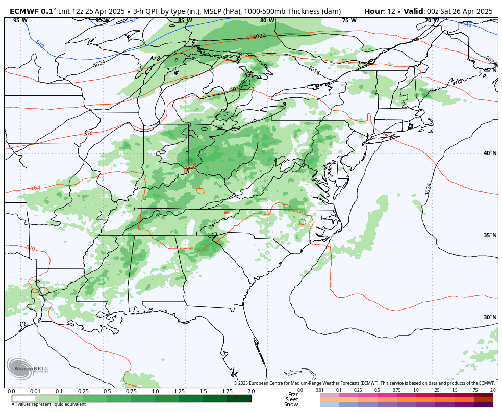
ECWMF Model Friday Evening to Sunday Afternoon
The BIG PICTURE view is that we will have showers tonight into Saturday morning. Then, there will be a break, with another buildup of rain and thunderstorms Saturday afternoon, then clearing on Sunday.
Local View Saturday
This gets more challenging to refine the resolution for specific bands of rain or lines of thunderstorms and timing them for each town. This is where the imperfection really shows.
The next part of this event is where it gets wonky.
There will be showers in the morning, but how much of a break we get is not promised.
Here is a comparison of the THREE short-range models I rely on.
Which is more reliable? Well, the HRRR is often best in the next 6 hours as it updates every hour. But farther out in time, it does change. The best answer is to use them all and develop a blend.
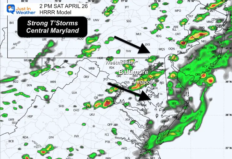
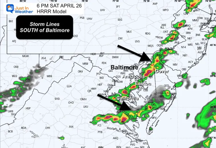
I would plan on the risk for thunderstorms in Central Maryland in the afternoon between 2 PM and 6 PM, then shifting south to last into the evening in Southern Maryland… while northern areas clear out.
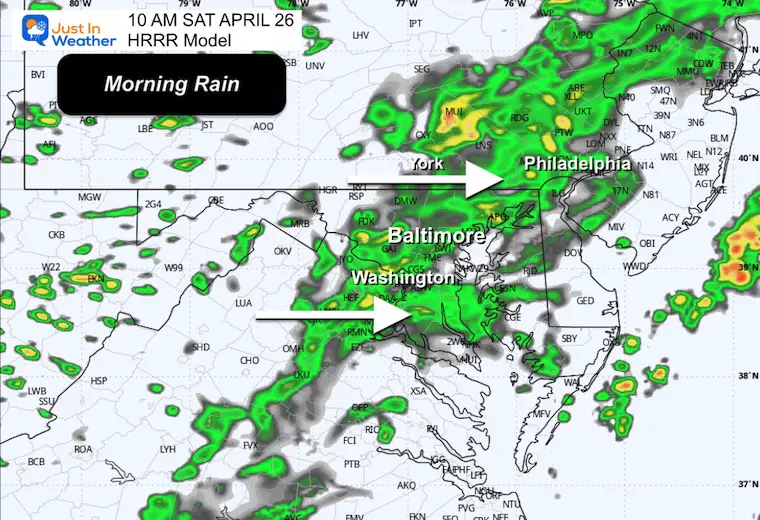
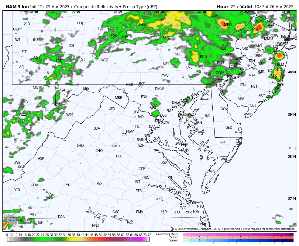
HRRR Model Radar Simulation
6 AM to 10 PM
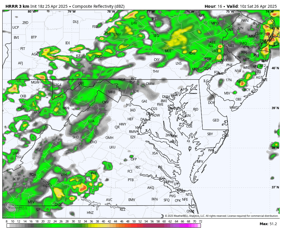
Snapshots
10 AM – Rain Across Central Areas
2 PM
6 PM
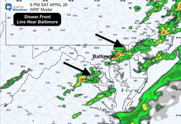
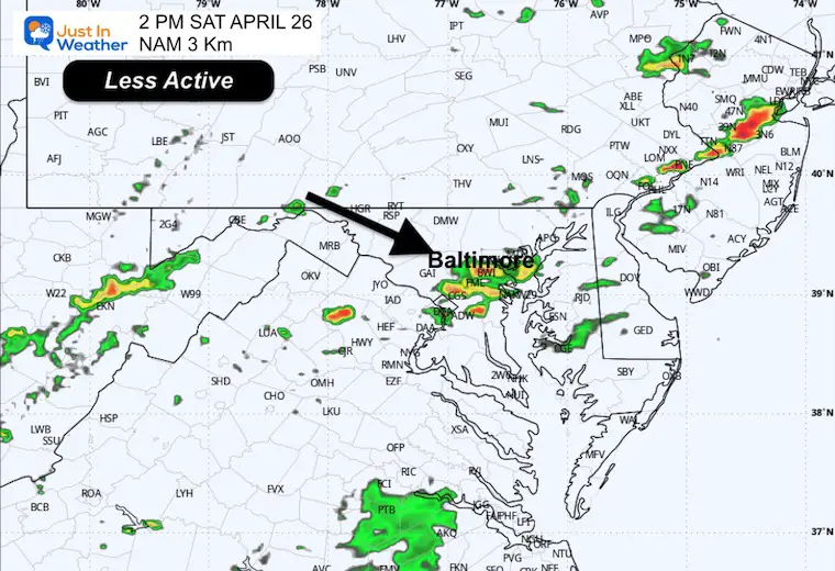
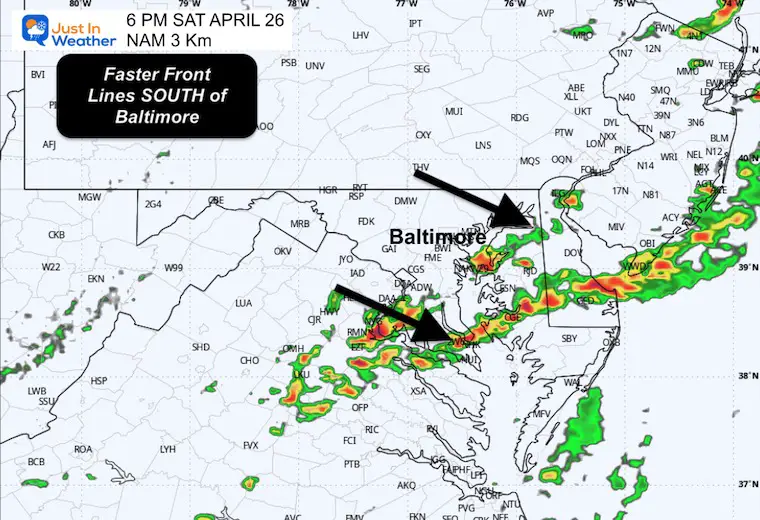
Comparing the WRF to NAM 3 Km Models
WRF Model: This is more active and Slower with the line of thunderstorms, which could result in more rain.
NAM 3 Km: This is less active and faster with the line of thunderstorms.
WRF Model 6 AM to 10 PM
Snapshots
2 PM
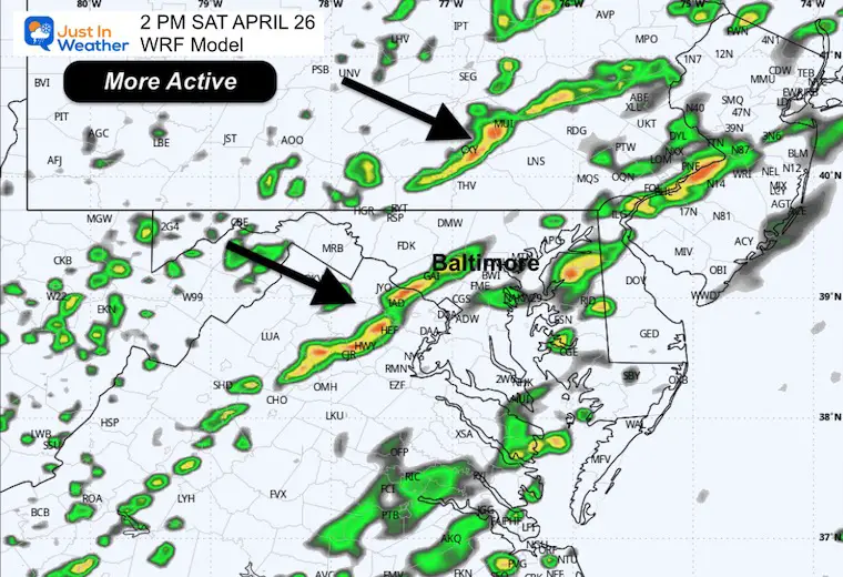
6 PM
NAM 3 Km Model 6 AM to 10 PM
Snapshots
2 PM
6 PM
Rainfall POTENTIAL Total
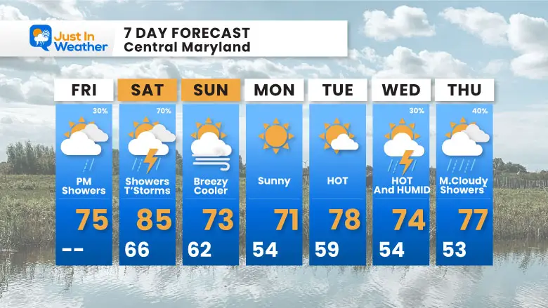
7 Day Forecast
- Today: Showers in the mountains, spotty afternoon…. More Rain Tonight.
- Saturday: Showers And T’Storms
- Sunday: Breezy and Clearing
- Summer Heat Next Week
Subscribe for eMail Alerts
Please share your thoughts and best weather pics/videos, or just keep in touch via social media.
SCHEDULE A WEATHER BASED STEM ASSEMBLY
Severe Weather: Storm Smart October and next spring Winter Weather FITF (Faith in the Flakes): November To March Click to see more and send a request for your school.

THANK YOU:
Baltimore Magazine Readers Choice Best Of Baltimore
Maryland Trek 11 Day 7 Completed Sat August 10
We raised OVER $104,000 for Just In Power Kids – AND Still Collecting More
The annual event: Hiking and biking 329 miles in 7 days between The Summit of Wisp to Ocean City.
Each day, we honor a kid and their family’s cancer journey.
Fundraising is for Just In Power Kids: Funding Free Holistic Programs. I never have and never will take a penny. It is all for our nonprofit to operate.
Click here or the image to donate:

RESTATING MY MESSAGE ABOUT DYSLEXIA
I am aware there are some spelling and grammar typos and occasional other glitches. I take responsibility for my mistakes and even the computer glitches I may miss. I have made a few public statements over the years, but if you are new here, you may have missed it: I have dyslexia and found out during my second year at Cornell University. It didn’t stop me from getting my meteorology degree and being the first to get the AMS CBM in the Baltimore/Washington region. One of my professors told me that I had made it that far without knowing and to not let it be a crutch going forward. That was Mark Wysocki, and he was absolutely correct! I do miss my mistakes in my own proofreading. The autocorrect spell check on my computer sometimes does an injustice to make it worse. I also can make mistakes in forecasting. No one is perfect at predicting the future. All of the maps and information are accurate. The ‘wordy’ stuff can get sticky. There has been no editor who can check my work while writing and to have it ready to send out in a newsworthy timeline. Barbara Werner is a member of the web team that helps me maintain this site. She has taken it upon herself to edit typos when she is available. That could be AFTER you read this. I accept this and perhaps proves what you read is really from me… It’s part of my charm. #FITF


