


January 2 Weather Still Cold This Weekend With A Warm Up Next Week
Friday, January 2, 2026 After the New Year's Day Morning Snow Squall, the cold air mass has been firmly in place. One more system passed through overnight with flurries and…
April 20 2025
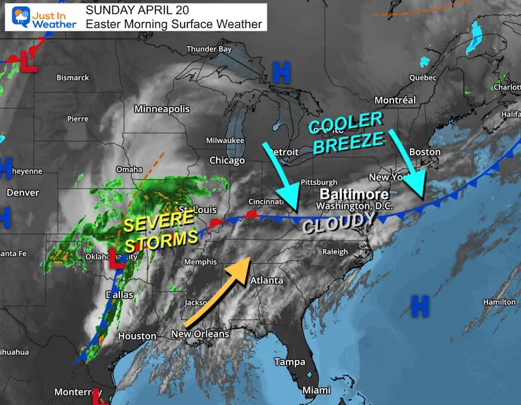
Sunday Morning Report
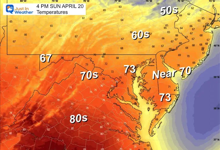
Many people along Maryland’s northern border will find Easter Sunday plans challenging. After the heat delay, Baltimore did get sun later in the afternoon and a bump up to 83F. This energy just north provided the energy for the destructive weather that followed at night.
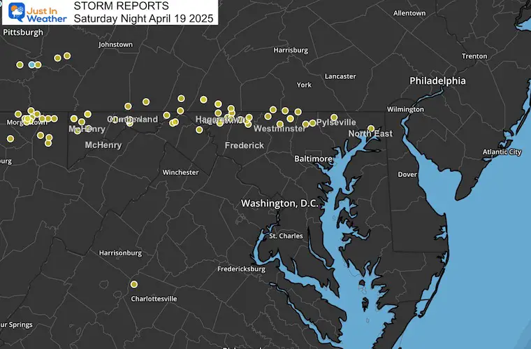
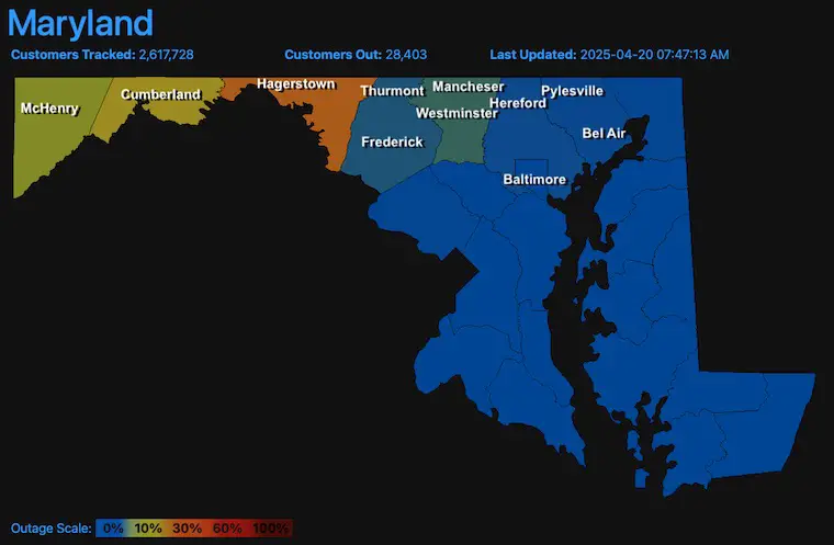
A rogue storm crossed the mountains and raced east between 8 PM and Midnight, leaving a trail of destruction. Winds gusted between 55 and 80 mph, resulting in countless trees down, structural damage, and, at one point, power outages affecting nearly 1 million people.
Before we get to the forecast, here is a recap of that storm.
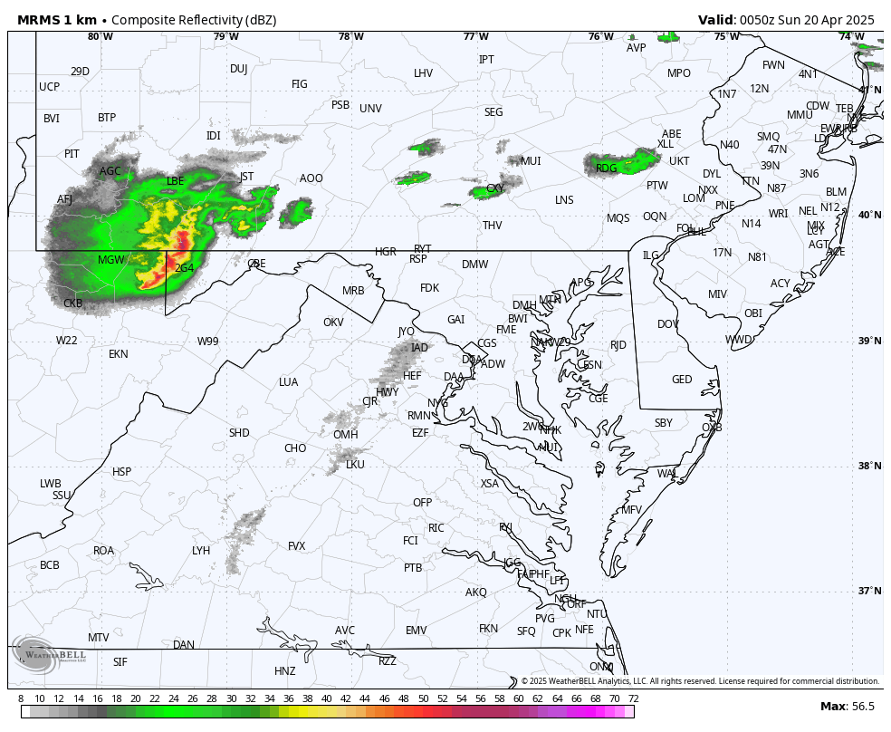
This can best be described as a single storm with pulsing microbursts. Wind Gusts ranged from 55 mph to 80 mph in the narrow path across Northern Maryland.
Here is the post I shared early this morning. I am showing it so you can read the additional firsthand accounts many others shared in the comments.
Hardest hit around Hagerstown and across Washington County.
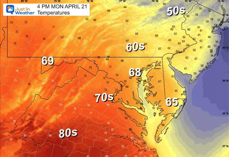
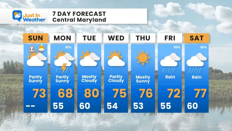
Temps will be cooler as the winds will shift, and yes since the rain remain gusty. During the week temperatures will remain warmer than average and there is little rain in sight.
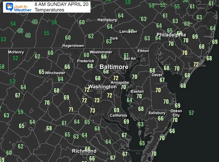
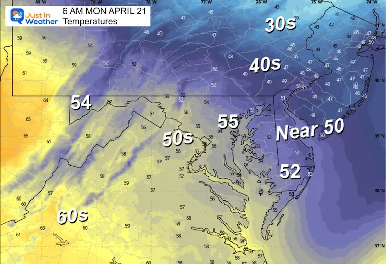
Cooler air has moved in with a frontal boundary to our south. Plenty of cloud cover is in place, but some breaks of sun may still pop out this Easter Sunday.
The main storm continues to regenerate in the South Central US, where another round of severe storms will erupt today.
Sunrise at 6:22 AM
Sunset at 7:49 PM
Normal Low in Baltimore: 45ºF
Record 27ºF in 1904
Normal High in Baltimore: 68ºF
Record 94ºF 1941
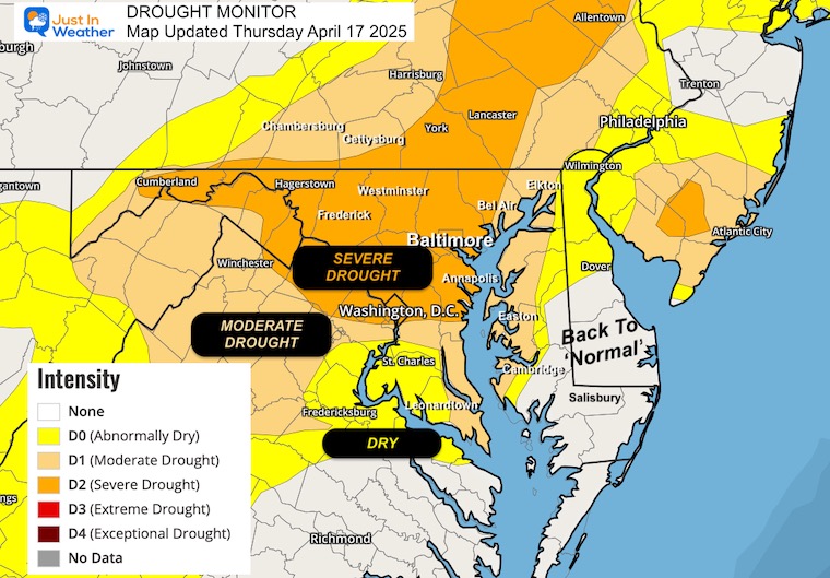
Drought Reminder
Rainfall Deficit at BWI
Subscribe for eMail Alerts
Sign up and be the first to know!
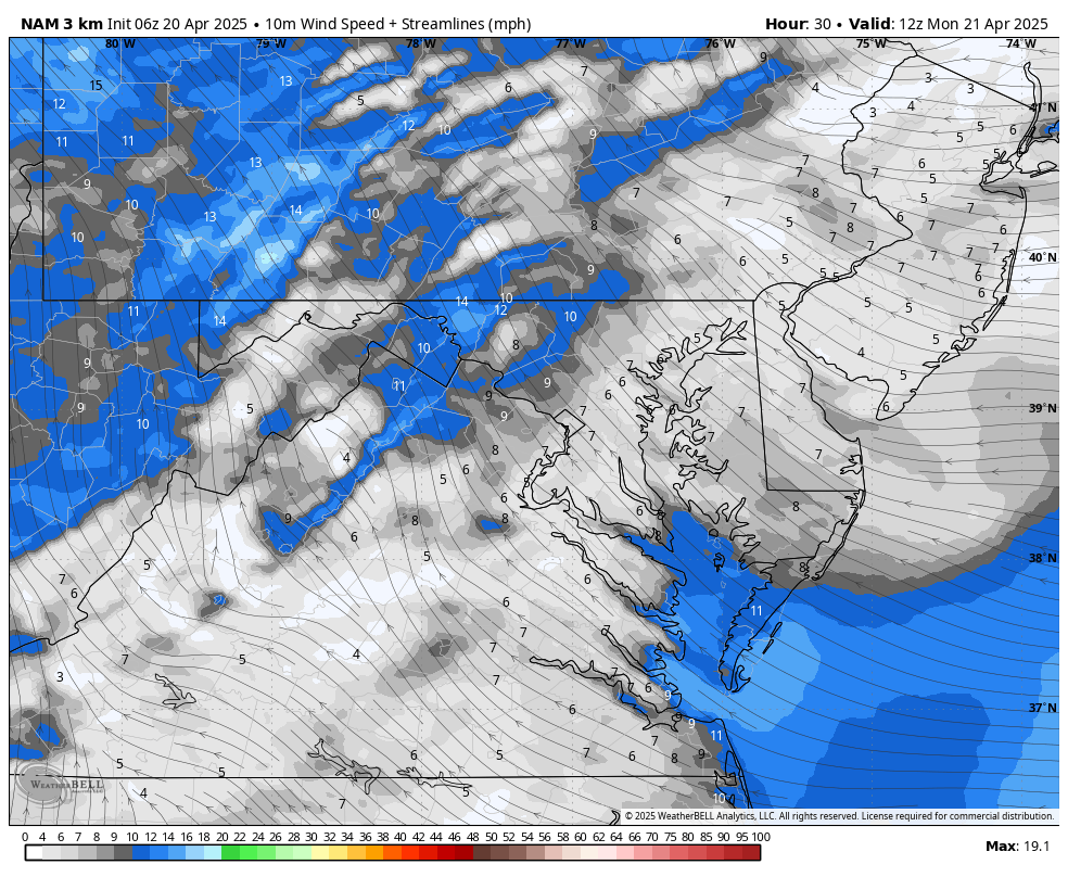
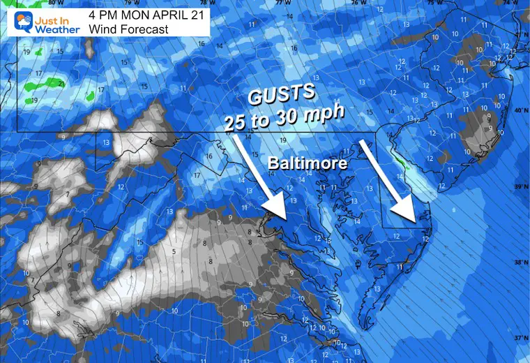
The wind will be gusting FROM THE NORTH this morning to keep temps cooler. It will decrease in the afternoon.
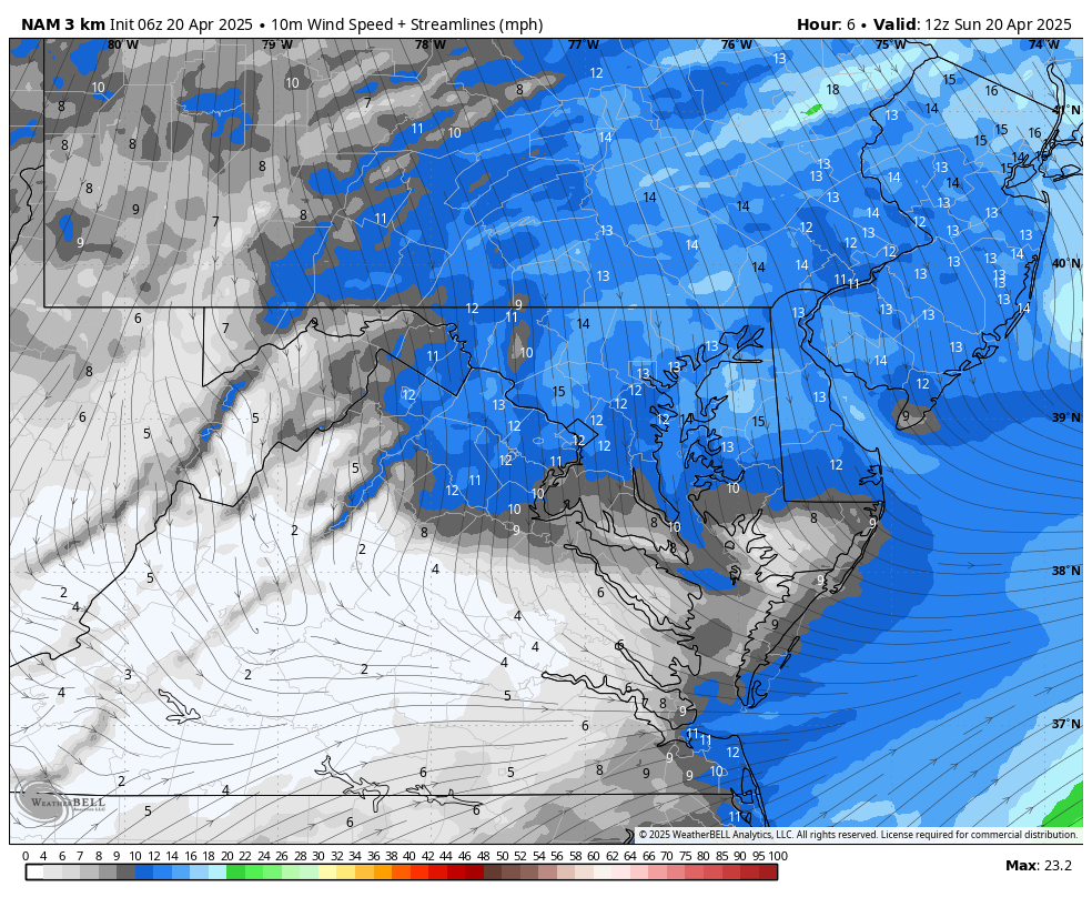
Gusts will be up to 25 mph, then relax this afternoon.
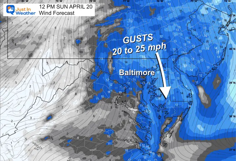
Most areas will be about 10 degrees cooler than yesterday.
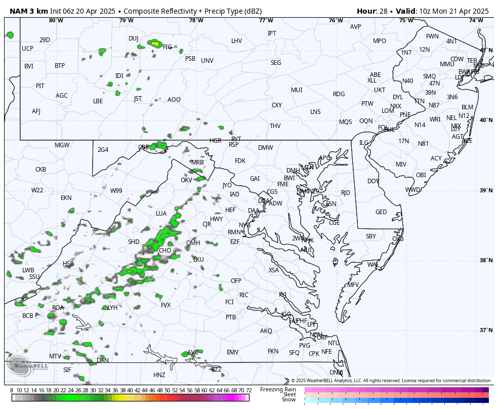
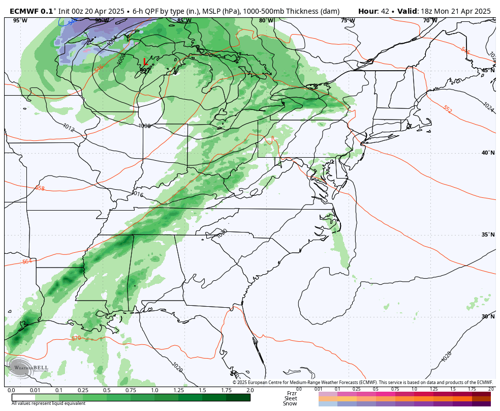
This will be an unsettled day with gusty winds and showers as a frontal boundary crosses the area.
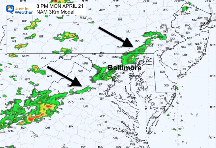
Morning showers in the mountains… followed by a line of rain and possibly a thunderstorm will cross metro areas Monday evening.
After the spotty showers to start the week, the pattern will relax and remain warm until the next storm organizes and reaches us with rain Friday into Saturday.
Temperatures remain above average. The next chance for rain will be Friday and Saturday.
Sign up and be the first to know!
Severe Weather: Storm Smart October and next spring Winter Weather FITF (Faith in the Flakes): November To March Click to see more and send a request for your school.

The annual event: Hiking and biking 329 miles in 7 days between The Summit of Wisp to Ocean City.
Each day, we honor a kid and their family’s cancer journey.
Fundraising is for Just In Power Kids: Funding Free Holistic Programs. I never have and never will take a penny. It is all for our nonprofit to operate.
Click here or the image to donate:

I am aware there are some spelling and grammar typos and occasional other glitches. I take responsibility for my mistakes and even the computer glitches I may miss. I have made a few public statements over the years, but if you are new here, you may have missed it: I have dyslexia and found out during my second year at Cornell University. It didn’t stop me from getting my meteorology degree and being the first to get the AMS CBM in the Baltimore/Washington region. One of my professors told me that I had made it that far without knowing and to not let it be a crutch going forward. That was Mark Wysocki, and he was absolutely correct! I do miss my mistakes in my own proofreading. The autocorrect spell check on my computer sometimes does an injustice to make it worse. I also can make mistakes in forecasting. No one is perfect at predicting the future. All of the maps and information are accurate. The ‘wordy’ stuff can get sticky. There has been no editor who can check my work while writing and to have it ready to send out in a newsworthy timeline. Barbara Werner is a member of the web team that helps me maintain this site. She has taken it upon herself to edit typos when she is available. That could be AFTER you read this. I accept this and perhaps proves what you read is really from me… It’s part of my charm. #FITF