April 6 2025
Sunday Morning Report
This weather report is just what the Doctor ordered. Yes, we are in a severe drought, and much-needed rain is on the way.
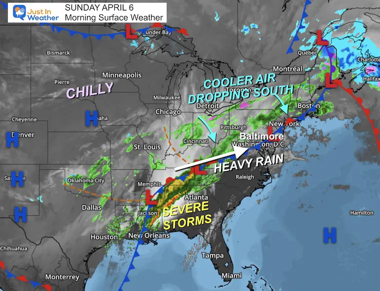
Last night brought a round of severe thunderstorms to north-central Maryland and southern Pennsylvania. This was the edge of the slow-moving storm system and long frontal boundary plaguing the nation. Now is our turn, but we will get chilly rain from it—not severe storms this time.
We can not make up our 10-inch deficit at once, nor do we want to. But we will have impulses of rain today and heavier rain overnight.
This will be followed by a chilly midweek and maybe a morning freeze. Then, another storm system will develop at the end of the week, which may bring a few additional days of rain Thursday into next weekend.
CLIMATE DATA: Baltimore
TODAY April 6
Sunrise at 6:43 AM
Sunset at 7:36 PM
Normal Low in Baltimore: 40ºF
Record 24ºF in 2016
Normal High in Baltimore: 63ºF
Record 90ºF 1929; 2010
Drought Reminder
Rainfall Deficit at BWI
- Ending 2024 = -8.00”
- Since Jan 1 = -3.38”
- We are DOWN -11.38” including last year
LIVE RADAR WIDGET
TODAY’S WEATHER
Surface Weather
The cooler air has settled in and will continue to drop south.
Heavy rain and flooding will continue across the Deep South, and more severe weather will be spread across the Gulf Coast.
An impulse of energy will send steady rain our way with a heavy burst tonight.
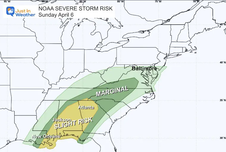
NOAA Severe Storm Risk
The Level 2 SLIGHT RISK shows the energy from this system is less intense and shrinking in coverage.
Storm Forecast Sunday Morning to Monday Night
ECWMF Model
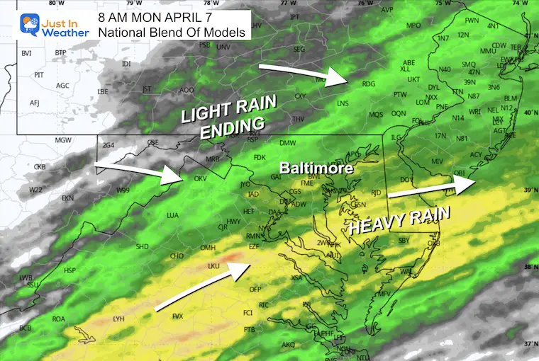
The band of rain will slide southward later today and overnight…
Rain will persist in our southern areas for much of Monday, while dry air will build north of Baltimore.

LOCAL WEATHER
Sharp Temperature Gradient
8 AM to 7 PM:
The cooler air will push southward all day, so the afternoon will be cooler AND no severe storms are expected for us.

Afternoon Temperatures

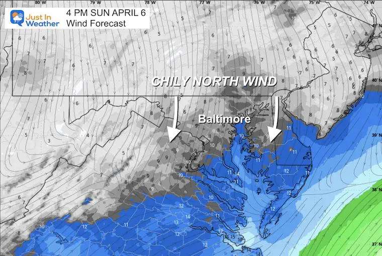
Wind Forecast
A light wind FROM THE NORTH is the source of our cooler air.
Radar Simulation 8 AM to 8 PM
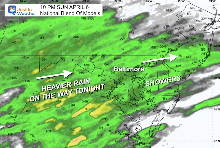
Steady rain to the north will slip south and break into showers, then redevelop into another solid burst of rain tonight.

Snapshot at 4 PM

Heavier Rain Tonight
Radar Simulation 4 PM Sunday to Noon Monday
This system will get a pulse of heavy rain tonight and slowly slip across our southern areas on Monday.

10 PM Snapshot
Heavier rain surges overnight.
Monday Weather
Morning Snapshot
Morning Temperatures
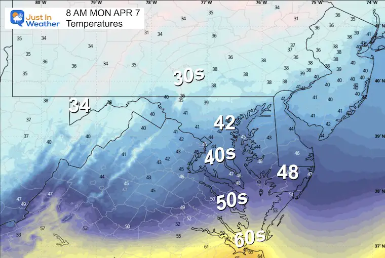
Afternoon Temperatures
The expectation is for the rain to arrive with the colder air mass… temps will be falling all day…

Rainfall Potential Total Through Monday

Jet Stream Monday to Friday Evening
This is a winter-like pattern but modified for early April. It will be chilly, and mornings may drop below freezing in many areas mid-week.
This will then help a new storm develop with needed rain at the end of the week.

Weather Forecast Thursday To Saturday
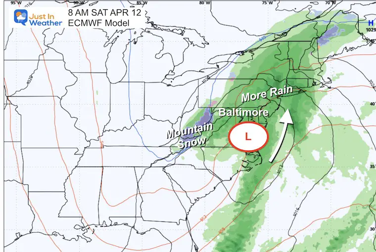
The next storm will develop in the deep trough across the Eastern US. It has the potential to be a slow-moving system with persistent rain for a few days.

Saturday Snapshot
This is 6 days away and subject to change…. For now, it looks like a strong Low Pressure may bring a chilly, heavy rain to much of our region.
7 Day Forecast
This round of rain will end Monday and will be followed by chilly air midweek.
The next storm will develop on Thursday and last into next weekend.

Subscribe for eMail Alerts
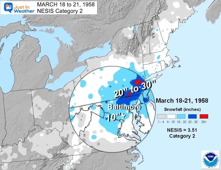
March Madness: History of Extreme Weather and Late Season Snow
Click here for the full report:
SNOW REPORTS THIS SEASON
Click on the maps for that full report.
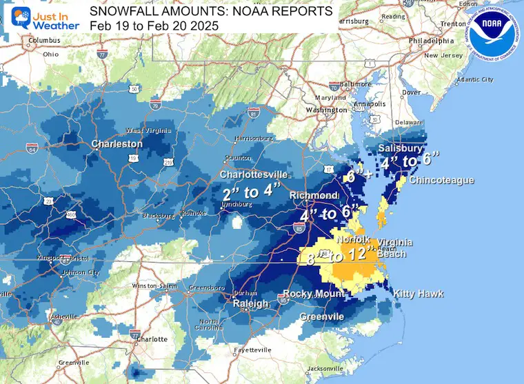
Just A Bit Outside Feb 19
Brief Recap Of The Record Snow For Virginia and the abrupt change from the longer range potential track.
February 11 Snow Report And Grade My Forecast
click here or the map for more

January 19 Snow Report

January 11 Snow Report

January 6 Snow Report

Previous Snow

ALSO SEE
Recent Snow Reports
La Nina Advisory January 2025
Full Report

MY WINTER OUTLOOK
My Winter Outlook Report

FITF Gear on Sale

In Case You Missed This
The Faith In The Flakes Dec 5 Origin Story

Please share your thoughts and best weather pics/videos, or just keep in touch via social media.
SCHEDULE A WEATHER BASED STEM ASSEMBLY
Severe Weather: Storm Smart October and next spring Winter Weather FITF (Faith in the Flakes): November To March Click to see more and send a request for your school.

THANK YOU:
Baltimore Magazine Readers Choice Best Of Baltimore
Maryland Trek 11 Day 7 Completed Sat August 10
We raised OVER $104,000 for Just In Power Kids – AND Still Collecting More
The annual event: Hiking and biking 329 miles in 7 days between The Summit of Wisp to Ocean City.
Each day, we honor a kid and their family’s cancer journey.
Fundraising is for Just In Power Kids: Funding Free Holistic Programs. I never have and never will take a penny. It is all for our nonprofit to operate.
Click here or the image to donate:

RESTATING MY MESSAGE ABOUT DYSLEXIA
I am aware there are some spelling and grammar typos and occasional other glitches. I take responsibility for my mistakes and even the computer glitches I may miss. I have made a few public statements over the years, but if you are new here, you may have missed it: I have dyslexia and found out during my second year at Cornell University. It didn’t stop me from getting my meteorology degree and being the first to get the AMS CBM in the Baltimore/Washington region. One of my professors told me that I had made it that far without knowing and to not let it be a crutch going forward. That was Mark Wysocki, and he was absolutely correct! I do miss my mistakes in my own proofreading. The autocorrect spell check on my computer sometimes does an injustice to make it worse. I also can make mistakes in forecasting. No one is perfect at predicting the future. All of the maps and information are accurate. The ‘wordy’ stuff can get sticky. There has been no editor who can check my work while writing and to have it ready to send out in a newsworthy timeline. Barbara Werner is a member of the web team that helps me maintain this site. She has taken it upon herself to edit typos when she is available. That could be AFTER you read this. I accept this and perhaps proves what you read is really from me… It’s part of my charm. #FITF


