January 19 Winter Storm Today: Air Gets Colder As Snow Arrives
January 19, 2025
Sunday Morning Report
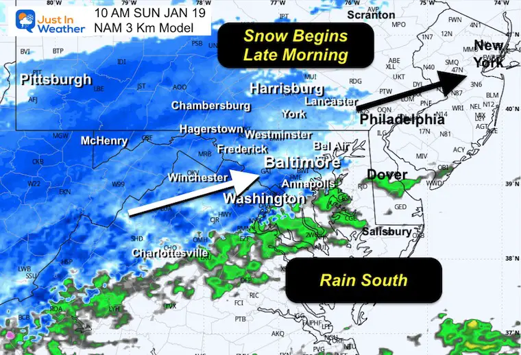
Today is our snow day, then the Polar Air and bitter cold will follow! I have been saying “Plan for an ALL DAY EVENT”. The only change is the start time… later this morning. This gets us a few early hours, but by lunchtime the snow should be here and last into the evening.
Morning temps are above freezing in most of our region. There may be a snow mix or rain in metro areas initially, then it will turn to snow as temps get colder THE REST OF THE DAY! That is important for the type of snow, where the rain line sets up, and even ending with snow in those wet areas turning icy tonight.
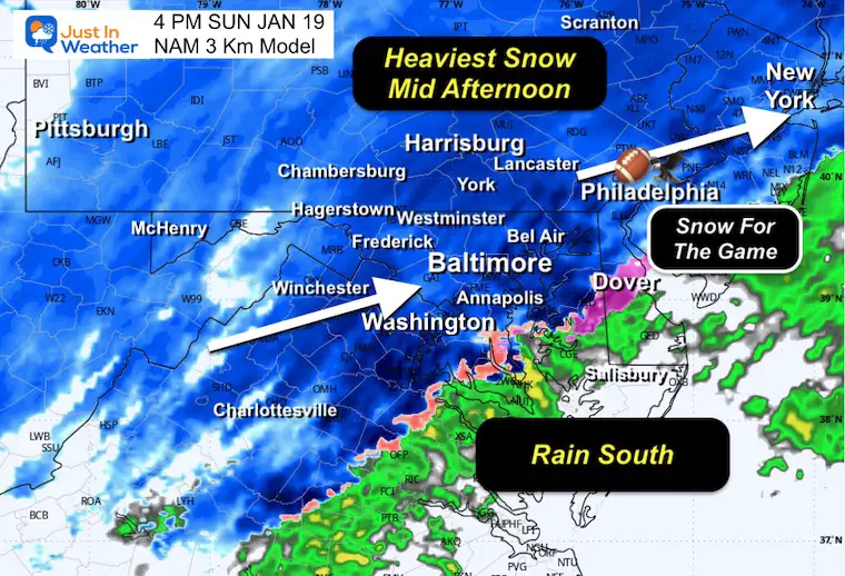
Nearby football fans in Philadelphia will have snow for the Eagles game. I wonder if one of those betting sites has wagers for fans throwing snowballs. Either way, the game will be entertaining.
Polar Vortex ‘Influence’: The actual circulation will be in Canada, but the Bitter Cold Air will arrive after the storm. So, clean-up will be slow. Drifting with the deep freeze could affect some schools that are scheduled to reopen on Tuesday morning.
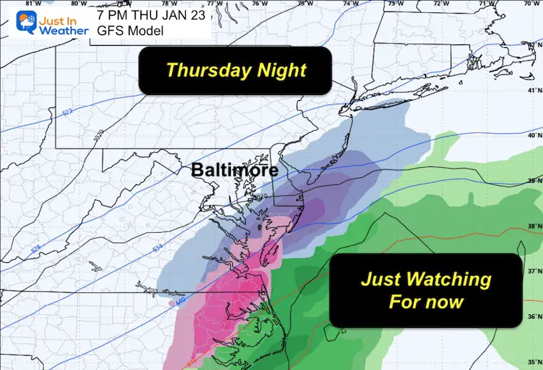
The rest of the week will be extremely cold, staying below freezing. The storm track will be pushed farther south, but it is worth watching the coast later this week.
Winter Storm Alerts
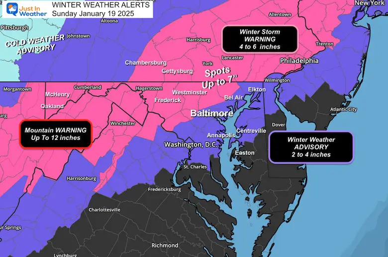
Winter Storm Warning has been issued for the typical colder counties in Central Maryland, North and West of Baltimore and Washington.
Winter Weather Advisory has added Queen Anne’s County in Maryland on the Eastern Shore.
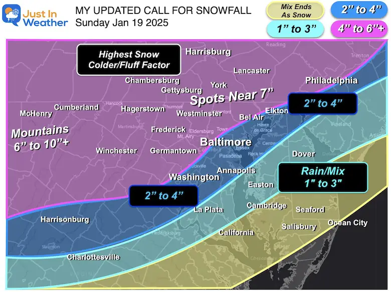
My Updated/Final Call For Snowfall
This was my call yesterday afternoon, and the computer guidance is still not in agreement. See the many maps below AND compare my call to the computer models and NWS forecasts.
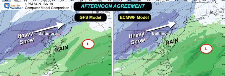
Sneak Peak: Afternoon
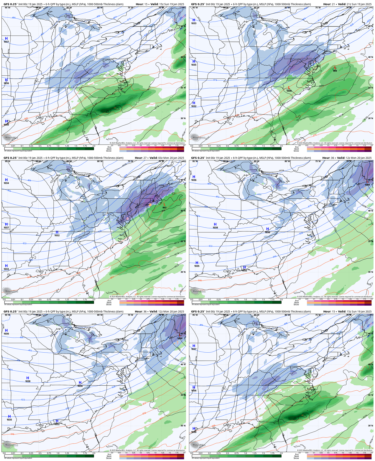
The GFS and European Models agree on the location and intensity of the snow. It will be heaviest at this time (mid-afternoon), and it will definitely be fun to watch that Eagles home game in Philadelphia.
CLIMATE DATA: Baltimore
TODAY January 19
Sunrise at 7:22 AM
Sunset at 5:13 PM
Normal Low in Baltimore: 25ºF
Record -5ºF in 1994
Normal High in Baltimore: 43ºF
Record 69ºF 1951
Baltimore Seasonal Snow
7.9” (This Will Change Today)
Subscribe for eMail Alerts
Weather posts straight to your inbox
Sign up and be the first to know!
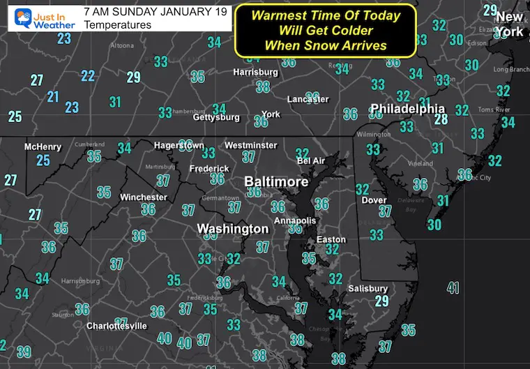
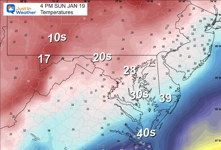
Morning Temperatures
This is the warmest time today. Temps will get colder all day.
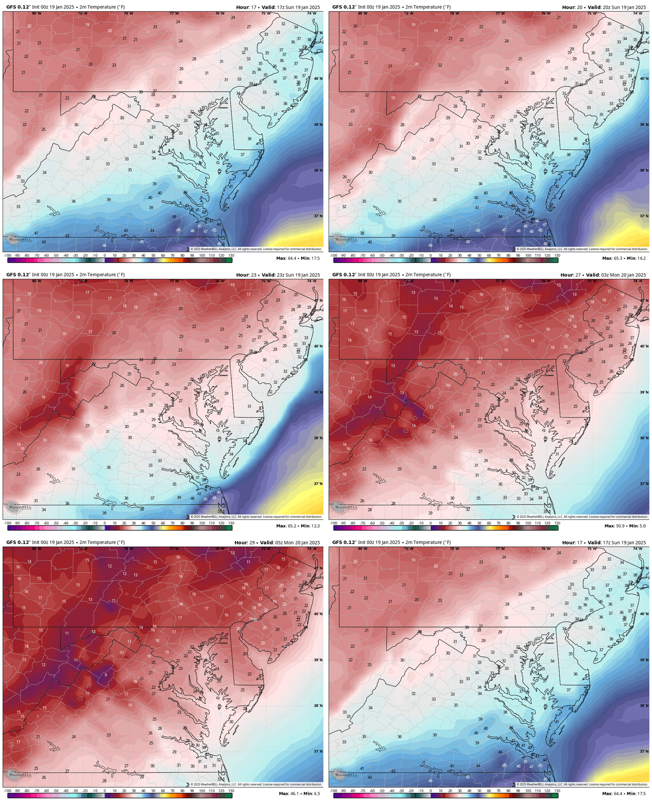
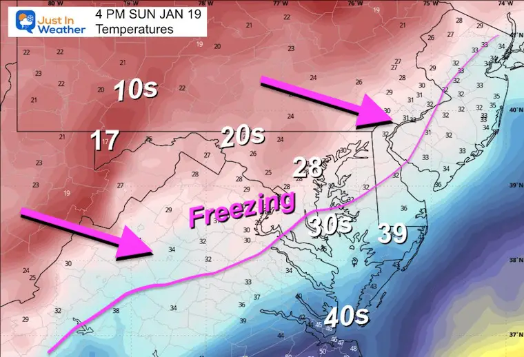
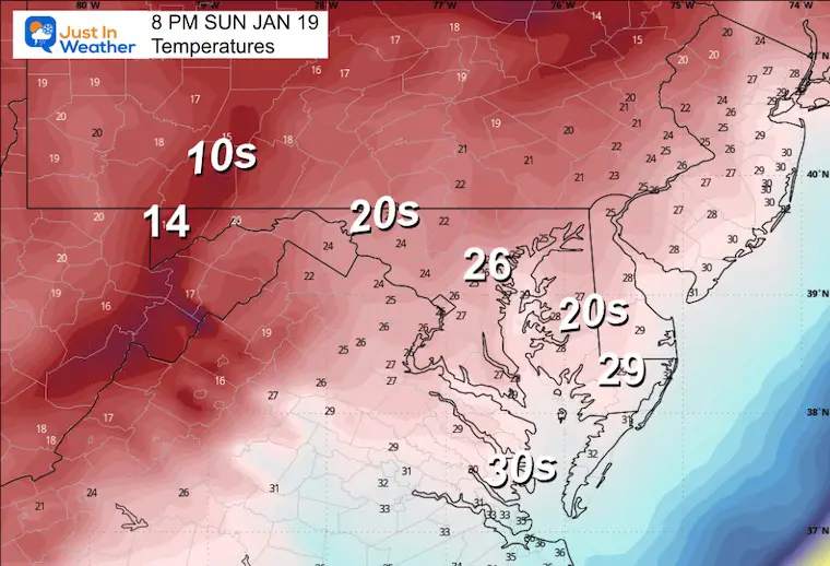
Temperature Forecast 7 AM to midnight
I rarely show this product, but I think this helps illustrate the falling temps this afternoon and tonight. Even if you start with rain or melting snow, that will change.
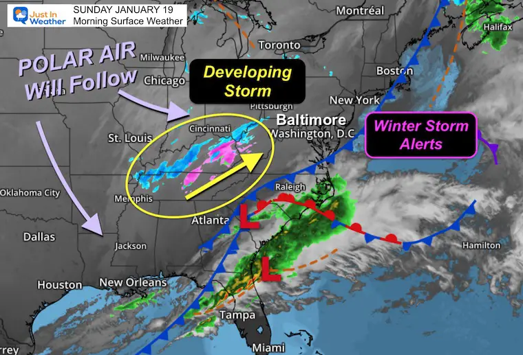
Morning Surface Weather
The storm is just starting to take form. The upper-level energy has a band of light snow in the mountains that will expand and build our way later this morning.
GFS Model Animation 7 AM Sun to 7 AM Mon
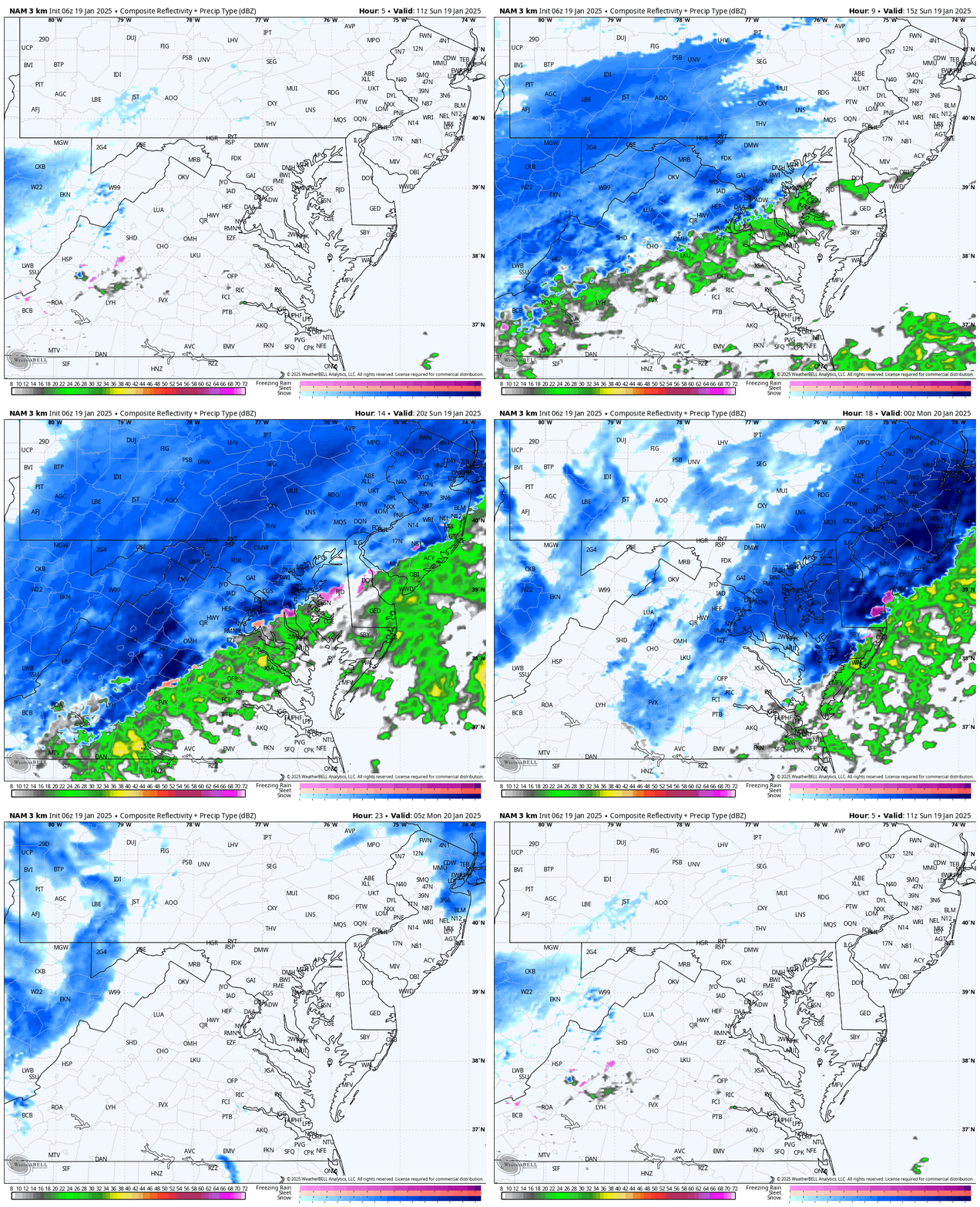
Short Range Timeline: NAM 3Km
Radar Simulation: 7 AM to Midnight
Snapshots
Morning: Snow begins 9 AM to Noon
Afternoon: Heaviest Snow
Temperatures
Evening Temperatures
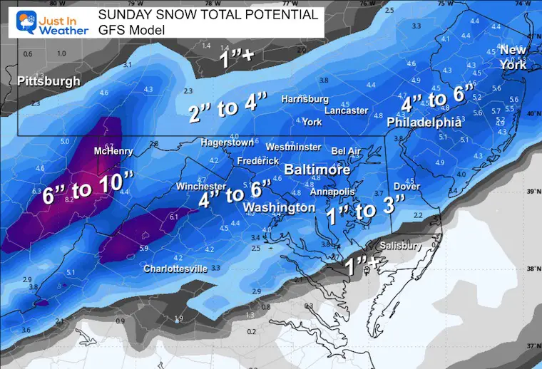
Sunday Snow Total Potential
This is using the standard 10 to 1 ratio given the temps closer to freezing for metro areas.
Inland will be in the 20s longer, so I do expect the ‘fluff factor’ to apply. Basically, I see a higher amount inland.
GFS Model
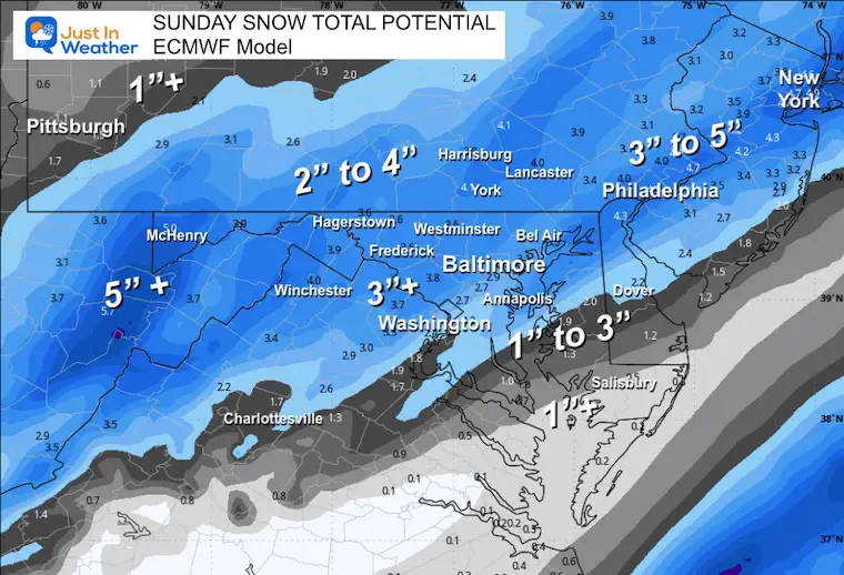
European ECMWF Model
More in line with the GFS again.
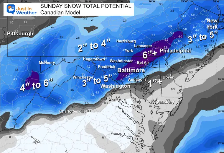
Canadian Model
This had been showing the strongest storm. It has come down with totals and down south with the rain line.
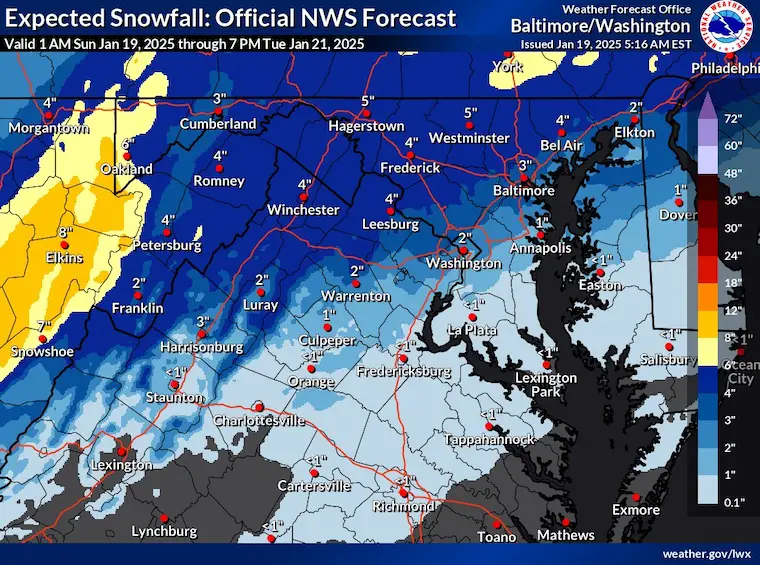
National Weather Service (Baltimore Washington Office)
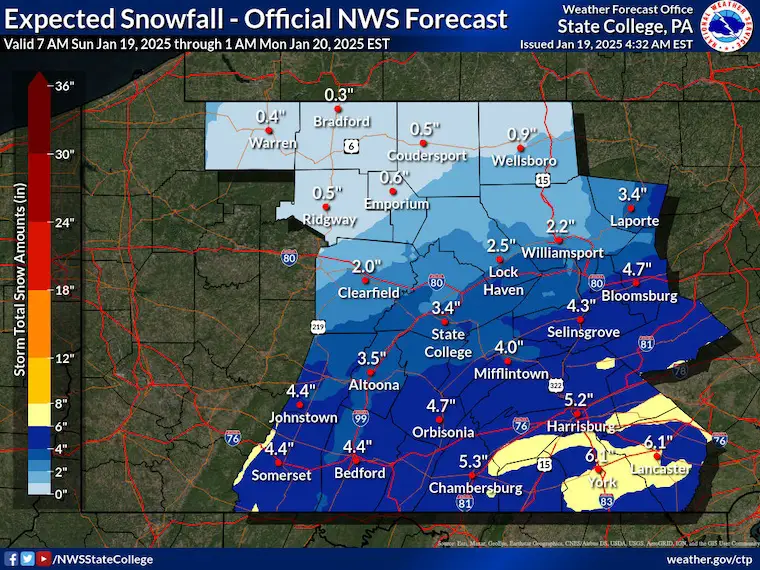
Central Pennsylvania (State College PA Office)
Click here to see other regional office snow maps
Repeat: My Updated/Final Call For Snowfall
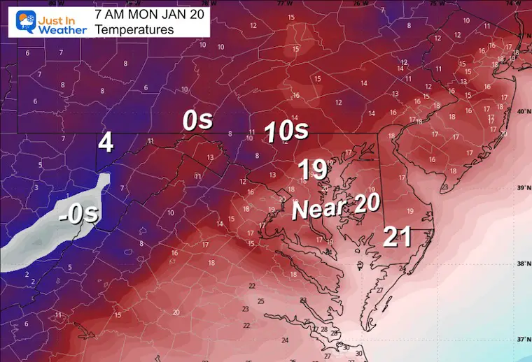
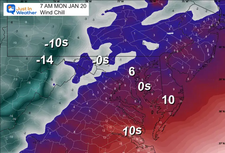
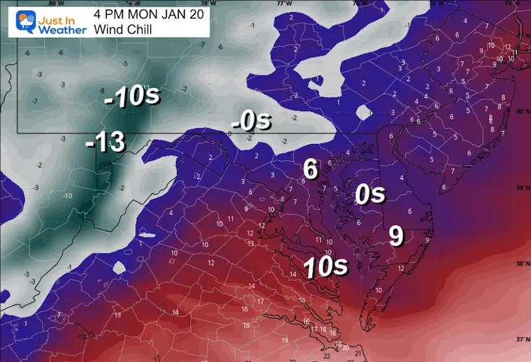
MONDAY WEATHER
Temperatures and Wind Chills
Morning
Wind Forecast
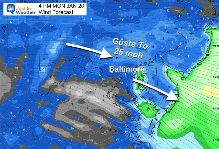
Afternoon
Work Week Outlook
The Jet Stream will be dominated by the push of Polar Air. The actual Polar Vortex will be in Canada, but dislodged to influence the ENTIRE Eastern US.
This may produce snow for the Gulf Coast and need to watch something trying to slide along the Mid Atlantic or Southeast Coast.
Jet Stream: Sunday Afternoon to Friday Evening
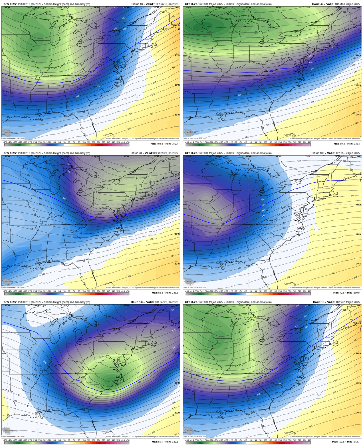
Storm Animations
GFS Model: Tuesday Afternoon to Friday
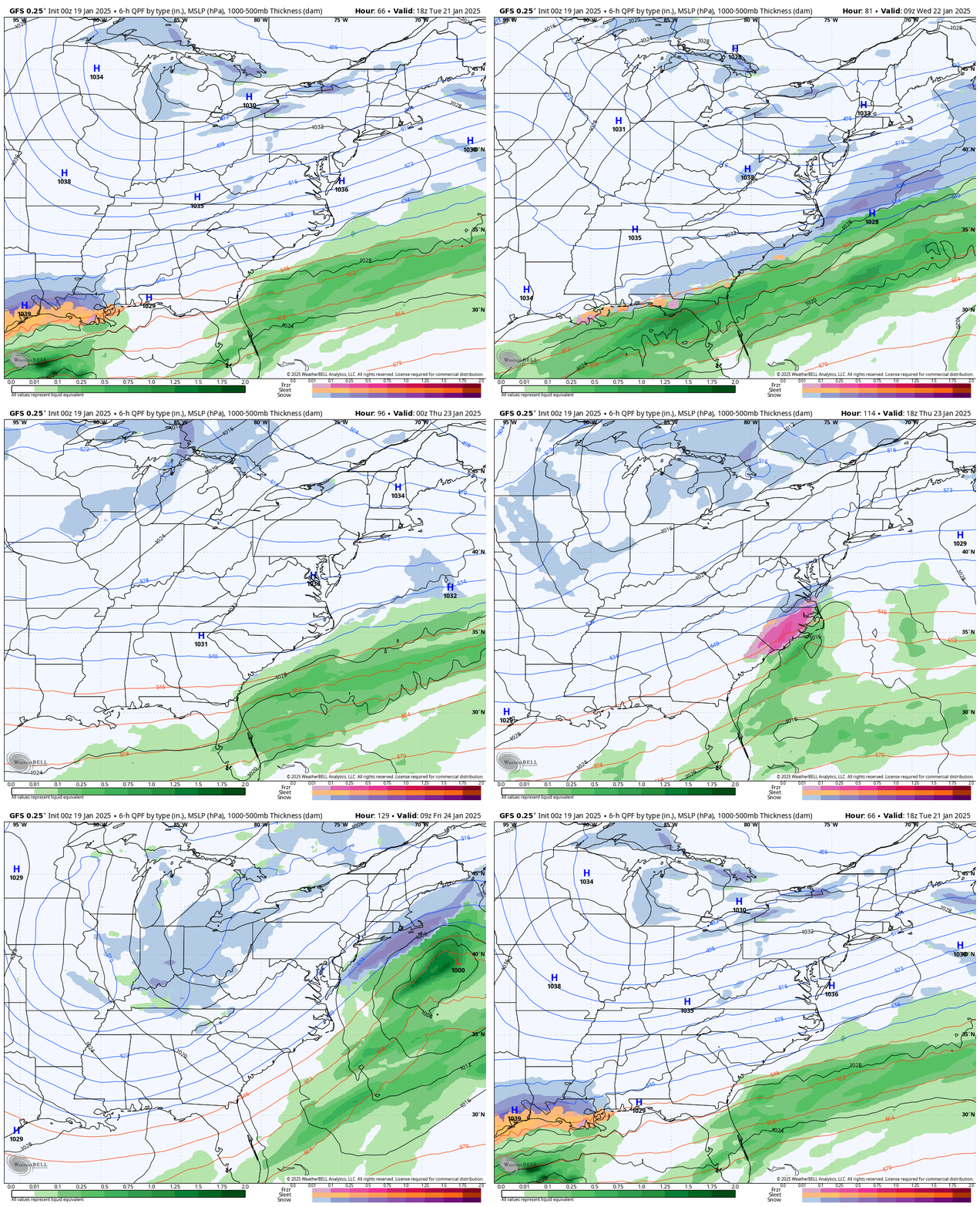
ECMWF Model: Tuesday Afternoon to Friday
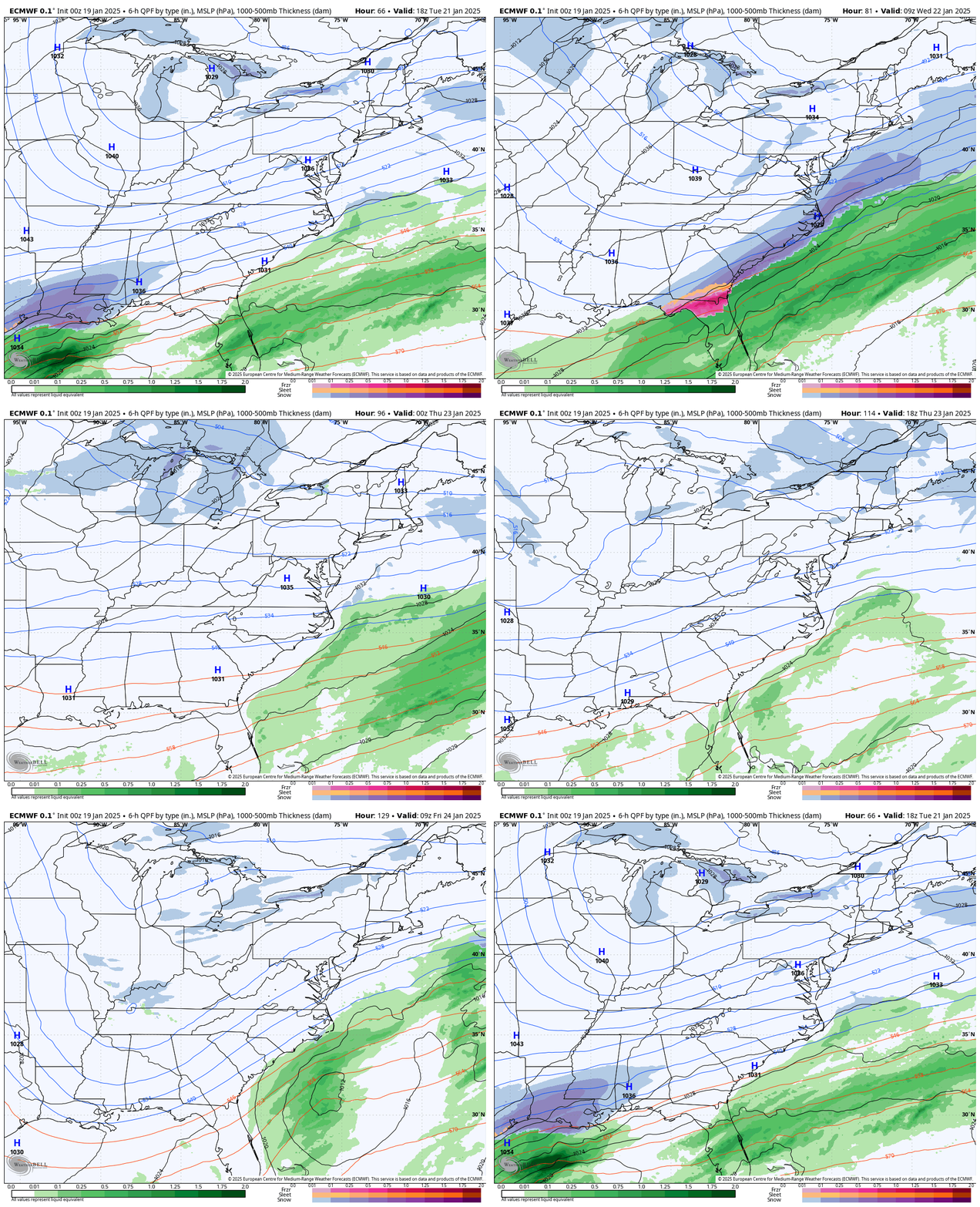
Snapshot:
The GFS has done the best with this Sunday storm, so I wanted to show it for the end of the week. This is NOT a promise, and I expect it to change as we get closer. It’s just something to watch.
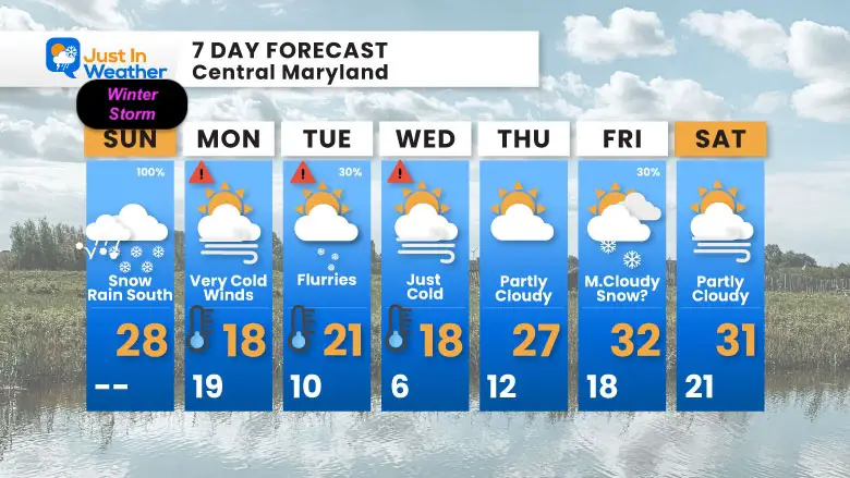
7 Day Forecast
Dangerously cold air will follow Monday.
We will remain BELOW FREEZING THROUGH THE WEEK!
Wind Chills will be lower.
Flurries may arrive on Tuesday, and some additional cloud cover may mitigate how cold we can get on Wednesday morning. This looks less intense than I have shown in prior days, but it is still extreme.
I have low confidence in the late-week snow chances, but I need to keep this a possibility.
Subscribe for eMail Alerts
Weather posts straight to your inbox
Sign up and be the first to know!
SNOW REPORTS THIS SEASON
Click on the maps for that full report.
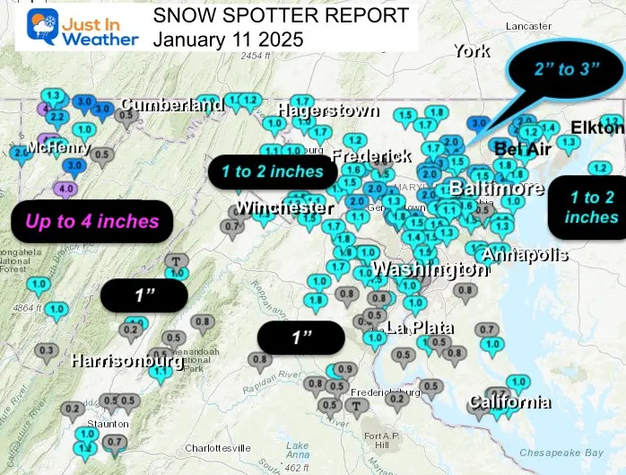
January 11 Snow Report
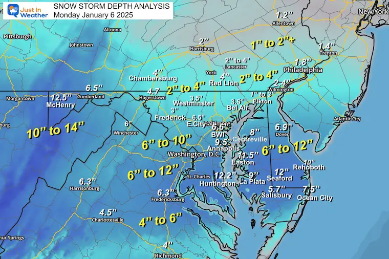
January 6 Snow Report
Previous Snow
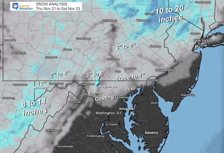
November 22 Snow Report
ALSO SEE
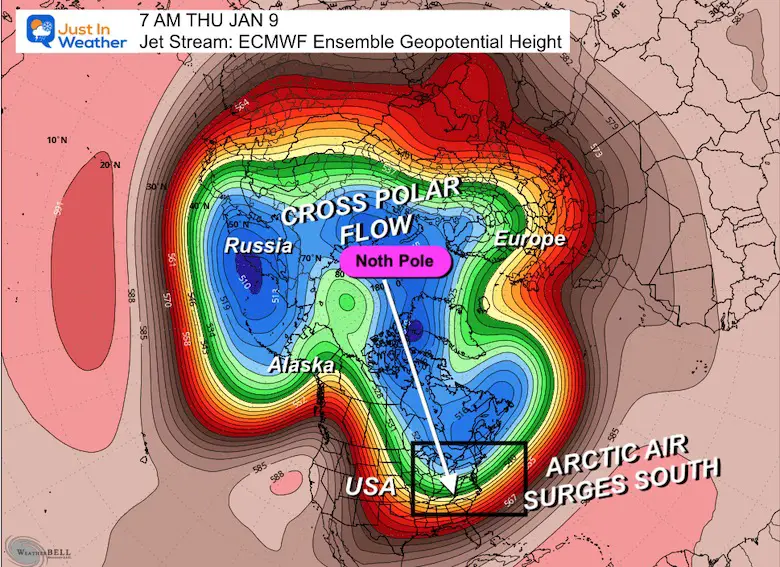
Arctic Outbreak For January
If you missed it, here is my detailed report from December 30 about why this IS A BIG DEAL!
MY WINTER OUTLOOK
FITF Gear on Sale
In Case You Missed This
The Faith In The Flakes Dec 5 Origin Story
Please share your thoughts and best weather pics/videos, or just keep in touch via social media.
-
Facebook: Justin Berk, Meteorologist
-
Twitter
-
Instagram
SCHEDULE A WEATHER BASED STEM ASSEMBLY
Severe Weather: Storm Smart October and next spring Winter Weather FITF (Faith in the Flakes): November To March Click to see more and send a request for your school.
THANK YOU:
Baltimore Magazine Readers Choice Best Of Baltimore
Maryland Trek 11 Day 7 Completed Sat August 10
We raised OVER $104,000 for Just In Power Kids – AND Still Collecting More
The annual event: Hiking and biking 329 miles in 7 days between The Summit of Wisp to Ocean City.
Each day, we honor a kid and their family’s cancer journey.
Fundraising is for Just In Power Kids: Funding Free Holistic Programs. I never have and never will take a penny. It is all for our nonprofit to operate.
Click here or the image to donate:
RESTATING MY MESSAGE ABOUT DYSLEXIA
I am aware there are some spelling and grammar typos and occasional other glitches. I take responsibility for my mistakes and even the computer glitches I may miss. I have made a few public statements over the years, but if you are new here, you may have missed it: I have dyslexia and found out during my second year at Cornell University. It didn’t stop me from getting my meteorology degree and being the first to get the AMS CBM in the Baltimore/Washington region. One of my professors told me that I had made it that far without knowing and to not let it be a crutch going forward. That was Mark Wysocki, and he was absolutely correct! I do miss my mistakes in my own proofreading. The autocorrect spell check on my computer sometimes does an injustice to make it worse. I also can make mistakes in forecasting. No one is perfect at predicting the future. All of the maps and information are accurate. The ‘wordy’ stuff can get sticky. There has been no editor who can check my work while writing and to have it ready to send out in a newsworthy timeline. Barbara Werner is a member of the web team that helps me maintain this site. She has taken it upon herself to edit typos when she is available. That could be AFTER you read this. I accept this and perhaps proves what you read is really from me… It’s part of my charm. #FITF


