December 15, 2024
Sunday Morning Report
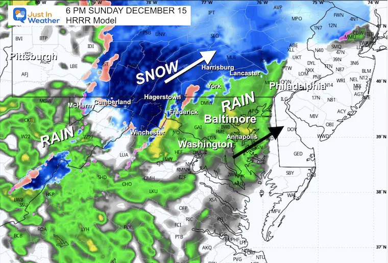
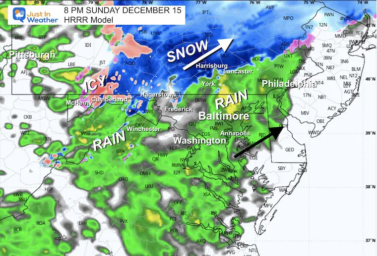
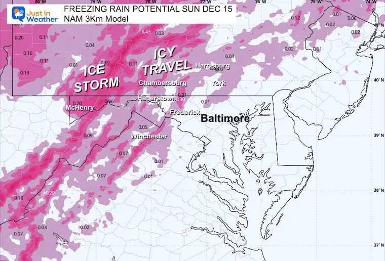
That very strong High Pressure had developed a deeper layer of cold air. This will be tough to move out AND will result in more snow than expected. This burst will affect mainly areas between Fredrick and Frostburg. The higher mountains will actually turn to freezing rain.
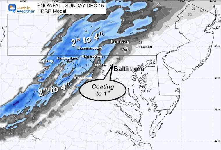
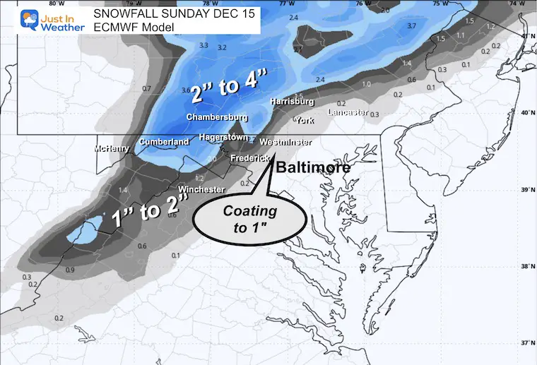
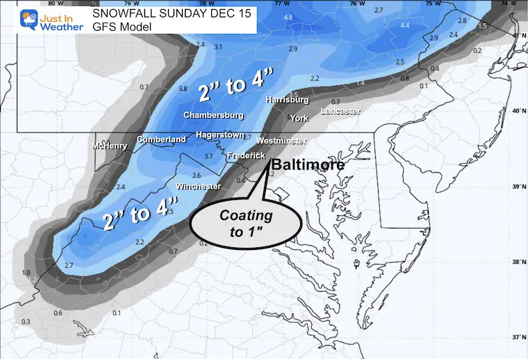
This deep layer of cold air may allow for the initial precipitation to bring light snow to Frederick, Westminster, and York, PA. A coating to 1 inch of snow is possible… mostly on the grass, as temps will be warming just above freezing.
A chilly rain for metro areas this afternoon and tonight.
Then we warm with more periods of rain through Wednesday.
The week will end with a dramatic cooldown and perhaps some flurries with the colder winds next weekend.
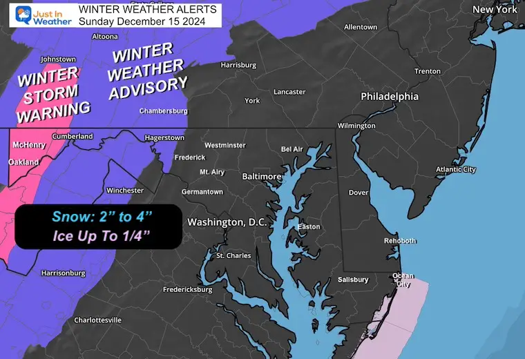
Winter Weather Alerts
Winter Weather Advisory: Slushy Snow, up to 4 inches of snow, and some freezing rain.
Winter Storm Warning: Lighter Snow, more freezing rain/icing up to 1/4 inch.
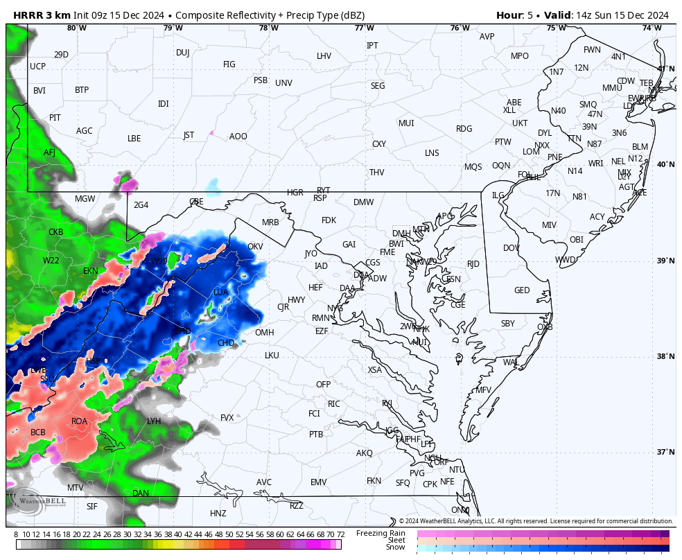
Radar Simulation Forecast:
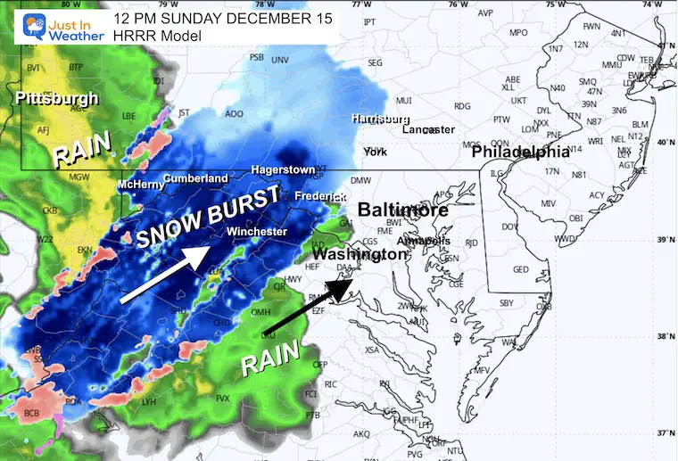
HRRR Model 10 AM to 10 PM
This is the High-Resolution Refresh Model I trust today more than the NAM 3 km.
Timeline Snapshots Detailed Below…
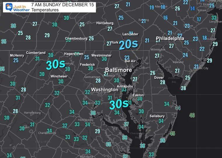
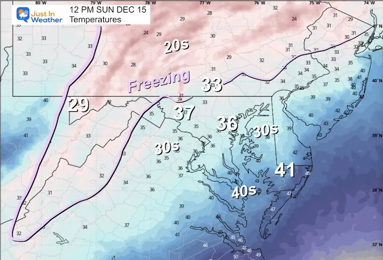
Local Morning Temperatures
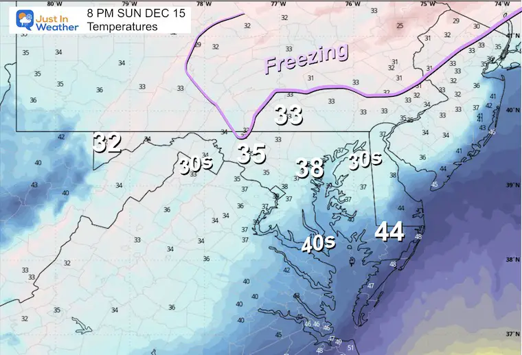
The cold air is capped by the advancing clouds and may hold for longer.
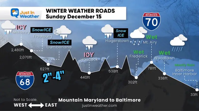
My Road Travel Forecast
See the model snow maps below.
The problems are more likely west of I-70 and along I-81.
Closer Look: Northwest Suburbs Along MD Rt 140

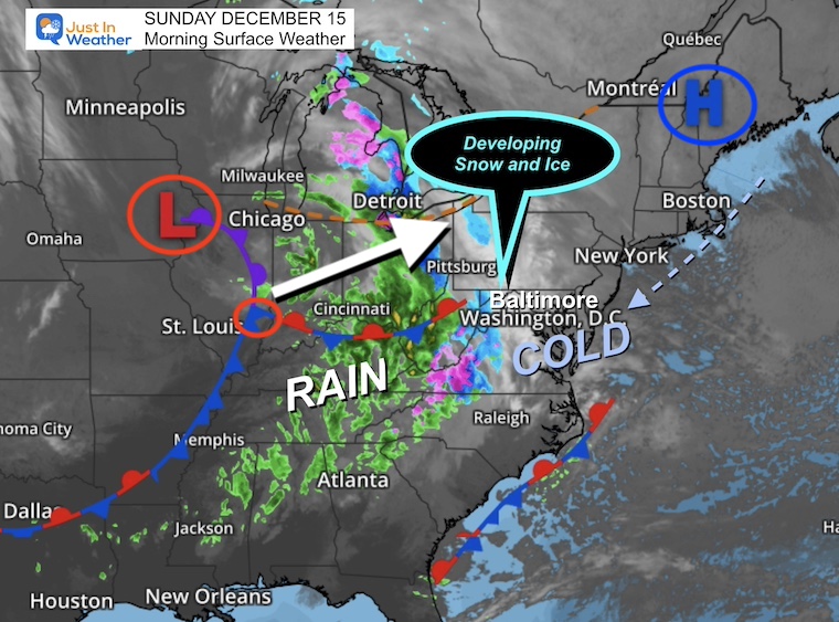
Morning Surface Weather
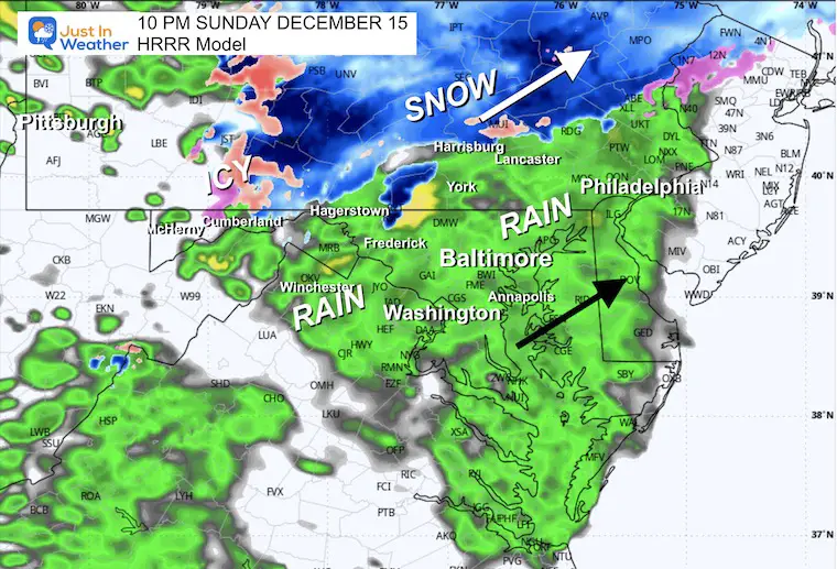
The developing storm is bumping into this deep layer of cold air. Snow and, eventually, freezing rain will result in the mountains. What we will see is detailed below.
A chilly rain is expected around Baltimore up through Philadelphia and Metro New York (for the end of the Ravens Game later).
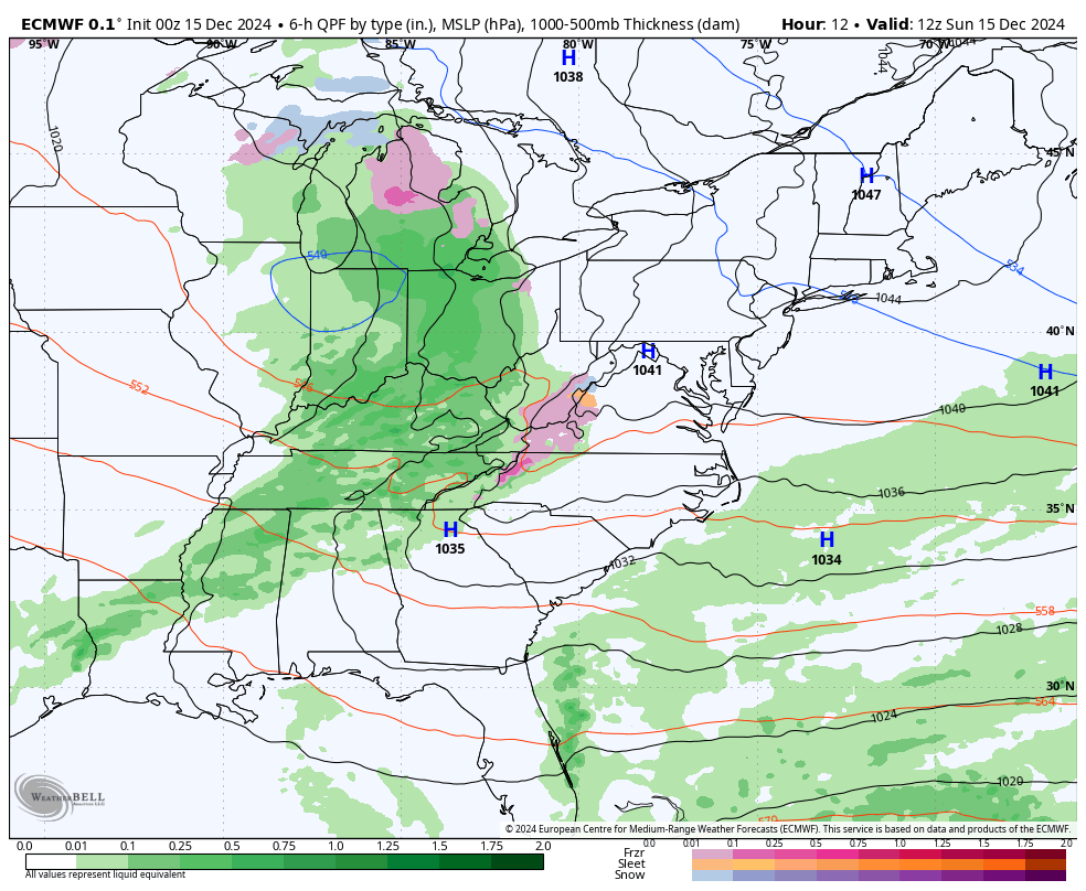
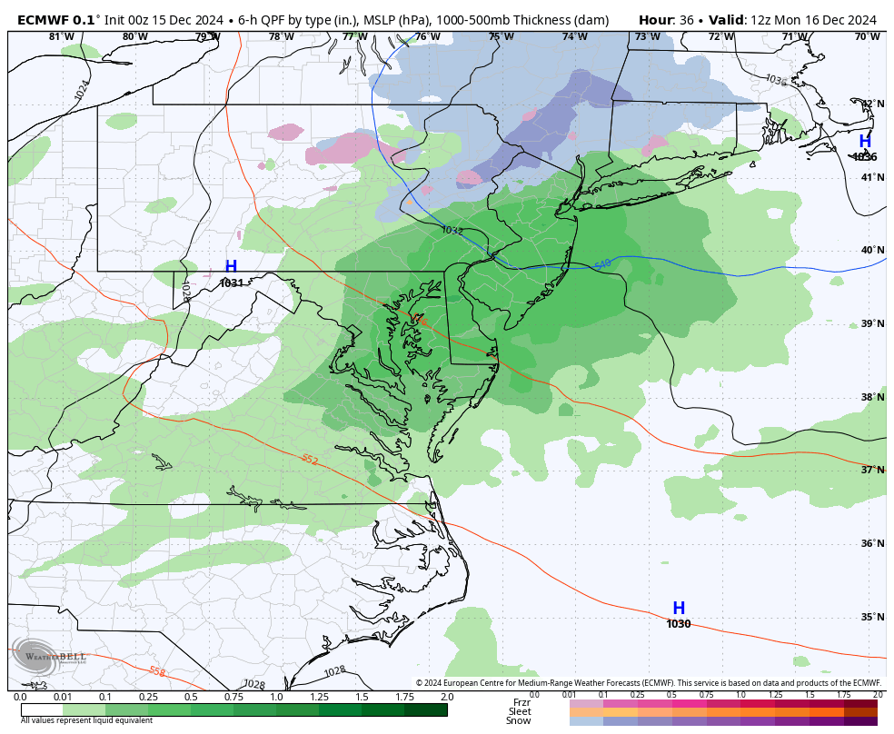
Storm Animation: ECWMF Model
Sunday Morning to Tuesday Morning
The first wave of snow and ice will trend to rain for most areas.. then a second push of rain with warmer air Monday night into Tuesday morning.
Timeline Snapshots
Noon
Temperatures
Radar Simulation
Afternoon
3 PM Temperatures
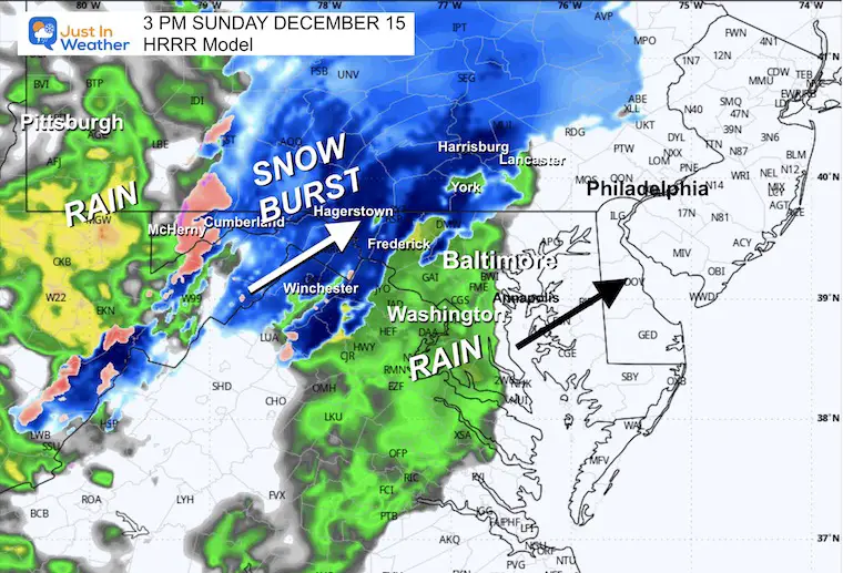
Radar Simulation

Evening at 6 PM
Evening at 8 PM
Temperatures
Radar Simulation
Tonight at 10 PM
Radar Simulation: Turning to rain with snow along I-81 North of Harrisburg to The Poconos.
Snow Potential
HRRR Model
Very reasonable.
ECWMF Model
Similar to the HRRR Model
GFS Model
Once again this seems overdone.
Freezing Rain and Sleet Ice Accumulation
CLIMATE DATA: Baltimore
TODAY December 15
Sunrise at 7:19 AM
Sunset at 4:45 PM
Normal Low in Baltimore: 30ºF
Record 9ºF in 1960; 1962
Normal High in Baltimore: 48ºF
Record 70ºF 1929; 1971
Baltimore Drought Update
- 7.47 inches BELOW AVERAGE rainfall since September 1st
- 7.95 inches BELOW AVERAGE rainfall since January 1st
WORK WEEK BRIEF LOOK
Due to all the details for today’s event, I want to simplify the work week with these brief graphics.
Storm Animation: Monday to Thursday Morning
A series of impulses or Low-Pressure Systems will ride with warmer air and bring more rain from Monday night to Tuesday morning, then Wednesday afternoon until Thursday morning.
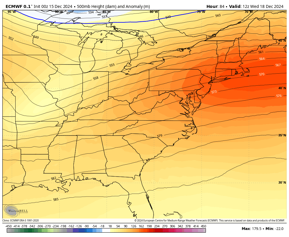
LONGER RANGE OUTLOOK
Jet Stream: Wed Dec 18 to Mon Dec 23
Warming with the rain, then the upper-level flow brings much colder air next weekend into the start of Christmas Week.
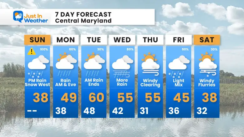
7 Day Forecast
There will be a big swing with periods of rain as we warm to the 50s and near 60. The final storm will shift the flow aloft and bring in colder air. I see one more system that could bring a light mix and then flurries to end the week. Much colder air will follow the day after this.
Subscribe for eMail Alerts
FITF Gear on Sale

In Case You Missed This
The Faith In The Flakes Dec 5 Origin Story

In Case You Missed It:

WINTER OUTLOOK
My Winter Outlook Report

Please share your thoughts and best weather pics/videos, or just keep in touch via social media.
SCHEDULE A WEATHER BASED STEM ASSEMBLY
Severe Weather: Storm Smart October and next spring
Winter Weather FITF (Faith in the Flakes): November To March
Click to see more and send a request for your school.

THANK YOU:
Baltimore Magazine Readers Choice Best Of Baltimore
Maryland Trek 11 Day 7 Completed Sat August 10
We raised OVER $104,000 for Just In Power Kids – AND Still Collecting More
The annual event: Hiking and biking 329 miles in 7 days between The Summit of Wisp to Ocean City.
Each day, we honor a kid and their family’s cancer journey.
Fundraising is for Just In Power Kids: Funding Free Holistic Programs. I never have and never will take a penny. It is all for our nonprofit to operate.
Click here or the image to donate:

RESTATING MY MESSAGE ABOUT DYSLEXIA
I am aware there are some spelling and grammar typos and occasional other glitches. I take responsibility for my mistakes and even the computer glitches I may miss. I have made a few public statements over the years, but if you are new here, you may have missed it: I have dyslexia and found out during my second year at Cornell University. It didn’t stop me from getting my meteorology degree and being the first to get the AMS CBM in the Baltimore/Washington region.
One of my professors told me that I had made it that far without knowing and to not let it be a crutch going forward. That was Mark Wysocki, and he was absolutely correct! I do miss my mistakes in my own proofreading. The autocorrect spell check on my computer sometimes does an injustice to make it worse. I also can make mistakes in forecasting. No one is perfect at predicting the future. All of the maps and information are accurate. The ‘wordy’ stuff can get sticky.
There has been no editor who can check my work while writing and to have it ready to send out in a newsworthy timeline. Barbara Werner is a member of the web team that helps me maintain this site. She has taken it upon herself to edit typos when she is available. That could be AFTER you read this. I accept this and perhaps proves what you read is really from me… It’s part of my charm. #FITF


