Winter Weather Advisory and Warning Sunday for Some Snow And Icy Travel
Saturday Evening Dec 14 2024
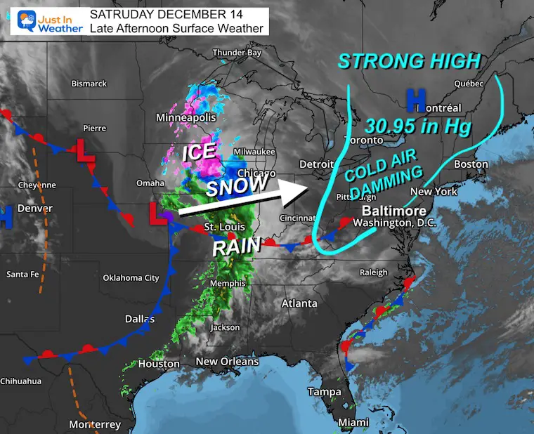
Strong High Pressure that brought us clearing and a cold start to the weekend is going to play another role as the next storm approaches: Cold Air Damming. This is when a layer of cold and dense air banks up in the valleys between the mountains and coastal areas in the Mid-Atlantic as a storm brings in warmer air and moisture aloft. The net result can be an extended period of wintry weather, mostly in the form of ice.
This is what is expected between the high mountains along the spine of the Appalachians and near I-81 across Virginia, Maryland, and into Central Pennsylvania.
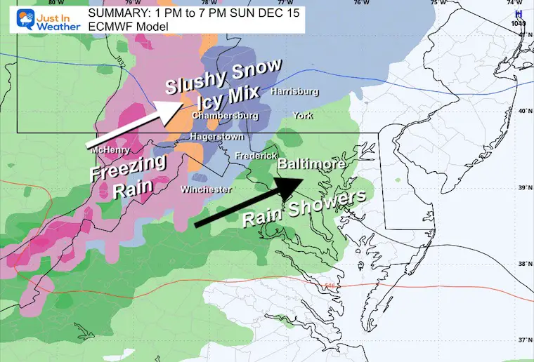
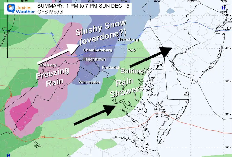
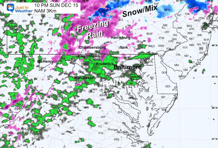
The inland suburbs west of Baltimore and Washington to Frederick, Westminster, and York, PA: There may be some flurries or light sleet, but this looks like a cold rain event developing early to mid-afternoon, steadier in the evening.
Winter Weather Alerts
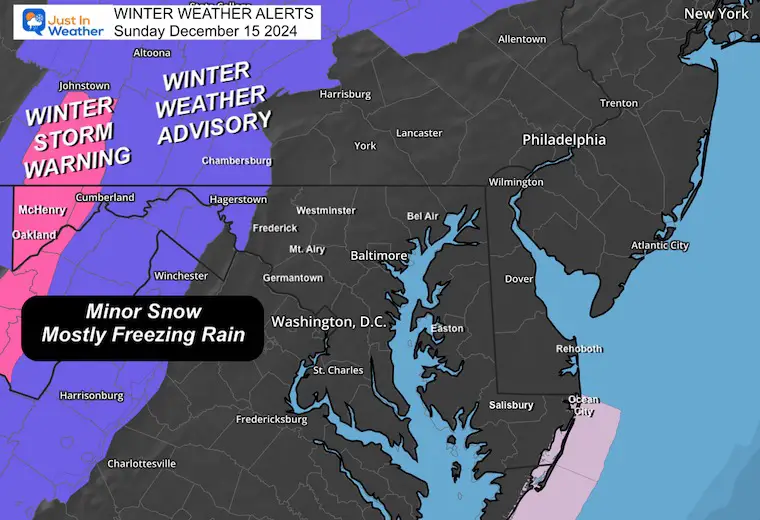
Winter Storm Warning in the higher mountains. I see more of an ice storm, but the National Weather Service has identified the potential for a snow burst with a few inches of snow.
Winter Weather Advisory: The models have a longer burst of snow, then sleet and freezing rain. I would lean more toward icy travel along and west of I-81 Virginia and Maryland, then passing just north of Harrisburg in PA. If you travel that road towards the Poconos, it will be slow-moving in the afternoon.
Before looking at the forecast timeline…
Preliminary Storm Expectations
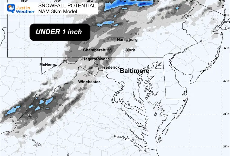
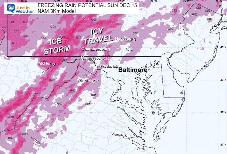
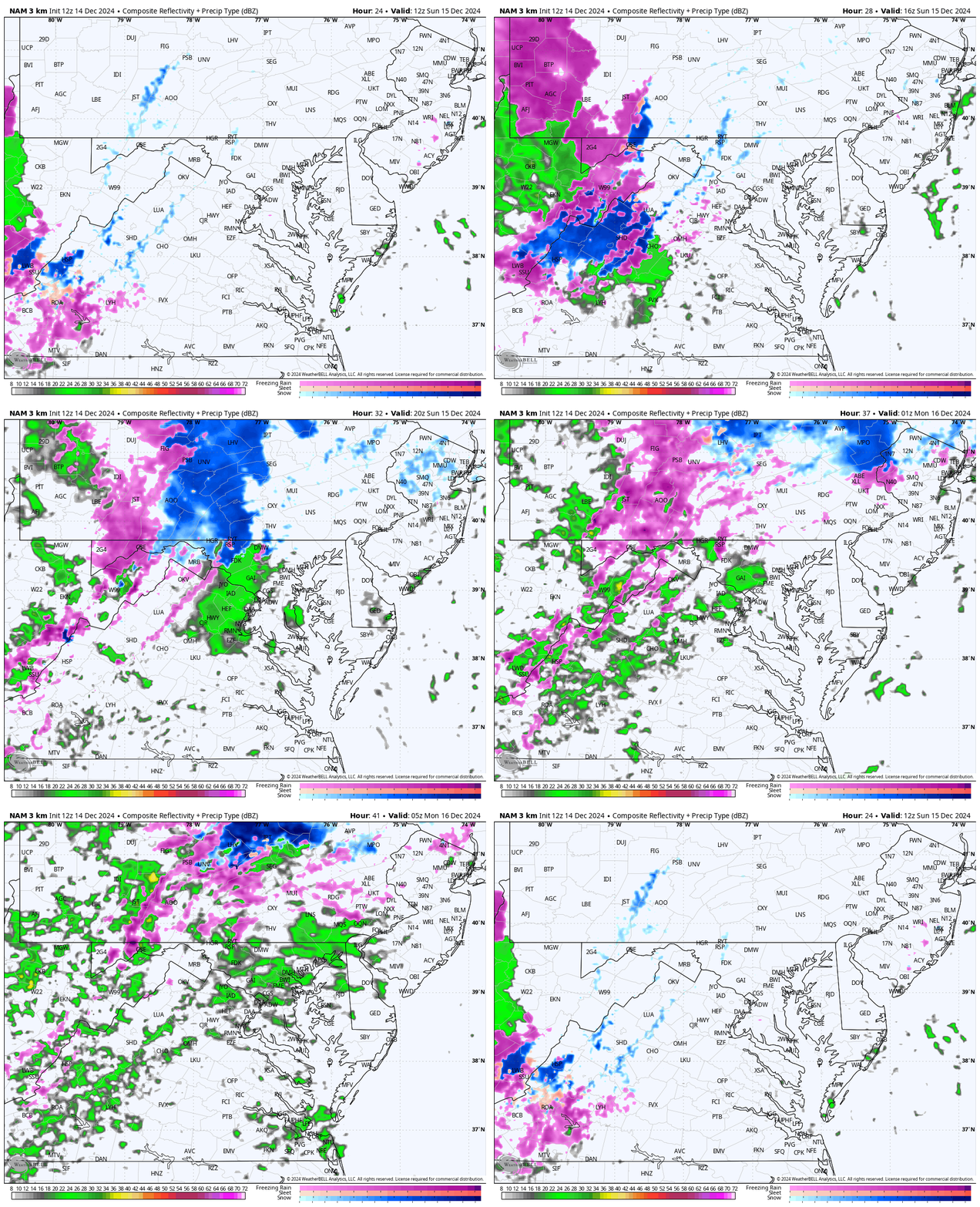
This is from the NAM 3Km, which tends to be a little more aggressive. It is still low on snow and more focused on the freezing rain.
Snow Potential
This is NOT the primary concern.
Freezing Rain Potential
This IS the primary concern.
Saturday Set Up
The High Pressure was centered near Montreal, Quebec, Canada. The pressure level of 30.95 in Hg is very strong, which will help establish the cold air and hold it longer.
The Low-Pressure/storm center was located near Kansas City and already had a band of ice and snow on the north end. This storm will track East-Northeast and arrive in our region mid-morning to noon Sunday.
Note: There will be a series of additional storms to follow, with warmer temps and rain into the middle of the week.
Model Forecast Maps
There is a bias or error that often leads winter weather events to arrive a little faster than shown here. While the models will lean towards noon for the arrival, I would plan for mid to late morning.
We will start with the Mid-Atlantic view and then take a closer look at the High-Resolution NAM 3Km Model and key timeframes.
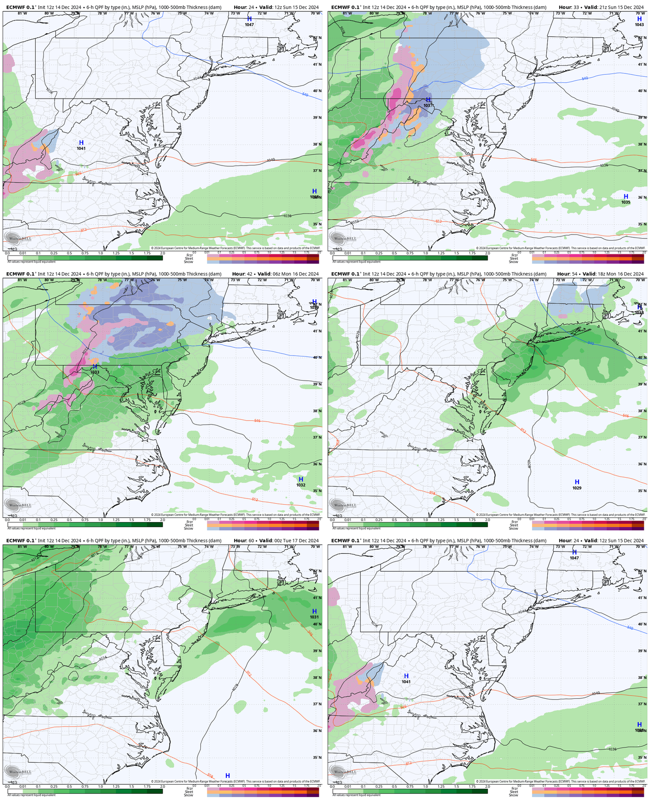
Wider View: Sunday Morning To Monday Evening
ECMWF Model
- Blue = Snow
- Pink = Freezing Rain
- Green = Rain
Note that this will develop during the day and transition to all rain overnight, ending Monday morning. The next wave will arrive by Monday night with all rain.
6-Hour Model Summaries
ECMWF Model 1 PM to 7 PM
GFS Model 1 PM to 7 PM
Closer Look NAM 3 Km Model
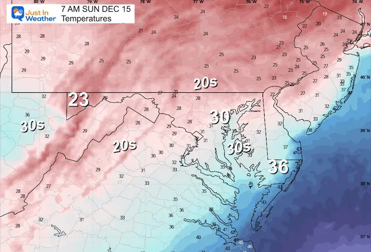
7 AM Temperatures
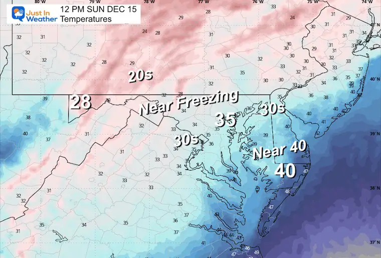
Deep reach of freezing temps with ample support to start the day.
7 AM to Midnight
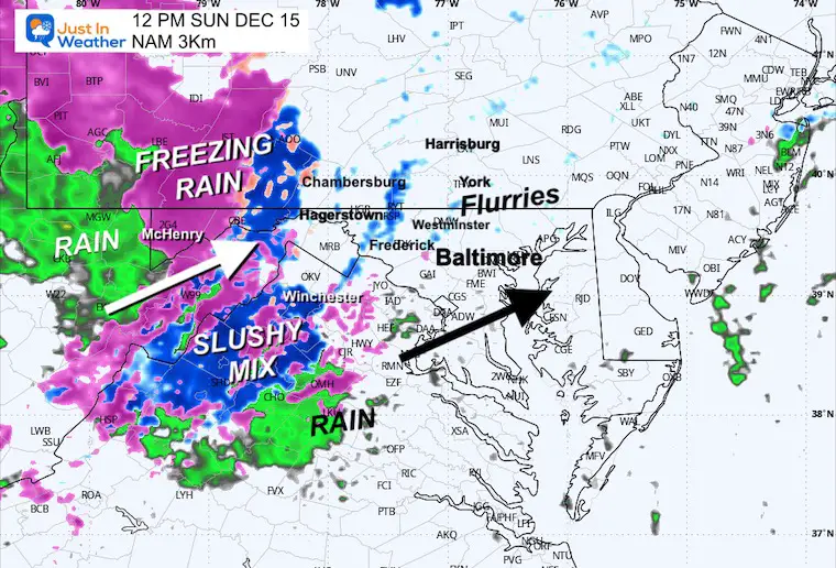
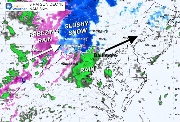
Rain/Snow often arrives and departs 1 to 2 hours earlier than shown.
Snapshots
Noon Radar
Noon Temperatures
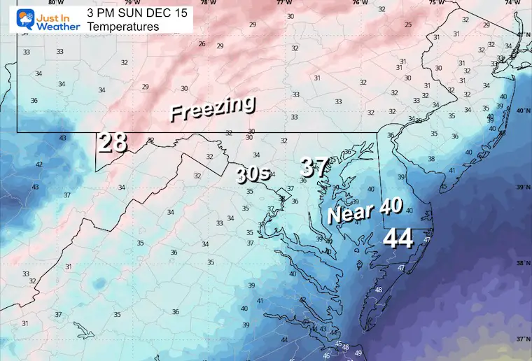
Mid Afternoon
3 PM Radar
3 PM Temperatures
Sunday Night
10 PM Radar
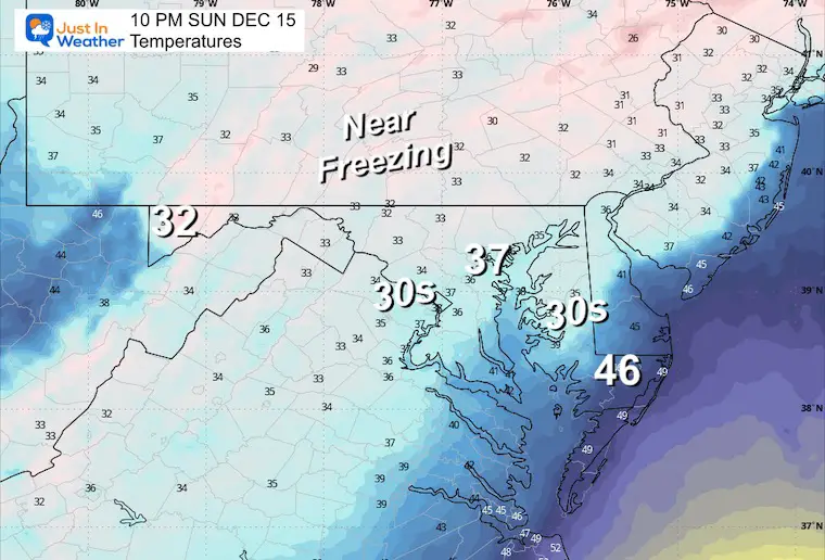
10 PM Temperatures
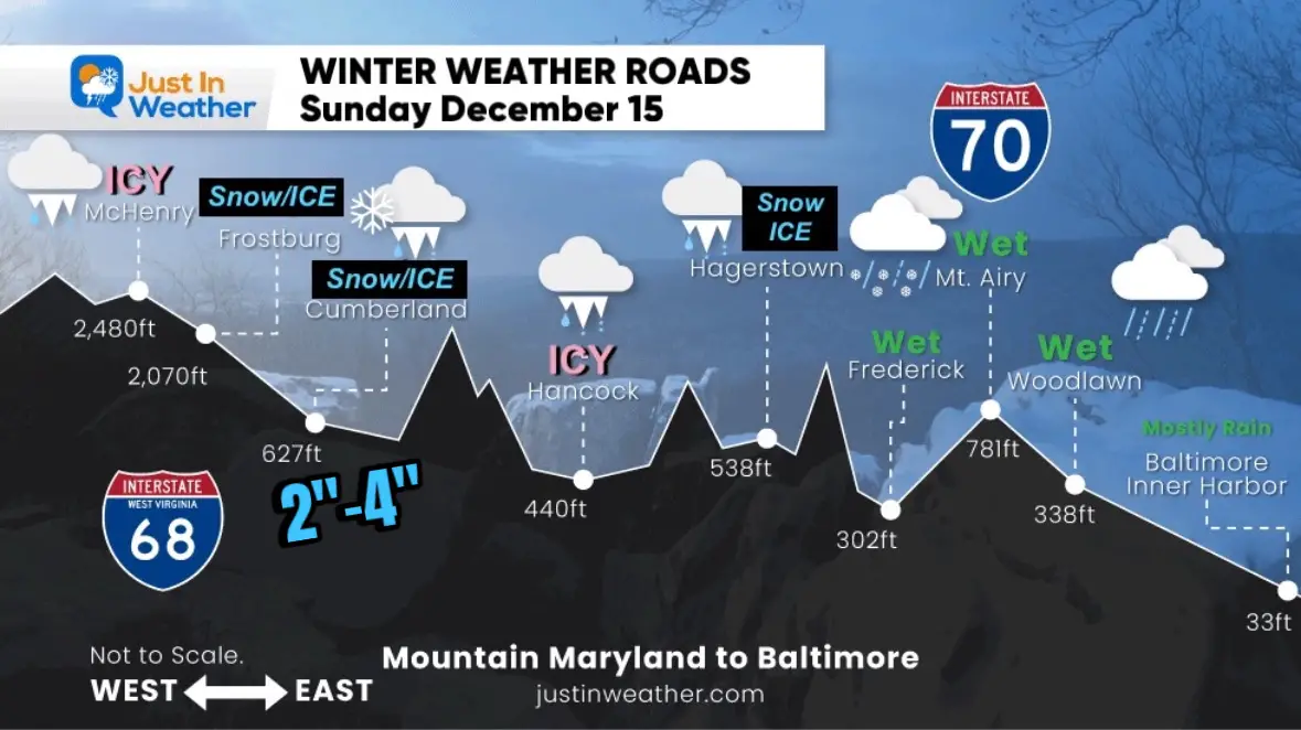
Road Travel Profile
This is between 8 AM and 6 PM
Long Range Forecast
From this morning
Wednesday Afternoon to Friday Afternoon
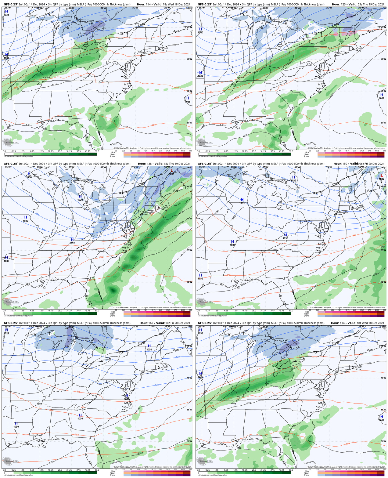
This round of rain will be followed by colder air and mountain snow. The subtle instability does not show, but there will be energy to produce flurries east of the mountains.
LONGER RANGE OUTLOOK
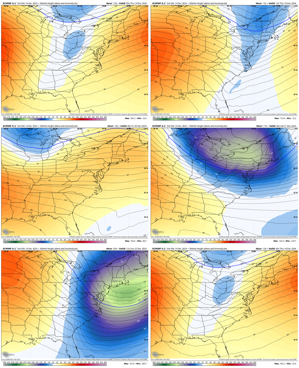
Focus on the Jet Stream because the surface storm plots are not reliable this far away…
After the rain and warm-up, a shot of very cold air arrives by the end of next week. This will dominate the Eastern US by the end of next weekend.
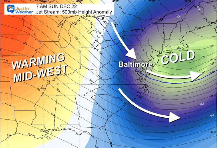
Sunday Morning
The coldest air is expected to end the weekend. Freezing temps may reach parts of Florida.
7 Day Forecast
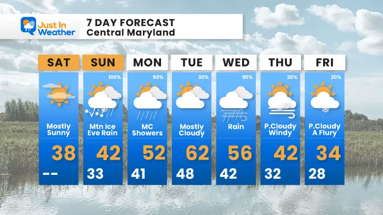
Sunday will be the most complex day, with ice and snow in the mountains and rain by evening in the metro areas.
Warming with rain next week. It will not be all rain but rather a few impulses for a few days.
The colder end of the week may come with flurries.
Subscribe for eMail Alerts
Weather posts straight to your inbox
Sign up and be the first to know!
FITF Gear on Sale
In Case You Missed This
The Faith In The Flakes Dec 5 Origin Story
In Case You Missed It:
November 22 Snow Report
WINTER OUTLOOK
Please share your thoughts and best weather pics/videos, or just keep in touch via social media.
-
Facebook: Justin Berk, Meteorologist
-
Twitter
-
Instagram
SCHEDULE A WEATHER BASED STEM ASSEMBLY
Severe Weather: Storm Smart October and next spring
Winter Weather FITF (Faith in the Flakes): November To March
Click to see more and send a request for your school.
THANK YOU:
Baltimore Magazine Readers Choice Best Of Baltimore
Maryland Trek 11 Day 7 Completed Sat August 10
We raised OVER $104,000 for Just In Power Kids – AND Still Collecting More
The annual event: Hiking and biking 329 miles in 7 days between The Summit of Wisp to Ocean City.
Each day, we honor a kid and their family’s cancer journey.
Fundraising is for Just In Power Kids: Funding Free Holistic Programs. I never have and never will take a penny. It is all for our nonprofit to operate.
Click here or the image to donate:
RESTATING MY MESSAGE ABOUT DYSLEXIA
I am aware there are some spelling and grammar typos and occasional other glitches. I take responsibility for my mistakes and even the computer glitches I may miss. I have made a few public statements over the years, but if you are new here, you may have missed it: I have dyslexia and found out during my second year at Cornell University. It didn’t stop me from getting my meteorology degree and being the first to get the AMS CBM in the Baltimore/Washington region.
One of my professors told me that I had made it that far without knowing and to not let it be a crutch going forward. That was Mark Wysocki, and he was absolutely correct! I do miss my mistakes in my own proofreading. The autocorrect spell check on my computer sometimes does an injustice to make it worse. I also can make mistakes in forecasting. No one is perfect at predicting the future. All of the maps and information are accurate. The ‘wordy’ stuff can get sticky.
There has been no editor who can check my work while writing and to have it ready to send out in a newsworthy timeline. Barbara Werner is a member of the web team that helps me maintain this site. She has taken it upon herself to edit typos when she is available. That could be AFTER you read this. I accept this and perhaps proves what you read is really from me… It’s part of my charm. #FITF


