Thursday Morning Snow Squall Wind Advisory And Mountain Blizzard
Wednesday Night Update December 4, 2024
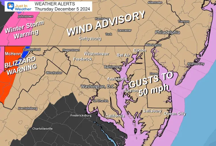
December 5th has a history of producing the first snow for Baltimore almost every year between 2003 to 2012. It was what prompted the start of Faith in the Flakes with my older son in 2009. This year, we have a little bit again on that date. The real problem will be the winds, but the morning may bring a little concern inland.
Wind Advisory and Blizzard Warning
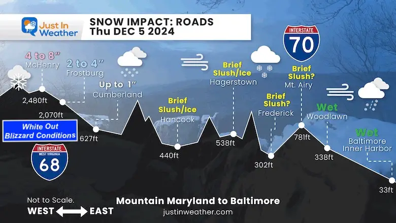
Road Profile Morning Impact Across Maryland
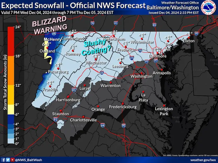
Temperatures will play a big role east of the mountains for any quick slushy coating or freezing. Metro areas around Baltimore and I-95 will stay wet.
Farther inland above 2,000 Ft will be impacted by snow-covered roads and white-out conditions. Snow totals around Deep Creek Lake will be 4 to 8 inches.
Set Up Tonight
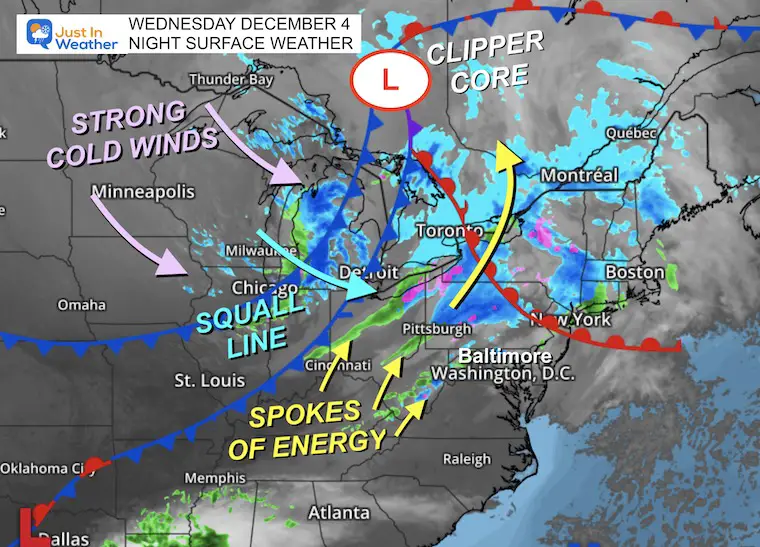
The Clipper storm we have been talking about is gaining intensity ahead of reaching our region on Thursday morning. The Low Pressure is centered in Ontario, Canada, and the trailing dual barrel cold fronts represent equal lines with snow and stronger, cold winds on the other side.
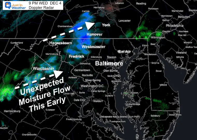
This has spokes of energy wrapping around it, with a few bands of precipitation, including a surprise flow into Maryland tonight. This suggests to me that the storm is stronger than models have forecasted. That is the only hesitation with the expectations for the morning impact.
Doppler Radar at 9 PM
This is one of those spokes, producing a flow of moisture with some light snow across the mountains. This was not on most forecast models, suggesting this storm is producing more of a footprint than expected. It might be a little stronger when it arrives in the morning.
Forecast Notes
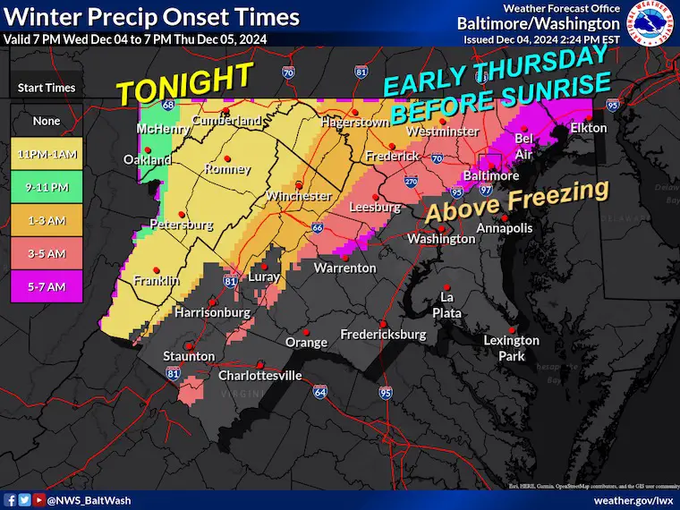
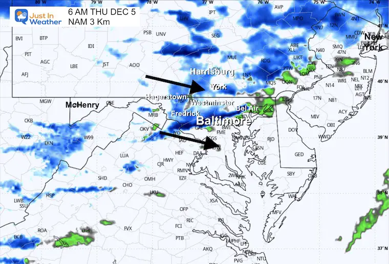
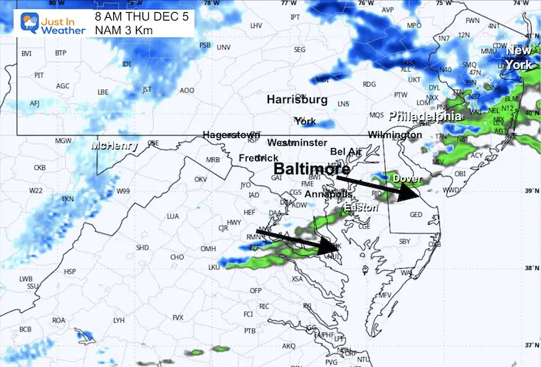
We know there will be a blizzard in the mountains and a wind advisory for the rest of our region. The squall line of snow will run into temperatures just above freezing, but a rapid freeze inland behind it may make for a couple of hours worth paying attention to just before sunrise.
I have encouraged students to do their homework and studies, while teachers should expect school on time. But just in case, pay attention for some brief impact.
Let’s take a look at it all.
National Weather Service Maps:
Winter Precipitation Onset Times
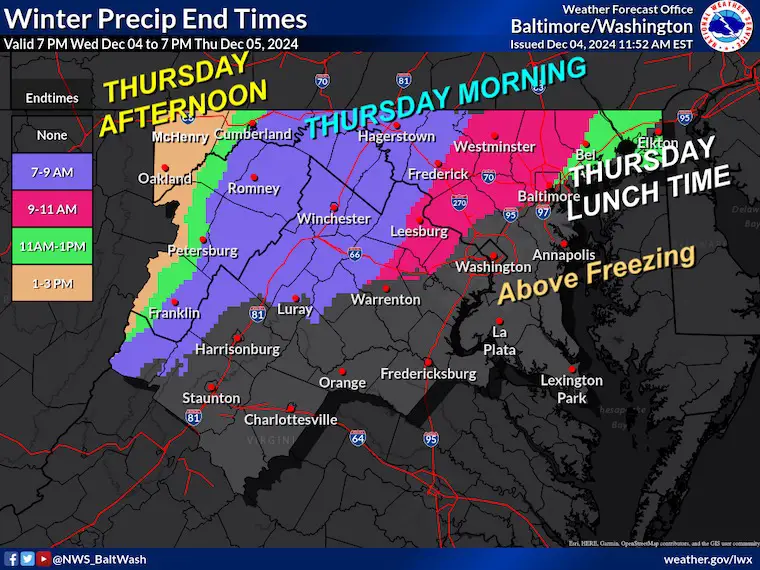
Winter Precipitation Ending Times
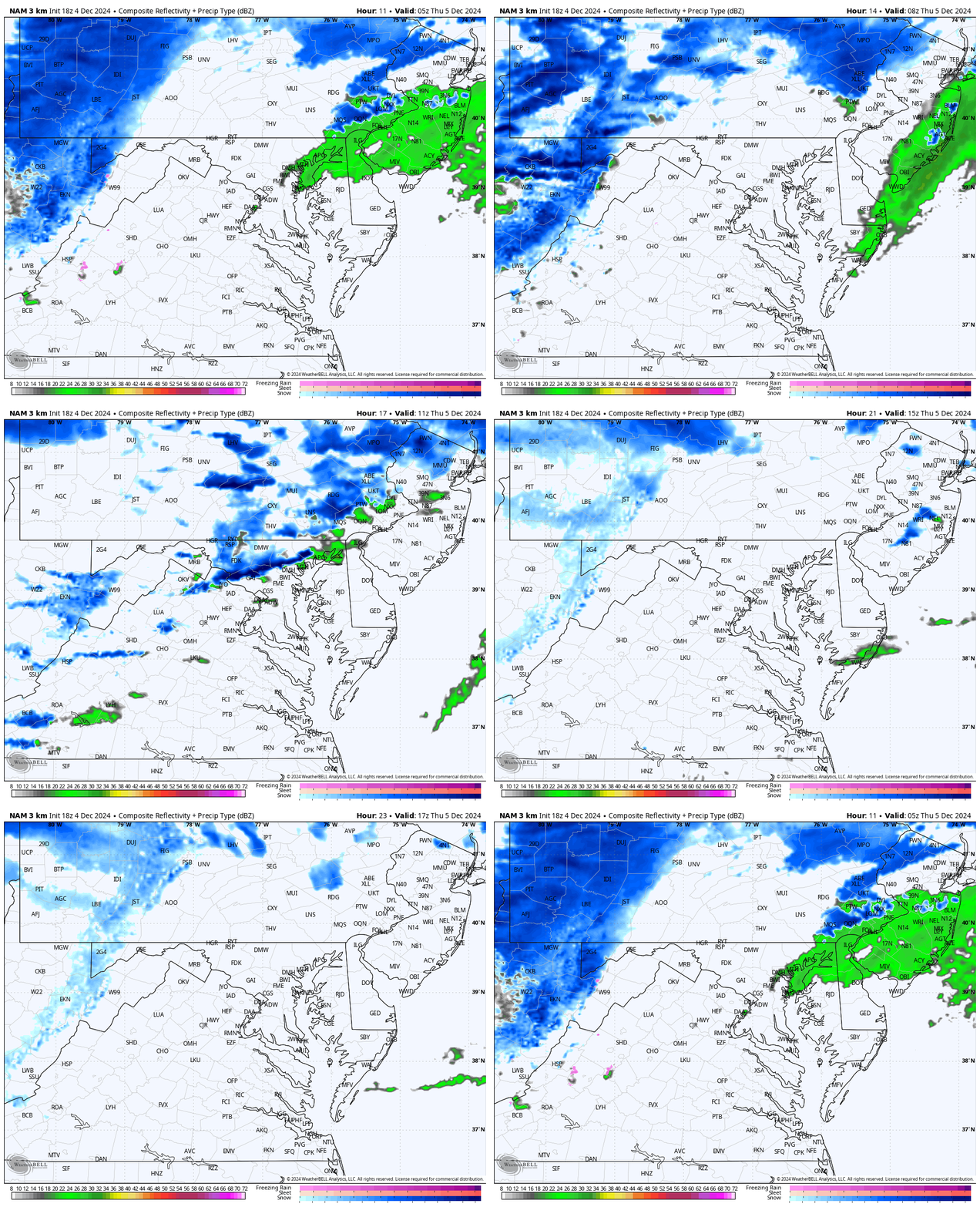
Radar Simulation Forecast
Midnight to Noon (suggestion from NAM 3Km Model)
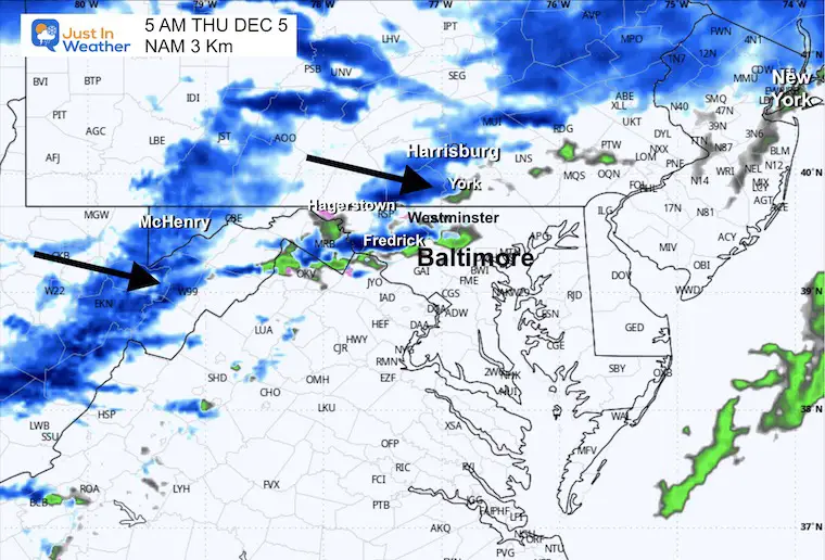
Snapshot at 5 AM
Snapshot at 6 AM
Snapshot at 7 AM
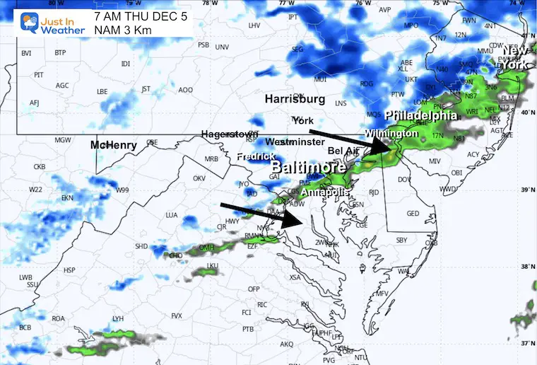
Temperatures at 7 AM
The freezing line will reach the inland suburbs with the end of the snow burst.
This may allow the melting on roads to briefly gain slush or freeze before sunrise.
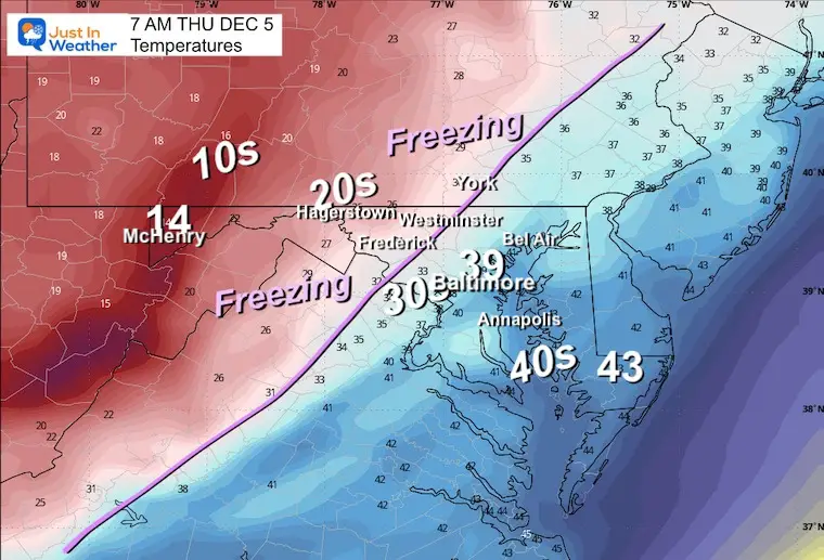
Wind Forecast at 7 AM
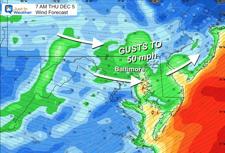
Wind Chills At 7 AM
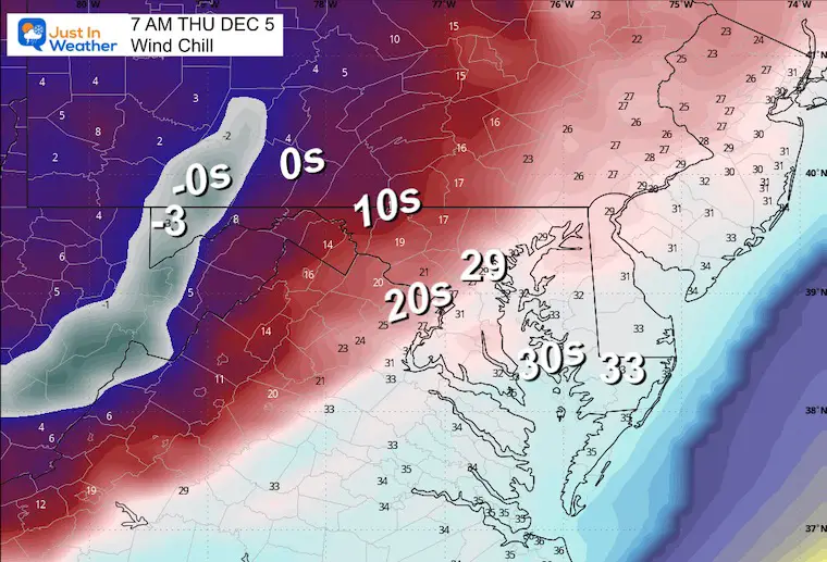
Snapshot at 8 AM
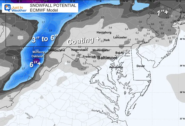
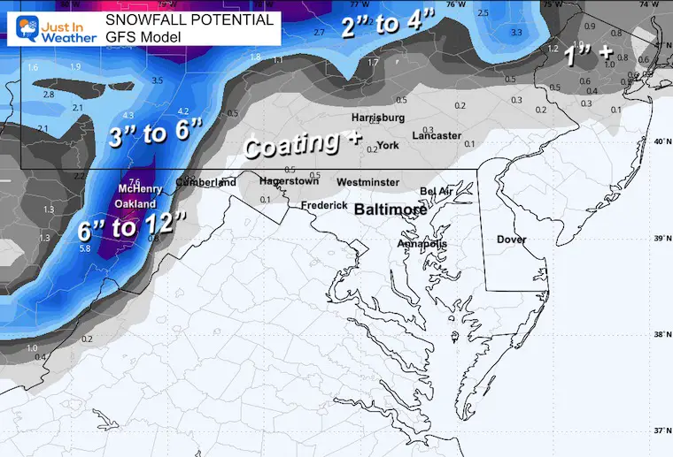
Snow Total Suggestion
ECMWF Model
GFS Model
NWS Forecast
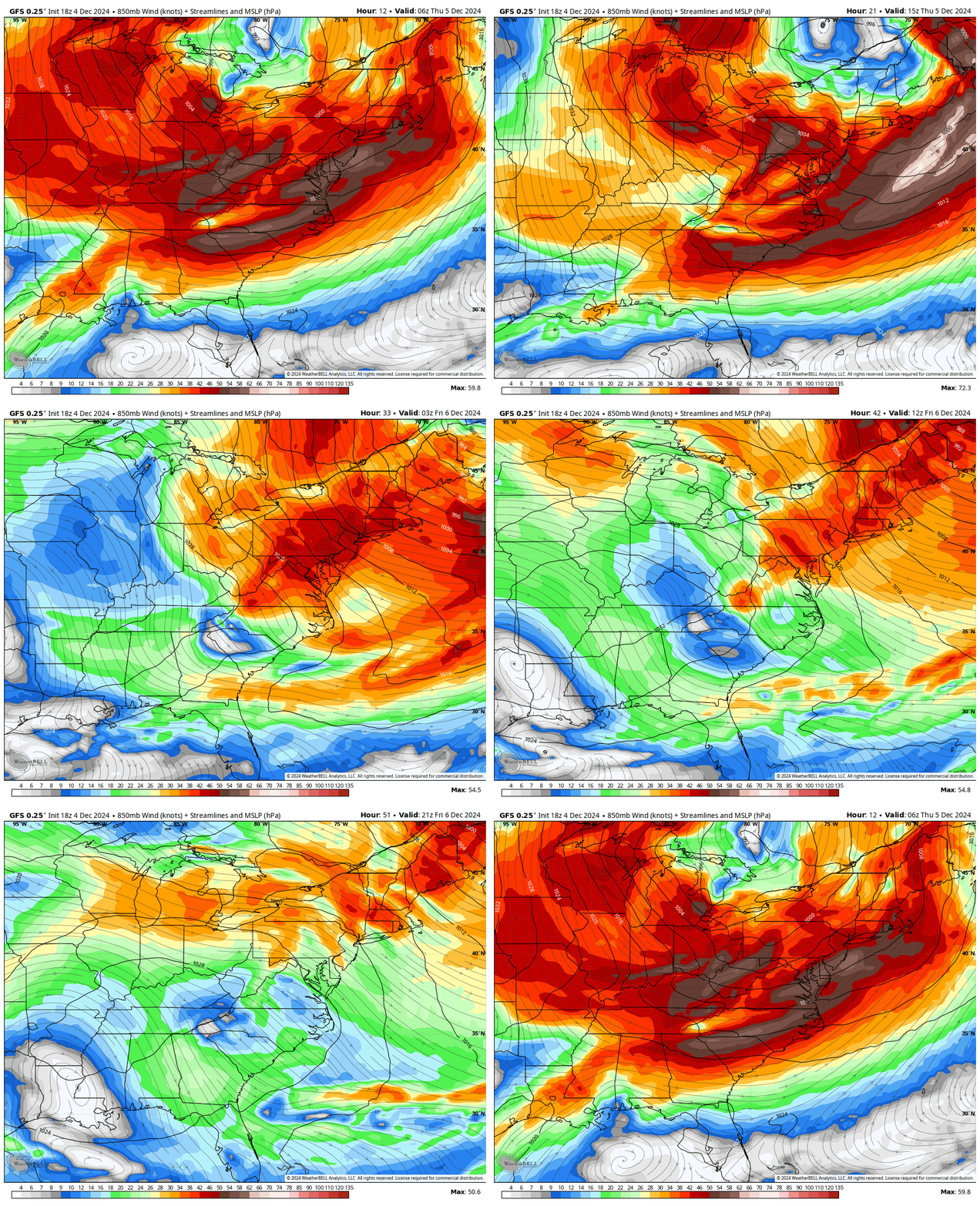
Winds At Jet Stream Level
Animation 1 AM Thursday to 4 PM Friday
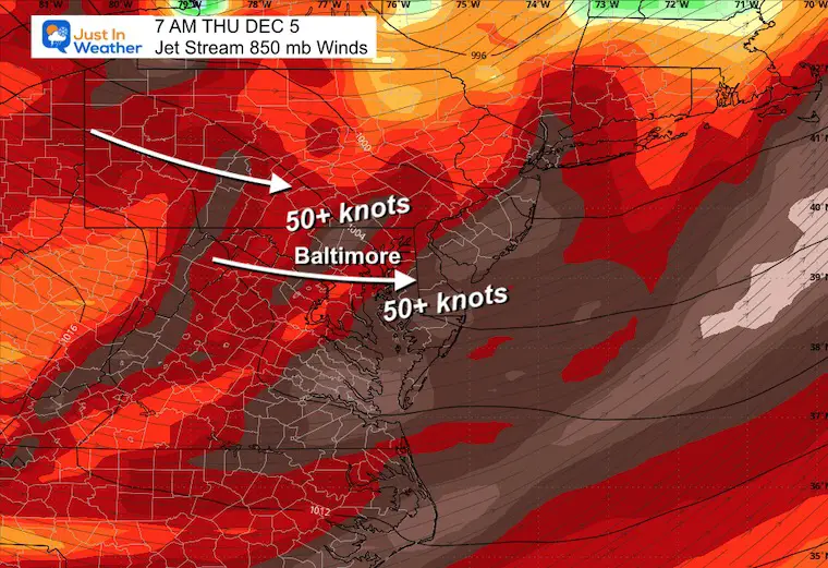
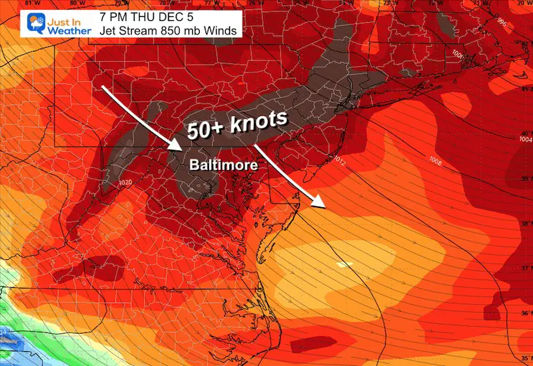
850 mb is around 5,000 Ft above the ground. Jet Streaks or peak winds at this level can translate down to the ground.
There will be strong winds in the morning squall and through the evening.
Close Up Snapshots
There may be wind restrictions on area bridges, as well as some downed trees and power lines.
7 AM Thursday
7 PM Thursday
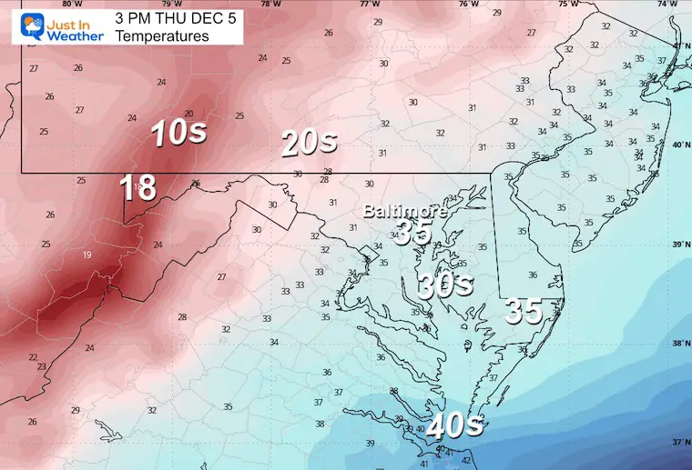
Afternoon Temperatures
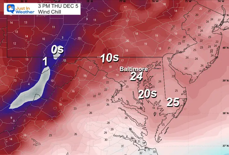
Afternoon Wind Chill
I will be up early to track the weather live across all of my social media channels.
Please share your thoughts and best weather pics/videos, or just keep in touch via social media.
-
Facebook: Justin Berk, Meteorologist
-
Twitter
-
Instagram
Subscribe for eMail Alerts
Weather posts straight to your inbox
Sign up and be the first to know!
FITF Products
In Case You Missed It:
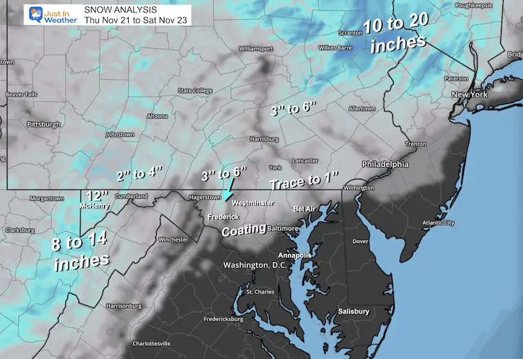
November 22 Snow Report
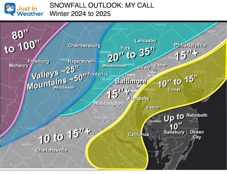
WINTER OUTLOOK
SCHEDULE A WEATHER BASED STEM ASSEMBLY
Severe Weather: Storm Smart October and next spring
Winter Weather FITF (Faith in the Flakes): November To March
Click to see more and send a request for your school.
THANK YOU:
Baltimore Magazine Readers Choice Best Of Baltimore
Maryland Trek 11 Day 7 Completed Sat August 10
We raised OVER $104,000 for Just In Power Kids – AND Still Collecting More
The annual event: Hiking and biking 329 miles in 7 days between The Summit of Wisp to Ocean City.
Each day, we honor a kid and their family’s cancer journey.
Fundraising is for Just In Power Kids: Funding Free Holistic Programs. I never have and never will take a penny. It is all for our nonprofit to operate.
Click here or the image to donate:
RESTATING MY MESSAGE ABOUT DYSLEXIA
I am aware there are some spelling and grammar typos and occasional other glitches. I take responsibility for my mistakes and even the computer glitches I may miss. I have made a few public statements over the years, but if you are new here, you may have missed it: I have dyslexia and found out during my second year at Cornell University. It didn’t stop me from getting my meteorology degree and being the first to get the AMS CBM in the Baltimore/Washington region.
One of my professors told me that I had made it that far without knowing and to not let it be a crutch going forward. That was Mark Wysocki, and he was absolutely correct! I do miss my mistakes in my own proofreading. The autocorrect spell check on my computer sometimes does an injustice to make it worse. I also can make mistakes in forecasting. No one is perfect at predicting the future. All of the maps and information are accurate. The ‘wordy’ stuff can get sticky.
There has been no editor who can check my work while writing and to have it ready to send out in a newsworthy timeline. Barbara Werner is a member of the web team that helps me maintain this site. She has taken it upon herself to edit typos when she is available. That could be AFTER you read this. I accept this and perhaps proves what you read is really from me… It’s part of my charm. #FITF


