December 4 Wind Advisory Expanded Plus Mountain Blizzard Warning For Thursday
December 4, 2024
Wednesday Morning Report
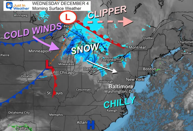
This morning, the clipper is centered in Canada on the map. It is passing well north, where most of the energy and snow will cross the Great Lakes.
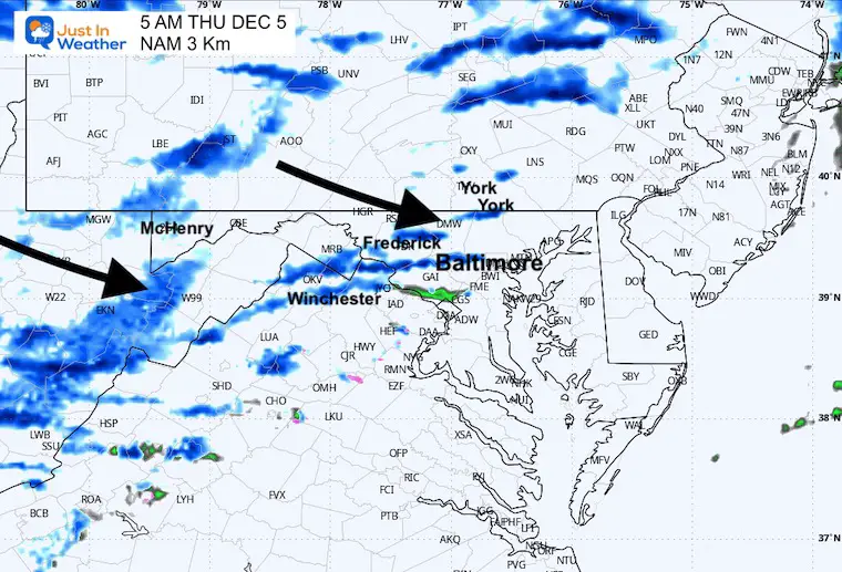
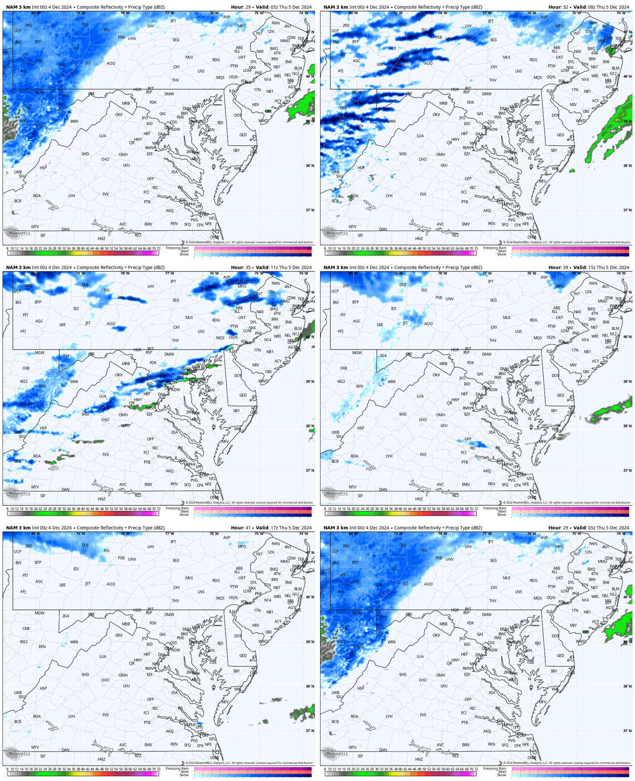
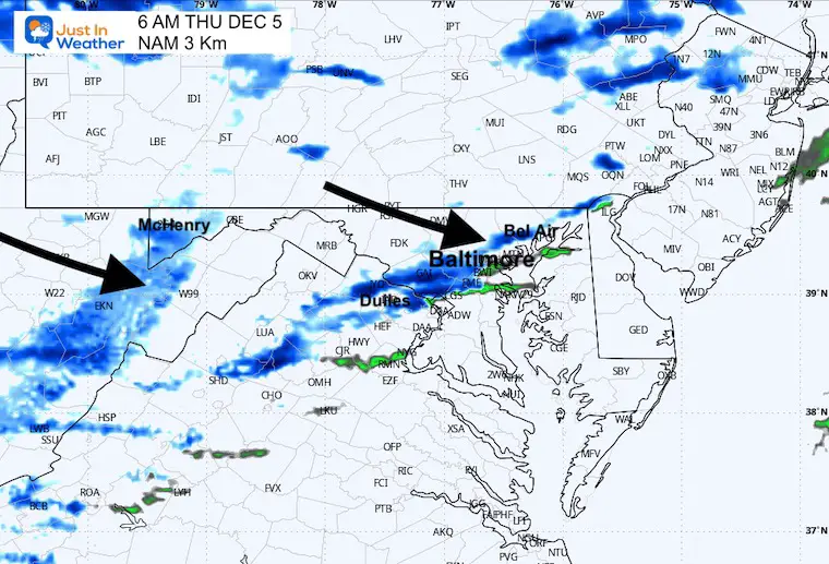
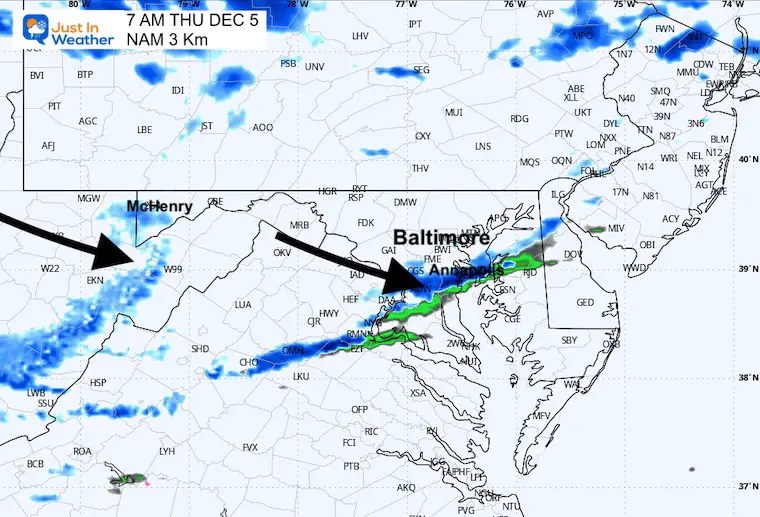
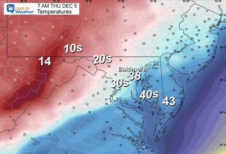
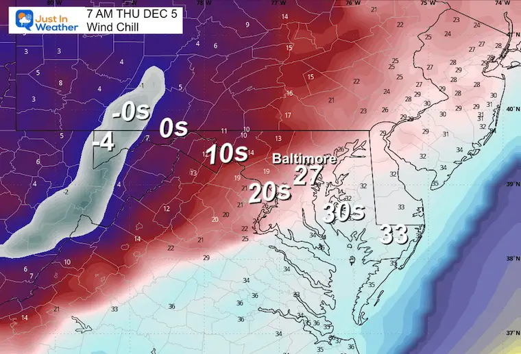
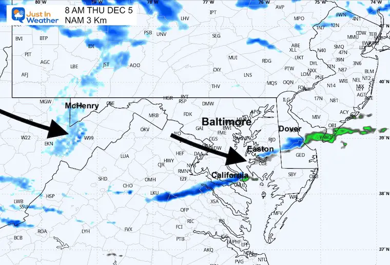
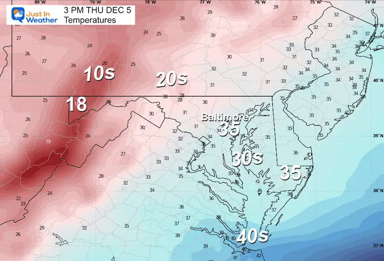
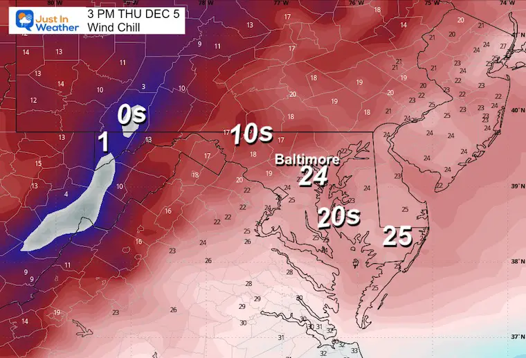
The trailing cold front will bring an arctic boundary on Thursday morning. As I suggested, and is often the case, the arrival time has sped up a little. This means a squall line of brief heavy snow will arrive before sunrise in metro areas and inland. Temps will be above freezing before, then drop rapidly. Wind chills will drop into the teens and 20s into the afternoon.
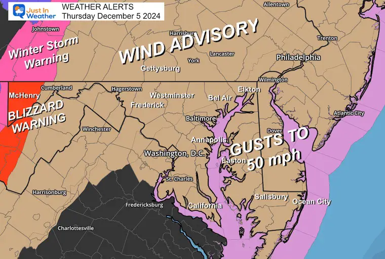
Wind Advisory
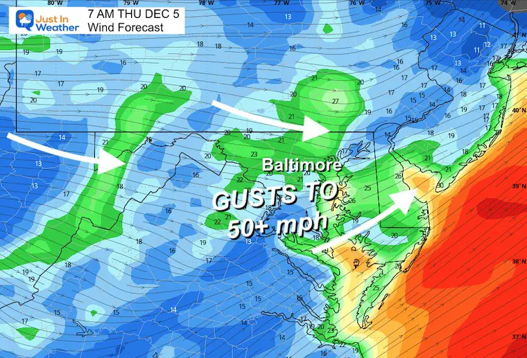
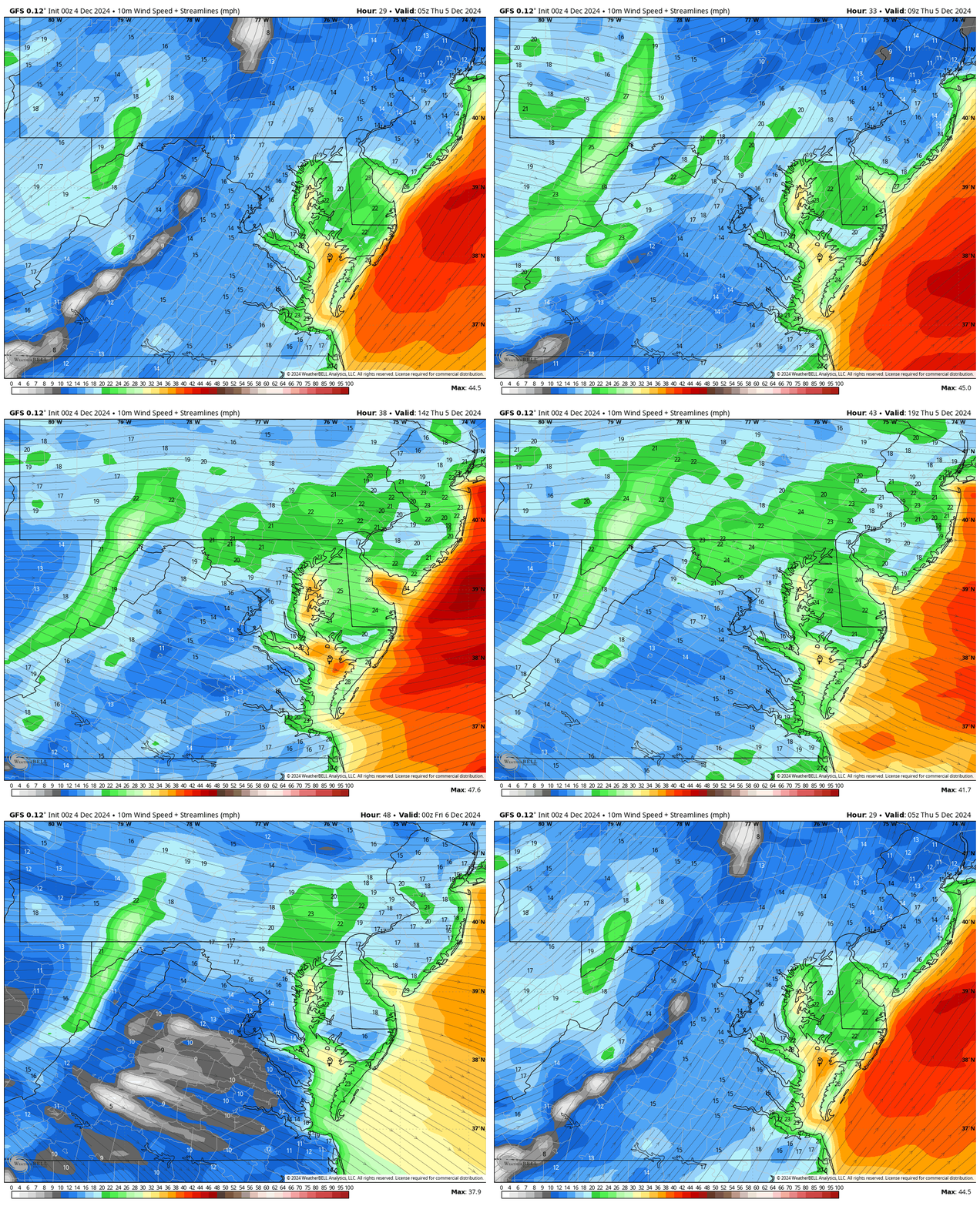
Winds are the main story: Gusts over 50 mph are possible with the squall line and again in the afternoon.
Blizzard Warning for the mountains. With the strong winds, snow may fall at rates over 1 inch per hour AND lead to whiteout conditions.
The snow will be less than 1 inch and mostly melt. A brief coating on the grass… and some roads. There will be a race for melting, evaporating, and what may be left to ice up. Most schools will likely be on time (in my opinion), but it is worth watching closely for roughly an hour or two during the commute.
The weekend will be cold and dry; then the next storm will arrive with a lifting of the jet stream… bringing us mild rain early next week.
Morning Surface Weather
The Clipper is located in Ontario, Canada. The trailing cold front and a mesoscale piece of energy ahead of it will enhance the developing line of snow.
This is what will reach Western Maryland tonight, and the rest of us early Thursday.
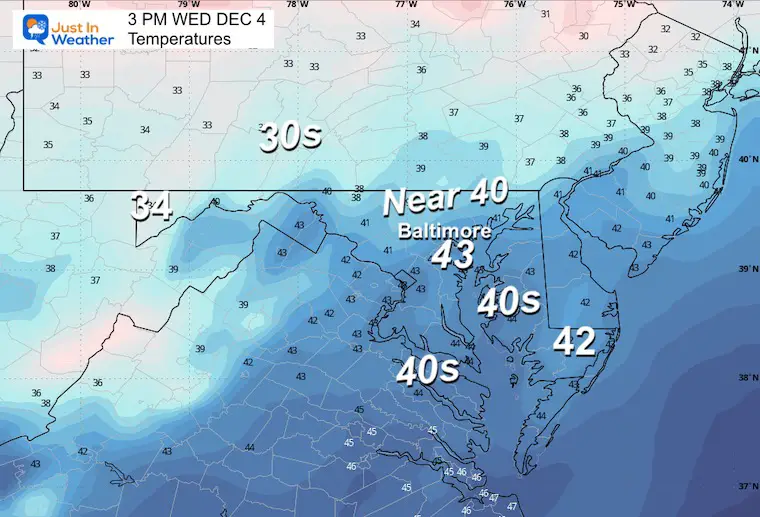
Afternoon Temperatures
CLIMATE DATA: Baltimore
TODAY December 4
Sunrise at 7:10 AM
Sunset at 4:44 PM
Normal Low in Baltimore: 32ºF
Record 13ºF in 1966
Normal High in Baltimore: 51ºF
Record 74ºF 1982
Baltimore Drought Update
- 7.04 inches BELOW AVERAGE rainfall since September 1st
- 7.50 inches BELOW AVERAGE rainfall since January 1st
THURSDAY DECEMBER 5
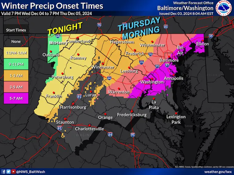
Arrival Time For Snow: NWS Map
Starting first in the mountains overnight….
Metro areas before sunrise. This is about 1 to 2 hours faster than prior forecast maps.
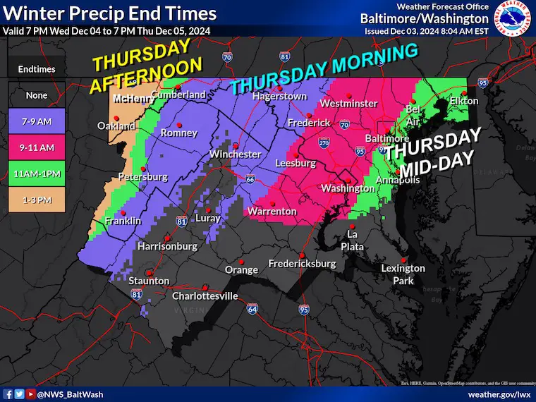
Ending Time For Snow: NWS Map
Ending last in the mountains.
Radar Simulation Midnight to Noon
Snapshots
4 AM
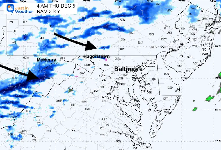
5 AM
6 AM
7 AM
Wind Forecast
Temperatures
Wind Chill
8 AM
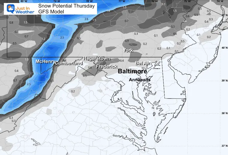
Snow Total
The real issue will be in the mountains. Locally a dusting to 1/2 inch on the grass is possible inland from the city and water.
Wind Forecast Midnight to 7 PM
It will be windy all day! There may be restrictions on the bridges around The Bay.
Afternoon Temperatures
Afternoon Wind Chill
Storm Animation: Friday to Tuesday
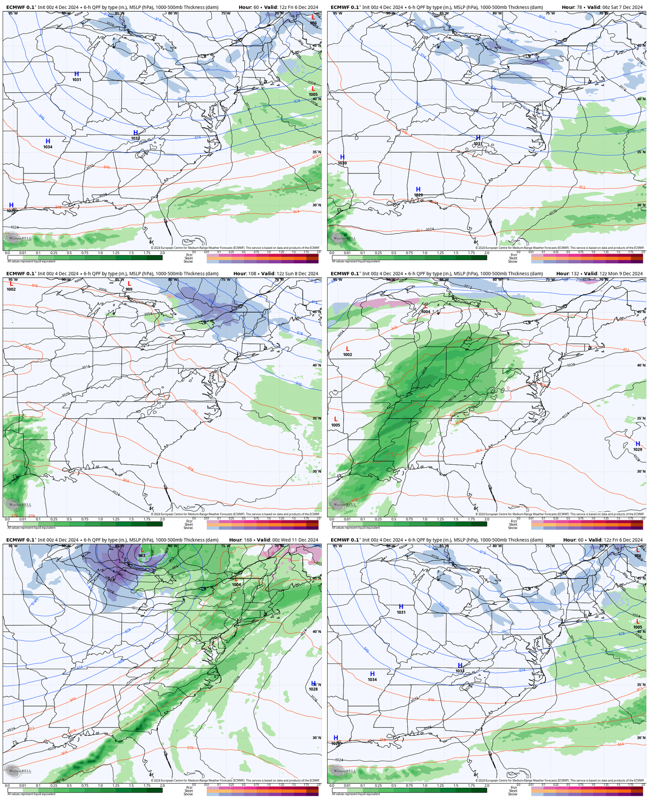
After a cold and dry start to the weekend, the next storm will ride to our west… bringing us the warmer and rainy side.
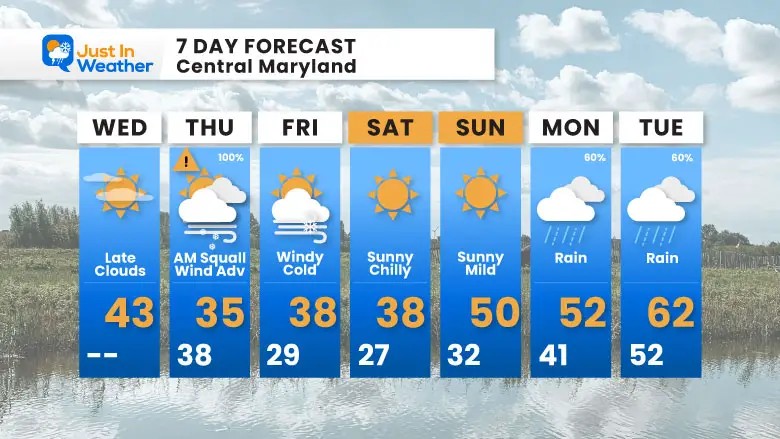
7 Day Forecast
The main event will be Thursday: Morning burst of snow or mix, then strong winds!
The next storm will be rain on Monday and Tuesday.
FITF
Subscribe for eMail Alerts
Weather posts straight to your inbox
Sign up and be the first to know!
In Case You Missed It:
November 22 Snow Report
WINTER OUTLOOK
Please share your thoughts and best weather pics/videos, or just keep in touch via social media.
-
Facebook: Justin Berk, Meteorologist
-
Twitter
-
Instagram
SCHEDULE A WEATHER BASED STEM ASSEMBLY
Severe Weather: Storm Smart October and next spring
Winter Weather FITF (Faith in the Flakes): November To March
Click to see more and send a request for your school.
THANK YOU:
Baltimore Magazine Readers Choice Best Of Baltimore
Maryland Trek 11 Day 7 Completed Sat August 10
We raised OVER $104,000 for Just In Power Kids – AND Still Collecting More
The annual event: Hiking and biking 329 miles in 7 days between The Summit of Wisp to Ocean City.
Each day, we honor a kid and their family’s cancer journey.
Fundraising is for Just In Power Kids: Funding Free Holistic Programs. I never have and never will take a penny. It is all for our nonprofit to operate.
Click here or the image to donate:
RESTATING MY MESSAGE ABOUT DYSLEXIA
I am aware there are some spelling and grammar typos and occasional other glitches. I take responsibility for my mistakes and even the computer glitches I may miss. I have made a few public statements over the years, but if you are new here, you may have missed it: I have dyslexia and found out during my second year at Cornell University. It didn’t stop me from getting my meteorology degree and being the first to get the AMS CBM in the Baltimore/Washington region.
One of my professors told me that I had made it that far without knowing and to not let it be a crutch going forward. That was Mark Wysocki, and he was absolutely correct! I do miss my mistakes in my own proofreading. The autocorrect spell check on my computer sometimes does an injustice to make it worse. I also can make mistakes in forecasting. No one is perfect at predicting the future. All of the maps and information are accurate. The ‘wordy’ stuff can get sticky.
There has been no editor who can check my work while writing and to have it ready to send out in a newsworthy timeline. Barbara Werner is a member of the web team that helps me maintain this site. She has taken it upon herself to edit typos when she is available. That could be AFTER you read this. I accept this and perhaps proves what you read is really from me… It’s part of my charm. #FITF


