First Flakes Into Baltimore Friday And My Reports From The Winter Storm Warning In Western Maryland
Thursday, November 21, 2024
Evening Report
We definitely have had an abrupt pattern flip, one that was hard to imagine with 60s just a couple of days ago. What is developing is an early winter weather set-up that has already brought accumulating snow to the high mountains and a few flakes into the inland suburbs.
What is new:
UPDATE FRIDAY MORNING NOW READY
CLICK HERE FOR THESE THREE IMAGES FOR THE NEW REPORT
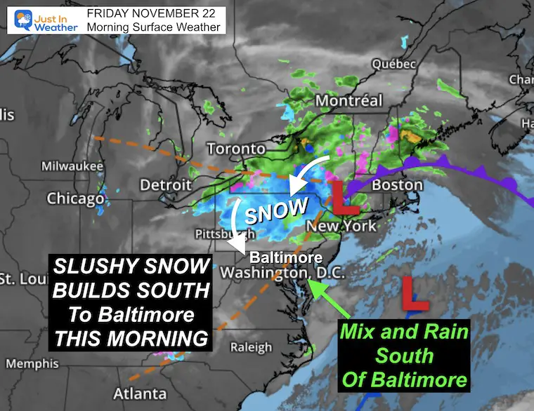
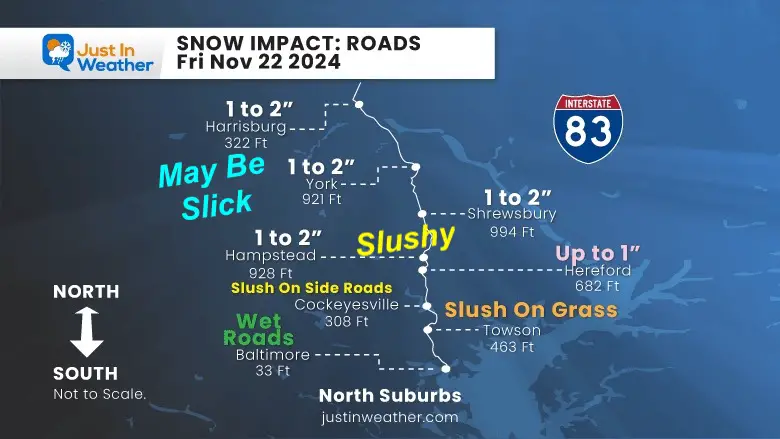
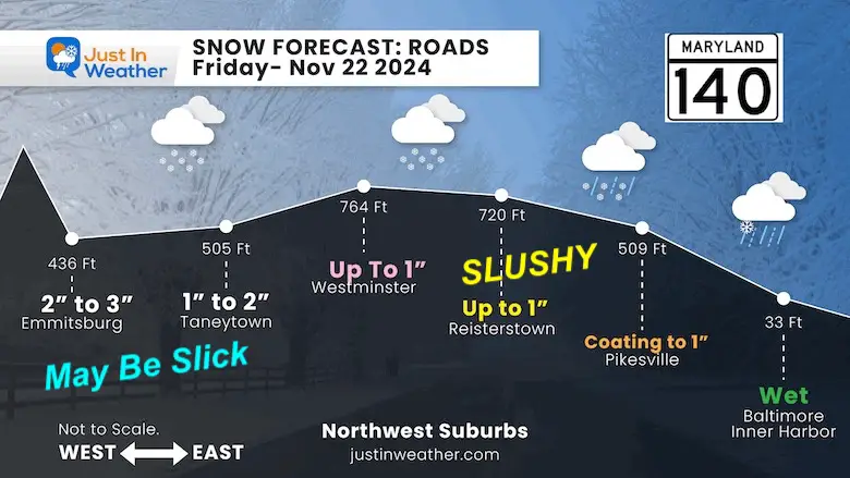
This weather pattern appears to line up to maximize the cold air and bring snow into metro Baltimore on Friday. Temperatures will remain above freezing, so the roads will stay wet. But the very start could leave a coating to one inch on the grass and maybe some other stickage for the normally colder suburbs North and West.
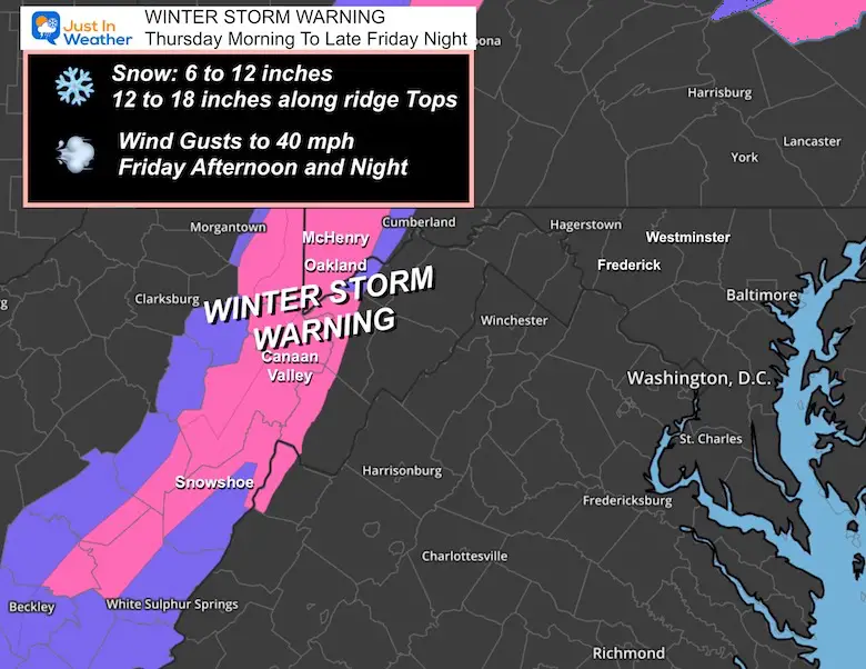
What Continues: Winter Storm Warning
Thursday to Saturday Morning
NOTE: The mountains are 3,000+ and 4,000+ peaks
- Snow between 6 to 12 inches, with higher amounts possible
- Wind may gust to 50 mph
I have a full weather report below. First, I want to start with my experience this afternoon.
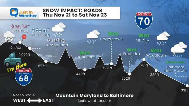
Snow Profile: Road Forecast
The impact on the roads and accumulation with the colder higher elevations.
I put that truck where I am riding out the storm.
I am in McHenry MD to report on the snow around Deep Creek Lake.
I’ve been sharing this on my social media channels.
Timelapse Video:
Here was my first snow squall AND the Timelapse video: 1 Hour compressed in to 32 seconds.
My First Snow Squall Of This Event
Reporting From Snow Zone Of Western Maryland
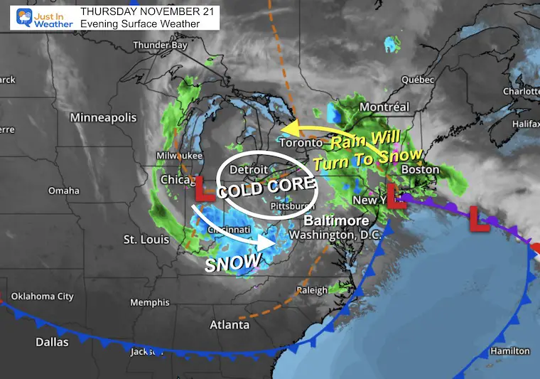
The Set Up: Surface Weather Map
The storm that produced the heavy rain and thunder in the squall line last night has pushed that much-needed rain to metro New York and New England.
A second Low Pressure is located in Northern Indiana has colder air and snow extending ahead into Kentucky and the mountains of West Virginia and Maryland.
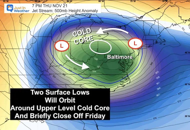
These are both pivoting around a larger Upper Level Low. This is the jet stream trough that is deepening and may briefly close off on Friday. With this, we maximize the cold air.
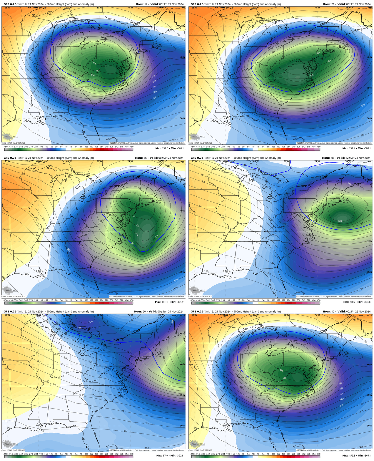
Jet Stream: 500mb Height Anomaly
Located around 18,000 Ft above the ground. The blue and green colors represent the coldest of the air at that level. I’ve highlighted the Surface Lows that will be pivoting around the cold core.
Forecast Animation Thursday Night to Saturday Night
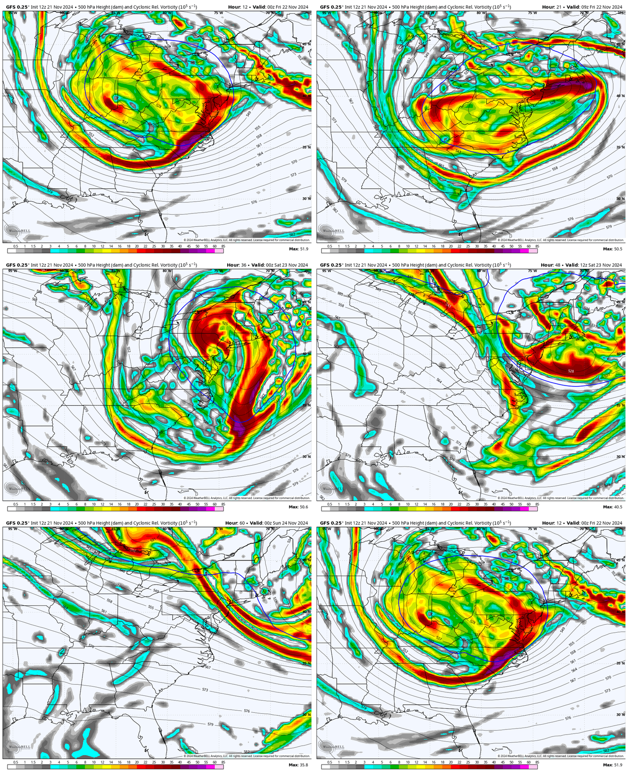
Vorticity Animation Thursday Night to Saturday Night
This is the spin within the jet stream and helps show spikes of energy that will pivot around and help the surface weather systems strengthen.
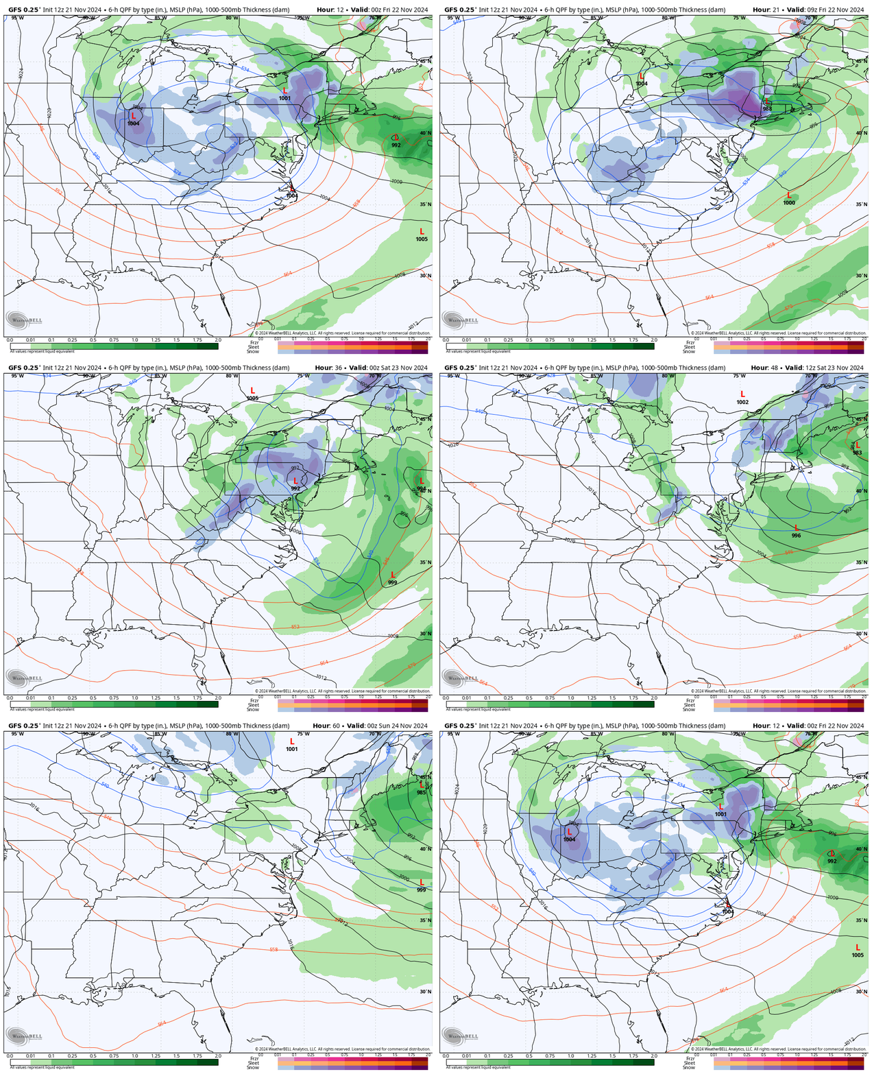
Surface Animation: Snow and Rain
Thursday Night to Saturday Night
Here, we can better see how the surface Lows behave with the pivot and enhance the snow. Below, we take a closer look at how that will develop in metro areas.
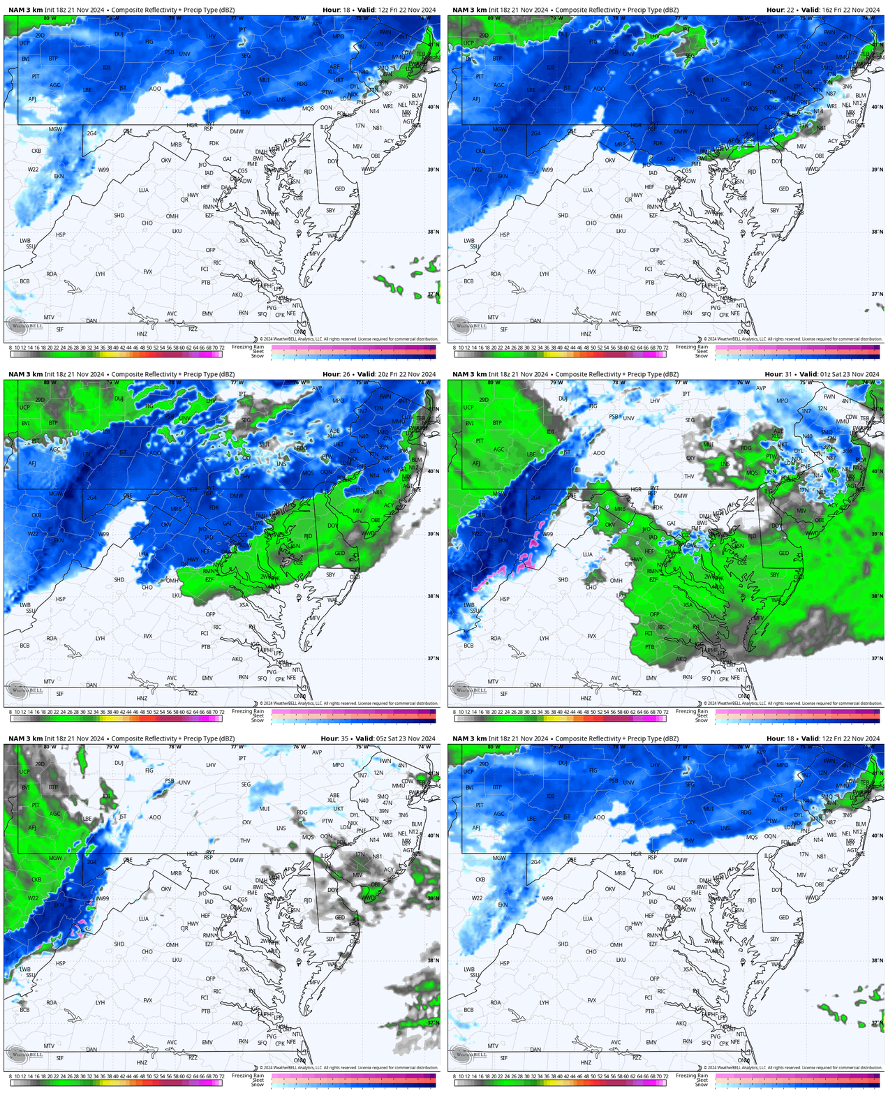
Radar Simulation 7 AM Friday to Midnight
NOTE: Often, the snow or rain can arrive a little faster than this product shows, perhaps up to one hour earlier.
After sunrise, a solid line of snow underneath the Jet Stream Trough will slide southward and push into Central Maryland.
This will run into the warmer air around I-95 and the Chesapeake Bay, mixing with rain. Inland, we may also see snow around Metro Washington, D.C.
The peak will be midday and early afternoon, the diminish at night.
The heavy snow will persist in the Winter Storm Warning Mountain Zone of Maryland and West Virginia mountains.
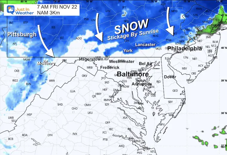
7 AM Snapshot
Snow may reach near York, Lancaster, and Harrisburg close to sunrise. This area may have spots that get an early coating of snow.
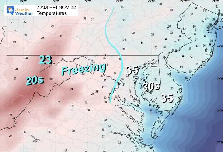
7 AM Temperatures
There may be a large inland area below freezing. This could play a role with some initial stickage on grassy areas across Southern PA and Northern Maryland between 7 AM and 10 AM. Most roads should be OK, but a heavy snow burst could lead to brief stickage and traffic slowing down.
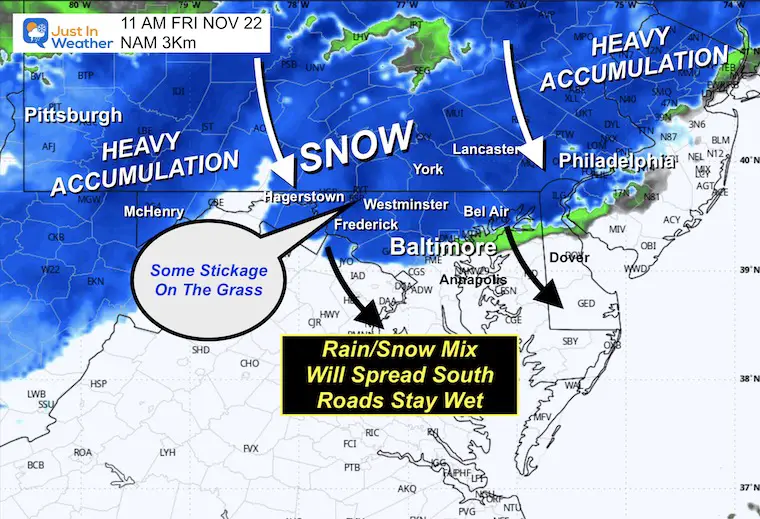
11 AM Snapshot
Snow appears to be pushing into Baltimore and around I-70. Snow and a mix of rain will continue to expand southward.
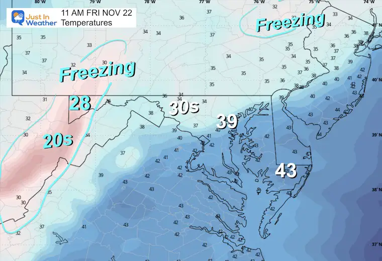
11 AM Temperatures
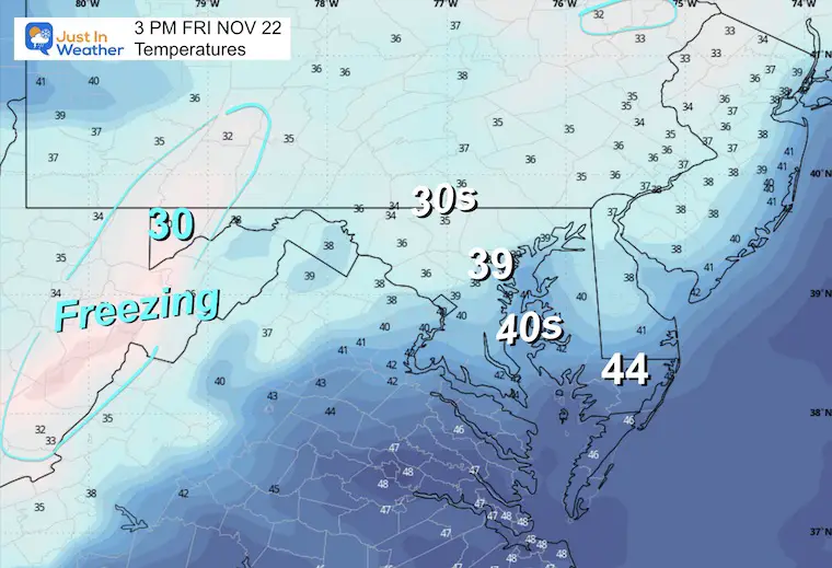
With temperatures in the mid to upper 30s and midday sun angle, the roads should be OK…
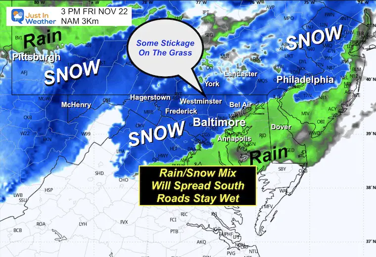
3 PM Snapshot
Moderate snow may fall through I-95 around Baltimore and even Washington. This would be heavy, wet snow… that will not stick.
The heavy snow and accumulation will continue in the high mountains.
3 PM Temperatures
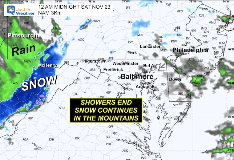
Midnight Snapshot
The snow and rain will break up into showers in the evening and fade at night.
Steady snow will continue in the high mountains….
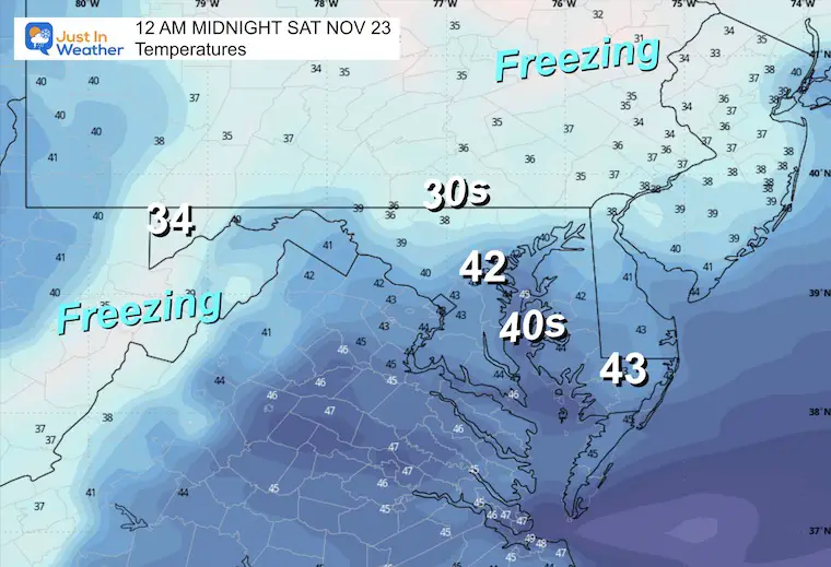
Midnight Temperatures
Most areas will remain above freezing.
Warmer air may sneak into some mountain areas as well.
Snow Total “Suggestions”
Coating to 1 inch on the grass: Suburbs of Baltimore inland to the West and North.
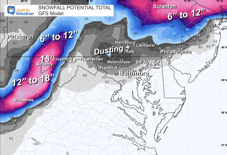
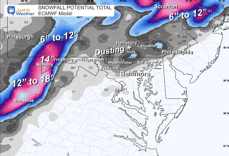
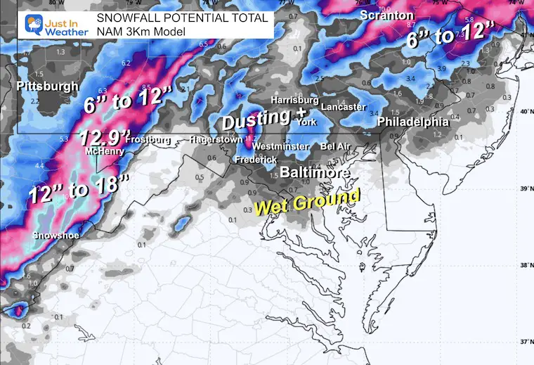
The snow totals around McHenry and the high mountains have remained consistent. They are holding now at 12″ to 15″ for McHenry and Wisp and up to 18″ between Canaan Valley and Snowshoe.
GFS Model
ECWMF Model
NAM 3 Km
FITF
Subscribe for eMail Alerts
Weather posts straight to your inbox
Sign up and be the first to know!
In Case You Missed It
Faith in the Flakes Gear
Please share your thoughts and best weather pics/videos, or just keep in touch via social media.
-
Facebook: Justin Berk, Meteorologist
-
Twitter
-
Instagram
SCHEDULE A WEATHER BASED STEM ASSEMBLY
Severe Weather: Storm Smart October and next spring
Winter Weather FITF (Faith in the Flakes): November To March
Click to see more and send a request for your school.
THANK YOU:
Baltimore Magazine Readers Choice Best Of Baltimore
Maryland Trek 11 Day 7 Completed Sat August 10
We raised OVER $104,000 for Just In Power Kids – AND Still Collecting More
The annual event: Hiking and biking 329 miles in 7 days between The Summit of Wisp to Ocean City.
Each day, we honor a kid and their family’s cancer journey.
Fundraising is for Just In Power Kids: Funding Free Holistic Programs. I never have and never will take a penny. It is all for our nonprofit to operate.
Click here or the image to donate:
RESTATING MY MESSAGE ABOUT DYSLEXIA
I am aware there are some spelling and grammar typos and occasional other glitches. I take responsibility for my mistakes and even the computer glitches I may miss. I have made a few public statements over the years, but if you are new here, you may have missed it: I have dyslexia and found out during my second year at Cornell University. It didn’t stop me from getting my meteorology degree and being the first to get the AMS CBM in the Baltimore/Washington region.
One of my professors told me that I had made it that far without knowing and to not let it be a crutch going forward. That was Mark Wysocki, and he was absolutely correct! I do miss my mistakes in my own proofreading. The autocorrect spell check on my computer sometimes does an injustice to make it worse. I also can make mistakes in forecasting. No one is perfect at predicting the future. All of the maps and information are accurate. The ‘wordy’ stuff can get sticky.
There has been no editor who can check my work while writing and to have it ready to send out in a newsworthy timeline. Barbara Werner is a member of the web team that helps me maintain this site. She has taken it upon herself to edit typos when she is available. That could be AFTER you read this. I accept this and perhaps proves what you read is really from me… It’s part of my charm. #FITF


