November 15 Weather Weekend Clearing TS Sara Update And Winter Pattern Next Week
November 15, 2024
Friday Morning Report
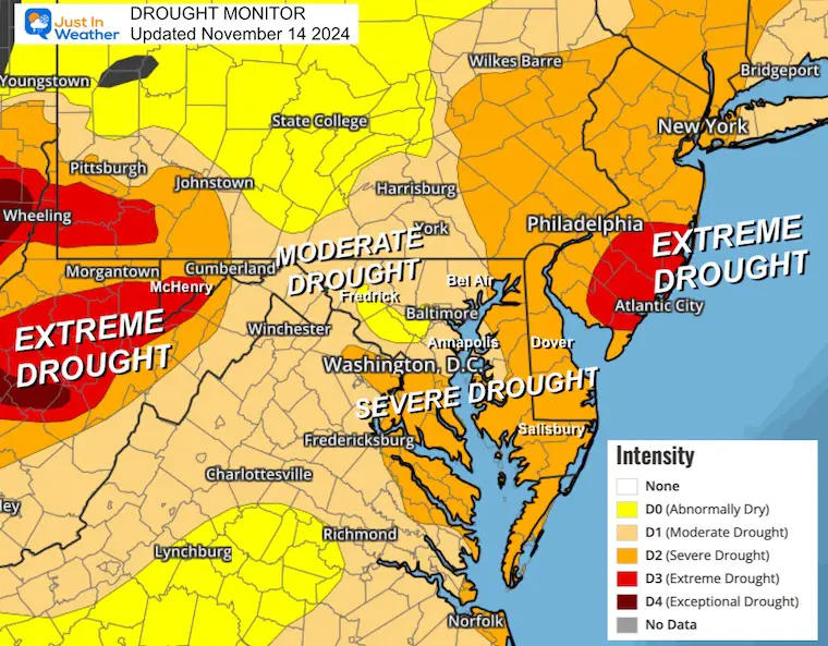
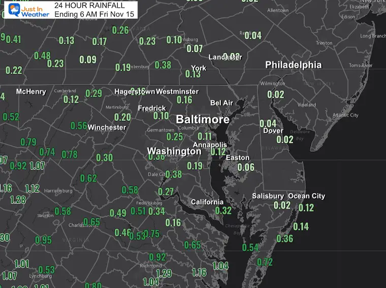
The rain we just received was welcome but short of what we needed. The numbers and how quickly we dry out again will make any questions about the burn ban easy to answer. The burn ban and drought continue.
Our weekend weather will be cool and dry, then mild and dry into the middle of next week. Rain is expected by Wednesday and Thursday with the first mountain snow.
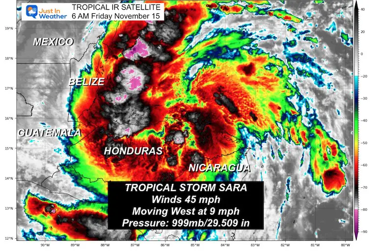
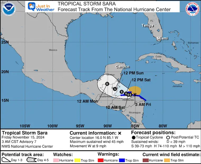
As for Tropical Storm Sara, that remains slowly crawling along the coast of Honduras. Deadly flooding in Honduras and it will continue to move along the coast through the weekend, making the flooding threat for Honduras, Nicaragua, Belize and the Yucatan very high, but it will move inland and dissipate. That is better news as it means a reduced tropical risk for Florida.
Baltimore Drought Update
- 0.09” Thursday; 0.11” Total
- 7.05 inches BELOW AVERAGE rainfall since September 1st
- 7.51 inches BELOW AVERAGE rainfall since January 1st
Map Updated Thursday, November 14
Rainfall Past 24 Hours
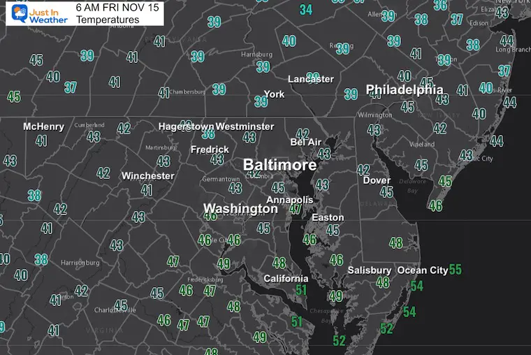
Temperatures at 6 AM
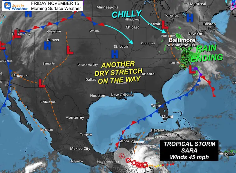
Morning Surface Weather
The recent storm will be moving off the coast and allowing a fresh chill and clearing in this afternoon.
This will set us up for another stretch of dry weather.
Tropical Storm Sara is far to our south across Central America. It will cause deadly flooding, and as it moves inland, we might watch it dissipate, which is better news for Florida.
Live Radar Widget
The current line of rain will be updated here. The evening and forecast maps are below.
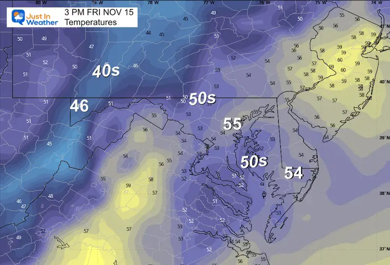
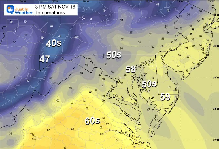
Afternoon Temperatures
The core of the cool air will settle in despite the sunshine.
CLIMATE DATA: Baltimore
TODAY November 15
Sunrise at 6:51 AM
Sunset at 4:52 PM
Normal Low in Baltimore: 37ºF
Record 19ºF in 1986
Normal High in Baltimore: 58ºF
Record 79ºF 1993
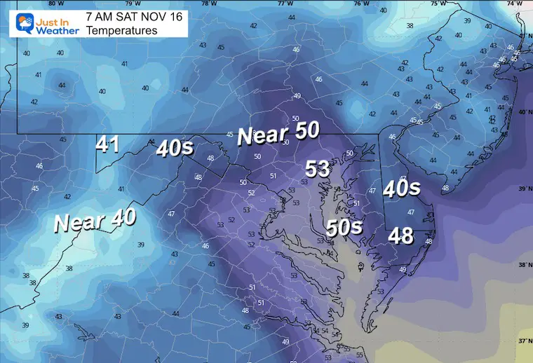
SATURDAY NOVEMBER 16
Morning Temperatures
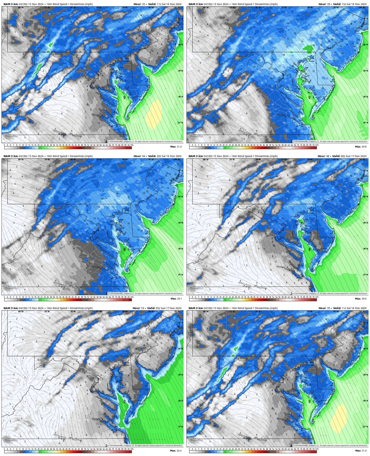
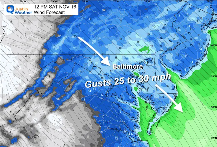
Wind Forecast 6 AM to Midnight
Snapshot at Noon
Afternoon Temperatures
Tropical Storm Sara
This will hug the coast of Central America and dump 10 to 30 inches of rainfall, resulting in deadly mudslides and flooding.
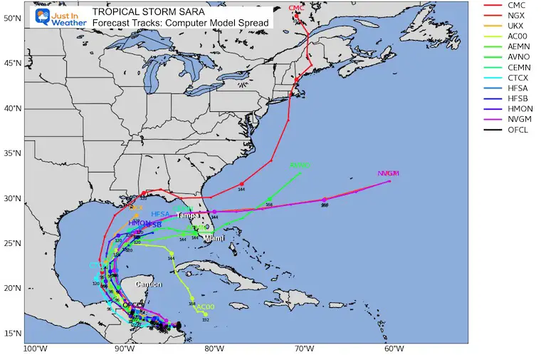
The trend has it moving inland and dissipating. Longer range models have it continuing to curve back over water and into Florida… but as a general low-pressure center or just a tropical depression.
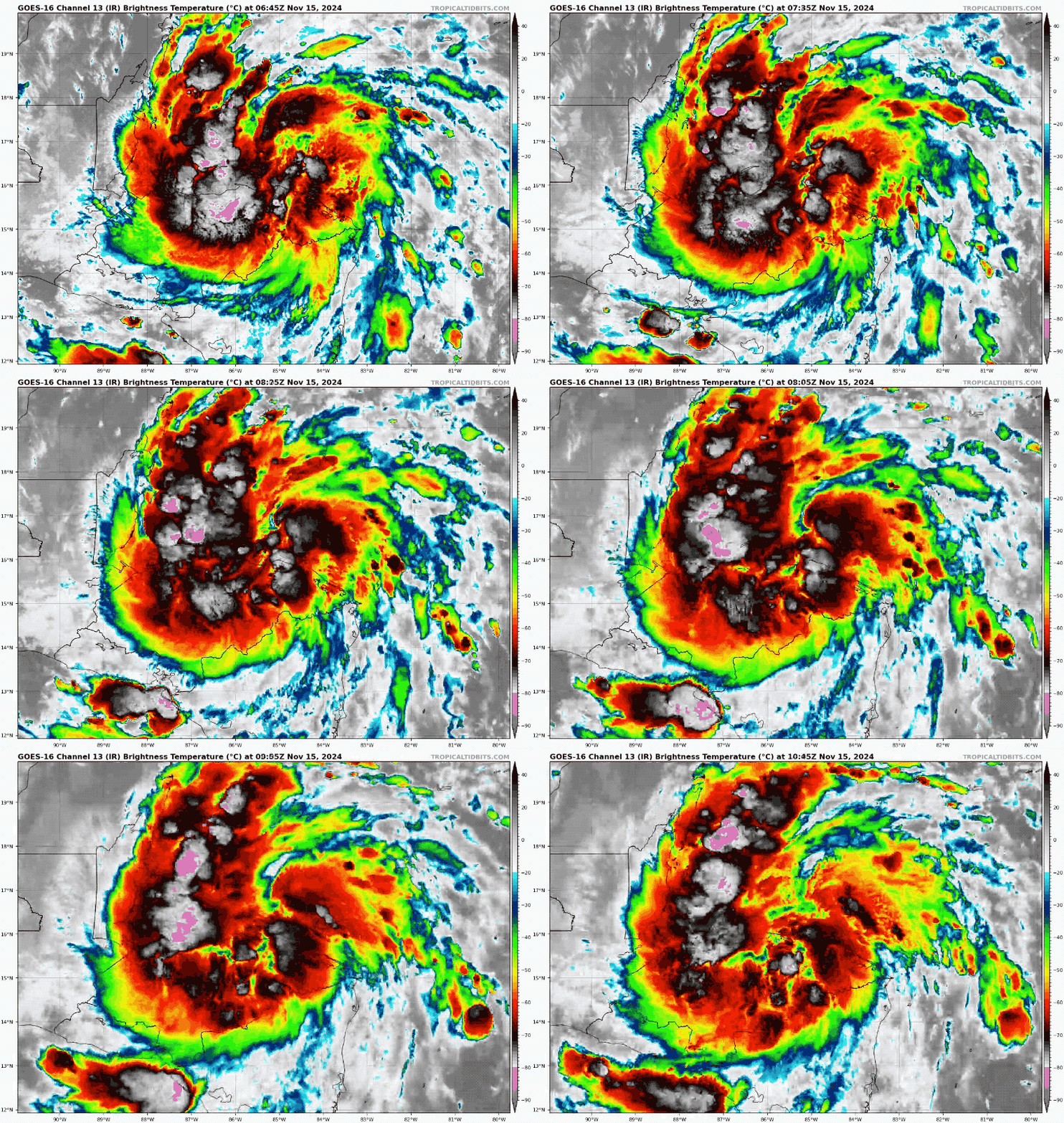
Satellite Friday Morning
National Hurricane Center Update
- LOCATION…16.0N 85.1W
- ABOUT 65 MI…100 KM ESE OF ISLA GUANAJA HONDURAS
- ABOUT 230 MI…370 KM ESE OF BELIZE CITY
- MAXIMUM SUSTAINED WINDS…45 MPH…75 KM/H
- PRESENT MOVEMENT…W OR 280 DEGREES AT 9 MPH…15 KM/H
- MINIMUM CENTRAL PRESSURE…999 MB…29.50 INCHES
Satellite Loop
National Hurricane Center Forecast Tracks
Computer Model Forecast Tracks
EXTENDED FORECAST
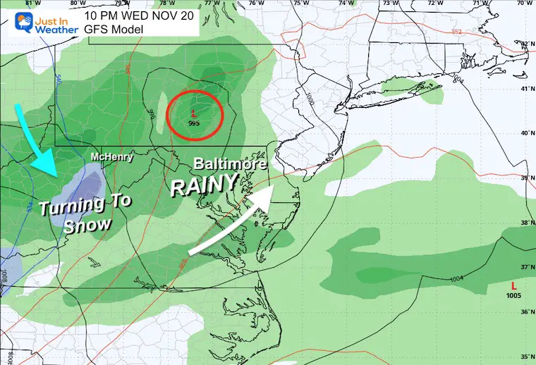
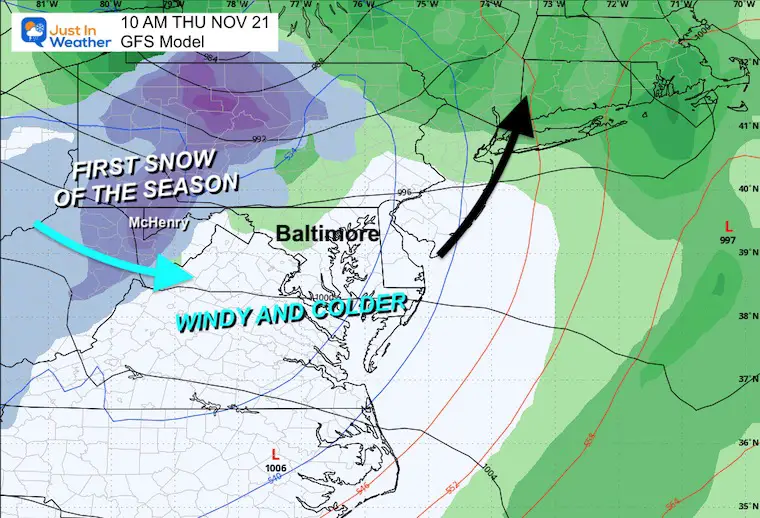
GFS Model Next Wednesday To Friday
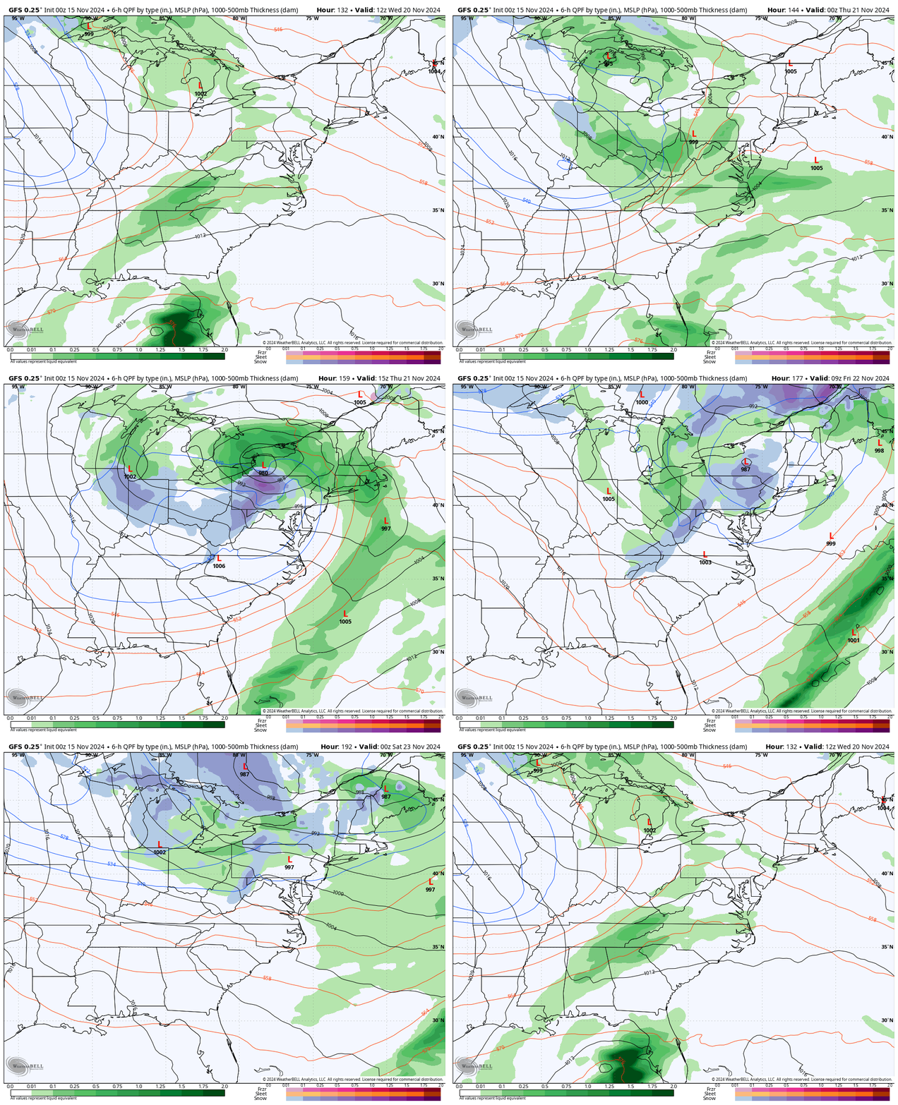
Snapshot Wednesday Night
Rain moves in…
Snapshot Thursday
Rain ends with a burst of snow, the first accumulation of the season in the mountains, including Western Maryland.
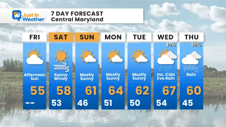
7 Day Forecast
Seasonably cool weekend, then mild next week. Our next rain will be Wednesday into Thursday leading into the pattern flip to colder weather we expect to last into Thanksgiving.
Subscribe for eMail Alerts
Weather posts straight to your inbox
Sign up and be the first to know!
Also See
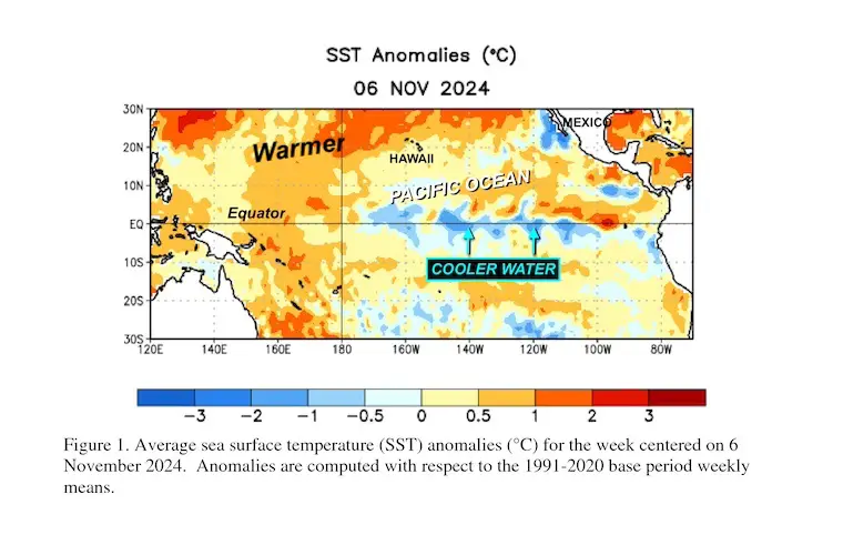
La Nina Watch Update: November 2024
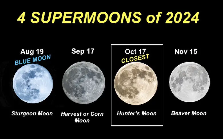
FOUR SUPERMOONS OF 2024
Please share your thoughts and best weather pics/videos, or just keep in touch via social media.
-
Facebook: Justin Berk, Meteorologist
-
Twitter
-
Instagram
SCHEDULE A WEATHER BASED STEM ASSEMBLY
Severe Weather: Storm Smart October and next spring
Winter Weather FITF (Faith in the Flakes): November To March
Click to see more and send a request for your school.
THANK YOU:
Baltimore Magazine Readers Choice Best Of Baltimore
Maryland Trek 11 Day 7 Completed Sat August 10
We raised OVER $104,000 for Just In Power Kids – AND Still Collecting More
The annual event: Hiking and biking 329 miles in 7 days between The Summit of Wisp to Ocean City.
Each day, we honor a kid and their family’s cancer journey.
Fundraising is for Just In Power Kids: Funding Free Holistic Programs. I never have and never will take a penny. It is all for our nonprofit to operate.
Click here or the image to donate:
RESTATING MY MESSAGE ABOUT DYSLEXIA
I am aware there are some spelling and grammar typos and occasional other glitches. I take responsibility for my mistakes and even the computer glitches I may miss. I have made a few public statements over the years, but if you are new here, you may have missed it: I have dyslexia and found out during my second year at Cornell University. It didn’t stop me from getting my meteorology degree and being the first to get the AMS CBM in the Baltimore/Washington region.
One of my professors told me that I had made it that far without knowing and to not let it be a crutch going forward. That was Mark Wysocki, and he was absolutely correct! I do miss my mistakes in my own proofreading. The autocorrect spell check on my computer sometimes does an injustice to make it worse. I also can make mistakes in forecasting. No one is perfect at predicting the future. All of the maps and information are accurate. The ‘wordy’ stuff can get sticky.
There has been no editor who can check my work while writing and to have it ready to send out in a newsworthy timeline. Barbara Werner is a member of the web team that helps me maintain this site. She has taken it upon herself to edit typos when she is available. That could be AFTER you read this. I accept this and perhaps proves what you read is really from me… It’s part of my charm. #FITF


