Welcome Rain Forecast Timeline And Totals For Thursday November 14
Wednesday Evening Report
Another round of needed rain is on the way, but it will not impact our Mid-Atlantic region equally. It will come with a chill in the air to hint at an early winter event and maybe some frozen stuff in the mountains as this begins.
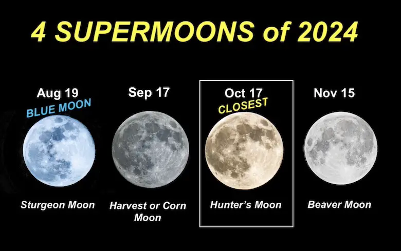
For what it’s worth, temperatures are cooler than expected as of Wednesday night. That might play a role in more areas, maybe getting in on sleet east of the high mountains. Also, there is a supermoon on Friday. I have a working hypothesis, and I’ve stated for years that weather systems have a tendency to overachieve near a full or new moon. This correlation may not be causation, but there may be some atmospheric tidal swing as well. Just wanted to float this ahead of the rain event with the full awareness that we need as much as we can get now.
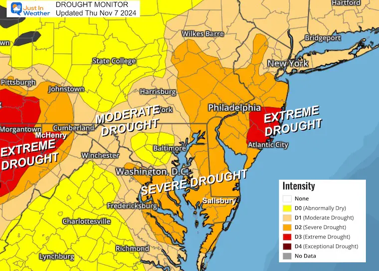
The growing drought continues to be a problem despite the recent rain breaking our 39-day dry streak. Baltimore’s rainfall deficit is currently
- 7.03 inches BELOW AVERAGE rainfall since September 1st
- 7.49 inches BELOW AVERAGE rainfall since January 1st
Regional Drought
Note that this map is from last week, and the new map will be posted tomorrow.
The most EXTREME DROUGHT is in West Virginia and Southern New Jersey.
A Moderate to Severe Drought has been identified across Maryland to Pennsylvania. There will be beneficial rain for most of the region, but New Jersey may miss out.
Note: The rain on the way may range from 0.25 inches to over 2 inches. This is not going to end the burn ban. We have a lot of ground to make up, and as we saw with the last rain, we can dry out quickly in a couple of days following the event.
Live Radar Widget
The current rain timeline will be updated here. The evening and forecast maps are below.
Wednesday Evening Set Up
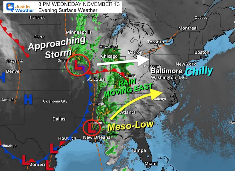
Low Pressure in Iowa has a trailing cold front to the Gulf Coast. This setup is helping to feed moisture along the boundary as it heads east. A Meso-Low, or smaller circulation, that is helping will travel from north of New Orleans into southern Virginia tomorrow.
The net result will bring heavier rain into the mountains including West Virginia, and into Maryland and Virginia. However, there may be a cut off of the rain not reaching into the other parched area of New Jersey.
Wednesday Evening Temperatures
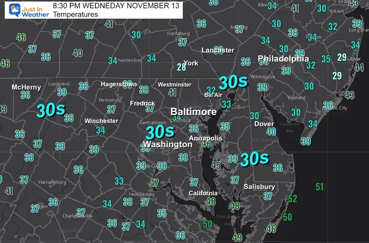
The chill in the air has already dropped lower than forecast. Once the clouds roll in, the drop will stabilize and may rise slightly by morning. There will not be much movement after that.
Thursday Weather
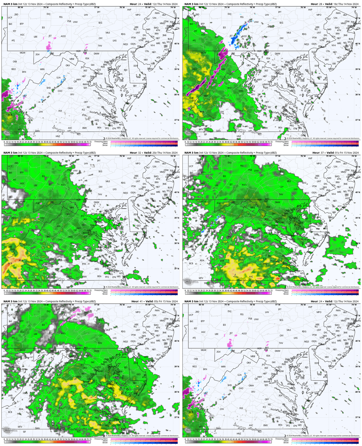
Radar Simulation 7 AM to Midnight
The heaviest rain will fall over the mountains of West Virginia to south-central Virginia.
Moderate rain will reach Washington, Baltimore, and Annapolis. However, a cutoff may leave areas dry from Northeastern Maryland to metro Philadelphia.
Snapshots
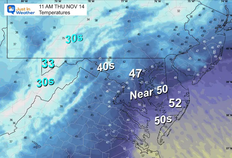
Late Morning Temperatures
The 30s may hold in the mountains as the precipitation arrives. The 40s to lower 50s will hold in central and eastern areas.
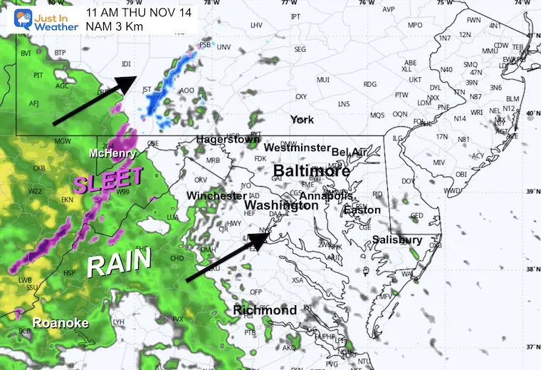
Late Morning Radar Simulation
The onset may be with sleet over the higher mountains of West Virginia, Western Maryland, and Pennsylvania. This is not likely to stick but it will be a reminder that winter is around the corner.
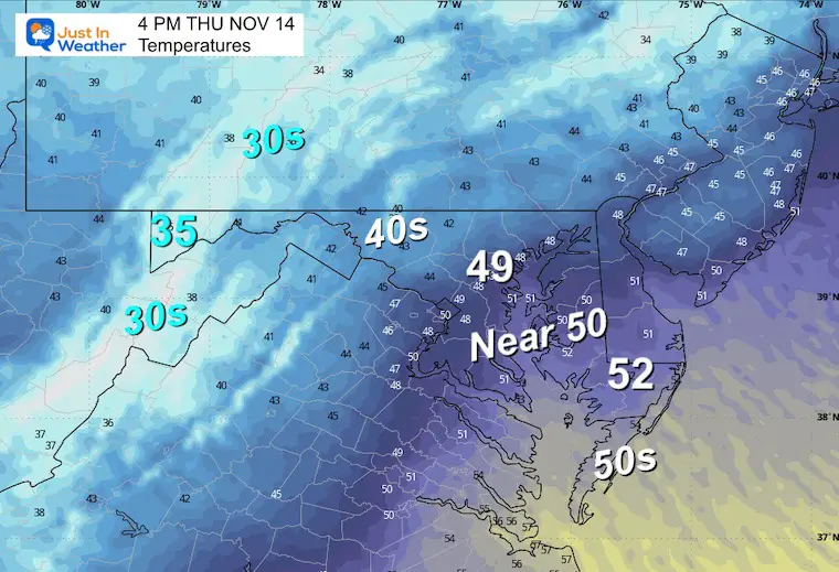
Afternoon Temperatures
A chill will hold across metro areas from the upper 40s to lower 50s.
Afternoon Radar
The main band of rain will reach metro areas, with heavier rain falling across the extreme drought areas of West Virginia to Southwest Virginia.
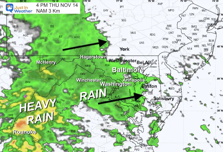
Evening Radar
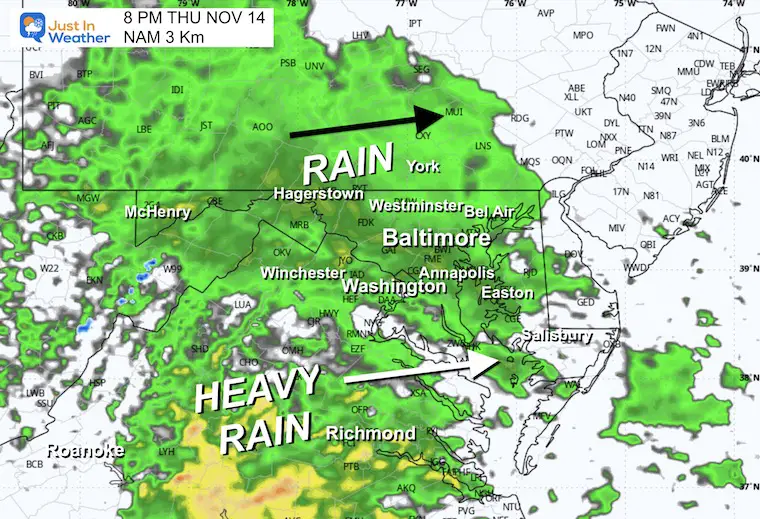
Midnight
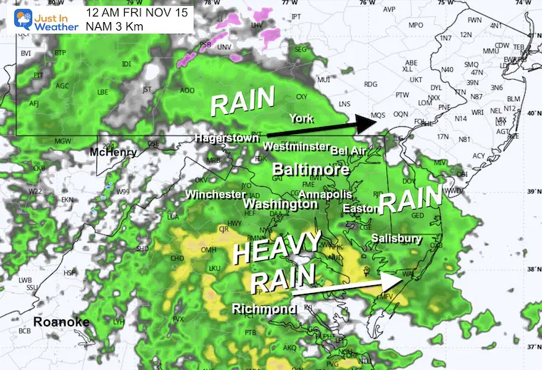
Radar Simulation Friday Midnight to Noon
Rain will continue to fall overnight, then shift south of metro areas by daybreak…
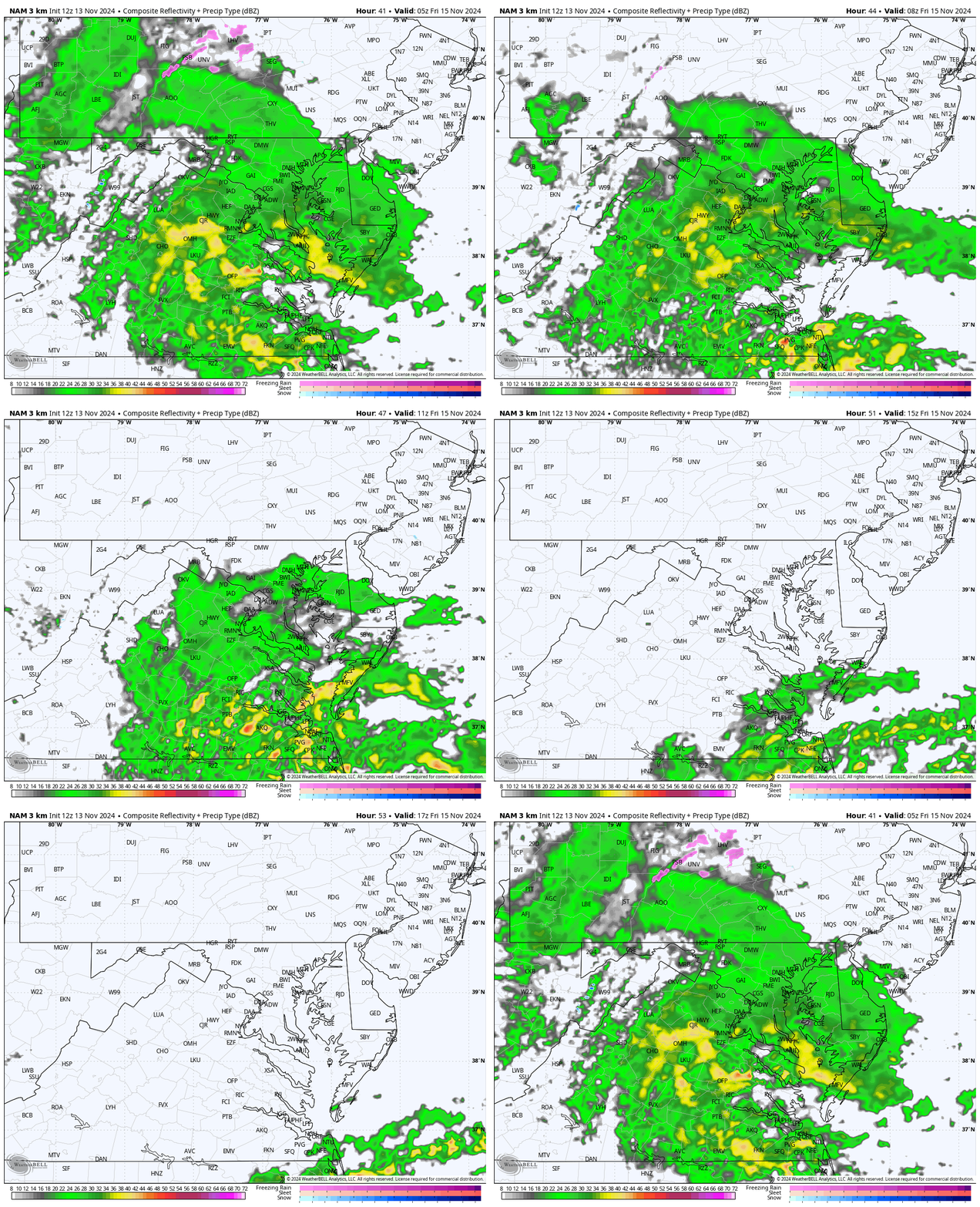
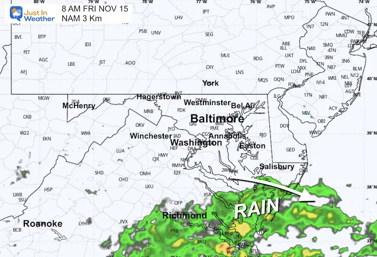
Snapshots at 8 AM
Rain may linger a few hours across Southeast Virginia.
Rainfall Forecast Model Comparison
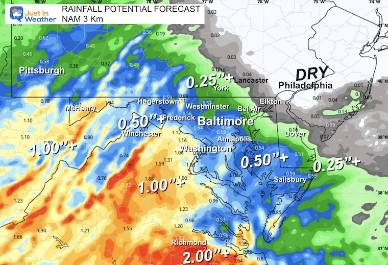
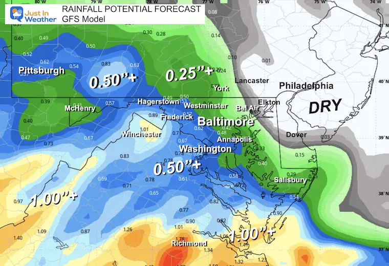
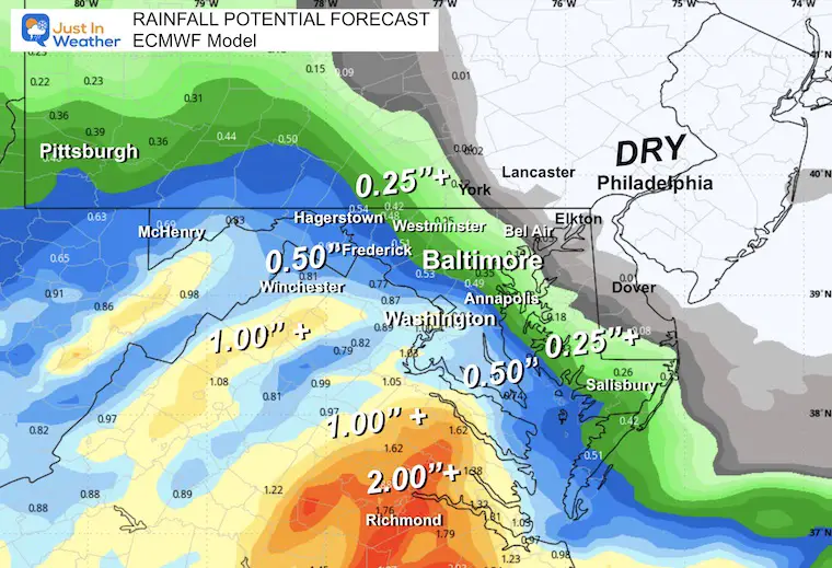
Comparing these three computer models for how much rain to expect, we can see some agreement:
Around metro Baltimore = 0.25″ to 0.50″.
Heavier rain will fall west and south of Baltimore. 1 to 2 inches possible around Richmond, VA.
It will be light or maybe completely dry farther East and North. Cecil County, MD, to Metro Philly may miss this!
NAM 3 Km Model
GFS Model
ECMWF Model
Subscribe for eMail Alerts
Weather posts straight to your inbox
Sign up and be the first to know!
FOUR SUPERMOONS OF 2024
Please share your thoughts and best weather pics/videos, or just keep in touch via social media.
-
Facebook: Justin Berk, Meteorologist
-
Twitter
-
Instagram
SCHEDULE A WEATHER BASED STEM ASSEMBLY
Severe Weather: Storm Smart October and next spring
Winter Weather FITF (Faith in the Flakes): November To March
Click to see more and send a request for your school.
THANK YOU:
Baltimore Magazine Readers Choice Best Of Baltimore
Maryland Trek 11 Day 7 Completed Sat August 10
We raised OVER $104,000 for Just In Power Kids – AND Still Collecting More
The annual event: Hiking and biking 329 miles in 7 days between The Summit of Wisp to Ocean City.
Each day, we honor a kid and their family’s cancer journey.
Fundraising is for Just In Power Kids: Funding Free Holistic Programs. I never have and never will take a penny. It is all for our nonprofit to operate.
Click here or the image to donate:
RESTATING MY MESSAGE ABOUT DYSLEXIA
I am aware there are some spelling and grammar typos and occasional other glitches. I take responsibility for my mistakes and even the computer glitches I may miss. I have made a few public statements over the years, but if you are new here, you may have missed it: I have dyslexia and found out during my second year at Cornell University. It didn’t stop me from getting my meteorology degree and being the first to get the AMS CBM in the Baltimore/Washington region.
One of my professors told me that I had made it that far without knowing and to not let it be a crutch going forward. That was Mark Wysocki, and he was absolutely correct! I do miss my mistakes in my own proofreading. The autocorrect spell check on my computer sometimes does an injustice to make it worse. I also can make mistakes in forecasting. No one is perfect at predicting the future. All of the maps and information are accurate. The ‘wordy’ stuff can get sticky.
There has been no editor who can check my work while writing and to have it ready to send out in a newsworthy timeline. Barbara Werner is a member of the web team that helps me maintain this site. She has taken it upon herself to edit typos when she is available. That could be AFTER you read this. I accept this and perhaps proves what you read is really from me… It’s part of my charm. #FITF


